File:Yata57.png
Original file (5,632 × 2,600 pixels, file size: 263 KB, MIME type: image/png)
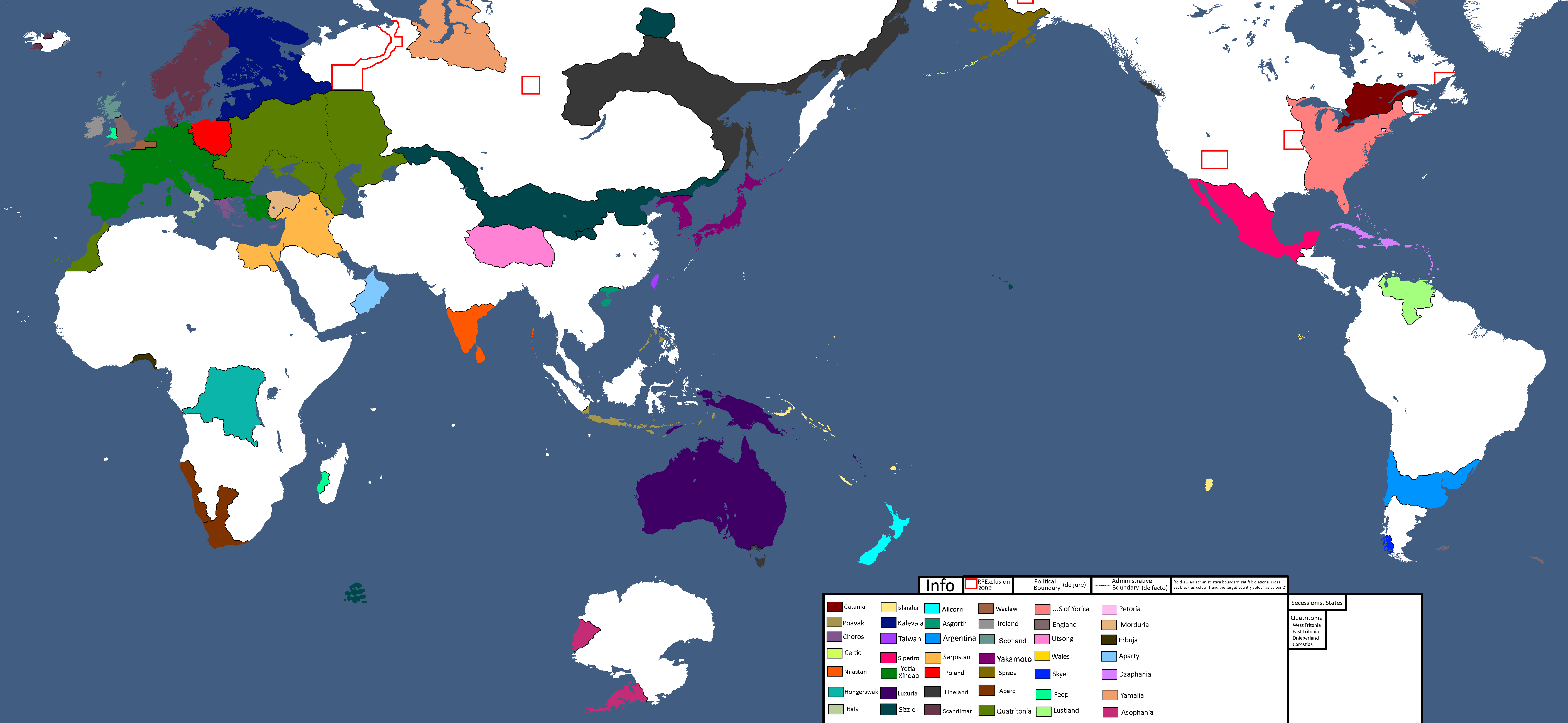
Summary
Administrative boundaries These are like disputed borders. They show what the actual border really is, while political boundaries show what is internationally accepted. For example, in Quatritonia, there are admin borders running through them. These show the separatist states which exist de facto (in fact) but not de jure (by law.) | Secessionist states I added a new list to show ongoing separatism, or countries within countries defined by the admin boundaries. Lovely Quatritonia has 4 of them! They are listed from most powerful to least powerful. | Extra info There is a note in info on how to draw admin boundaries, and the countries list box has clearly been expanded to accommodate roughly another 14 new countries.
File history
Click on a date/time to view the file as it appeared at that time.
| Date/Time | Thumbnail | Dimensions | User | Comment | |
|---|---|---|---|---|---|
| current | 17:43, 27 April 2025 | | 5,632 × 2,600 (263 KB) | Hakced (talk | contribs) | Administrative boundaries These are like disputed borders. They show what the actual border really is, while political boundaries show what is internationally accepted. For example, in Quatritonia, there are admin borders running through them. These show the separatist states which exist de facto (in fact) but not de jure (by law.) | Secessionist states I added a new list to show ongoing separatism, or countries within countries defined by the admin boundaries. Lovely Quatritonia has 4 of the... |
You cannot overwrite this file.
File usage
The following page uses this file: