File:Yetianconfederationmap.png
From YATA Wiki
Jump to navigationJump to search
Size of this preview: 800 × 582 pixels. Other resolution: 2,381 × 1,731 pixels.
Original file (2,381 × 1,731 pixels, file size: 103 KB, MIME type: image/png)
Summary
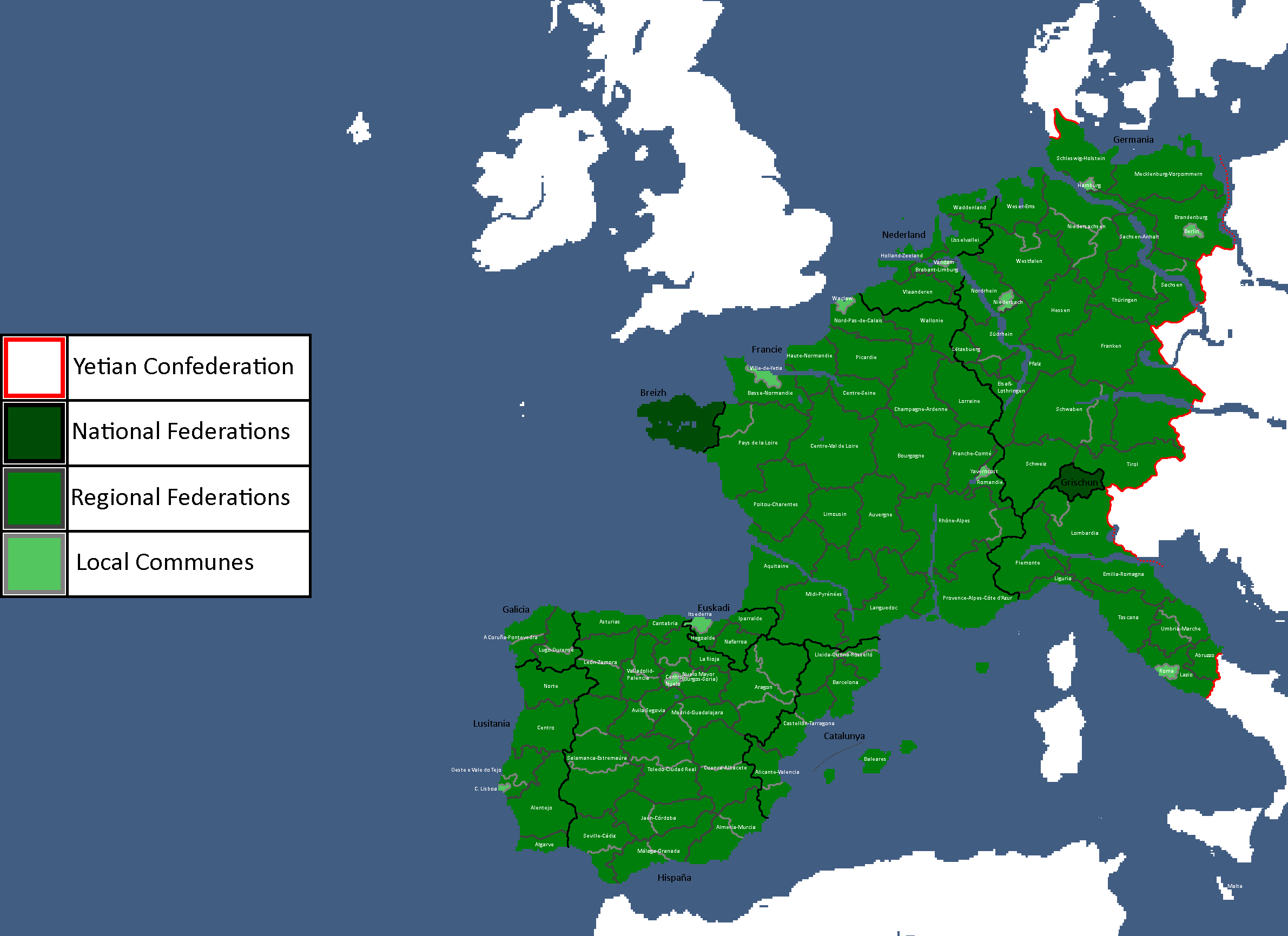
How it works abridged: Communes exist on the municipal level and are direct democracies, Communes federate regionally for common interests and elect delegates into the region councils, regional federations federate into national federations and elect delegates for common interests, national federations elect delegates into the confederation assembly which does yetia-wide cooperation and foreign policy Each level of government is voluntary, with each level being theoretically allowed to opt out of a higher one
File history
Click on a date/time to view the file as it appeared at that time.
| Date/Time | Thumbnail | Dimensions | User | Comment | |
|---|---|---|---|---|---|
| current | 14:53, 9 May 2025 | | 2,381 × 1,731 (103 KB) | Hakced (talk | contribs) | How it works abridged: Communes exist on the municipal level and are direct democracies, Communes federate regionally for common interests and elect delegates into the region councils, regional federations federate into national federations and elect delegates for common interests, national federations elect delegates into the confederation assembly which does yetia-wide cooperation and foreign policy Each level of government is voluntary, with each level being theoretically allowed to opt ou... |
You cannot overwrite this file.
File usage
The following page uses this file: