List of Maps
International Maps
Yatan Maps
-
Map of the First Human-Yomtach War: Year 15638 BCE
-
Map of Elemental Nations: Year 8701 BCE
-
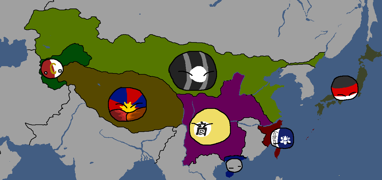
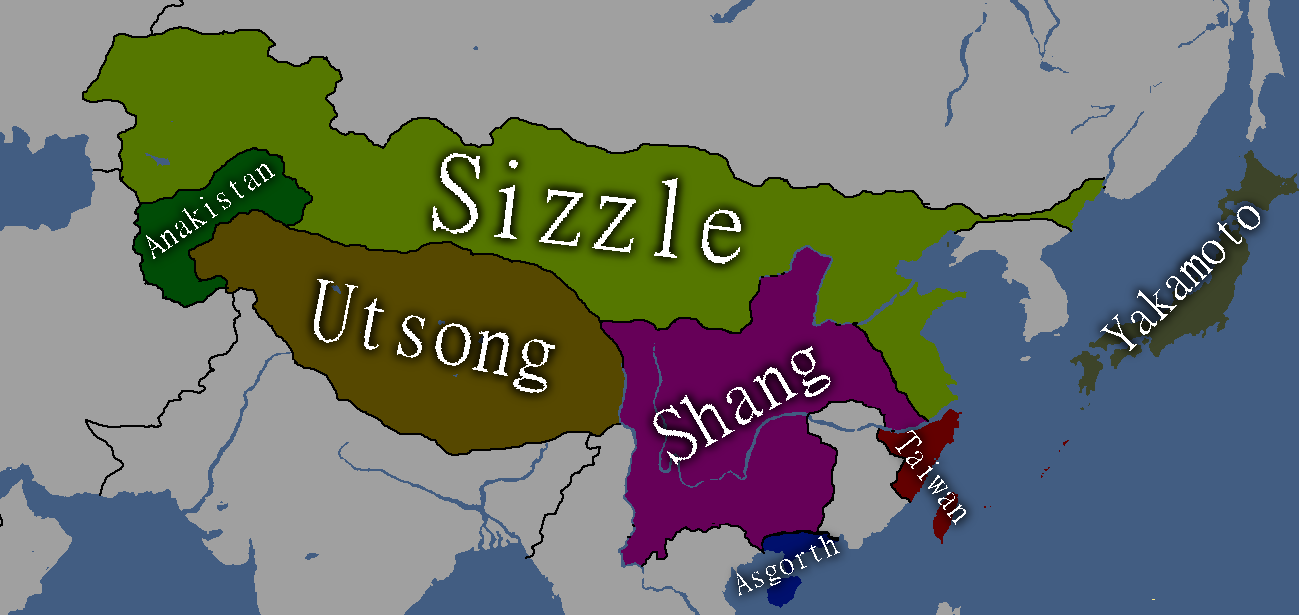
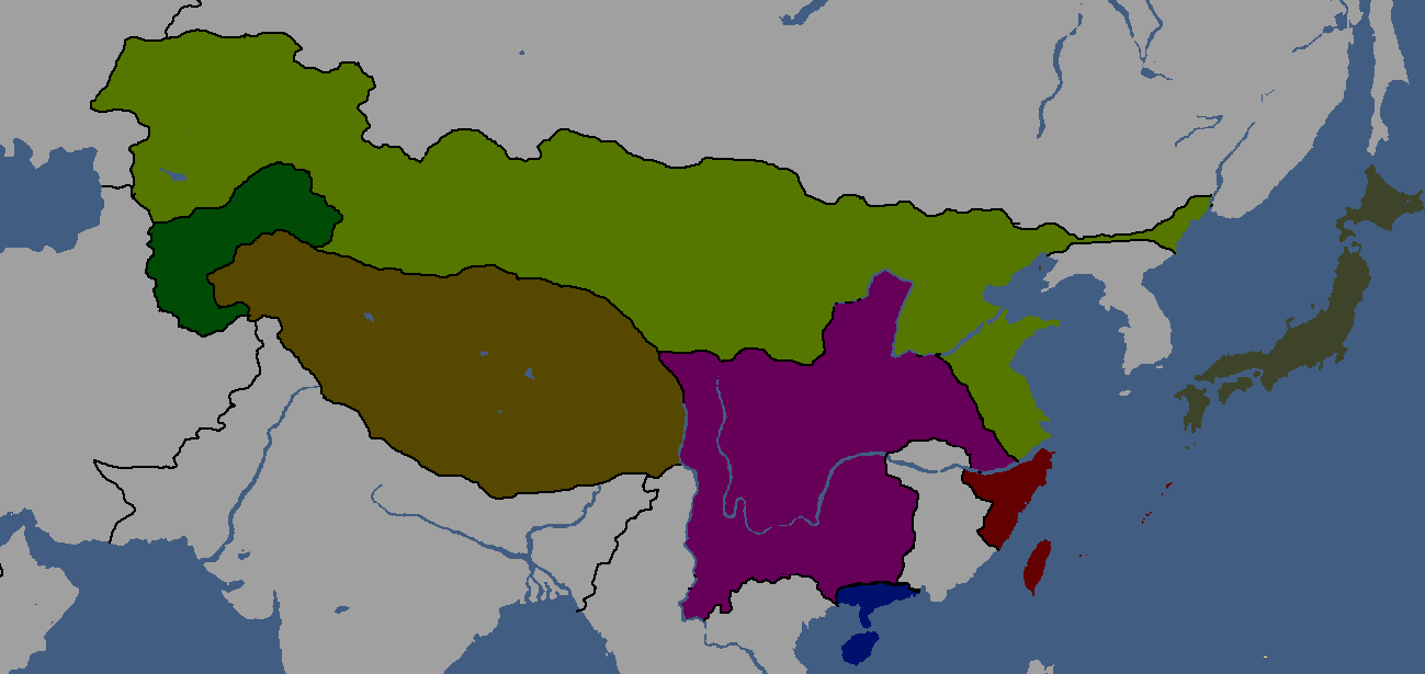
Map of East Asia: Year 1854 BCE
-
Map of the Tarqalan Empire: Year 1700 BCE
-
Map of Ancient Nations: Year 319 BCE
-
Lost Archives Map: 1
-
Lost Archives Map: 2
-
Lost Archives Map: 3
-
Lost Archives Map: 4
-
Lost Archives Map: 5
-
Lost Archives Map: 6
-
Lost Archives: Nuclear Test Map
-
-
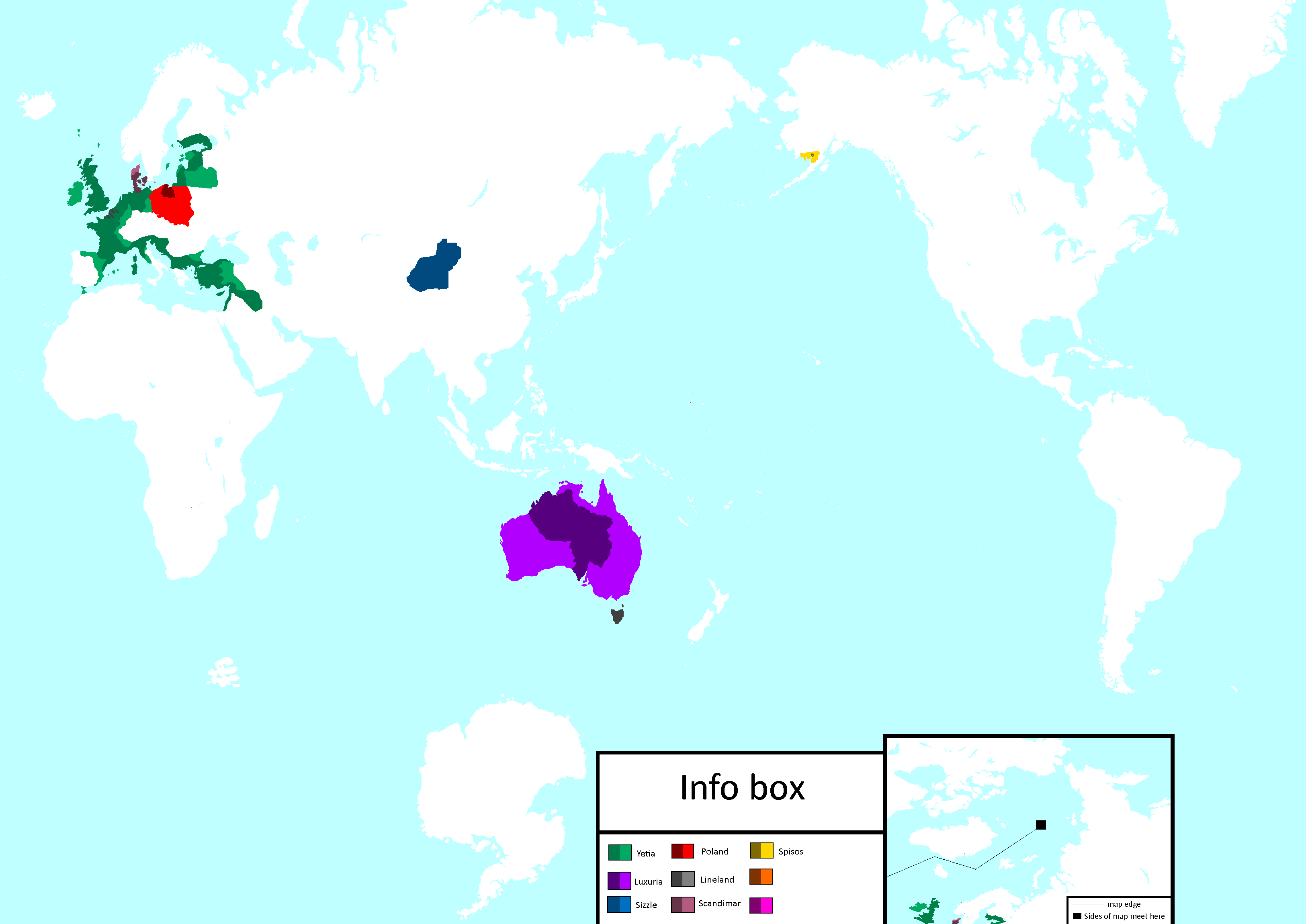
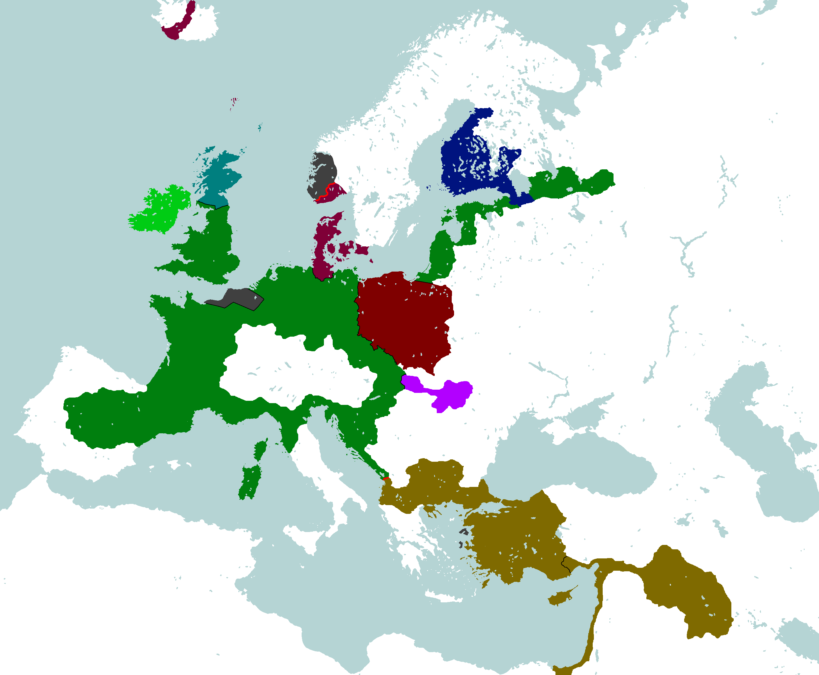
Map of the end of World War 2
-
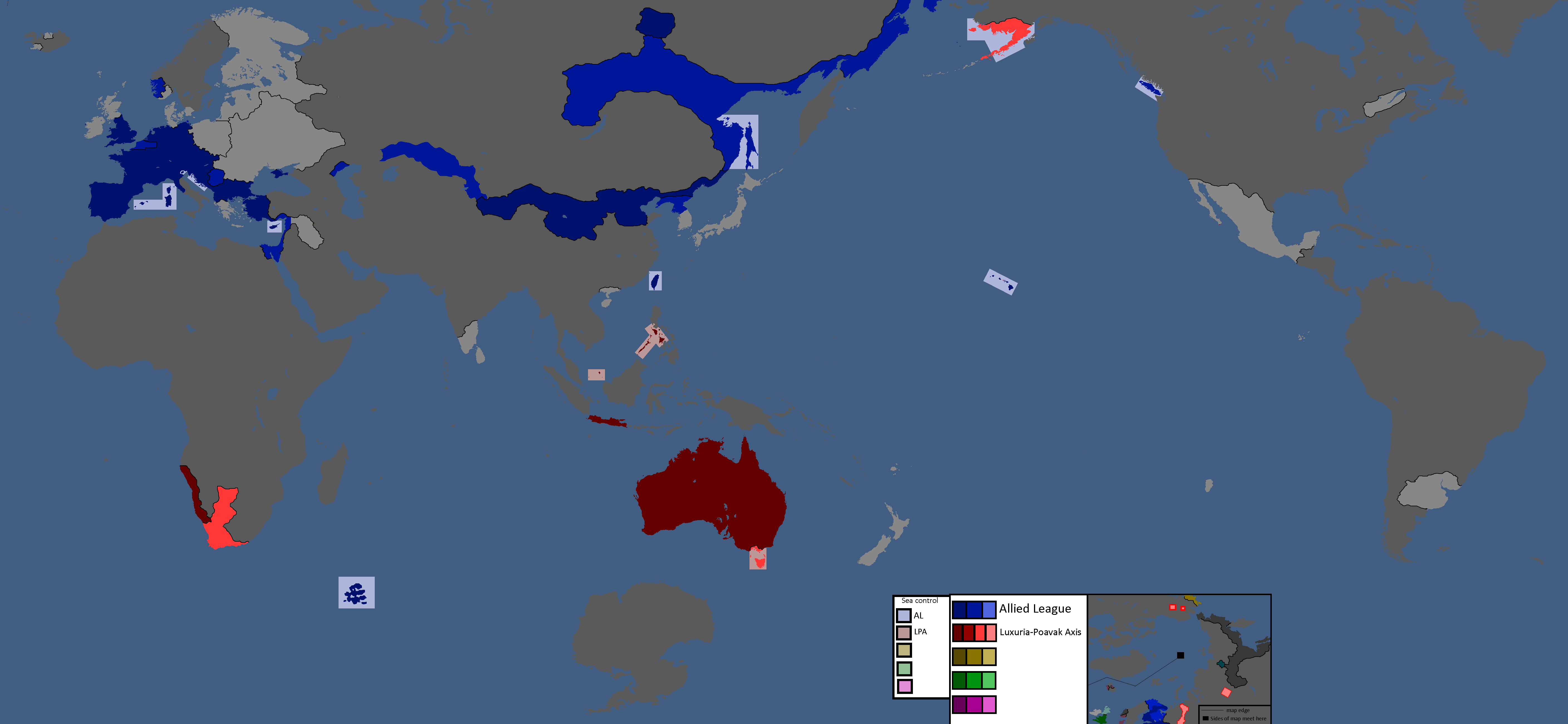
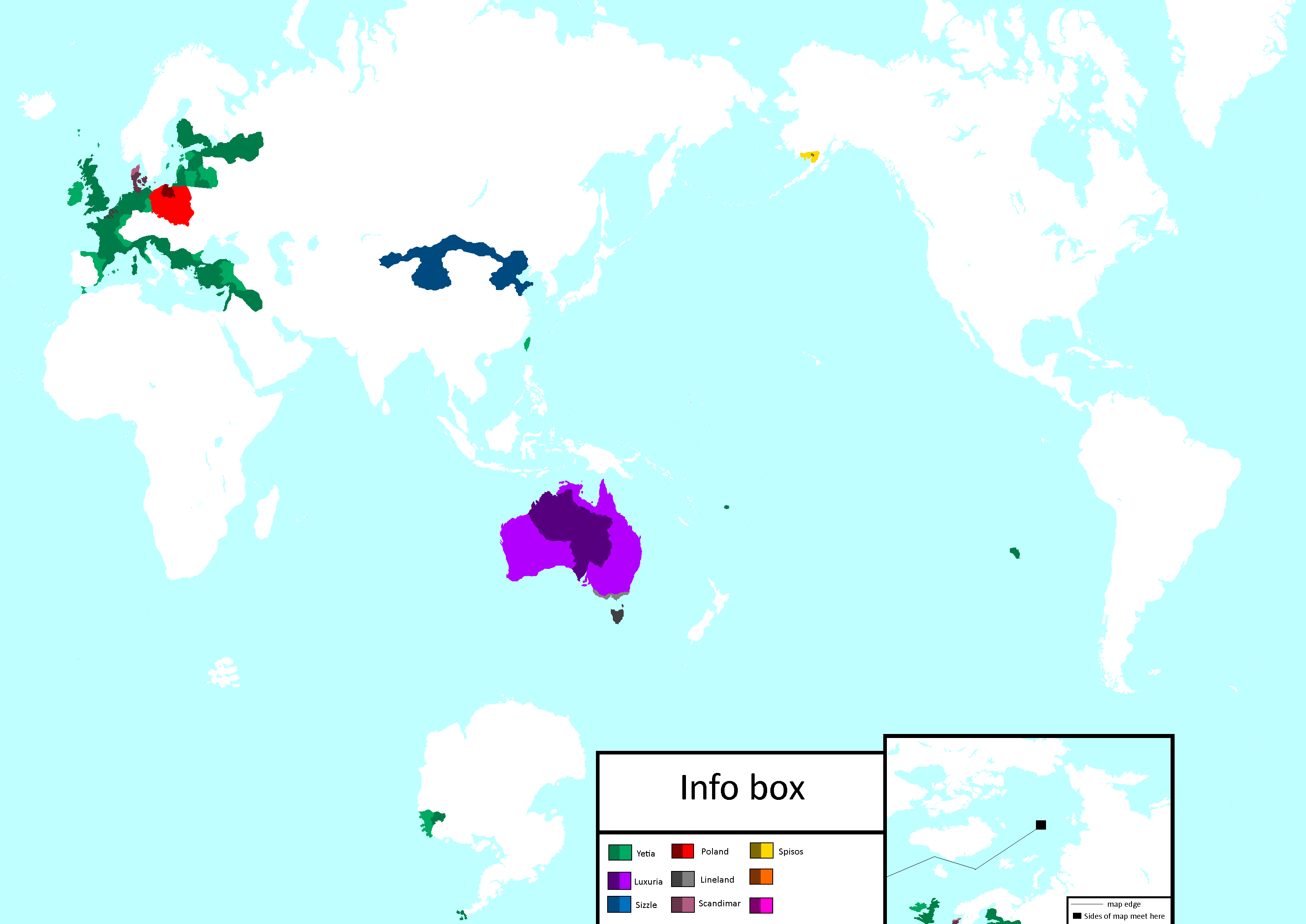
Map of early World War 3
-
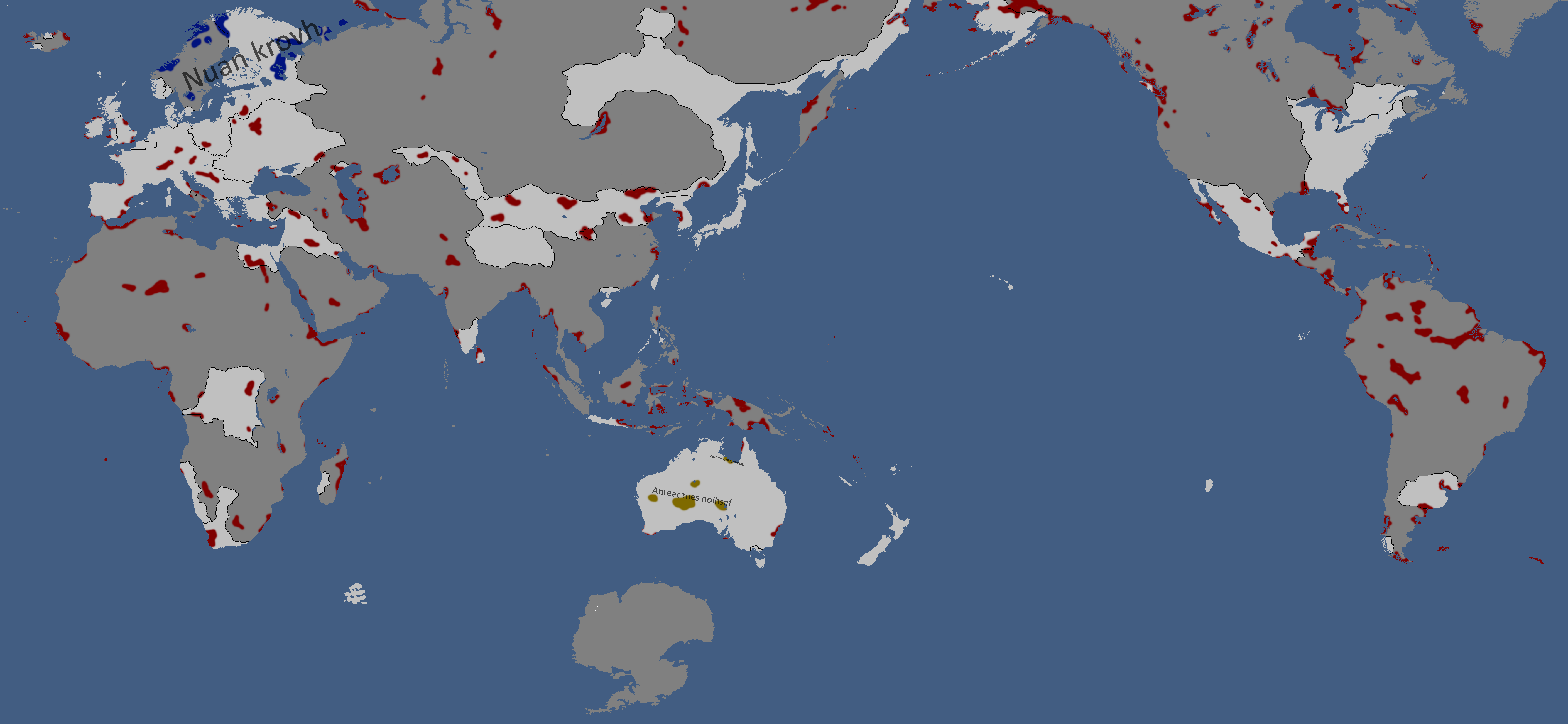
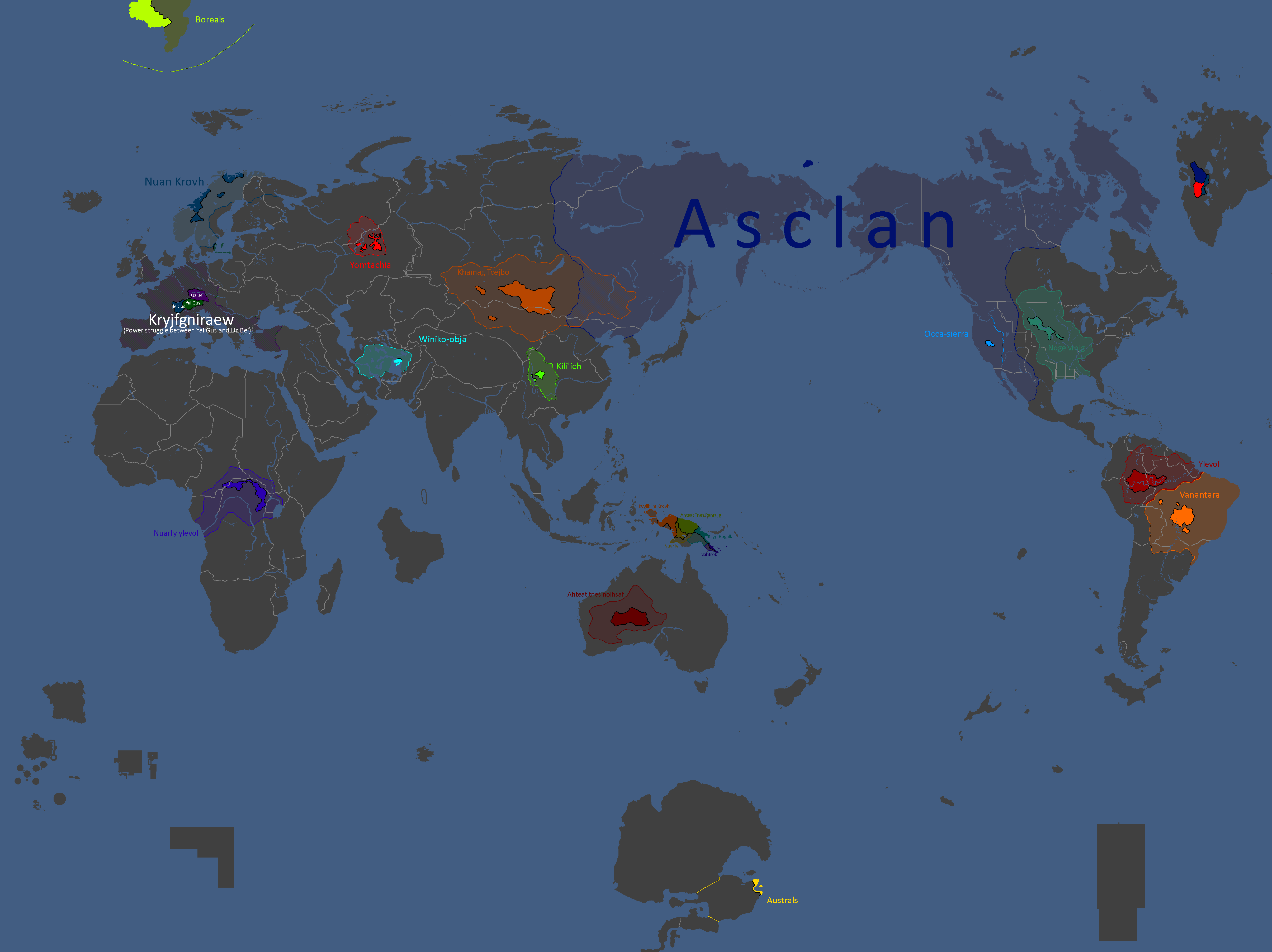
Yomtach Tribes: Year 85
-
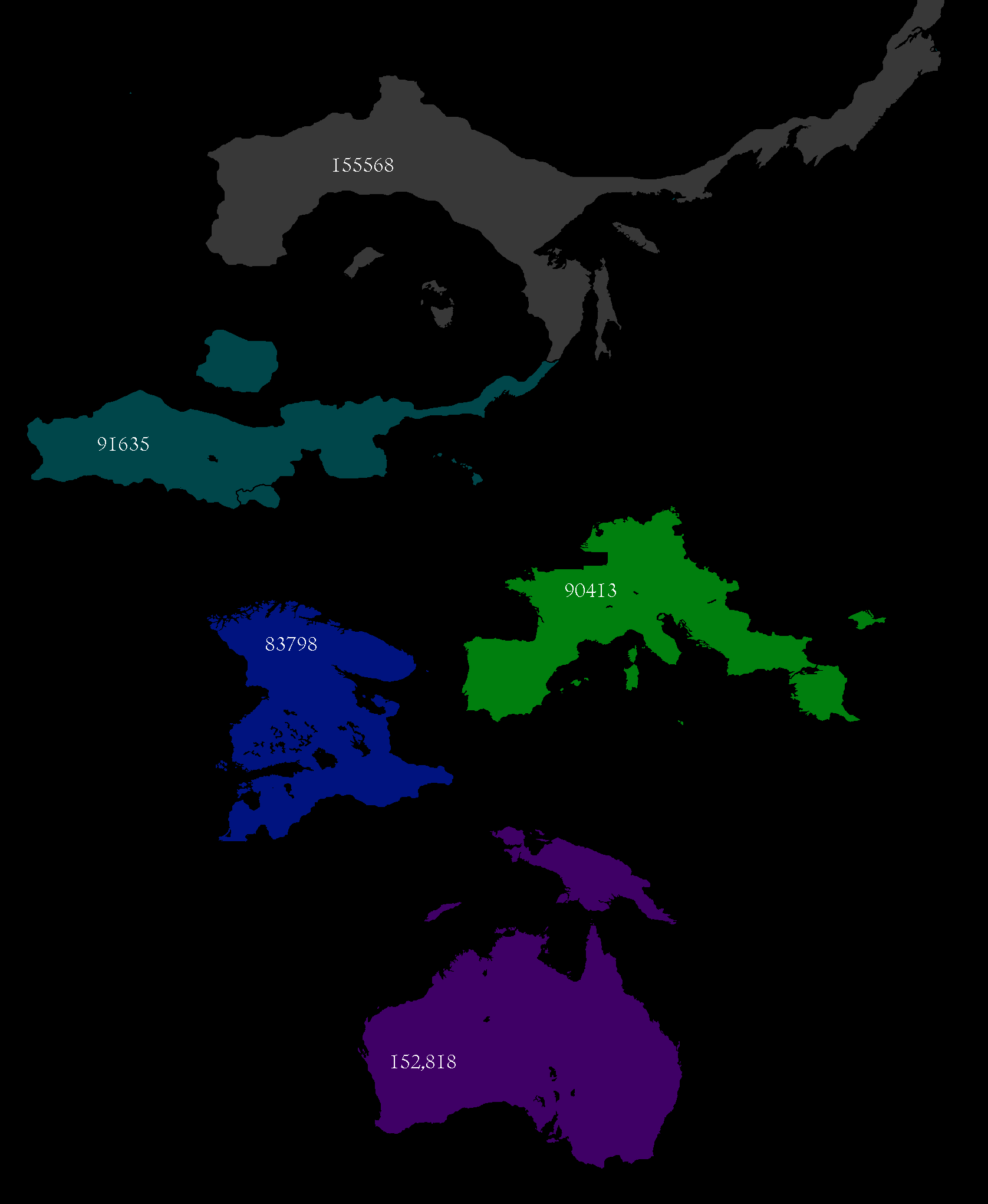
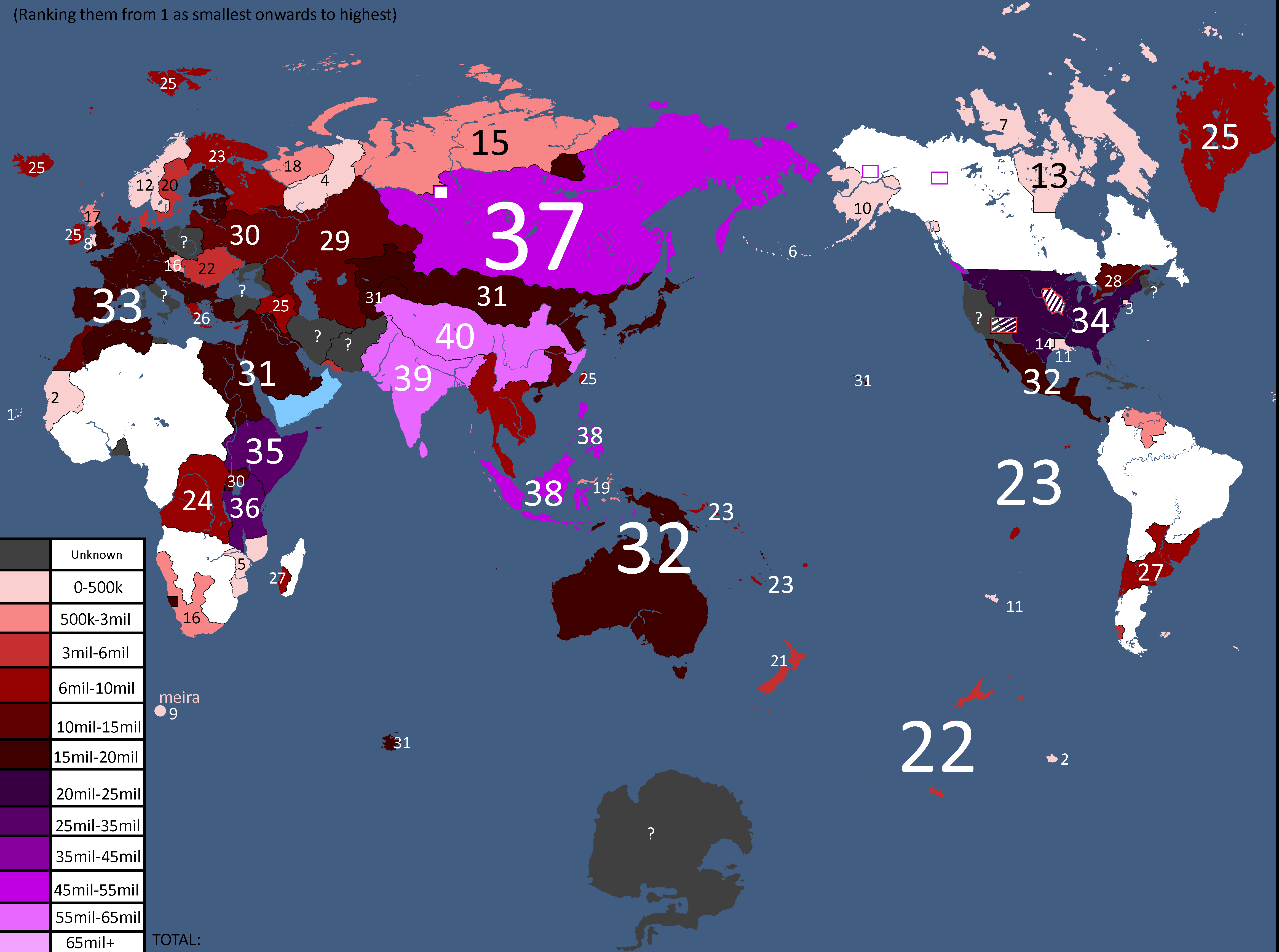
Pixels in sizes: Year 90
-
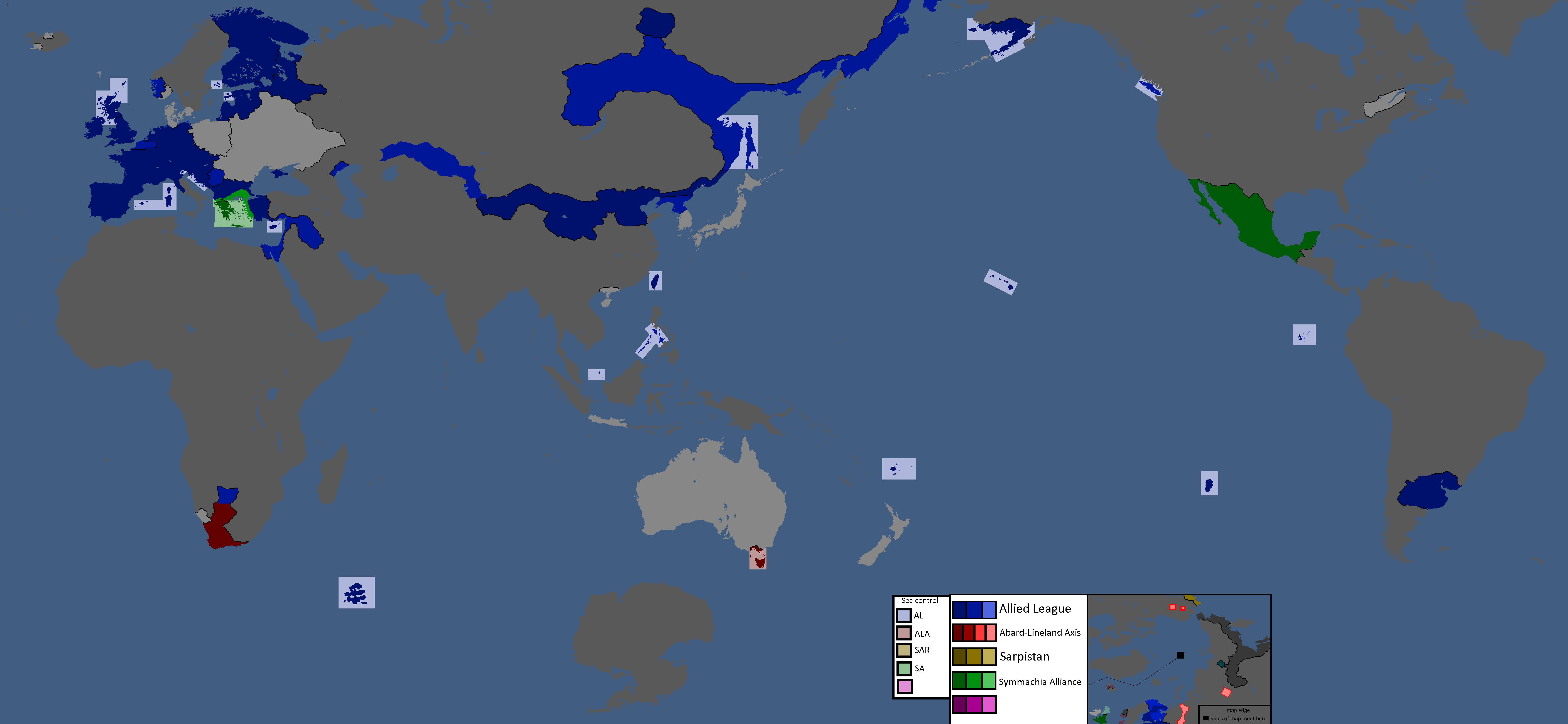
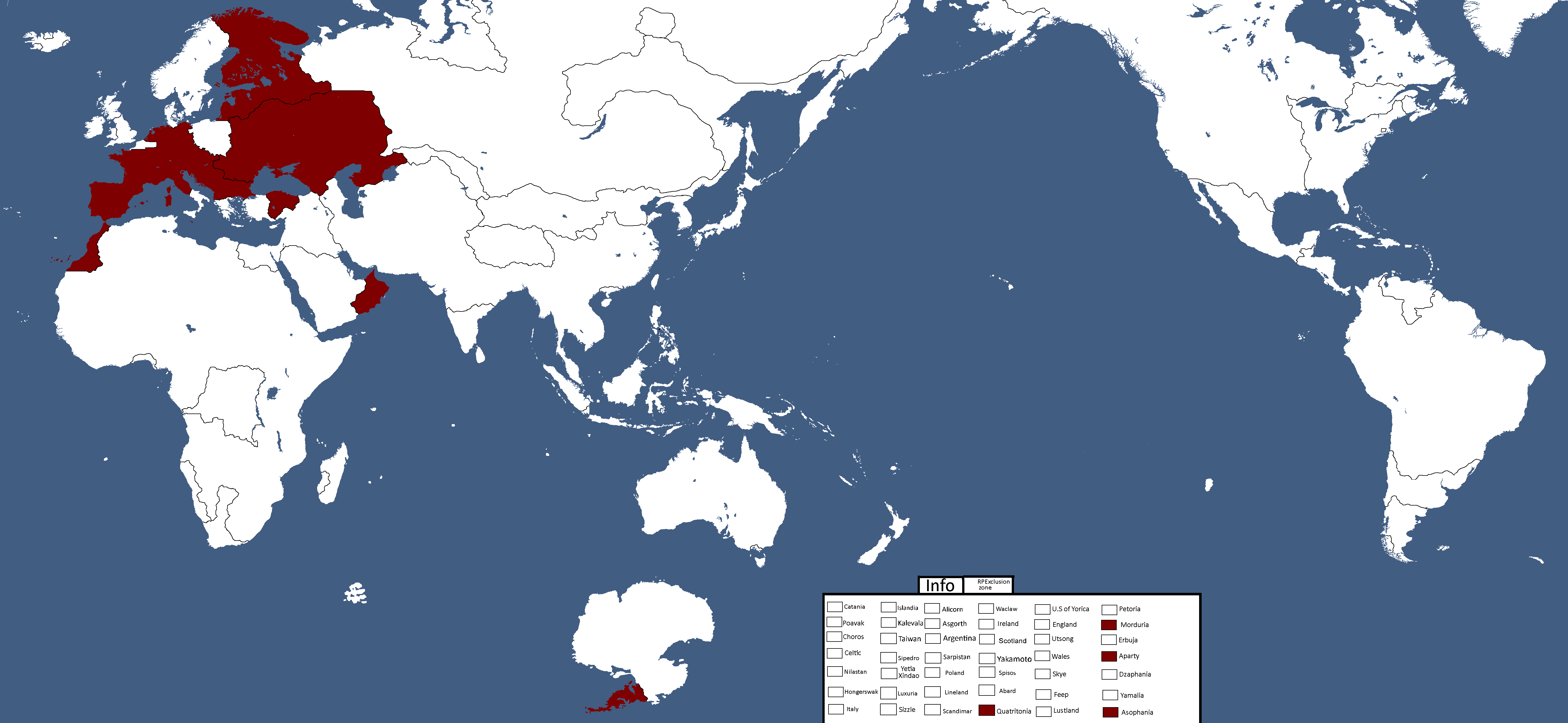
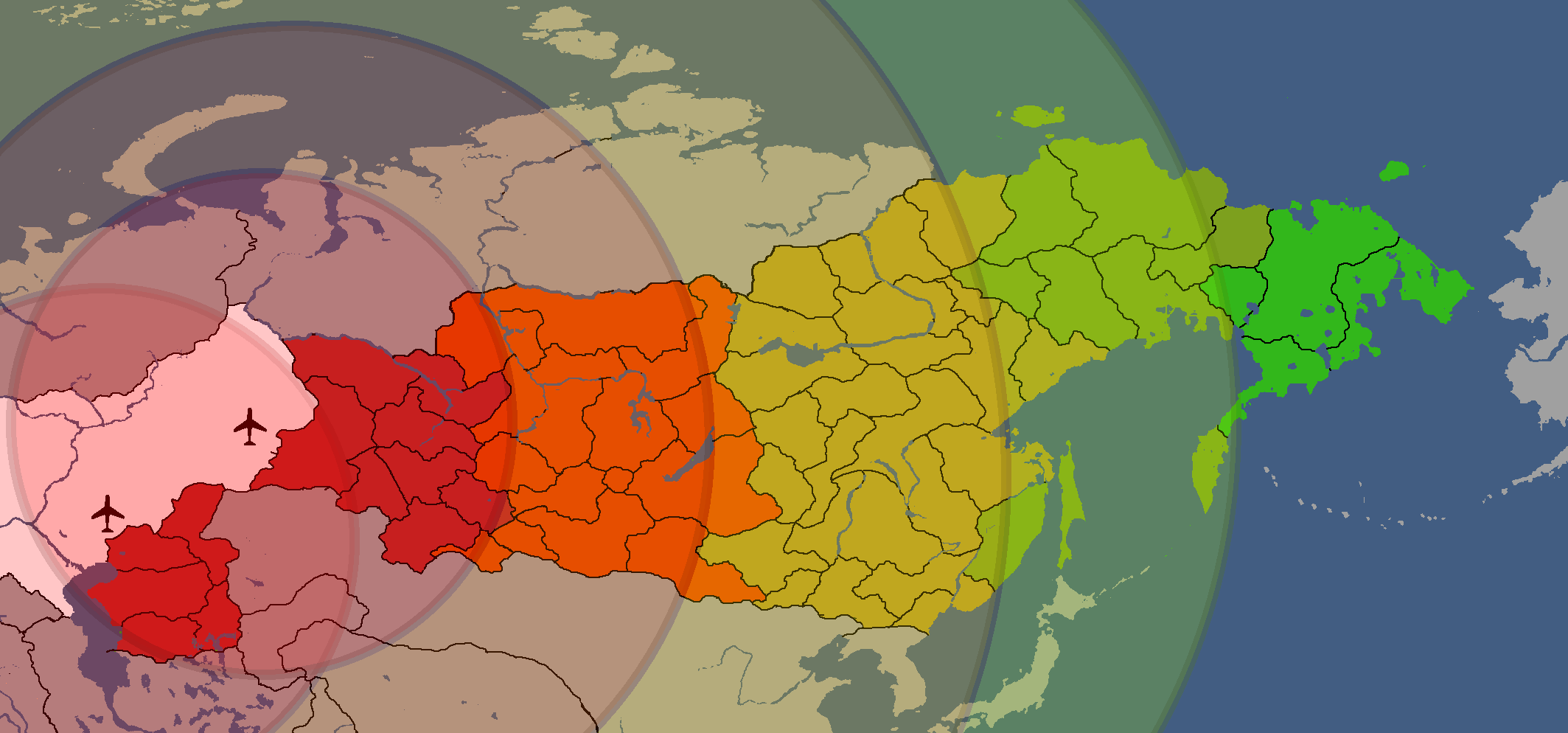
Occupation Zones after Woorld War 5: Year 90
-
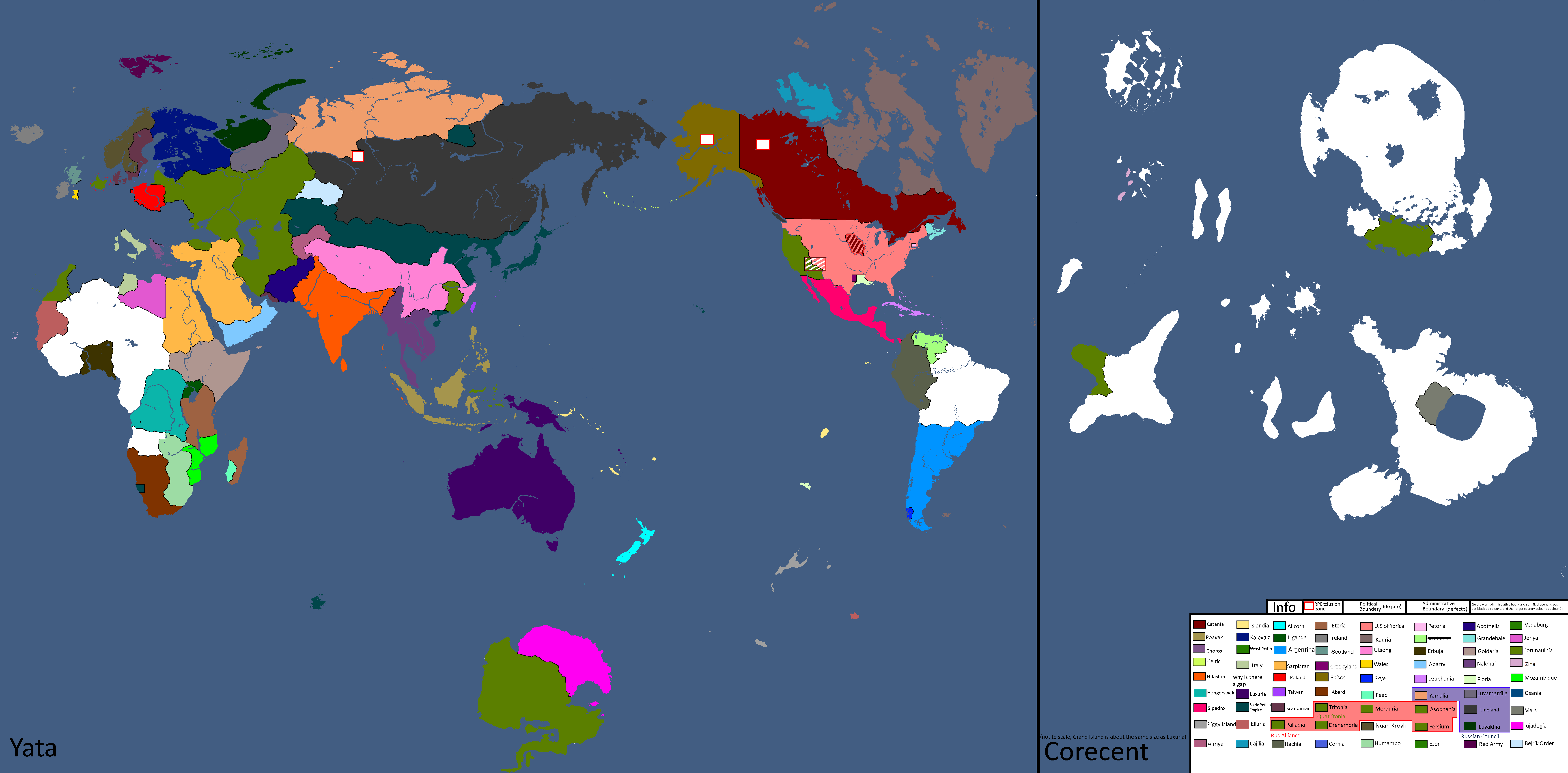
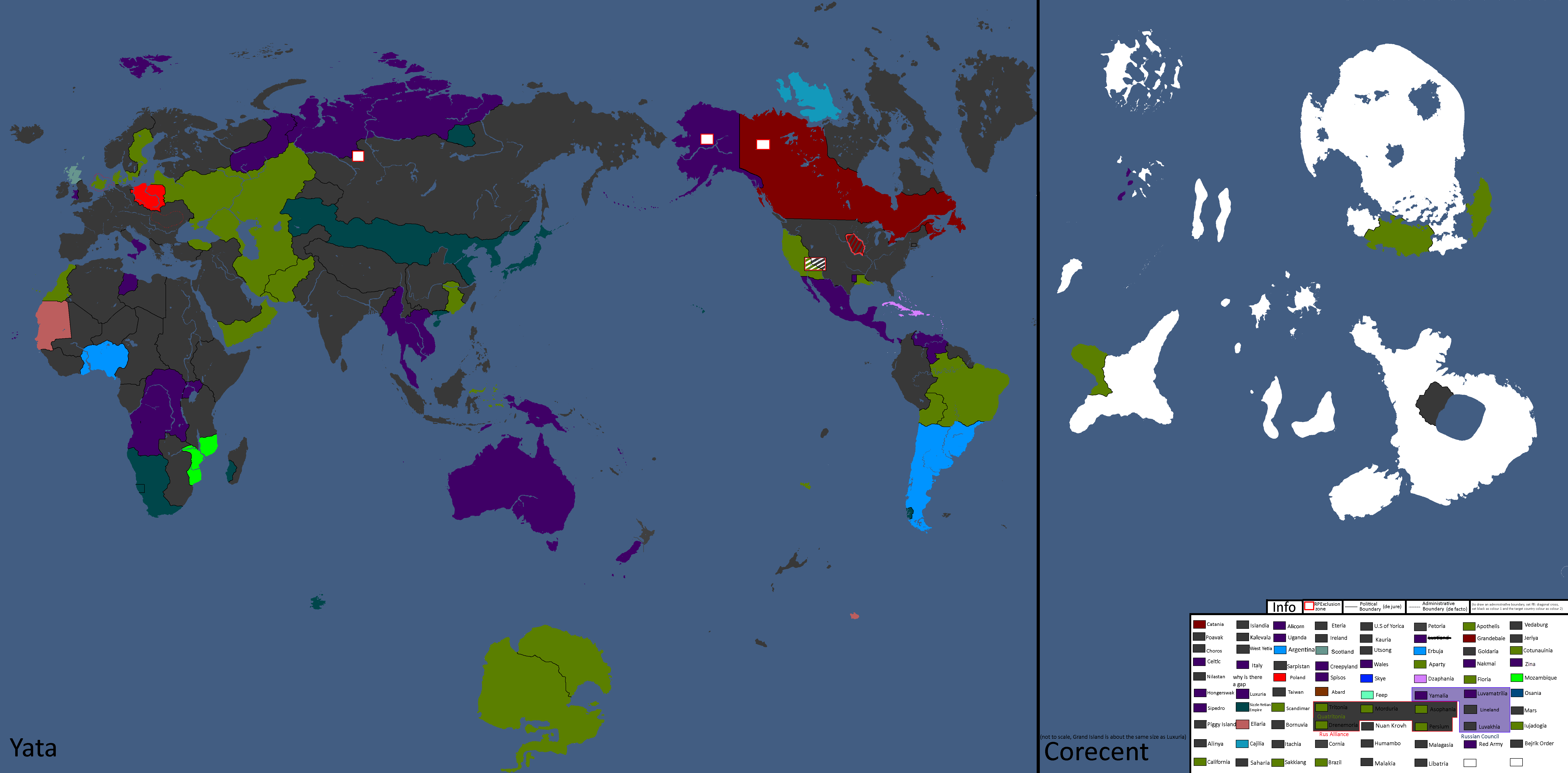
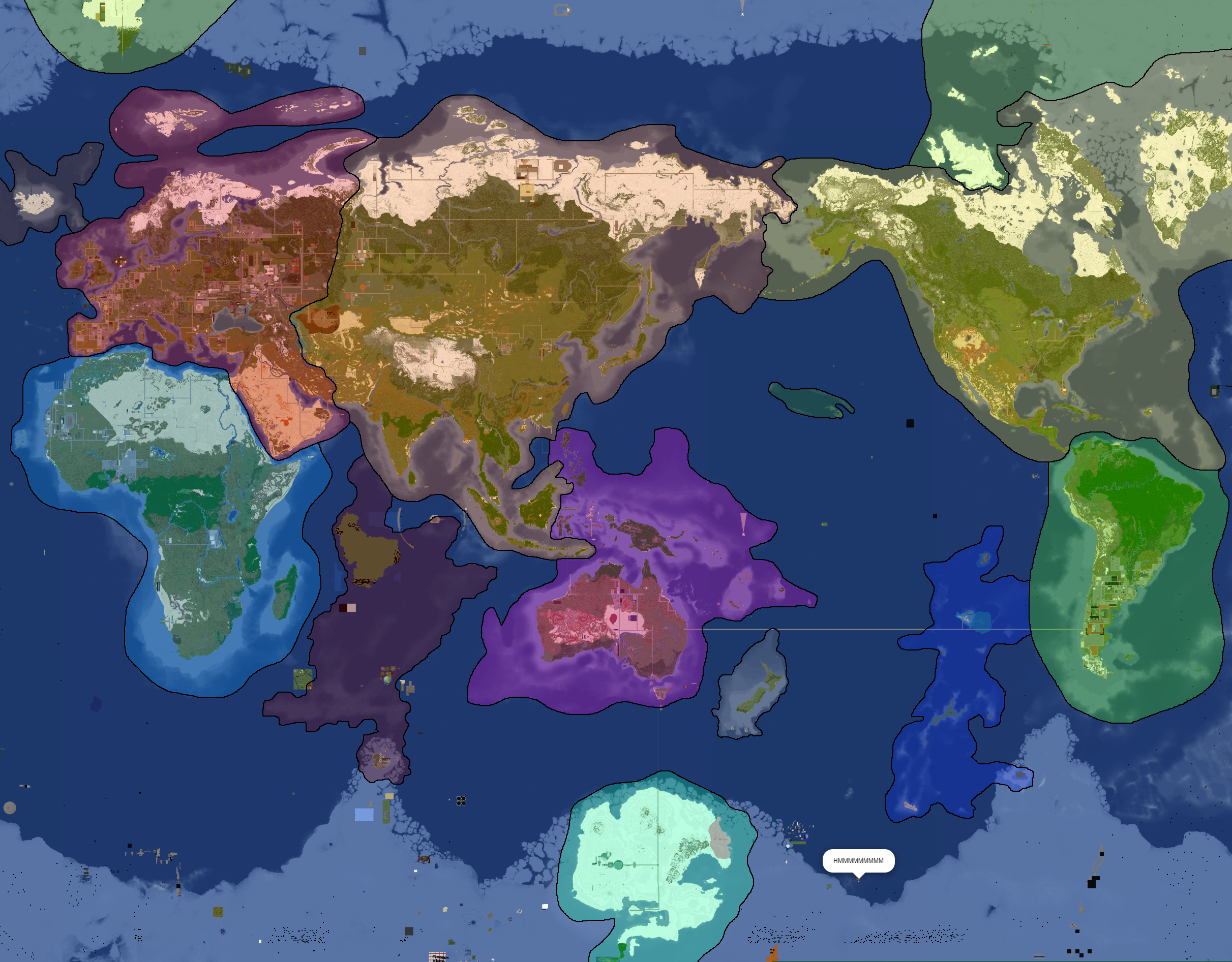
What Quatritonia calls the world
-
Year 97
-
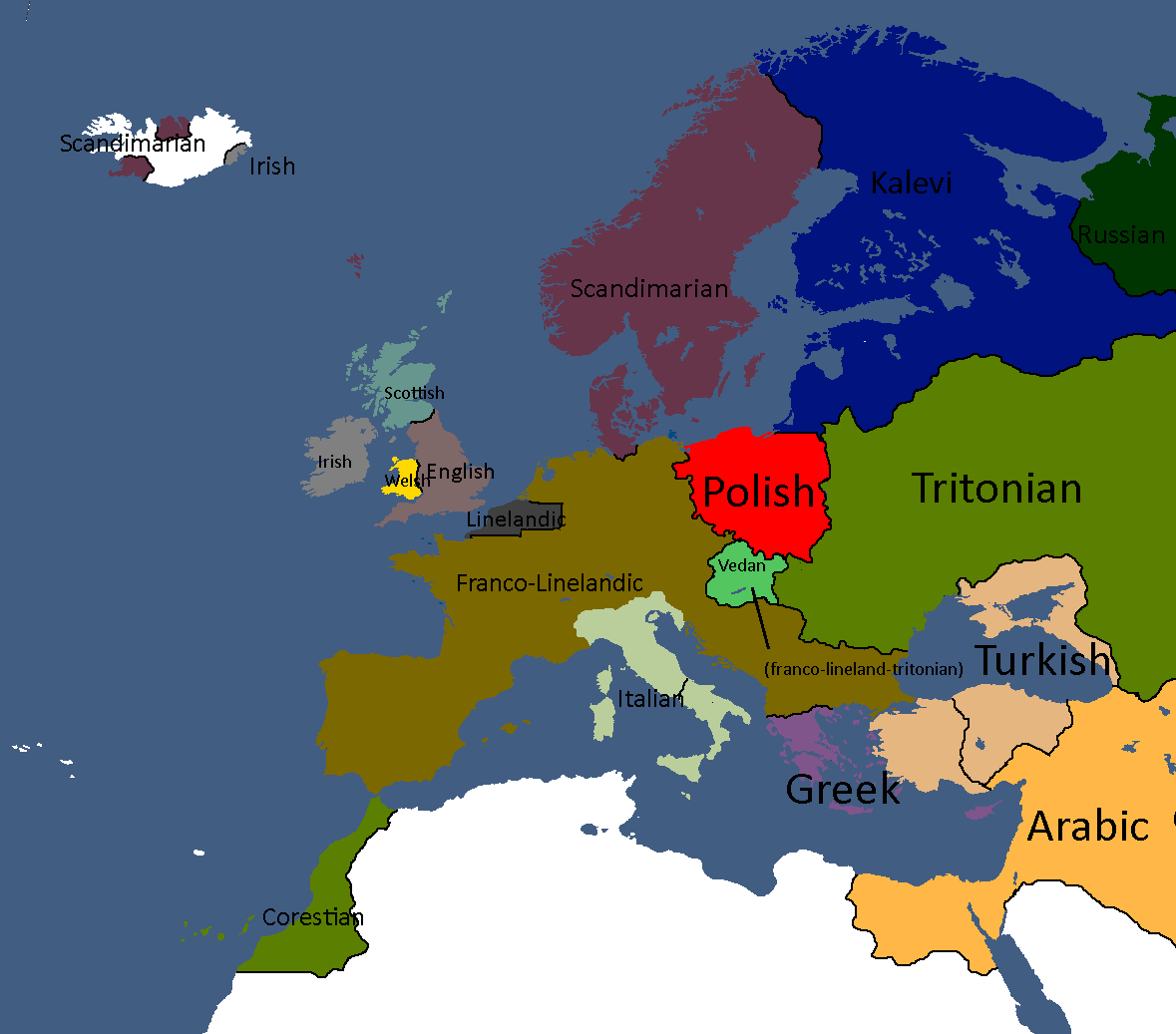
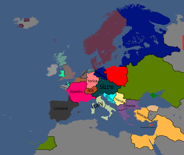
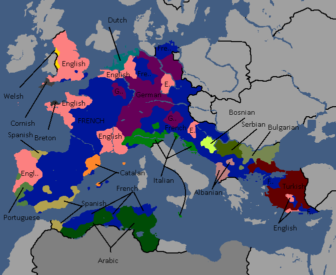
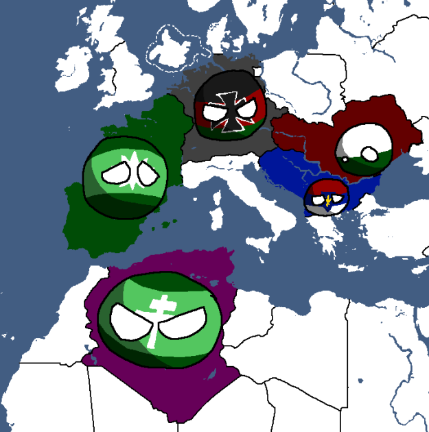
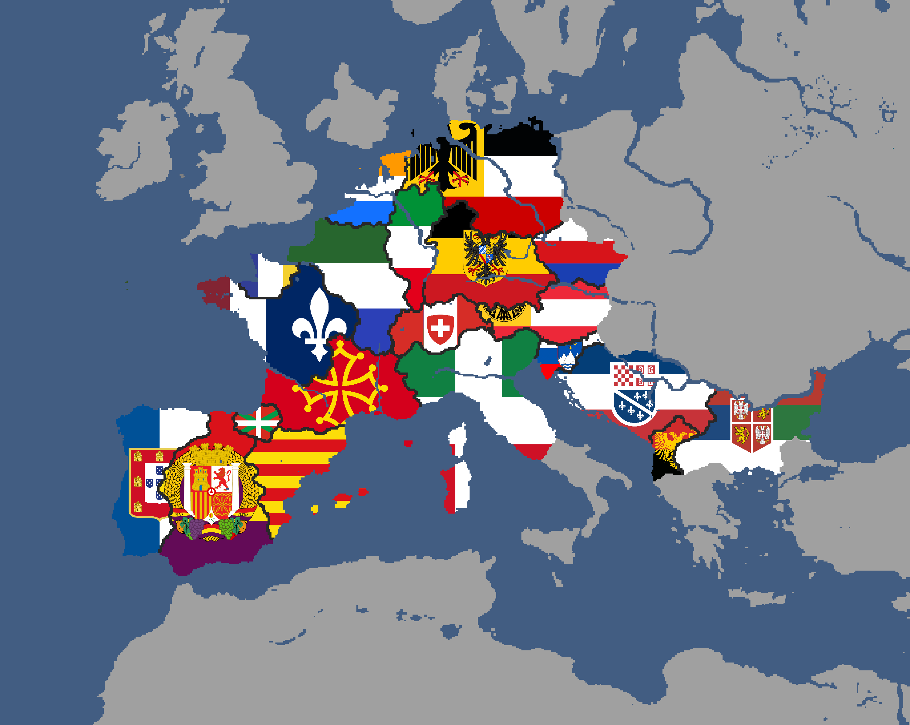
European Cultures: Year 103
-
Modern Map Beta: Year 103
-
Unlabled
-
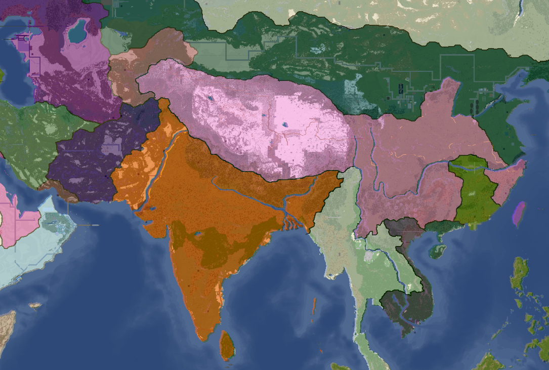
South Asia Overlay: Year 112
-
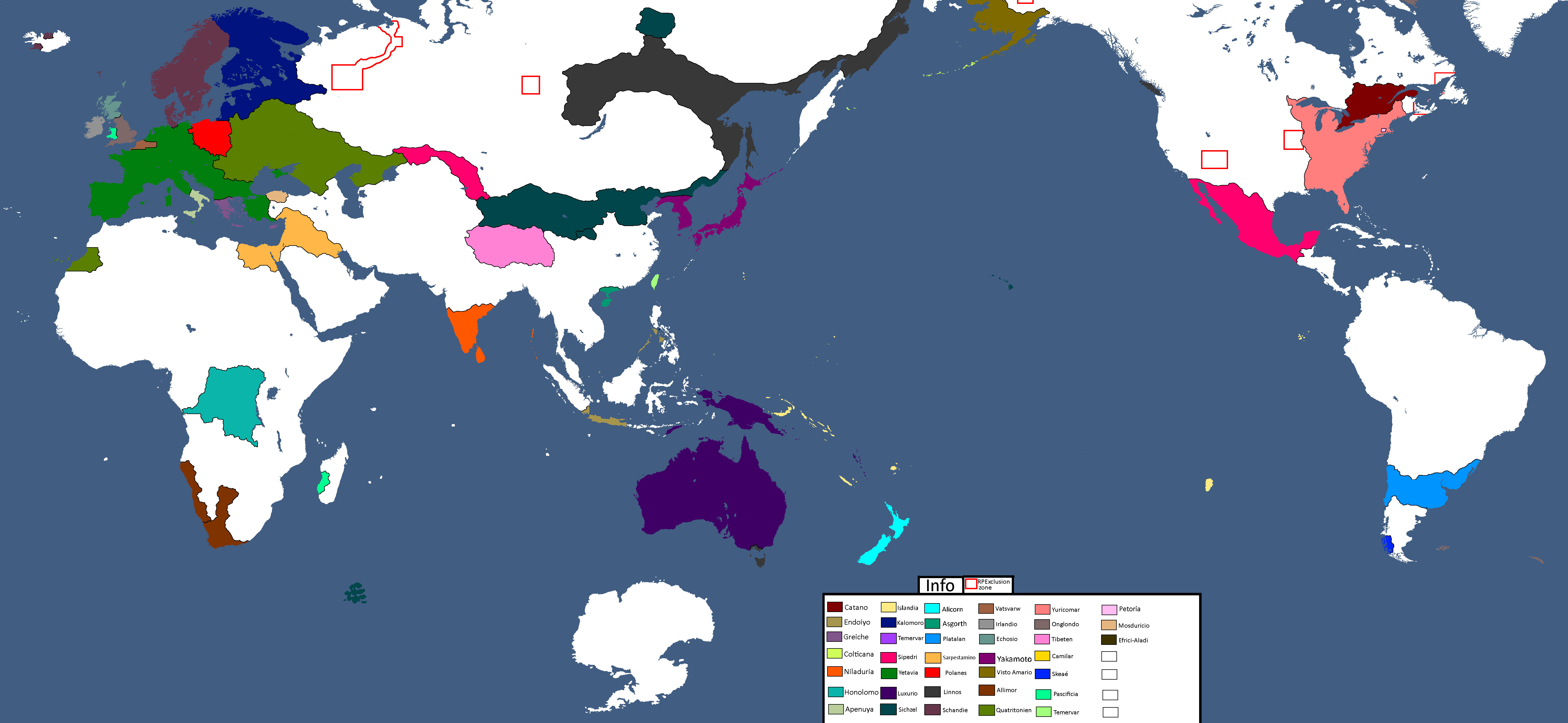
Nation Owners Map: Year 112
-
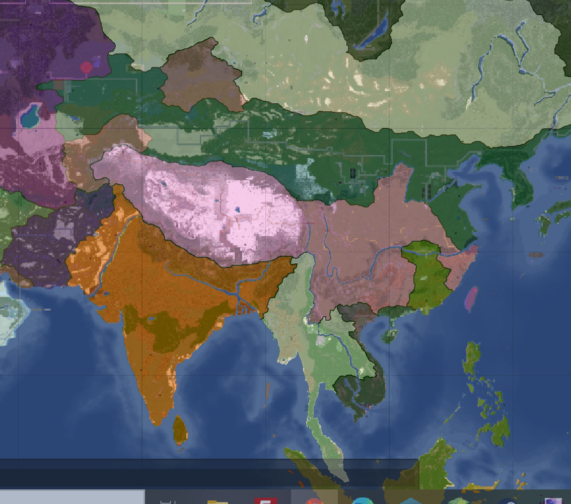
South Asia Overlay: Year 112 (2)
-
Communist Governments: Year 112
-
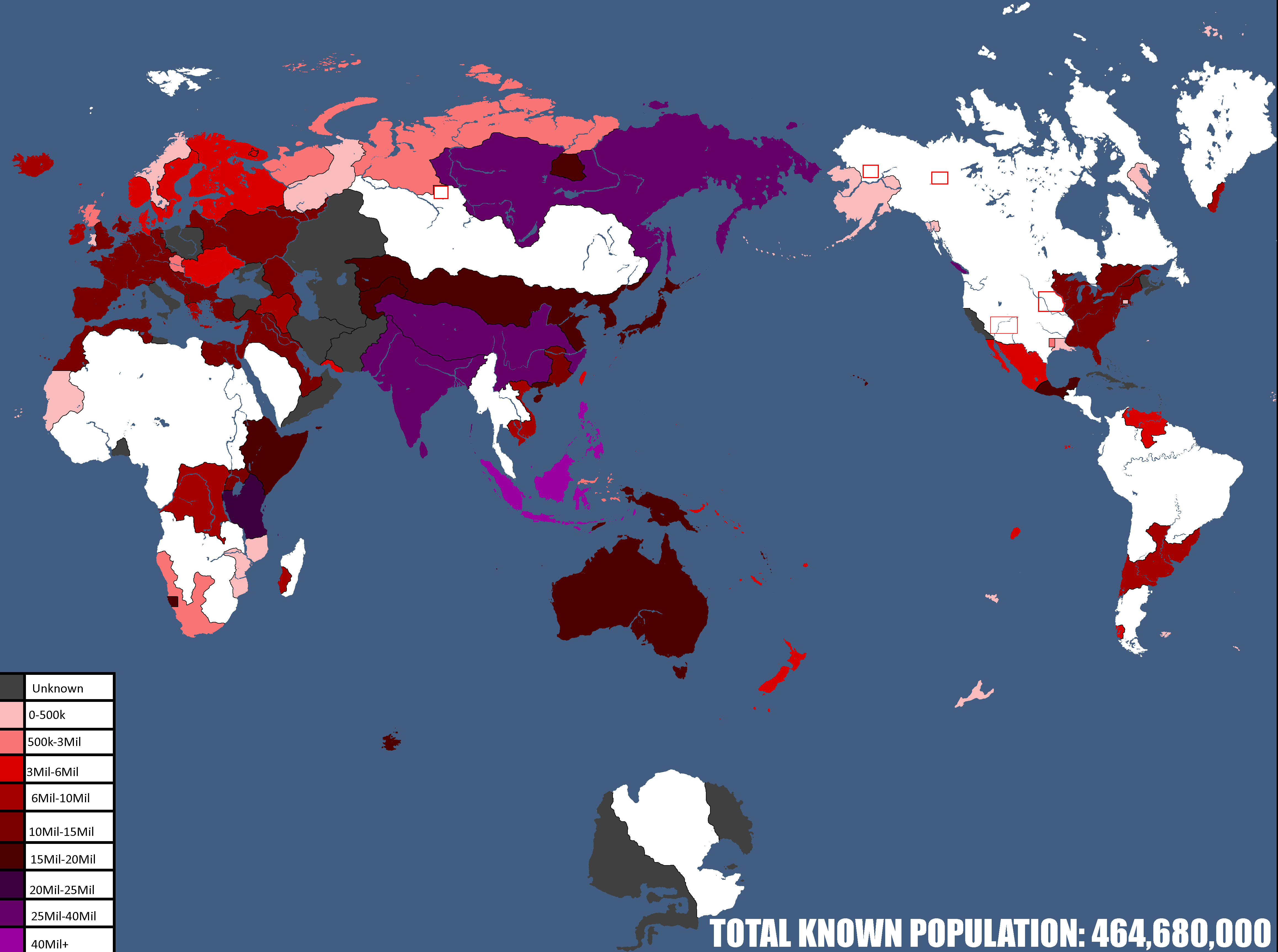
Population Map: Year 112
-
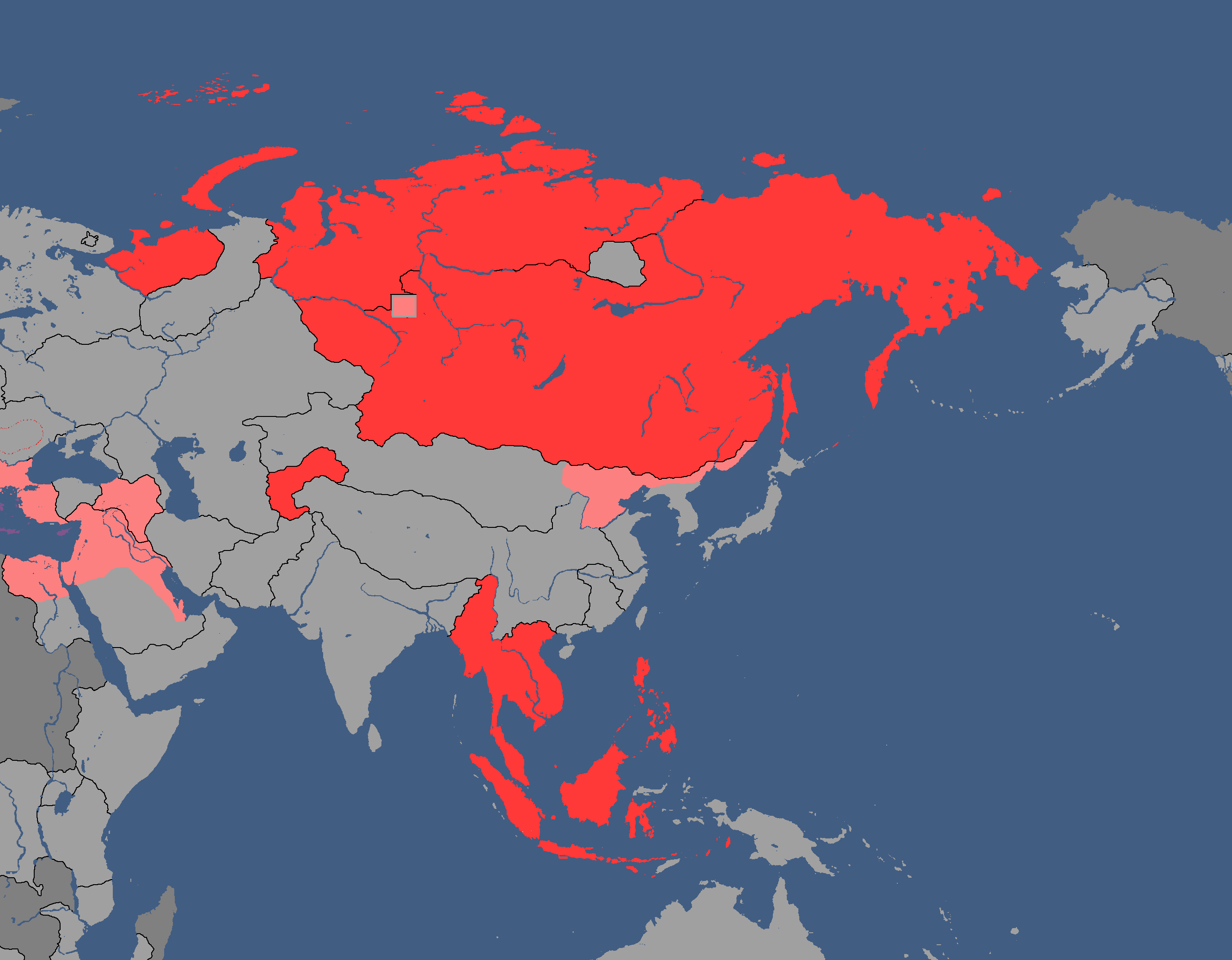
Asia Overlay: Year 113
-
Population of Yata's Countries: Year 114
-
Northern Canada Overlay: Year 114
-
IRL Countries with no claims in them on YATA: Year 115
-

Europe's Population Density: Year 115
-
"Yata if it was good" meme: Year 116
-
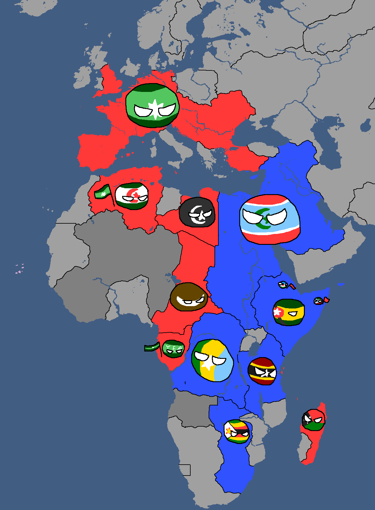
African Cold War: Year 117
-
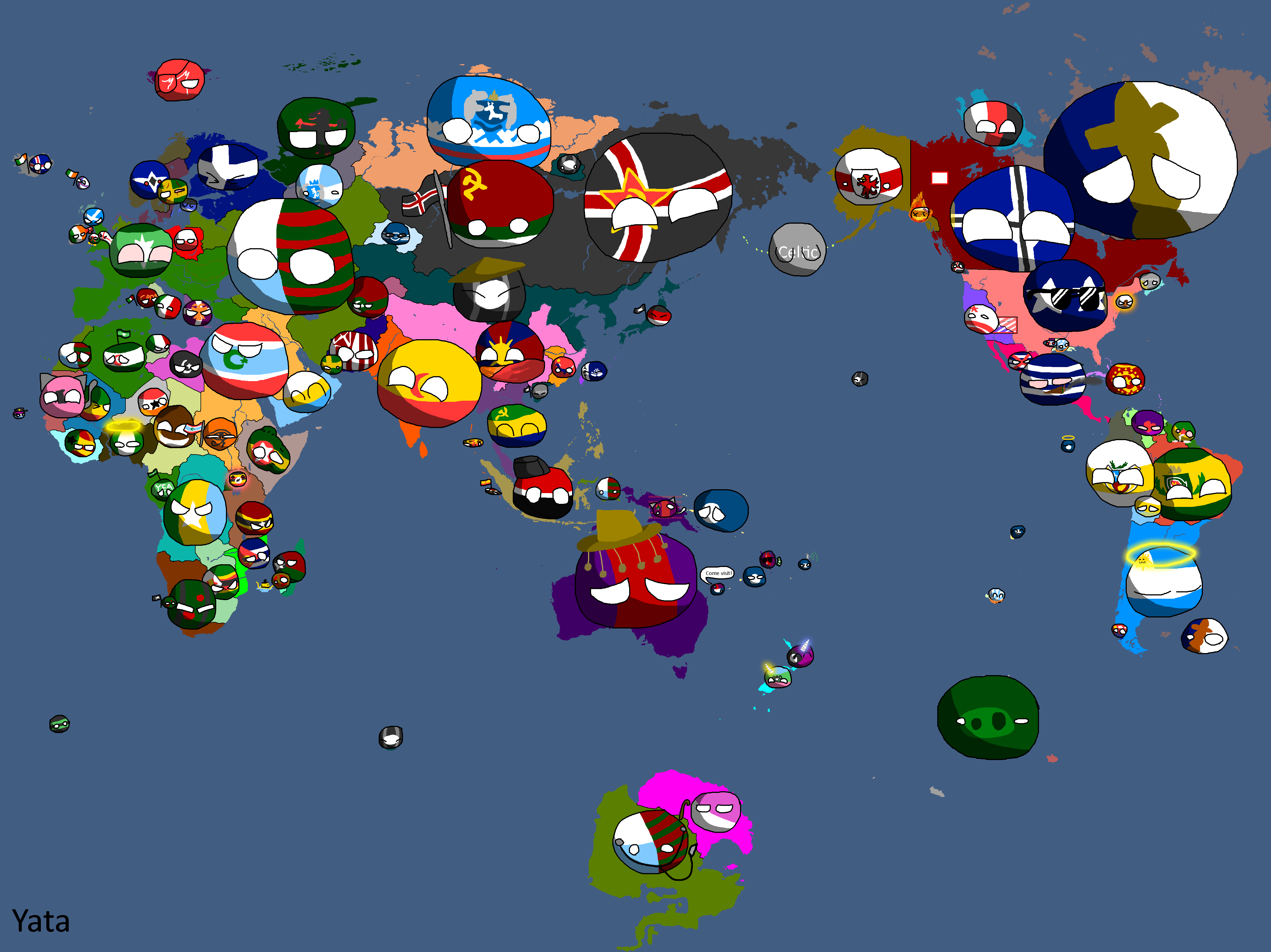
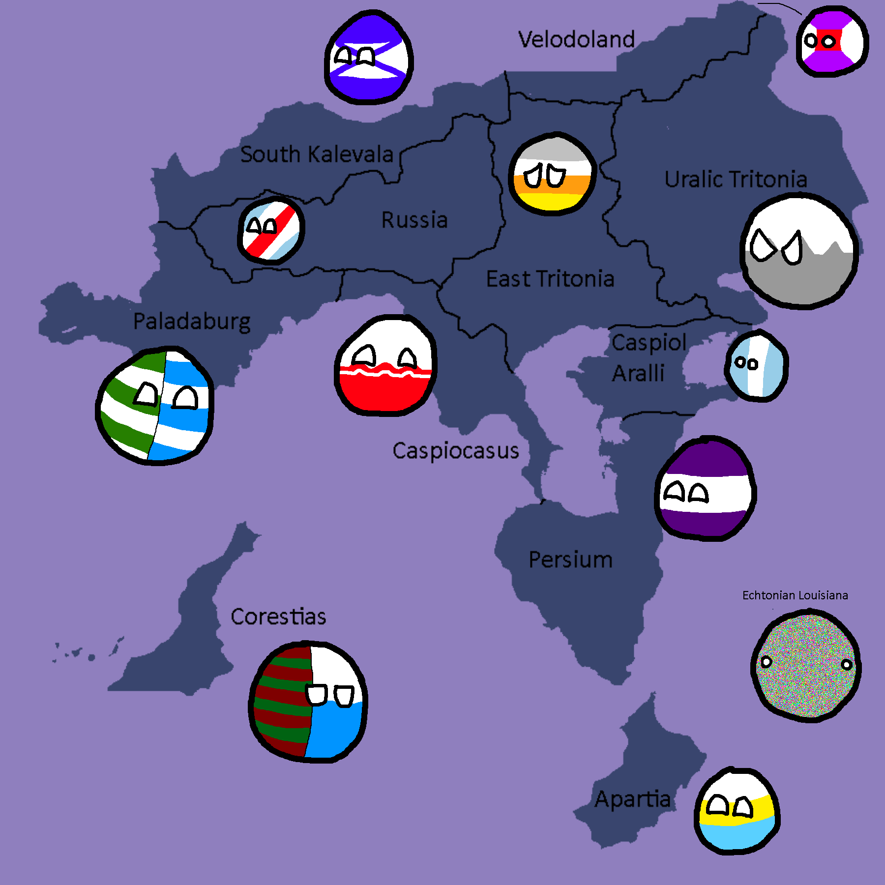
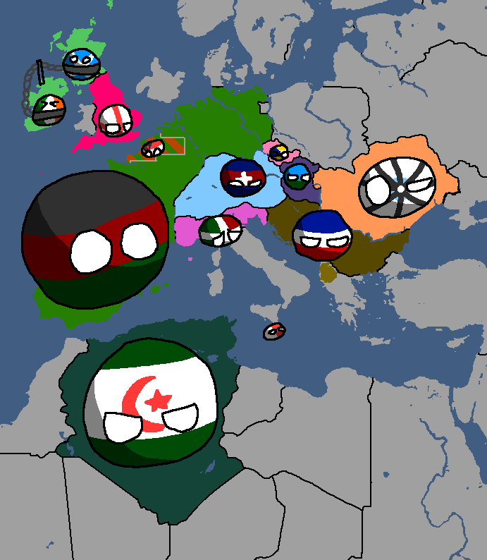
Yata Countryballs Map: Year 117
-
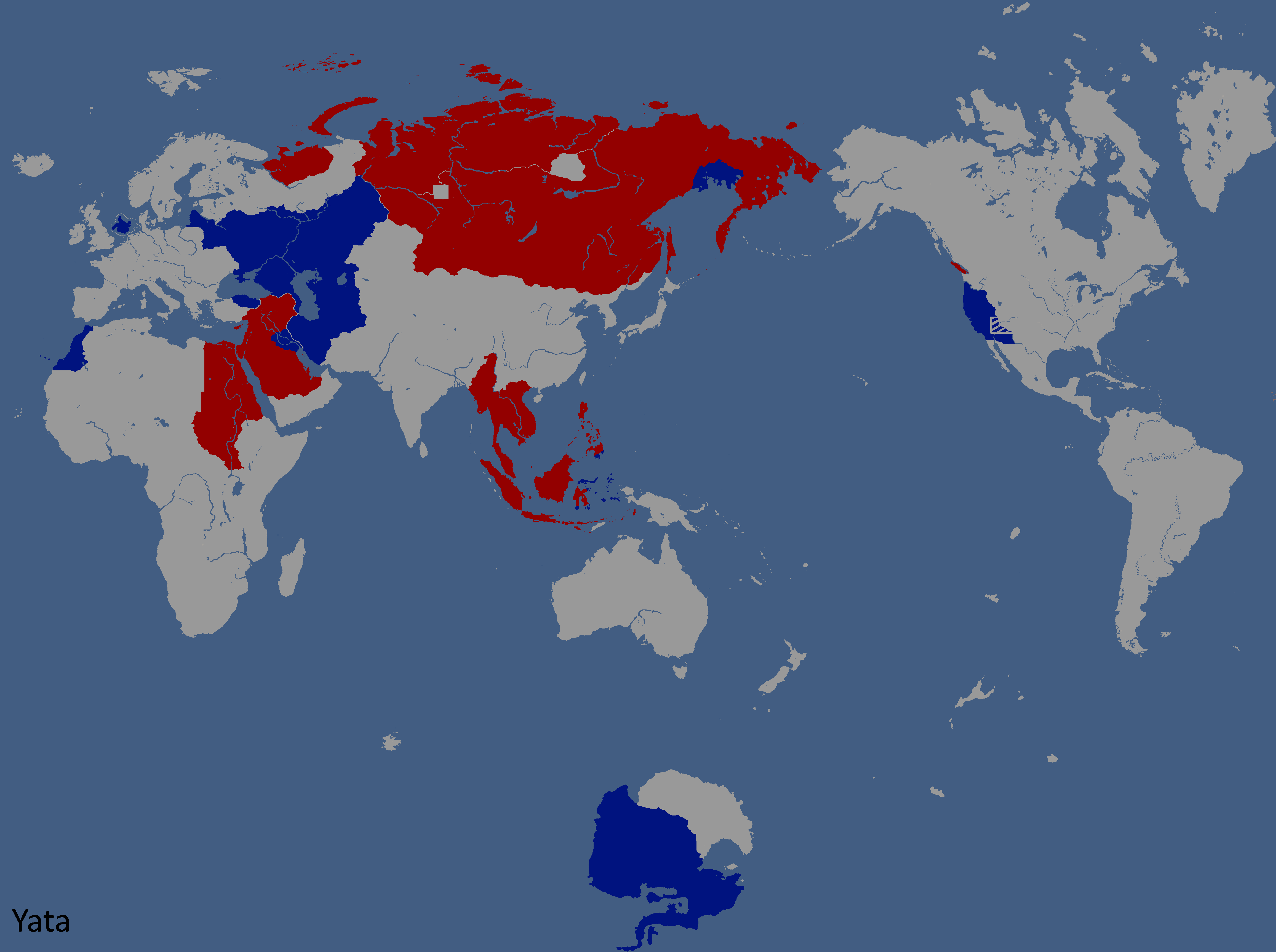
Hypothetical War between the UQSR and Aundzer Alliance: Year 117
-
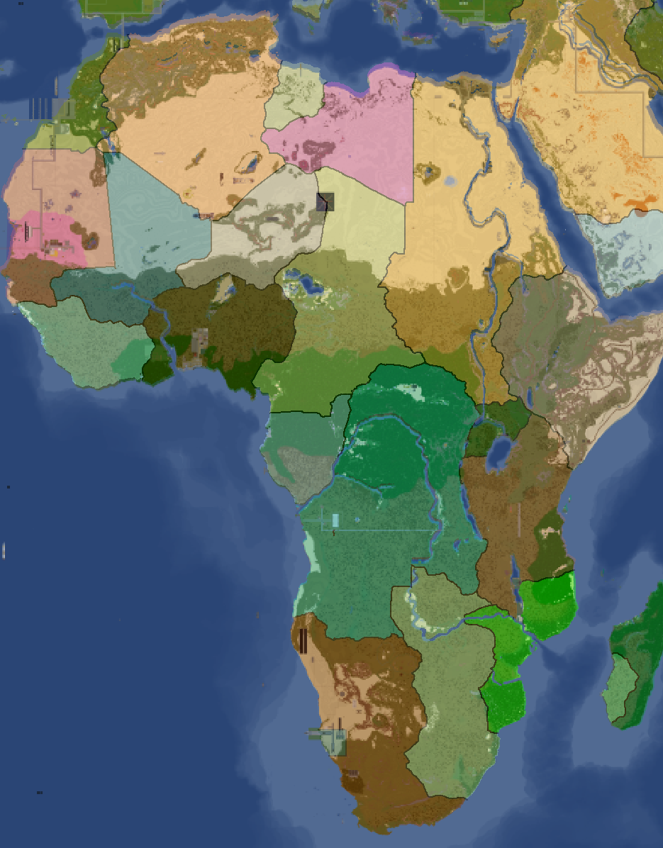
Africa Overlay: Year 117
-
Countries by Owners: Year 117
-
Lineland Overlay: Year 123
-
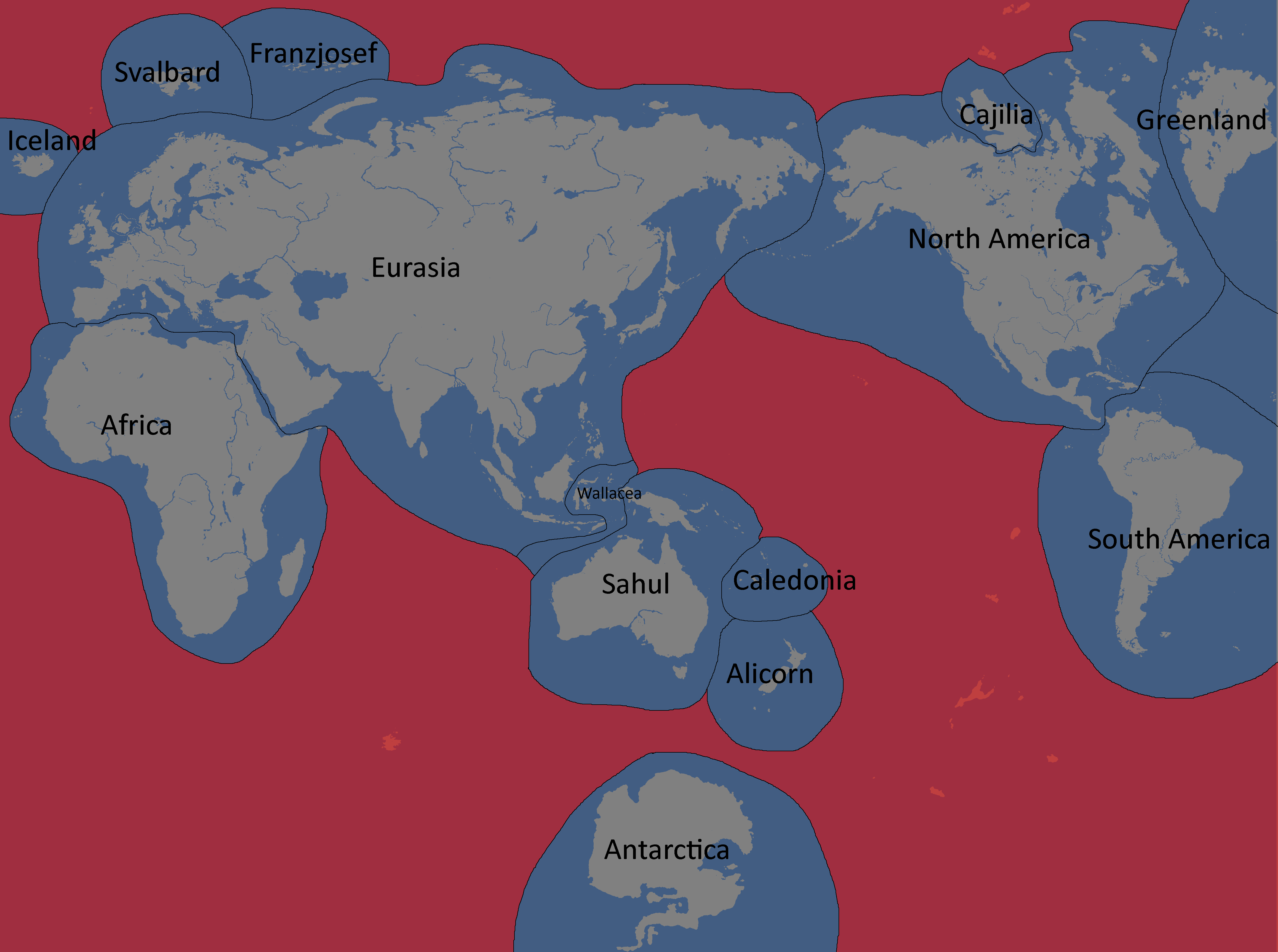
Continent Proposal: Year 124
-
Nuclear Powers in White: Year 134
-
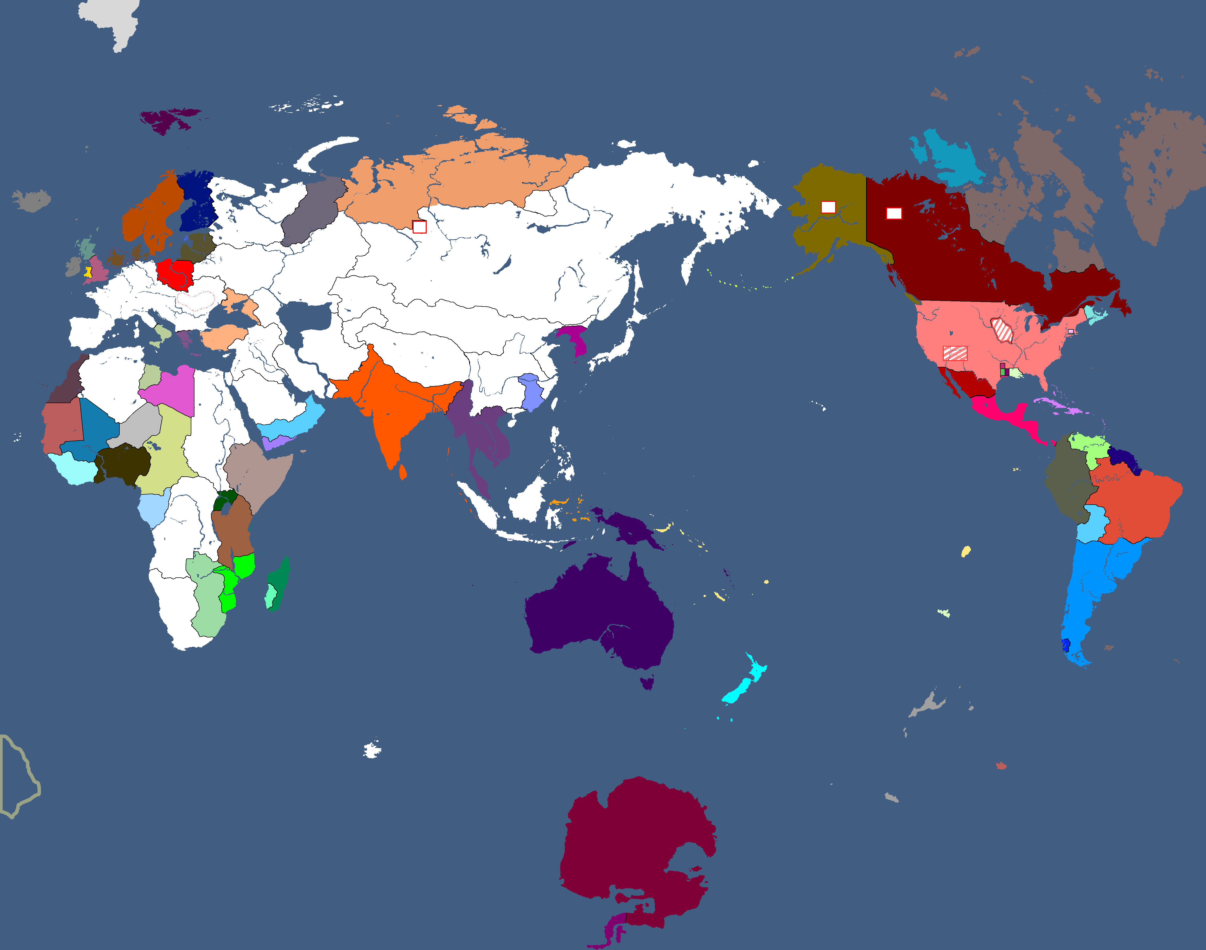
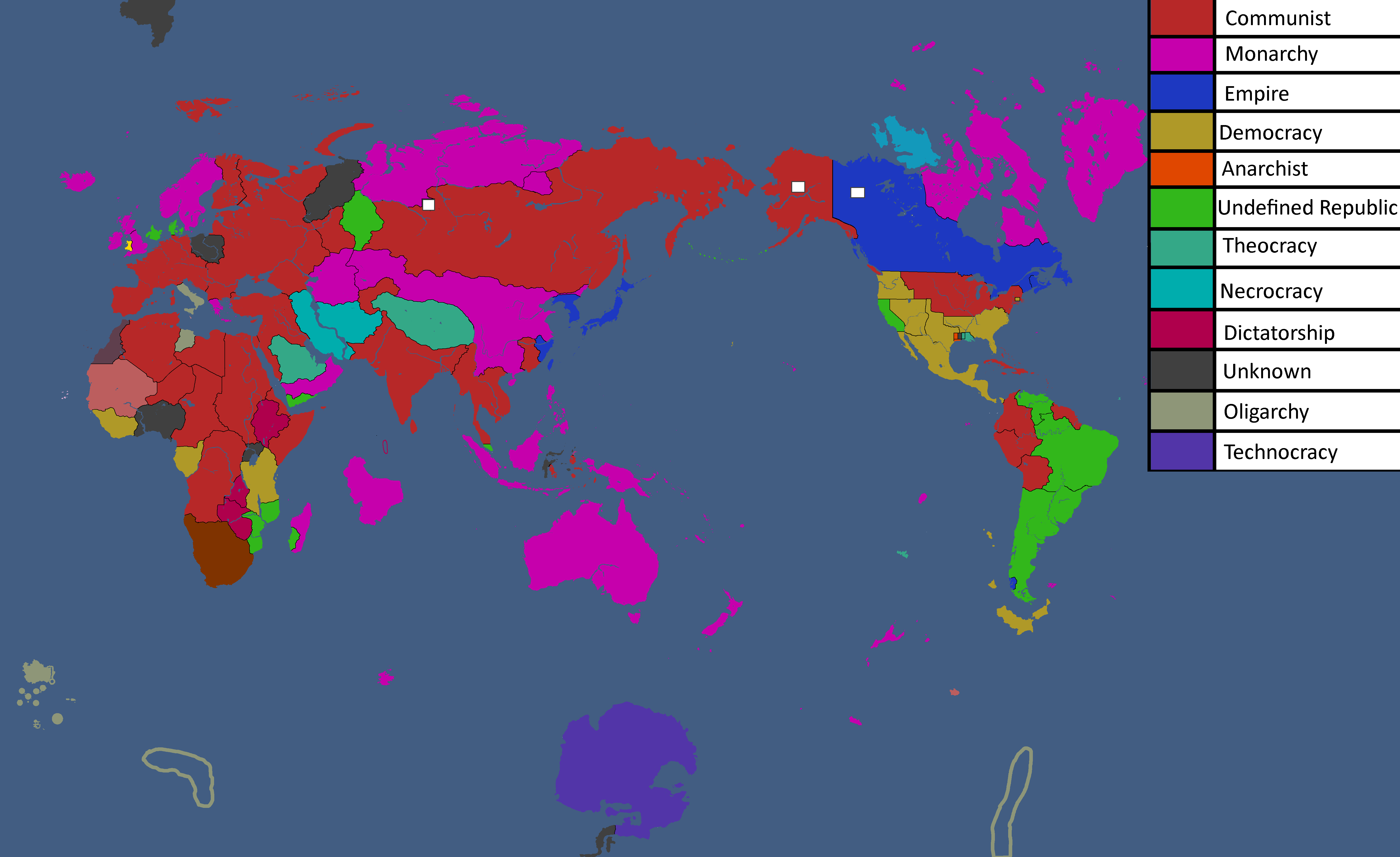
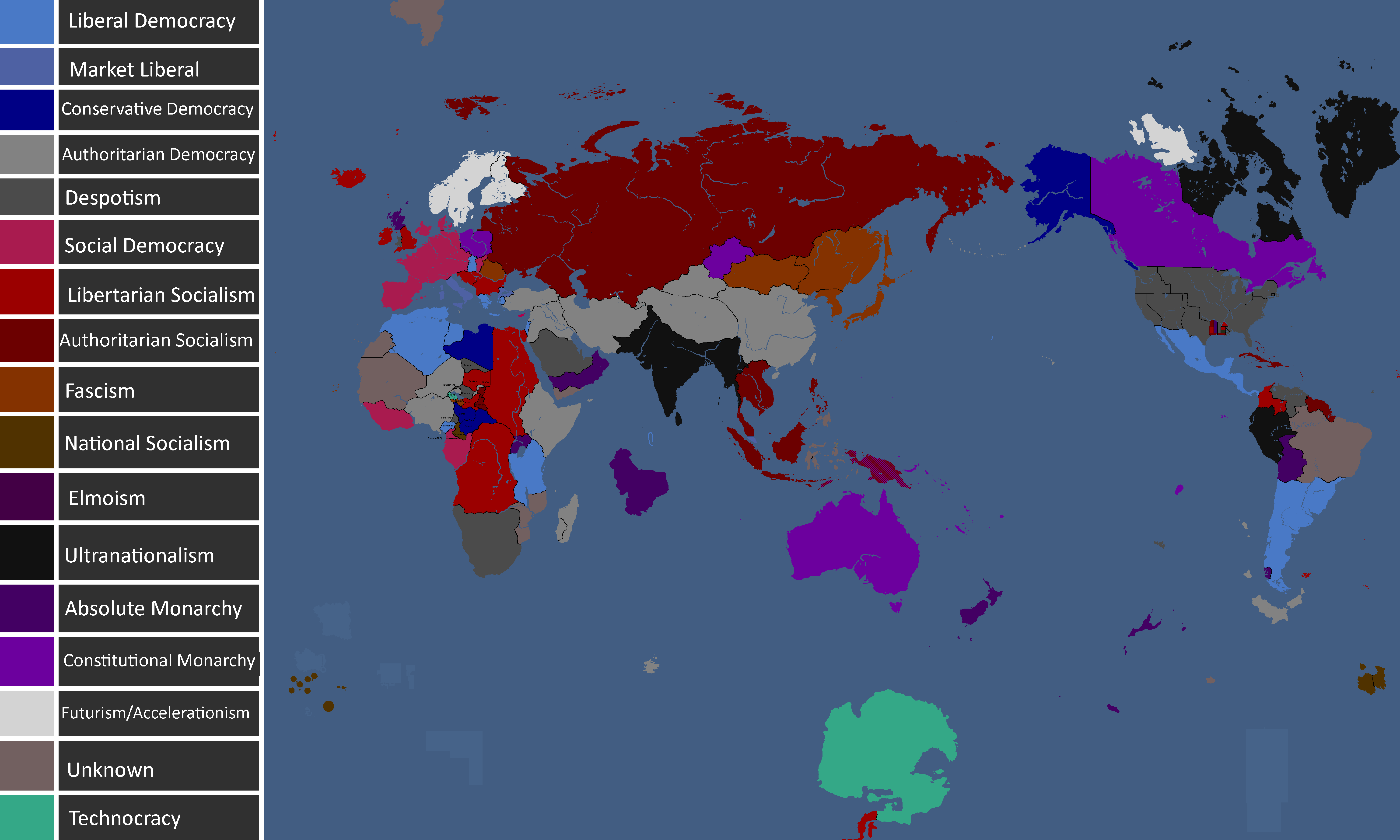
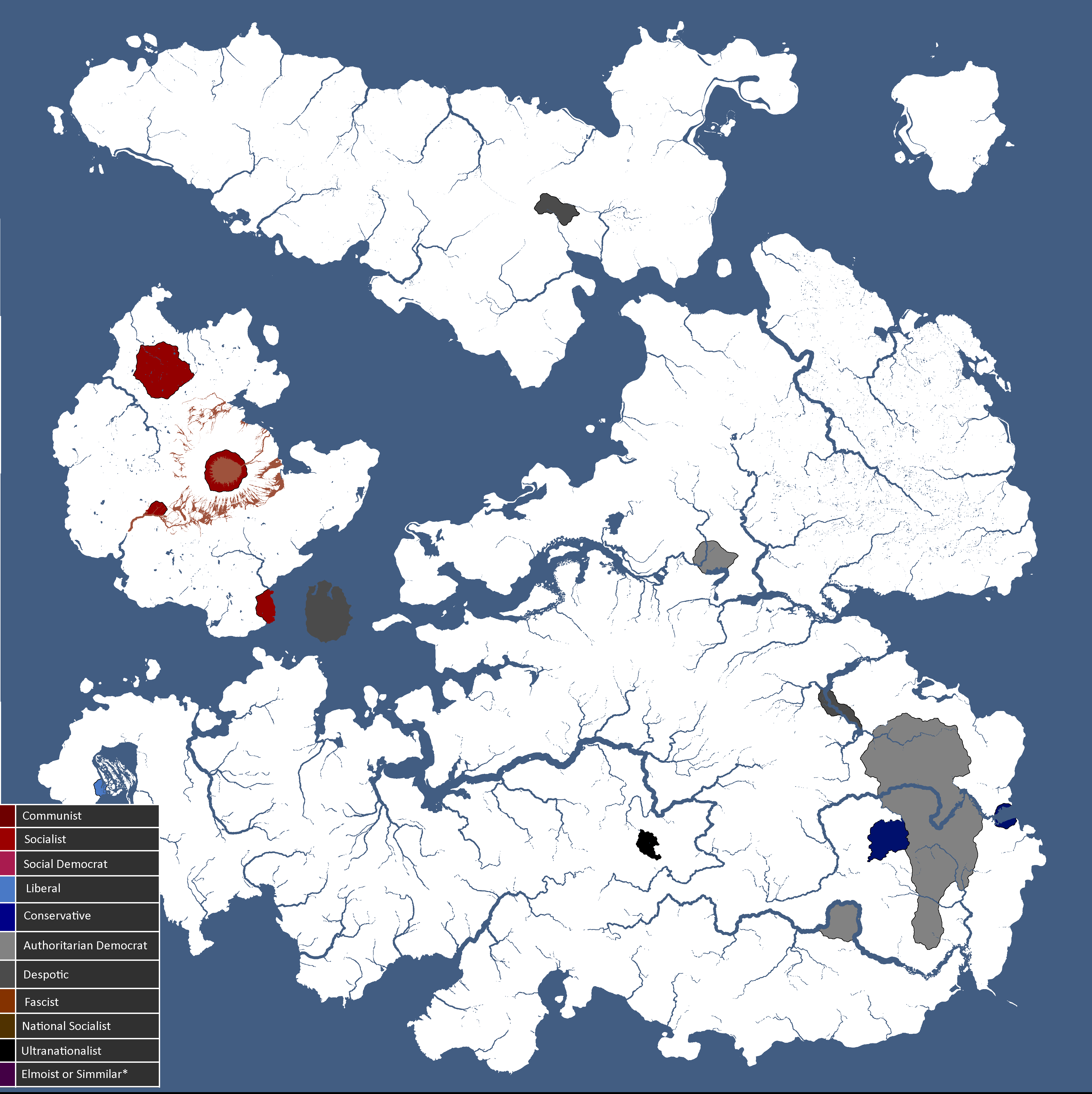
Map of Political Ideologies: Year 147
-
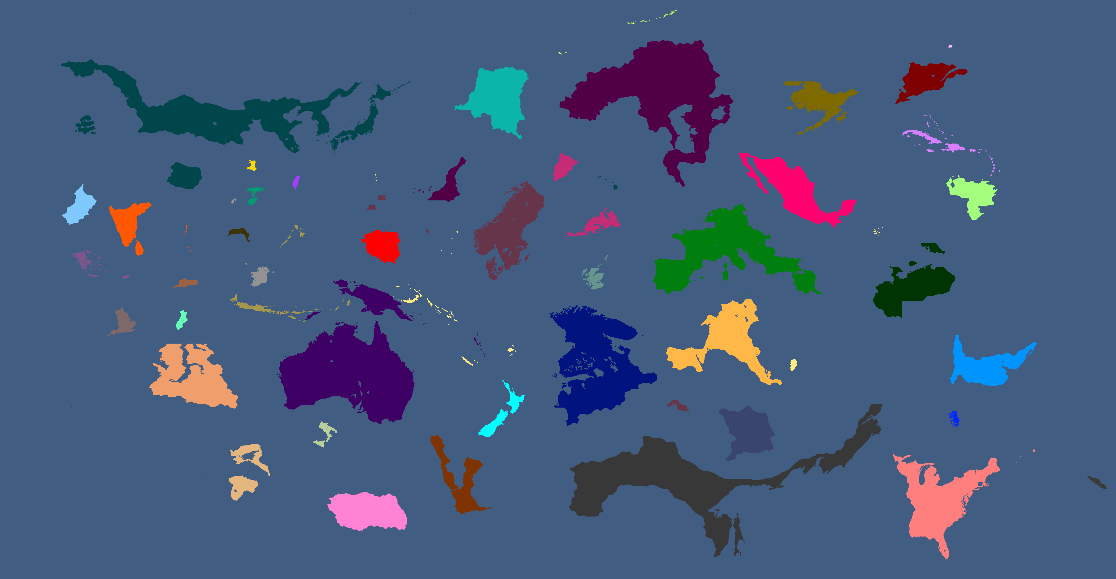
Proposed Map of Continents: Year 153
-
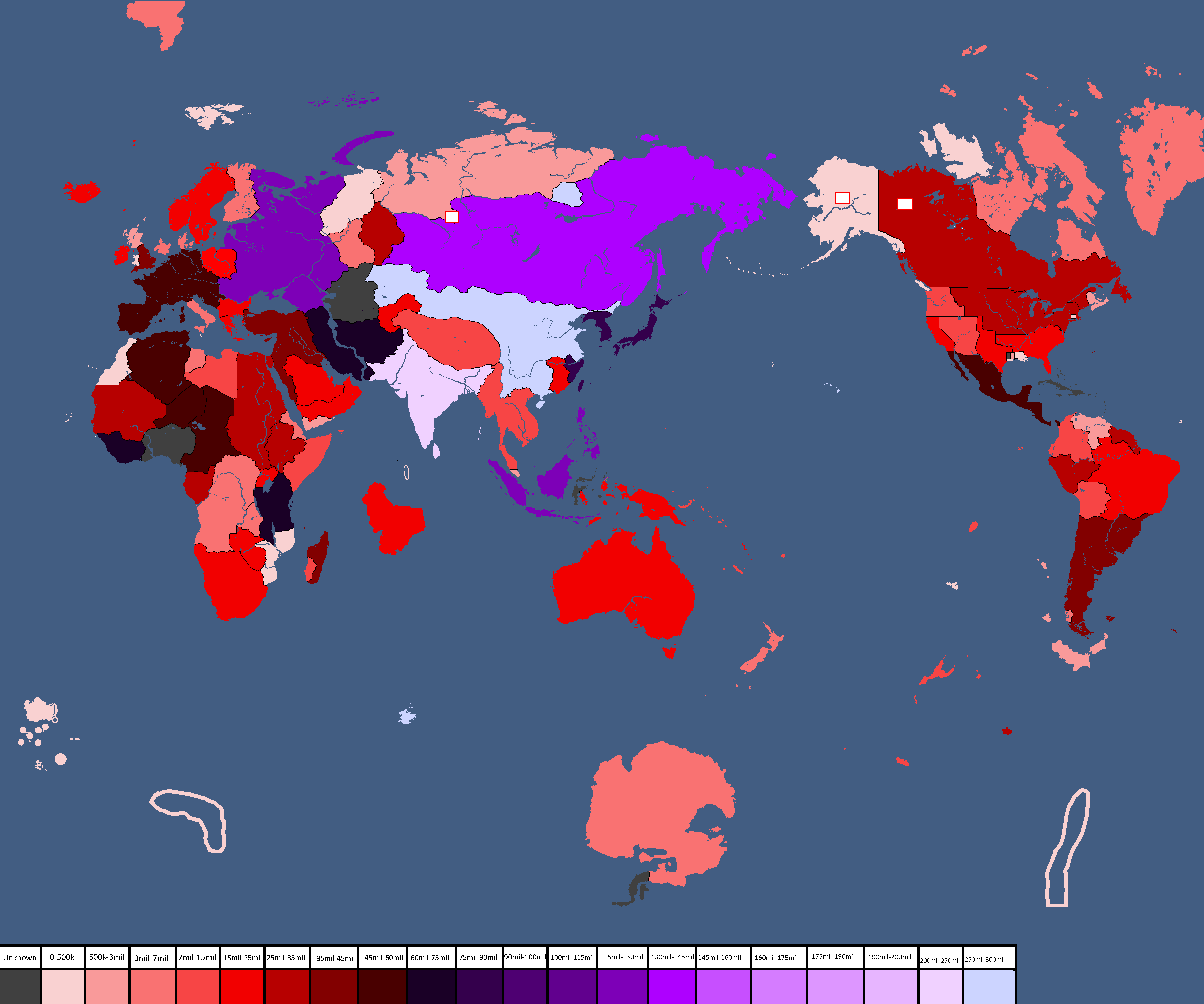
Population Map: Year 166
-
Ideology Map: Year 166
-
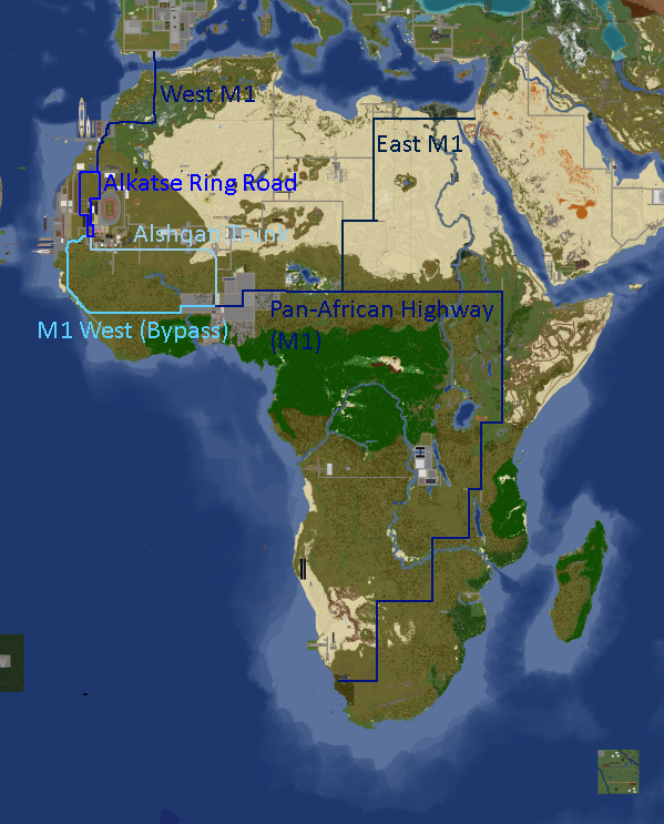
Africa Road Map: Year 168
-
Yatan Cold War: Year 172
-
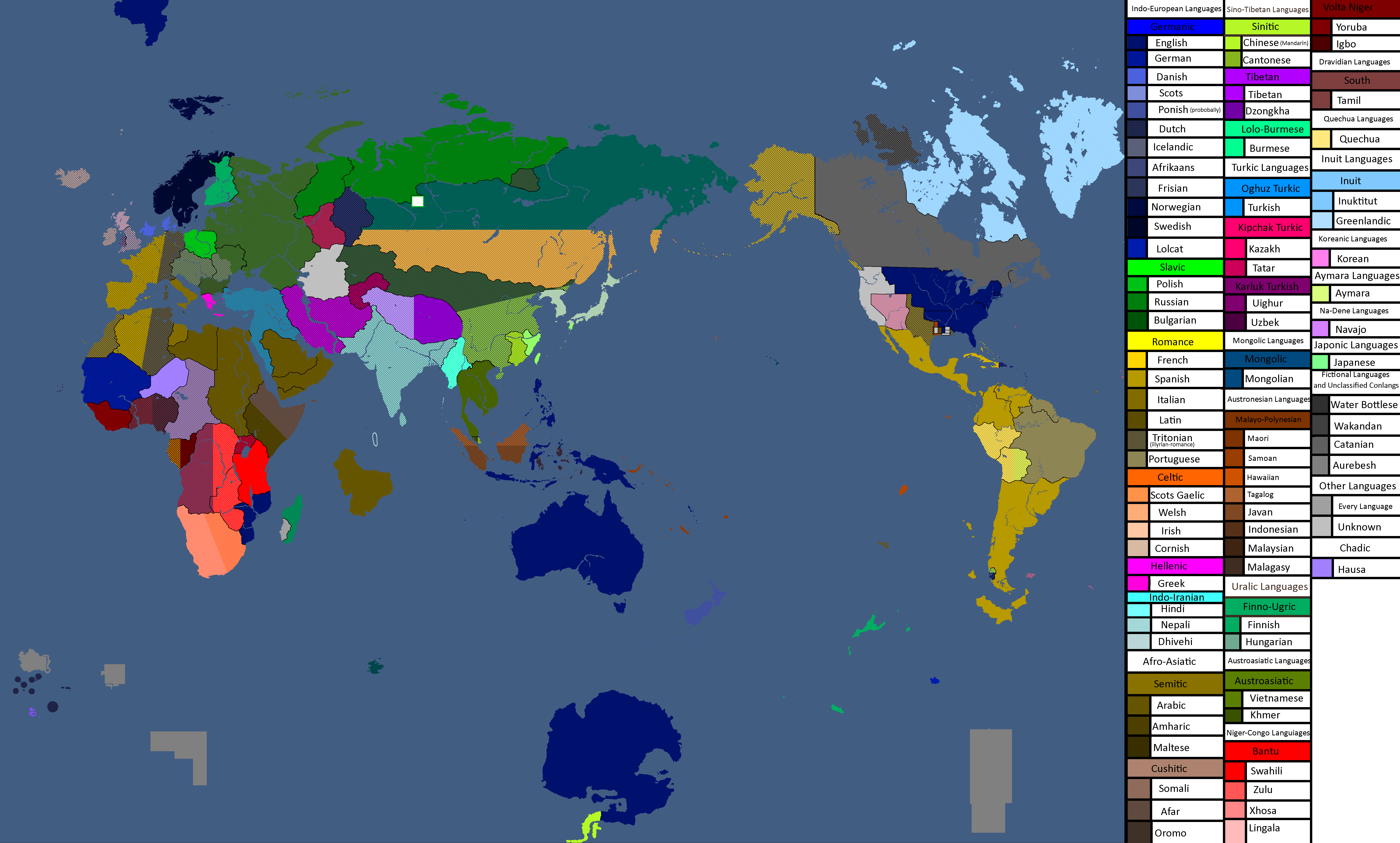
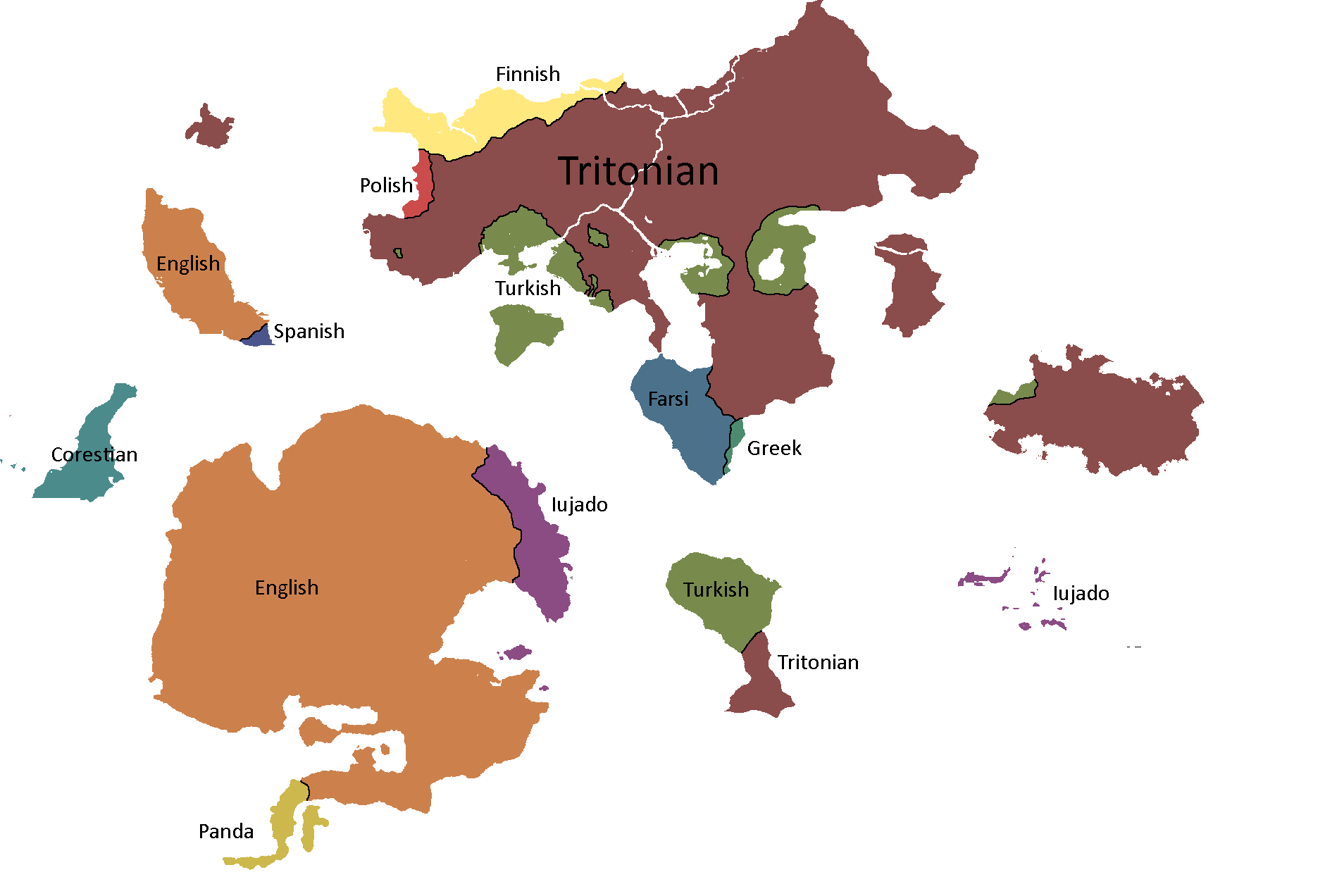
Map of Official Languages: Year 174
-
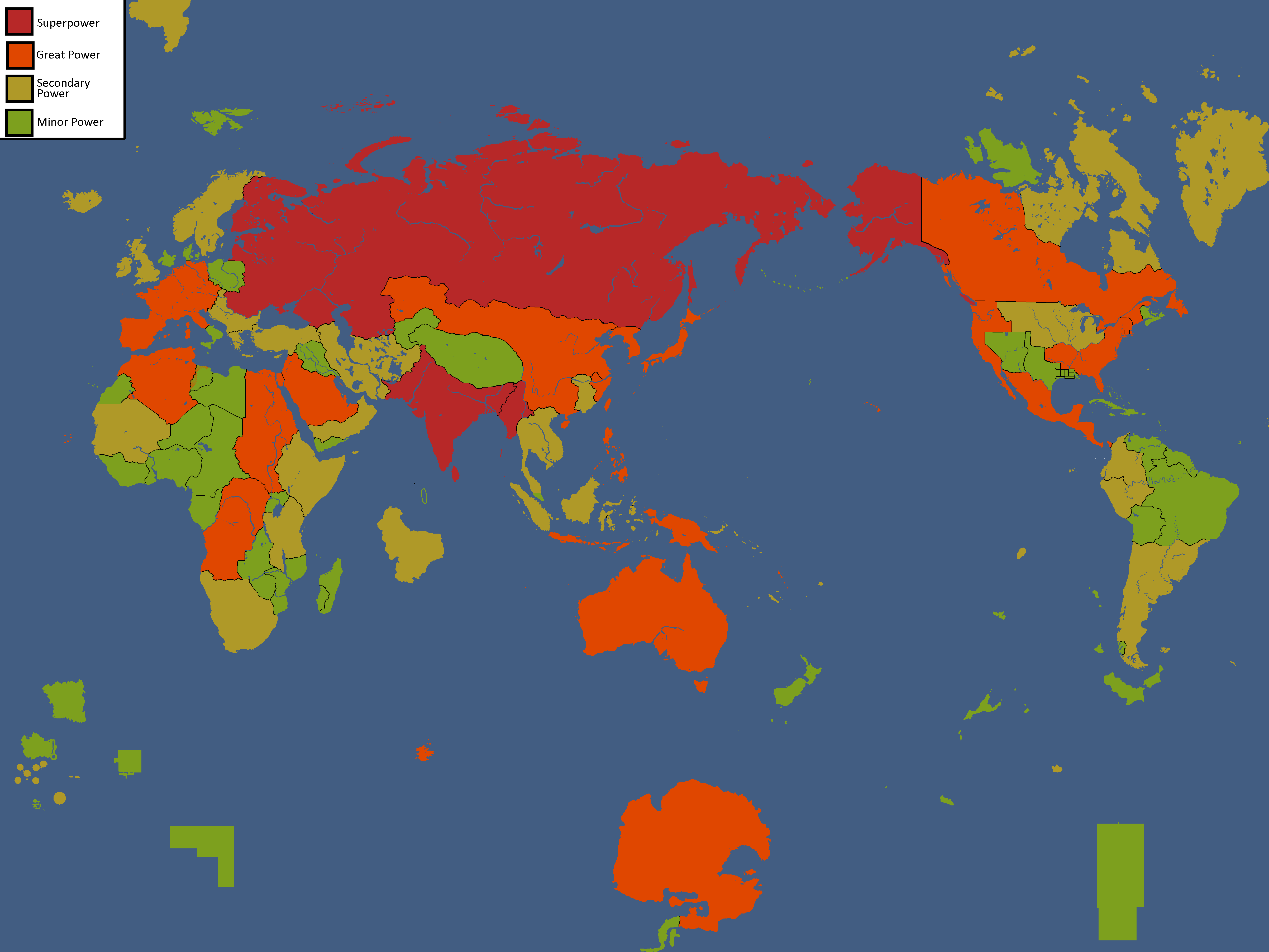
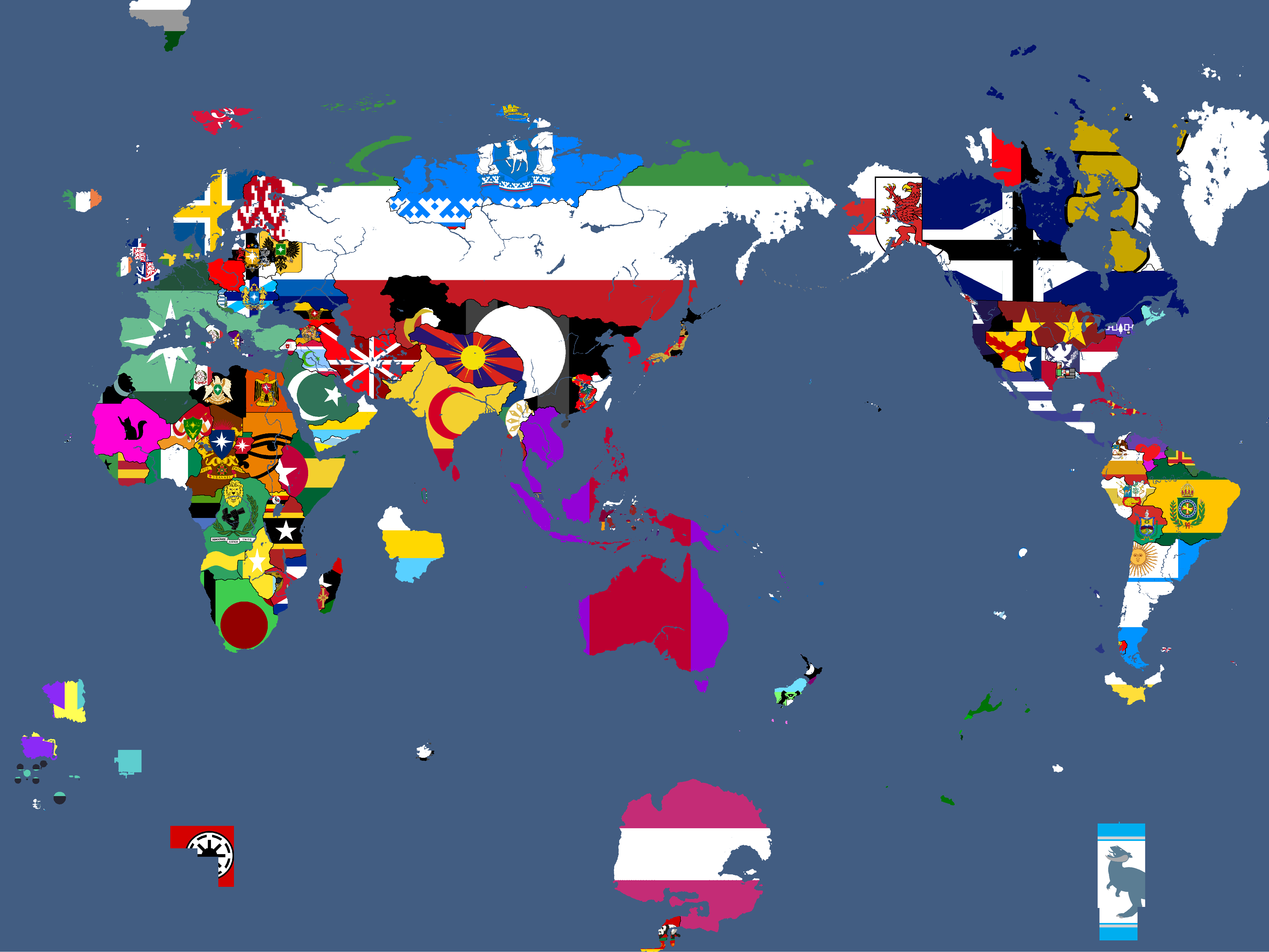
Map of Yata's Power Statuses: Year 180
-
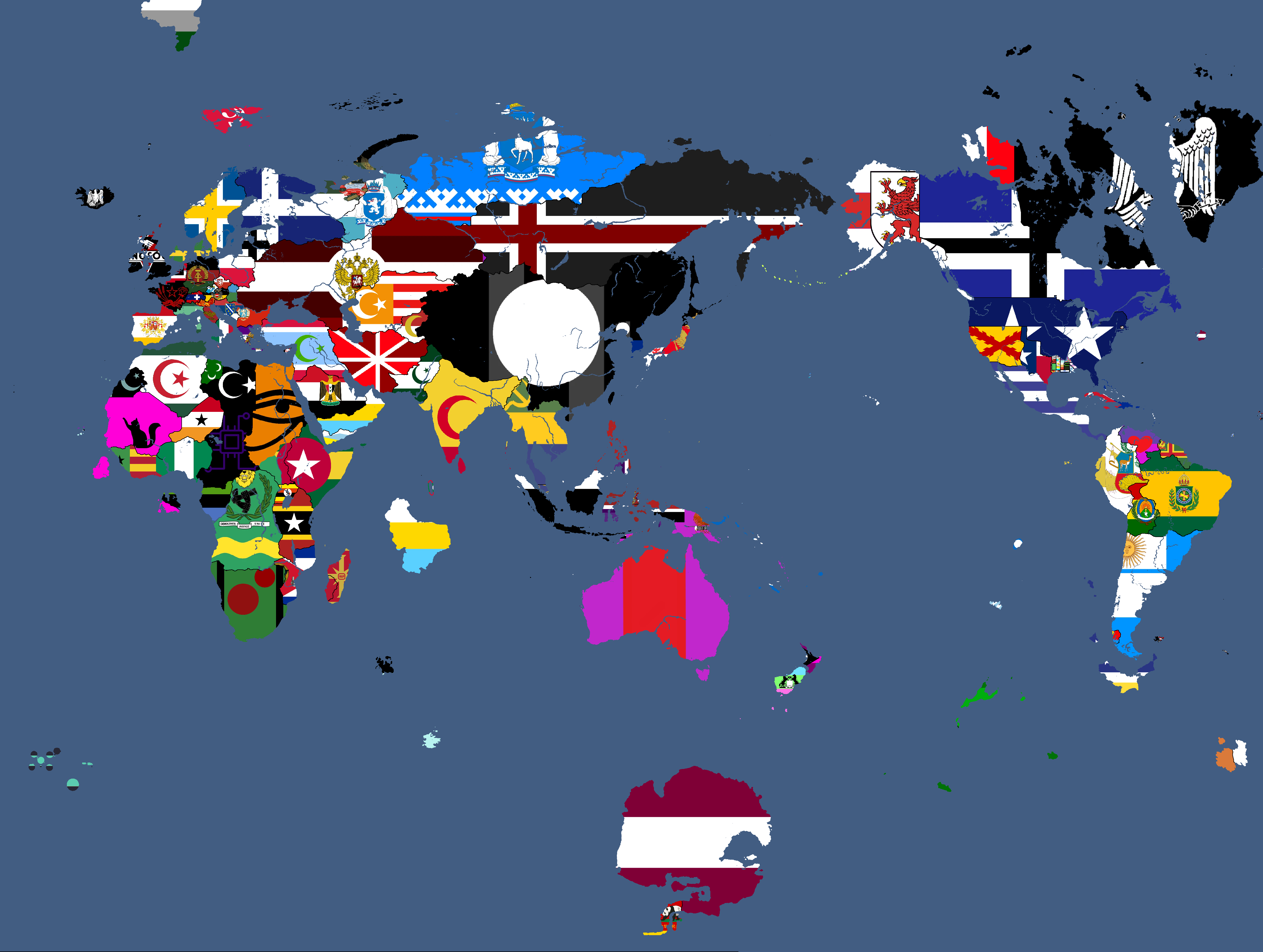
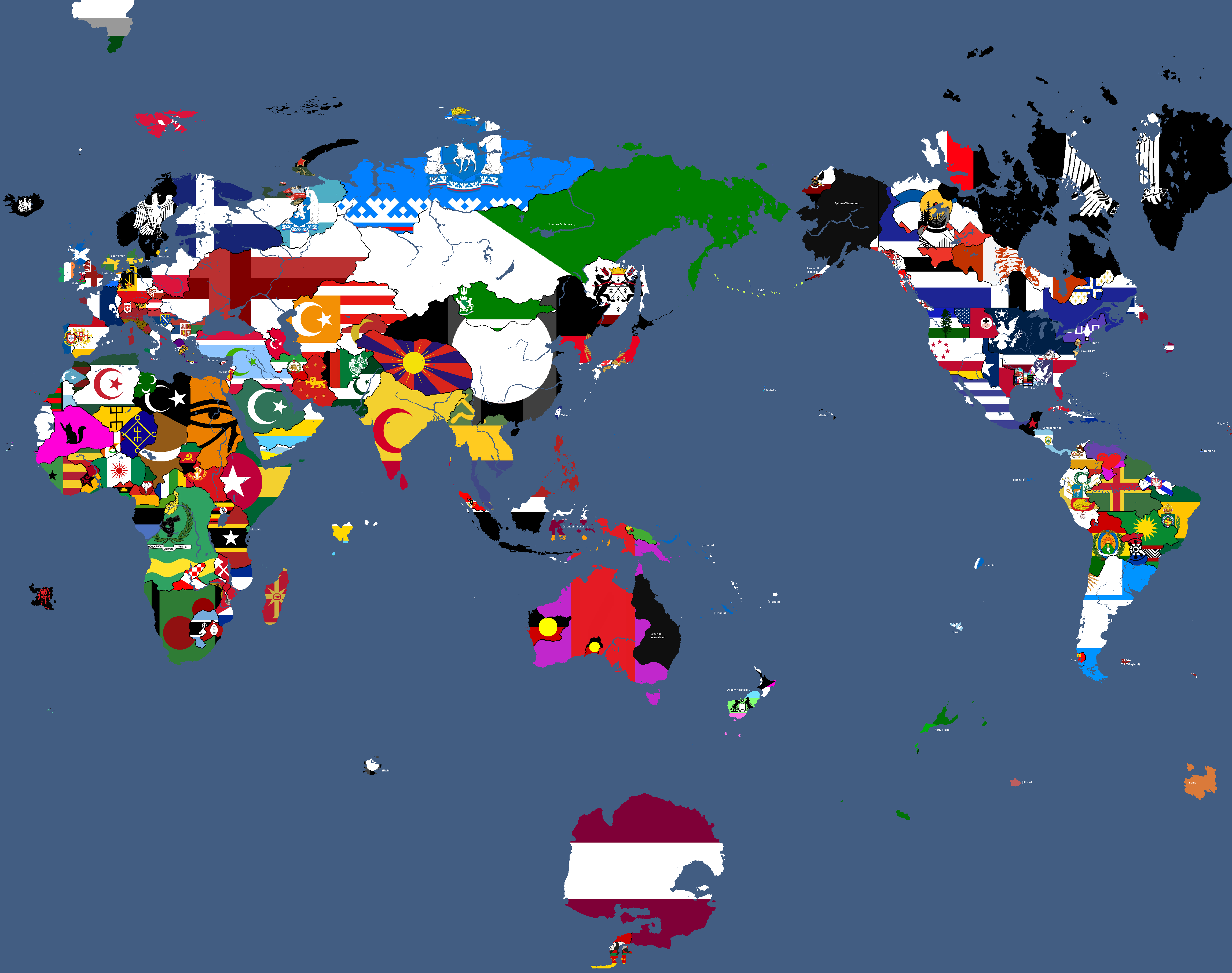
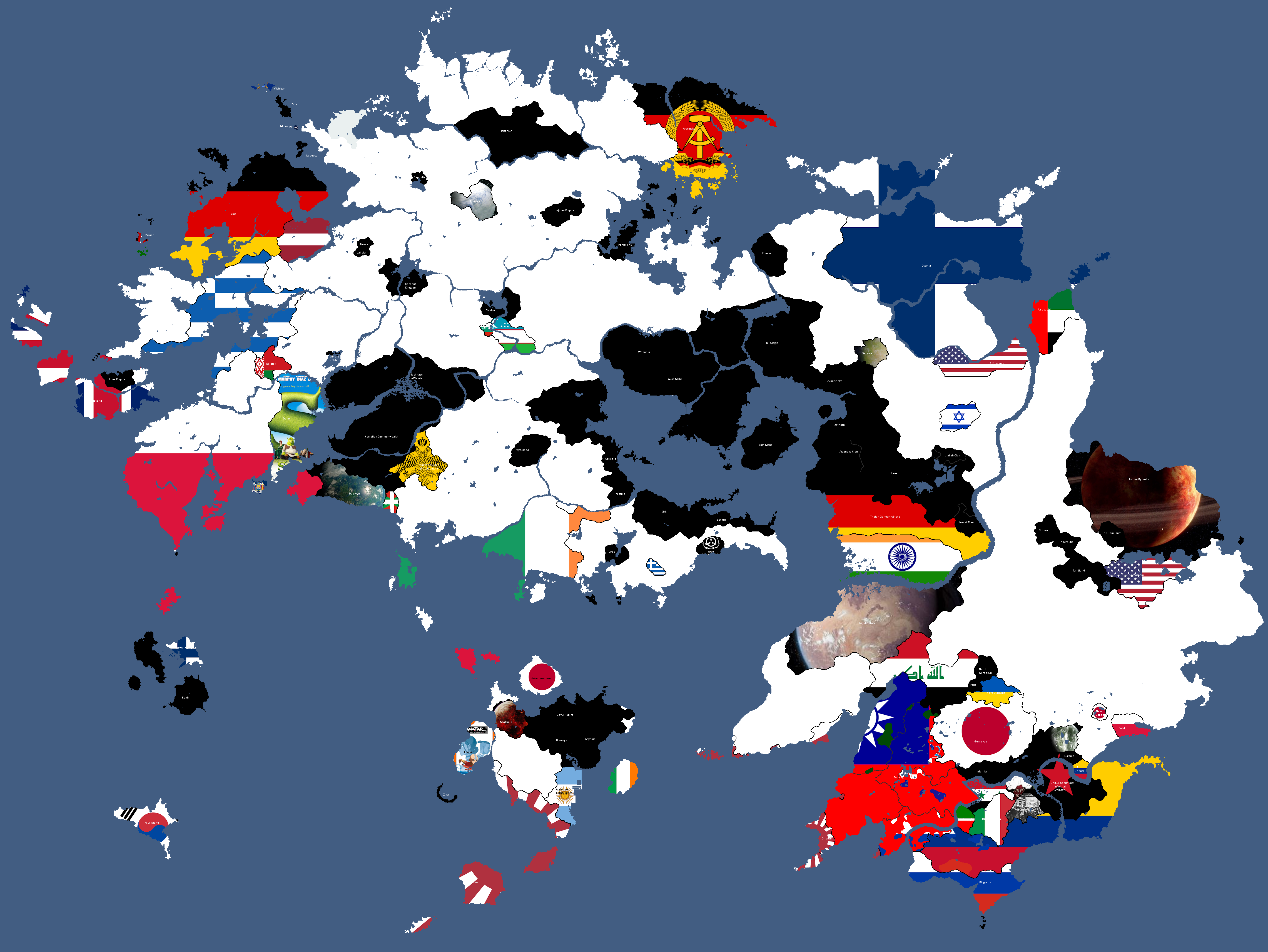
Flag Map: Year 183
-
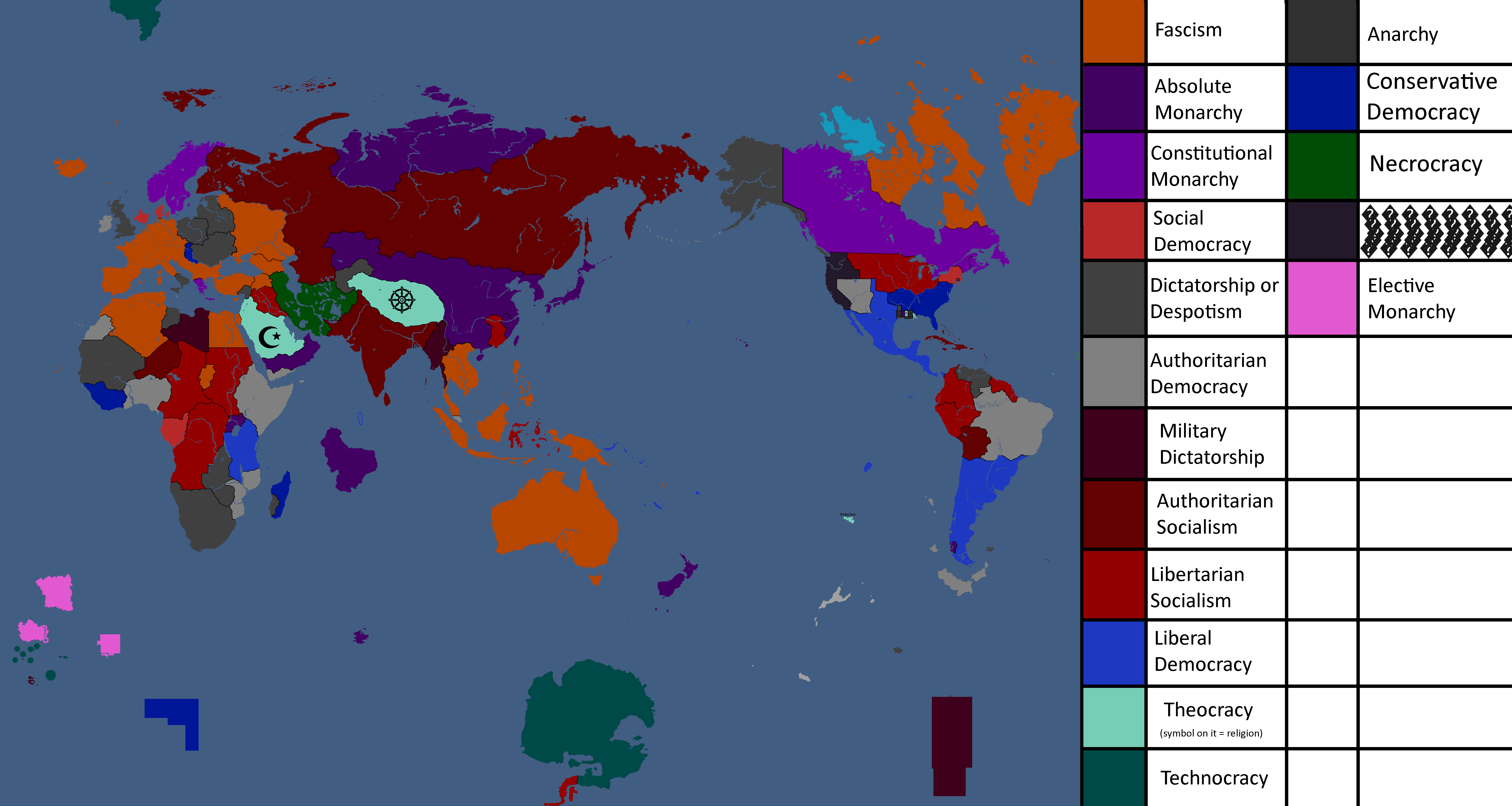
Ideology Map: Year 183
-
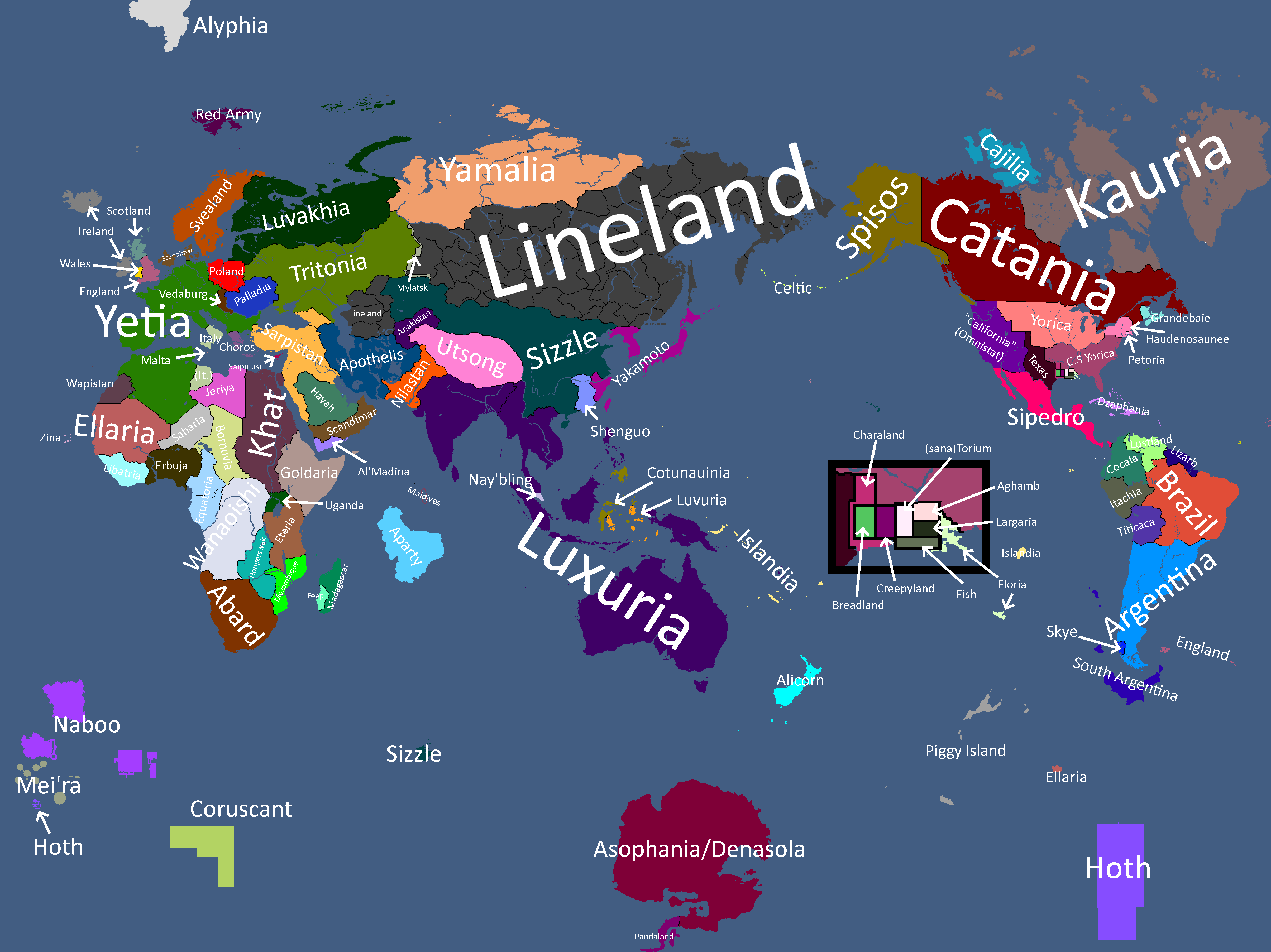
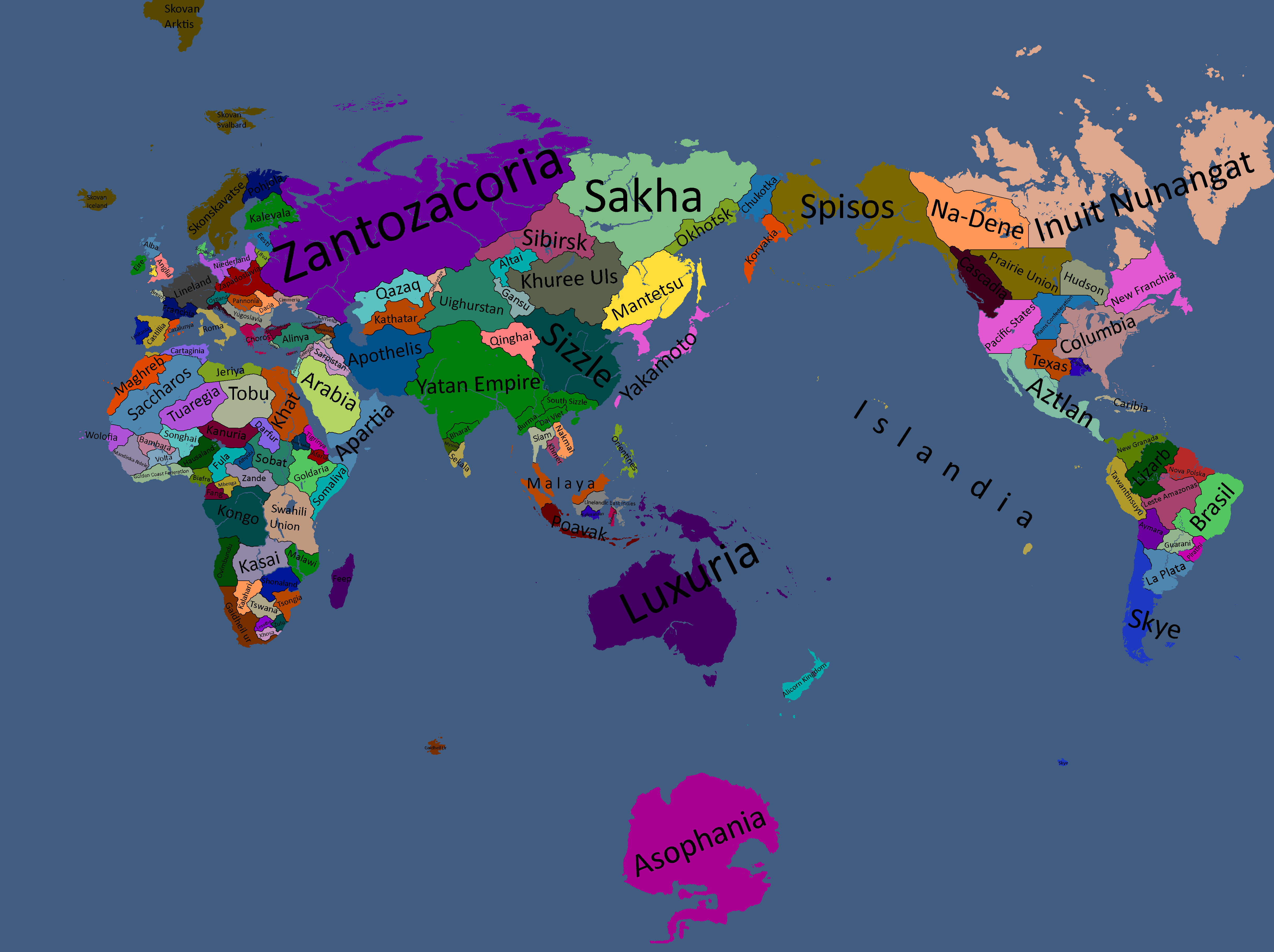
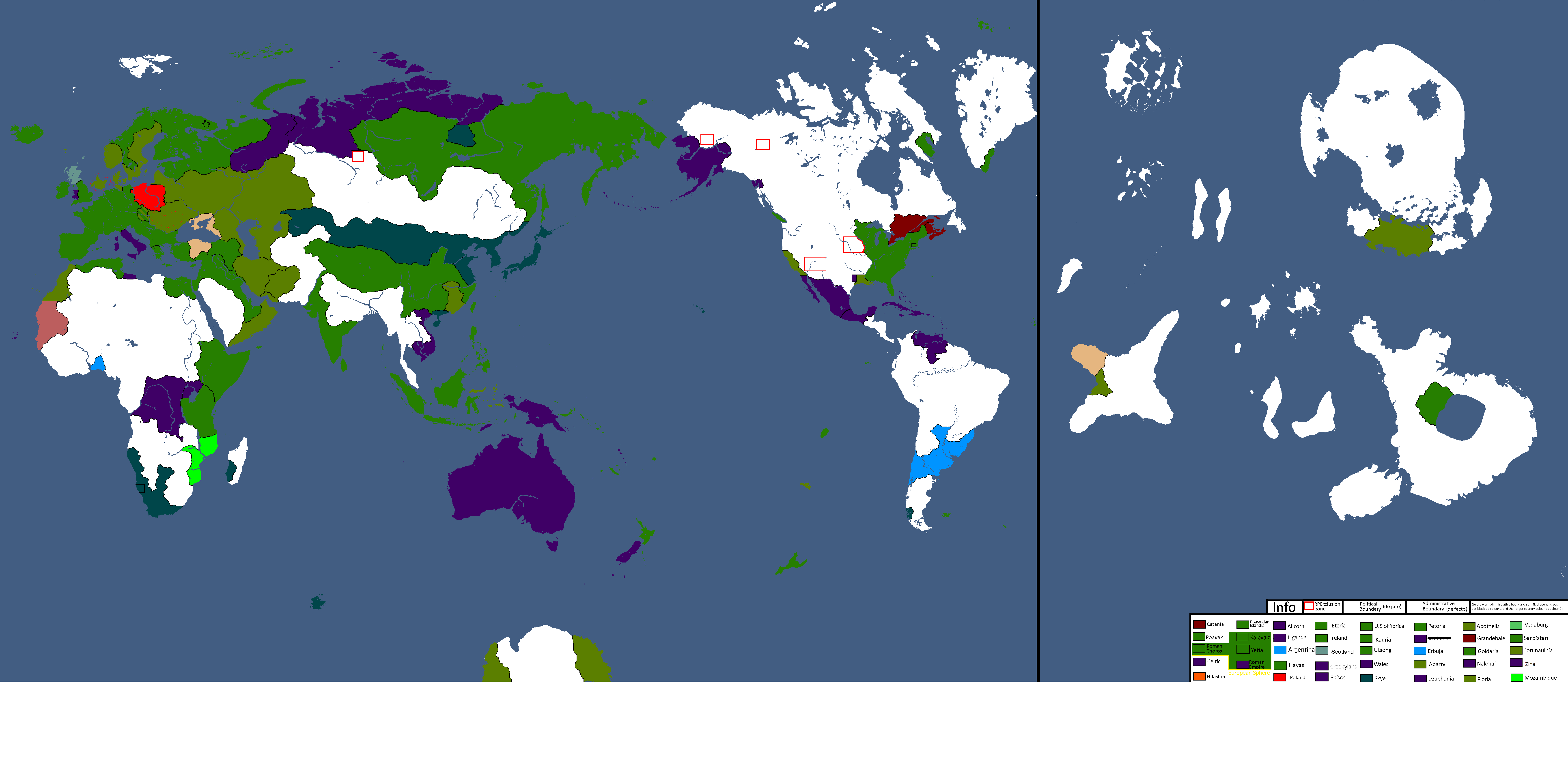
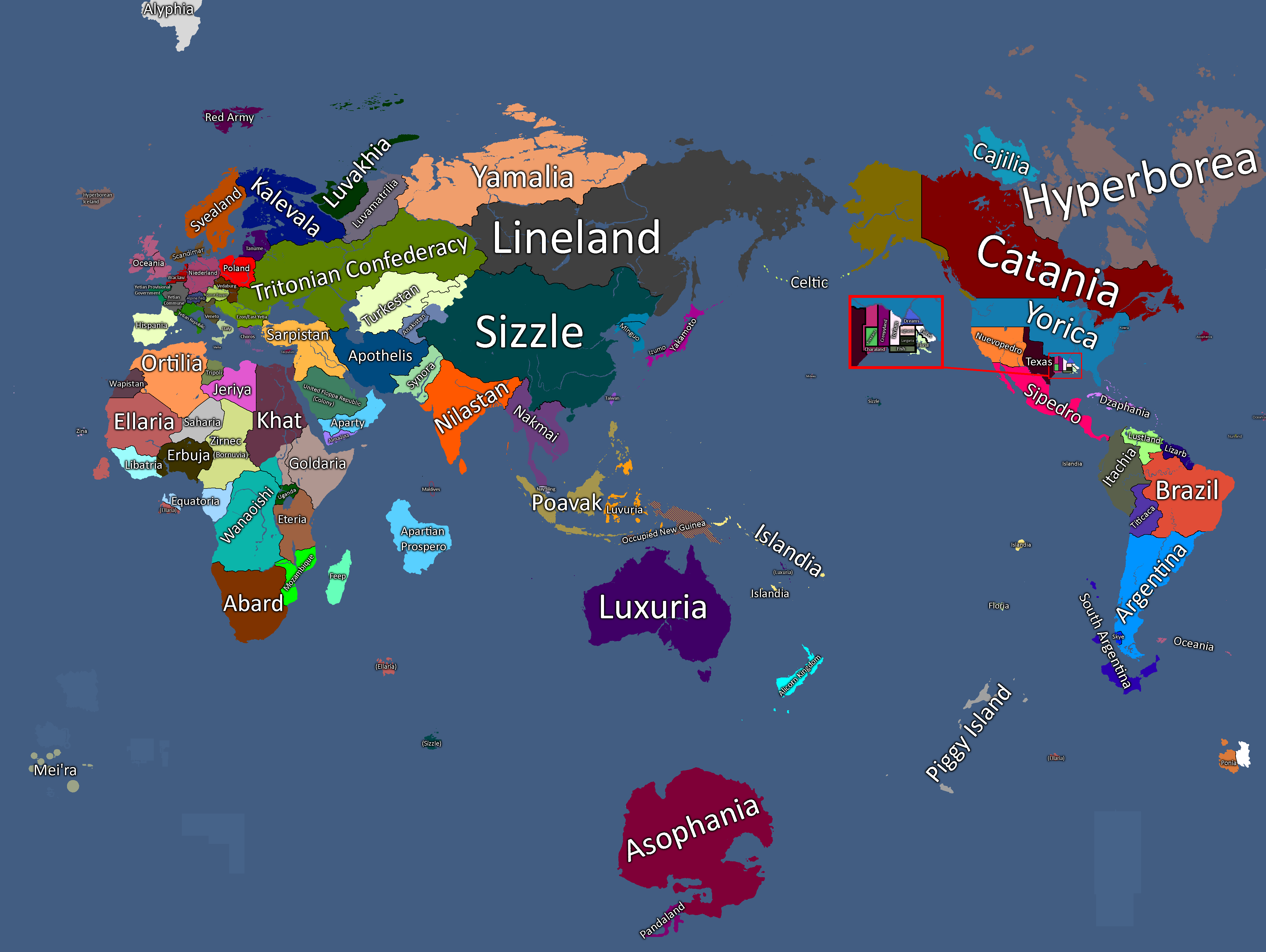
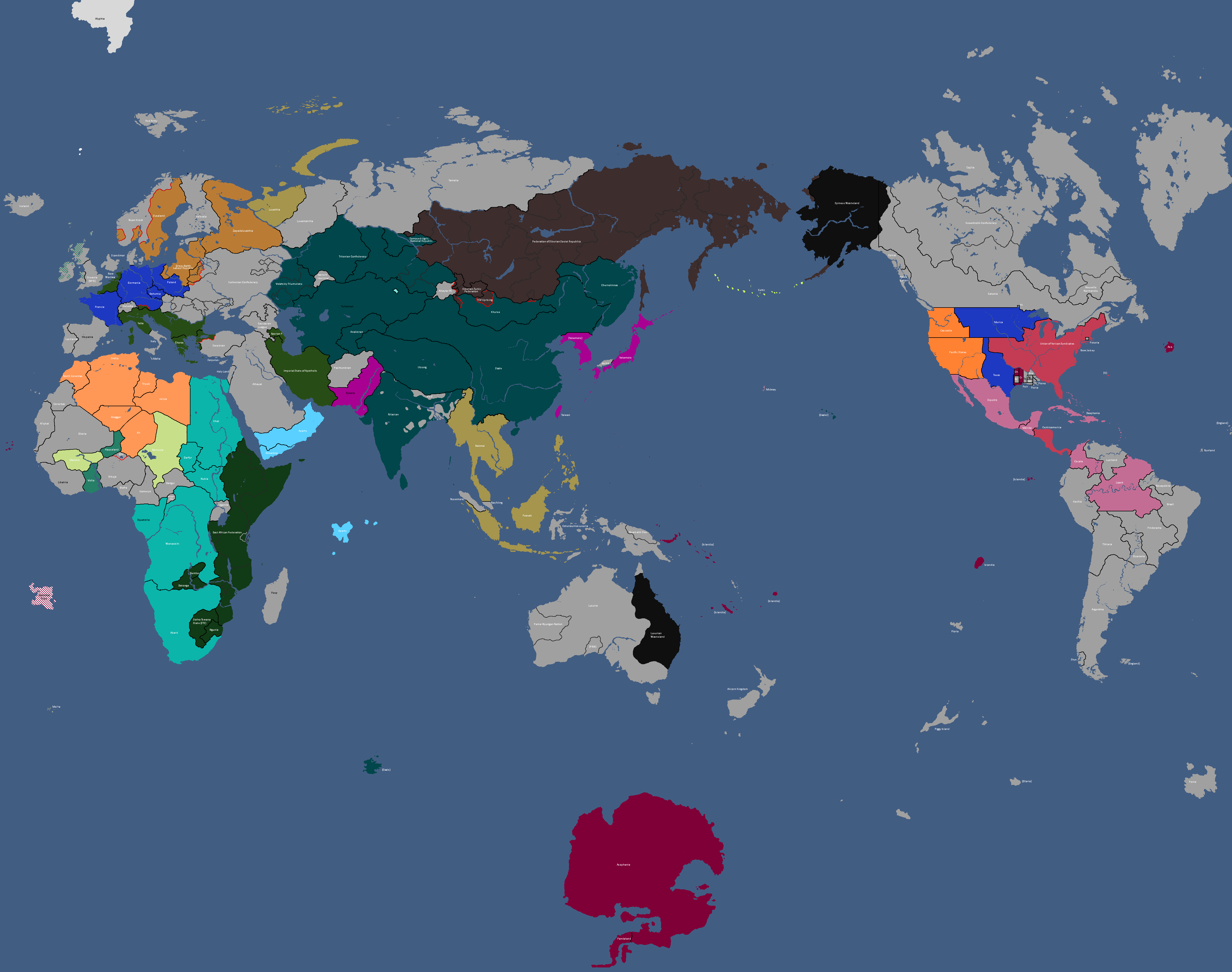
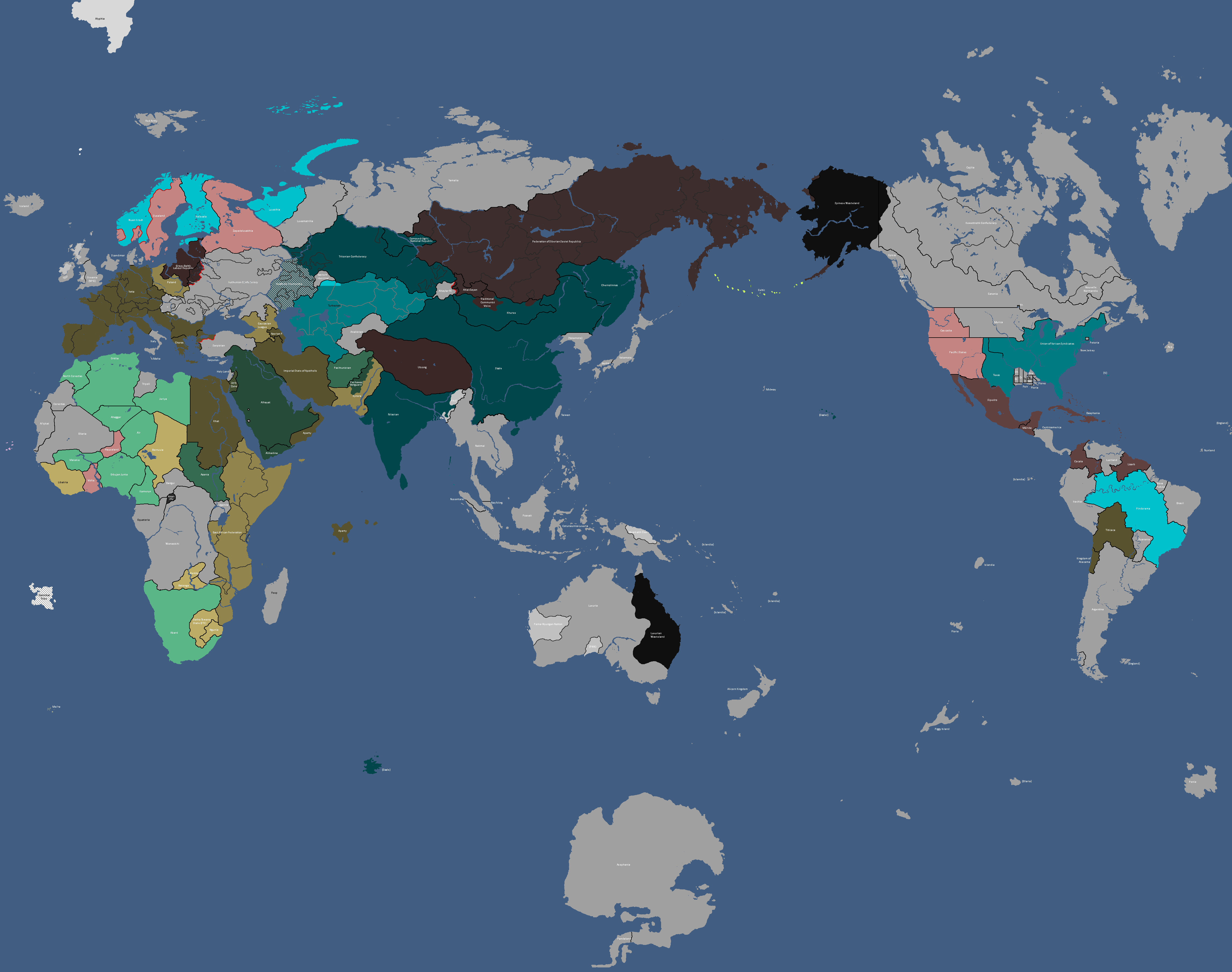
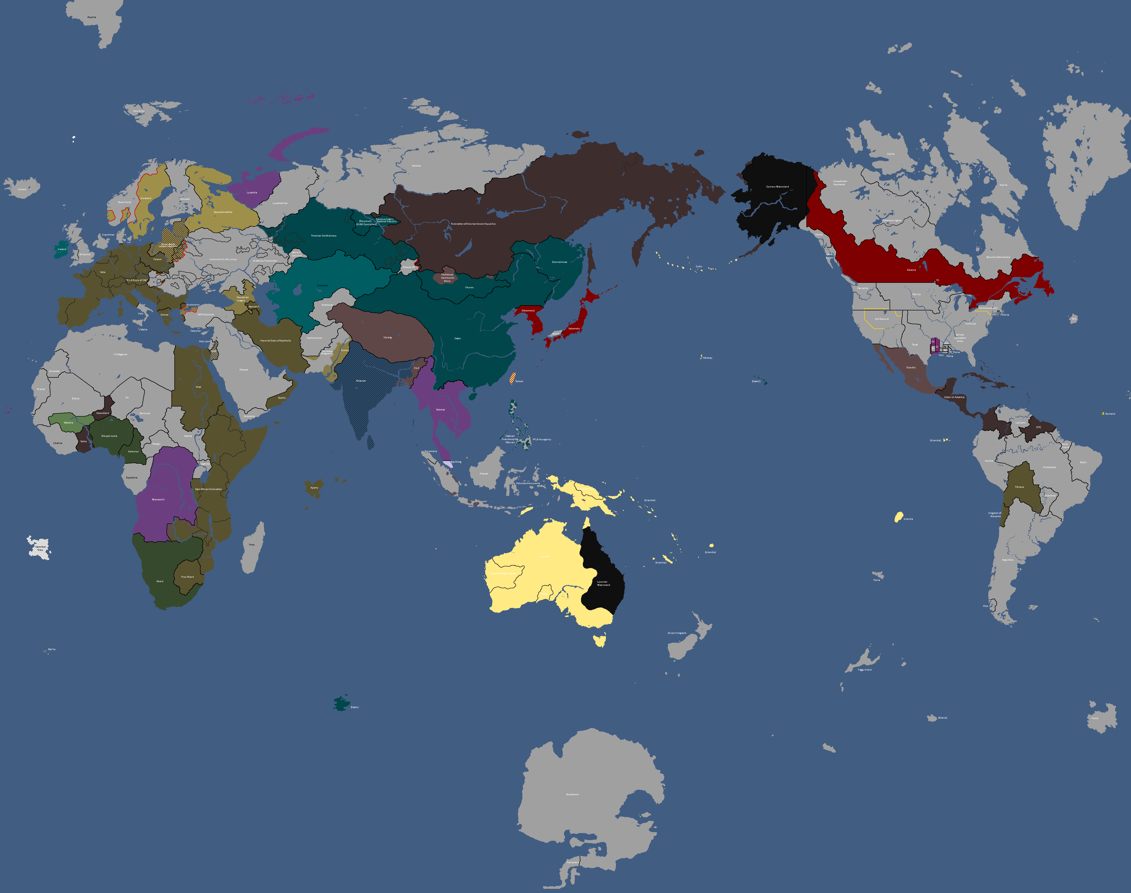
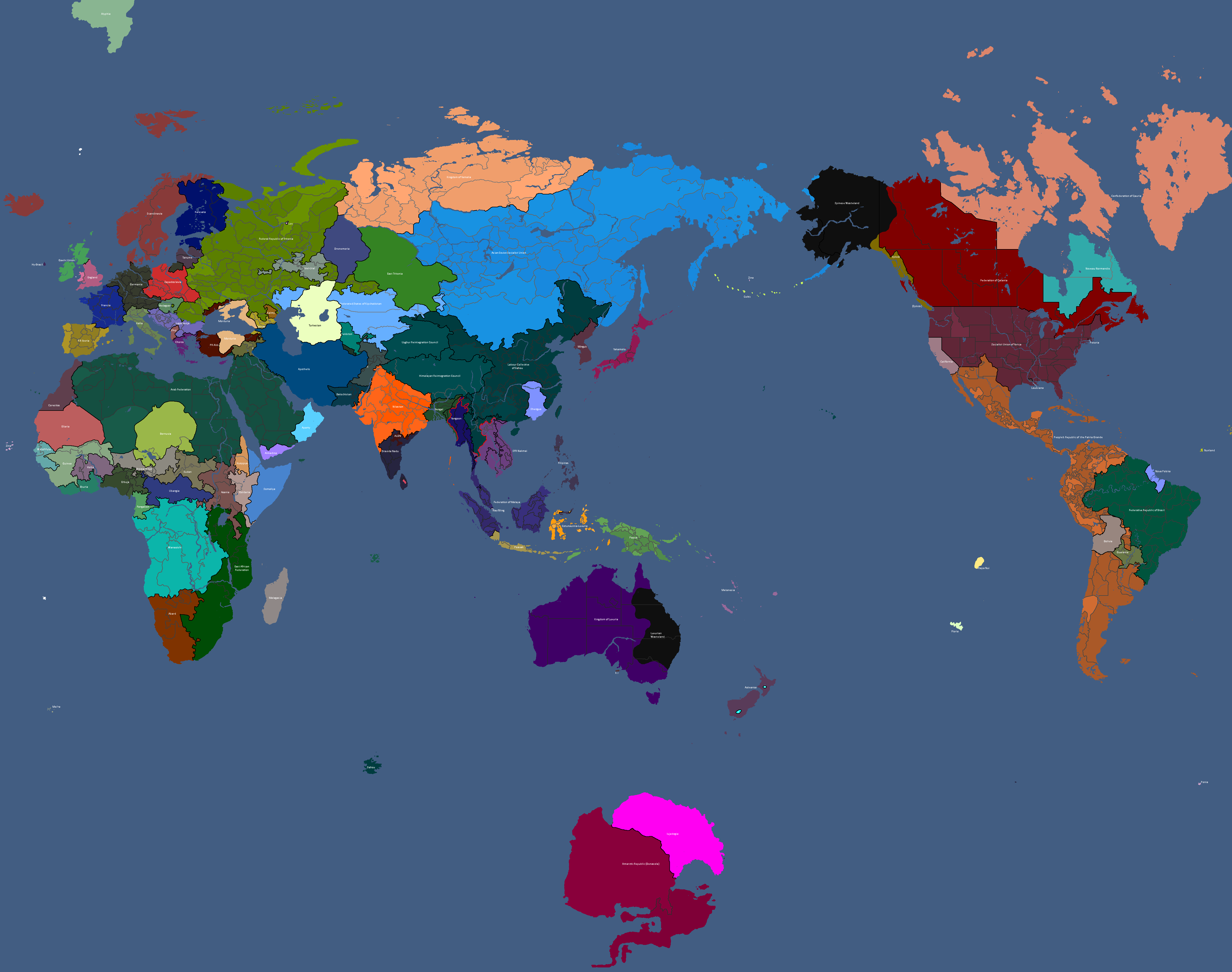
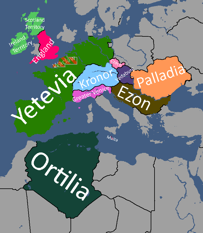
Map with names: Year 186
-
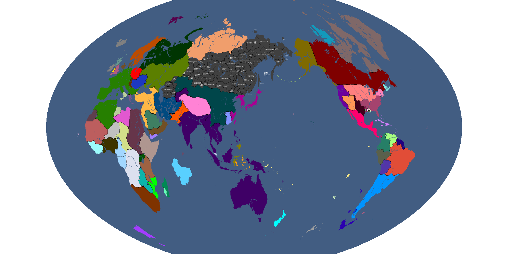
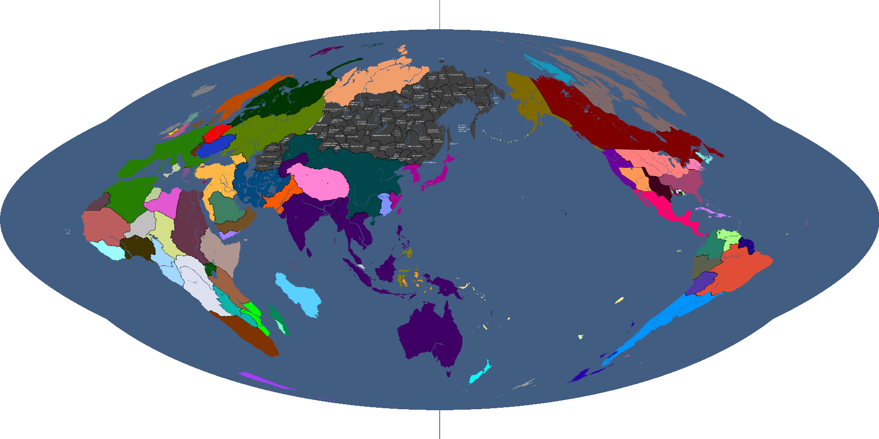
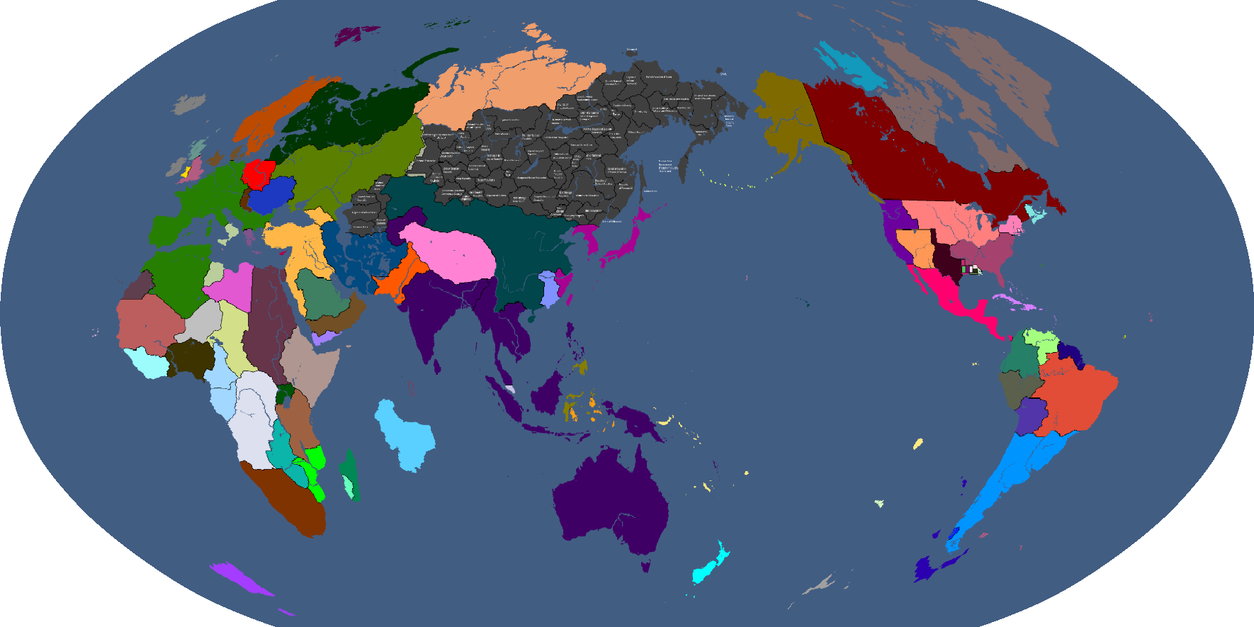
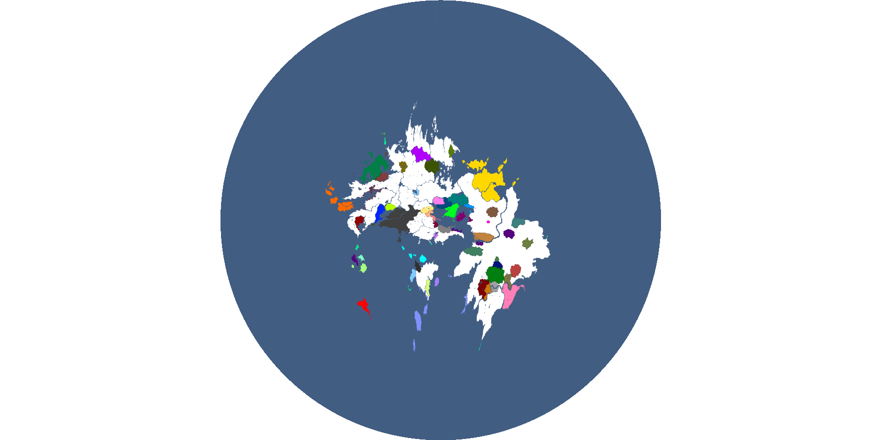
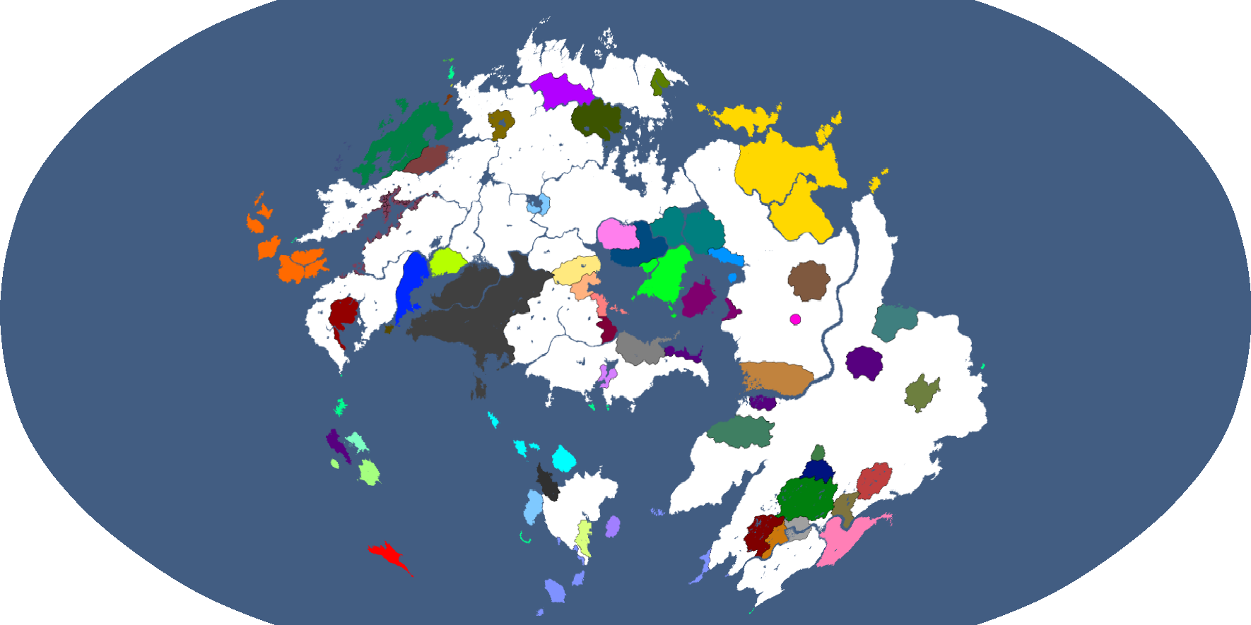
Projection 1: Year 186
-
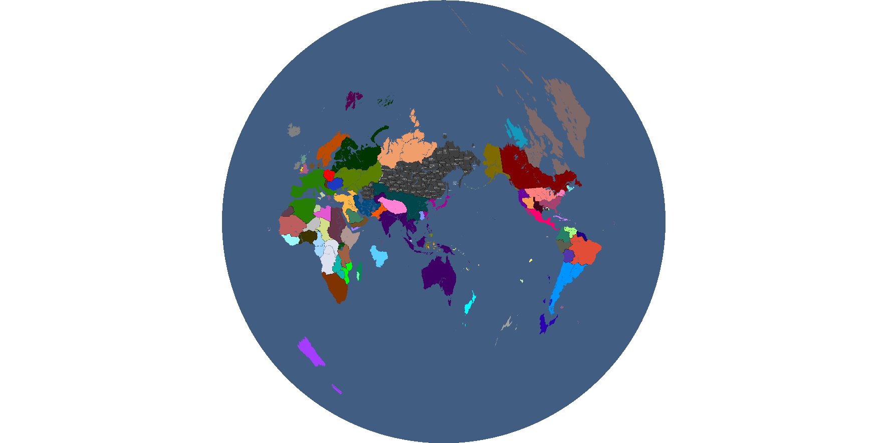
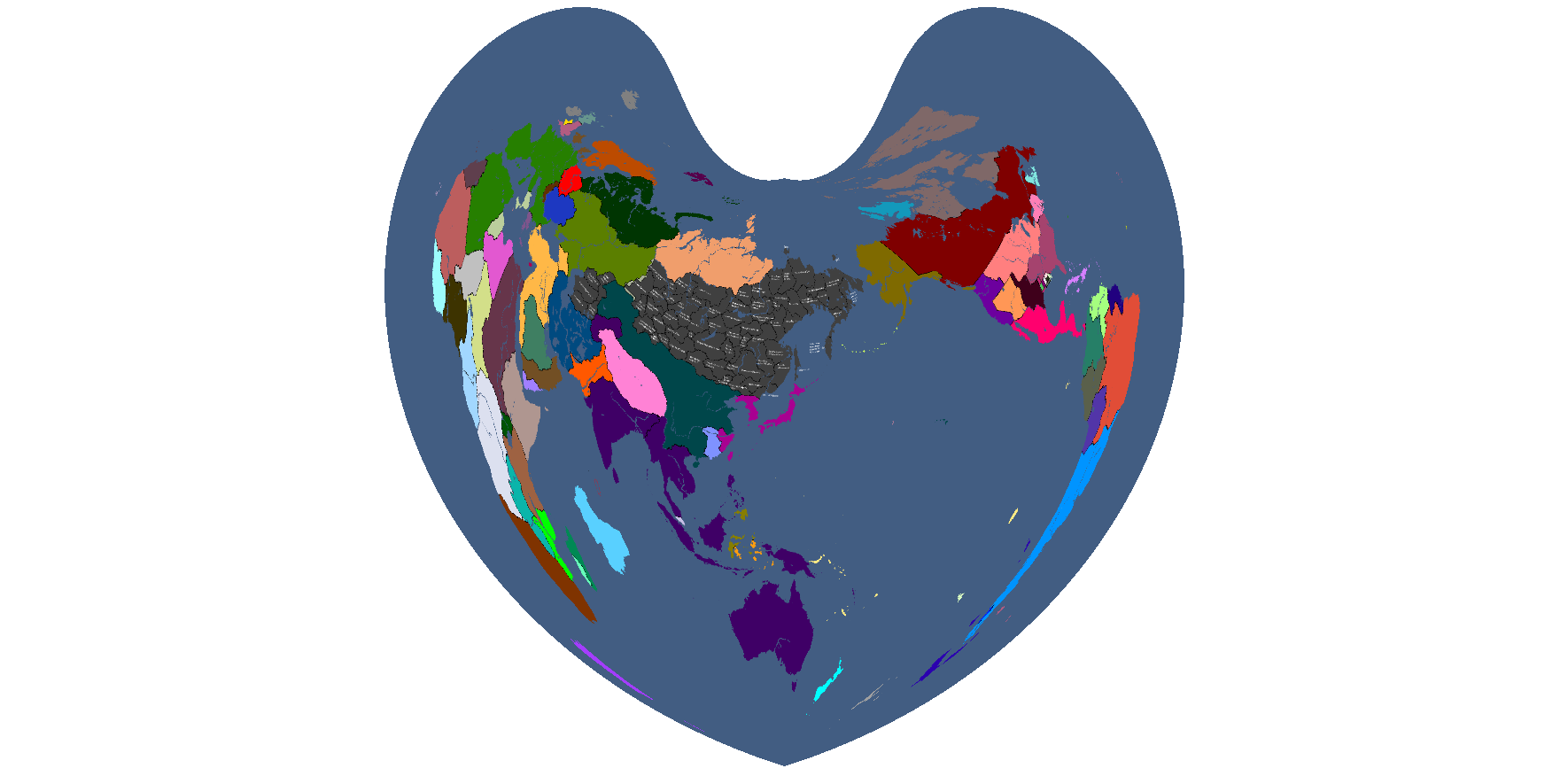
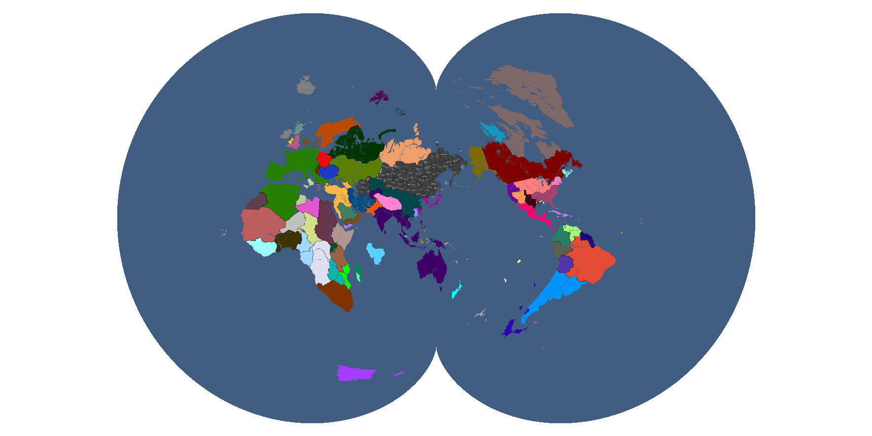
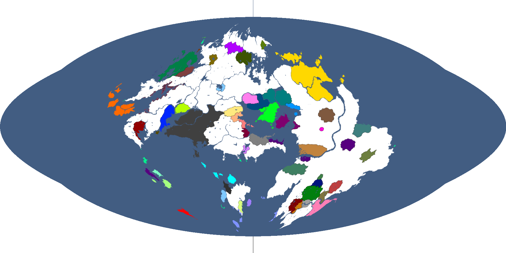
Projection 2: Year 186
-
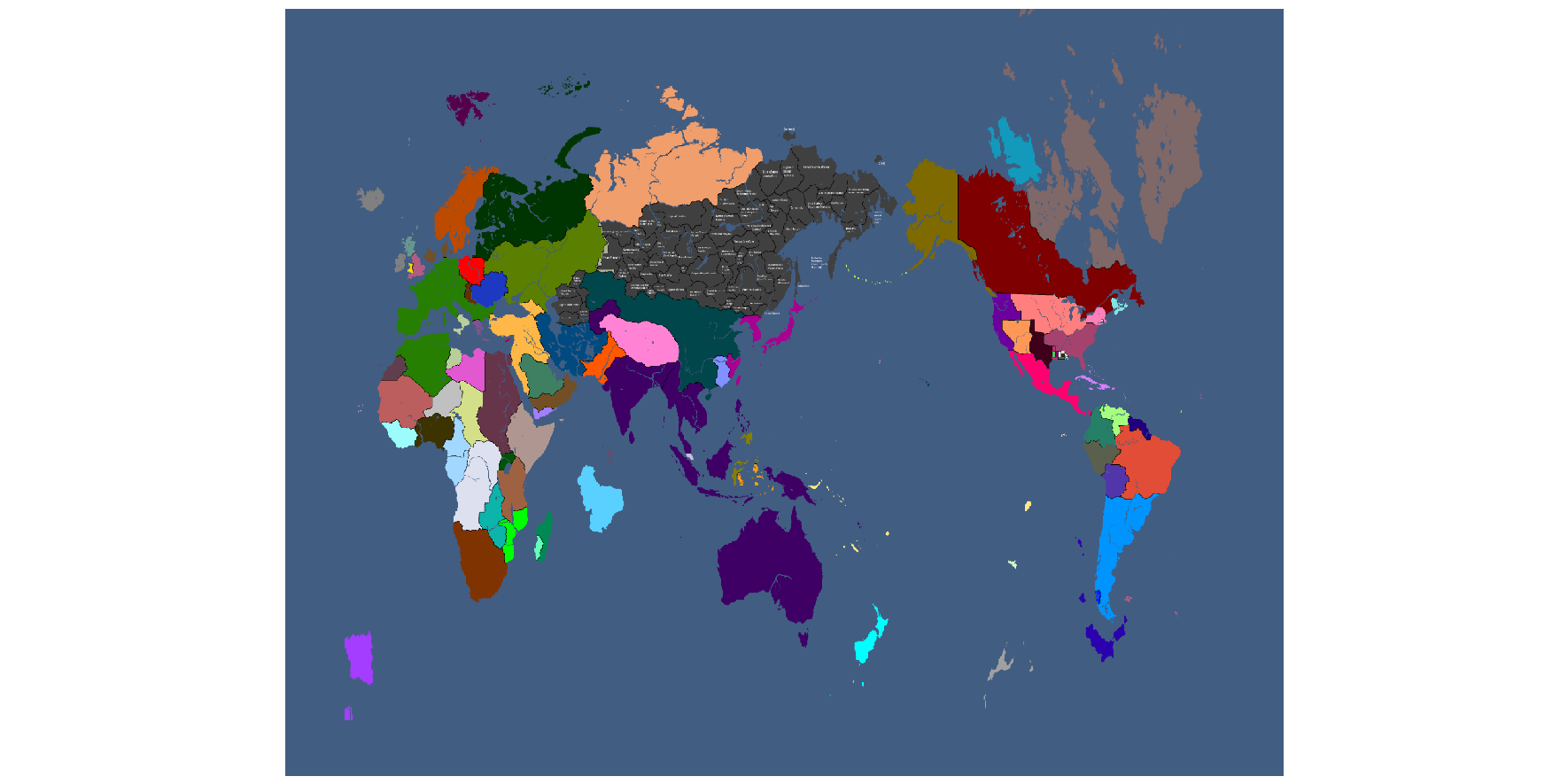
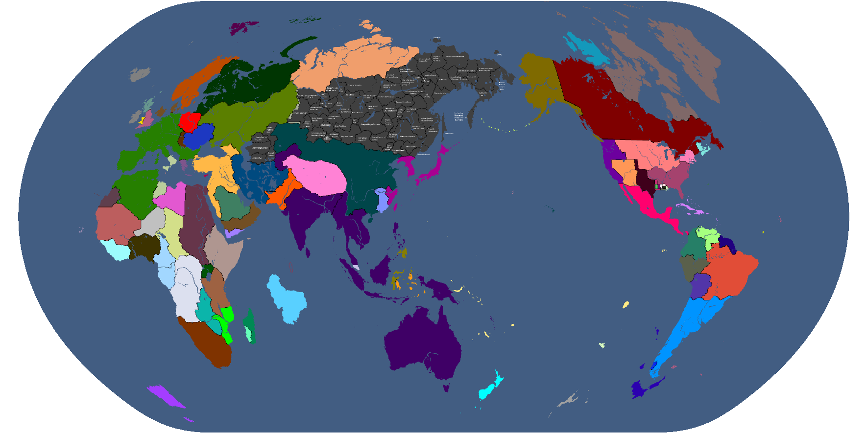
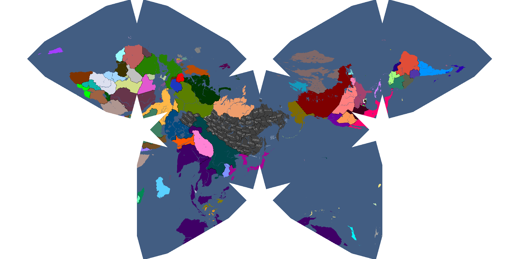
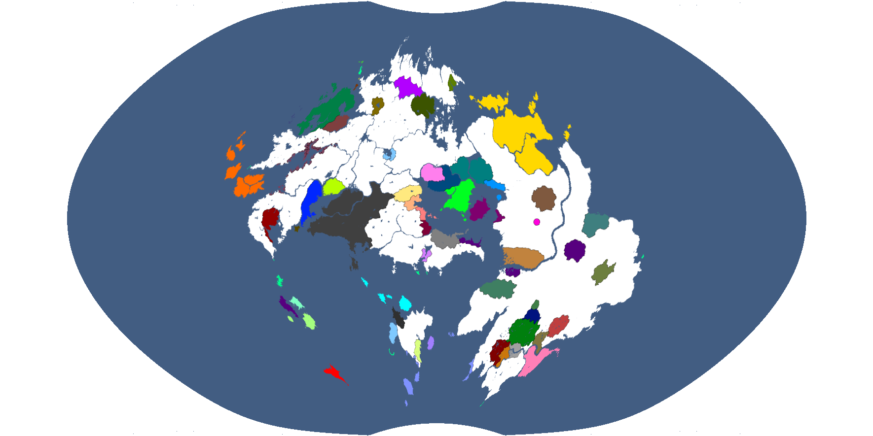
Projection 3: Year 186
-
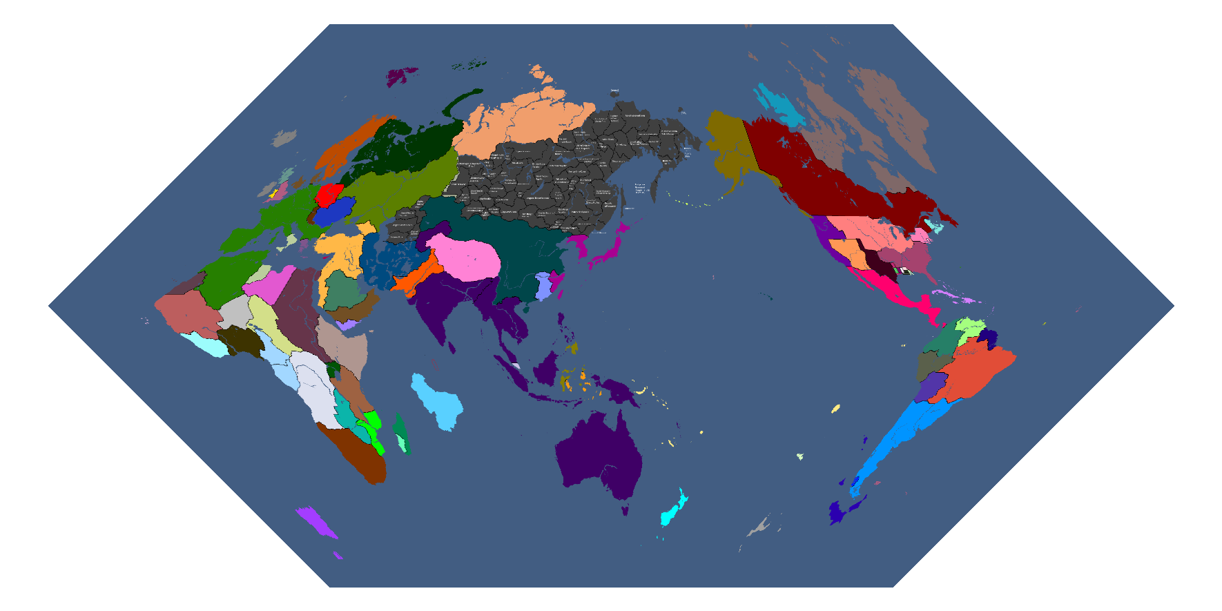
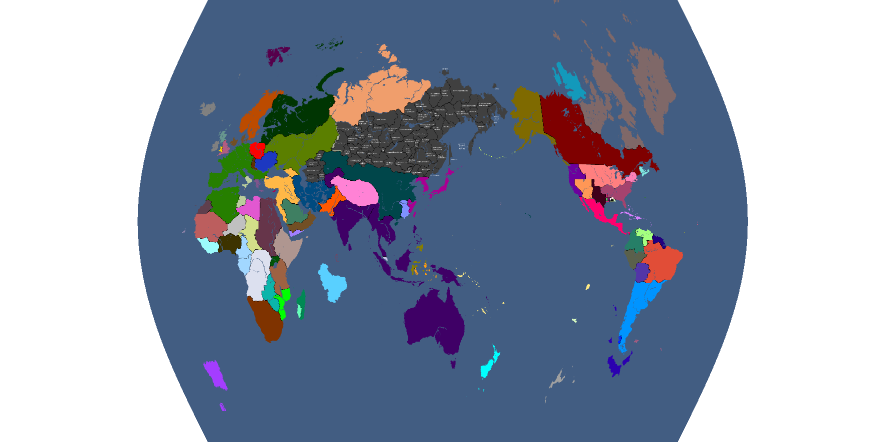
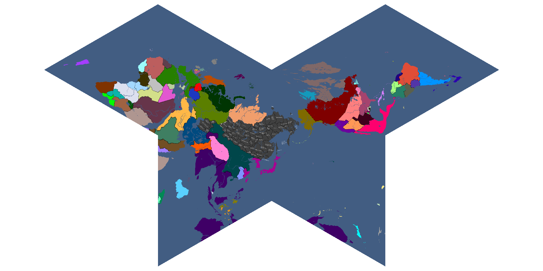
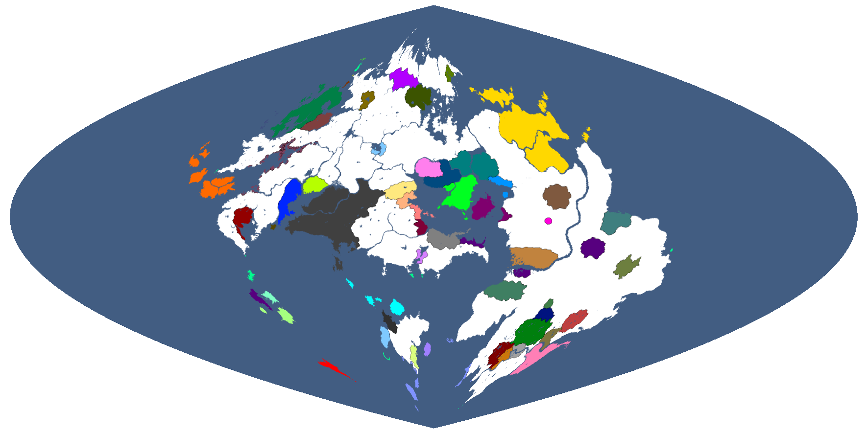
Projection 4: Year 186
-
Projection 5: Year 186
-
Projection 6: Year 186
-
Projection 7: Year 186
-
Projection 8: Year 186
-
Projection 9: Year 186
-
Projection 10: Year 186
-
Projection 11: Year 186
-
Projection 12: Year 186
-
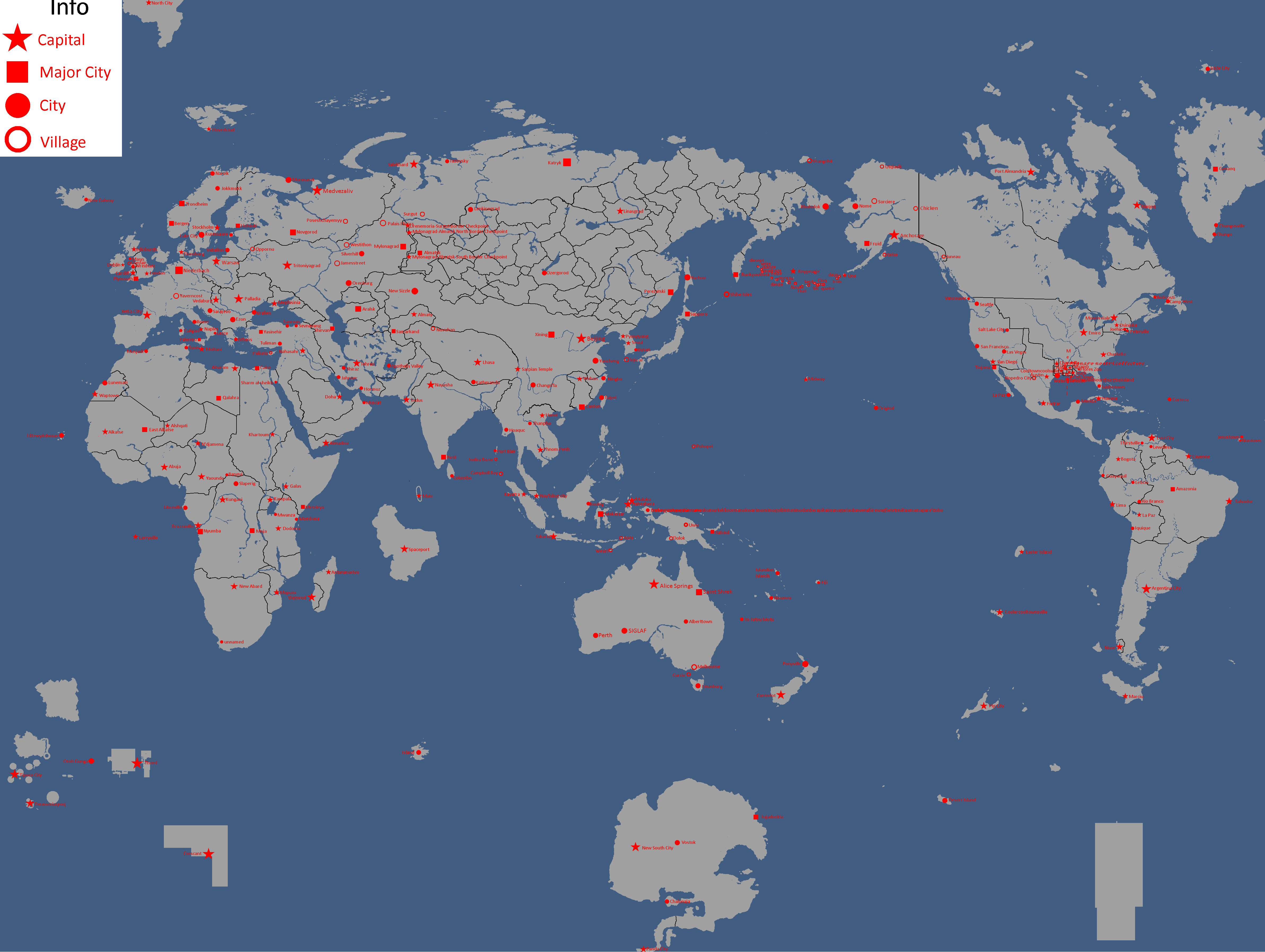
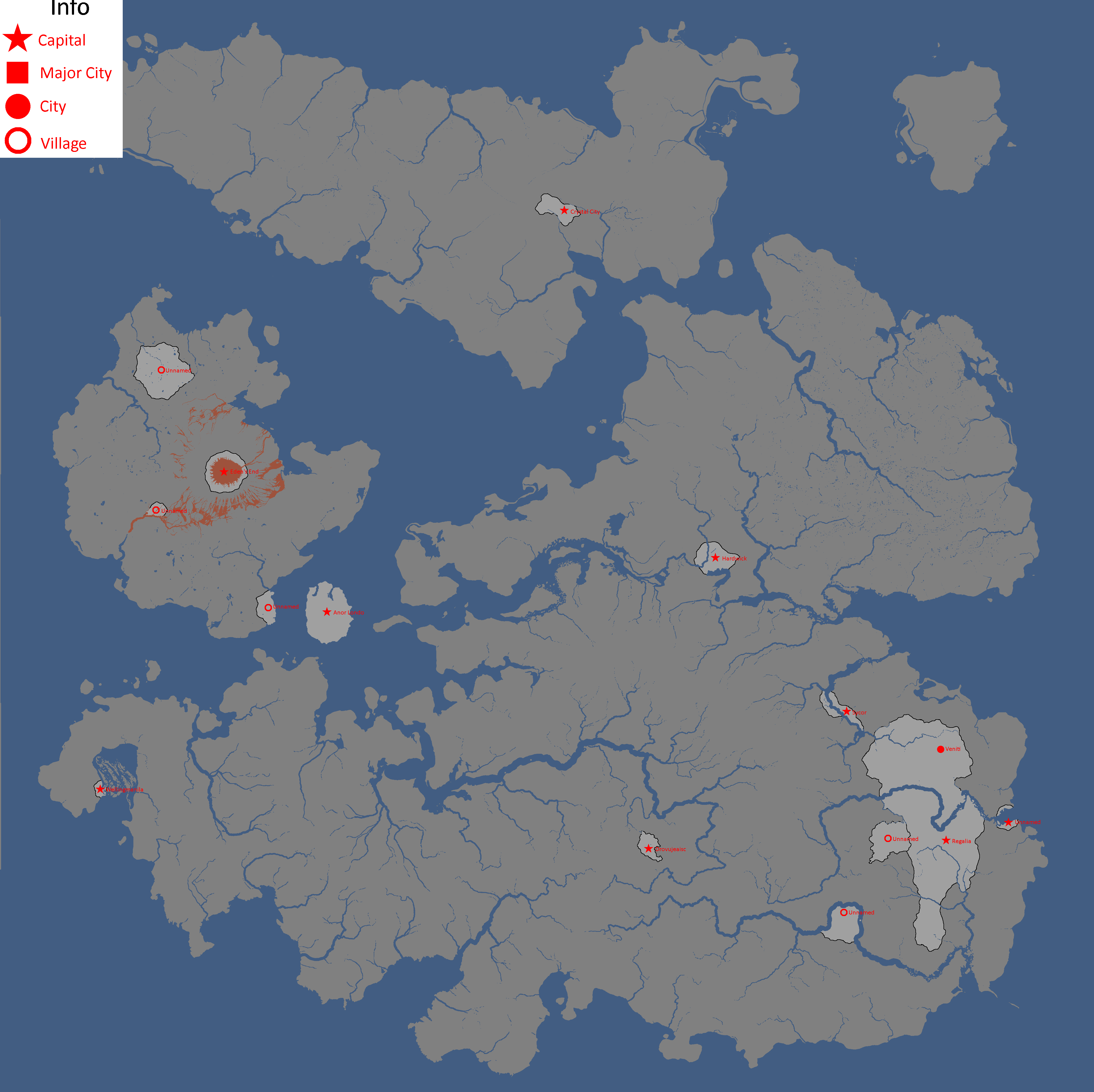
Map of Cities: Year 188
-
Map of Governments in Exile: Year 193
-
Flag Map: Year 193
-
Map of Alliances: Year 195
-
Map of Yomtach Clans: Year 196
-
Map of Ideologies: Year 211
-
Map of Alliances: Year 211 (Baghdad Accordin red, Liberty Pact in blue)
-
Flag Map: Year 217
-
Map with names: Year 227
-
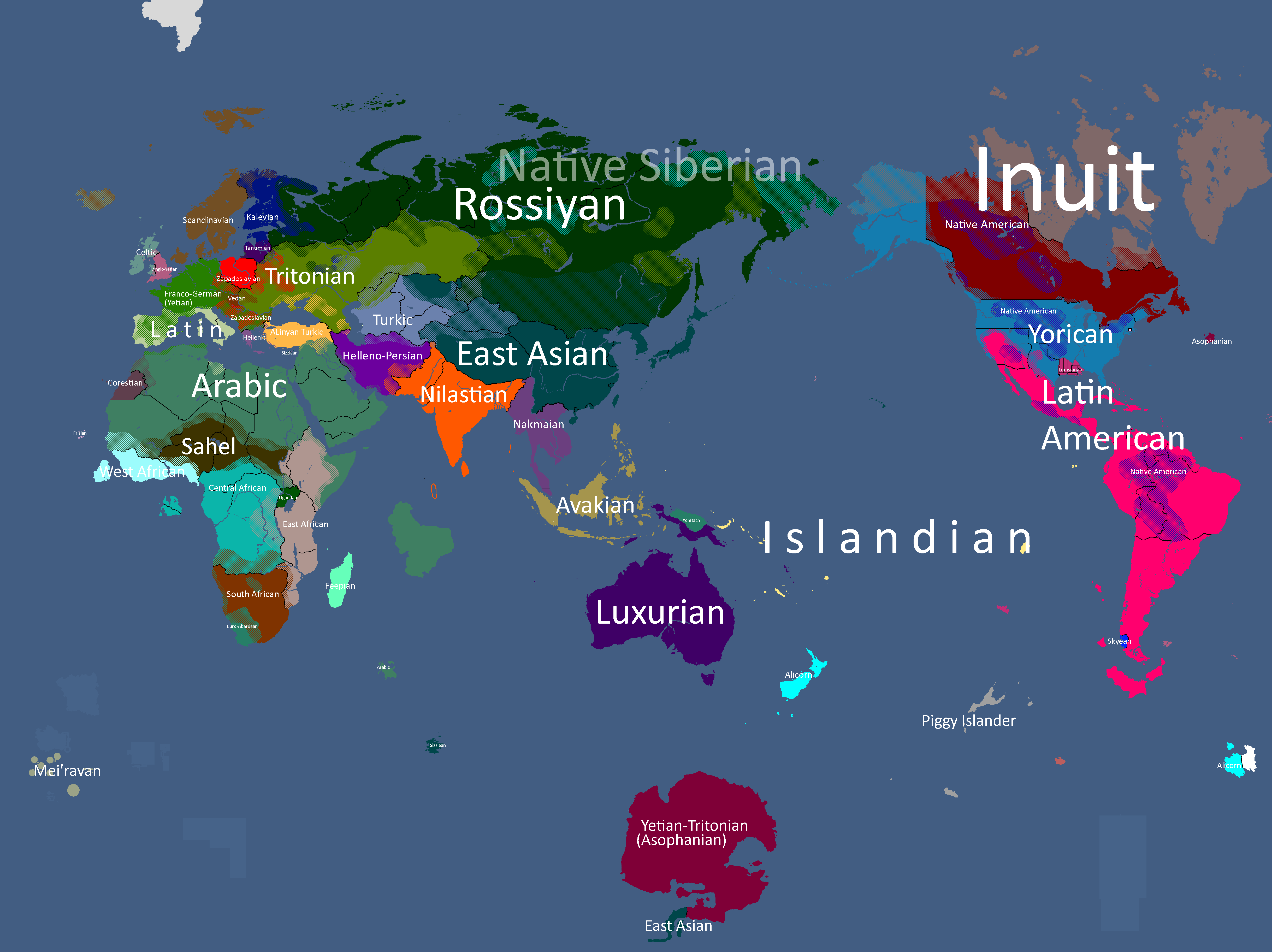
Map of Yatan Cultures: Year 230
-
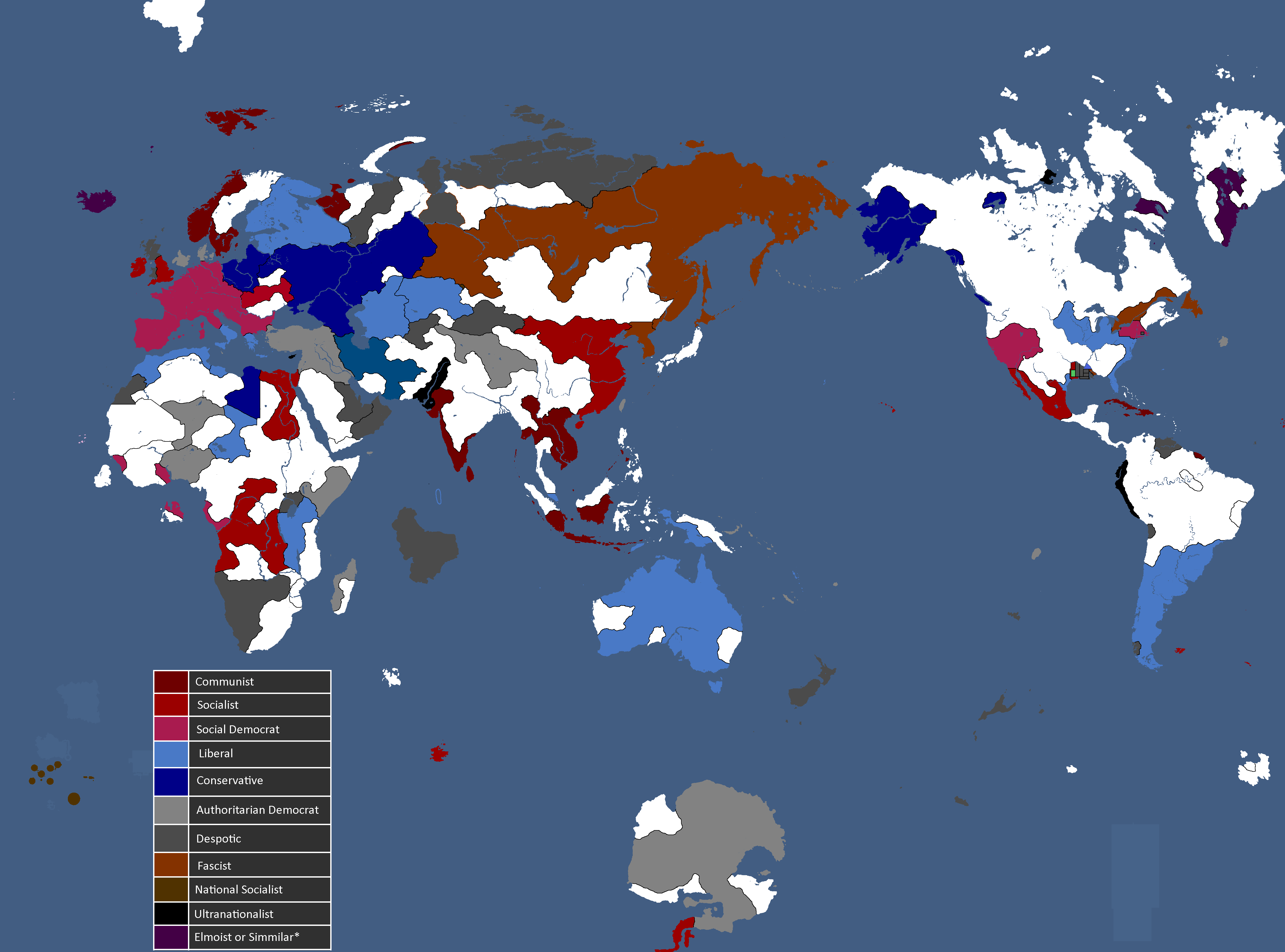
Ideology Map: Year 247
-
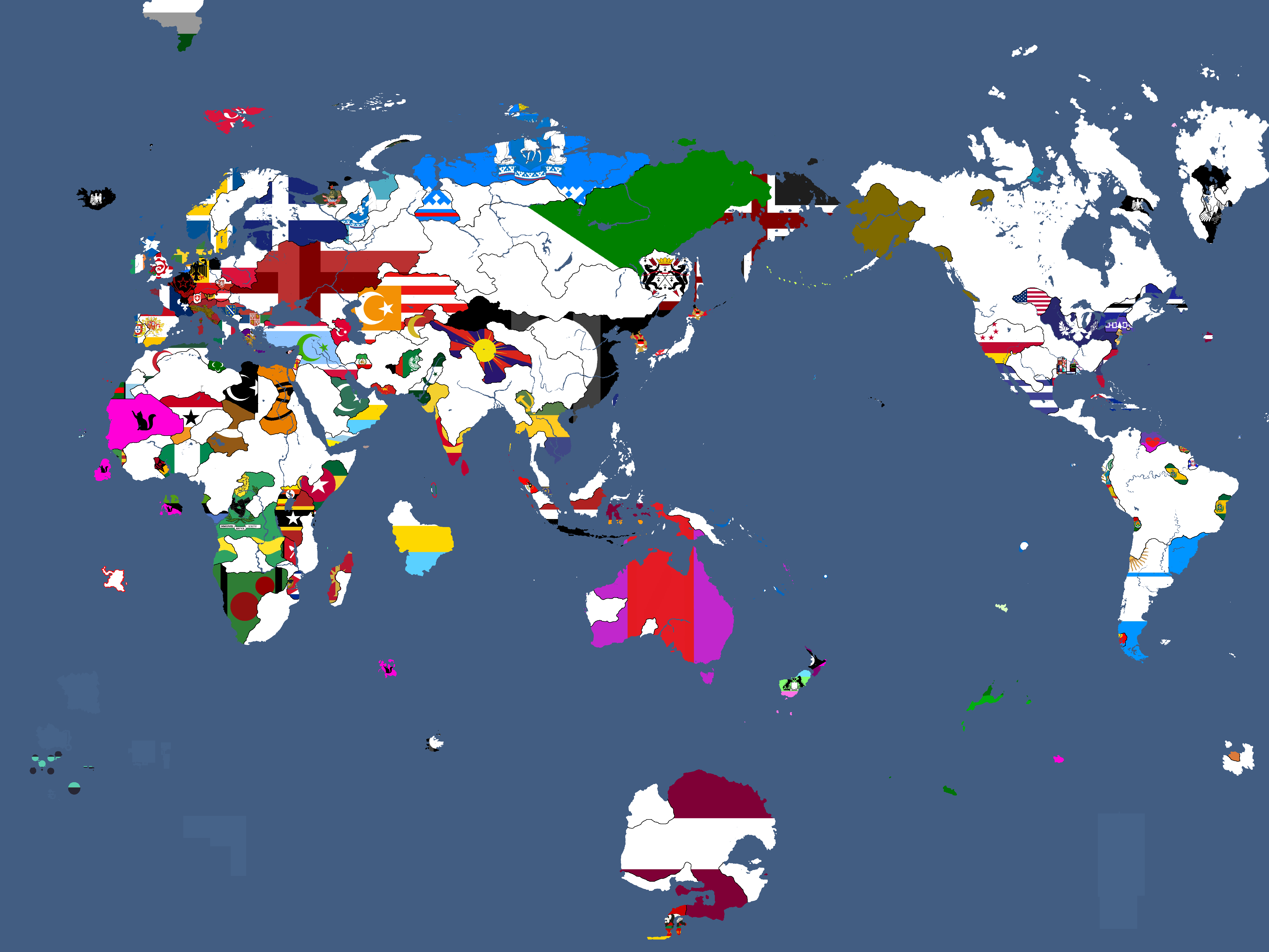
Flag Map: Year 266
-
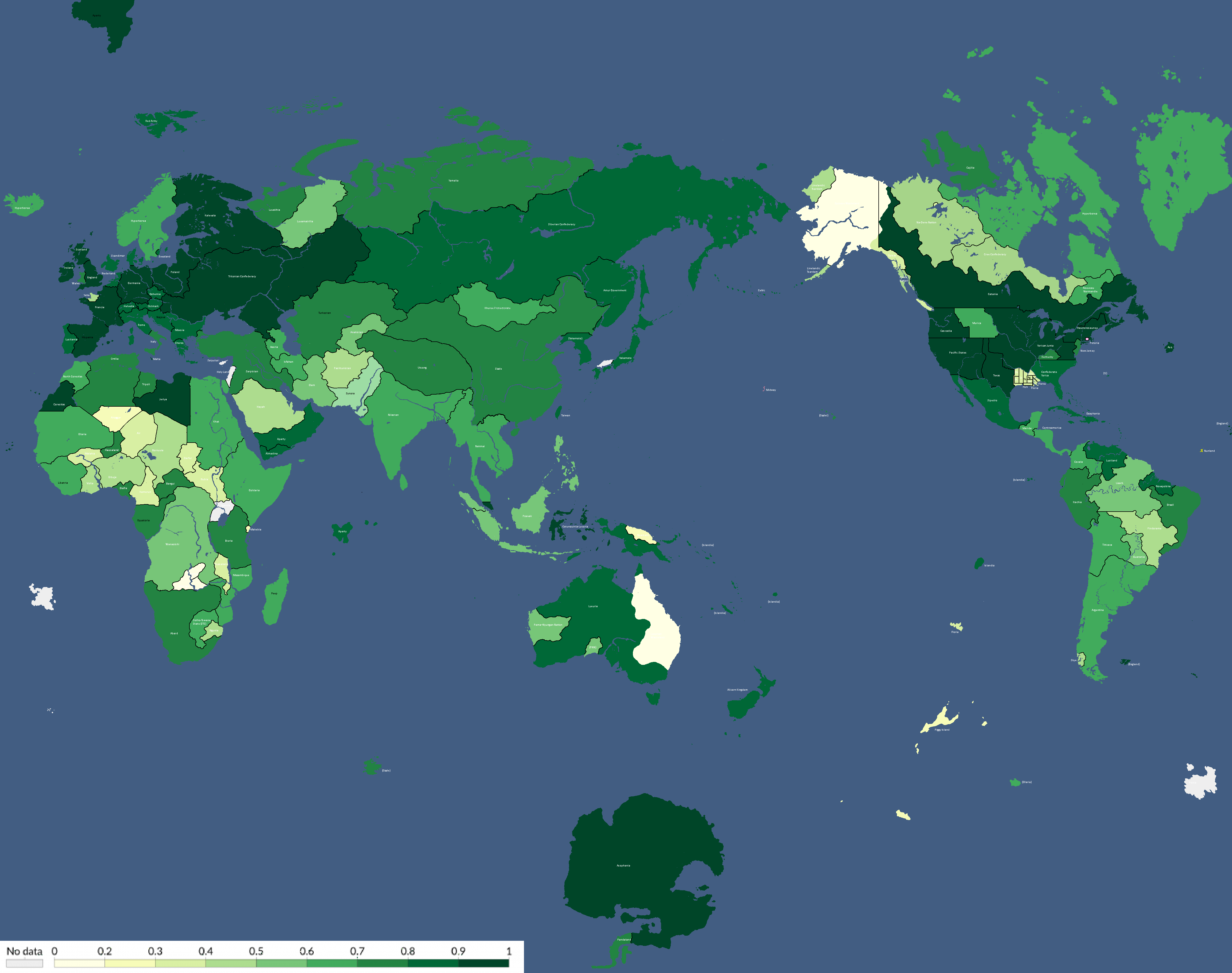
Human Development Index Map: Year 306
-
Flag Map: Year 311
-
Map of Alliances: Year 315
-
Map of Alliances: Year 315
-
Map of Allied Nations: Year 332
-
Map of the Yatan Cold War: Year 337
-
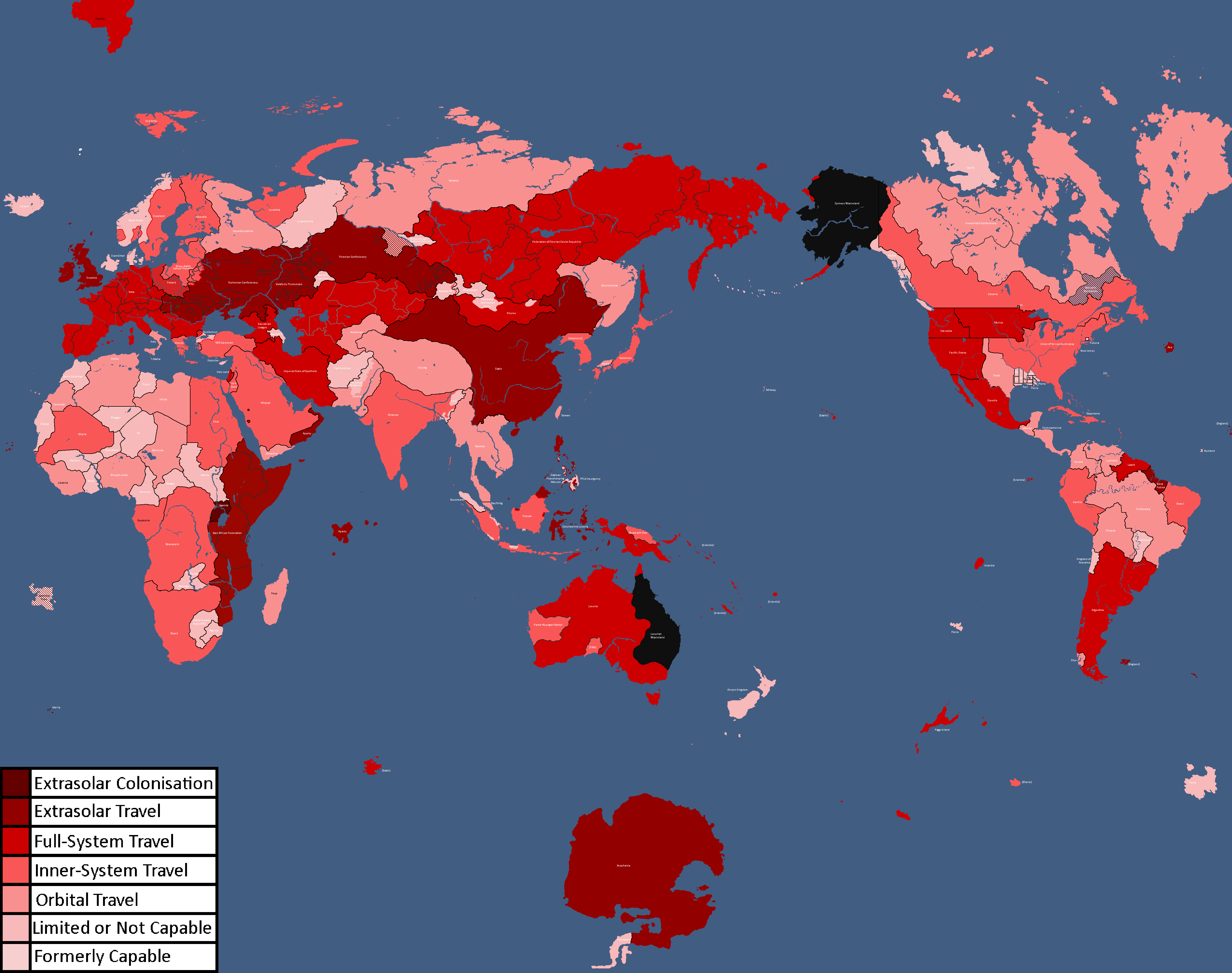
Map of Spacefaring Countries: Year 339
-
![Map of Democracy[1]: Year 343](/yatawiki/images/6/69/Democracymap.png)
Map of Democracy[1]: Year 343
-
![Monarchy or Republic[2]: Year 347](/yatawiki/images/5/5f/Monarchyrepublic.png)
Monarchy or Republic[2]: Year 347
-
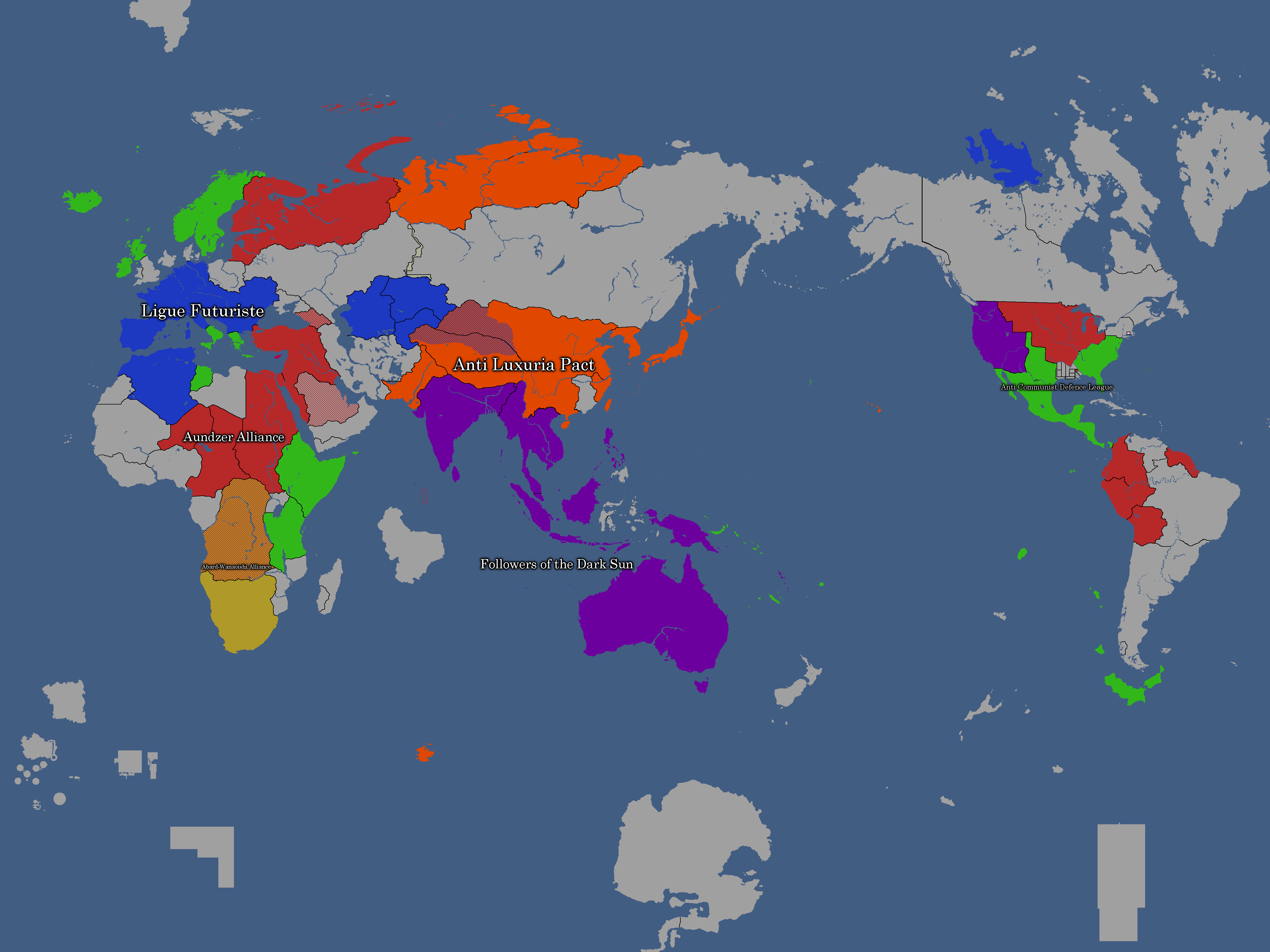
Map of Major Alliances: Year 348
-
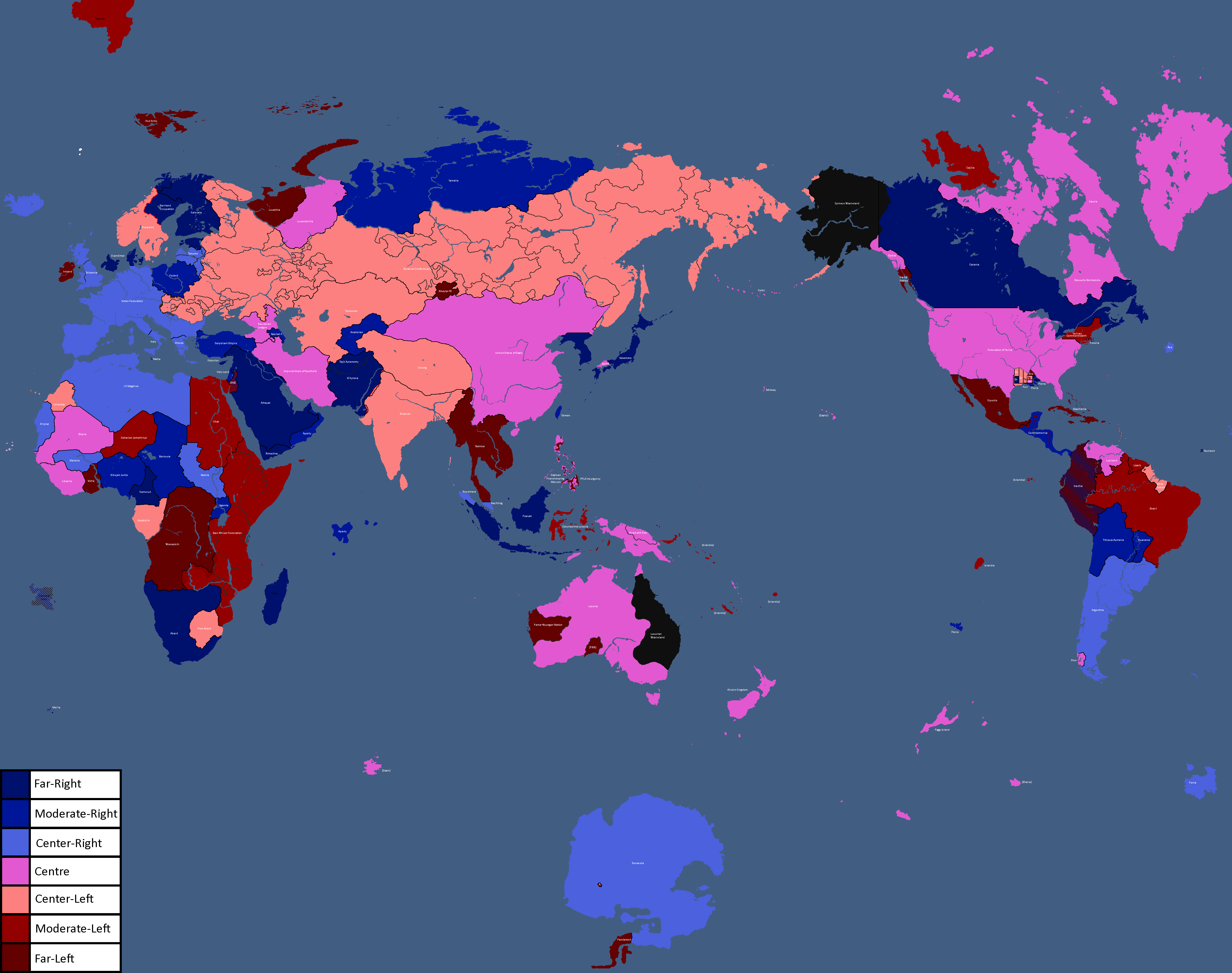
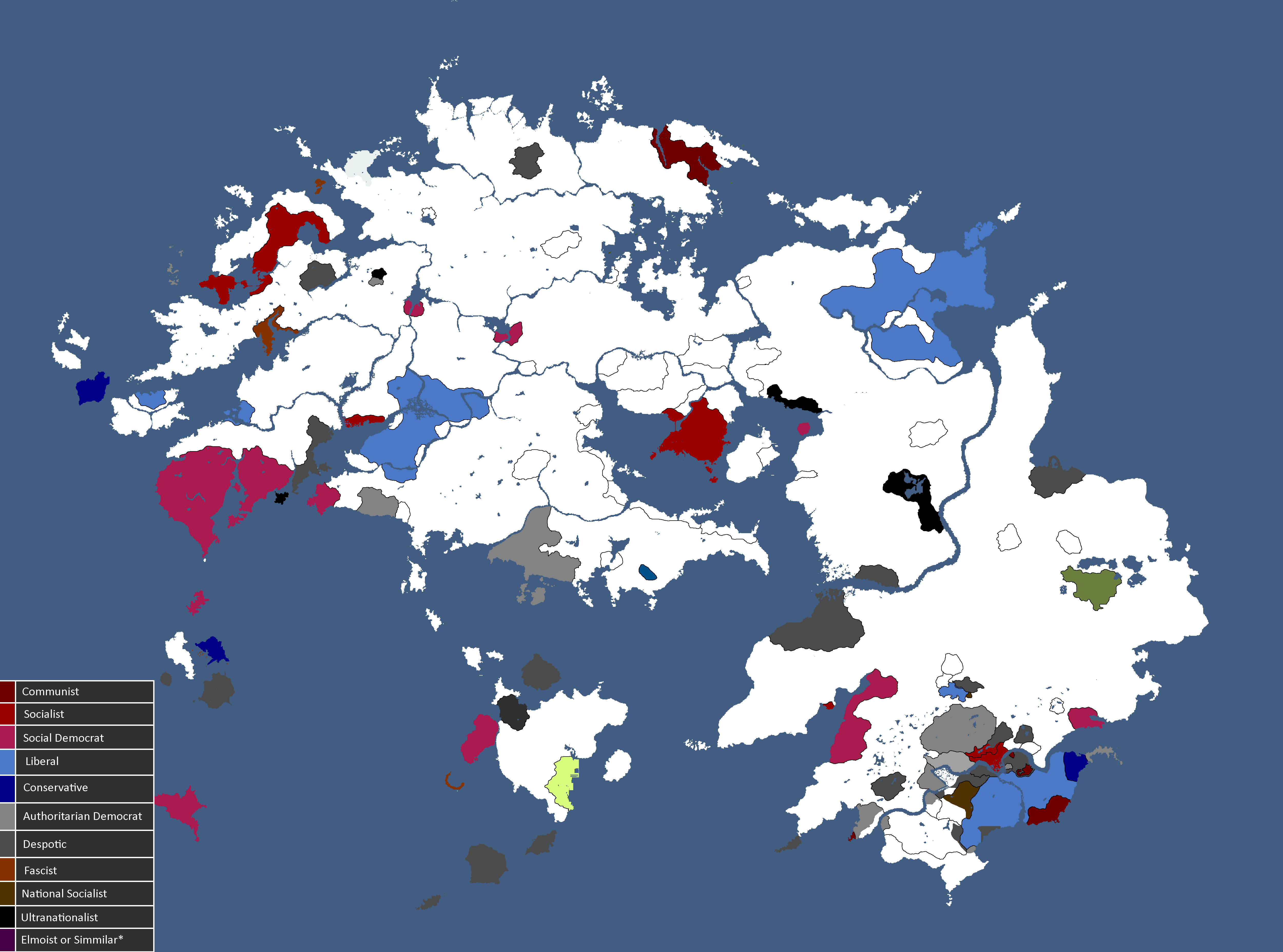
Map of Ideologies: Year 354
-
Map of the Yatan Cold War: Year 358
-
![Map of Religions[3]: Year 362](/yatawiki/images/1/15/Religionmap.png)
Map of Religions[3]: Year 362
-
Other nations opinions of the CIS/Polsk: Year 367
-
![Map of Nuclear Powers[4]: Year 367](/yatawiki/images/1/10/Nuclearpowers.png)
Map of Nuclear Powers[4]: Year 367
-
![Map of the Yatan Cold War[5]: Year 371](/yatawiki/images/d/d8/Yatancoldwar.png)
Map of the Yatan Cold War[5]: Year 371
-
![Map of World Power Statuses[6]: Year 371](/yatawiki/images/c/c1/Powersmap.png)
Map of World Power Statuses[6]: Year 371
-
![Development Map[7]: Year 372](/yatawiki/images/2/21/Developmentmap.png)
Development Map[7]: Year 372
-
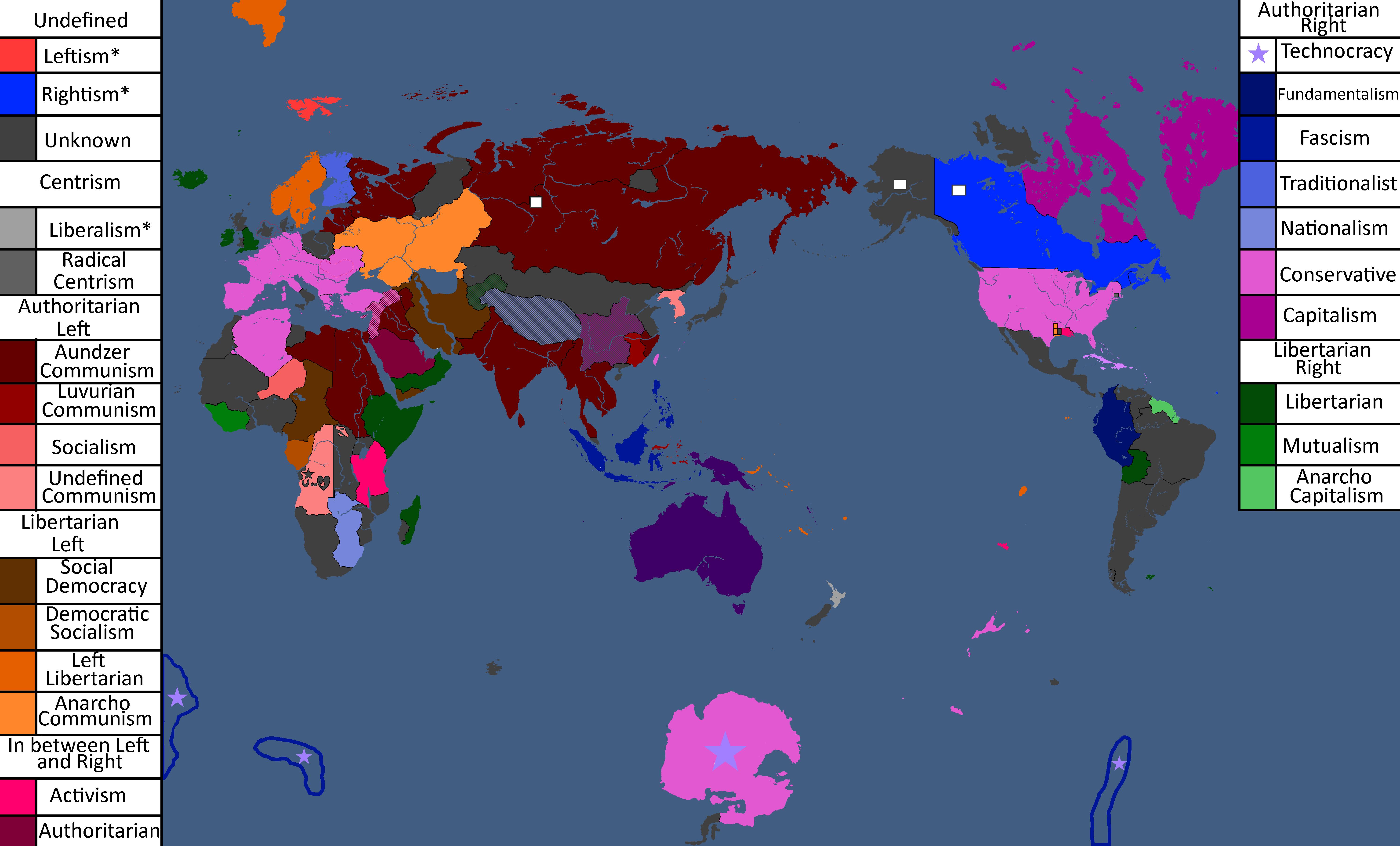
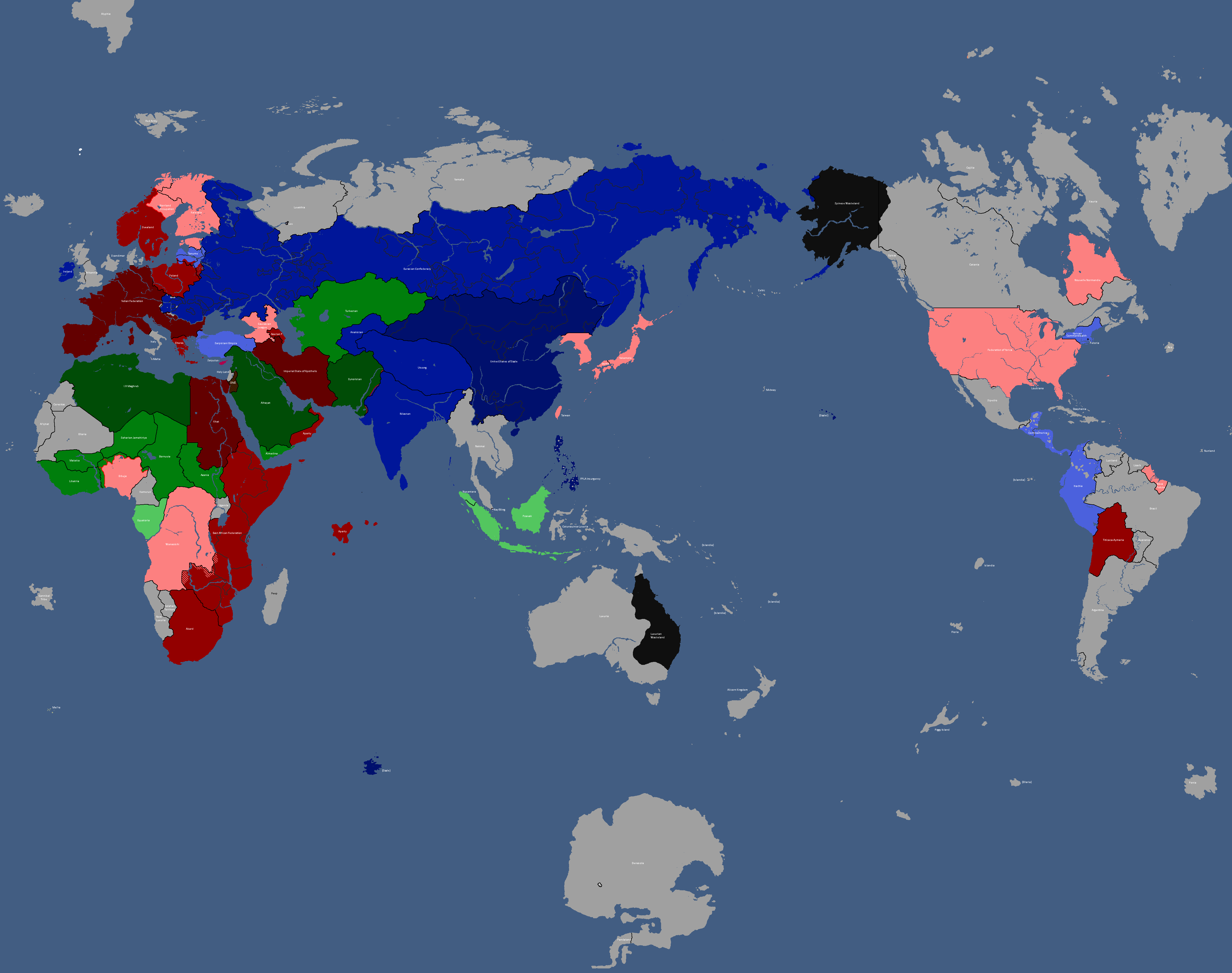
Map of Ideologies: Year 372
-
![Democracy Map[8]: Year 372](/yatawiki/images/6/6c/Democracymap3.png)
Democracy Map[8]: Year 372
-
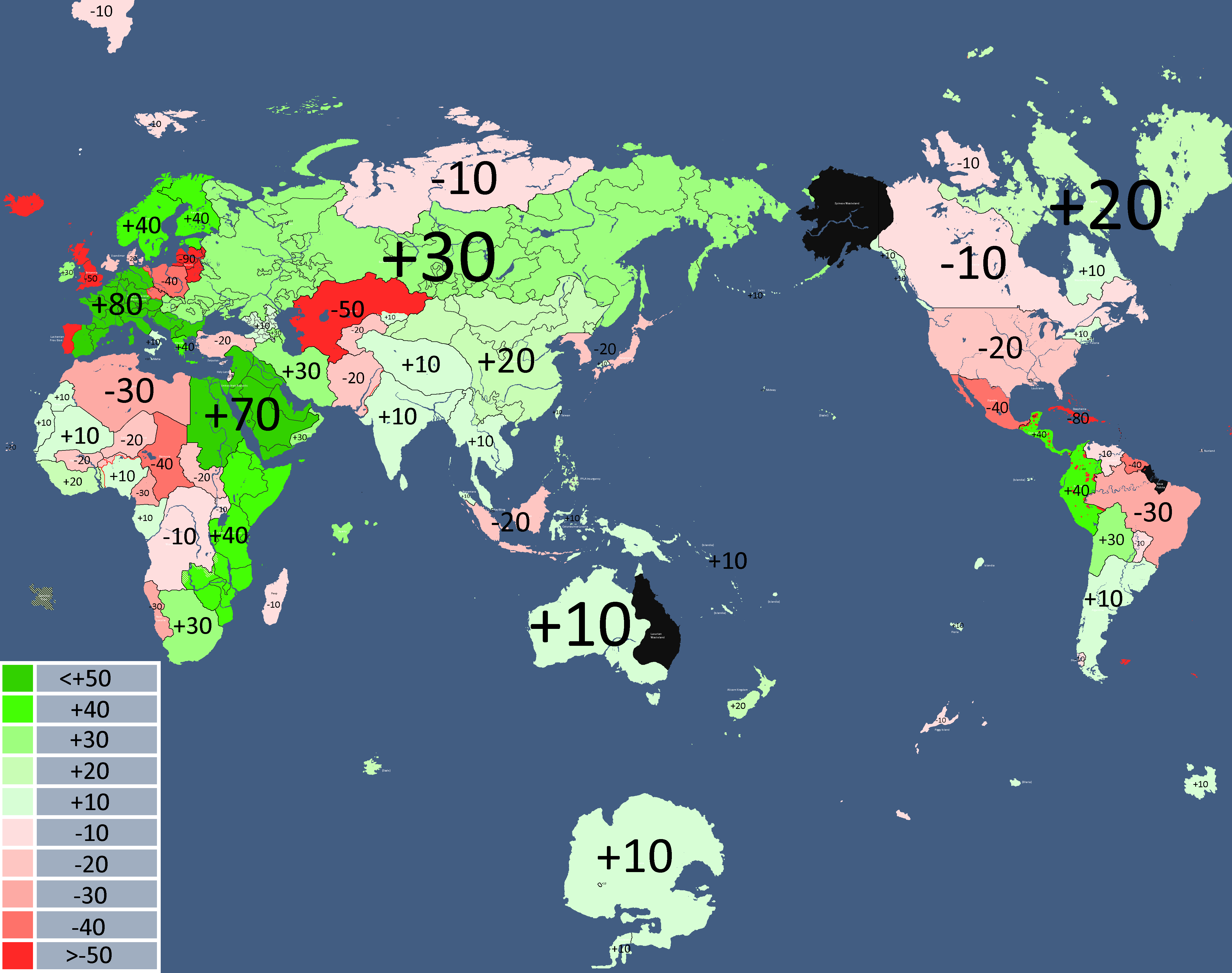
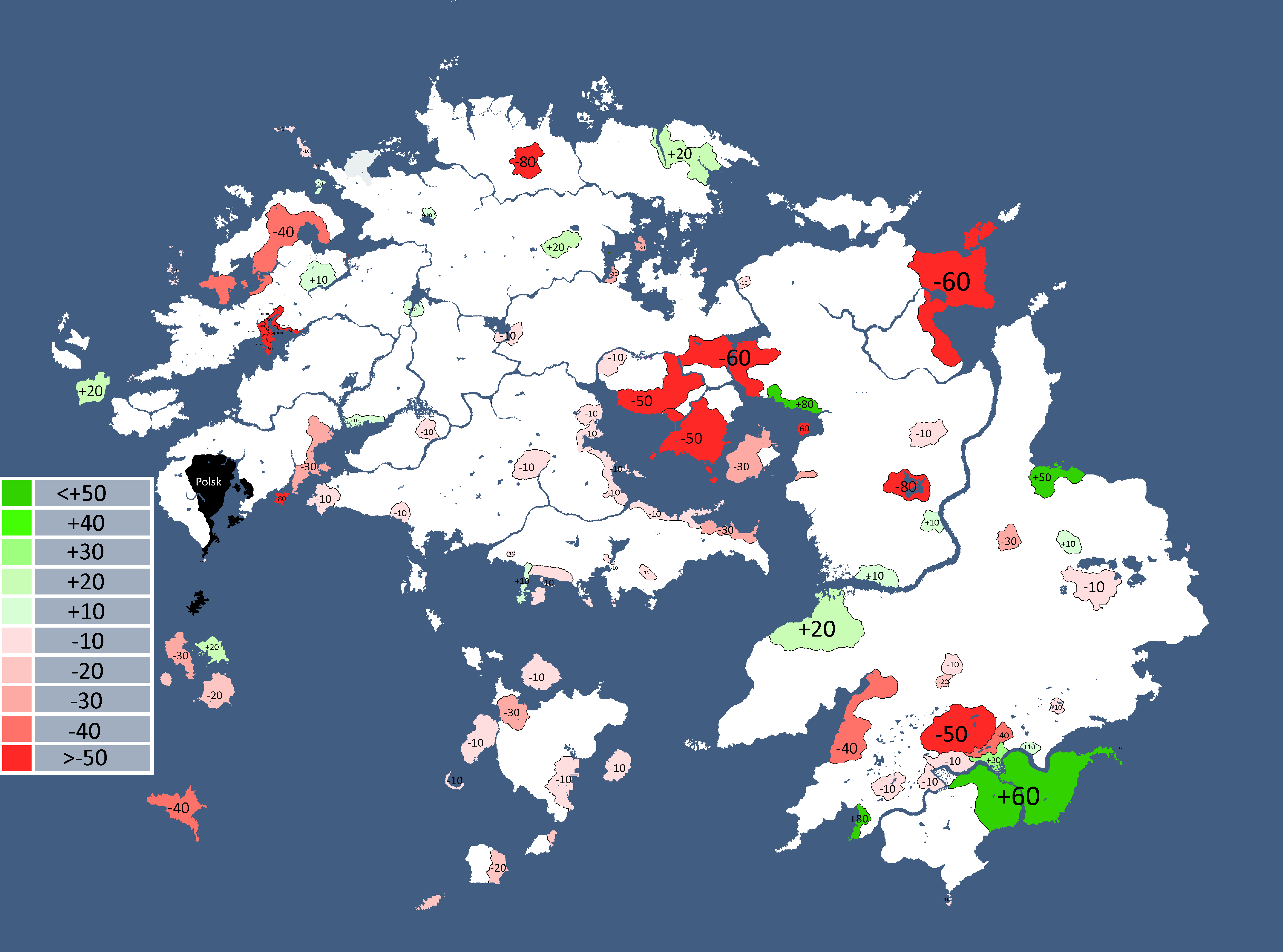
Other nations opinions of the CIS: Year 372
-
![Map of Economic Structure[9]: Year 373](/yatawiki/images/6/64/Economymap.png)
Map of Economic Structure[9]: Year 373
-
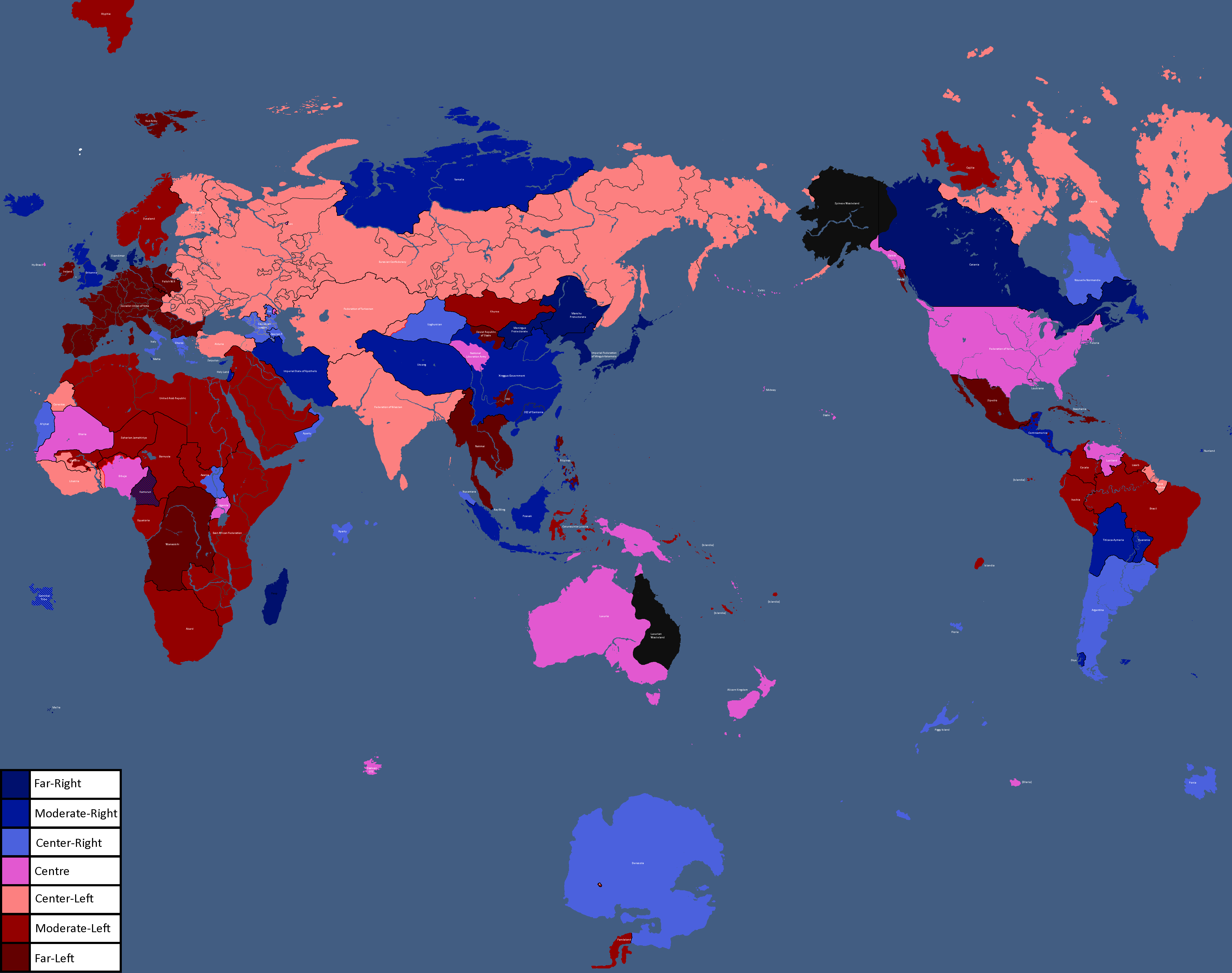
Map of Ideologies: Year 375
-
-
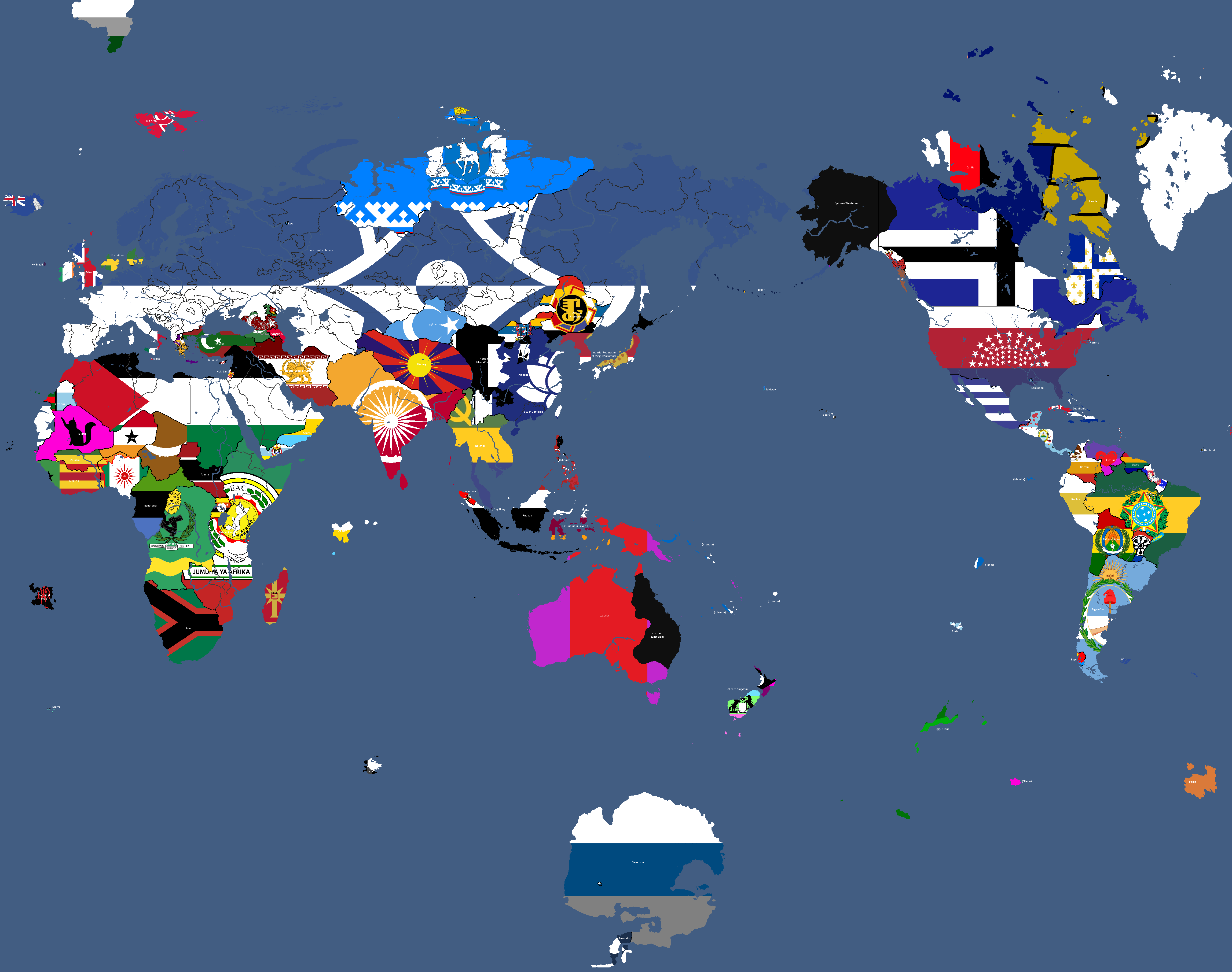
Flag Map: Year 377
-
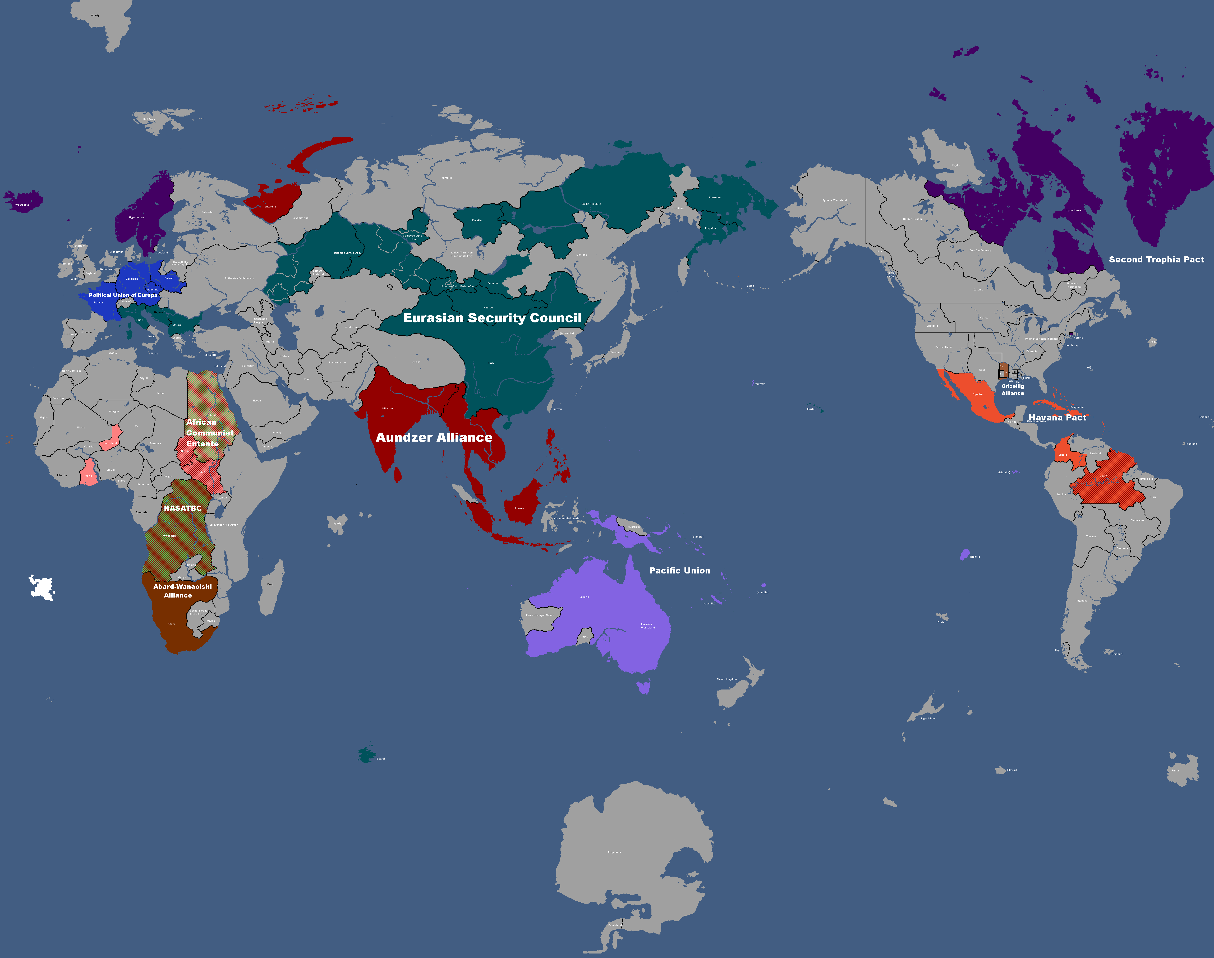
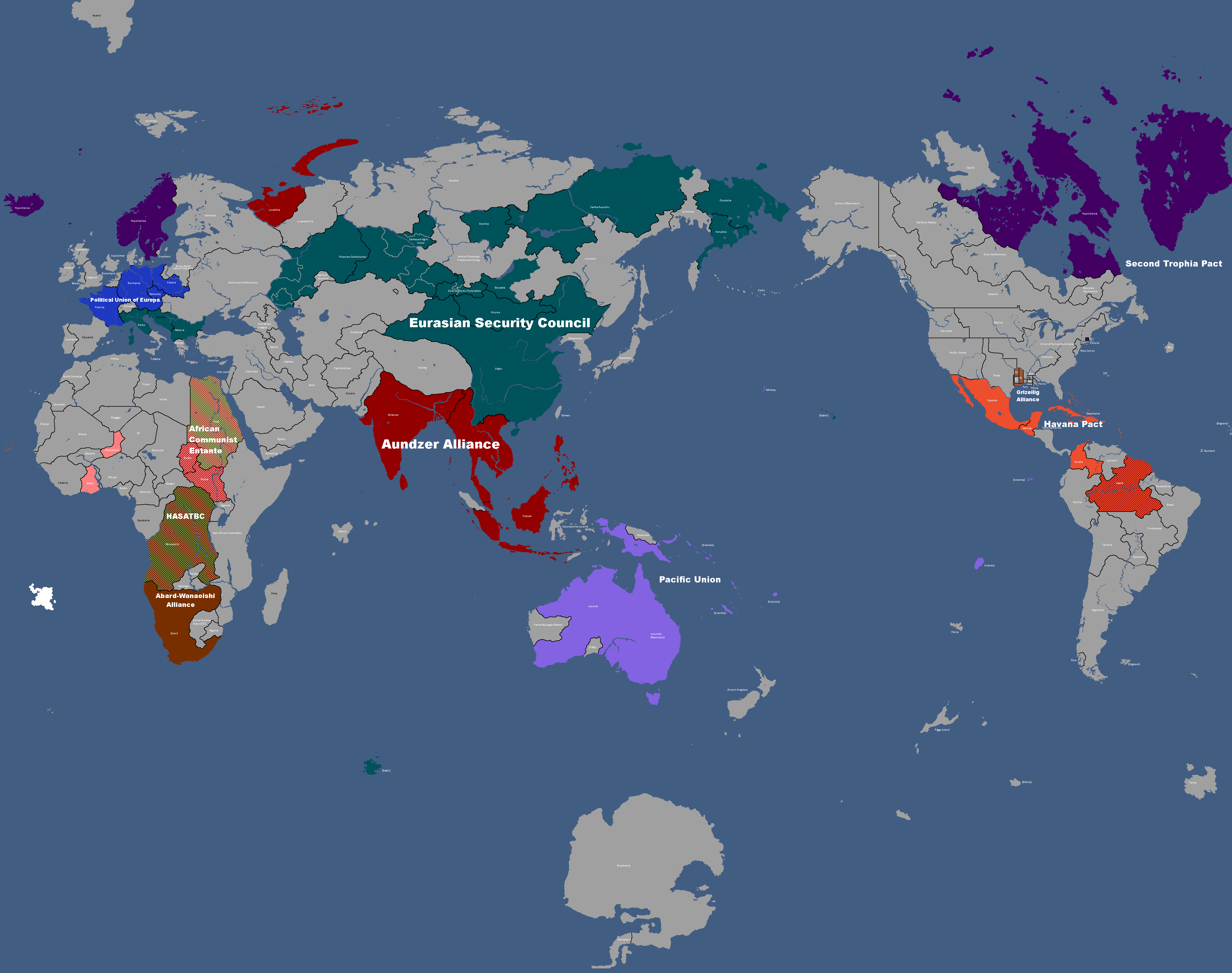
![Flag of Post-Cold War Yata's Geopolitical Blocs[10]: Year 383](/yatawiki/images/c/ca/Yatacoldwar.png)
Flag of Post-Cold War Yata's Geopolitical Blocs[10]: Year 383
-
Map where the Church of Saint Peter has adherents: Year 391
-
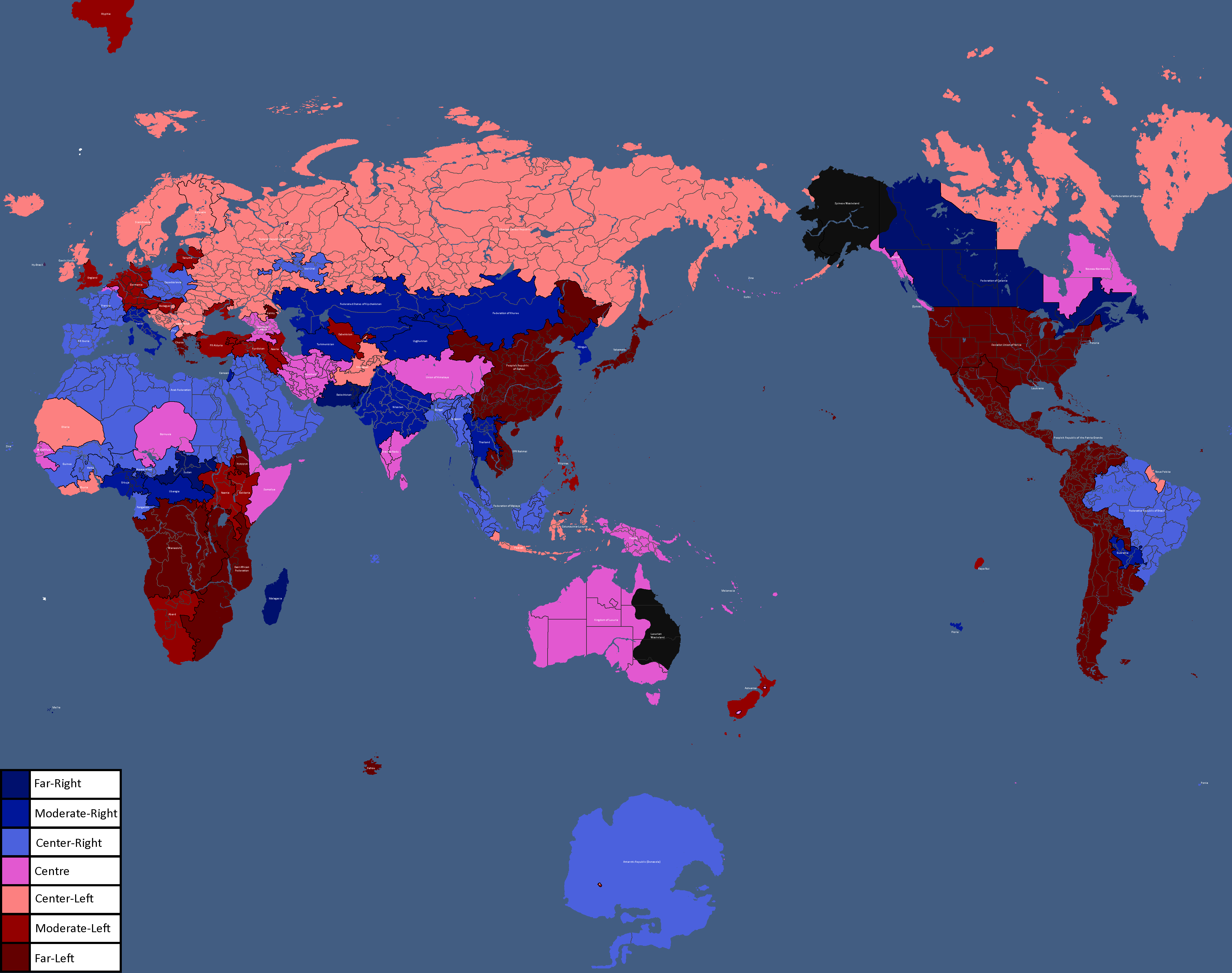
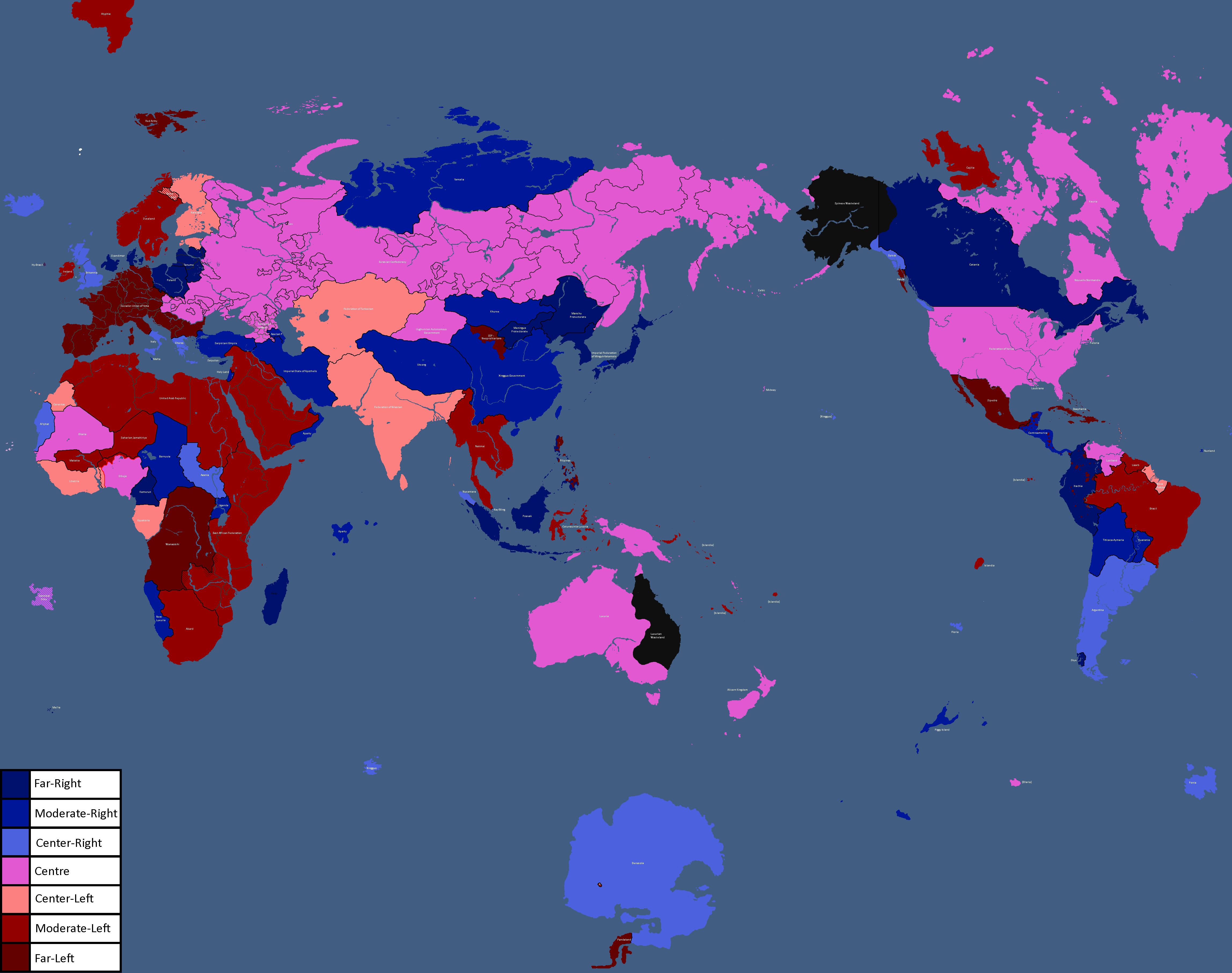
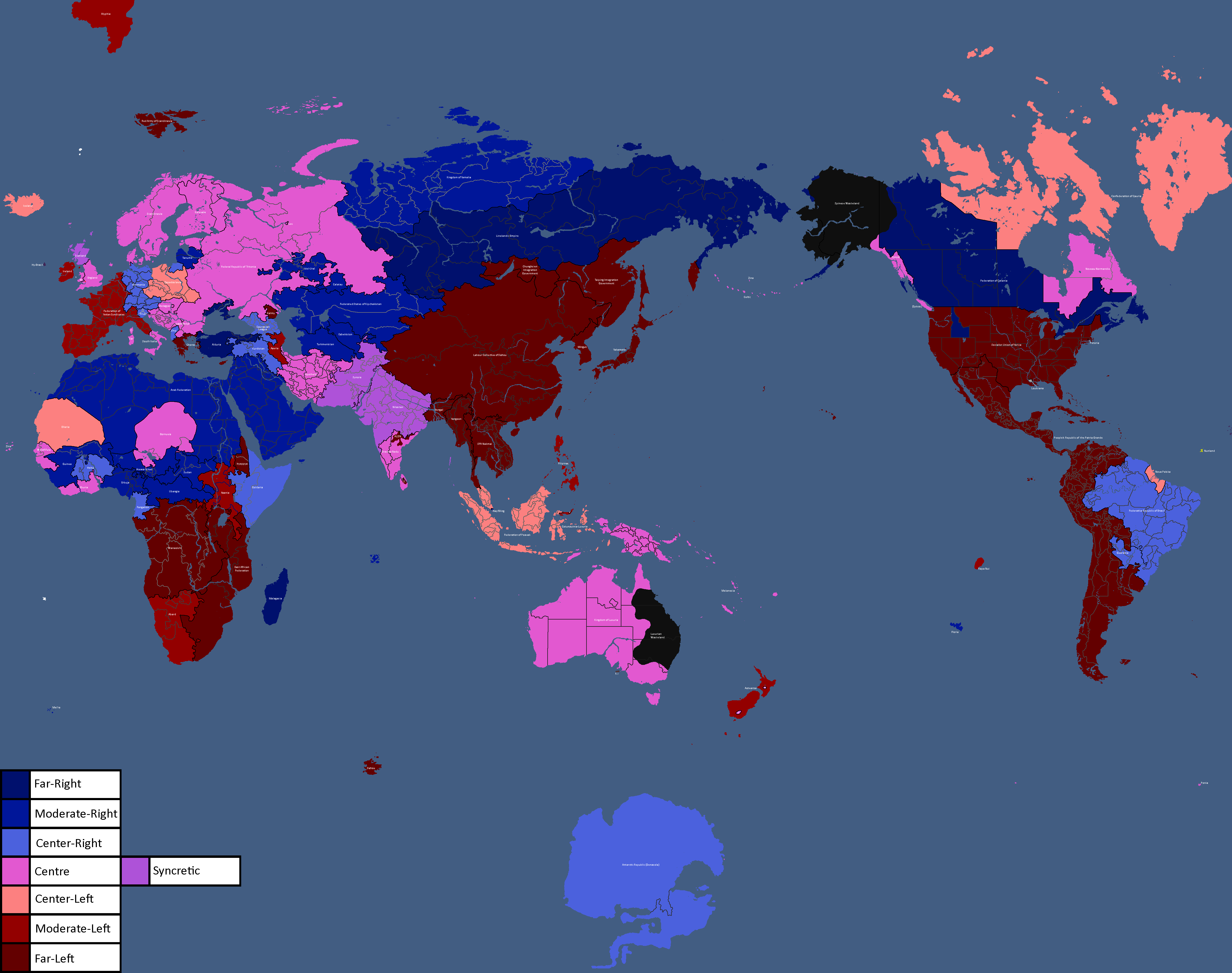
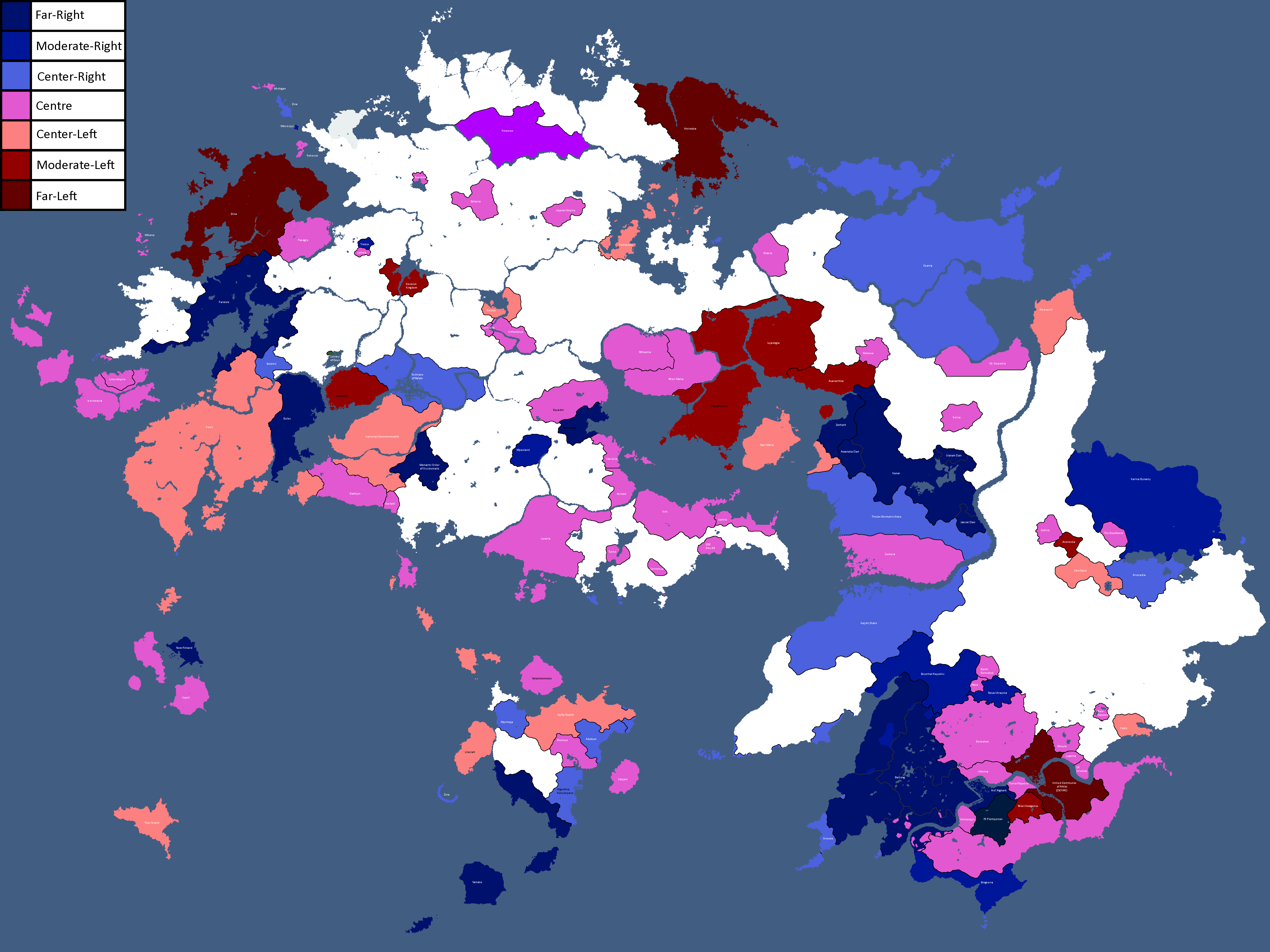
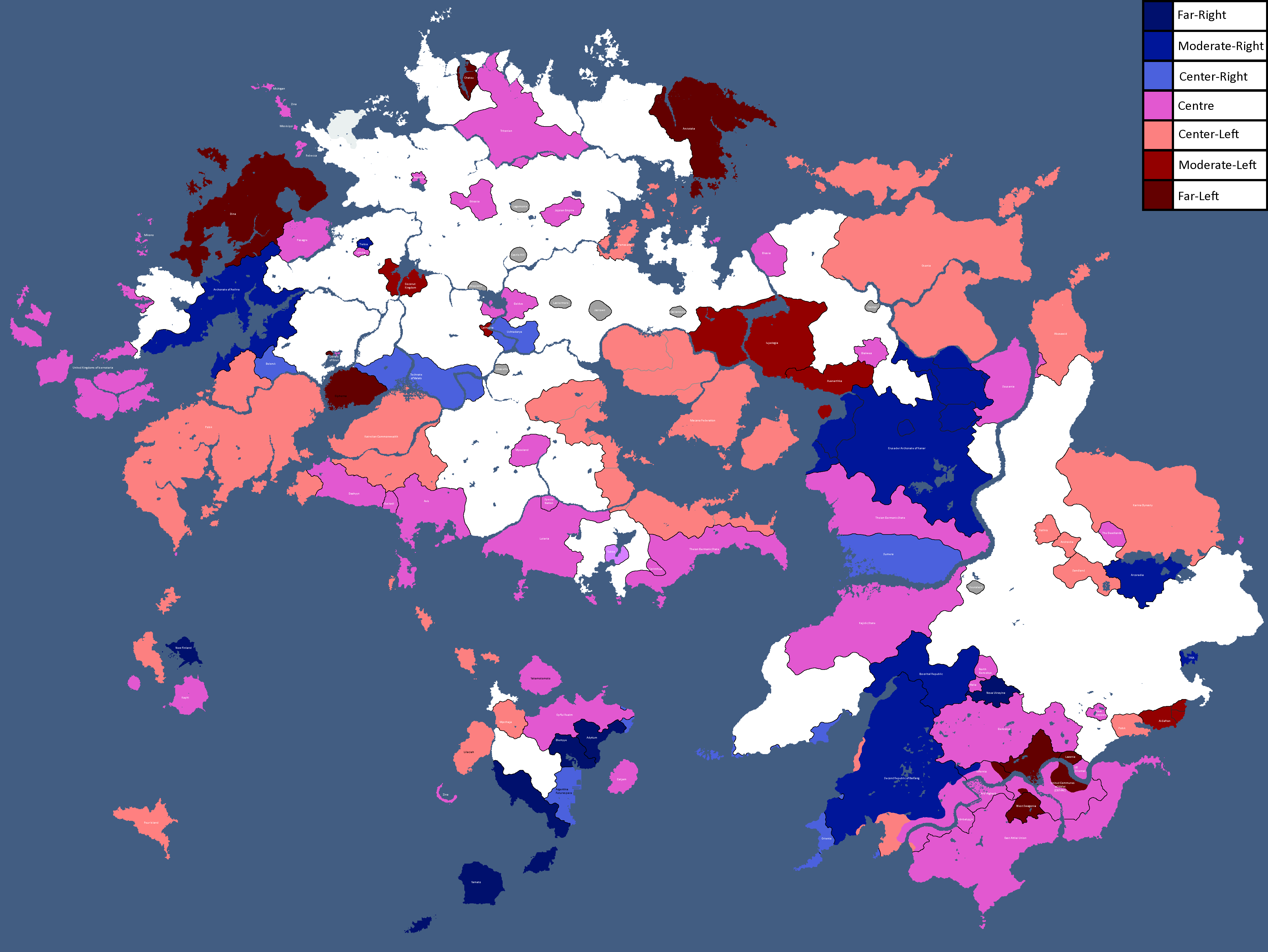
Map of Political Leanings: Year 398
-
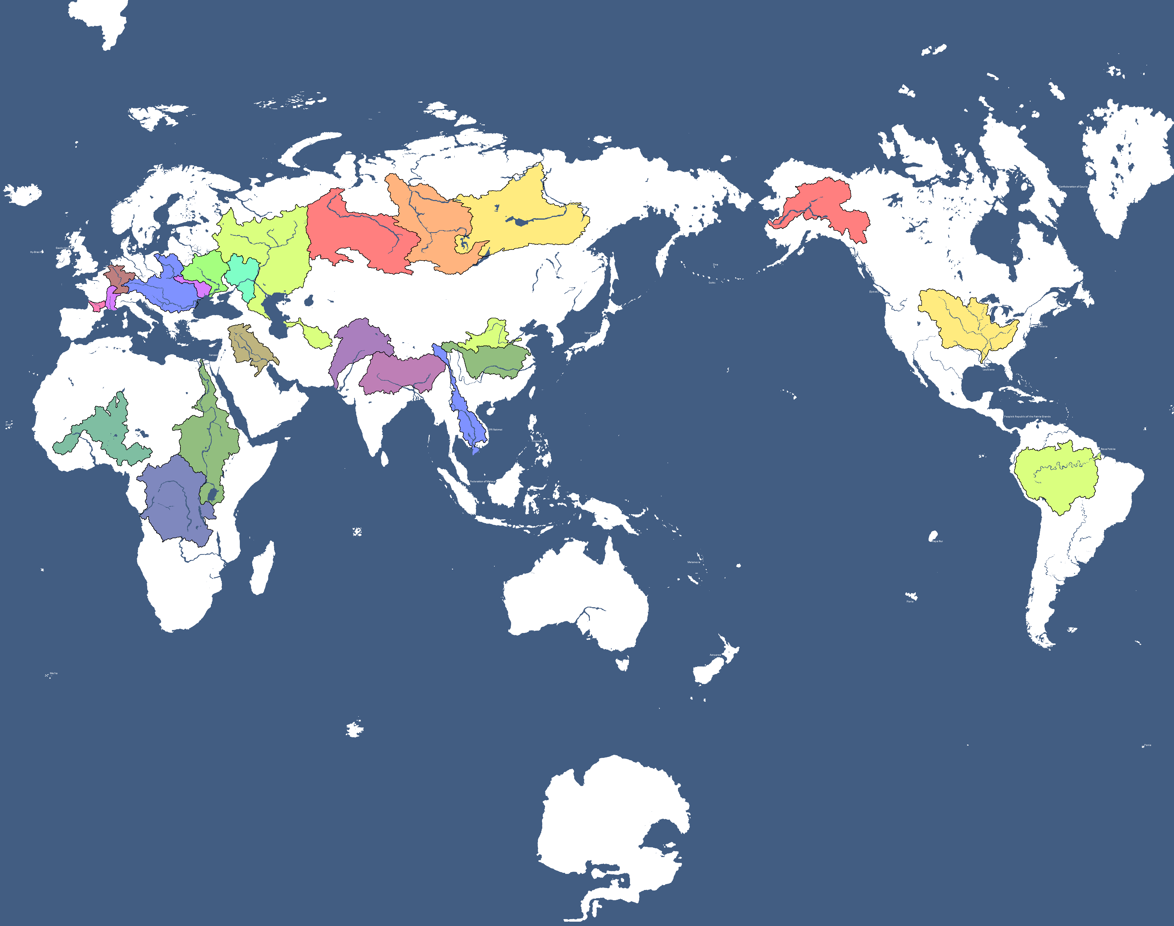
Map of Watersheds: Year 398
-
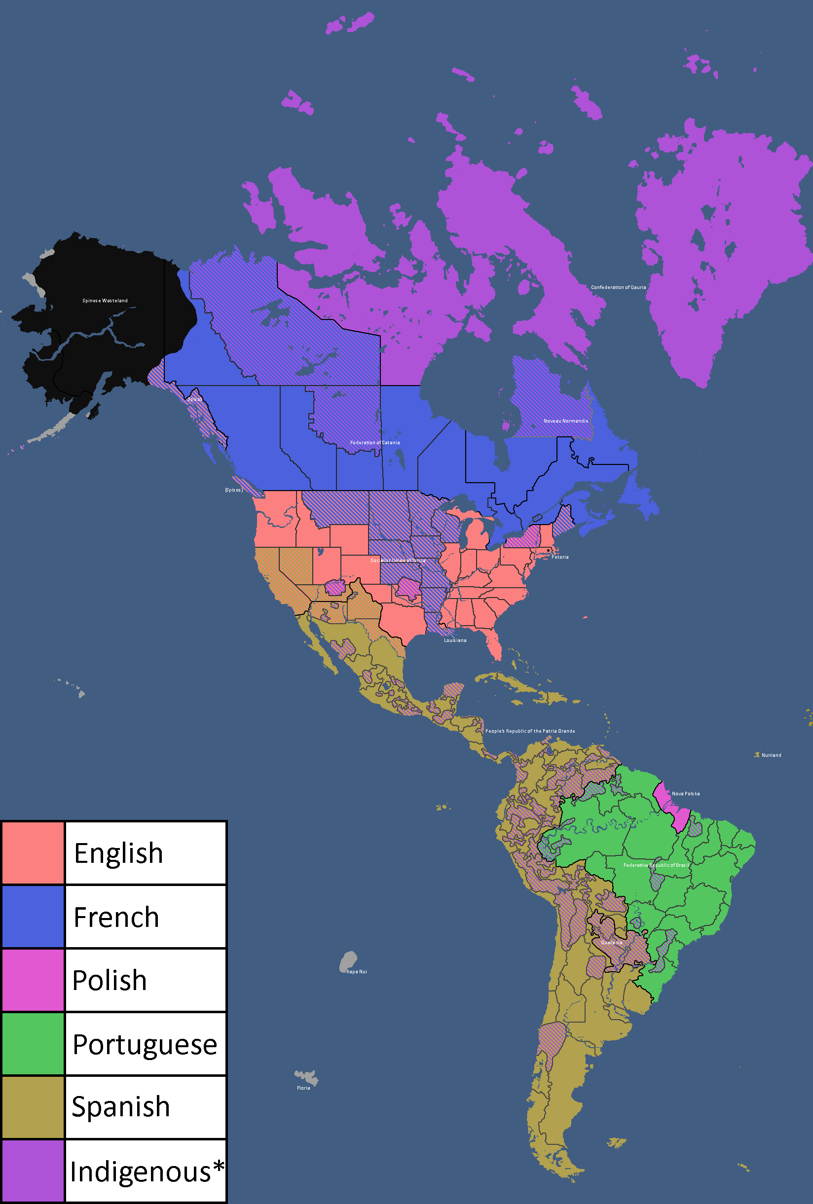
Map of Official Languages in the Americas: Year 403
-
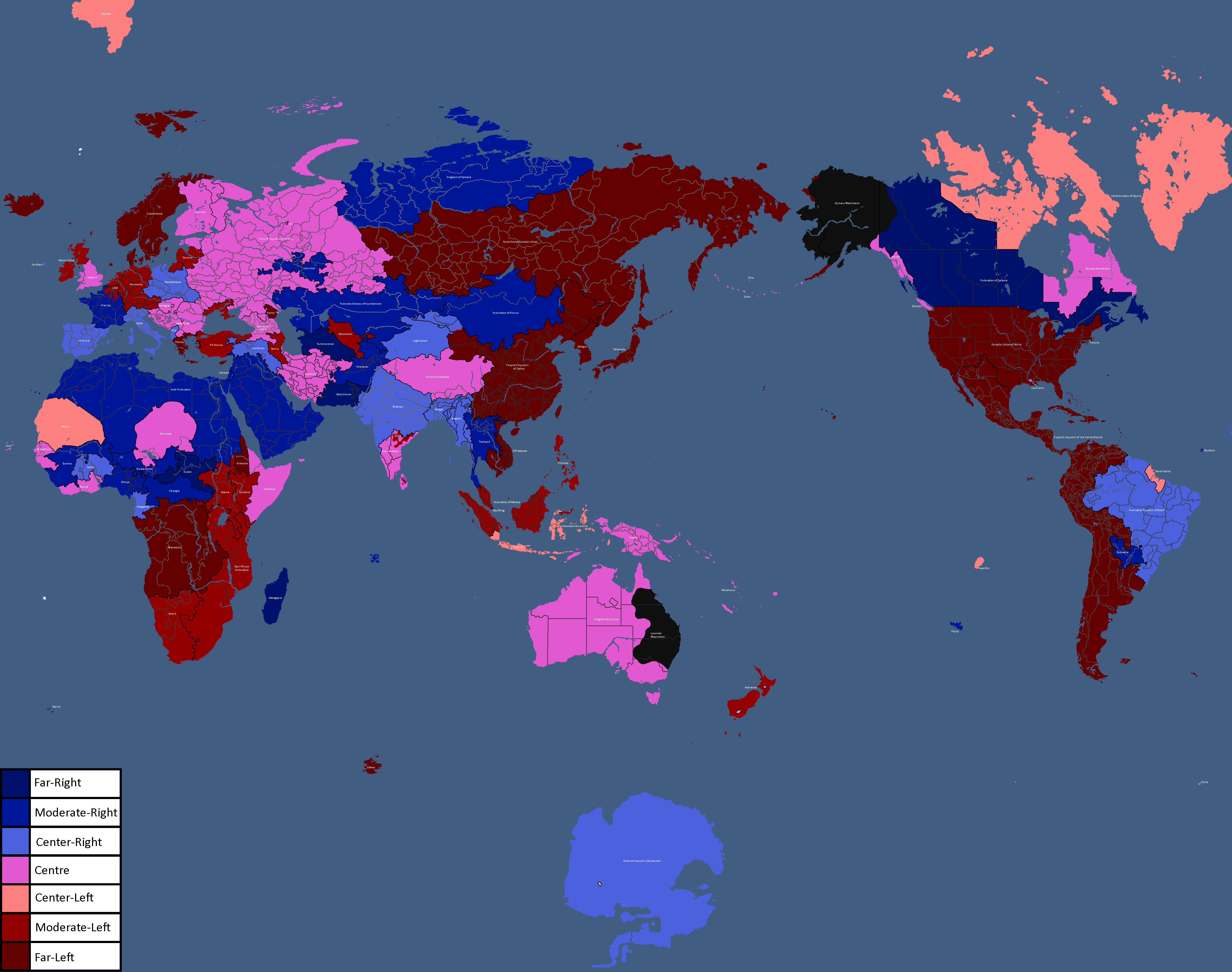
Map of Political Leanings: Year 404
-
![Map of Diplomatic Blocs[11]: Year 405](/yatawiki/images/0/0a/Diplomaticblocs.png)
Map of Diplomatic Blocs[11]: Year 405
-
Map of Yata with some of Peter's former countries returning or inexplicably grown: Year 408
-
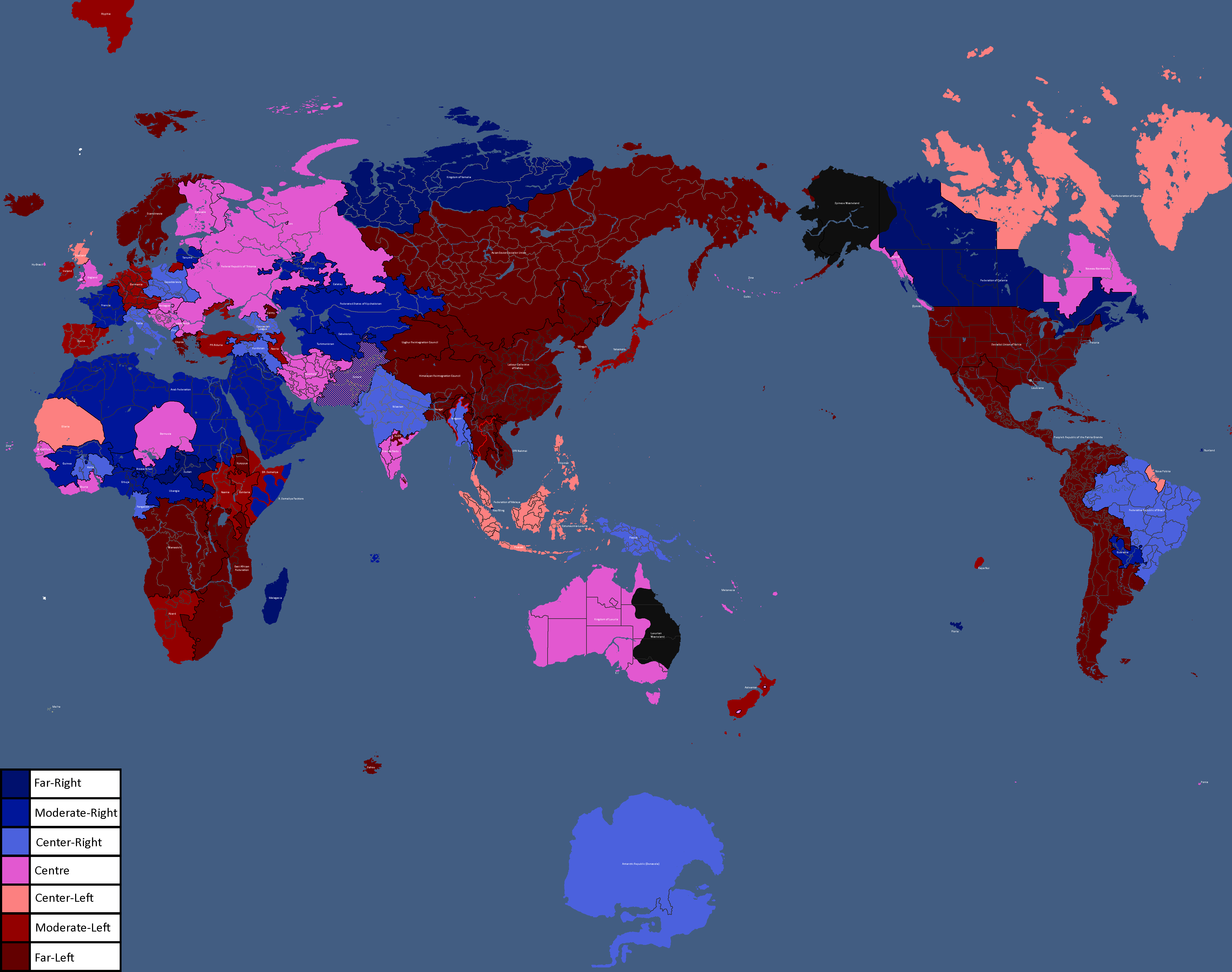
Map of Political Leanings: Year 409
-
![Map of Democracy Status[12]: Year 409](/yatawiki/images/4/43/Democracymap5.png)
Map of Democracy Status[12]: Year 409
-
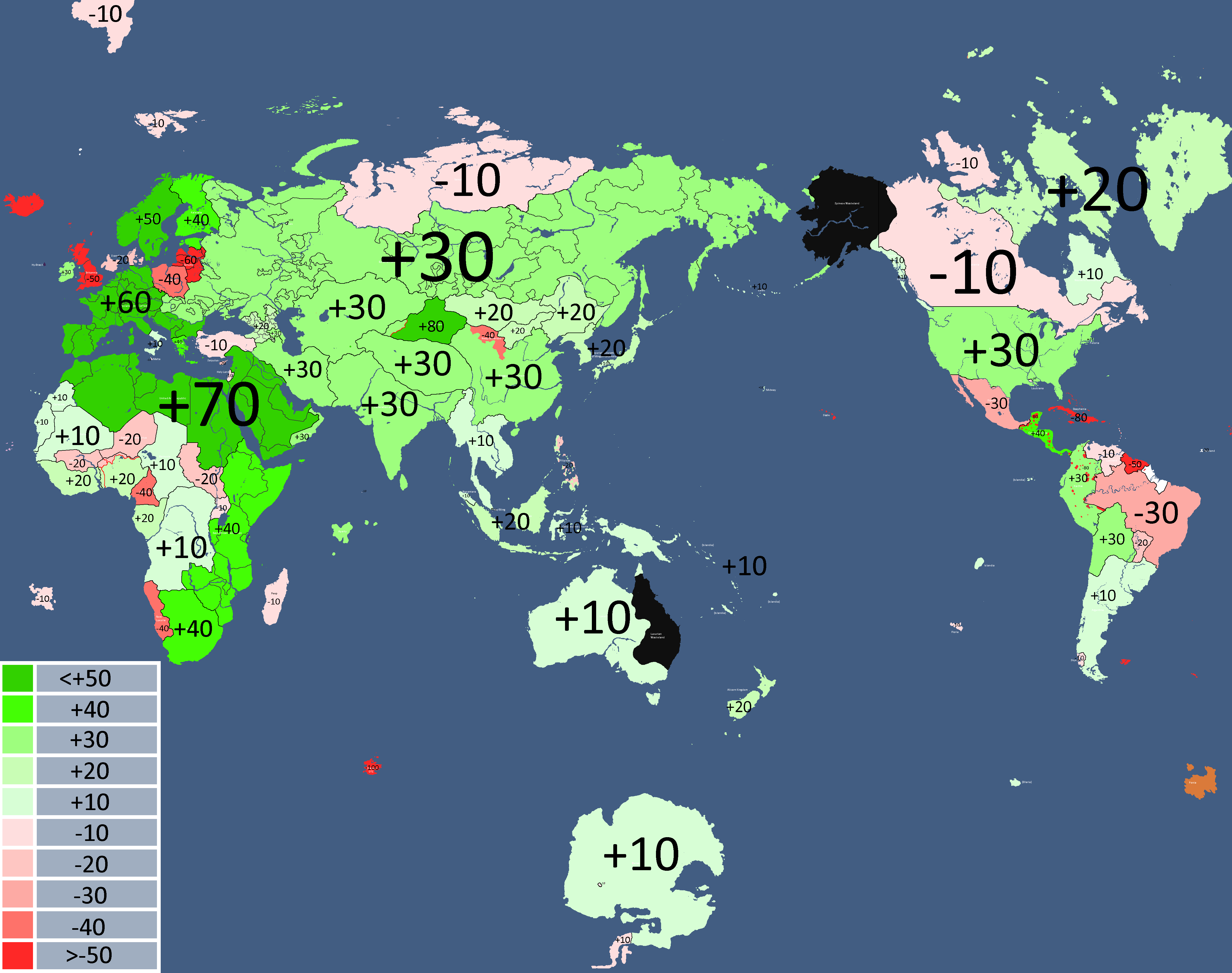
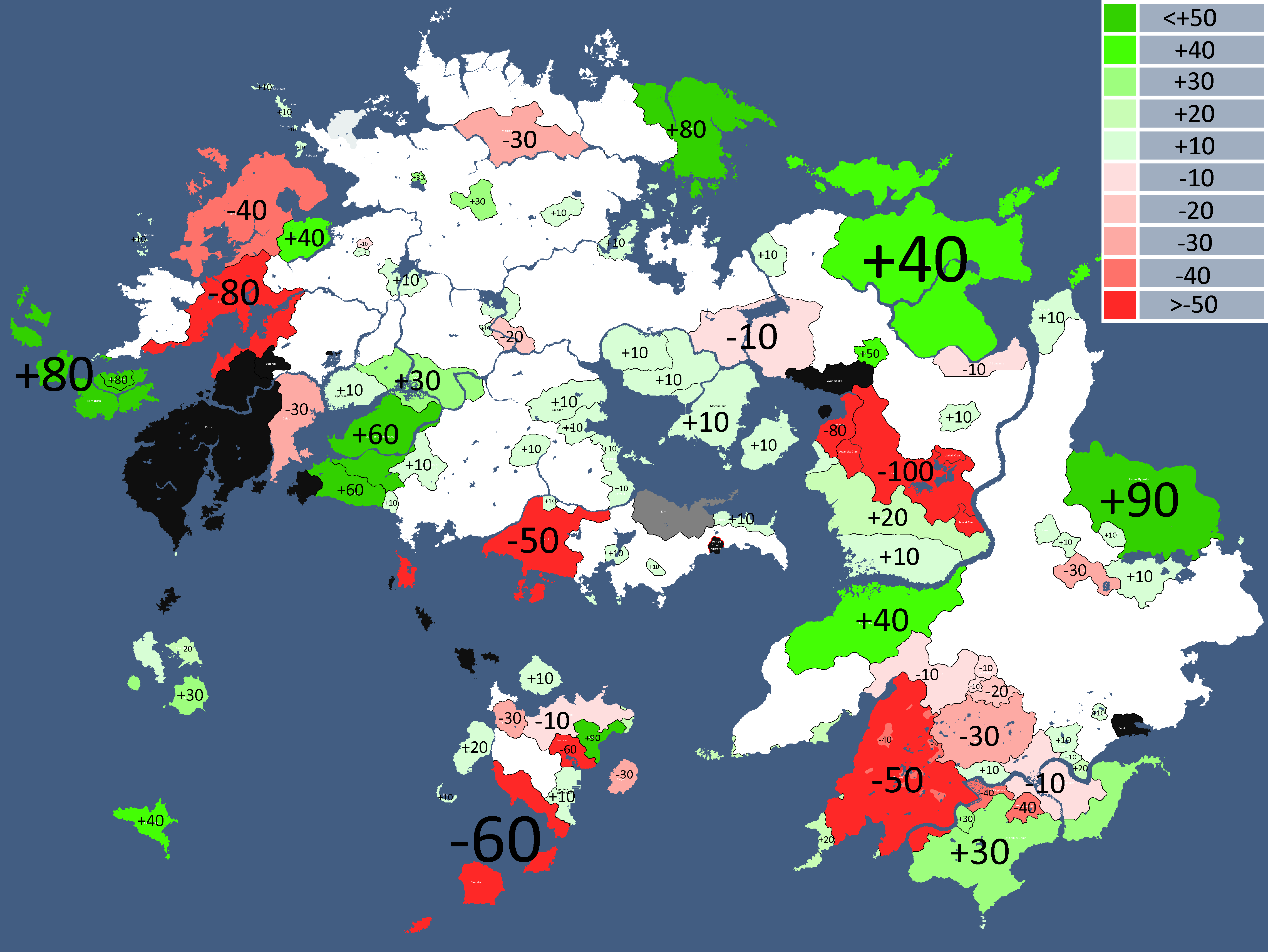
![Map of countries that like the CIS[13]: Year 409](/yatawiki/images/e/e4/Cisopinionmap.png)
Map of countries that like the CIS[13]: Year 409
-
![Map of Diplomatic Blocs[14]: Year 410](/yatawiki/images/c/cd/Yatapolitics4.png)
Map of Diplomatic Blocs[14]: Year 410
-
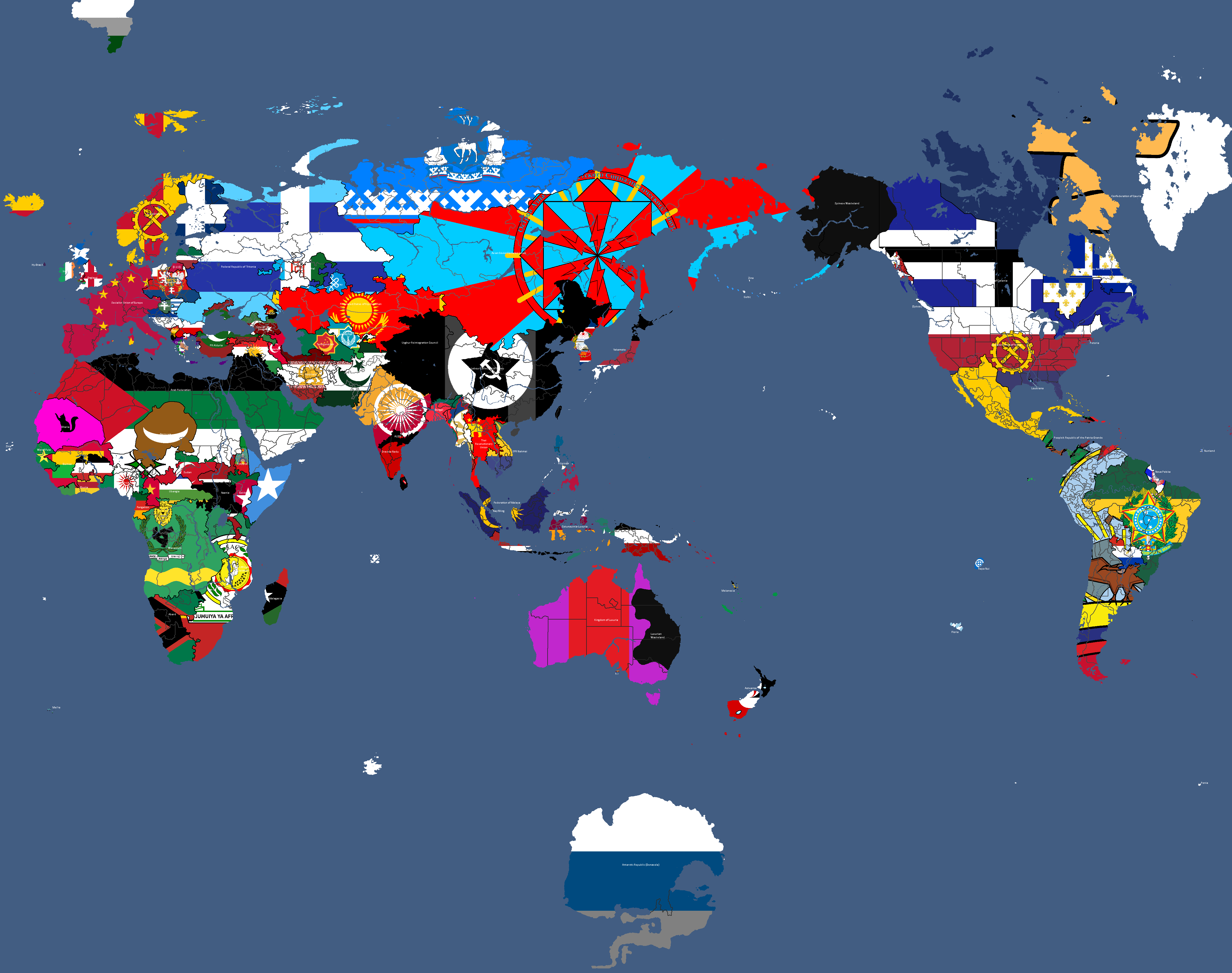
Flag Map: Year 412
-
![Map of Diplomatic Blocs[15]: Year 413](/yatawiki/images/a/a1/Yatadiplomaticblocs.png)
Map of Diplomatic Blocs[15]: Year 413
-
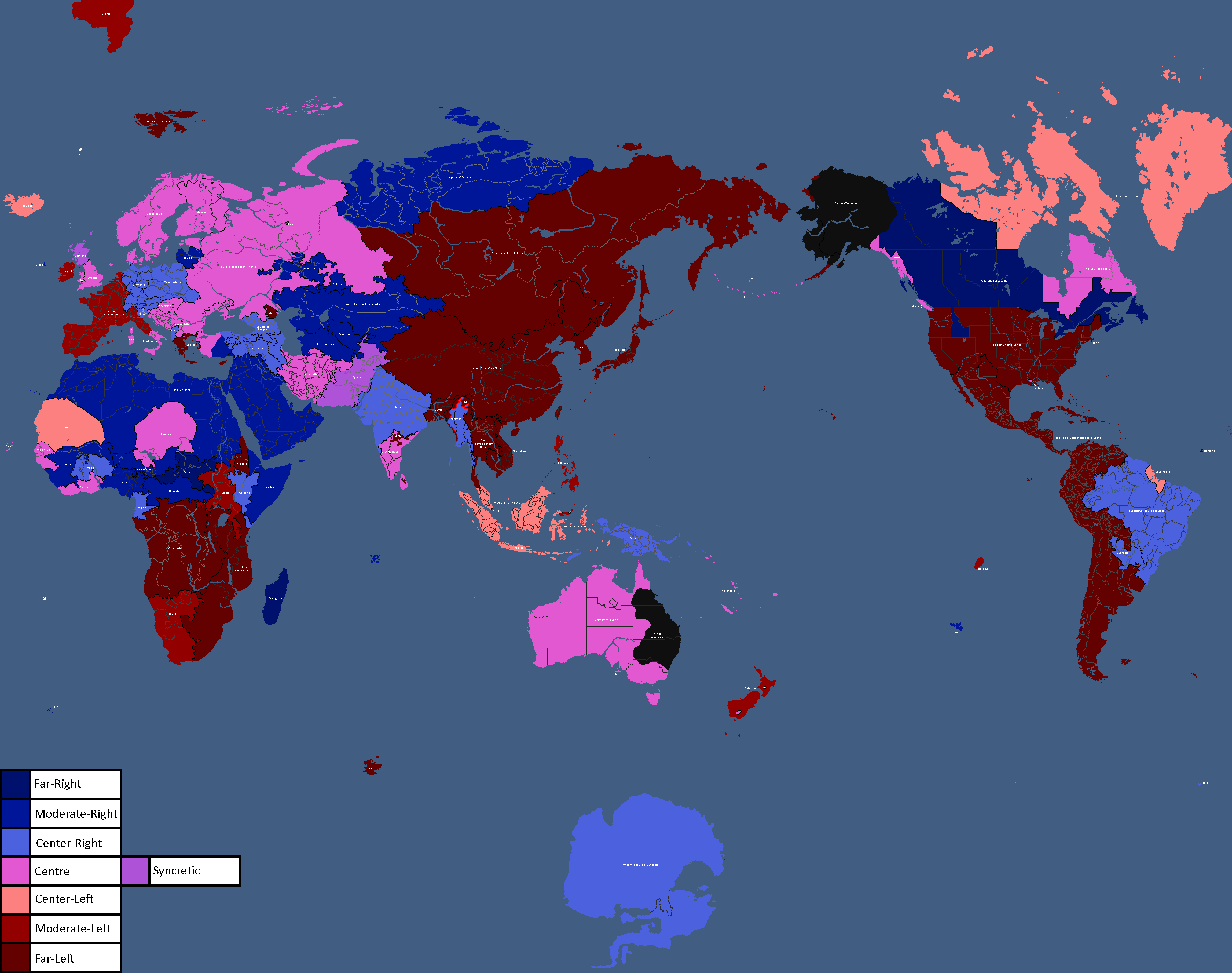
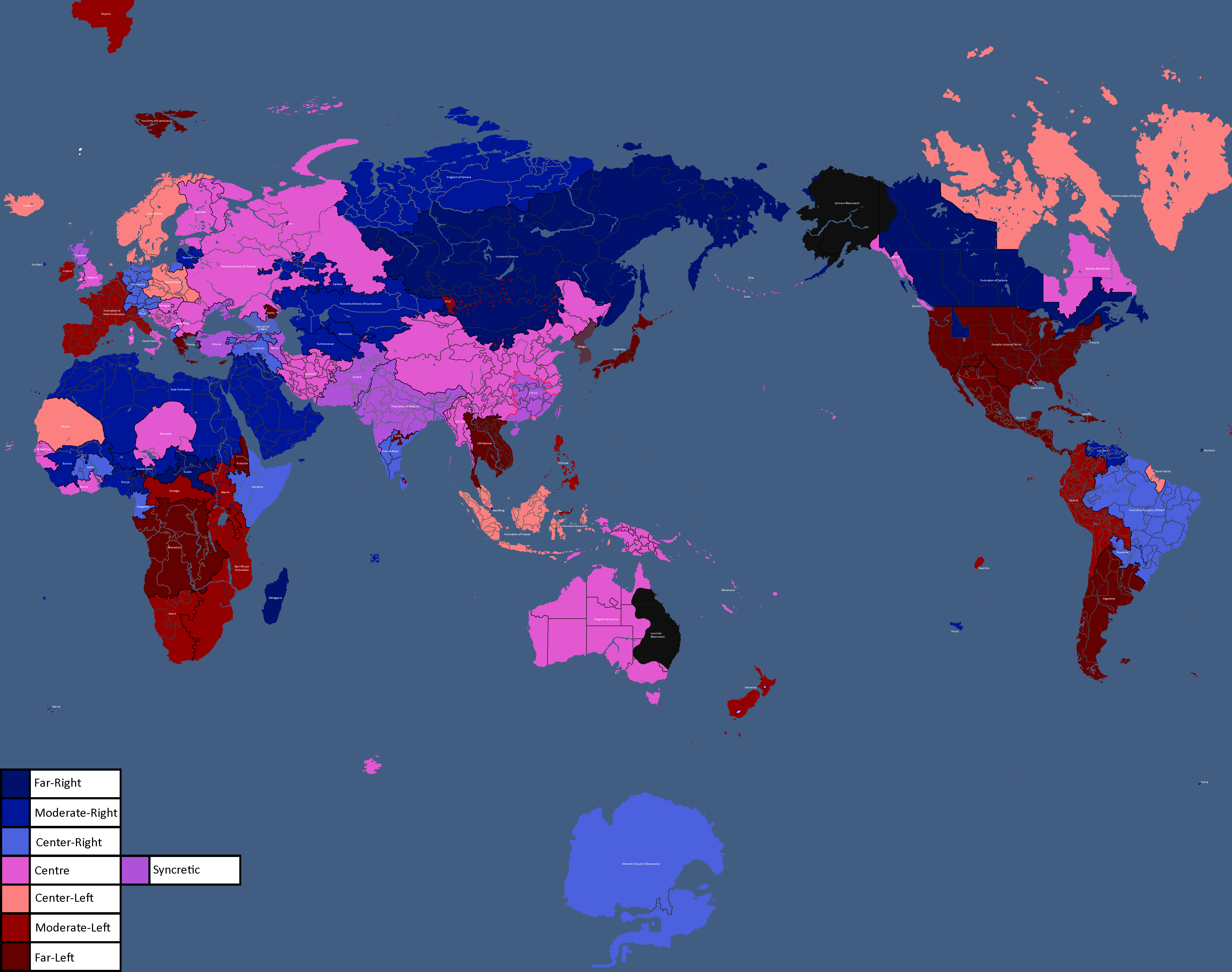
Map of Political Leanings: Year 414
-
![Map of Diplomatic Leanings[16]: Year 416](/yatawiki/images/8/83/Diplomaticblocs3.png)
Map of Diplomatic Leanings[16]: Year 416
-
Map of Political Leanings: Year 419
-
![Map of Democracy Status[17]: Year 419](/yatawiki/images/8/8c/Democracymap6.png)
Map of Democracy Status[17]: Year 419
-
![Map of Diplomatic Blocs[18]: Year 419](/yatawiki/images/d/d6/Diplomaticblocs4.png)
Map of Diplomatic Blocs[18]: Year 419
-
Map of Political Leanings: Year 424
-
Map of Yata using the Kavrayskiy VII Projection: Year 427
-
![Maap of Diplomatic Blocs[19]: Year 433](/yatawiki/images/c/c4/Diplomaticblocs5.png)
Maap of Diplomatic Blocs[19]: Year 433
-
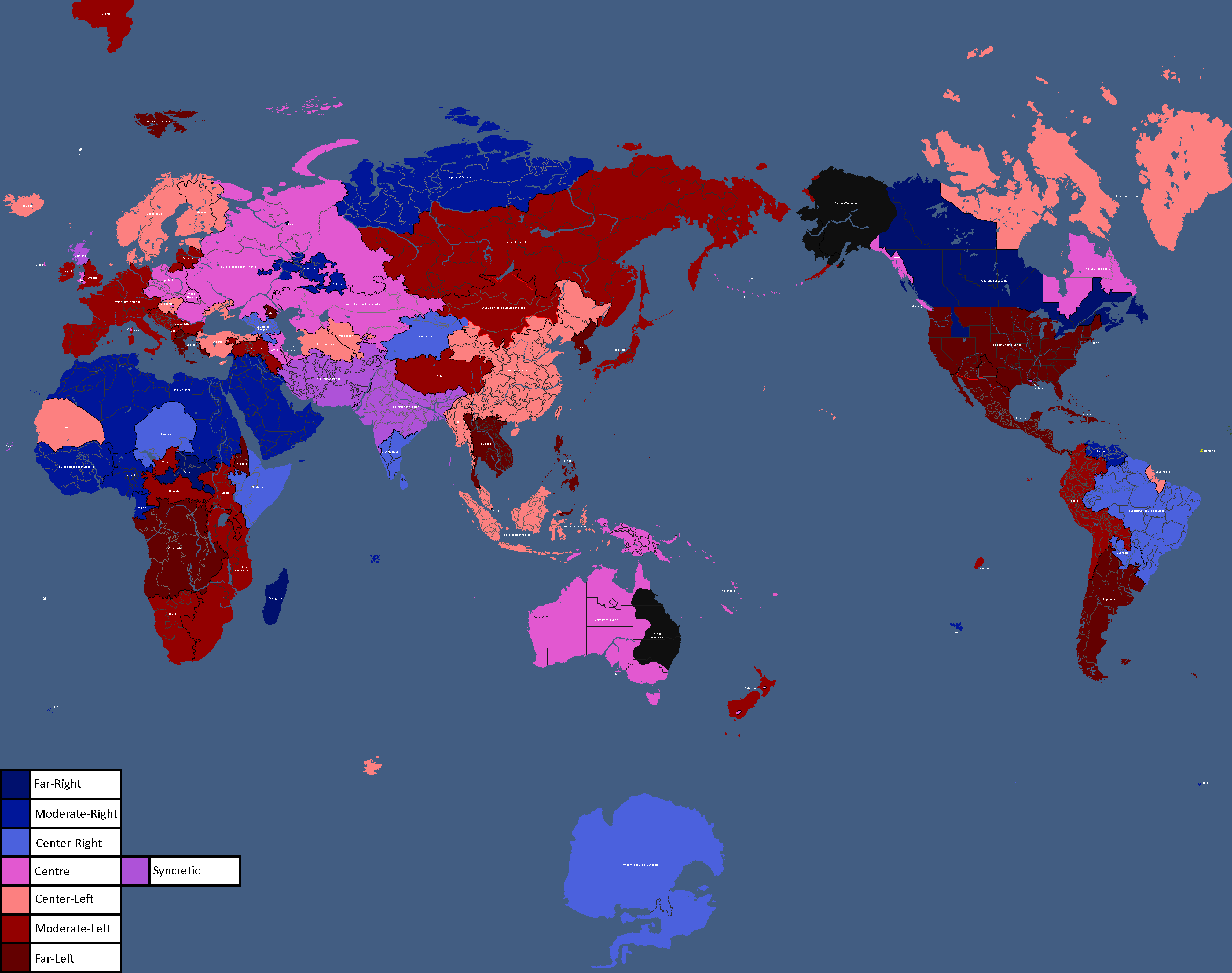
Map of Political Leanings: Year 437
-
![Map of Democracy Status[20]: Year 437](/yatawiki/images/1/12/Democoracymap437.png)
Map of Democracy Status[20]: Year 437
-
![Map of Diplomatic Blocs[21]: Year 438](/yatawiki/images/9/9f/Diplomaticblocs438.png)
Map of Diplomatic Blocs[21]: Year 438
-
Map of Yata's species distribution: Year 517


![Map of Democracy[1]: Year 343](/yatawiki/index.php/File:Democracymap.png)
![Monarchy or Republic[2]: Year 347](/yatawiki/index.php/File:Monarchyrepublic.png)


![Map of Religions[3]: Year 362](/yatawiki/index.php/File:Religionmap.png)

![Map of Nuclear Powers[4]: Year 367](/yatawiki/index.php/File:Nuclearpowers.png)
![Map of the Yatan Cold War[5]: Year 371](/yatawiki/index.php/File:Yatancoldwar.png)
![Map of World Power Statuses[6]: Year 371](/yatawiki/index.php/File:Powersmap.png)
![Development Map[7]: Year 372](/yatawiki/index.php/File:Developmentmap.png)

![Democracy Map[8]: Year 372](/yatawiki/index.php/File:Democracymap3.png)

![Map of Economic Structure[9]: Year 373](/yatawiki/index.php/File:Economymap.png)


![Flag of Post-Cold War Yata's Geopolitical Blocs[10]: Year 383](/yatawiki/index.php/File:Yatacoldwar.png)


![Map of Diplomatic Blocs[11]: Year 405](/yatawiki/index.php/File:Diplomaticblocs.png)


![Map of Democracy Status[12]: Year 409](/yatawiki/index.php/File:Democracymap5.png)
![Map of countries that like the CIS[13]: Year 409](/yatawiki/index.php/File:Cisopinionmap.png)
![Map of Diplomatic Blocs[14]: Year 410](/yatawiki/index.php/File:Yatapolitics4.png)

![Map of Diplomatic Blocs[15]: Year 413](/yatawiki/index.php/File:Yatadiplomaticblocs.png)

![Map of Diplomatic Leanings[16]: Year 416](/yatawiki/index.php/File:Diplomaticblocs3.png)

![Map of Democracy Status[17]: Year 419](/yatawiki/index.php/File:Democracymap6.png)
![Map of Diplomatic Blocs[18]: Year 419](/yatawiki/index.php/File:Diplomaticblocs4.png)


![Maap of Diplomatic Blocs[19]: Year 433](/yatawiki/index.php/File:Diplomaticblocs5.png)

![Map of Democracy Status[20]: Year 437](/yatawiki/index.php/File:Democoracymap437.png)
![Map of Diplomatic Blocs[21]: Year 438](/yatawiki/index.php/File:Diplomaticblocs438.png)

Ancient Maps
Note: Many of these aren't canon anymore.
-
Ancient Tritonia NOT CANON/RETCONNED
-
Ancient Tritonia NOT CANON/RETCONNED
-
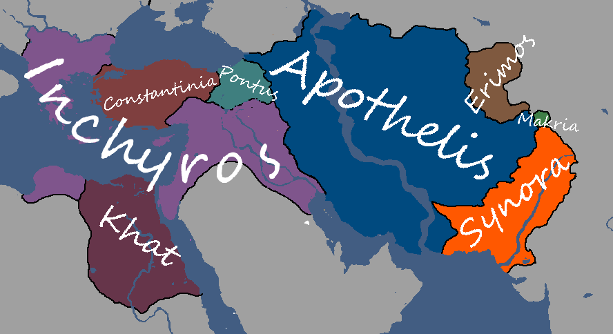
Ancient Inchyros
-
Ancient Theia
-
Ancient Lineland NOT CANON/RETCONNED
-
Ancient Choros
-
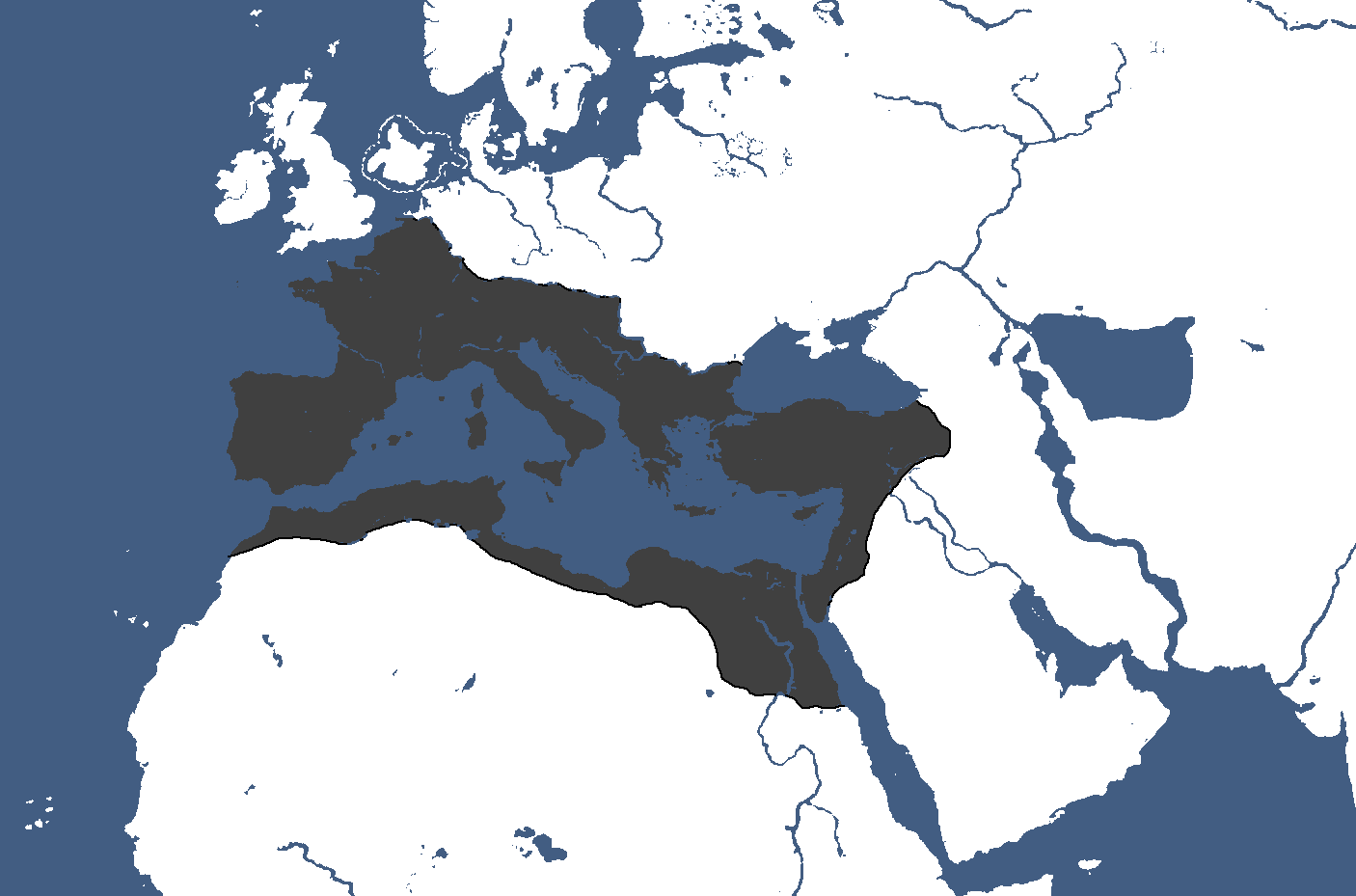
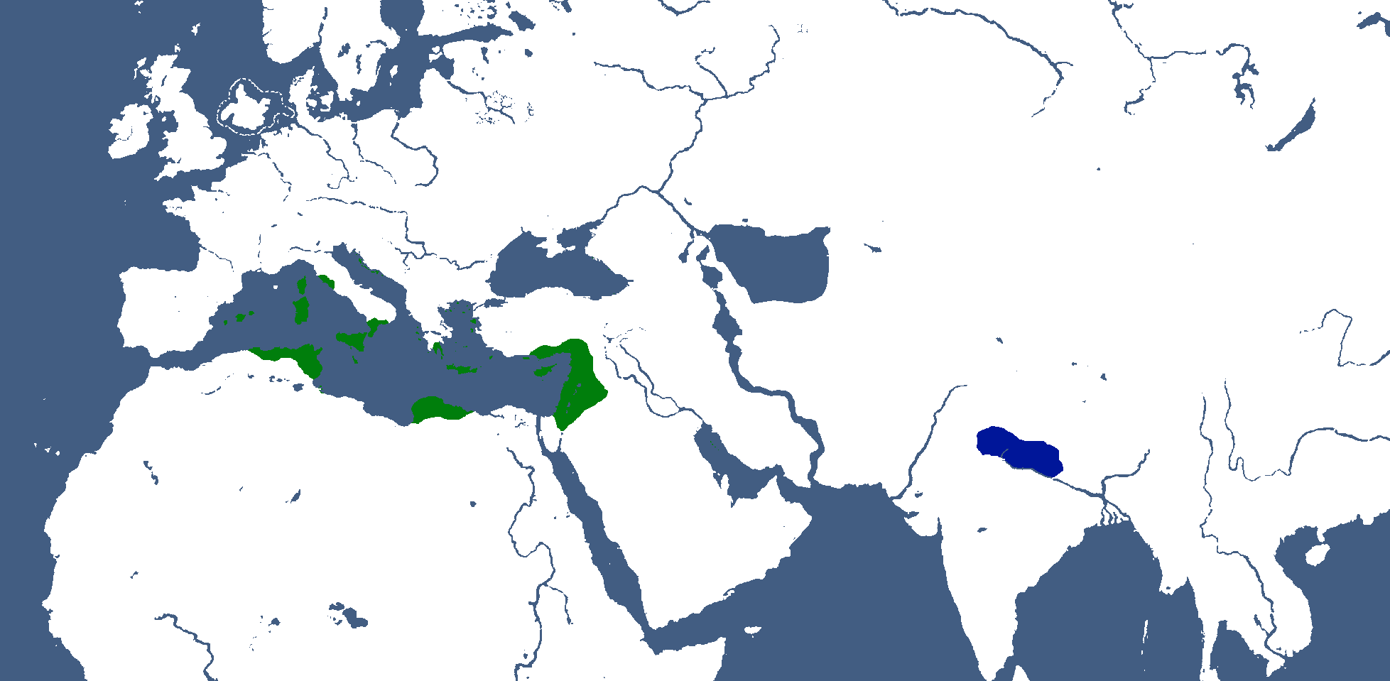
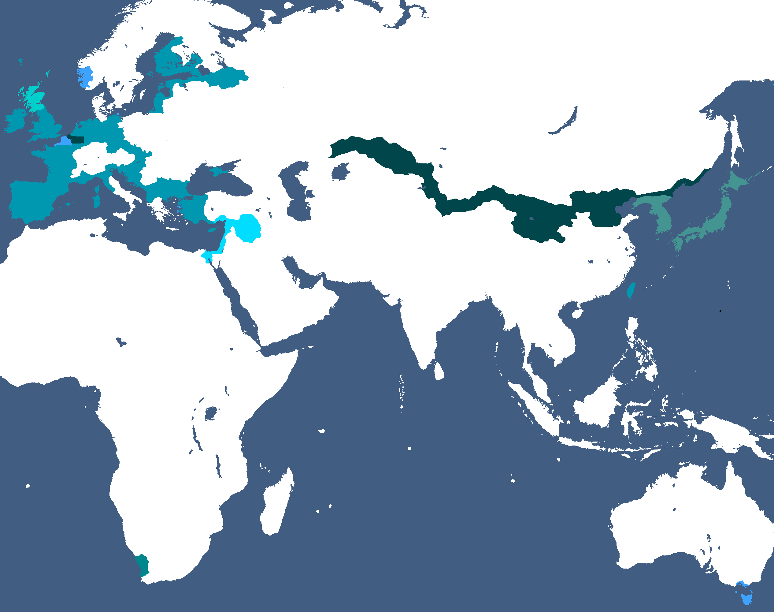
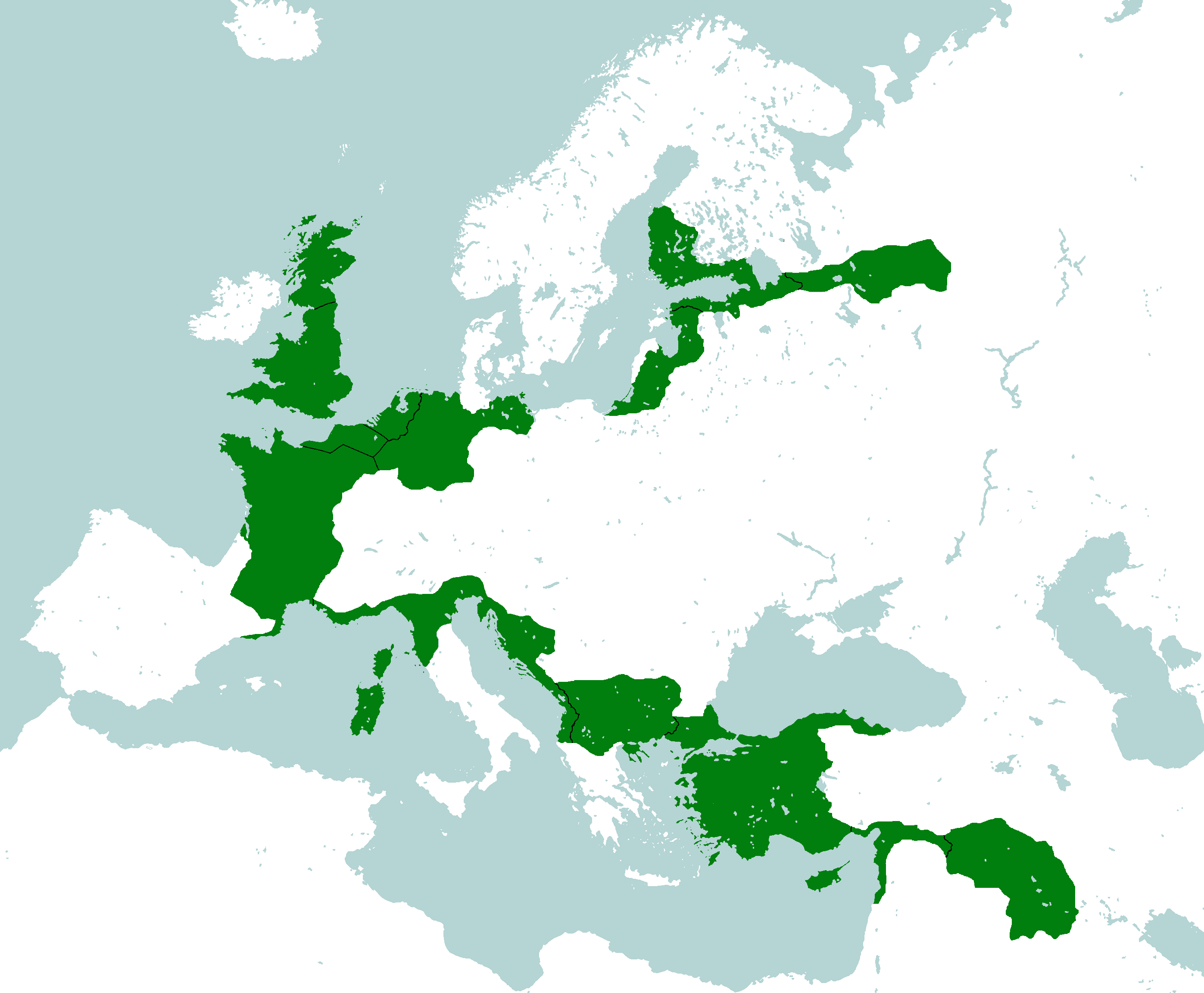
![Ancient Afro-Eurasia MOSTLY[22] NOT CANON/RETCONNED](/yatawiki/images/e/e3/Ancientafroeurasia.png)
Ancient Afro-Eurasia MOSTLY[22] NOT CANON/RETCONNED
-
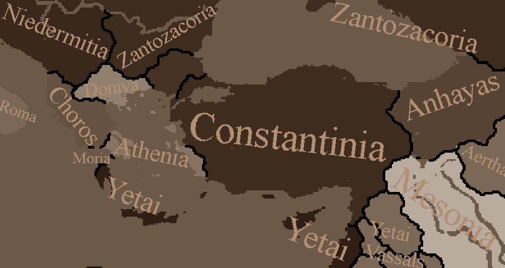
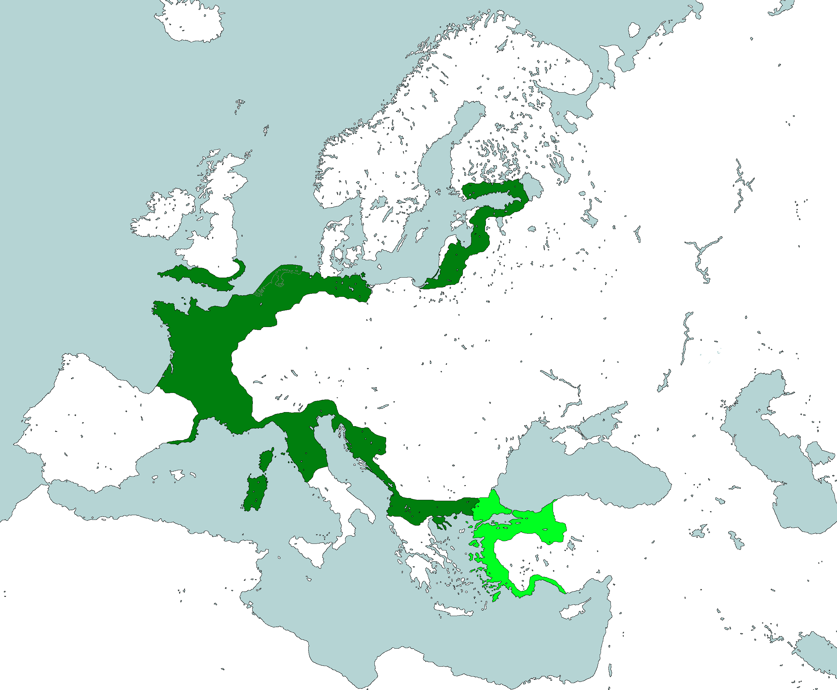
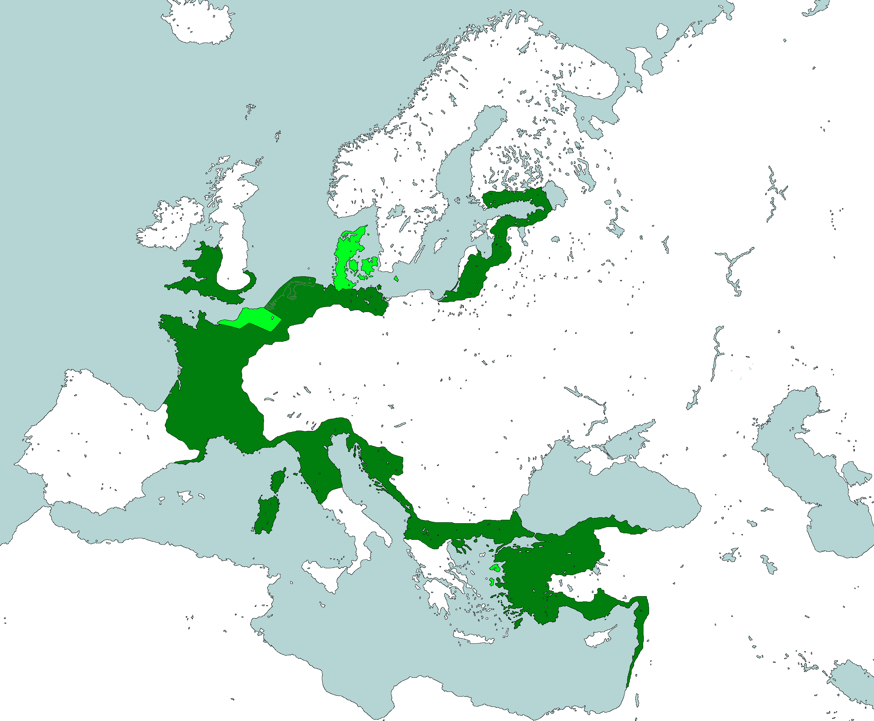
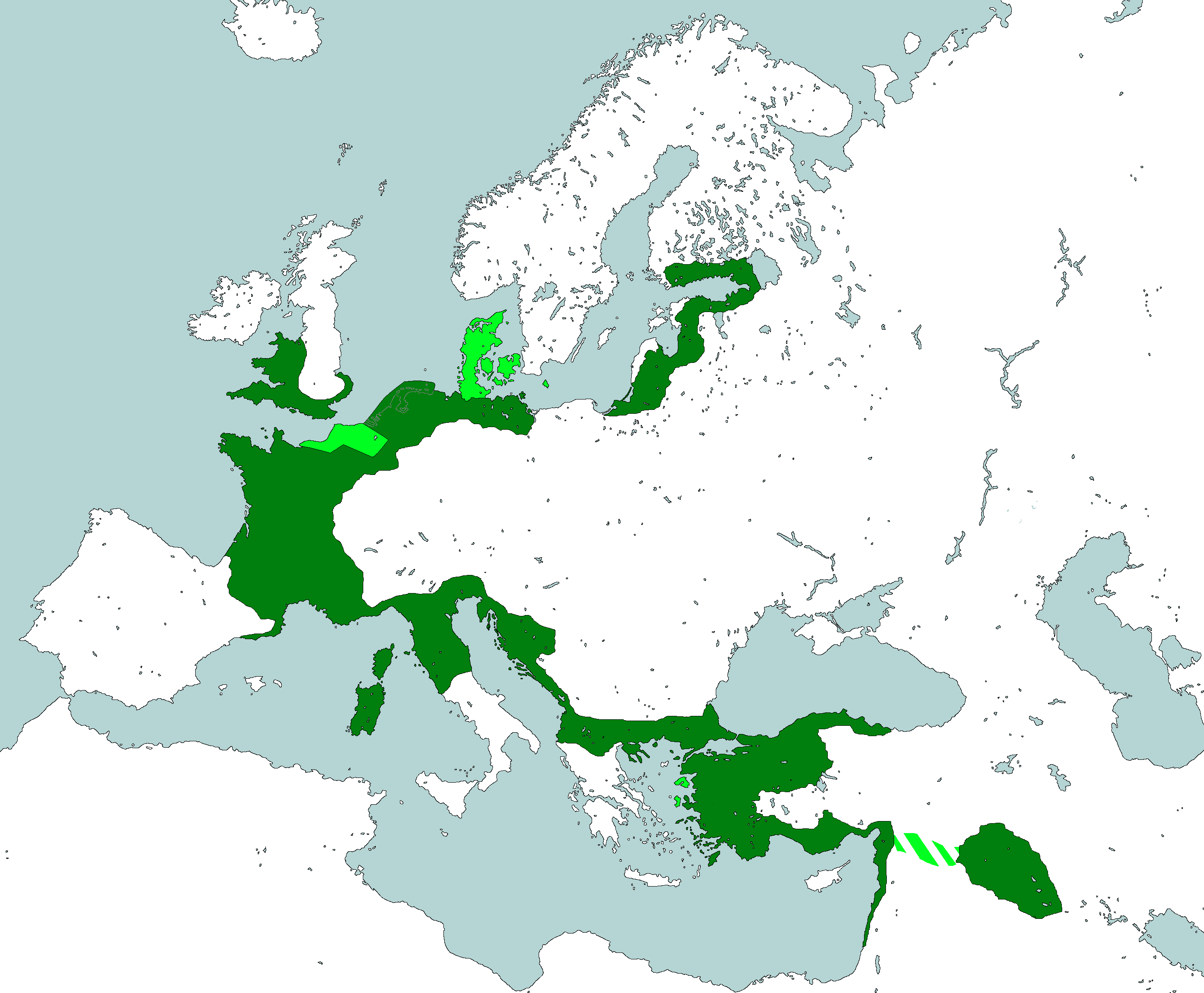
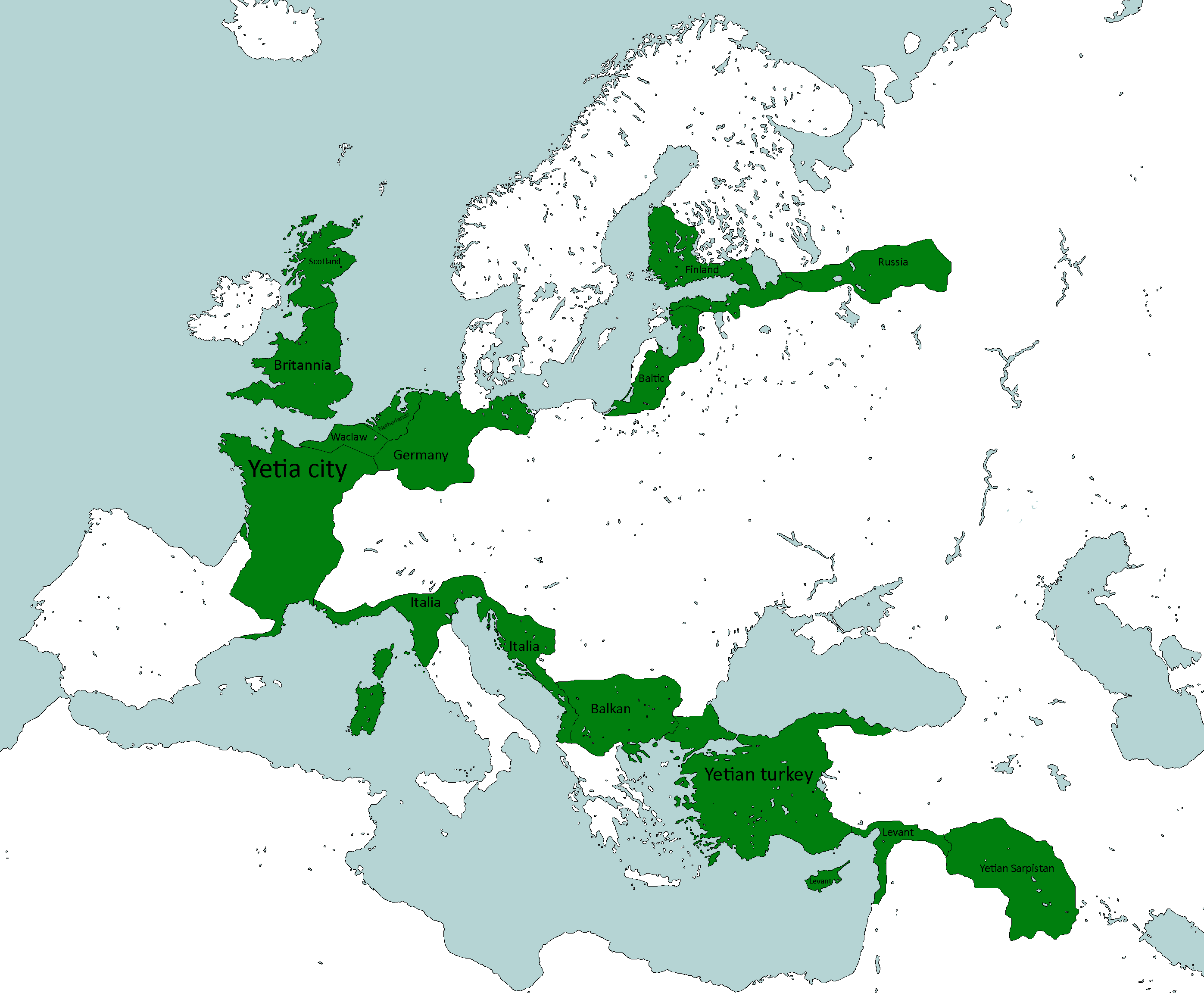
Yetai Empire
-
Collapsed Yetai Empire
-
Ancient Iujadogia & Jakalaika NOT CANON/RETCONNED
-
Inchyros Collapse MOSTLY NOT CANON/RETCONNED
-
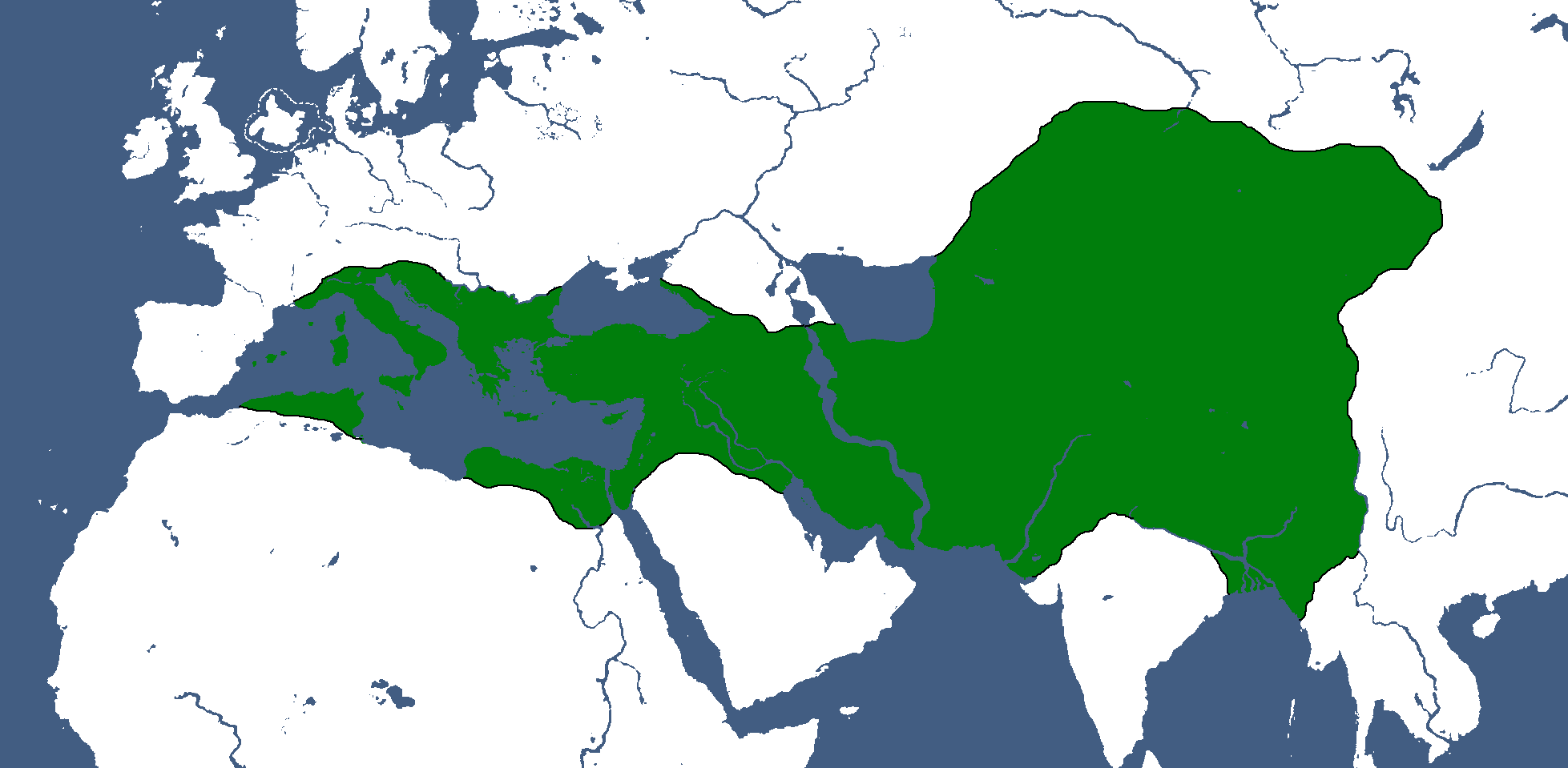
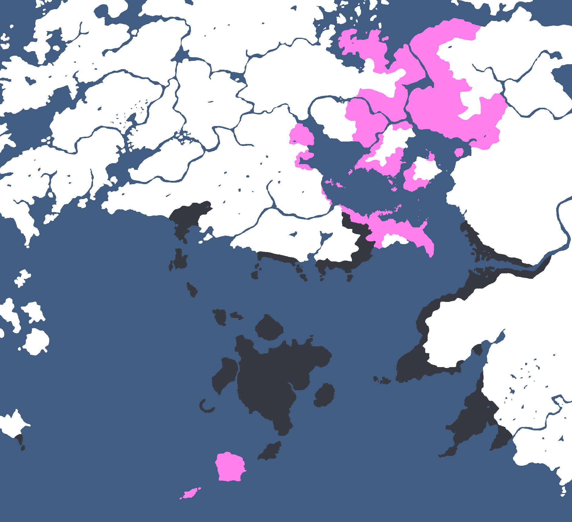
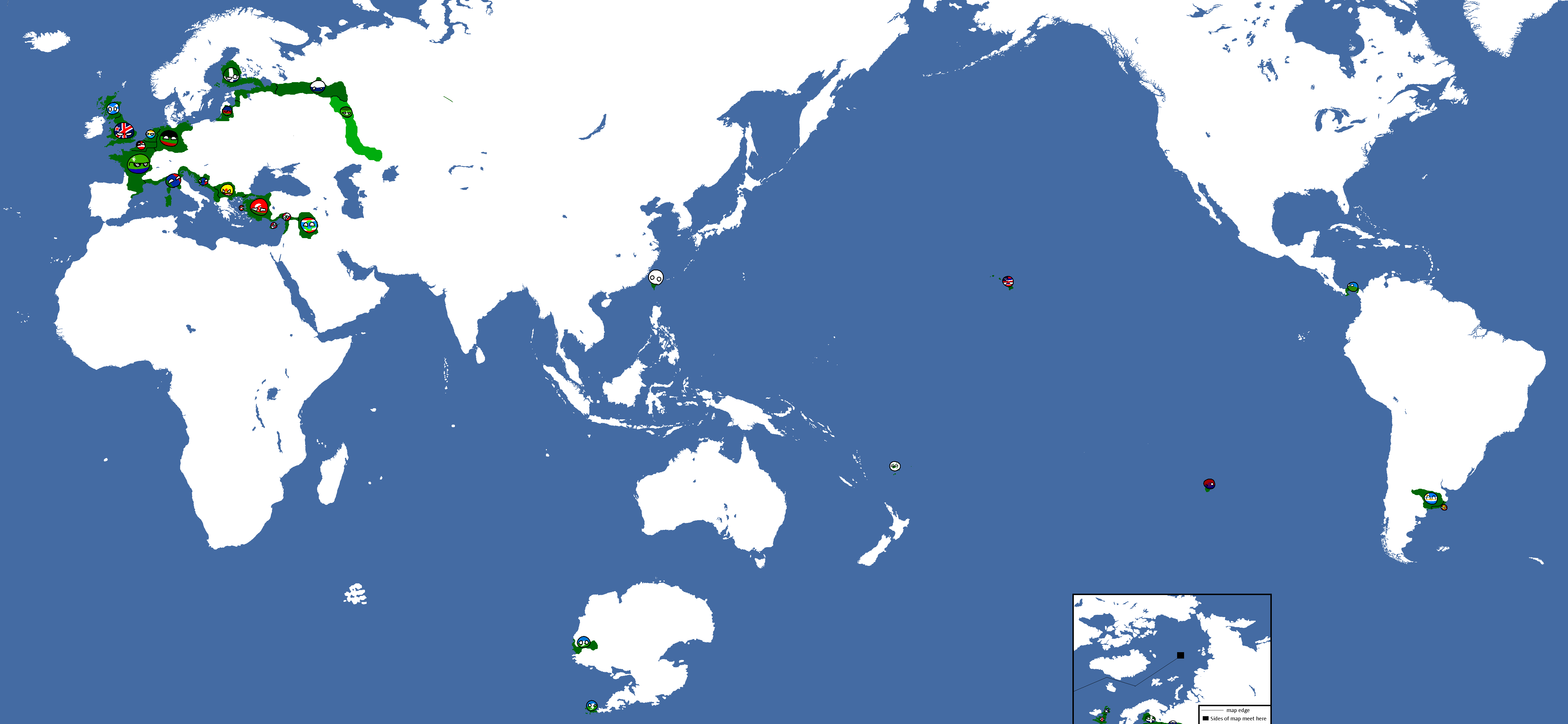
![The ancient world, according to Zantozacoria. MOSTLY[23] NOT CANON/RETCONNED](/yatawiki/images/8/85/Ancientafroeurasia2.png)
The ancient world, according to Zantozacoria. MOSTLY[23] NOT CANON/RETCONNED
-
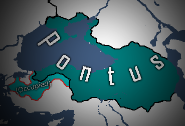
Pontic Empire
-
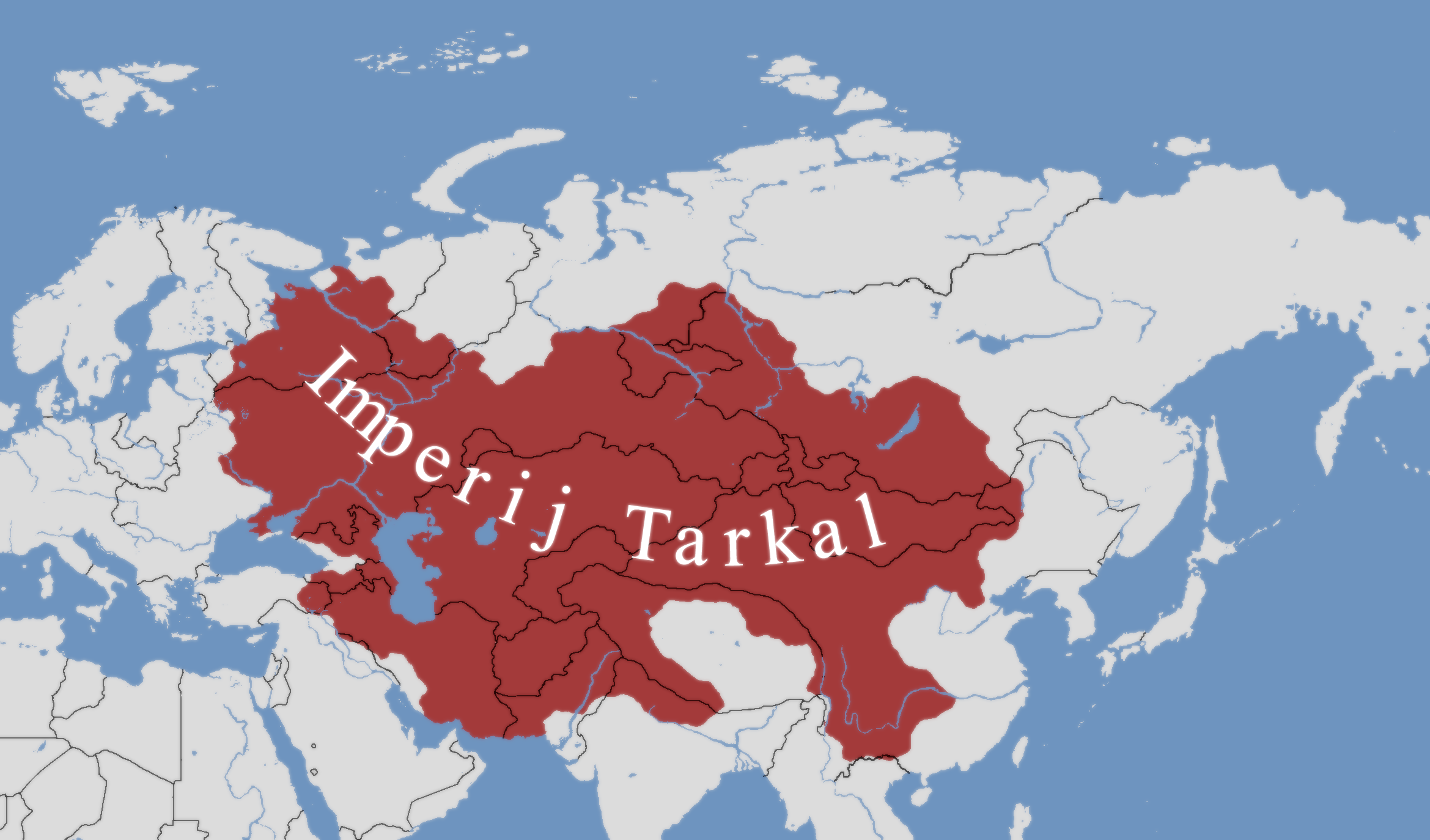
The Tarqalan Empire when it formed, and at its greatest extent.


![Ancient Afro-Eurasia MOSTLY[22] NOT CANON/RETCONNED](/yatawiki/index.php/File:Ancientafroeurasia.png)


![The ancient world, according to Zantozacoria. MOSTLY[23] NOT CANON/RETCONNED](/yatawiki/index.php/File:Ancientafroeurasia2.png)


Theian Maps
-
Simplified Native Realms: Year 4328 BCE
-
Osanian Trade Routes: Year 141
-
Map of the Deltaic Region: Year 145
-
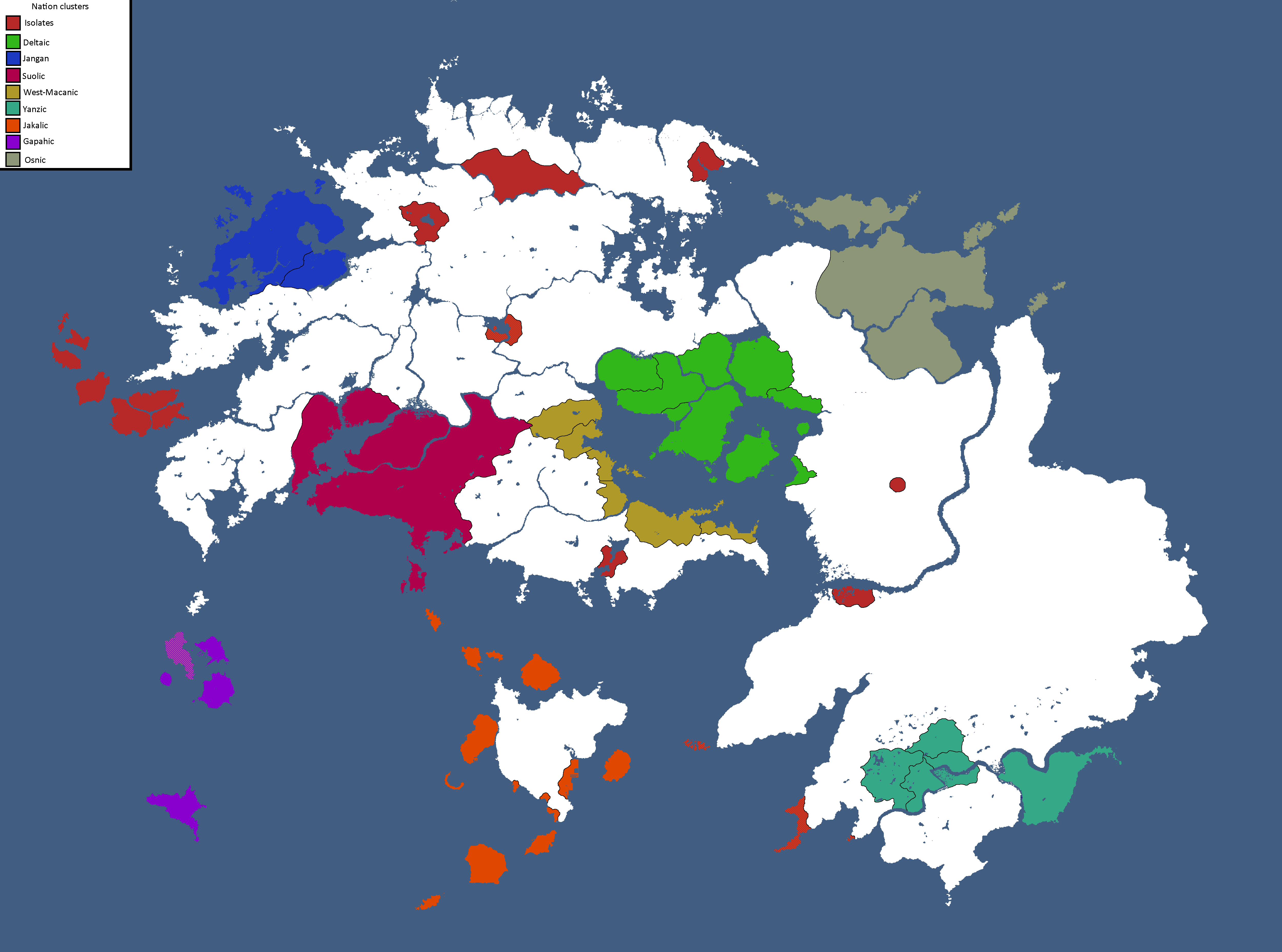
Nation Clusters of Theia: Year 165
-

Homelands of the Theian Natives: Year 171
-
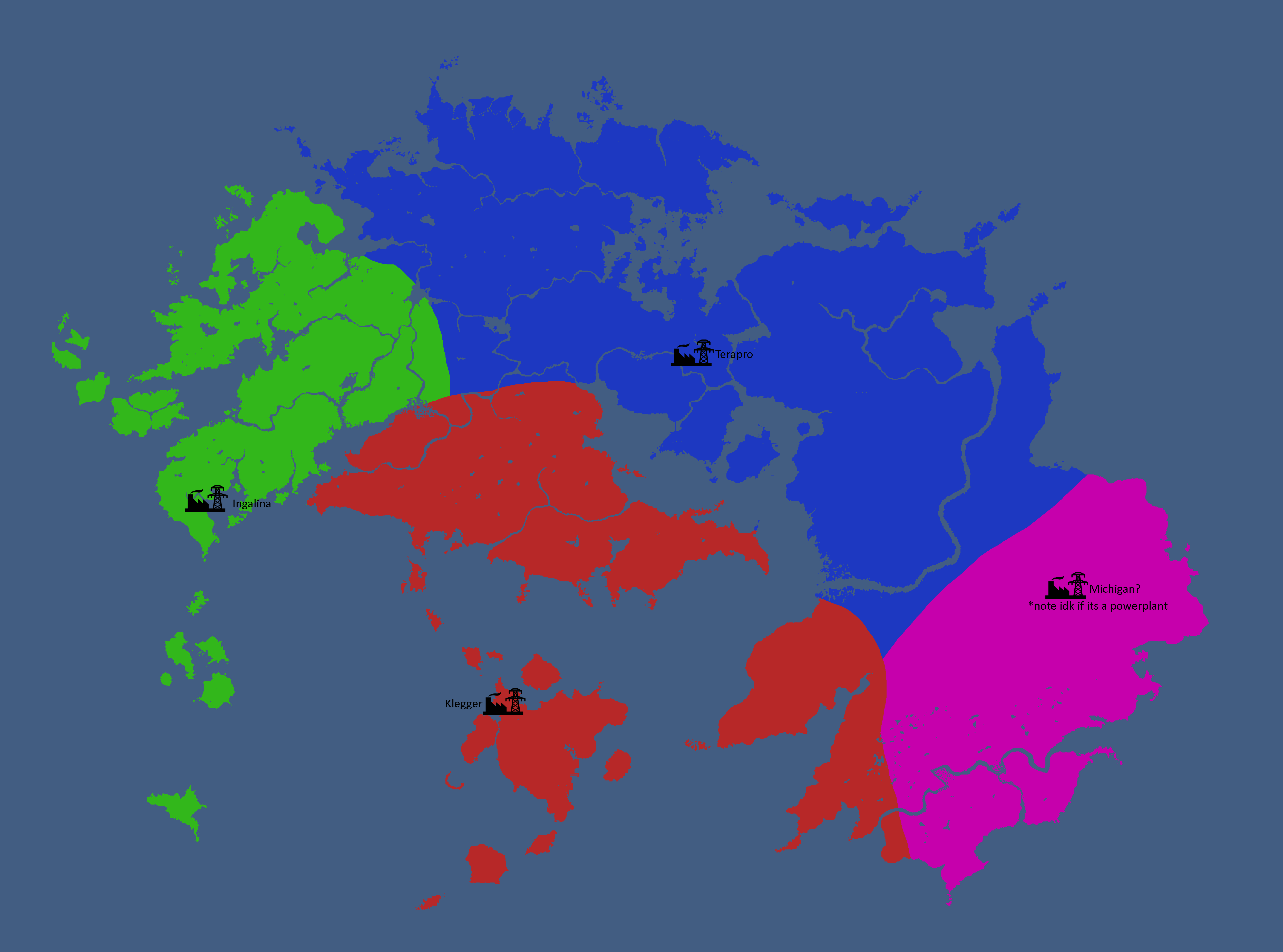
Major Powerplant Service Areas: Year 185
-
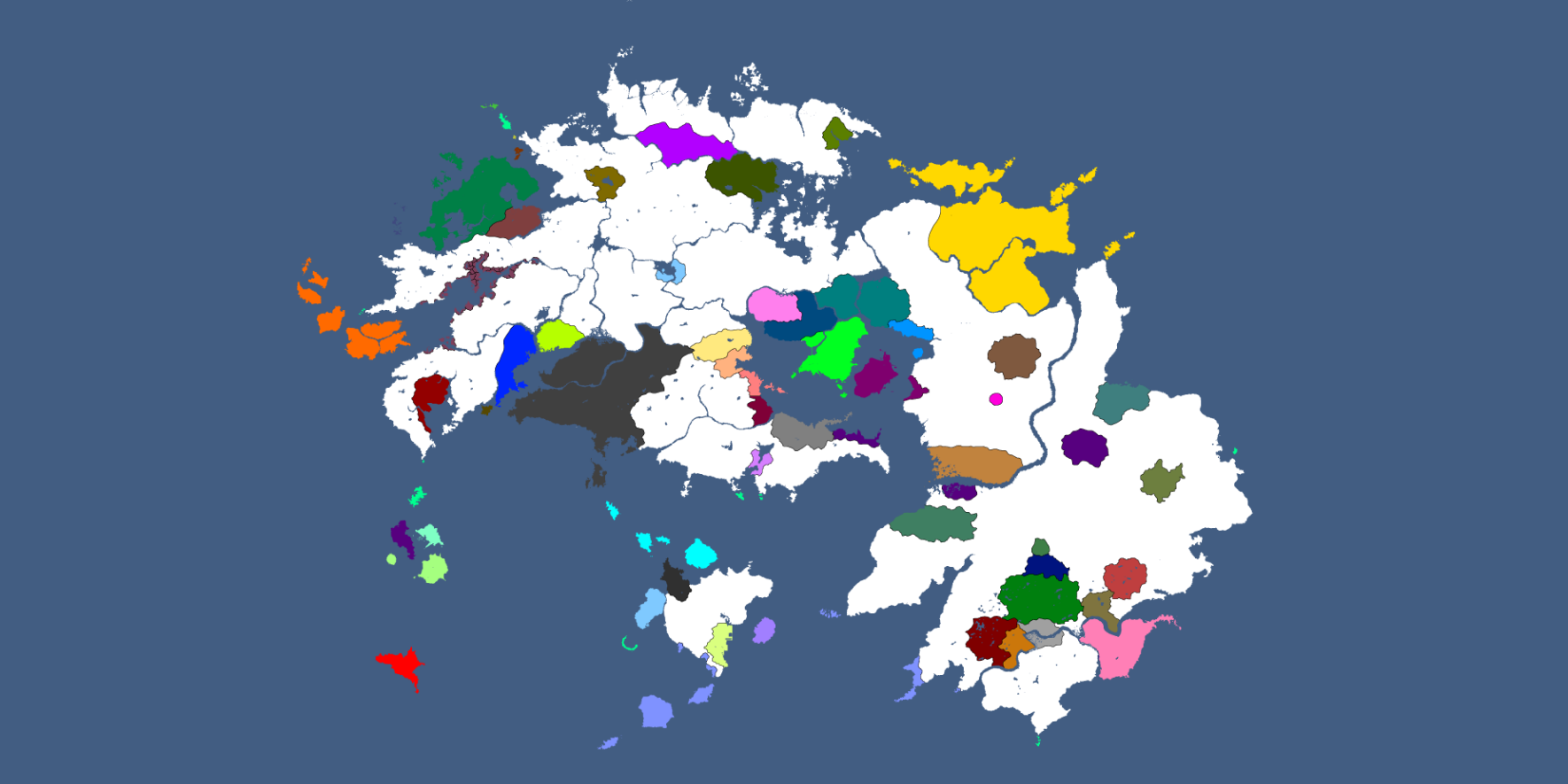
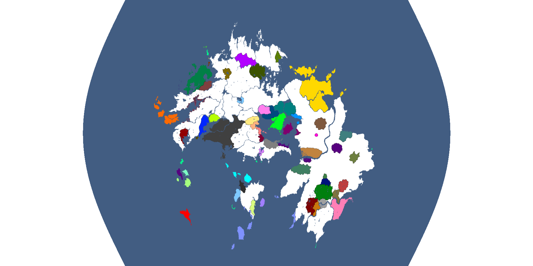
Theia Equirectangular: Year 186
-
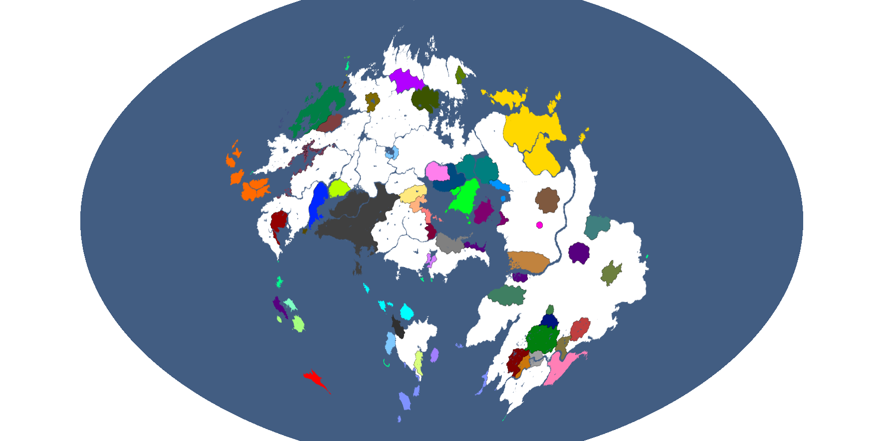
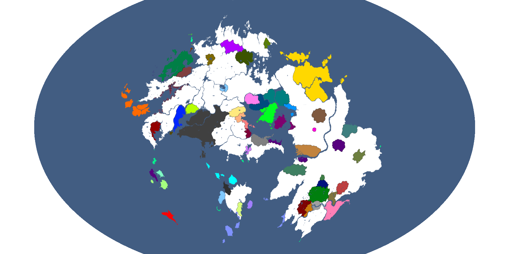
Theia Winkel-Tripel: Year 186
-
Theia Lagrange: Year 186
-
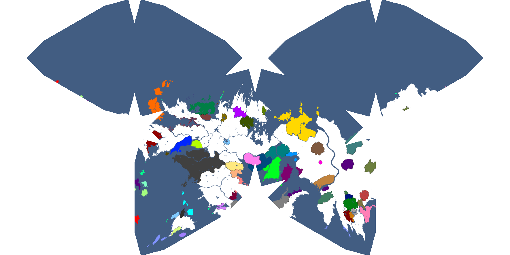
Theia Goode Homolosine: Year 186
-
Theia Ginzburg IV: Year 186
-
Theia Parabolic: Year 186
-
Theia Times: Year 186
-
Theia Kavrayskiy: Year 186
-
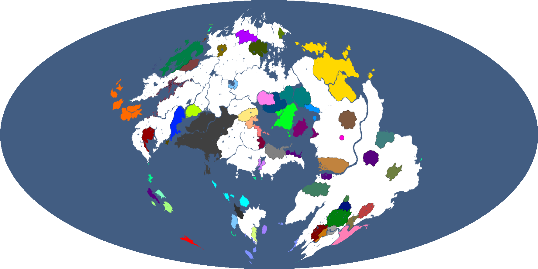
Theia Mollweide: Year 186
-
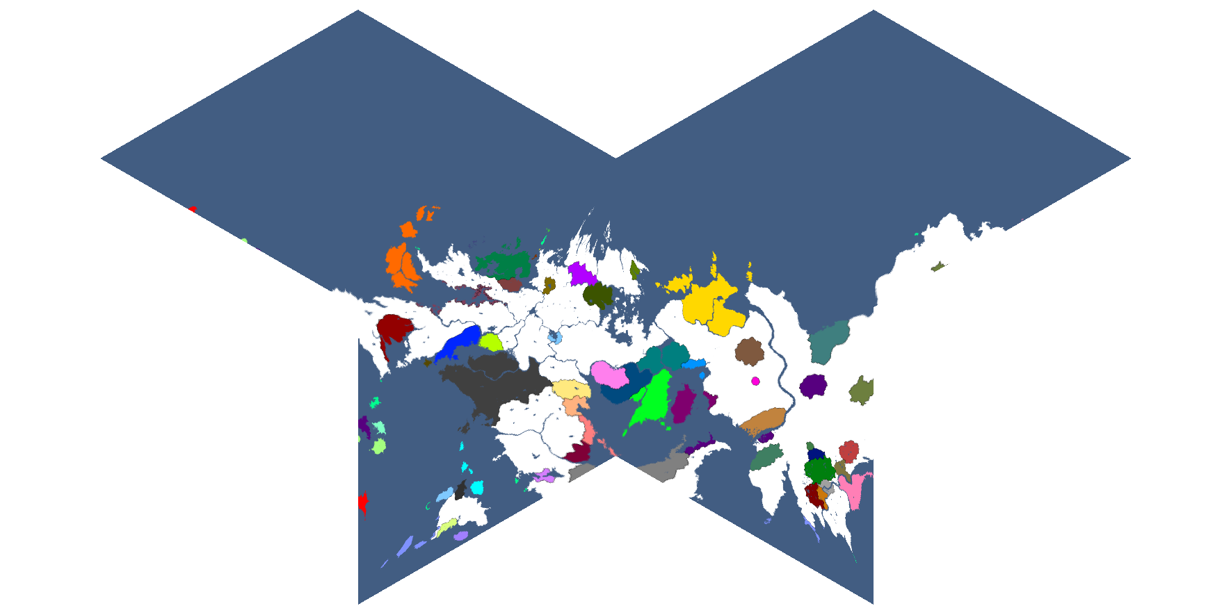
Theia Loximuthal: Year 186
-
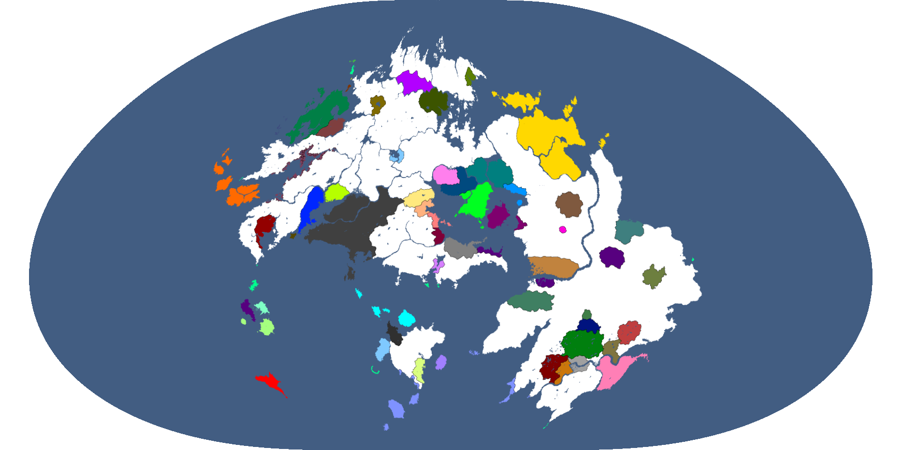
Theia Robinson: Year 186
-
Theia Waterman: Year 186
-
Theia Gnomonic: Year 186
-
"Old Theia": Year 186
-
Map Highlighting Sumera: Year 193
-
Relevant Countries of Theia: Year 229
-
Theian Countries' opinions of Polsk: Year 229
-
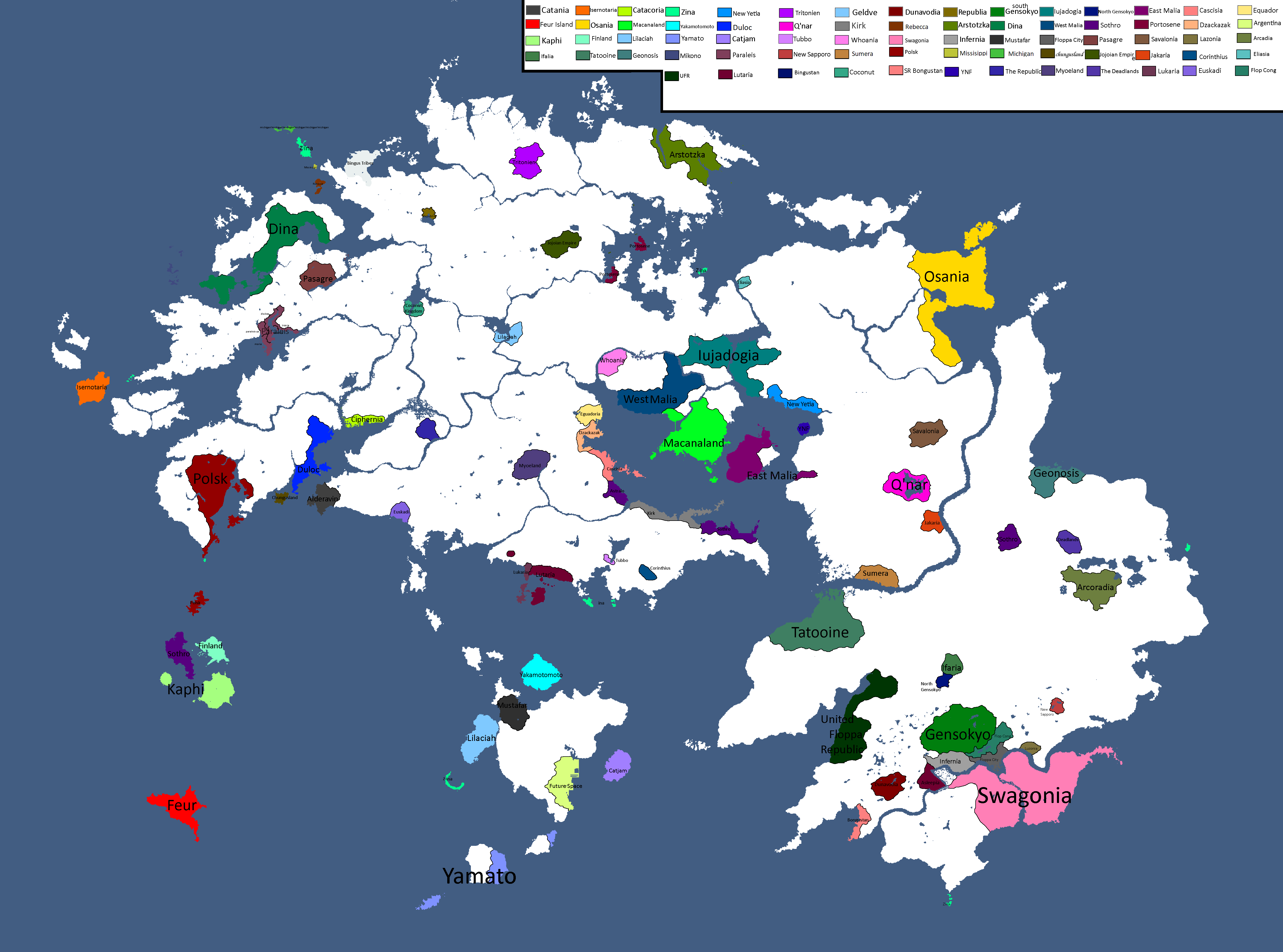
Map with names: Year 229
-
Theian Cold War: Year 231
-
Map of Orientalian Names: Year 232
-
Paper Map of Orientalis: Year 232
-
Map of Disputed Territories in Altilai: Year 233
-
Ideology Map: Year 247
-
Theian Cold War: Year 249
-
Alliance Map: Year 338
-
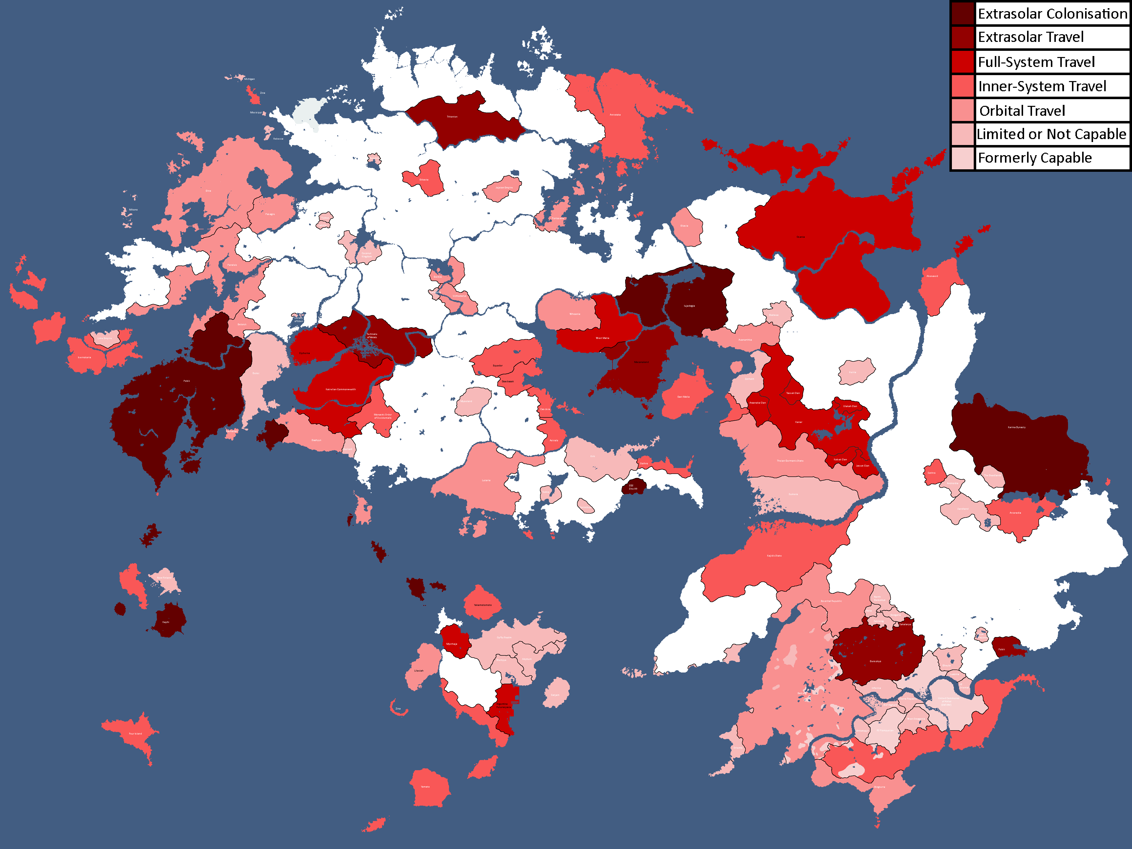
Map of Spacefaring Countries: Year 339
-
![Map of Democracy[24]: Year 343](/yatawiki/images/f/f0/Democracymap2.png)
Map of Democracy[24]: Year 343
-
Inspirations of Theian Countries: Year 343
-
Map of Ideologies: Year 354
-
Other nations opinions of the CIS/Polsk: Year 367
-
![Map of World Power Statuses[25]: Year 371](/yatawiki/images/9/92/Powersmap2.png)
Map of World Power Statuses[25]: Year 371
-
Map of Ideologies: Year 375
-
Map of Political Leanings: Year 408
-
Map of Political Leanings: Year 414
-
Map of Theia (Mercator Projection): Year 498
-
Map of the Kairen Ocean: Year 498 CE
-
Map of Theia's Species Distribution: Year 517
-
Map of Theia's Macroregions: Year 520
-
Map of the Nislandian Range Superorganism's size: Year 531
-
Map of Official Languages: Year 538
-
Map of Great Mountains: Year 541


![Map of Democracy[24]: Year 343](/yatawiki/index.php/File:Democracymap2.png)


![Map of World Power Statuses[25]: Year 371](/yatawiki/index.php/File:Powersmap2.png)


Skantoan Maps
-
Ideology Map: Year 247
-
Map of Cities: Year 254
-

Map of Skantoan cultural groups: Year 536
-
Great Mountains of Skantos: Year 548
-

Map of the Sacred Union of Skantos: Present


Other Planet Maps
-

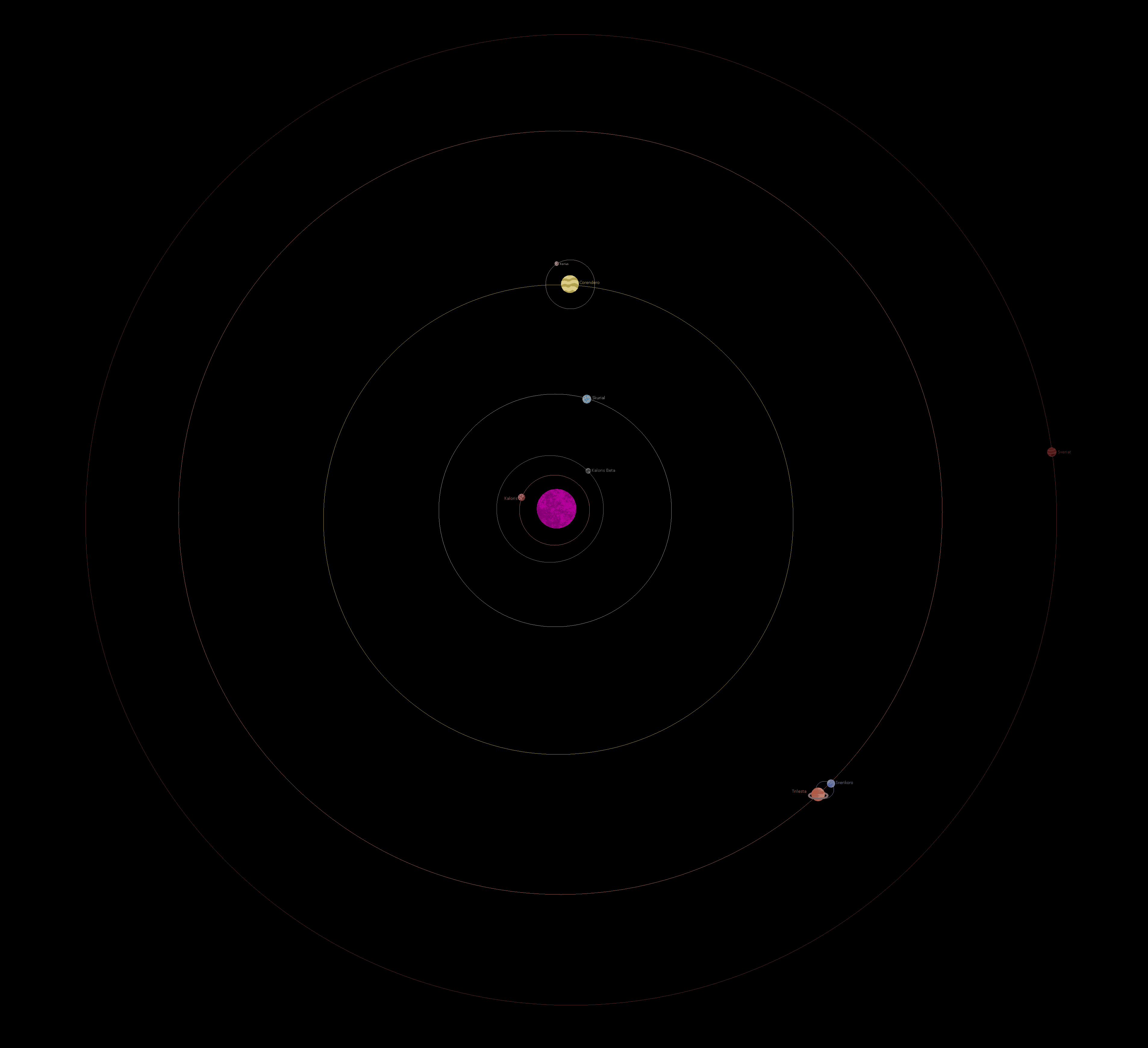
Map of the Alpha Sol System: Year 163 (OUTDATED, RETCONNED CONENT)
-
Map of the Beta Sol System: Year 165
-
Map of Kanashi: Year 296
-
Map of Narakam's Surface: Year 306 (Retconned)
-

Map of Skurial: Year 317
-
Map of Skurial: Year 317 (Simplified)
-
Map of Narakam's Surface: Year 318
-
Map of Proxima Centauri B: Year 320
-
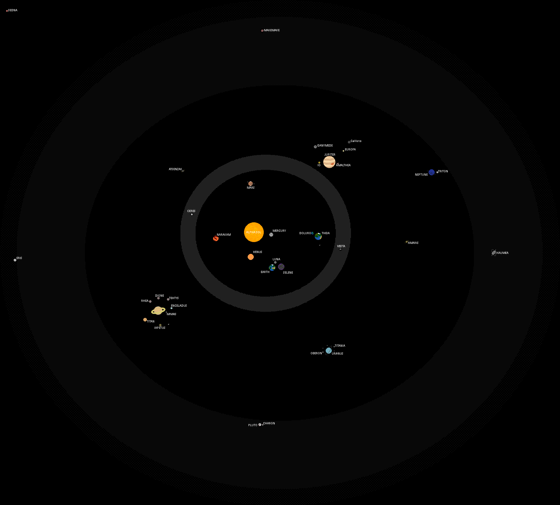
Map of the Alpha Sol System: Year 320
-
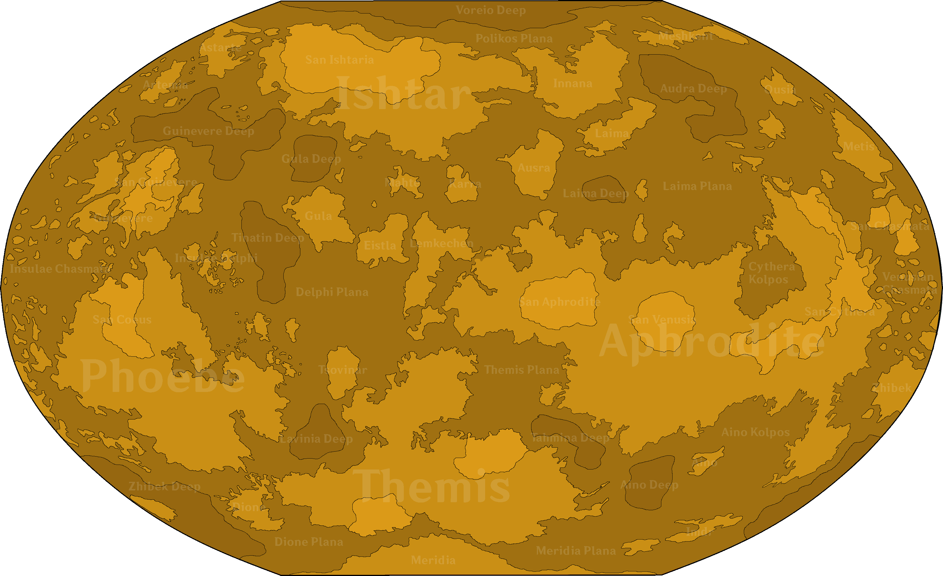
Map of Venus: Year 430


Extrasolar Maps
-
First Draft of the Milky Way Map (Retconned)
-
Blank Map of the Milky Way
-

Expanded Blank Map of the Milky Way
-
Quadrants of the Milky Way
-
Grid Coordinates of the Milky Way
-
Grid Coordinates (Blank)
-
Map of Major Civilisations upon the beginning of the First Qu Invasion: Year 469,430 BGS
-
![Former Nations of modern King Space[26]: Year 199](/yatawiki/images/c/c5/Kingspace199bgs.png)
Former Nations of modern King Space[26]: Year 199
-
Original Milky Way Map: Year 264
-
Battle between Echqatja and the Twelve Suns: Year 311
-
Map of FTL Routes: Year 327
-
![Map of Democracy[27]: Year 343](/yatawiki/images/5/5b/Democracymap4.png)
Map of Democracy[27]: Year 343
-
Map with only systems: Year 356
-
Map of areas Humanity has explored: Year 366
-
Map with only systems: Year 368
-
Grid Coordinates: Year 368
-
Map with only systems: Year 384
-

Grid Coordinates: Year 384
-
Map of areas Humanity has explored: Year 439
-
Map with only systems: Year 444
-
Astrography Map: Year 471
-
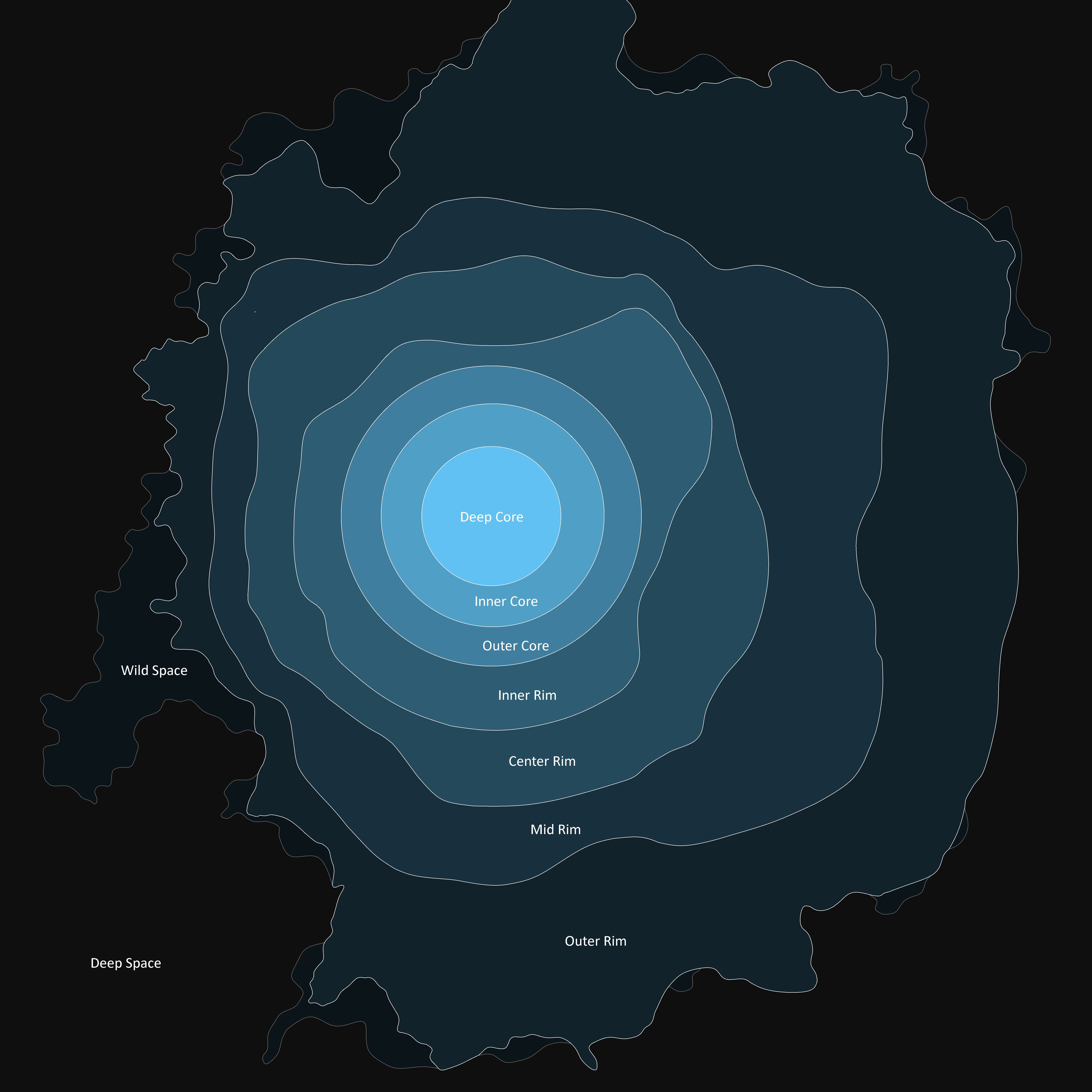
Map of the Galactic Community: Year 502
-
Map with only systems: Year 508
-
Distribution of Humans: Year 518
-

Outline of the Galactic Community: Year 520
-

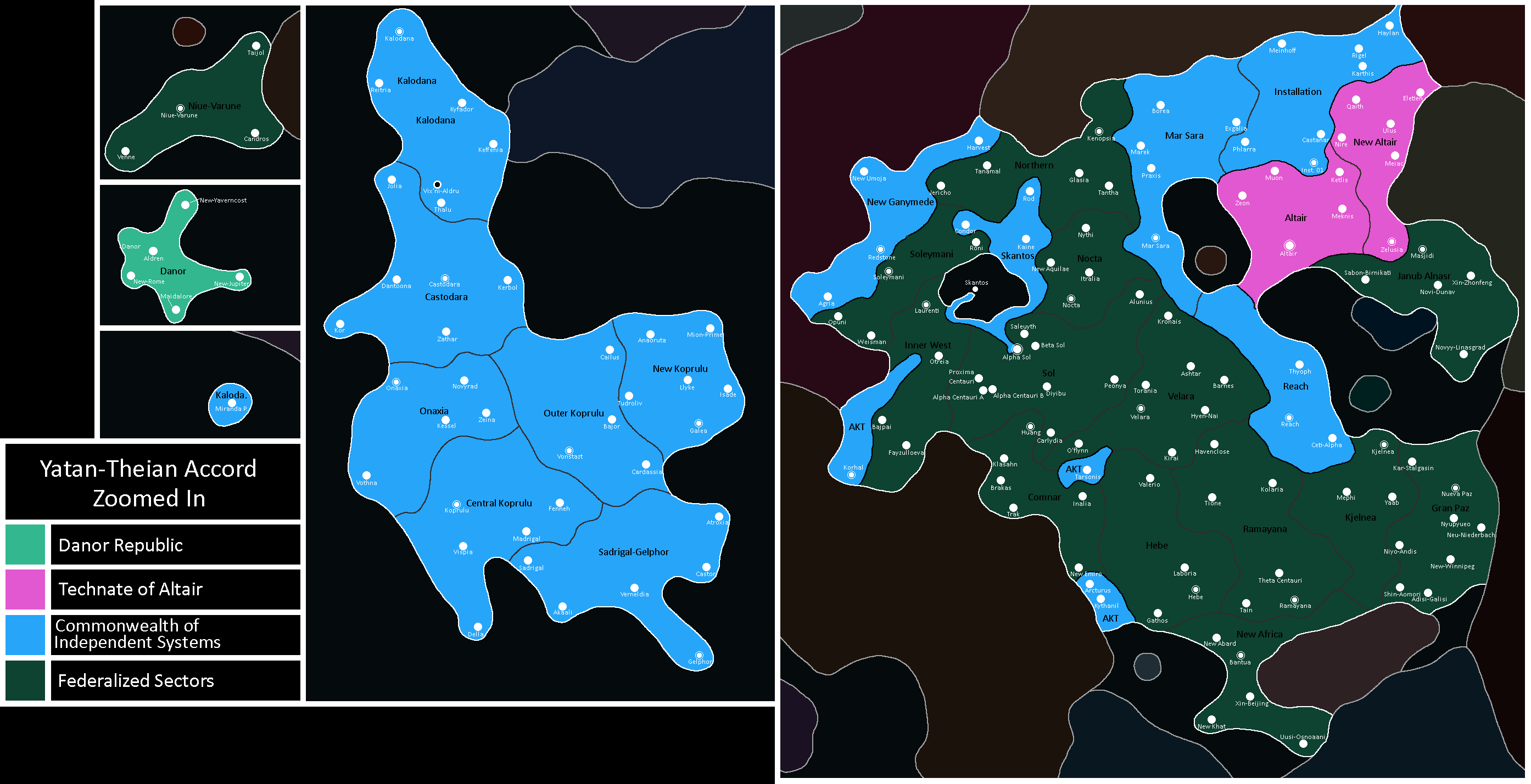
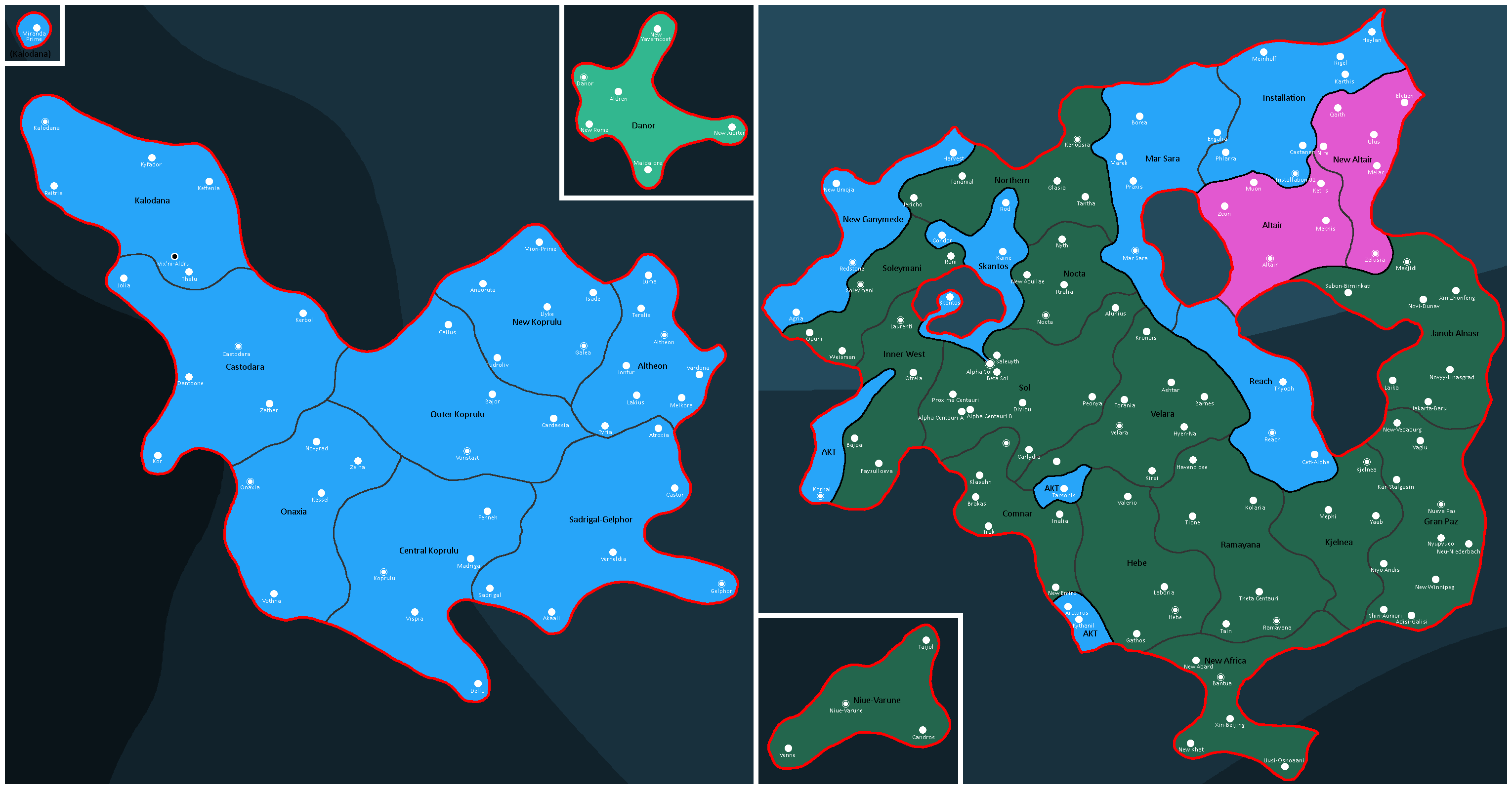
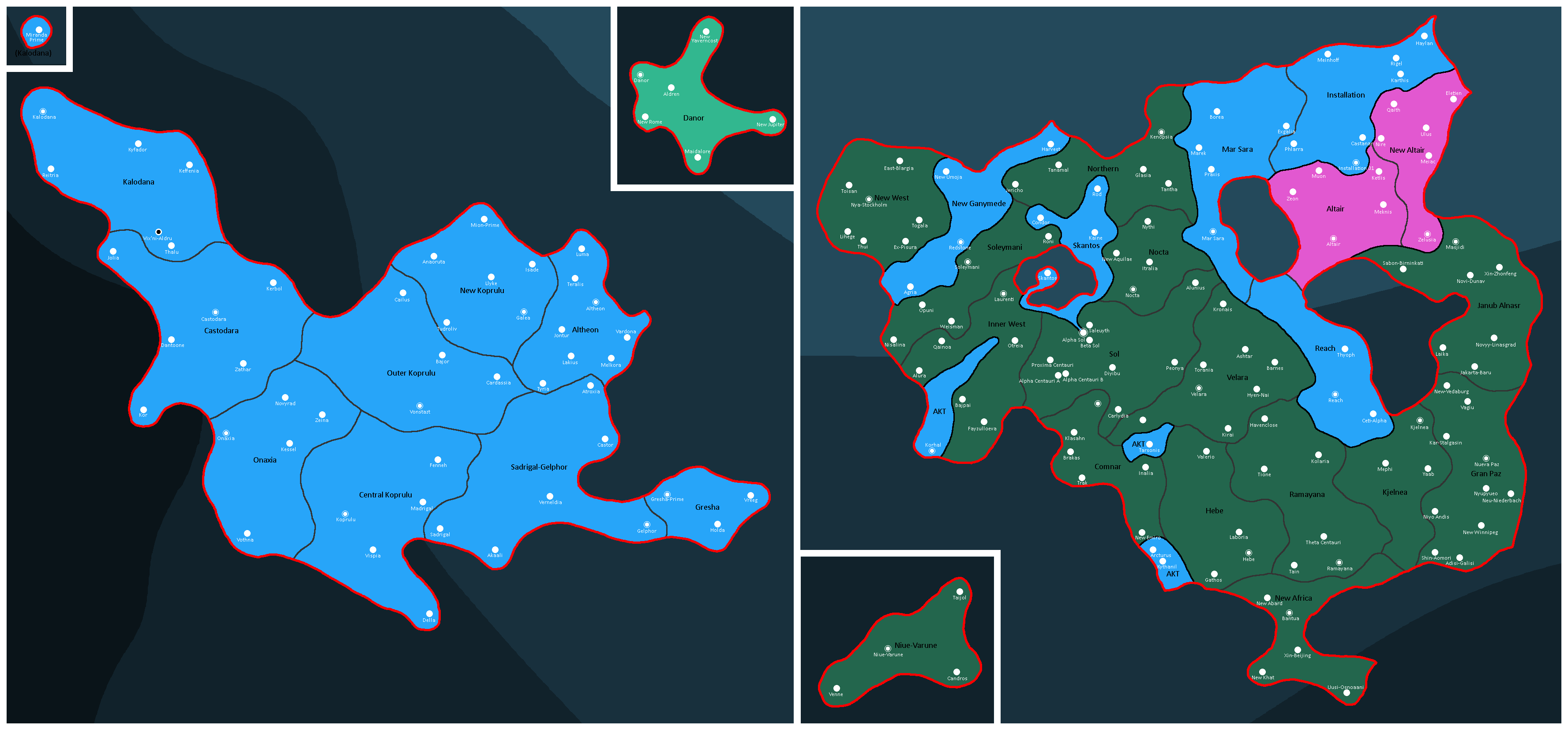
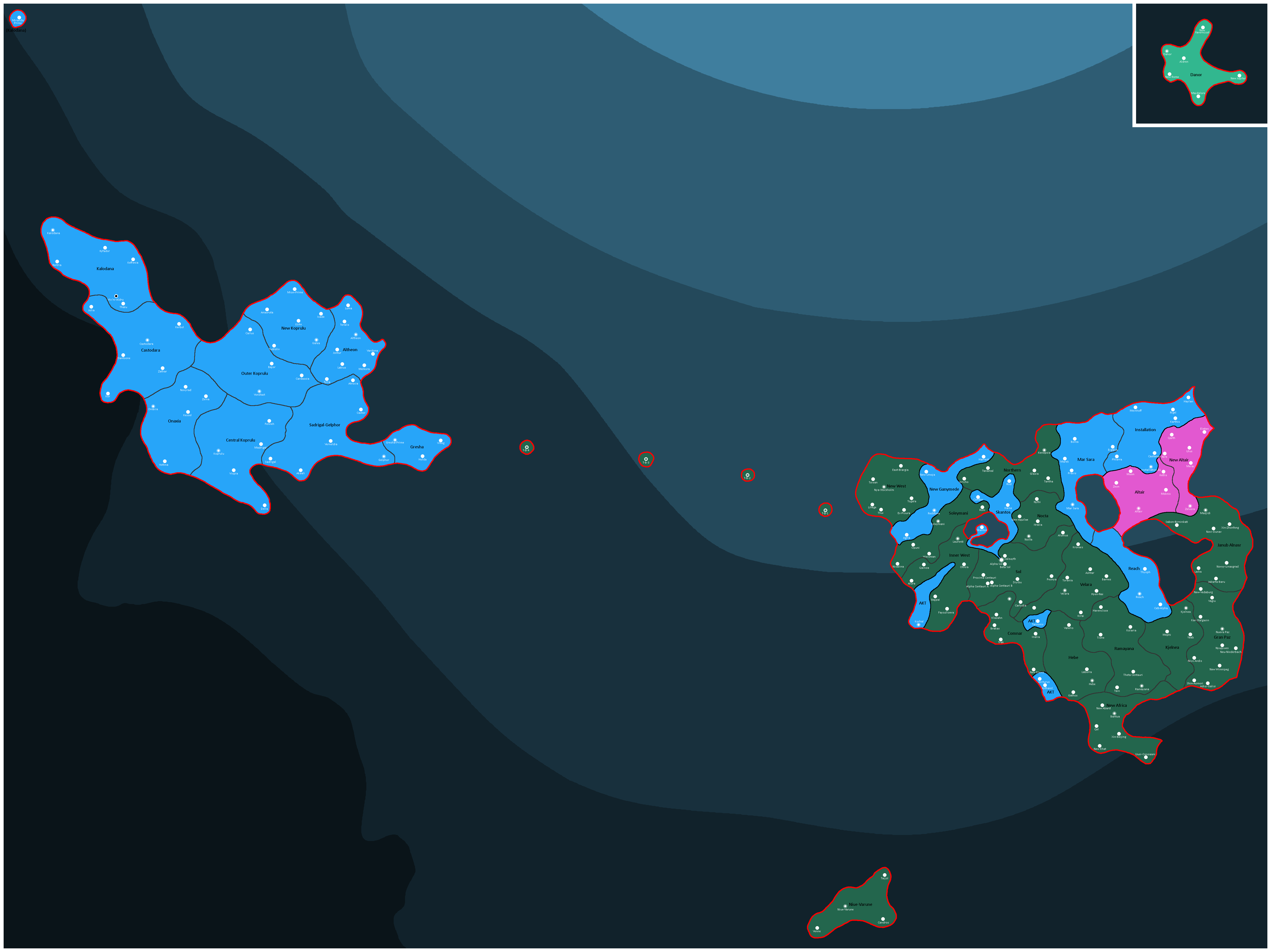
Map of the Yatan-Theian Accord: Year 523
-
Map of areas Humanity has explored: Year 526
-
Map of the extent of the Post-Sollurians: Year 529


![Former Nations of modern King Space[26]: Year 199](/yatawiki/index.php/File:Kingspace199bgs.png)


![Map of Democracy[27]: Year 343](/yatawiki/index.php/File:Democracymap4.png)


Non-Dated Maps
-
Map of FTL Lanes
-

Map of the Galactic Halo


Extradimensional Maps
-

Map of the Dimension seen in The Hunger Games: Year 155

Extragalactic Maps
-
Map of Galaxy Directions: Year 512
-

Scale map of the Milky Way and Andromeda, including distance and halos.
-
Size comparison of the Milky Way and Corundum Galaxies.


National Maps
Abardean Maps
-
Provinces of Abard: Year 306

Adytian Maps
-
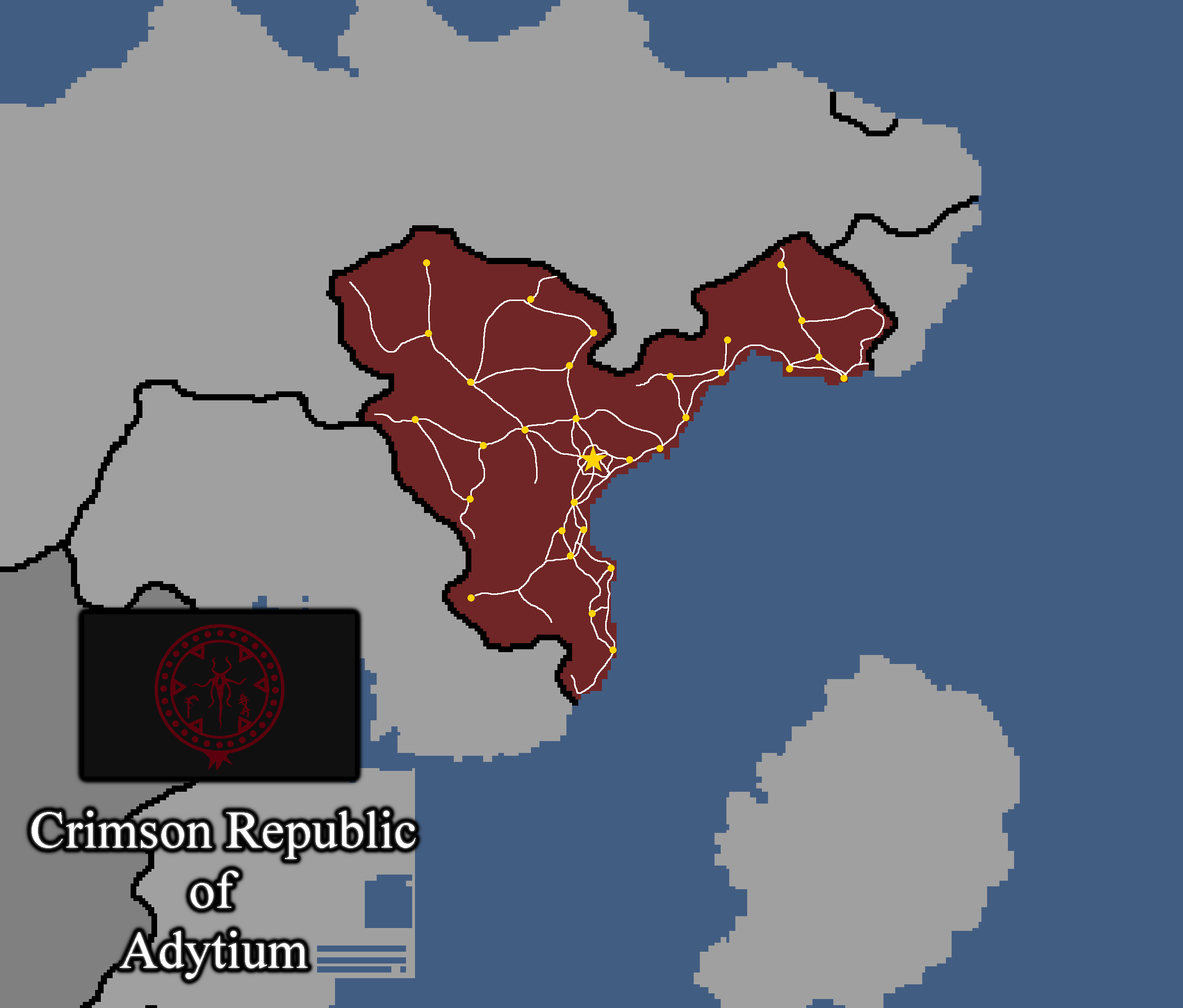
Map of Adytium: Year 324

Alsavaeidan Maps
-
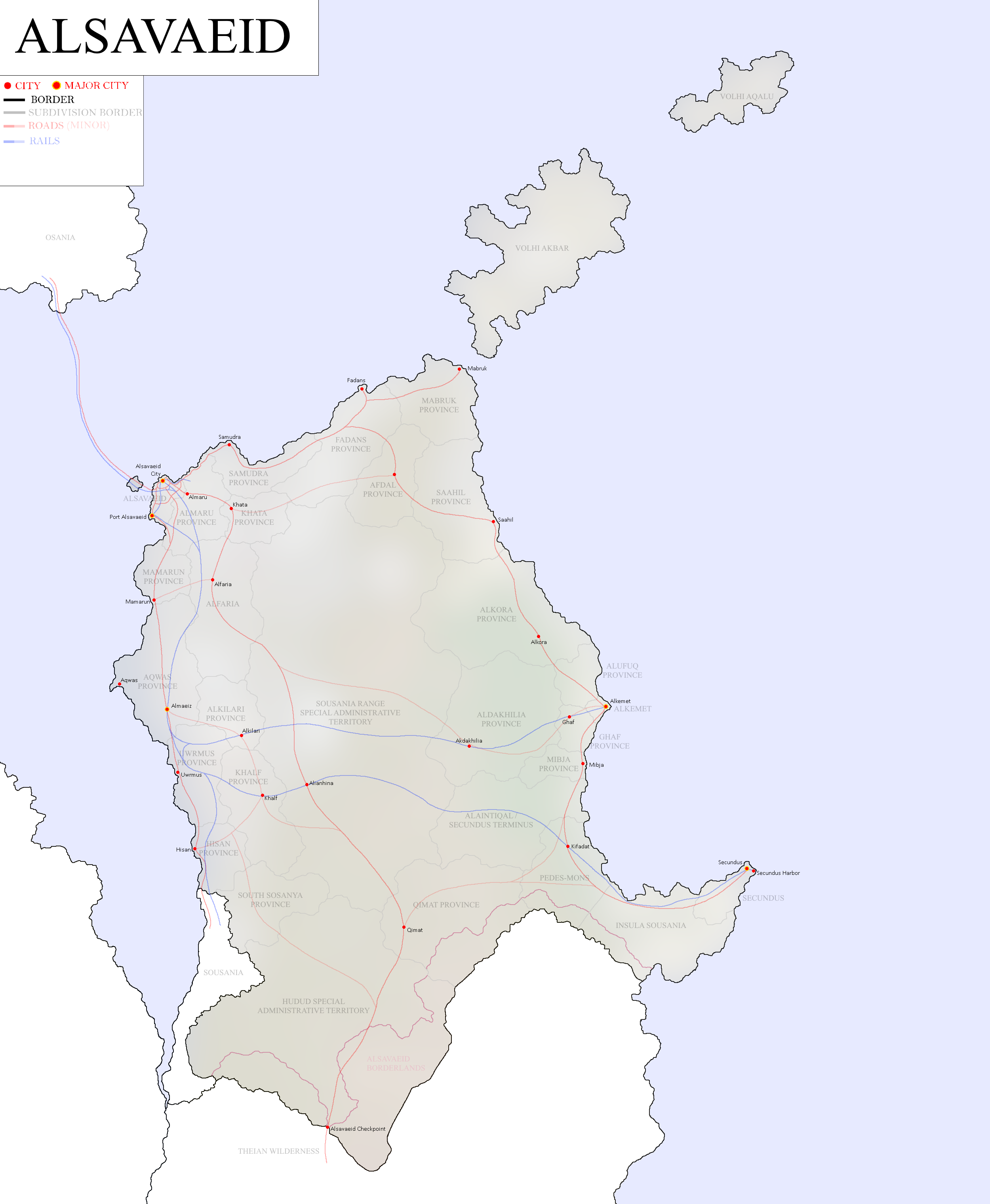
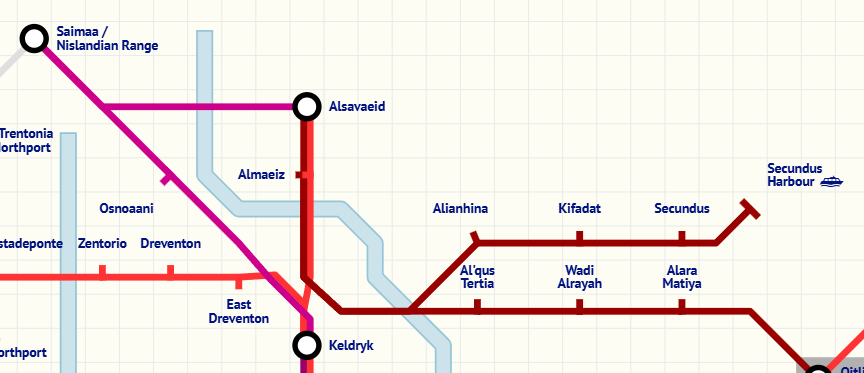
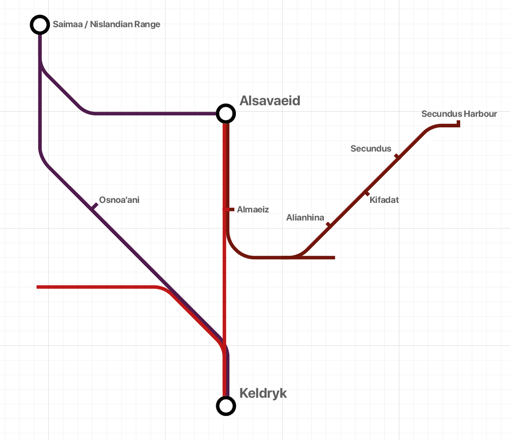
Map of Alsavaeid: Year 404

Anakistani Maps
-
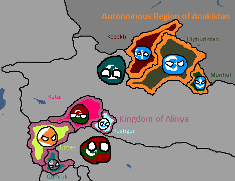
Anakistani Provinces & Regions: Year 112

Catanian Maps
-
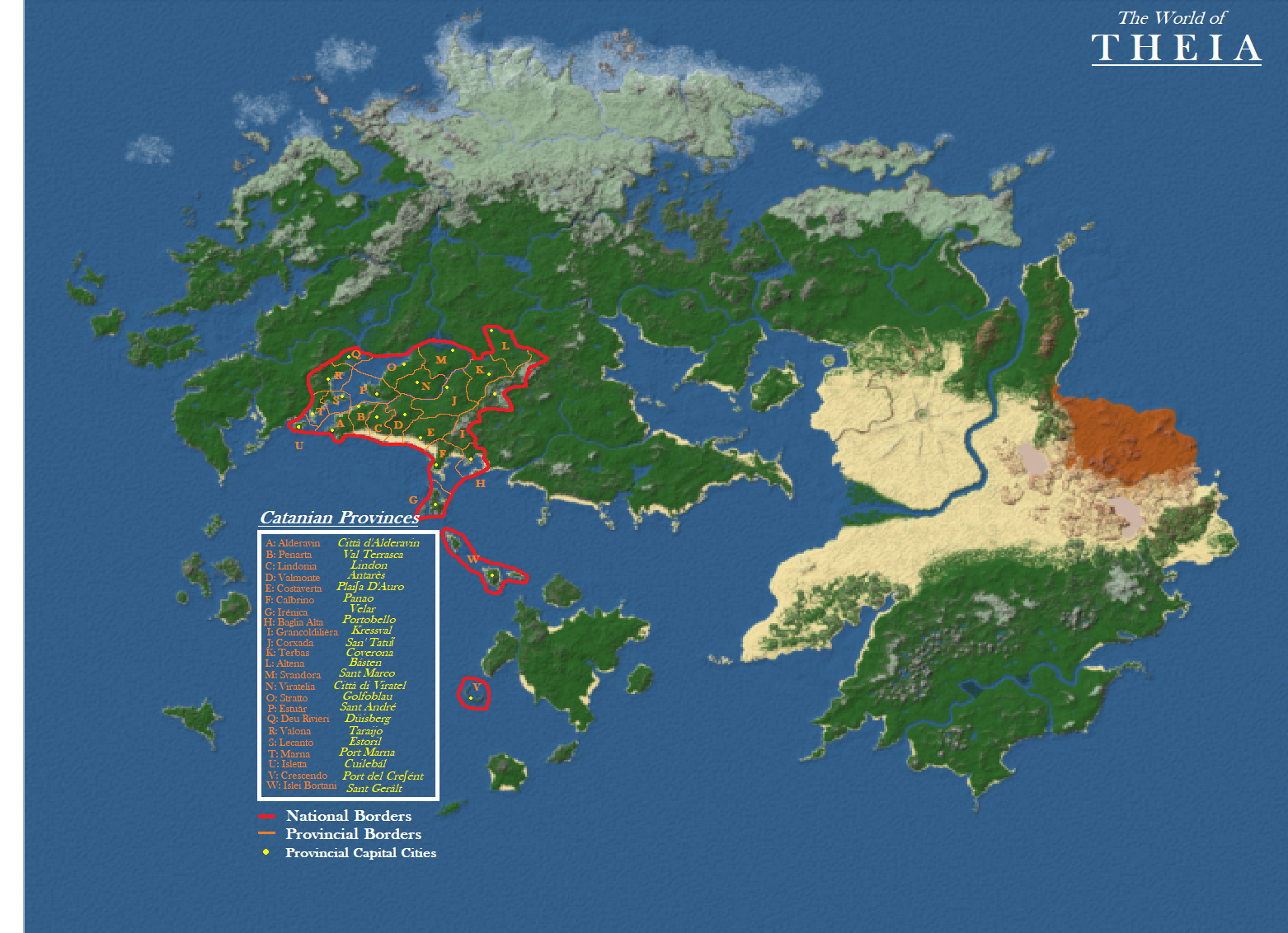
Proposed Catanian Claims on Theia: Year 116
-
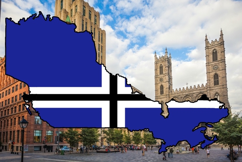
Catania Flag Map: Year 215
-
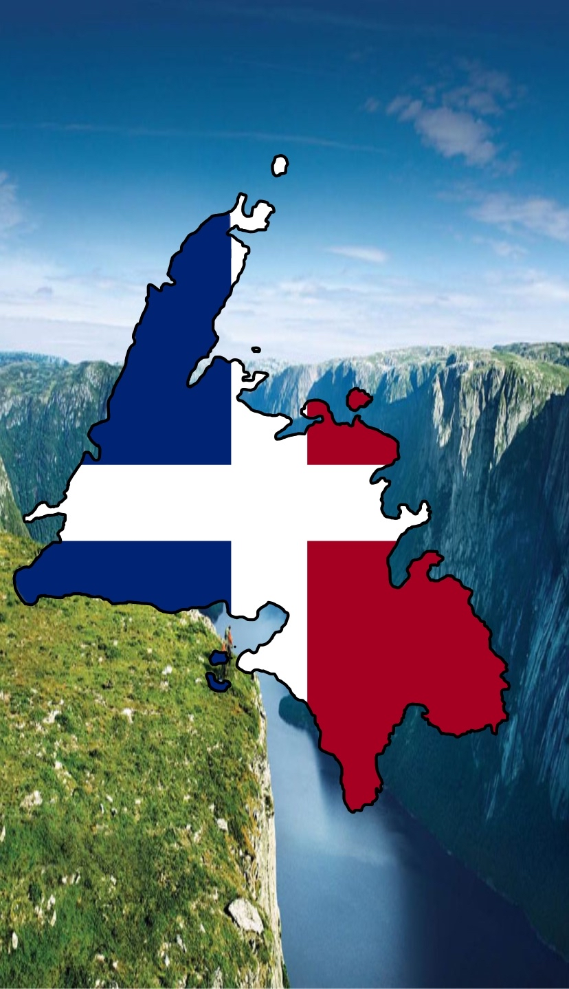
Map of the Newfoundland National Restoration Council, de facto Catanian land: Year 229


Caucasian Maps
-
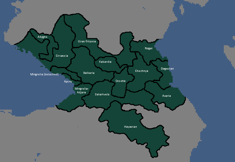
Republics of the Caucasian League

Confederate[28] Flags
-
Map of the Tritonian Confederacy: Year 216
-
Map of the Tritonian Confederacy: Year 230
-
Map of the Tritonian Confederacy: Year 259
-
Map of the Tritonian Confederacy: Year 260
-
Map of the Tritonian Confederacy: Year 314
-

Map of The Confederacy: Year 396


Cotunauinian-Luvurian Maps
-
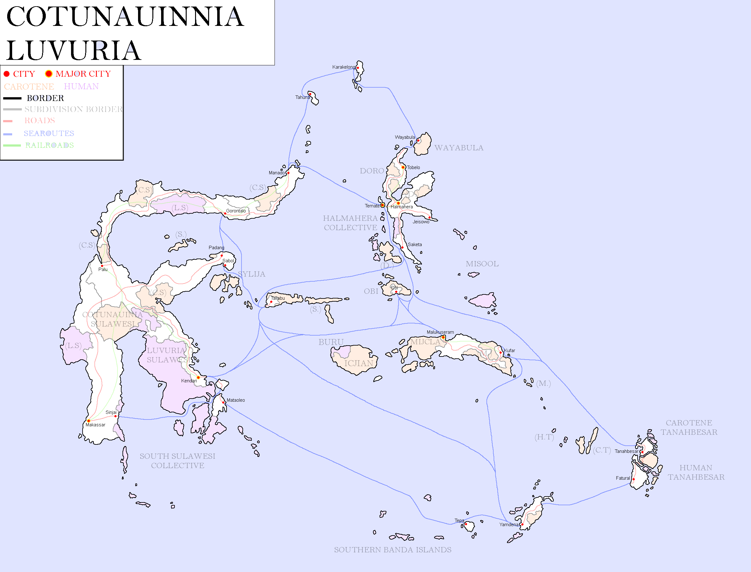
Map of Cotunauinia-Luvuria: Year 377

Denasolan/Asophanian Maps
-
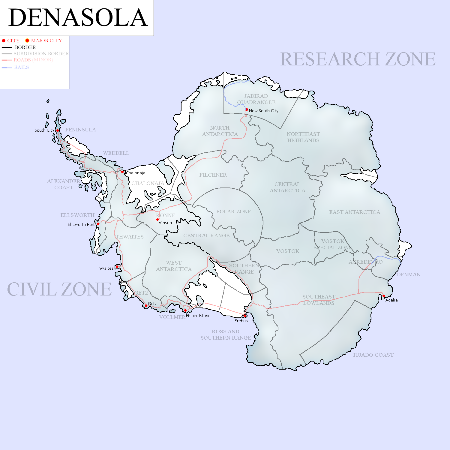
Map of Denasola: Year 405
-
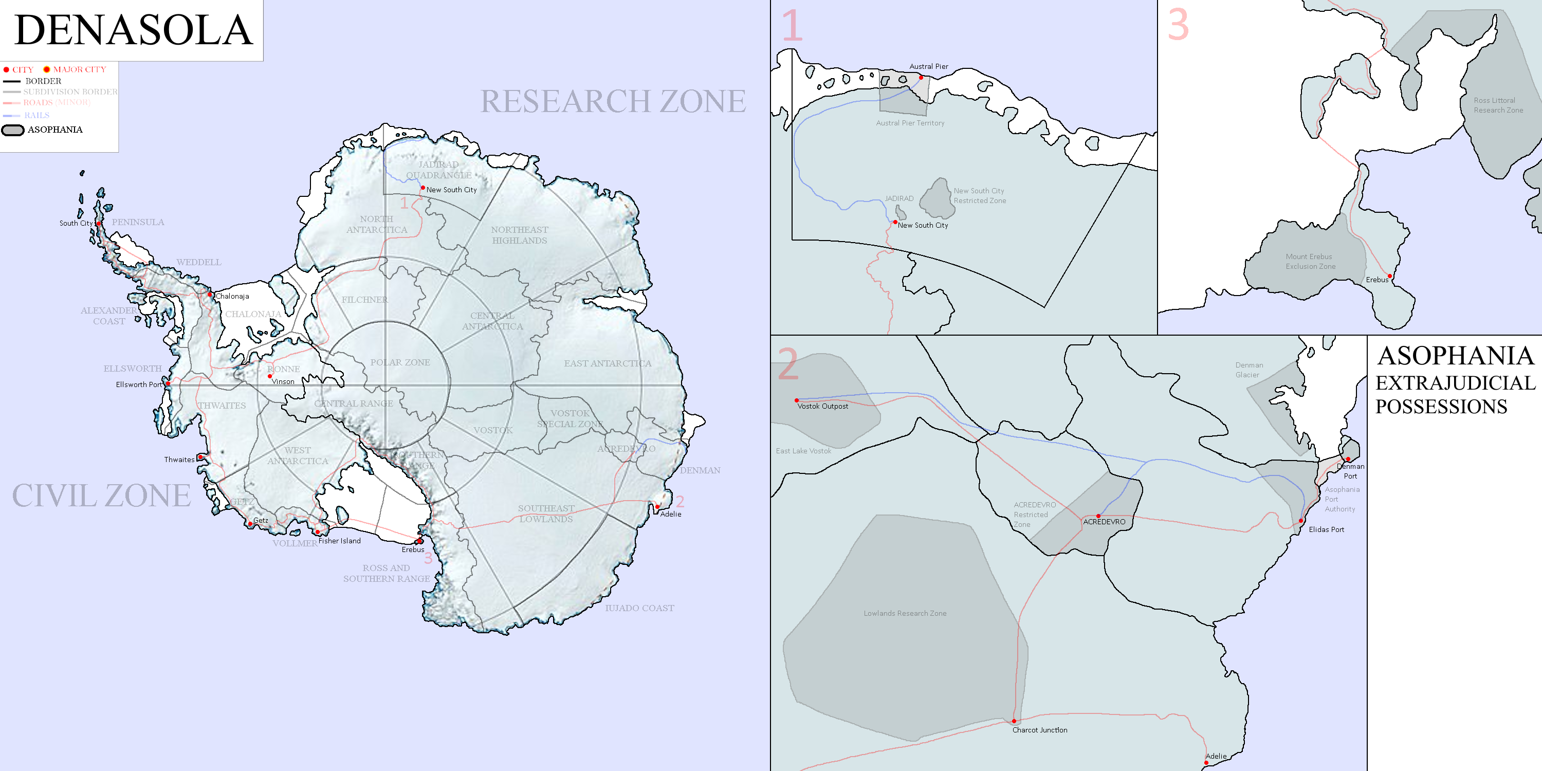
Map of Denasola and Asophania: Year 406


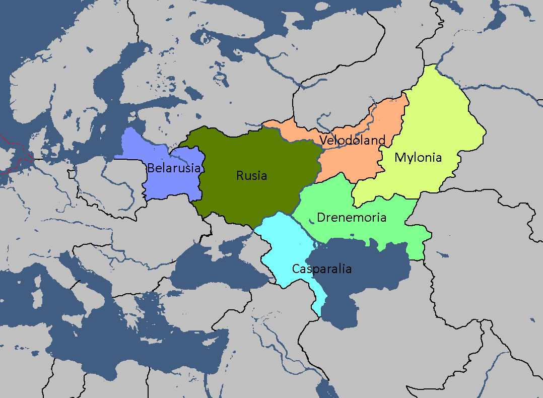
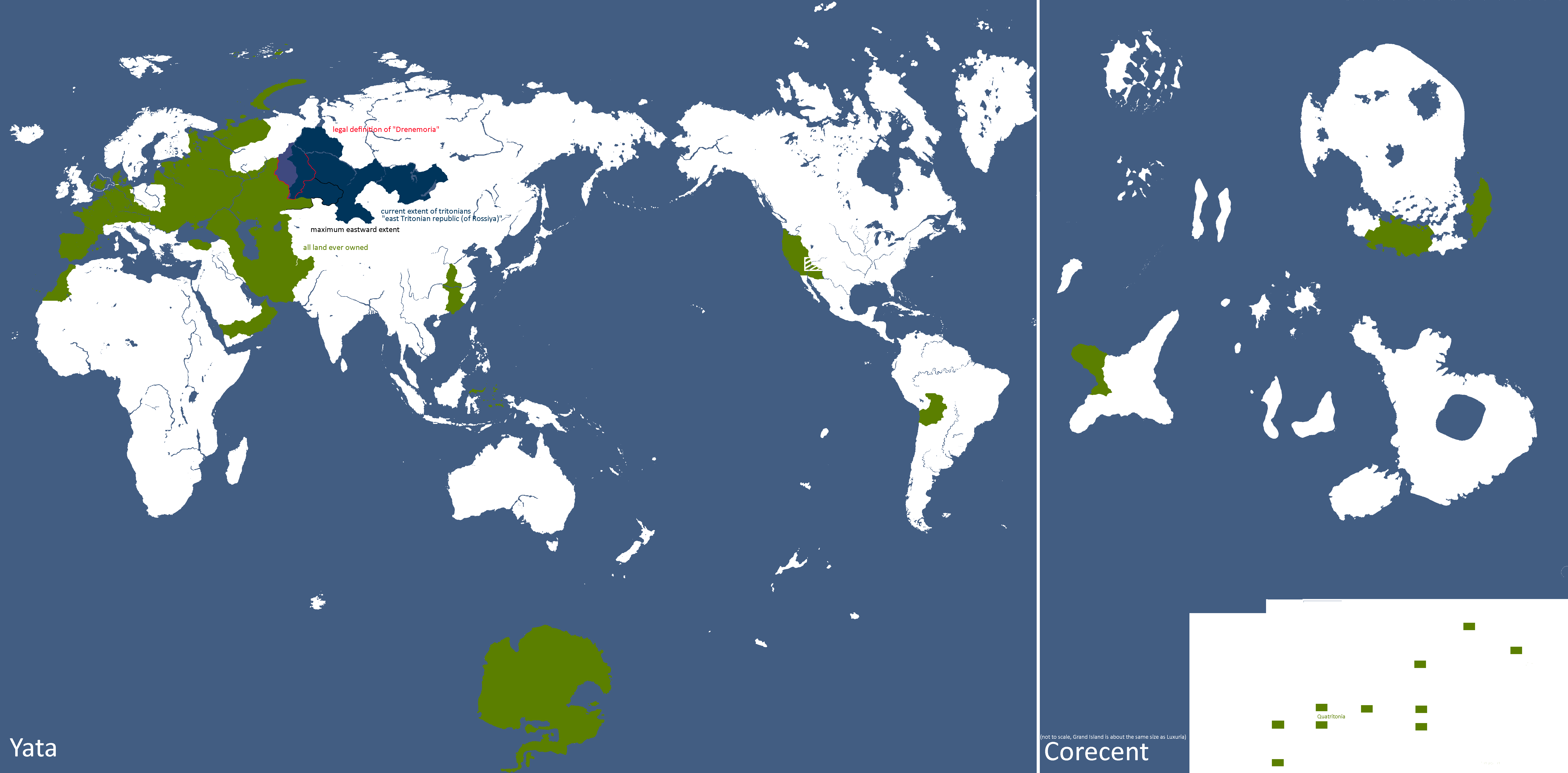
Drenemorian Maps
-
Drenemoria Territorial History: Year 185

East Tritonia Maps
-
Map of Linelandic Occupation in East Tritonia: Year 204

English Maps
-
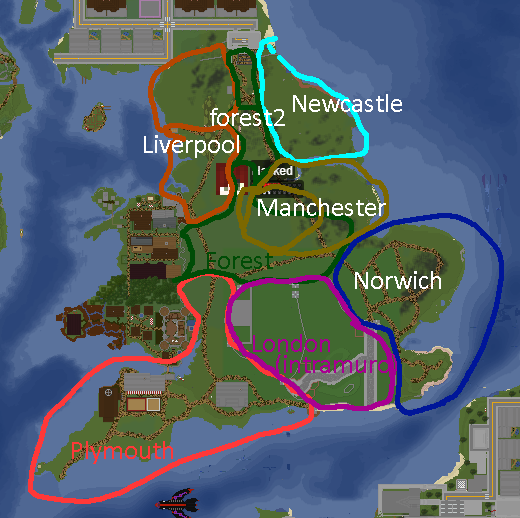
English City Plan: Year 105
-

York: Year 160


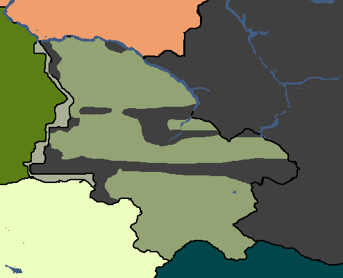
Goldarian Maps
-
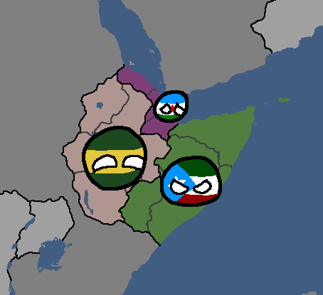
Goldarian Federal States: Year 102 (Countryballs)
-
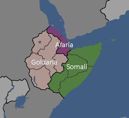
Goldarian Federal States: Year 102


Hayahian Maps
-
Languages of Hayah: Year 191
-
Flag Map of Alhayat: Year 345


Hayastani Maps
-
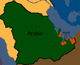
Languages of Hayas: Year 112

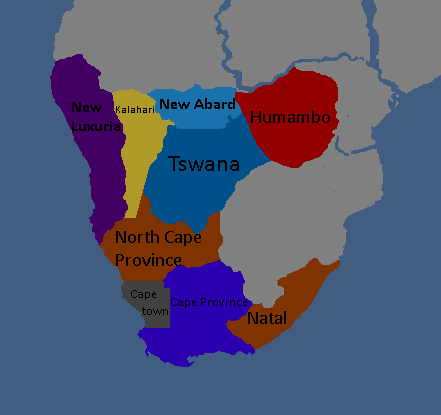
Humamboan Maps
-

Homeland & Colonies of Humambo: Year 115

Isernotarian Maps
-
Isernotarian Constituent Nations: Year 116 (Countryballs)
-
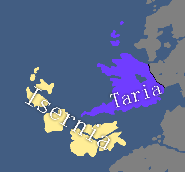
Isernotarian Constituent Nations: Year 116


Islandian Maps
-
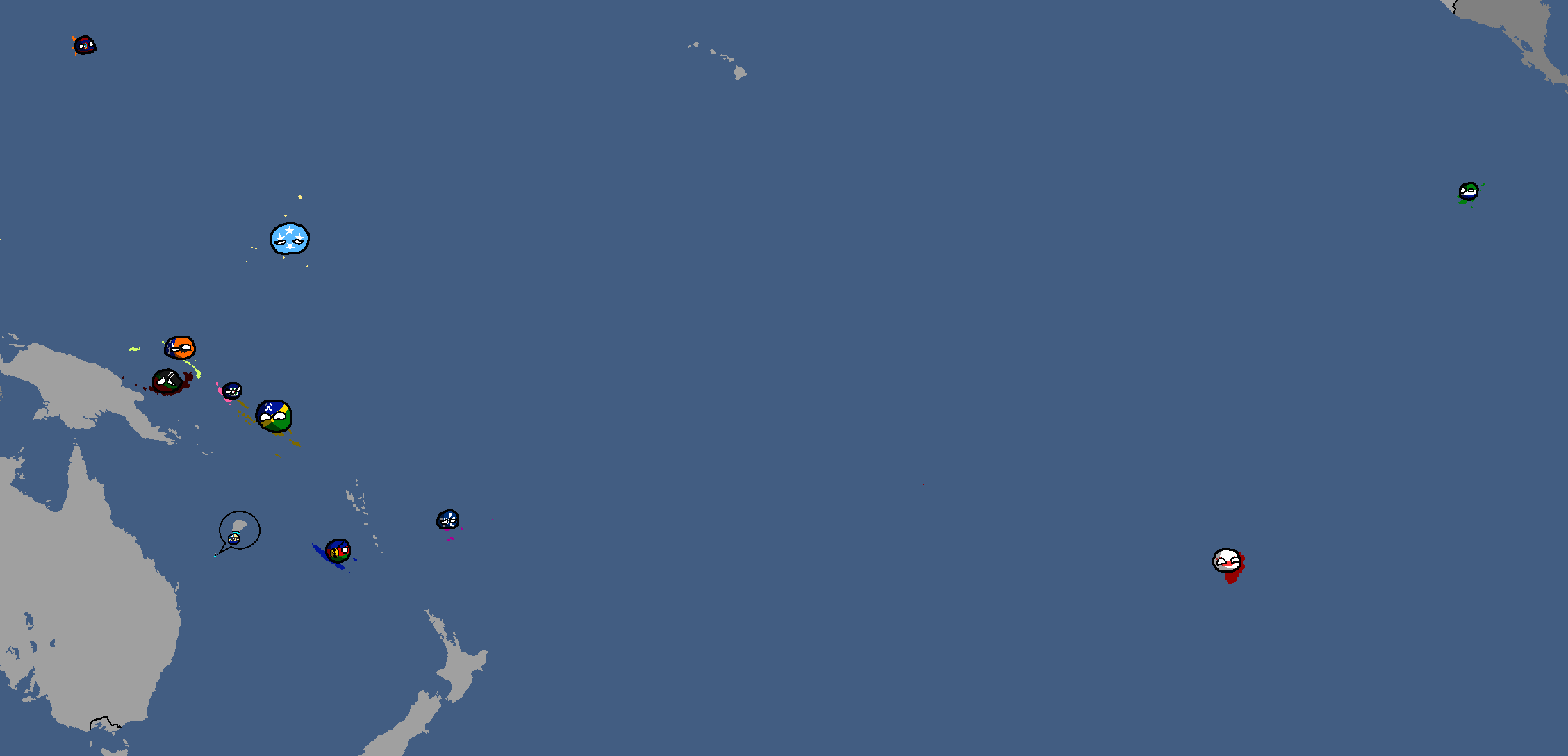
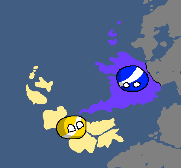
Islandian kingdoms and principalities: Year 95 (Countryballs)
-
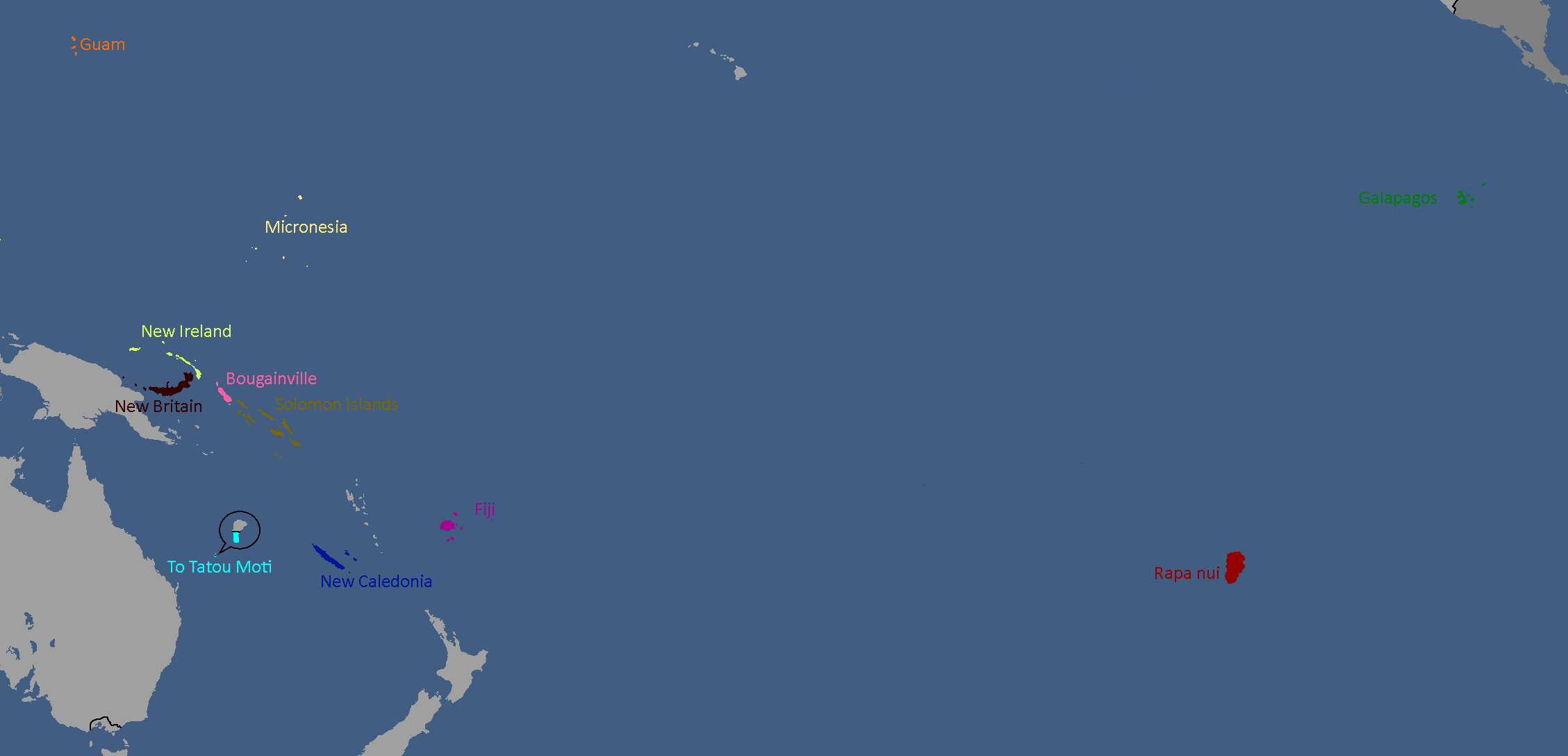
Islandian kingdoms and principalities: Year 95


Iujadogian Maps
-
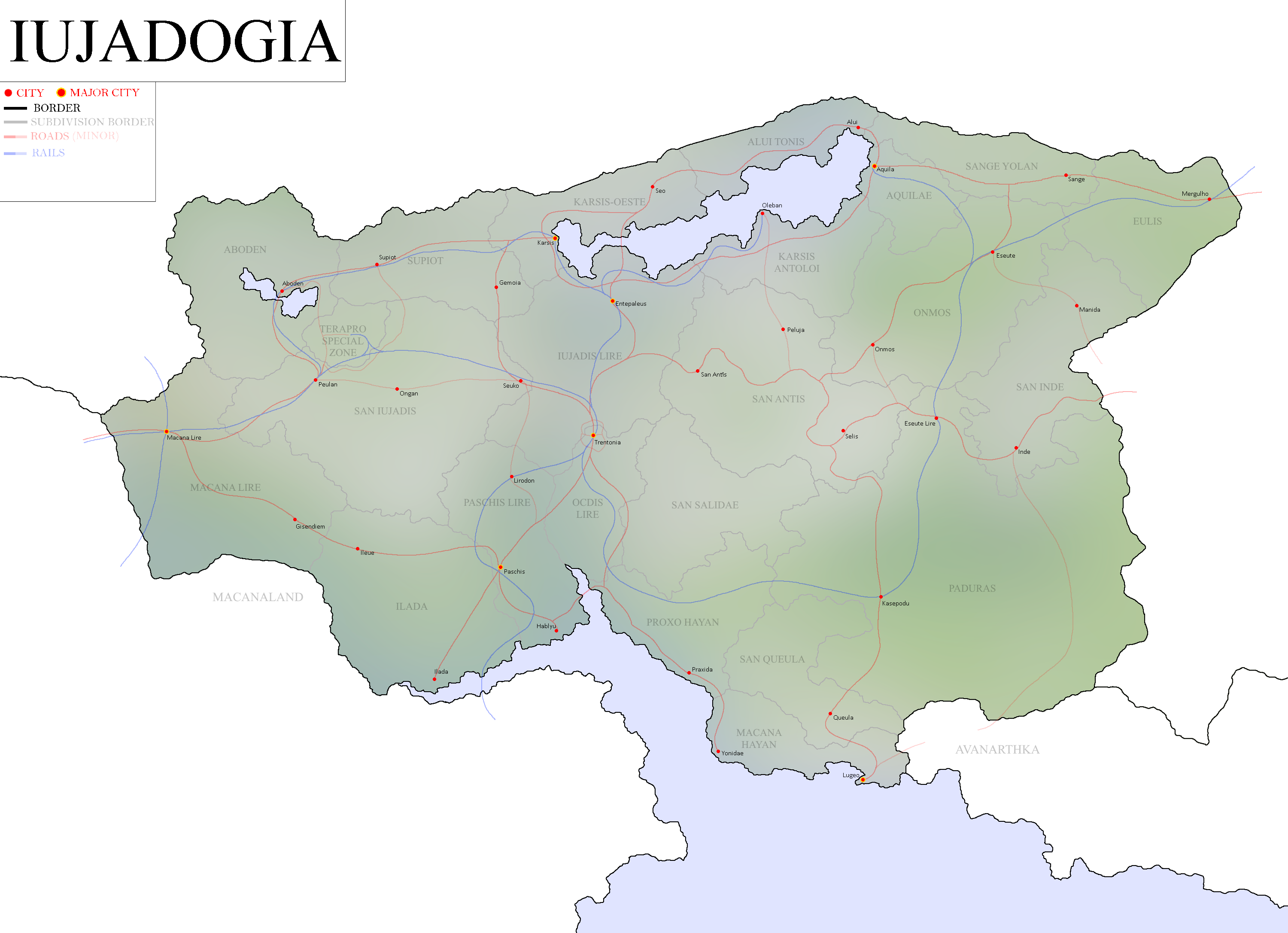
Map of Iujadogia: Year 405

Kanaran Maps
-
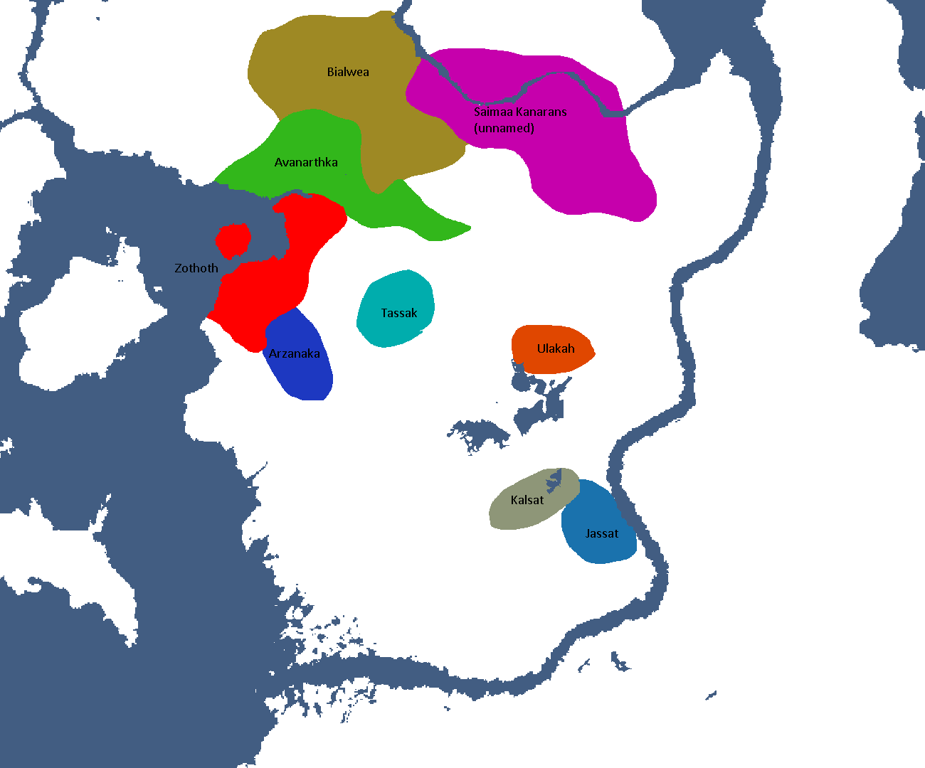
(Sloppy) Map of Kanaran Sub-Cultures

Linelandic Maps
-
Linelandic Federal Subjects: Year 101
-
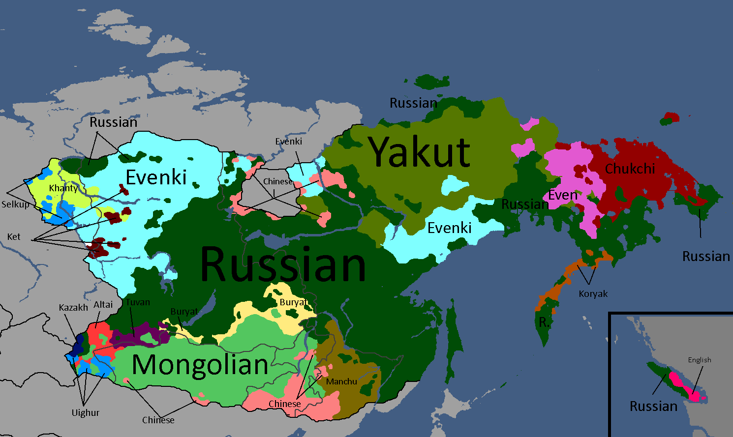
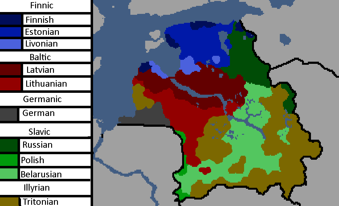
Linelandic Languages: Year 112
-
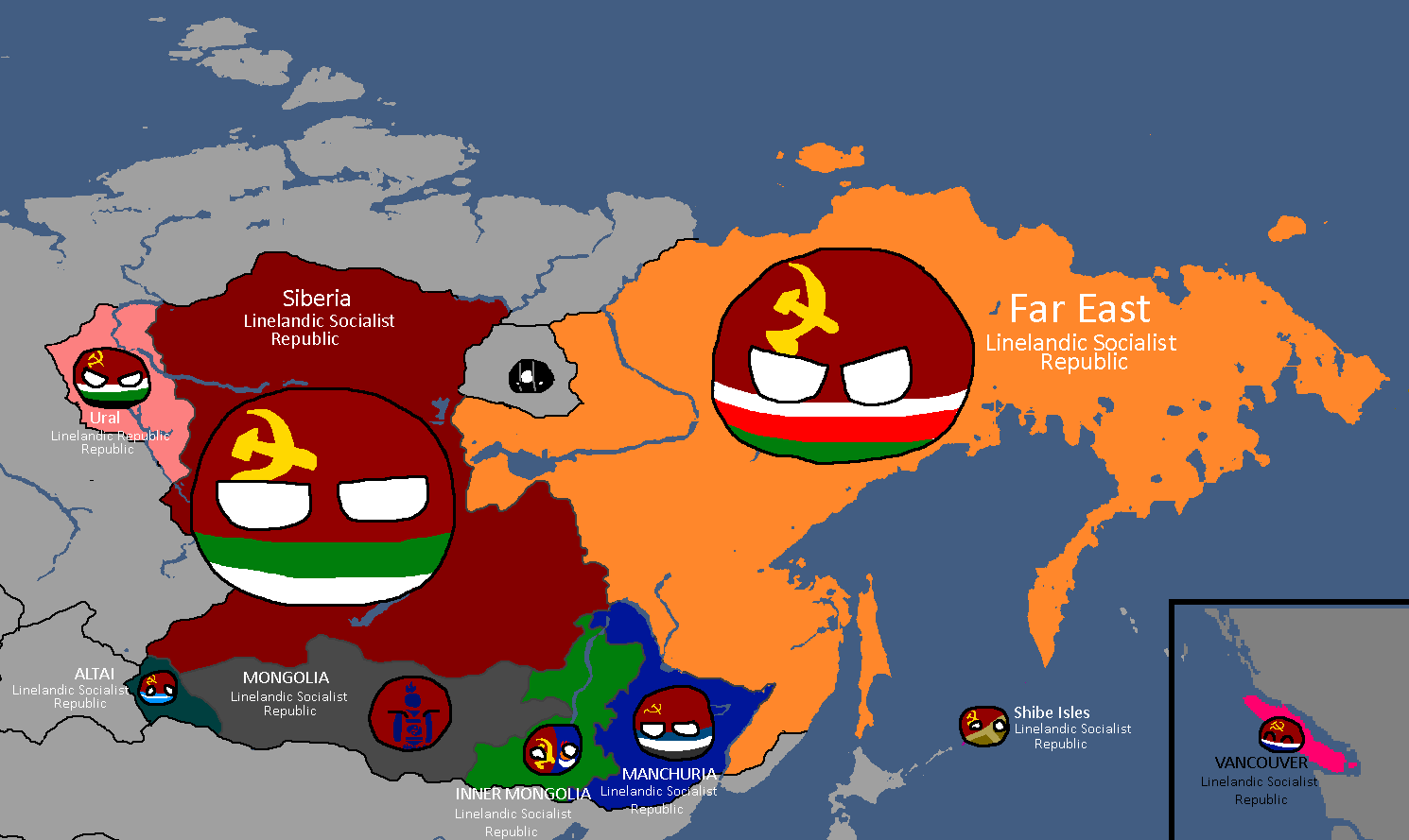
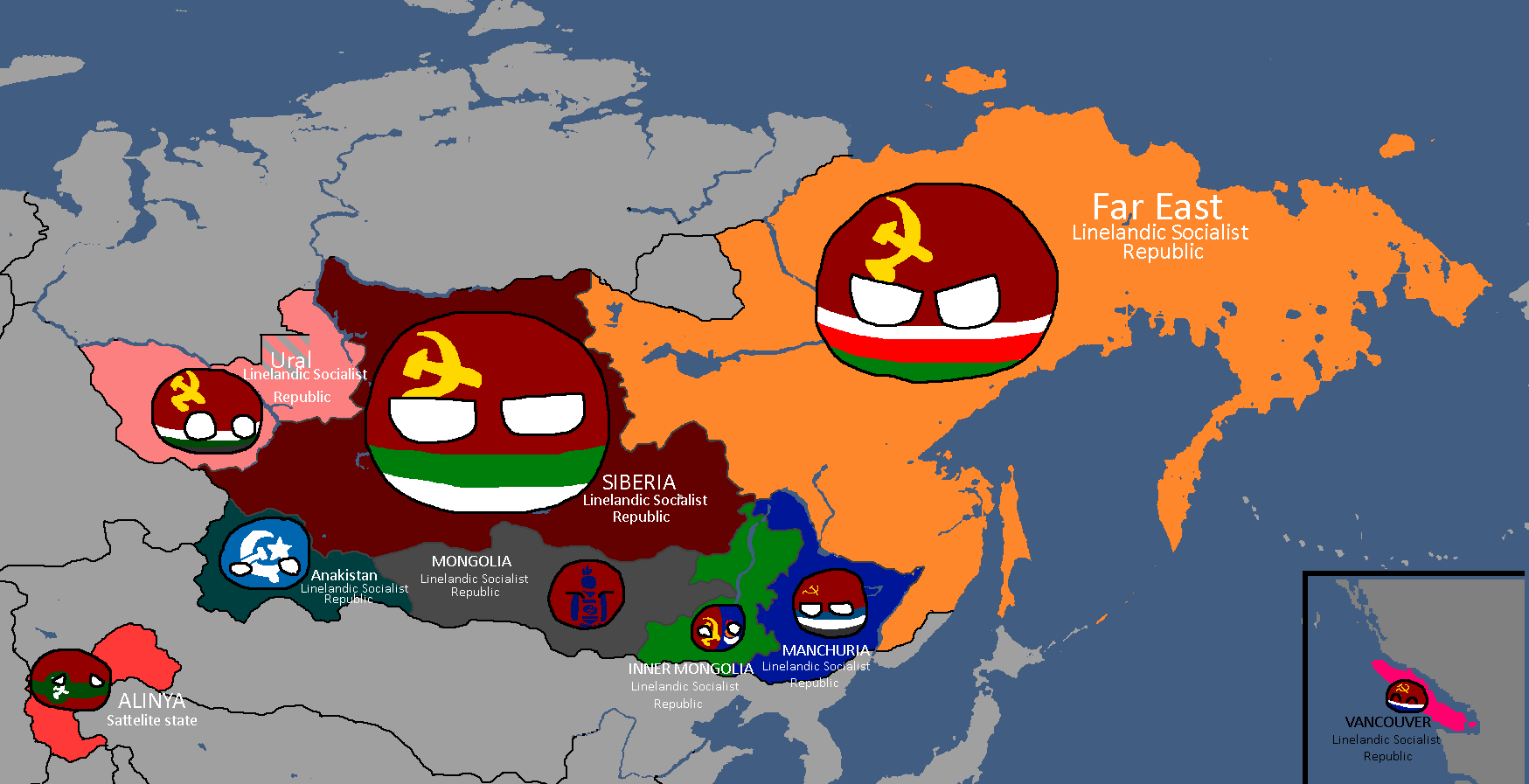
Member-Republics of the Union of Linelandic Socialist Republics: Year 112
-
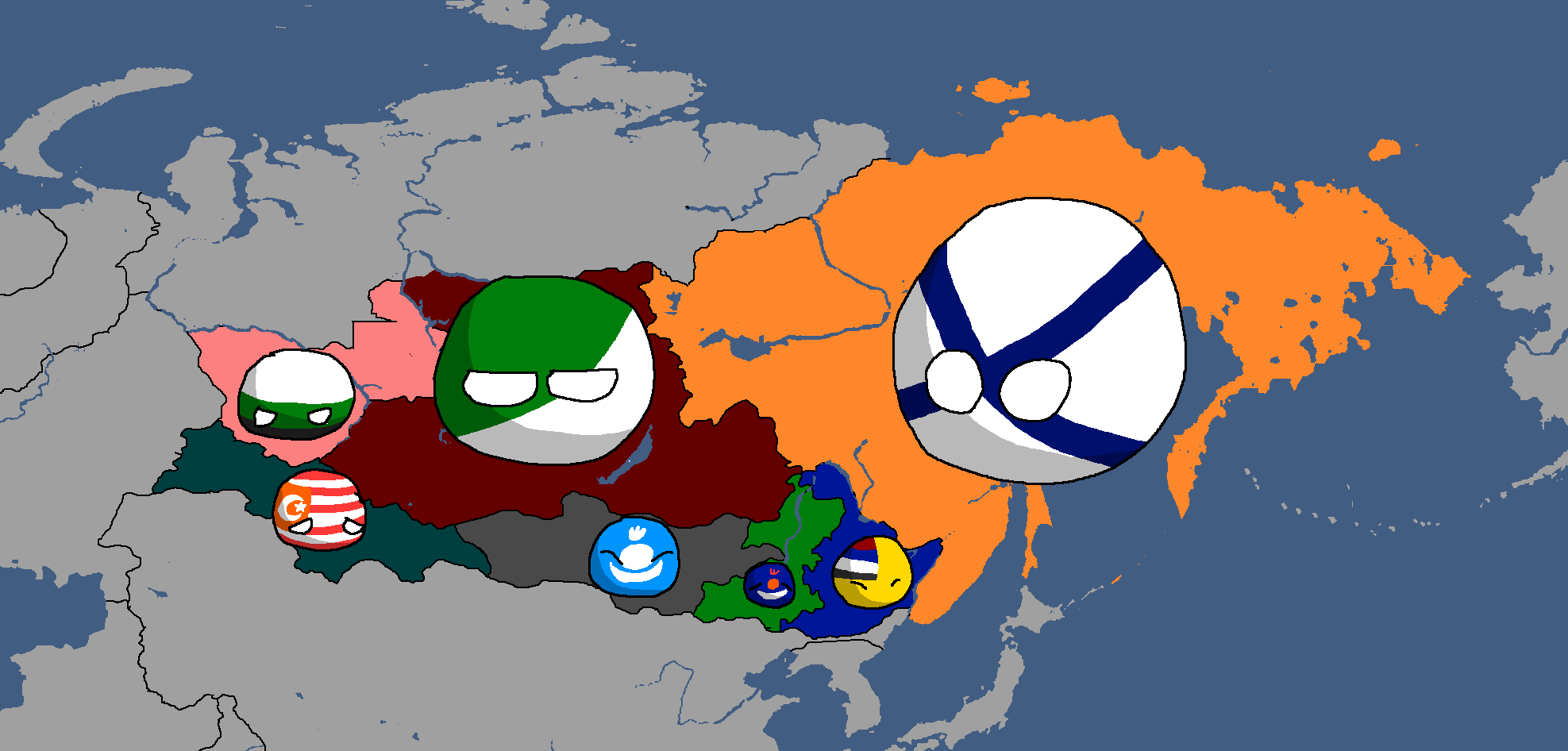
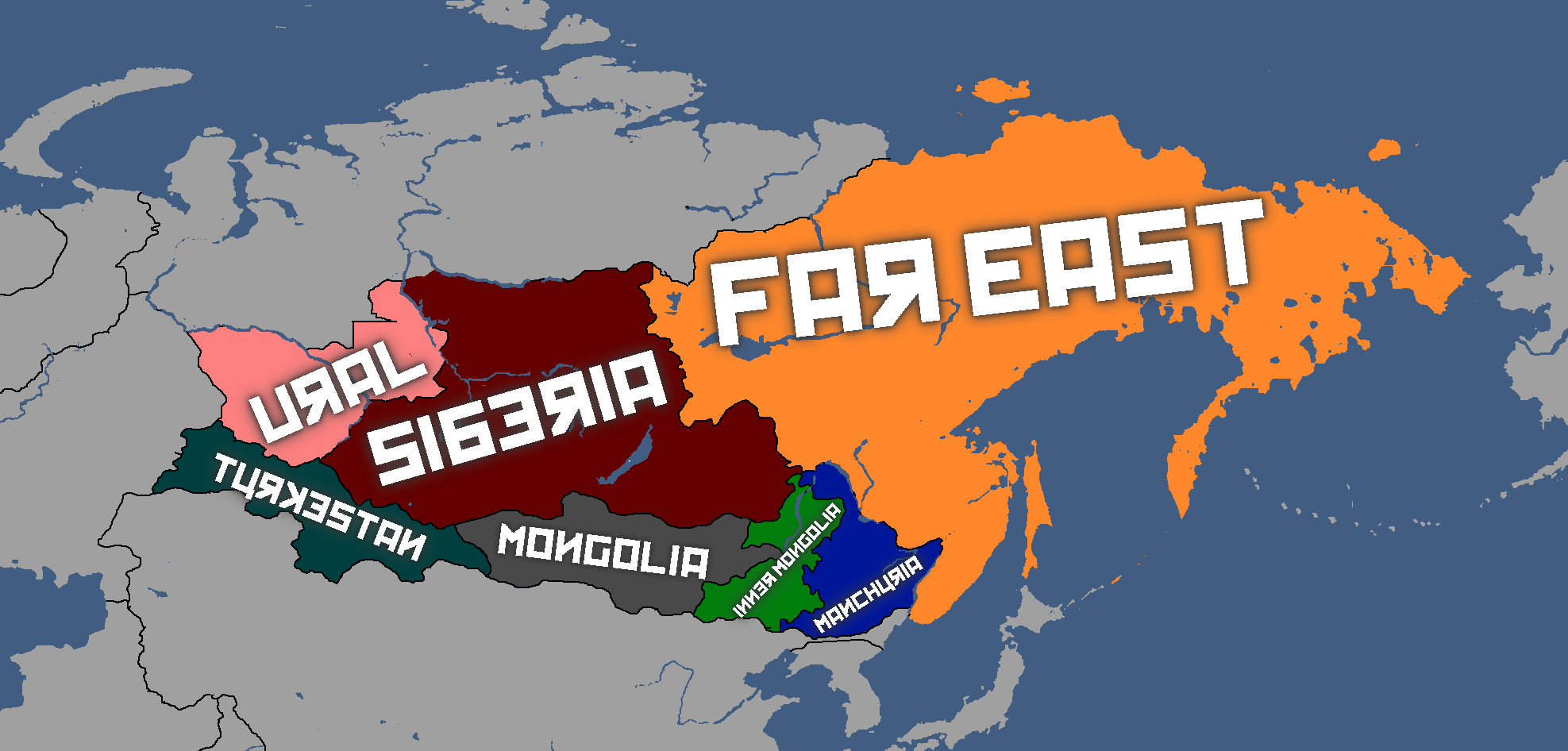
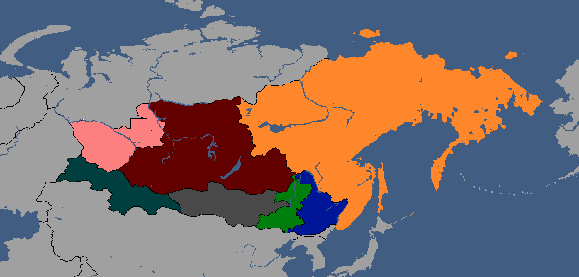
Member-Republics of the Union of Linelandic Socialist Republics: Year 113
-
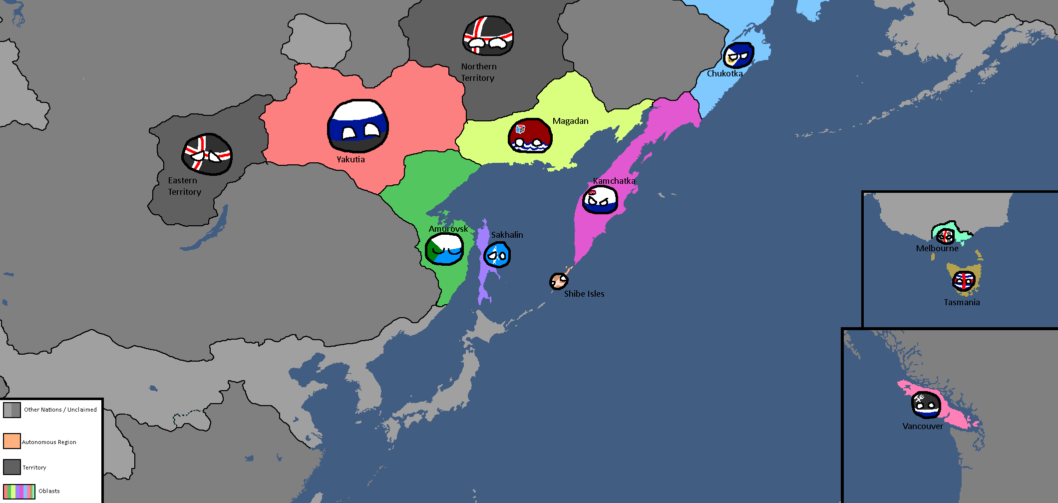
Oblasts of Lineland: Year 130 (Countryballs)
-
Oblasts of Lineland: Year 130 (Names)
-
Oblasts of Lineland: Year 130 (Blank)
-
Oblasts of Lineland: Year 132
-
Constituent Countries of Lineland: Year 144 (Countryballs)
-
Constituent Countries of Lineland: Year 144
-
Linelandic Railway Plan: Year 147
-
Map of damages caused by Tritonian terror-bombing: Year 185
-
Linelandic Warlords without labels: Year 186
-
Map of the Linelandic Sphere: Year 231
-
Tritonian Okrugs, Linelandic Okrugs, and Republics of Siberia: Year 314
-
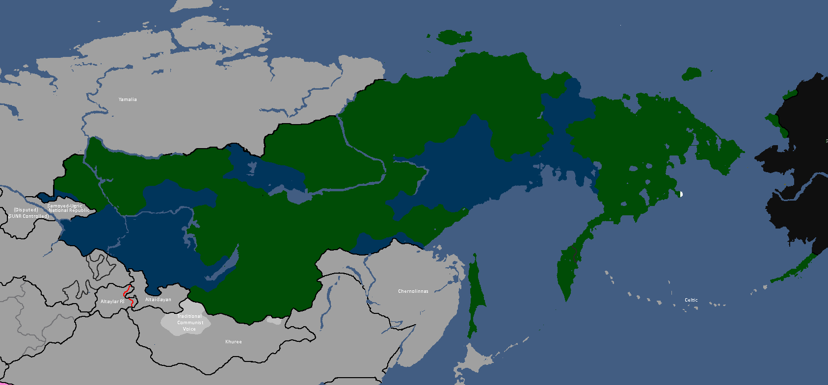
Map of Linelandic or Tritonian ethnicity in Siberia: Year 347


Luxurian Maps
-
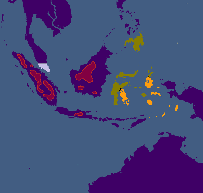
Map of areas with active Poavakian resistance movements: Year 188
-
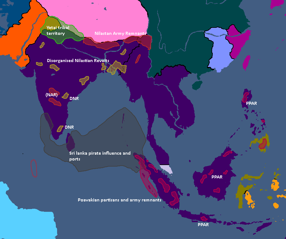
Map of areas with active resistance movements: Year 193


Nakamaian Maps
-
Languages of Nakmai: Year 112

Old Osanian Maps
-
Old Osanian States: Year 105

Paralesian Maps
-
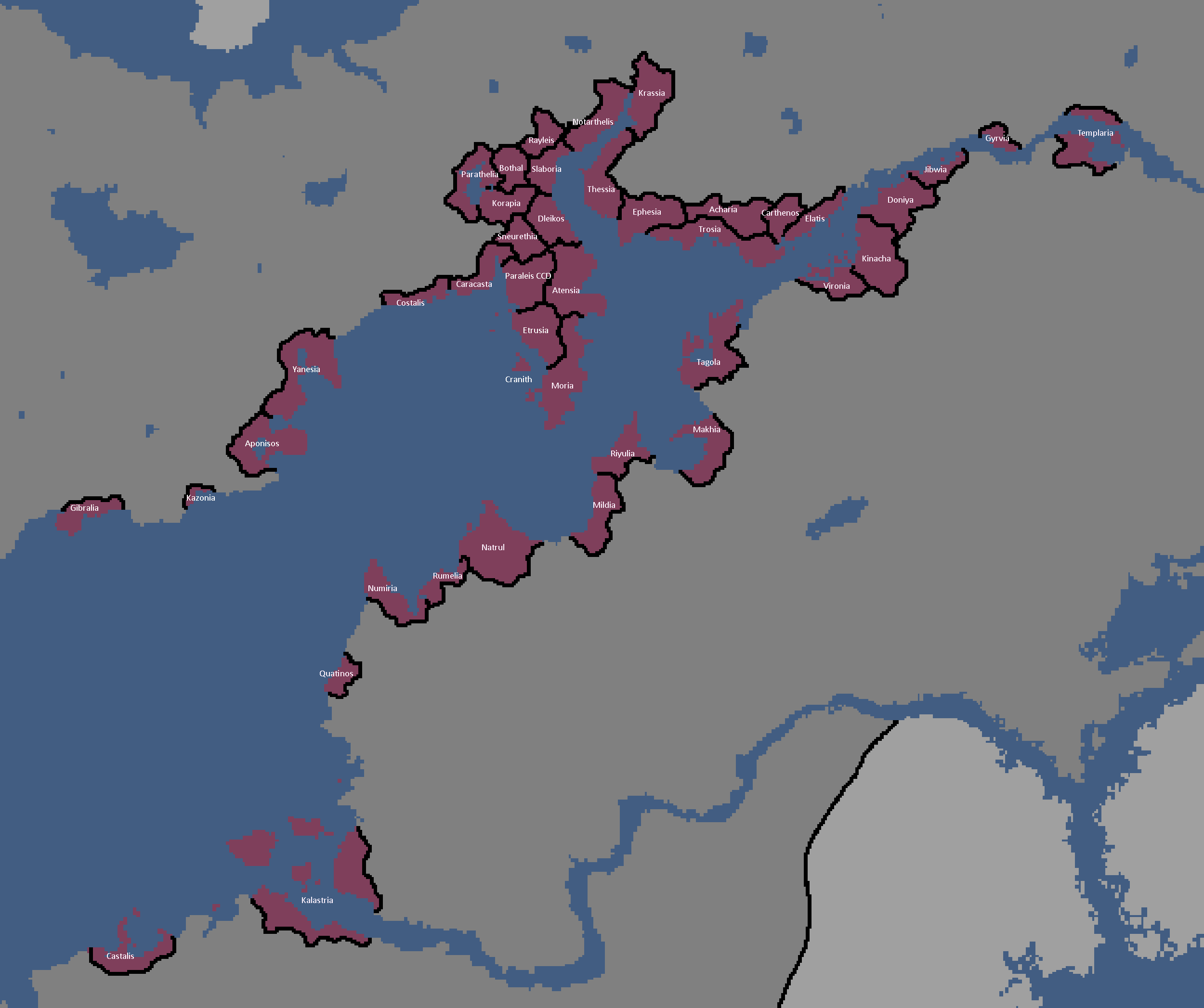
City States of Paraleis: Year 180

Poavakian Maps
-
Poavakian Subdivisions: Year 96
-
Areas settled by Nay'Bling refugees: Year 171


Rossiyan Maps
-
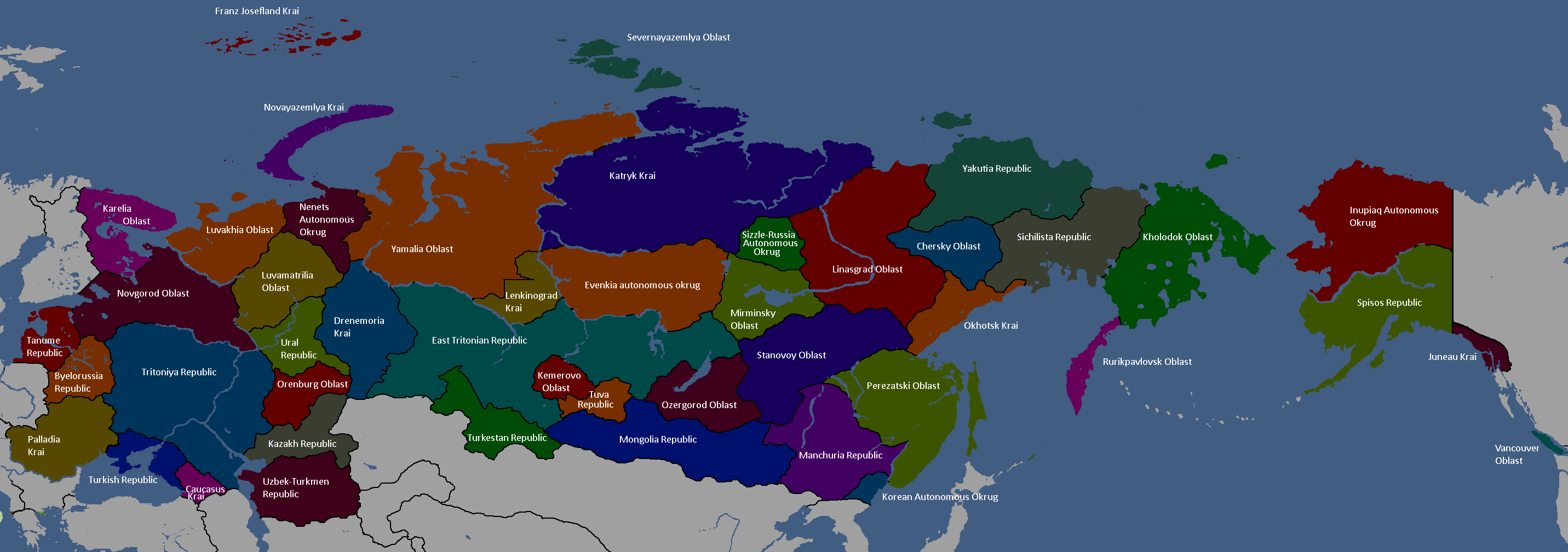
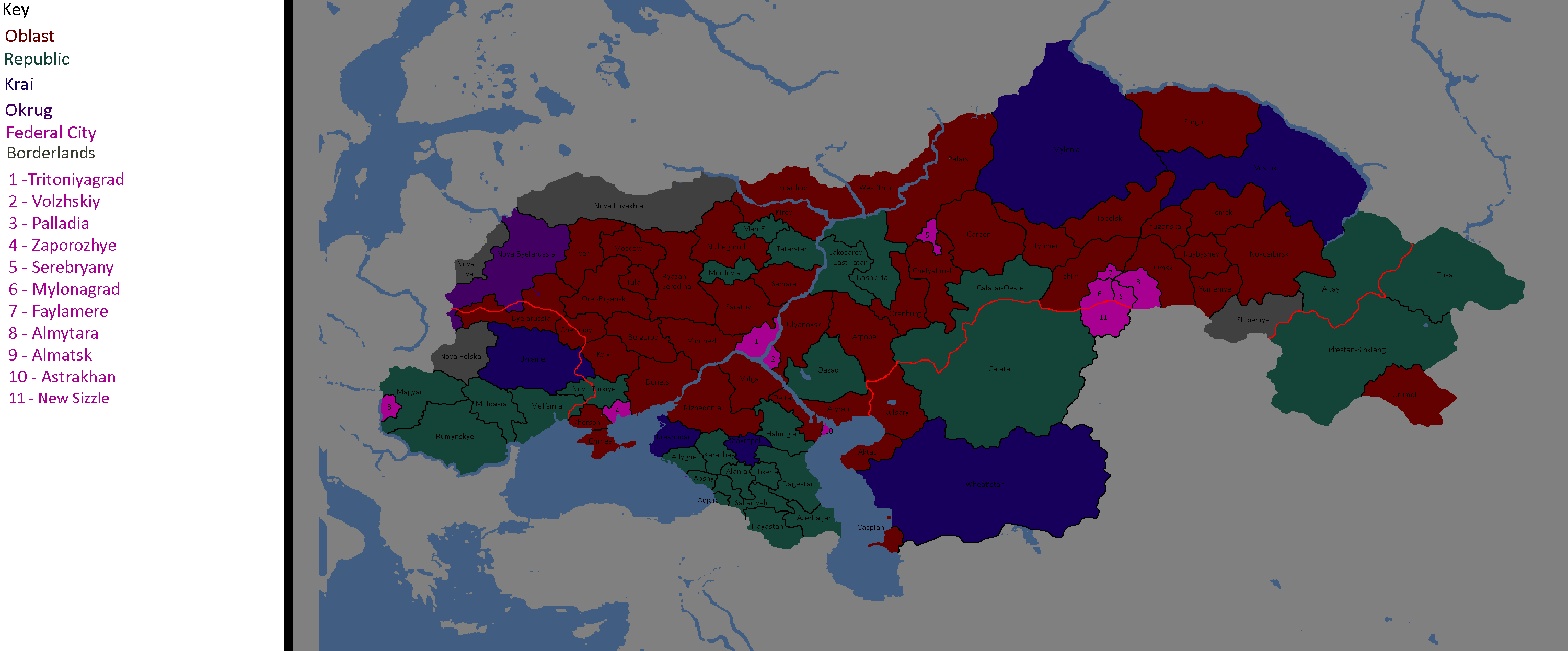
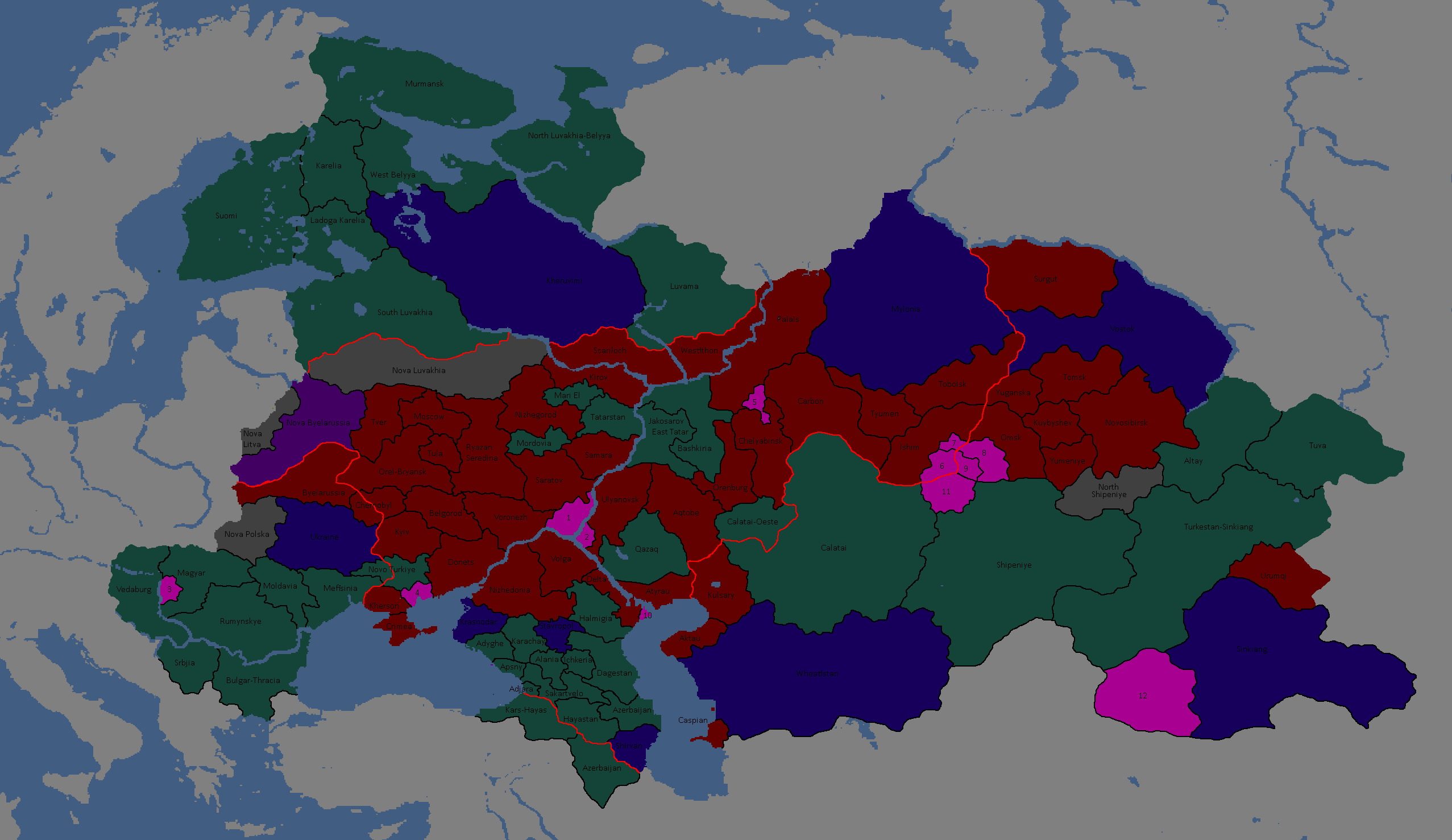
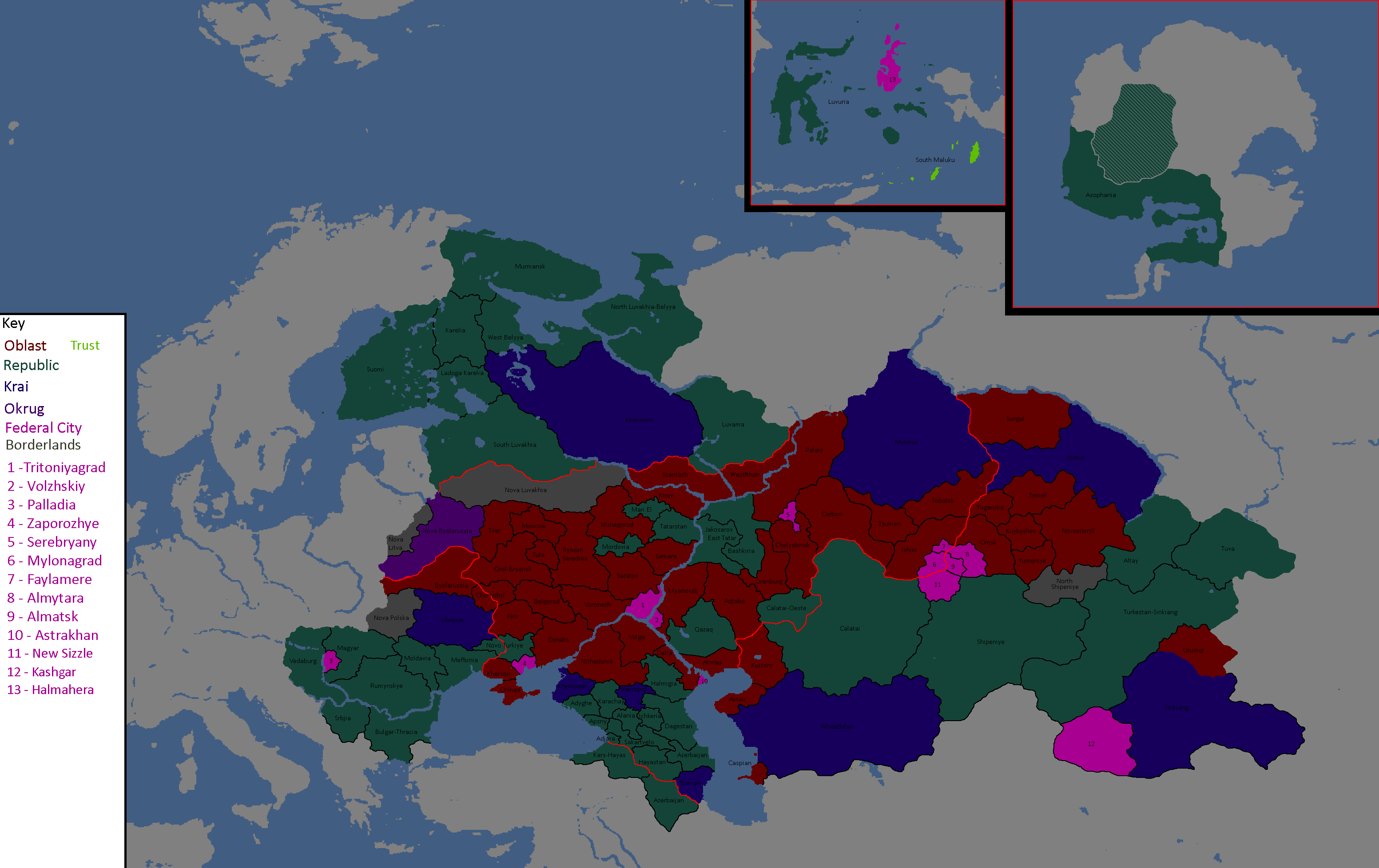
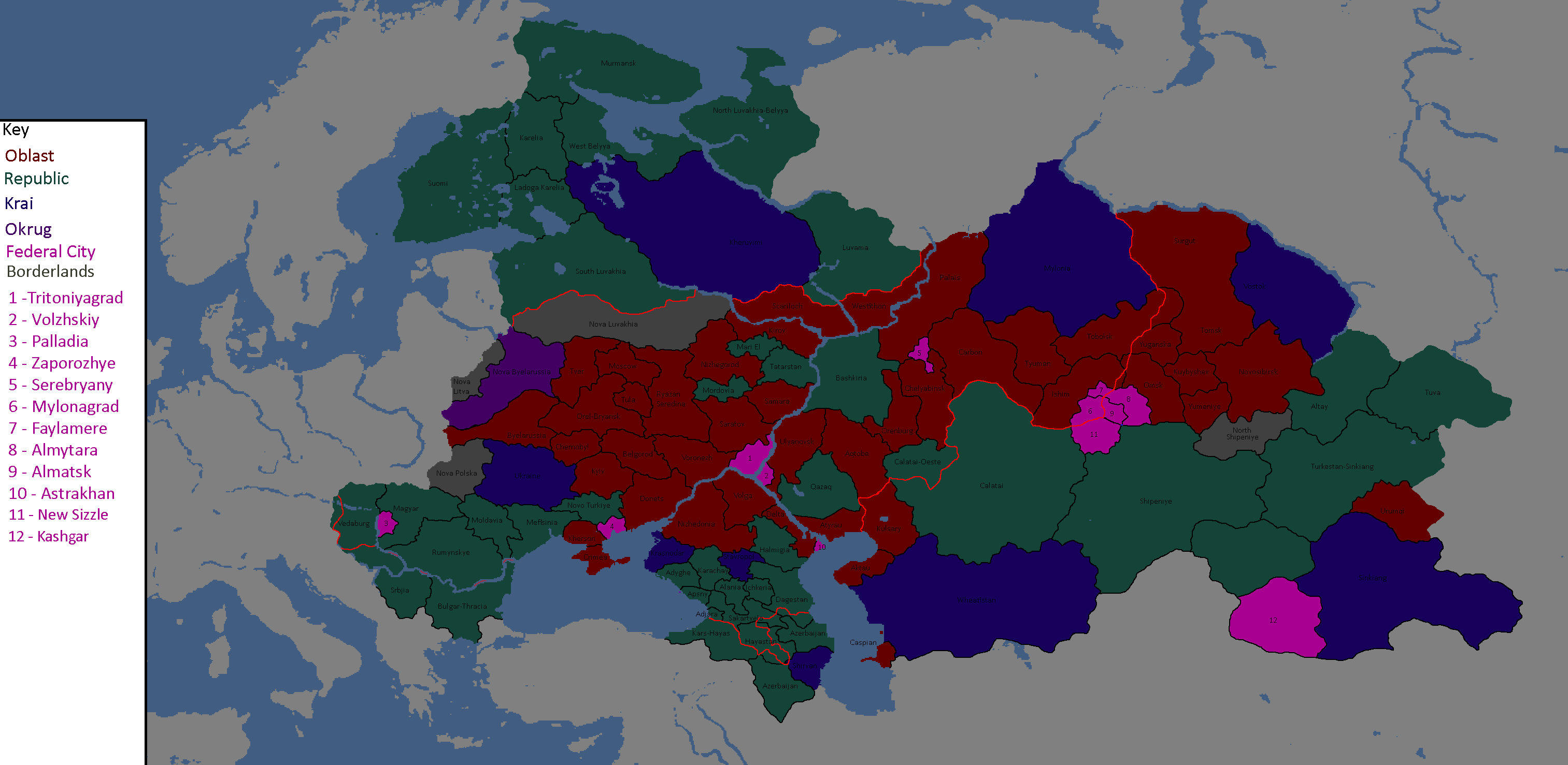
Federal Subjects of Rossiya: Year 176 (Names)
-
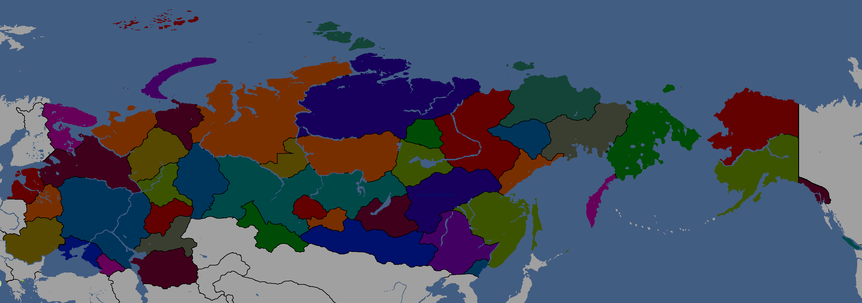
Federal Subjects of Rossiya: Year 176 (Blank)
-
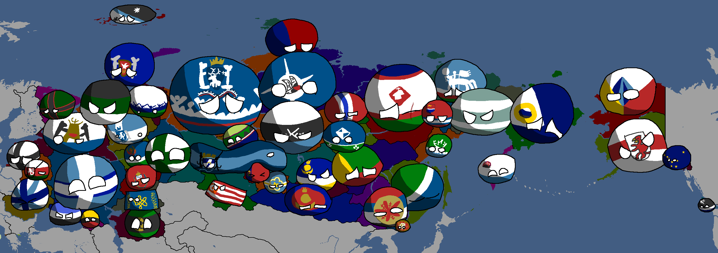
Federal Subjects of Rossiya: Year 176 (Countryballs)
-
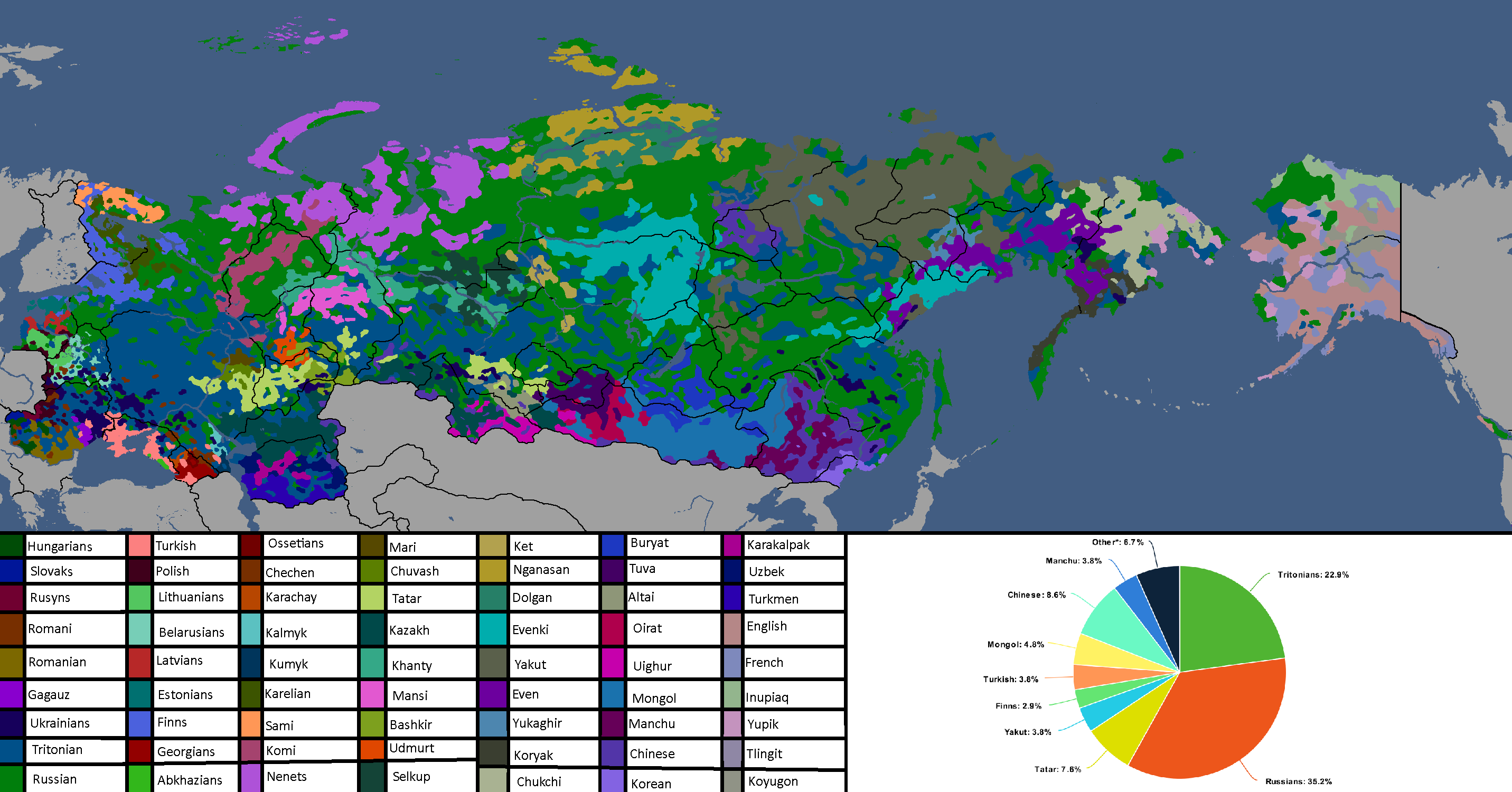
Languages of Rossiya: Year 180
-
Map of the Tritoniyan Empire: Year 180


Sarpistani Maps
-
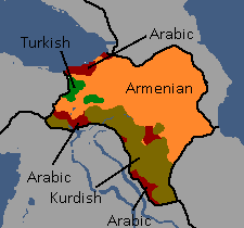
Languages of Sarpistan: Year 114
-
Provinces of Sarpistan and Jeriya (Protectorate): Year 115
-
Map of the planned partition of Sarpistan: Year 121


Sizzlean Maps
-
Map of the (First) Sizzlean Empire: Year ~40s
-
Regions of Great Sizzle: Year 128 (Countryballs)
-
Regions of Great Sizzle: Year 128 (Names)
-
Regions of Great Sizzle: Year 128 (Blank)


Swagonian Maps
-
Provinces of Swagonia: Year 218
-
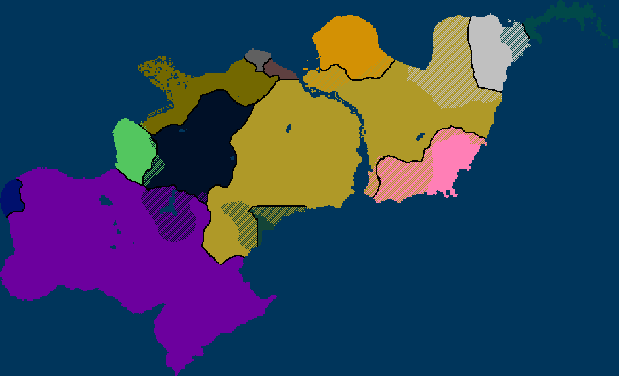
![Swagonian Provinces by Type[29]: Year 218](/yatawiki/images/9/9f/Swagoniaprovincetypes.png)
Swagonian Provinces by Type[29]: Year 218
-
Counties of Swagonia: Year 253
-
Counties of Swagonia: Year 254

![Swagonian Provinces by Type[29]: Year 218](/yatawiki/index.php/File:Swagoniaprovincetypes.png)


Tanumian Maps
-
Languages of Tanume: Year 152

Tritonian Maps
-
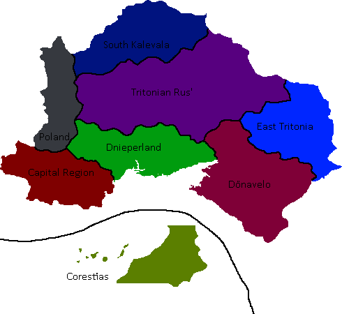
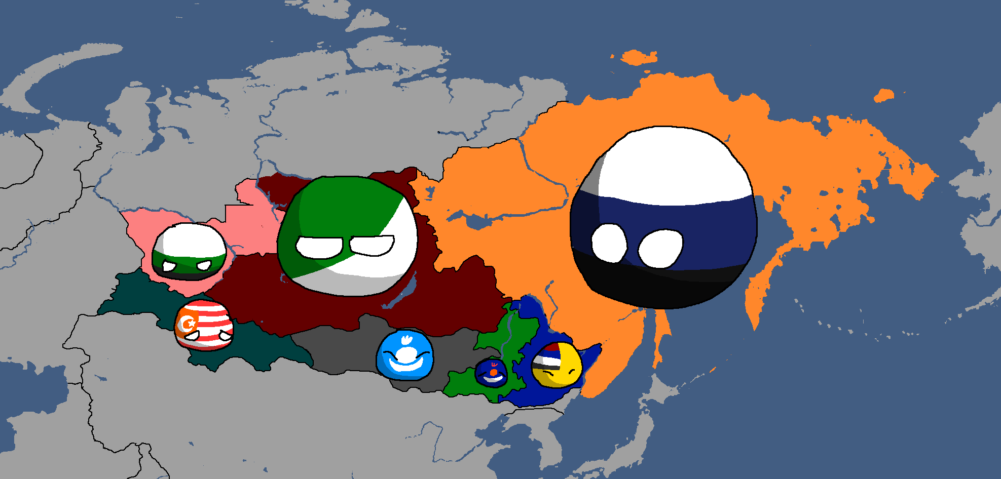
Tritonian Regions: Year 90
-
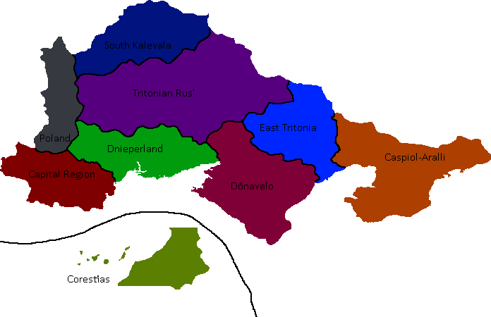
Tritonian Regions: Year 91
-
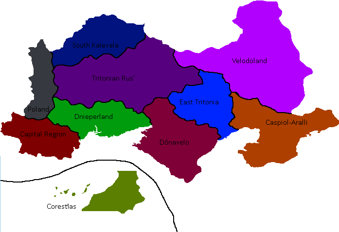
Tritonian Regions: Late Year 91
-
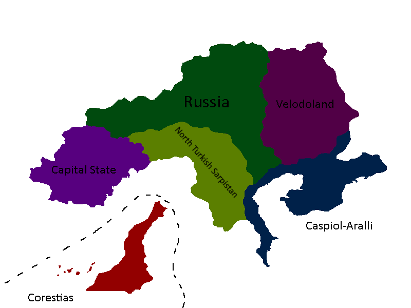
Tritonian Regions: Year 96
-
Tritonian Regions: Year 101
-
Tritonian Railways: Year 106
-
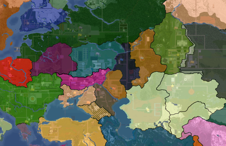
![Tritonian Cultures[30]: Year 110](/yatawiki/images/2/27/Tritoniacultures.png)
Tritonian Cultures[30]: Year 110
-
Member-Republics of the Union of Quatritonian Socialist Republics: Year 114
-
Languages of Quatritonia: Year 115
-
Tritonian Regions: Year 128
-
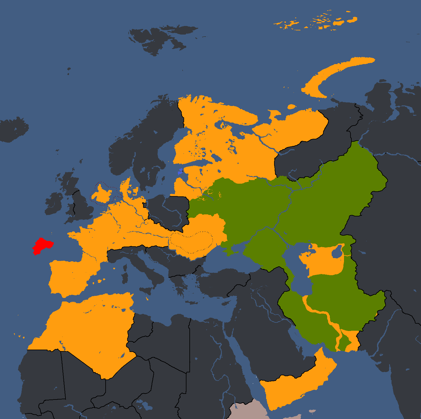
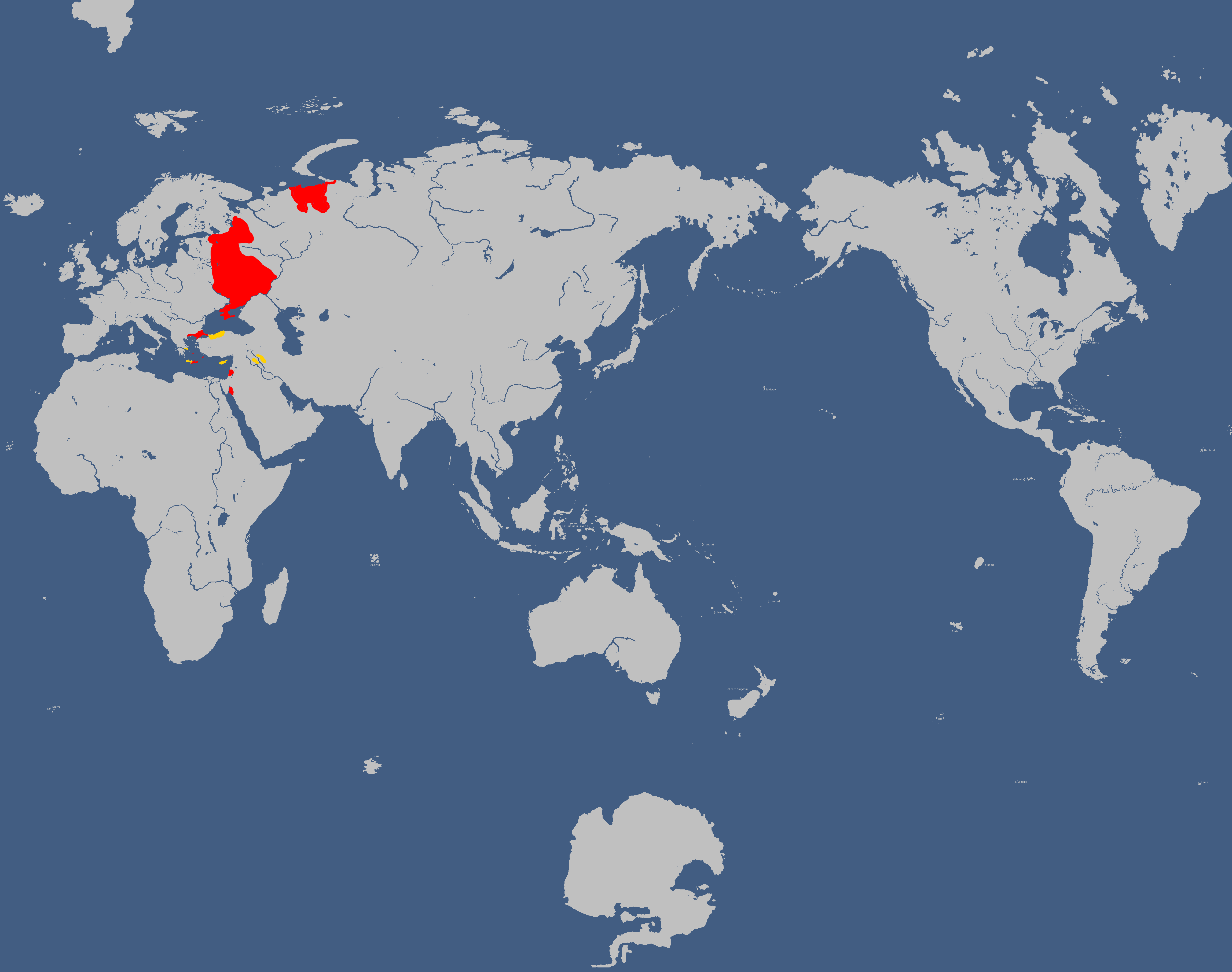
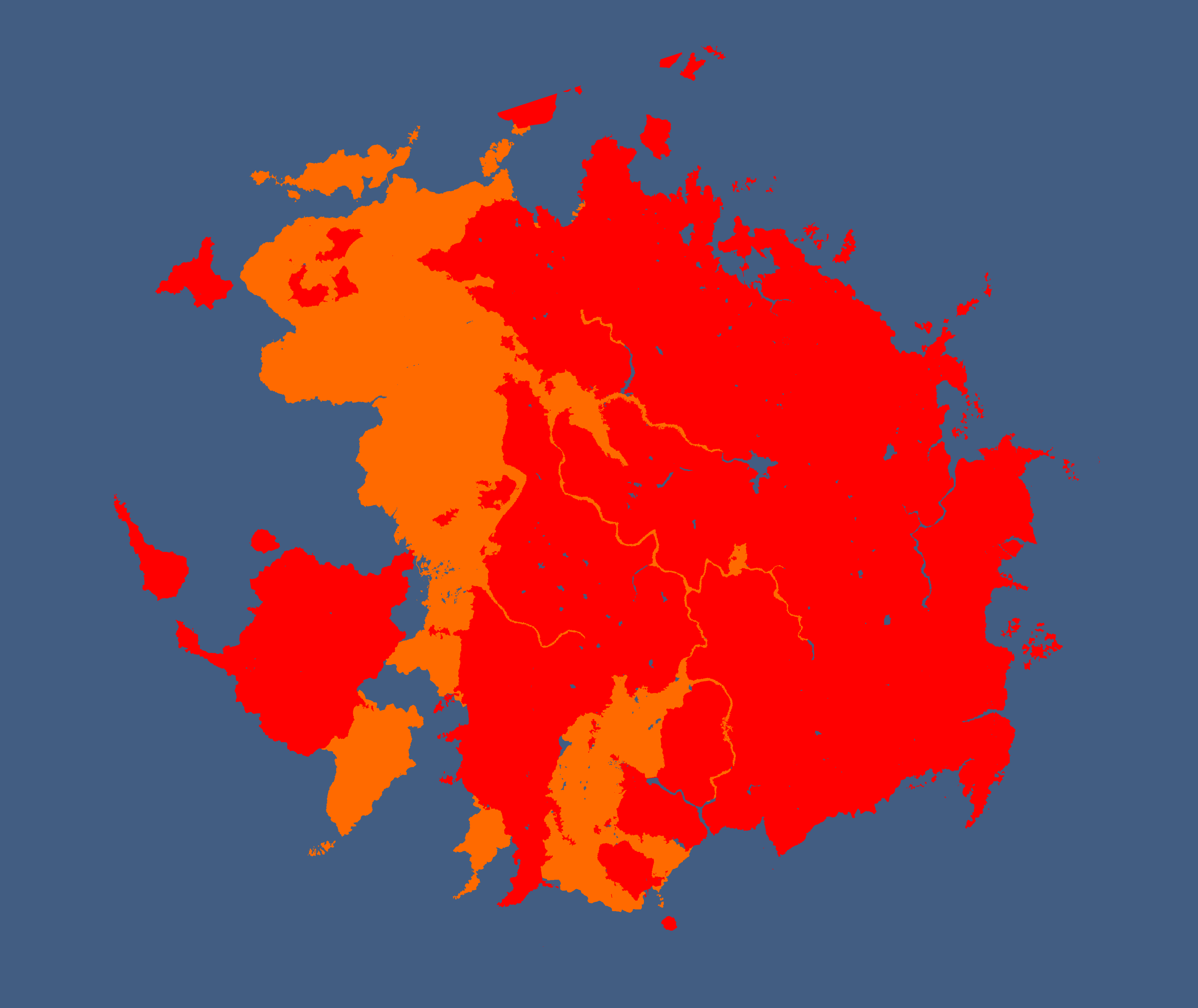
Red = Original Tritonia, Green = Current Tritonia, Yellow ) Tritonia at height: Year 135
-
Lands Tritonia has owned across history: Year 175
-
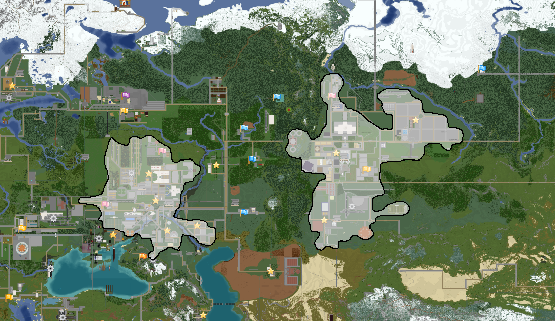
![Election Map[31]: Year 182](/yatawiki/images/e/e6/Tritoniaelectionmap.png)
Election Map[31]: Year 182
-
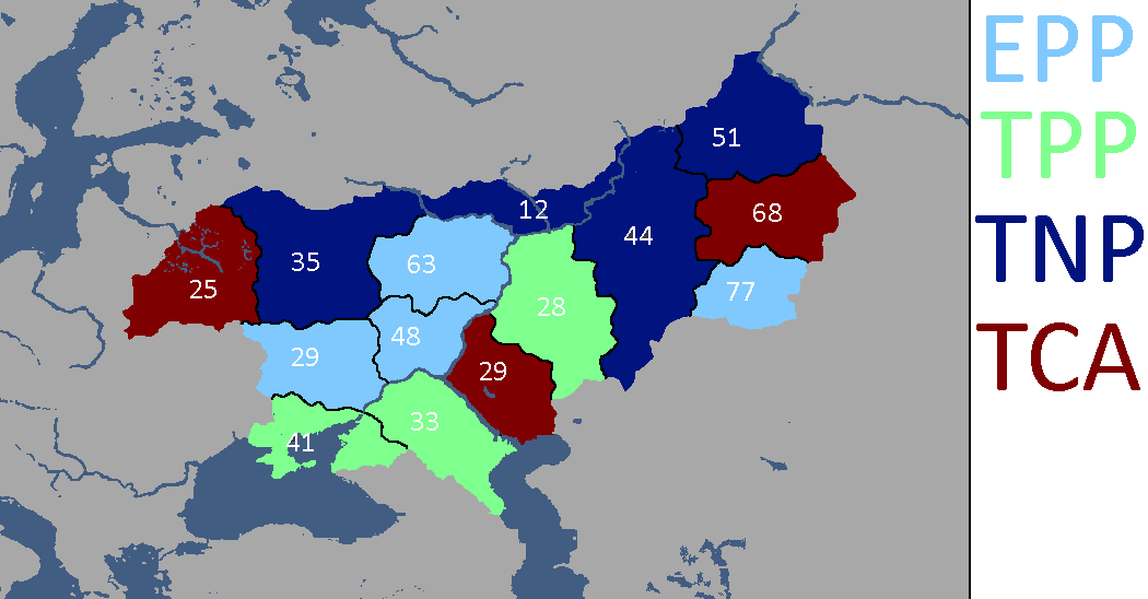
Tritonian Election: Year 188
-
Tritonia Overlay: Year 204
-
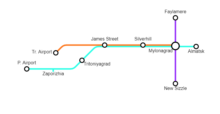
Tritoniyagrad and New Mylatsk: Year 210
-
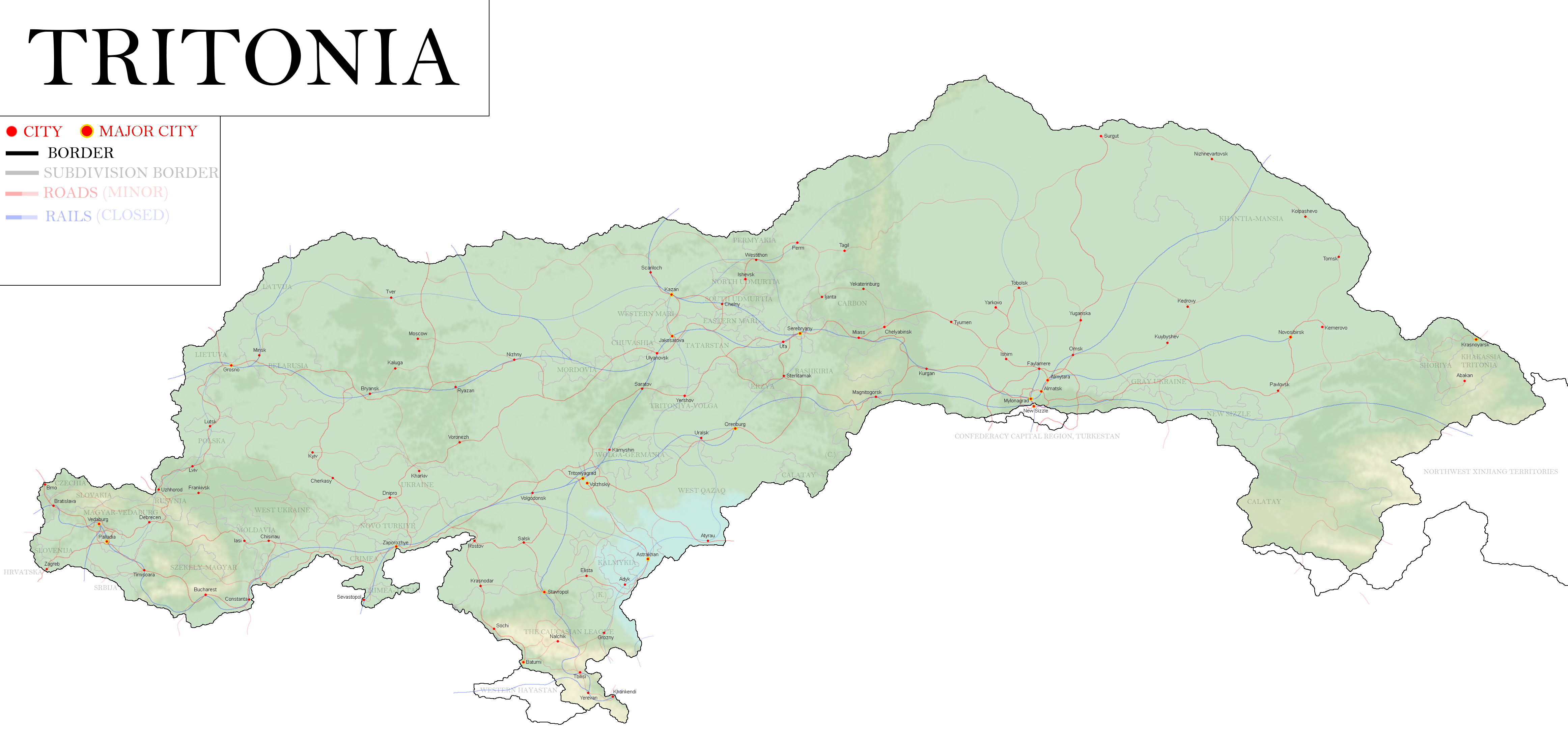
Map of Tritonia: Year 377


![Tritonian Cultures[30]: Year 110](/yatawiki/index.php/File:Tritoniacultures.png)


![Election Map[31]: Year 182](/yatawiki/index.php/File:Tritoniaelectionmap.png)


Turkestani Maps
-
Proposed Turkestani Annexations after the Siberian-Confederate War: Year 314
-
Proposed Turkestani Annexations after the Siberian-Confederate War: Year 314


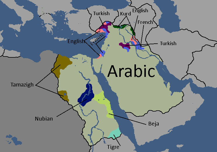
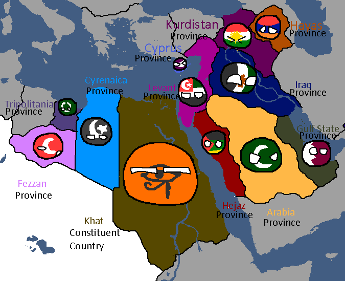
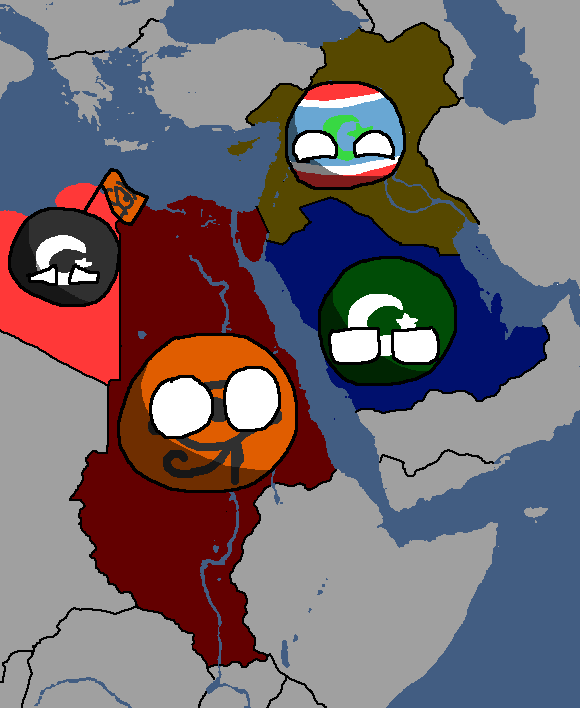
UAR/Arab Federation Maps
-
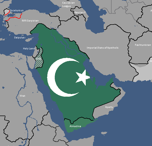
Map of UAR States: Year 365
-
Map of UAR States: Year 368
-
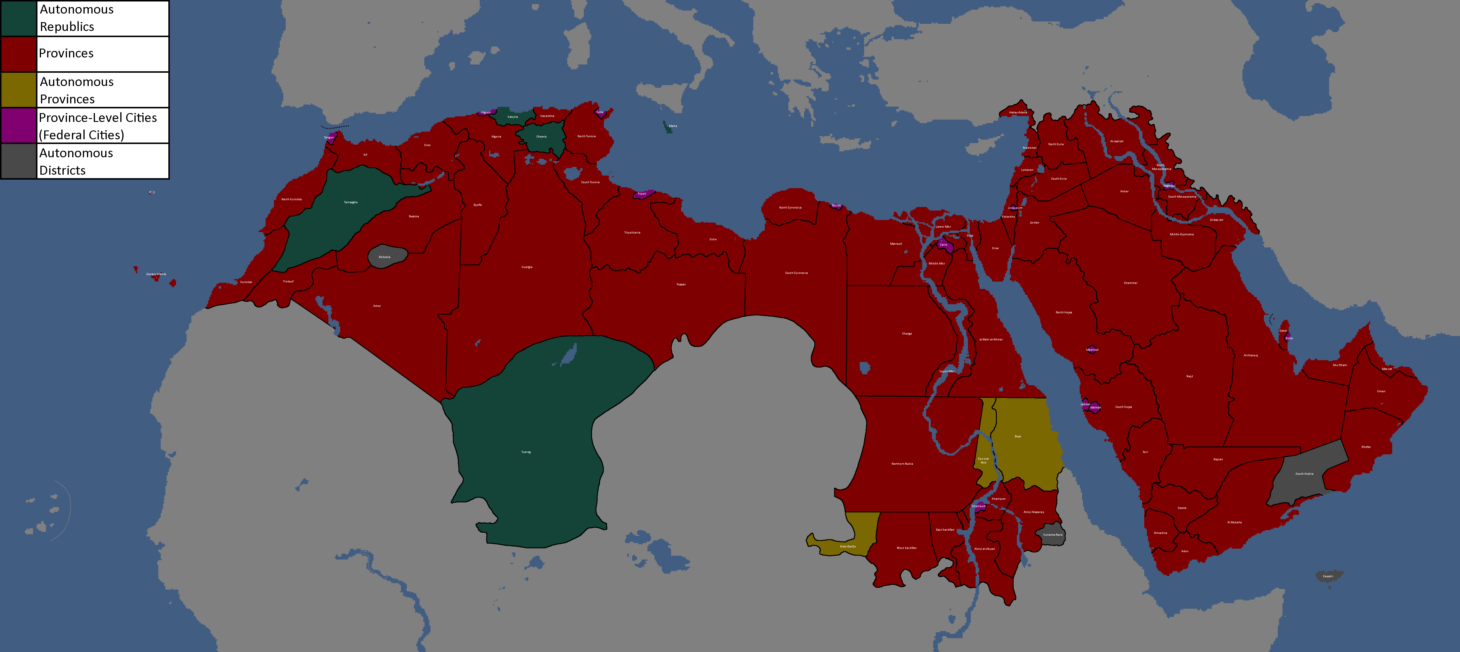
Map of the Provinces/Republics/Districts of the Arab Federation: Year 406


UFR/Floppastani Maps
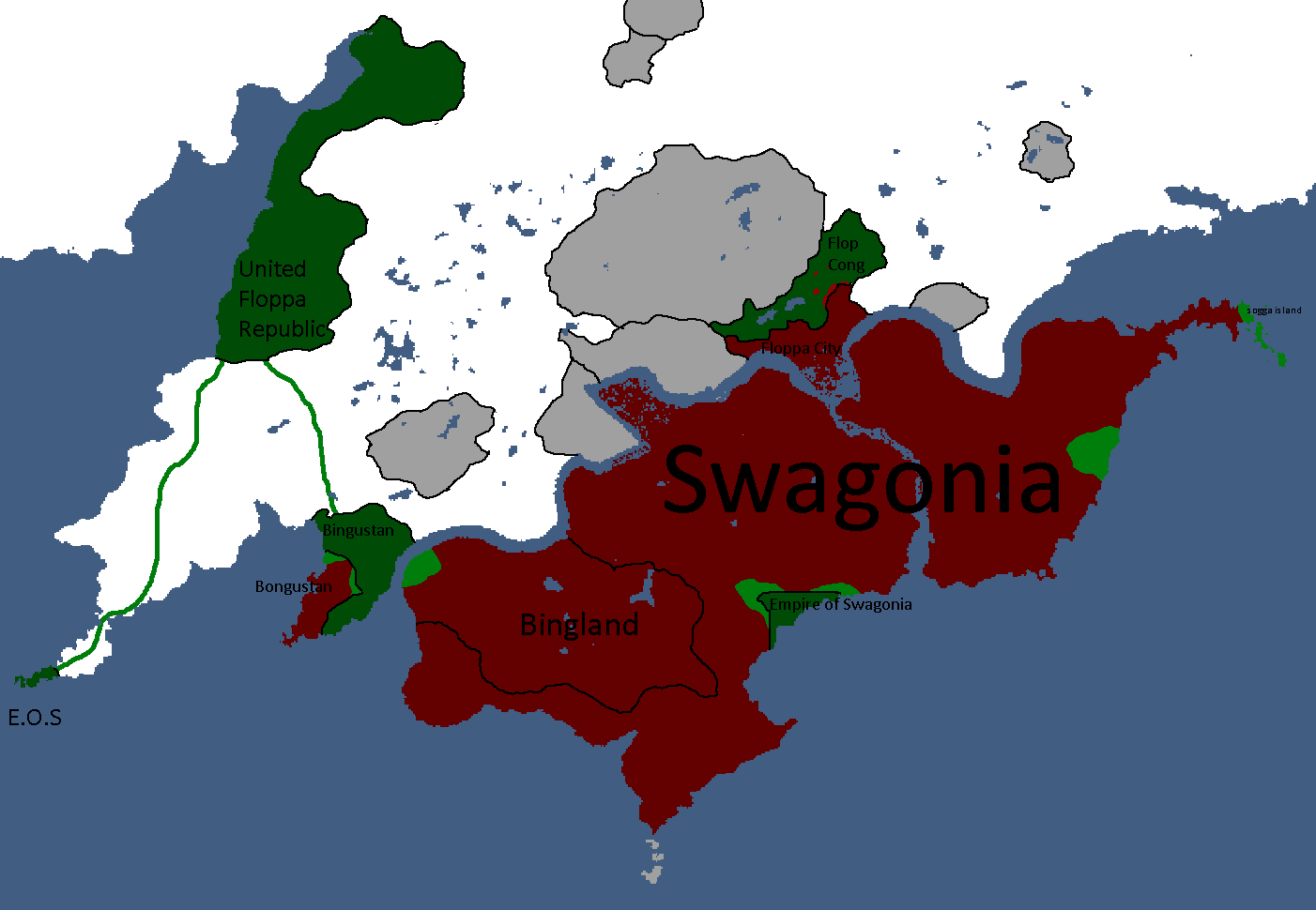
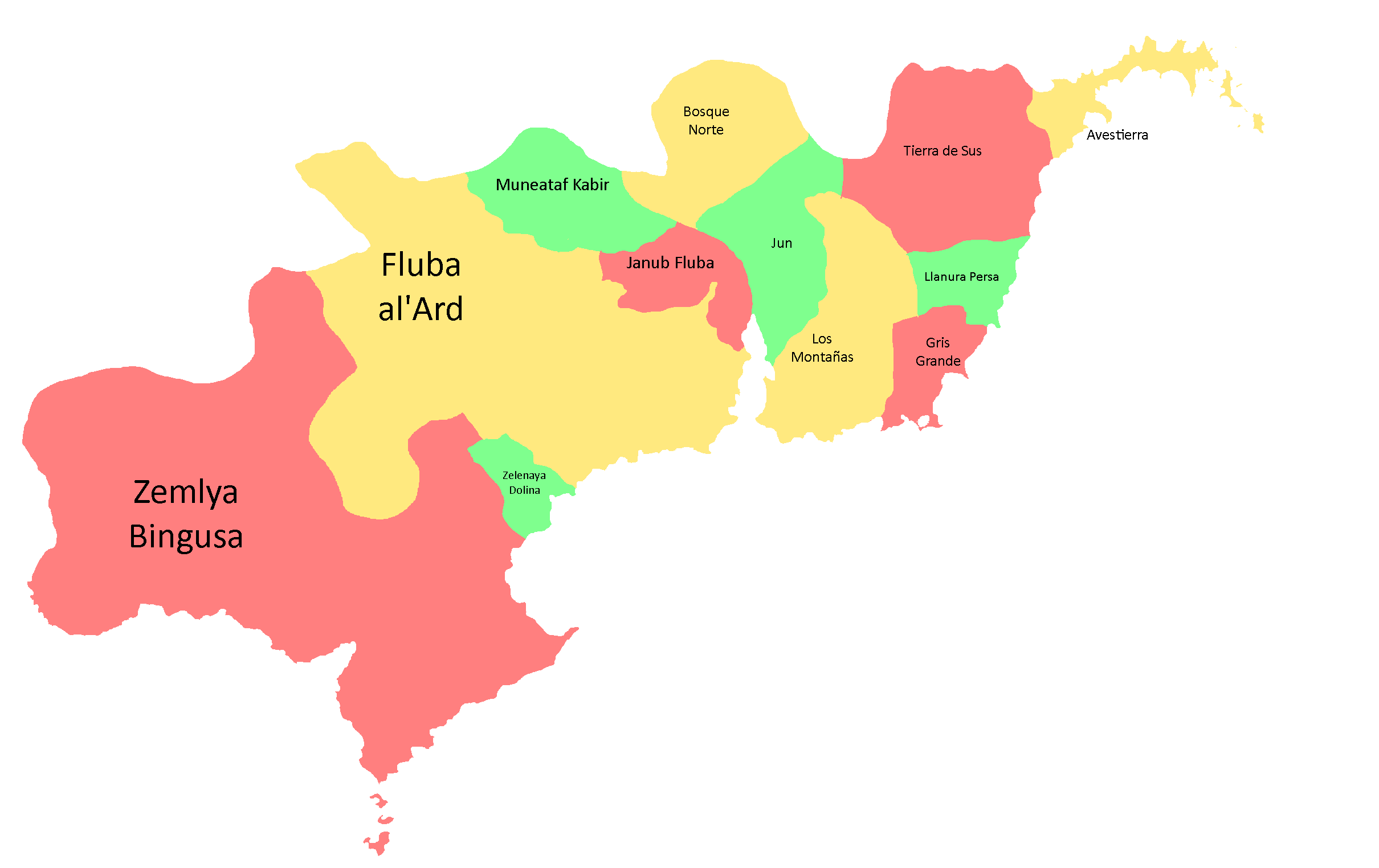
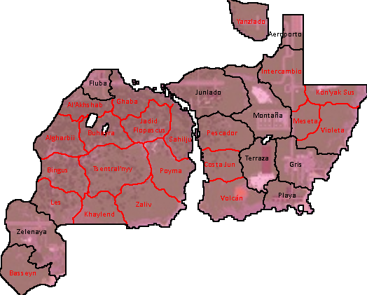
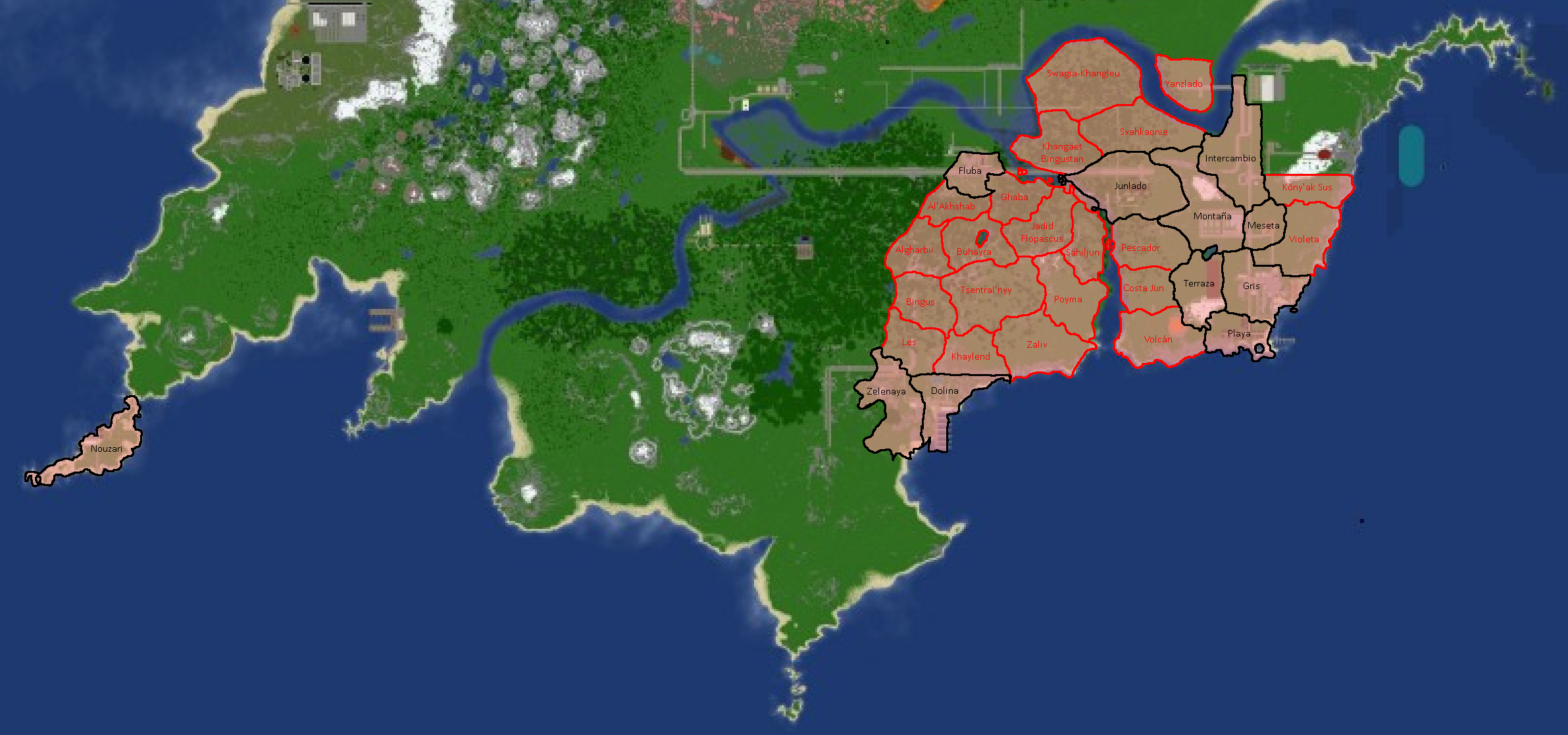
-
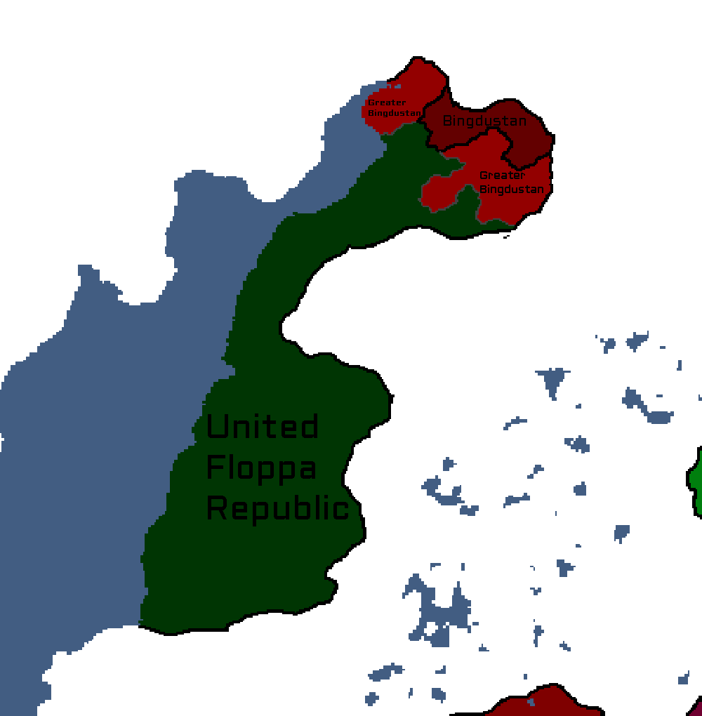
Map of the Bingdustan autonomy in the UFR

Utsongan Maps
-
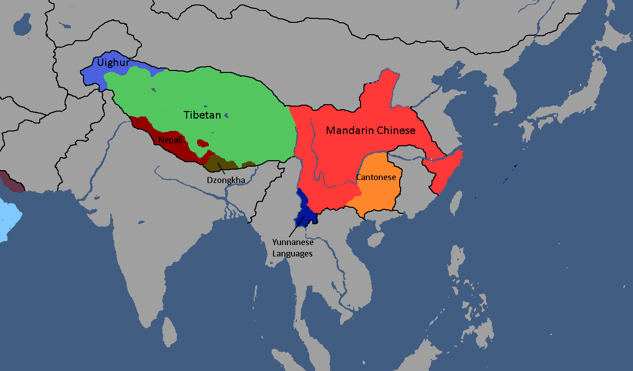
Languages of Utsong: Year 114
-
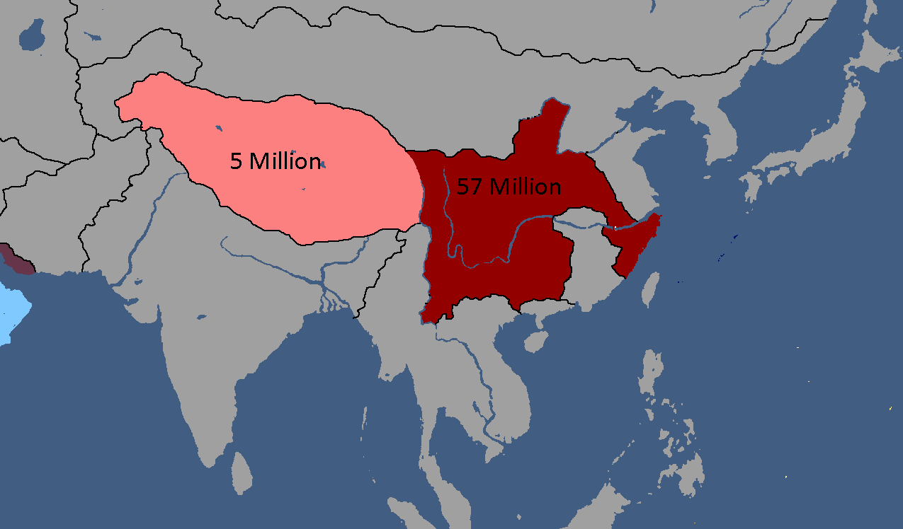
Utsong's Population Distribution: Year 114


Vedan Maps
-
Vedan Districts: Year 103

Waclawan Maps
-
Map of Waclaw: Year 172

Yamatoan Maps
-
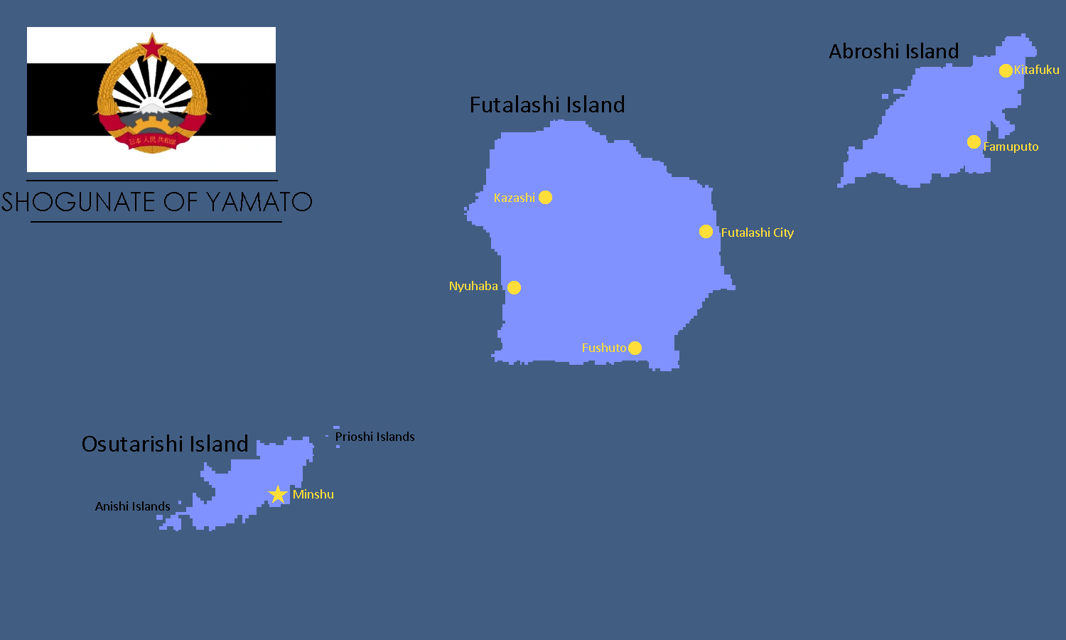
Map of Yamato: Year 245

Yatan Commonwealth Maps
-
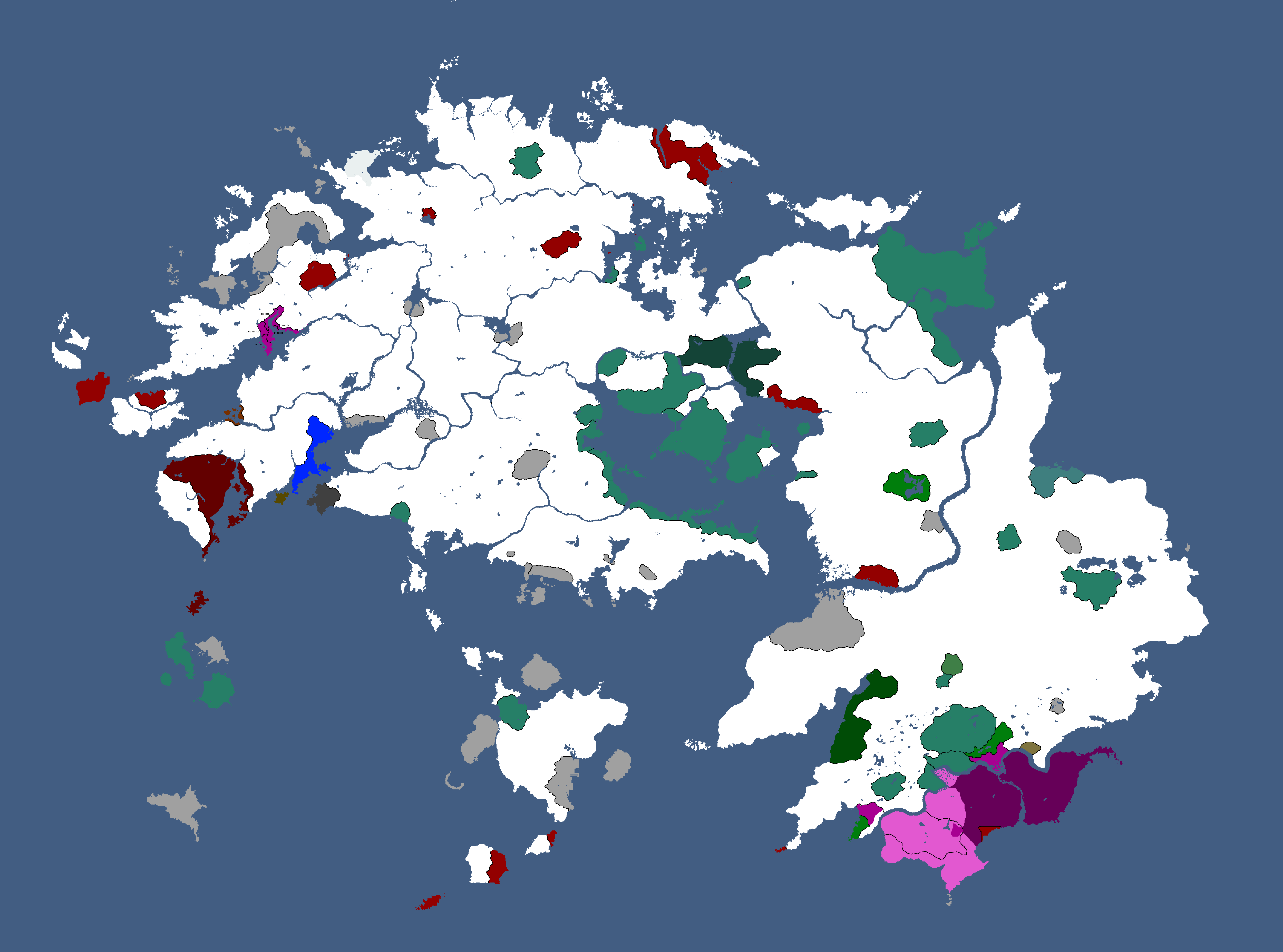
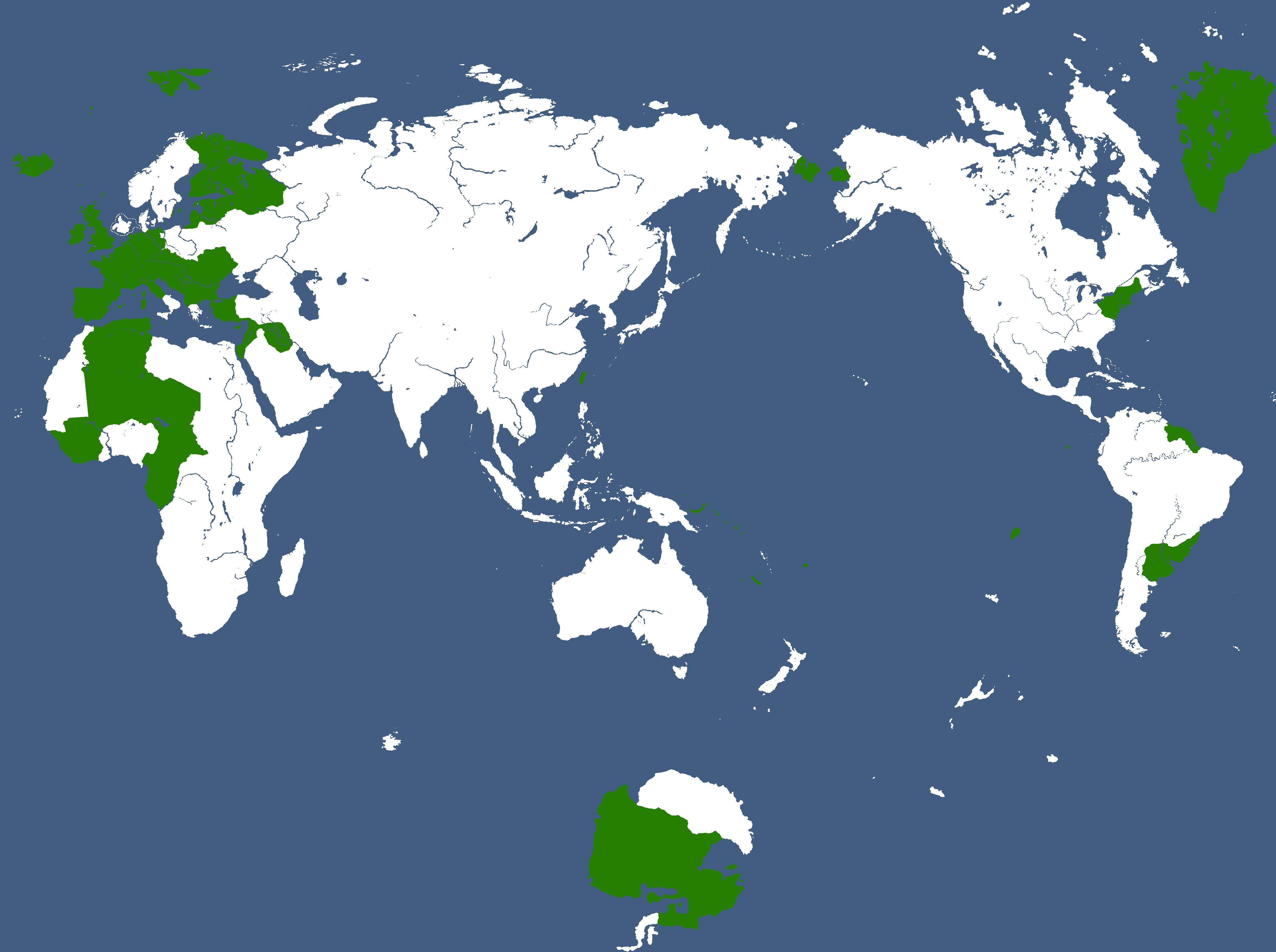
![Map of Yata[32]](/yatawiki/images/4/4b/Commonwealthmap.png)
Map of Yata[32]
![Map of Yata[32]](/yatawiki/index.php/File:Commonwealthmap.png)
Yatan-Theian Accord Maps
-
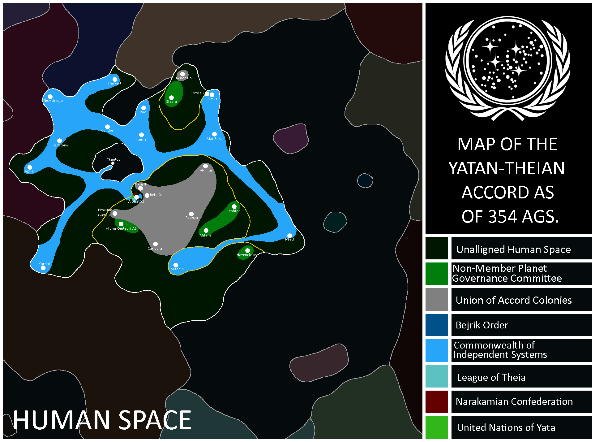
Map of the Accord: Year 354
-
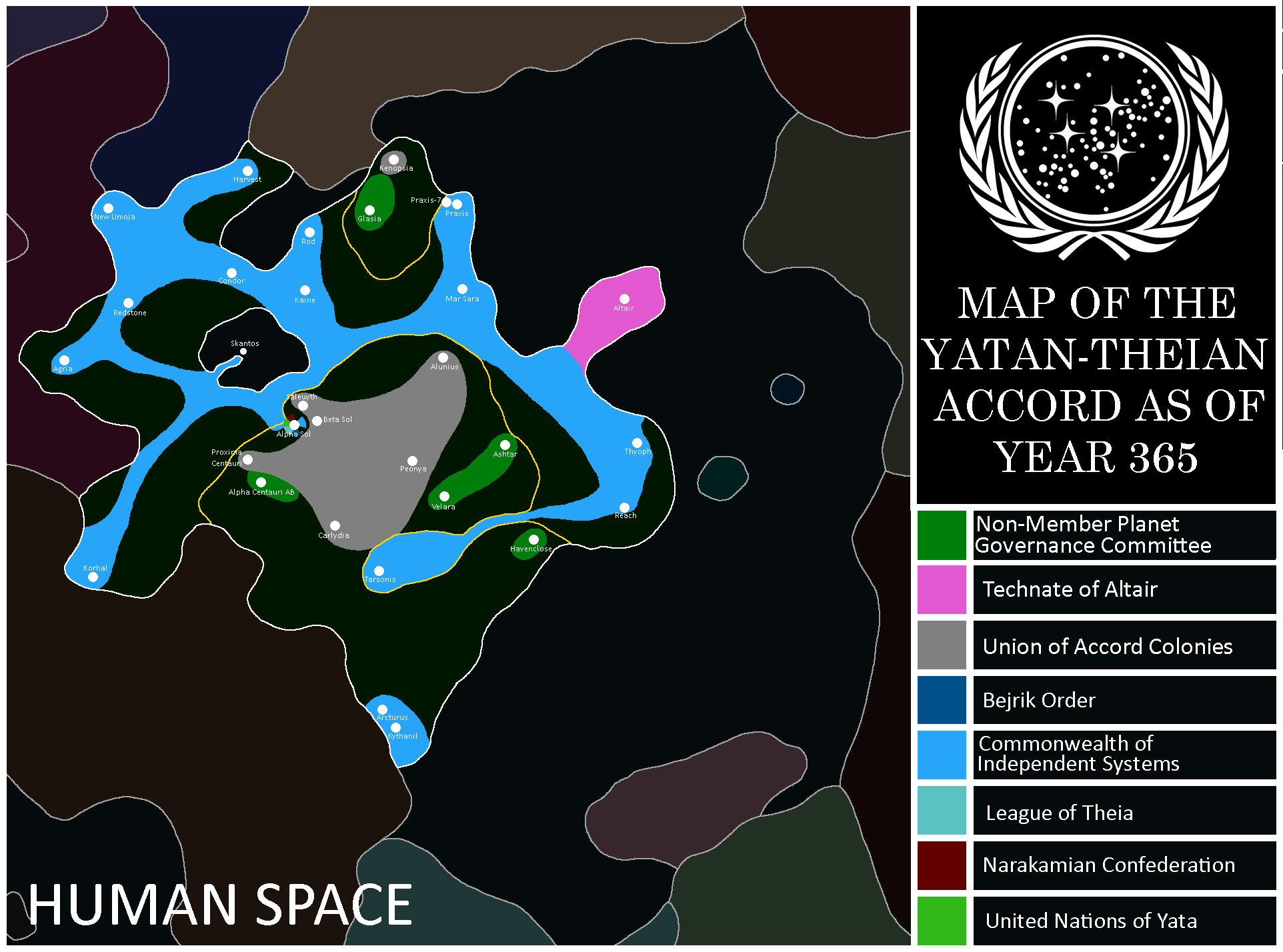
Map of the Accord: Year 365
-
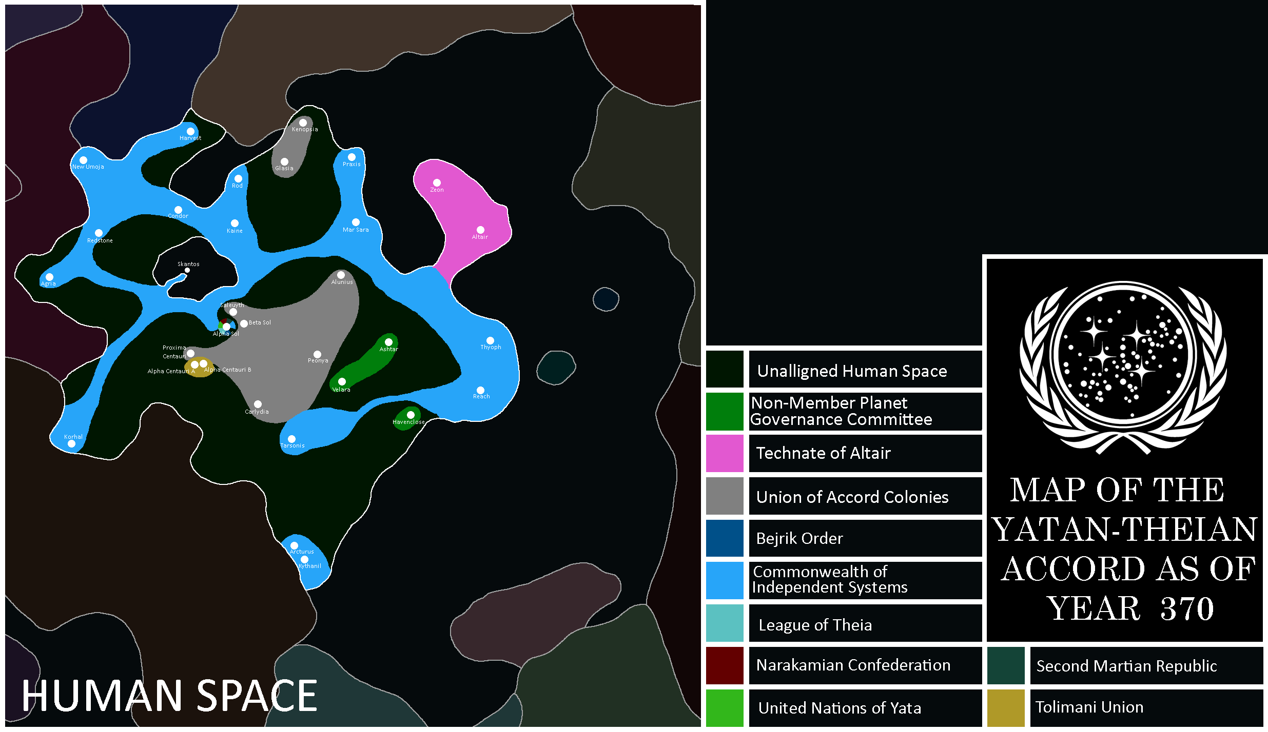
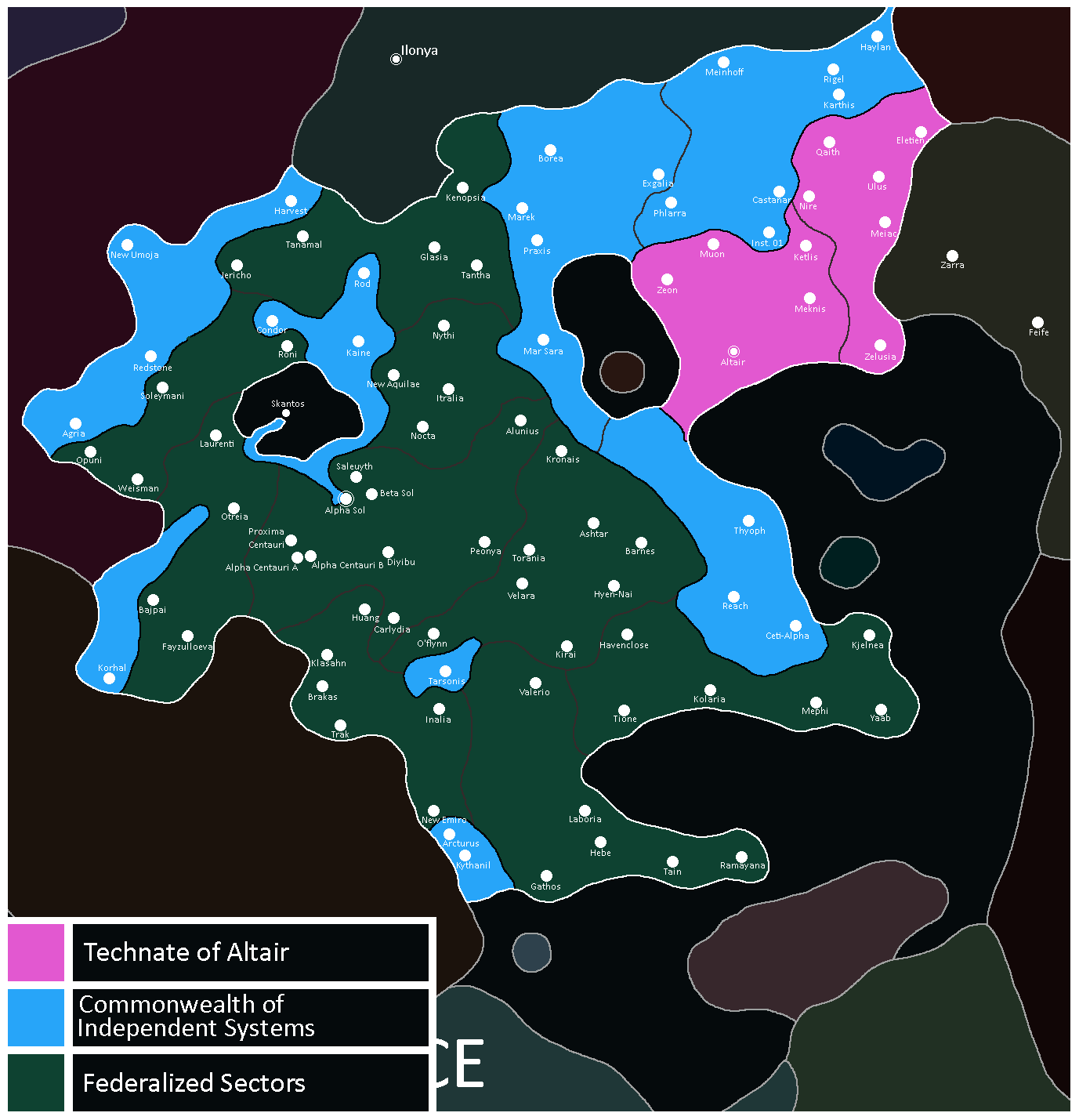
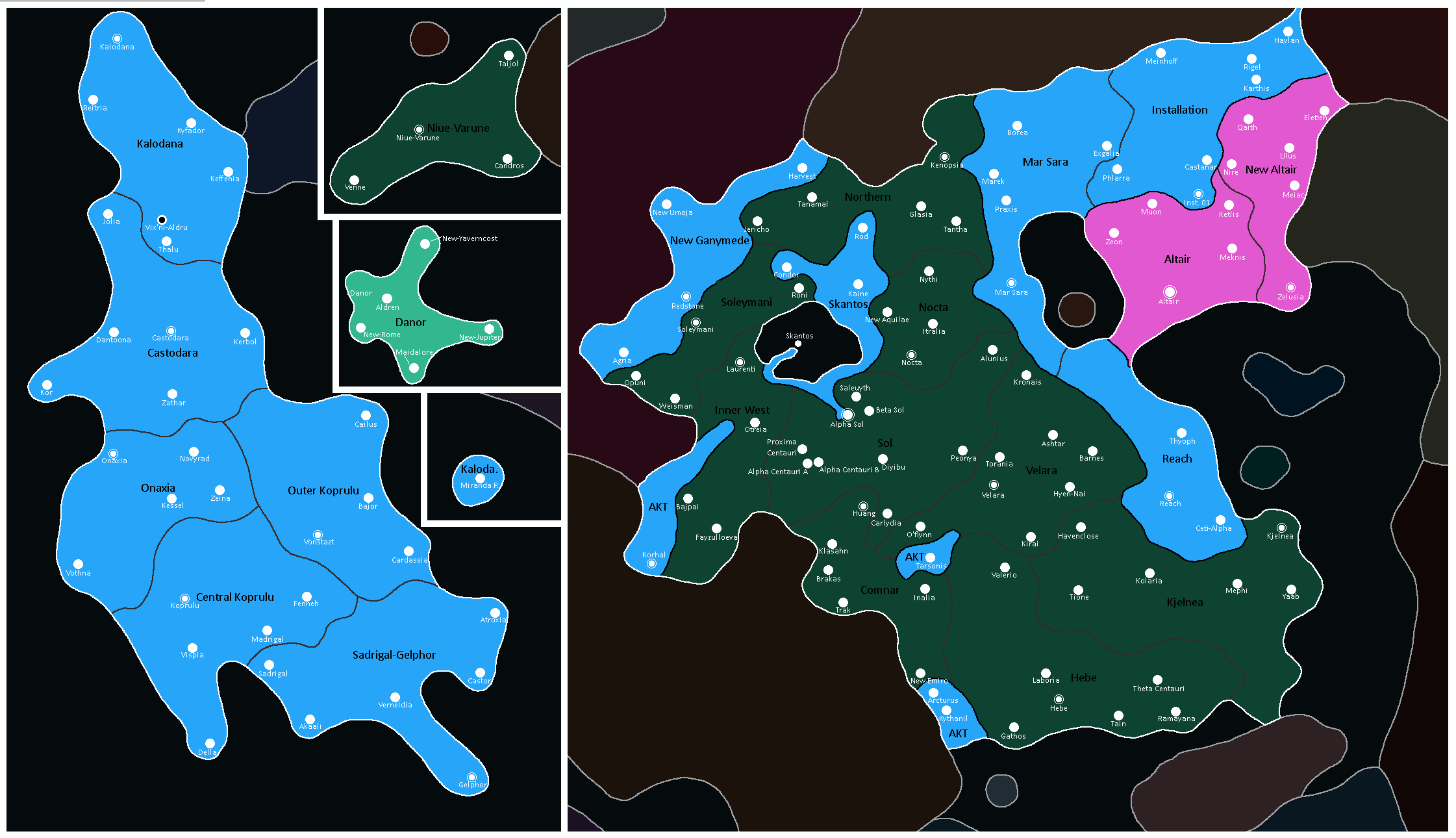
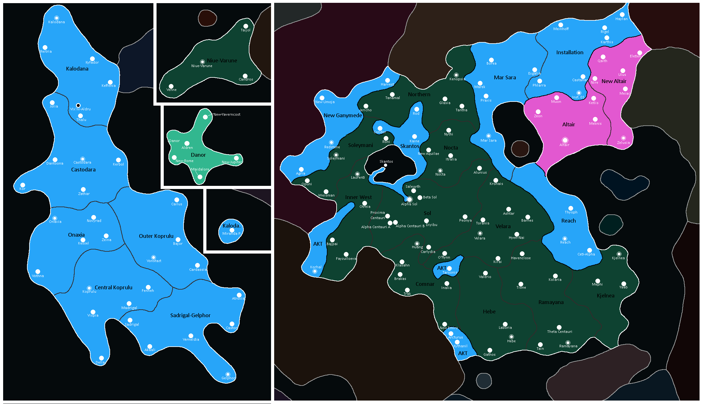
Map of the Accord: Year 370
-
Map of the Accord: Year 496
-
Map of the Accord: Year 515
-
Map of the Accord: Year 516
-
Map of the Accord: Year 520
-
Map of the Accord: Year 523
-
Map of the Accord: Year 526
-
Map of the Accord: Year 527
-
Map of the Accord: Year 550


Accord Planetary Governments
-
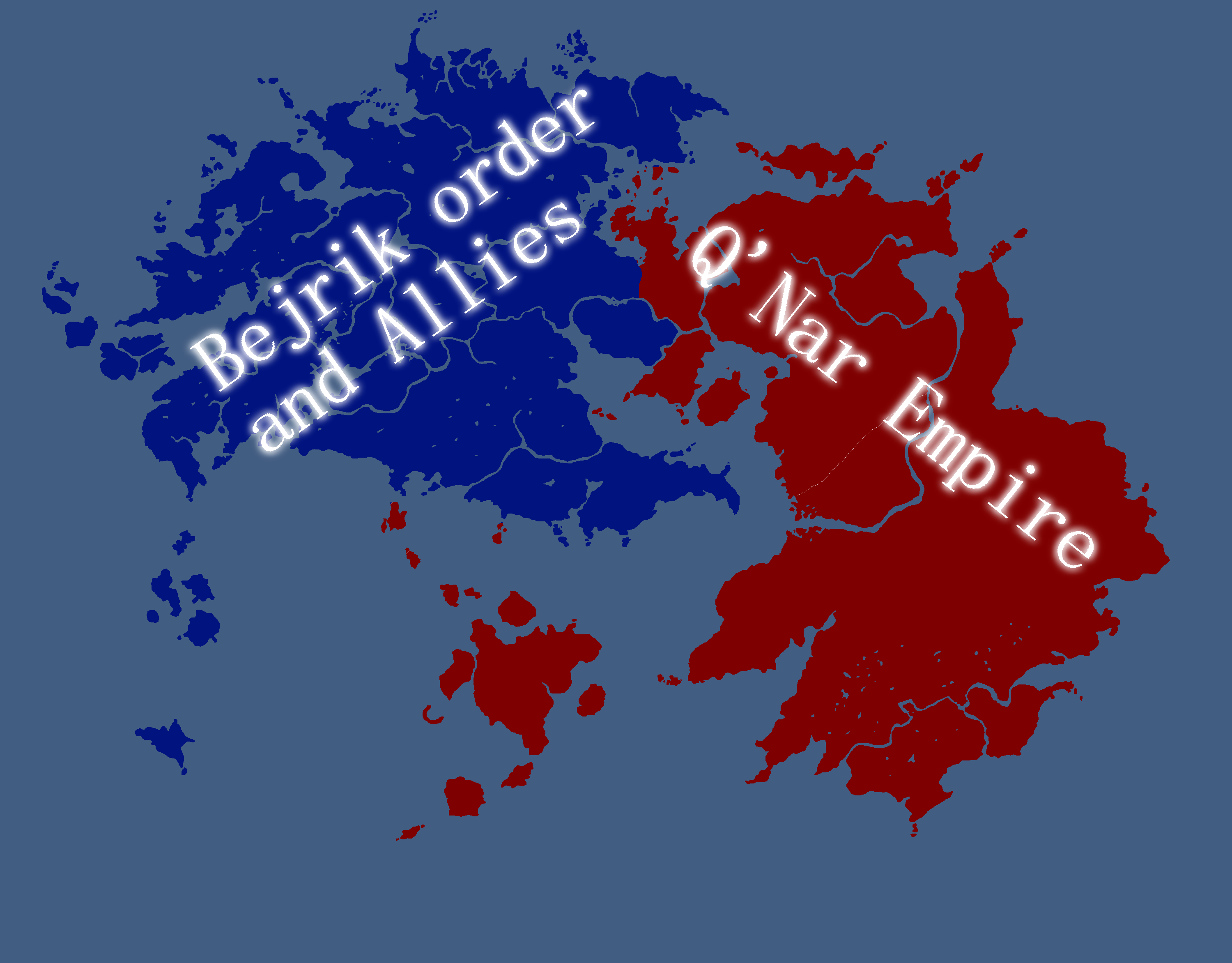
Map of the Bejrik Order of Doluro
-
Map of the Third Martian Republic
-
Map of the Plurinational Union of Theia
-

Map of the Confederation of Yata


Yatan-Theian Federation Maps
![Map of Yata[33]](/yatawiki/index.php/File:Yatafedmap.png)
![Map of Theia[34]](/yatawiki/index.php/File:Theianfedmap.png)

Yetian Maps
-
Lost Archives Map: Yetia 1
-
Lost Archives Map: Yetia 2
-
Lost Archives Map: Yetia 3
-
Lost Archives Map: Yetia 4
-
Lost Archives Map: Yetia 5
-
Yetian Provinces: Spring 2019
-
Yetian Provinces
-
Map of where The Newtown Project was developed
-
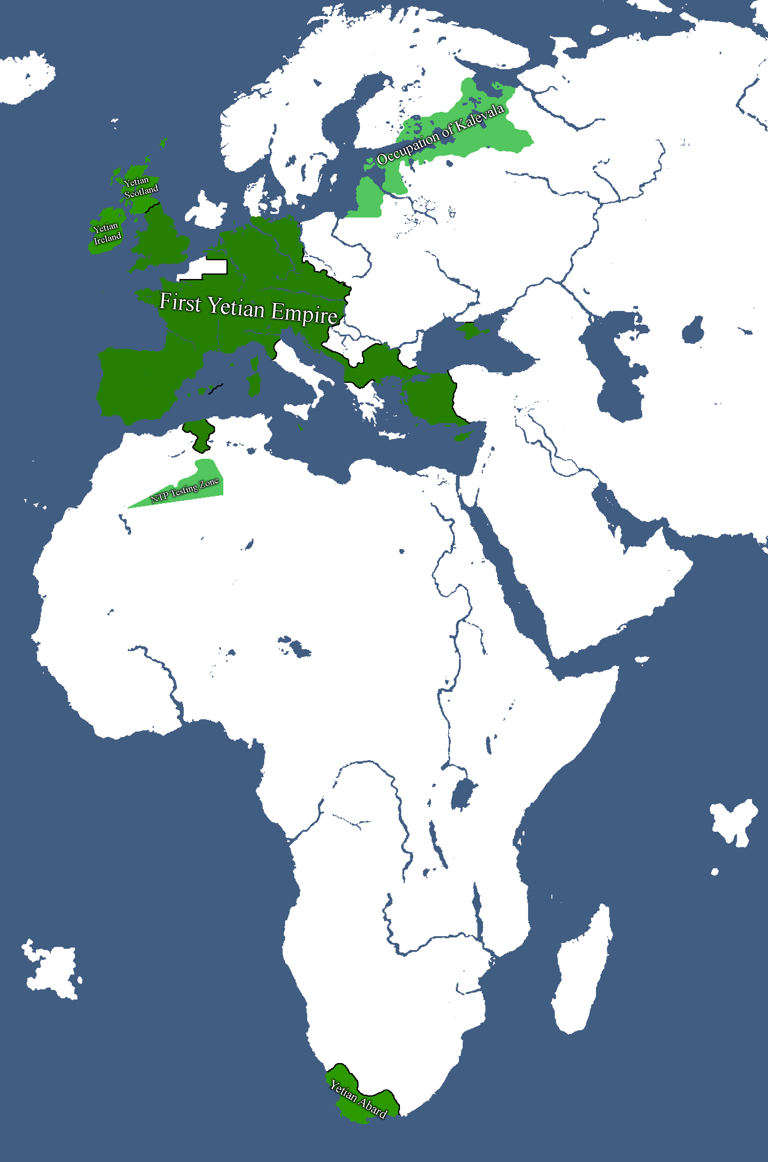
Map of the First Yetian Empire
-
Map of which country captured what in yetia during WW5
-
Yetian Provinces: Year 90
-
Yetian Provinces: Year 108
-
Yetian Languages: Year 112
-
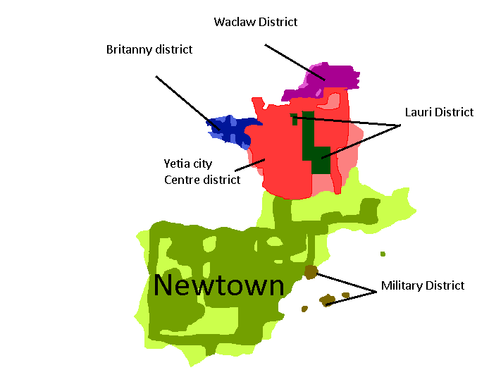
Districts of Yetia City: Year 114
-
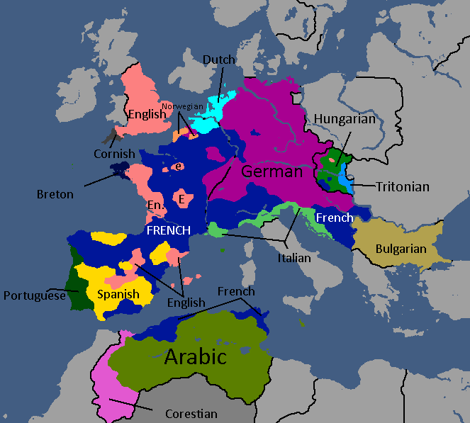
Yetian Languages: Year 115
-
Yetian Provinces: Year 119 (Countryballs)
-
Yetian Provinces: Year 119
-
Yetian Provinces: Year 119 (Nameless)
-
All territories ever ruled by Yetia: Year 121
-
Governorates of the Yetian State: Year 122
-
Hypothetical Partitioned Yetia: Year 122
-
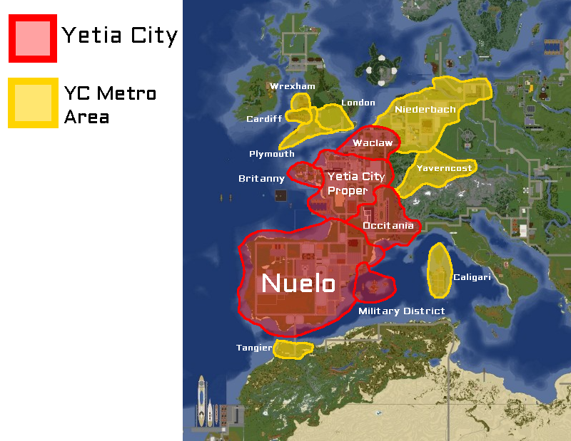
Boroughs of Greater Yetia City: Year 225
-
Map of the Yetian Old Metro: Year 225
-
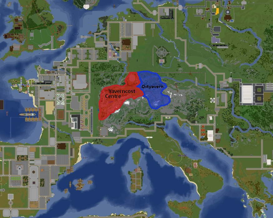
Map of Yaverncost: Year 237
-
Yetian Federal Provinces: Year 362
-
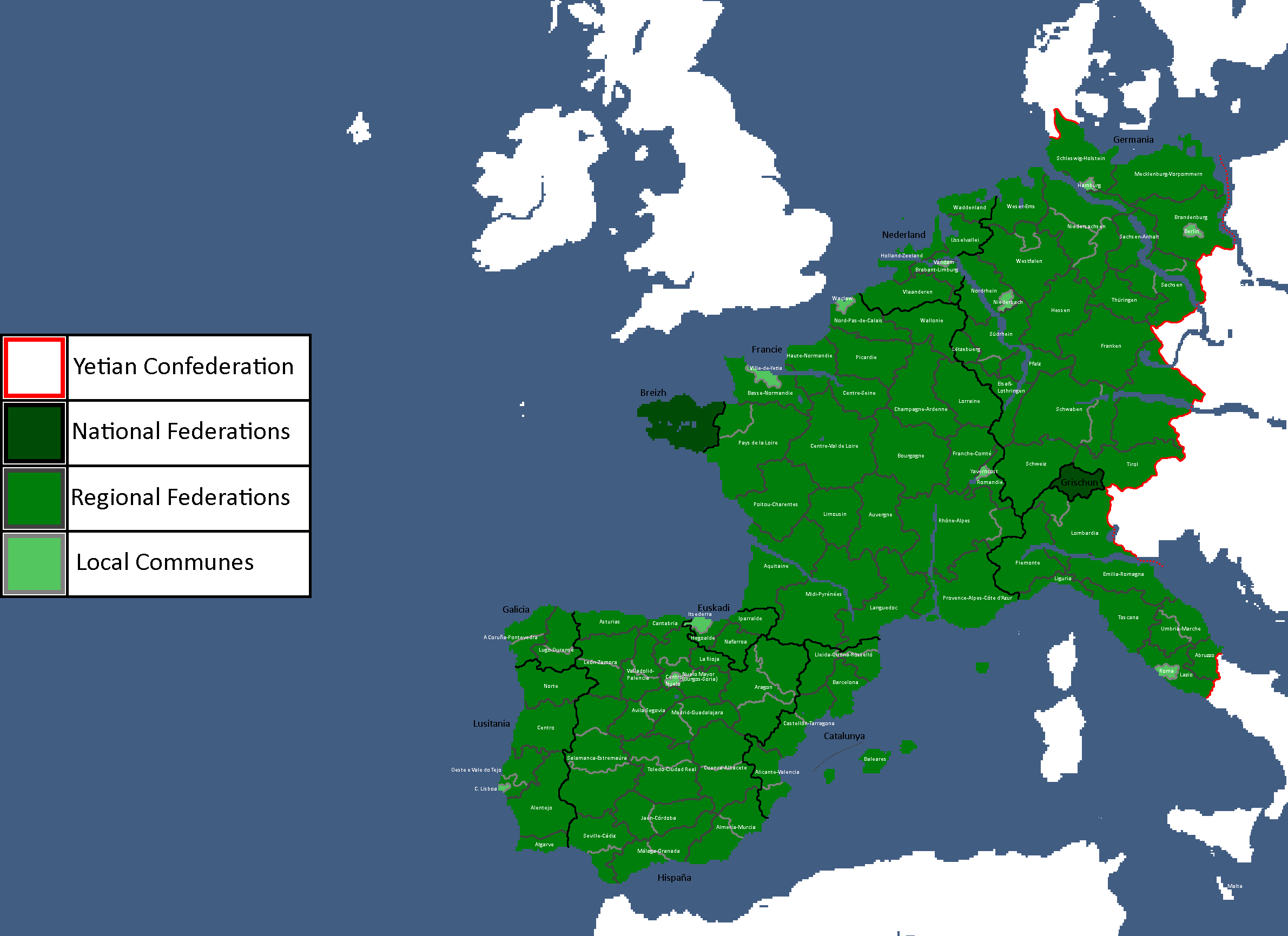
Communes/Federations of the Yetian Confederation: Year 428


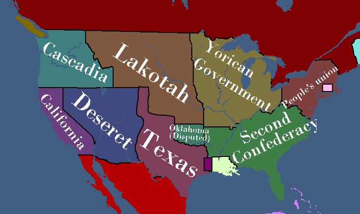
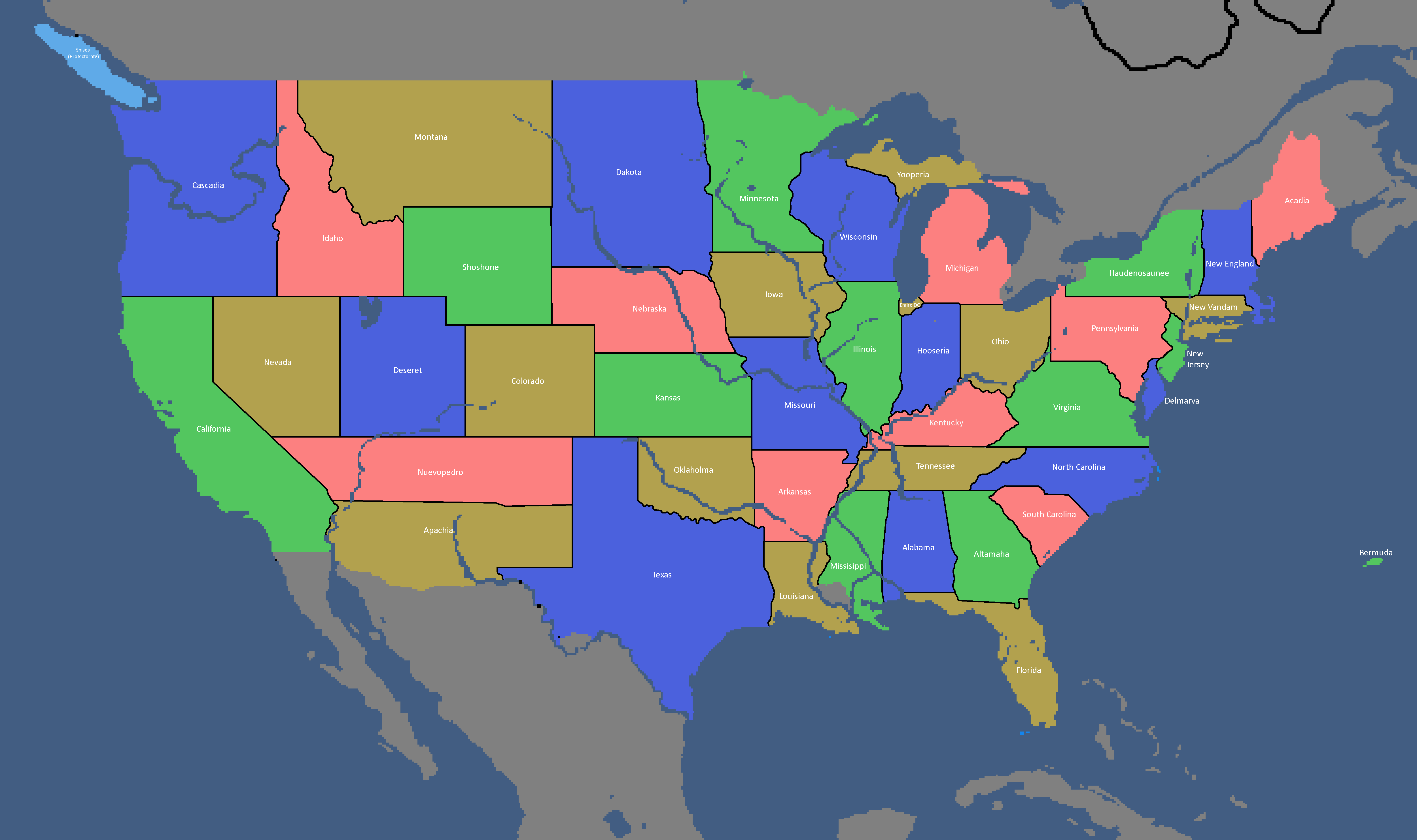
Yorican Maps
-
Yorican States: Year 117
-
Yorica Overlay: Year 117
-
Proposed Yorican Partition Map: Year 158
-
Year 379


Infrastructure Maps
-
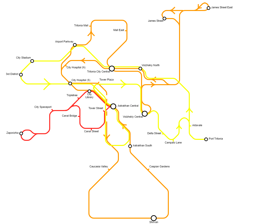
Tritonia Domestic Railways: Year 124
-
Tritonia Domestic Railways: Year 124
-
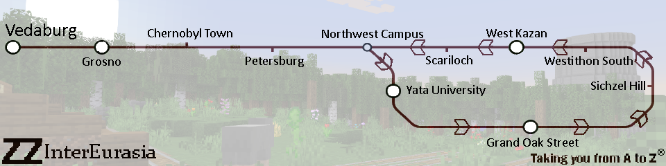
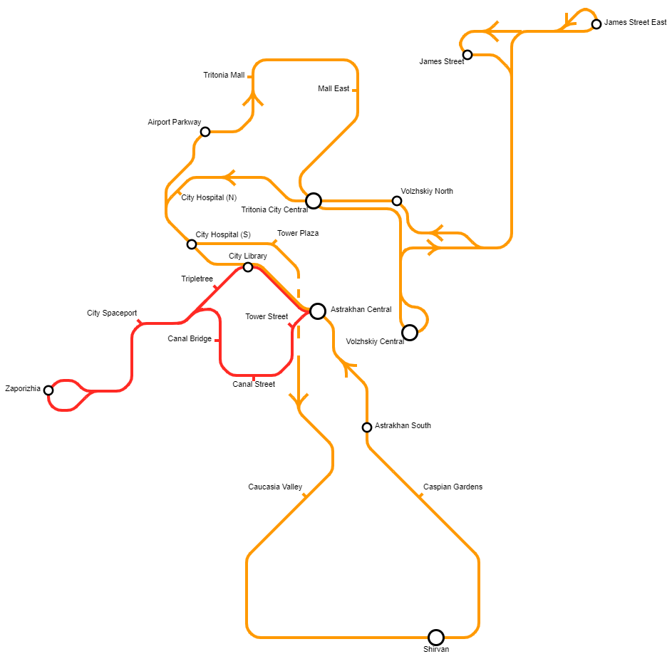
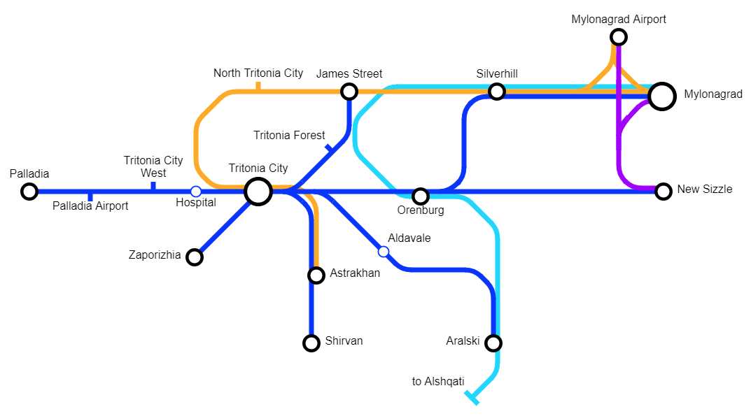
Tritonia Connect: Year 124
-
Tritonia Railways: Year 126
-
Tritonia Railways: Year 131
-
Motorway Map: Year 135
-
Tritonia Railways: Year 140
-
Tritonia Railways: Year 141
-
Iujadogia Railways: Year 141
-
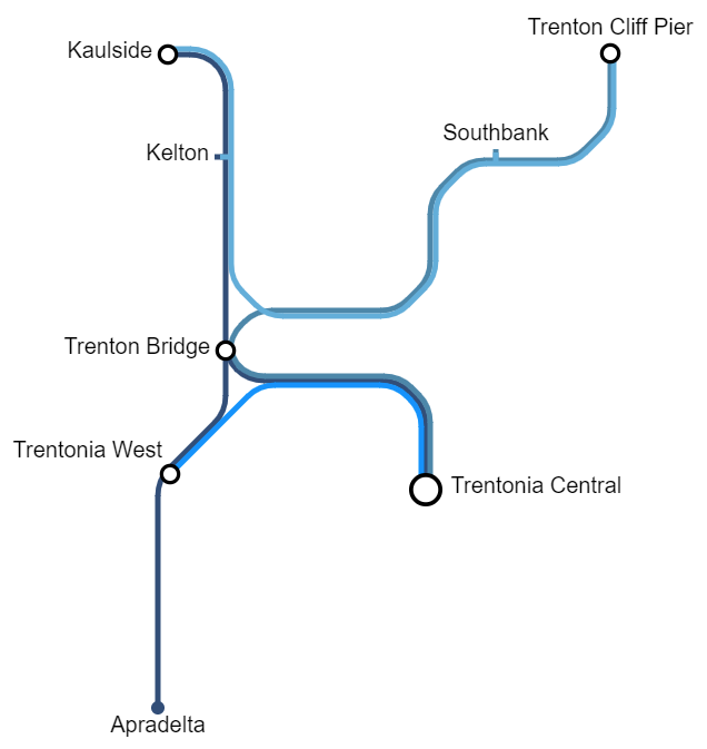
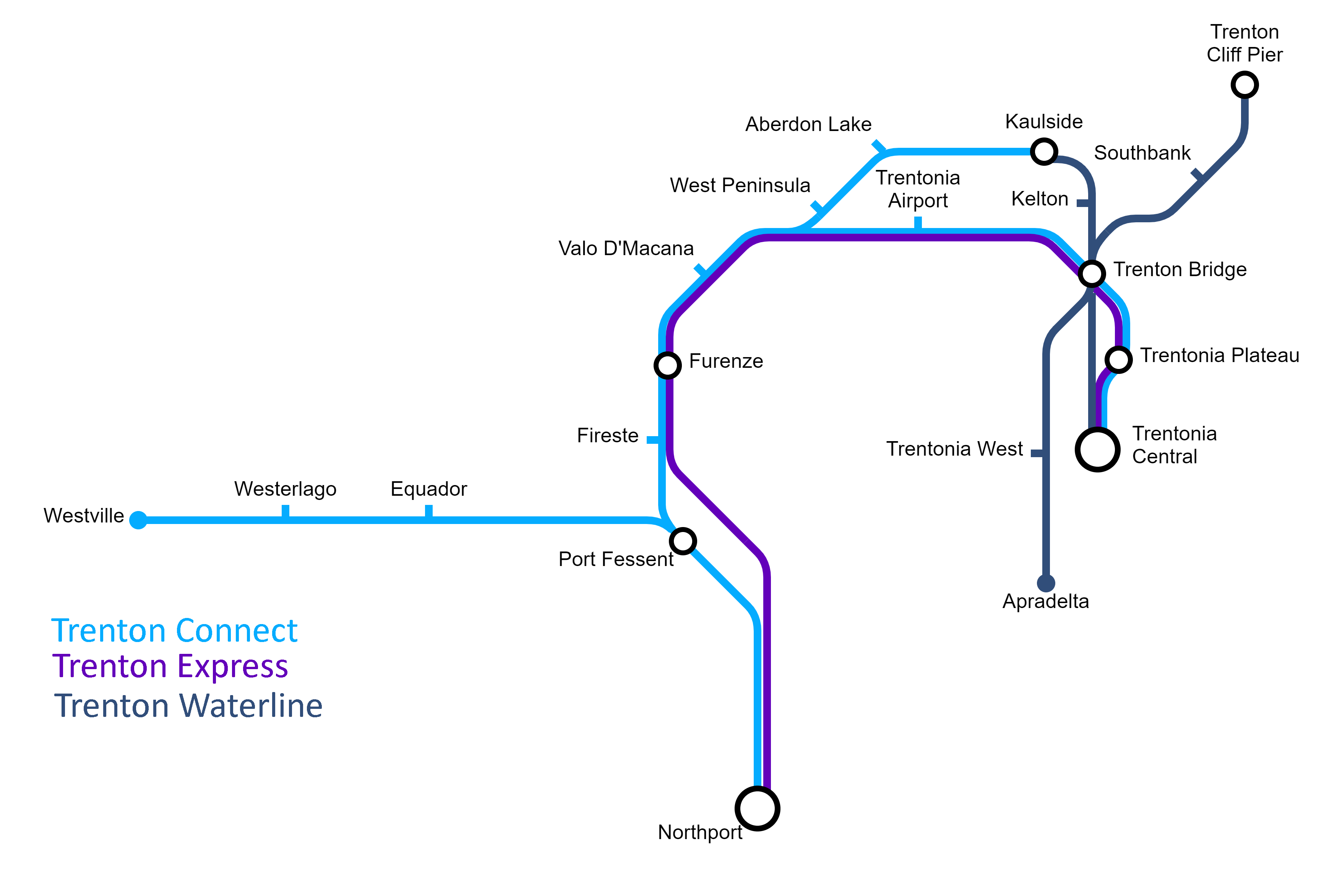
Trenton Waterline: Year 141
-
Theia Railways: Year 142
-
Ellaria Railways: Year 147
-
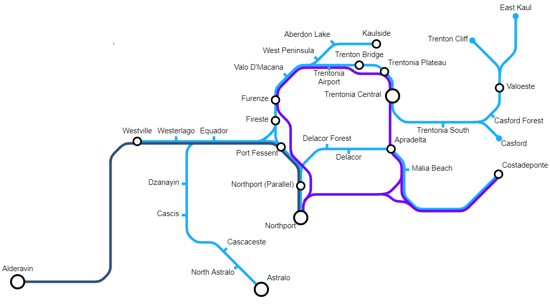
Macana Railways: Year 147
-
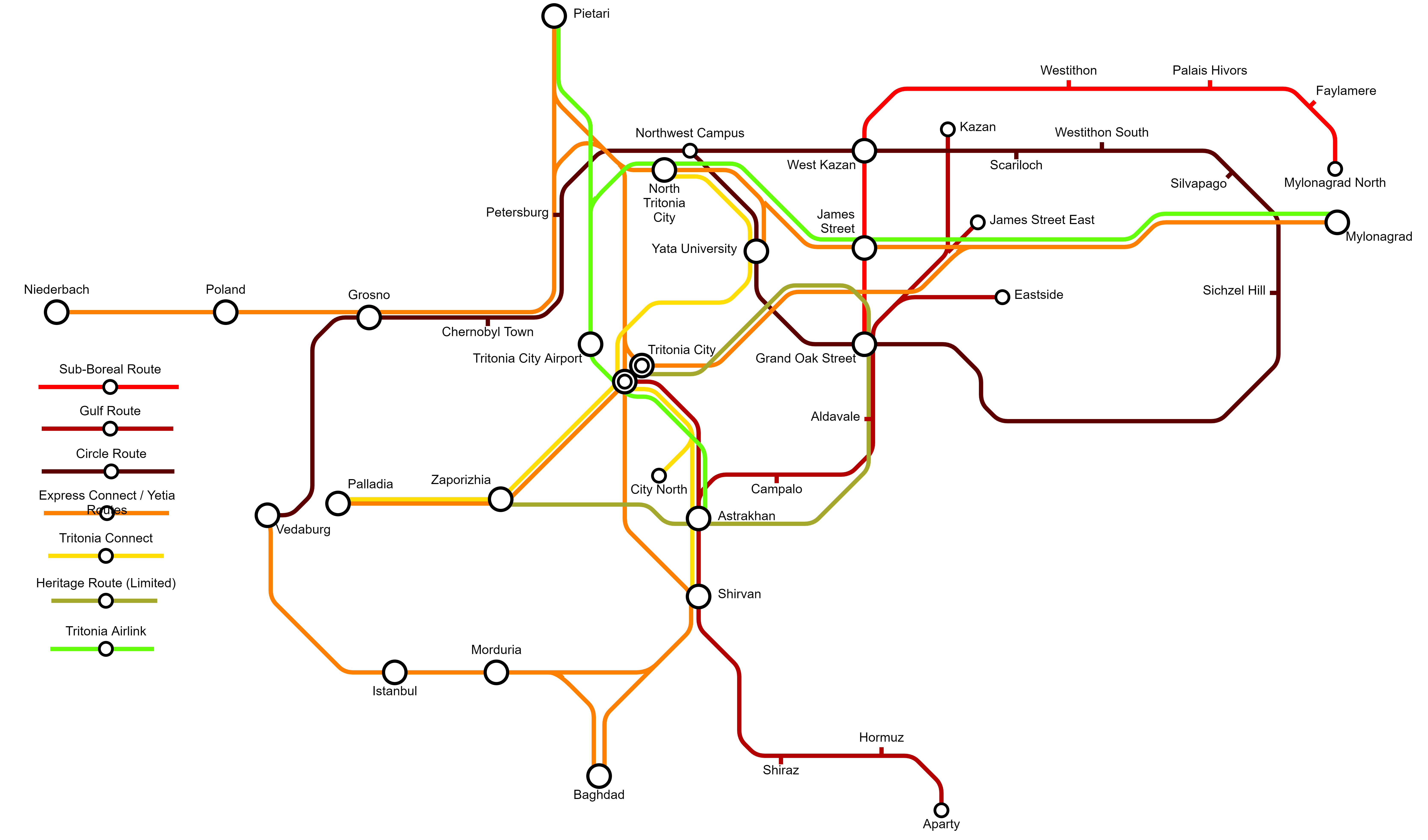
Yata Railways: Year 149
-
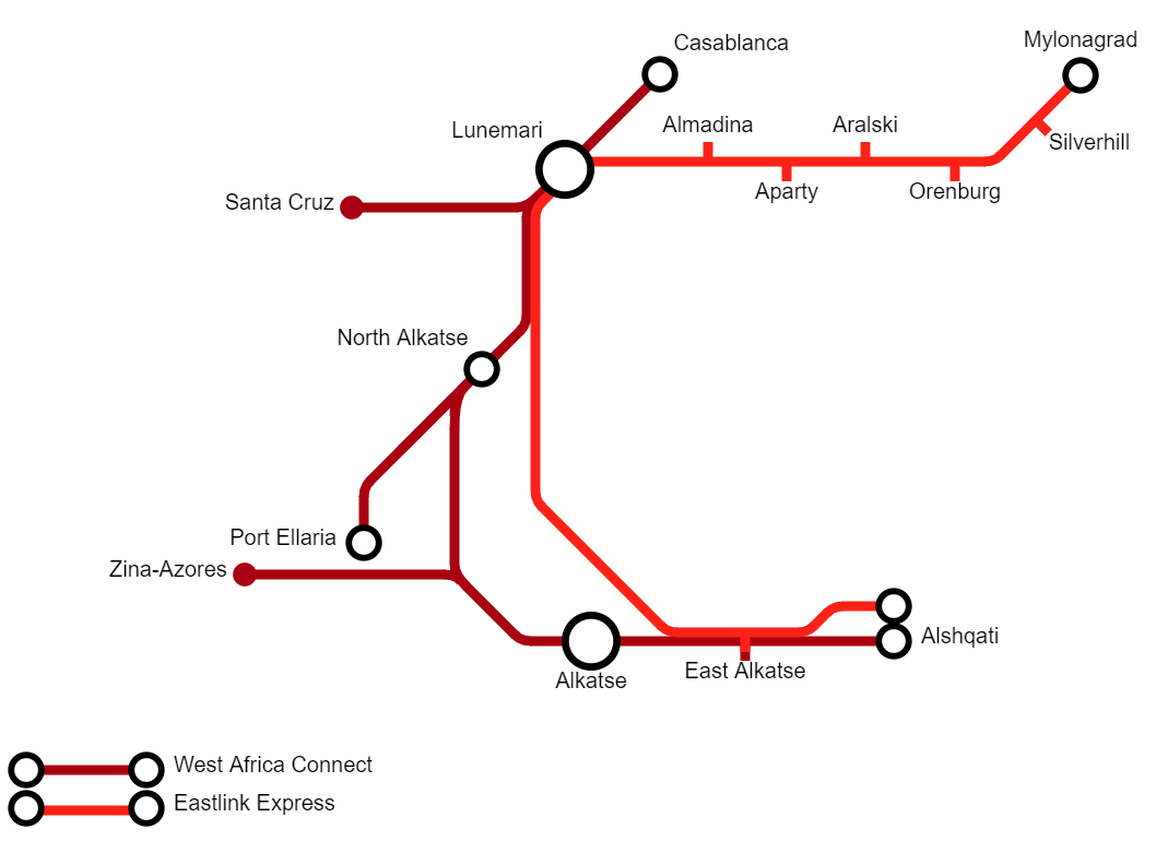
West Africa & Eastlink: Year 150
-
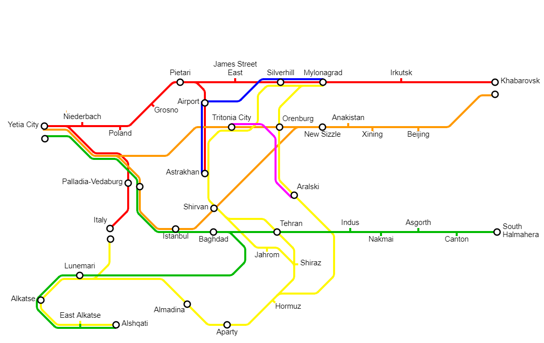
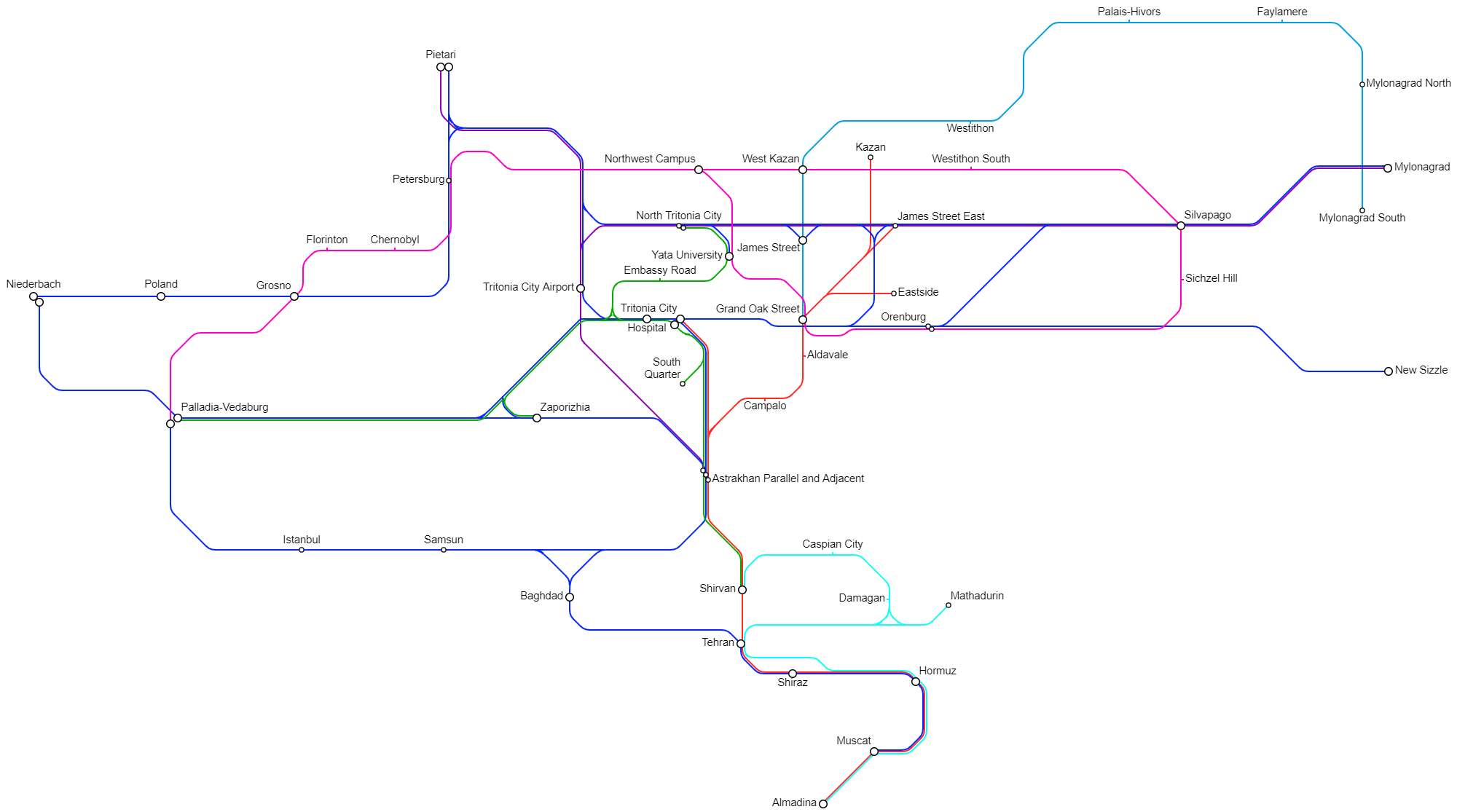
Yata Railways: Year 150
-
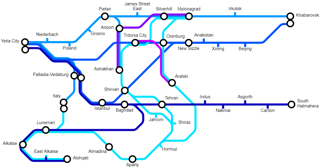
Yata Railways: Year 150
-
Theia Railways: Year 151
-
Tritonia Railways: Year 152
-
Theia Railways: Year 154
-
Theia Railways: Year 154
-
Theia Railways: Year 160
-
Theia Railways: Year 160
-
Deshret Railways: Year 181
-
Theia Railways: Year 182
-
Yata Railways: Year 185
-
Tritonia Railways: Year 185
-
Yata Railways: Year 185
-
Mylonagrad Railways: Year 186
-
West Eurasia Railways: Year 189
-
Theia Railways: Year 197
-
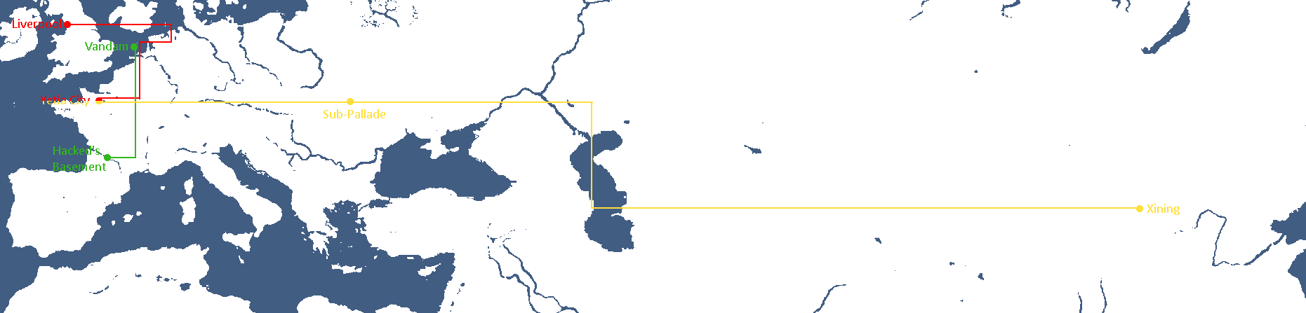
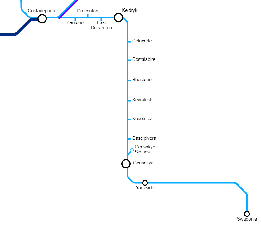
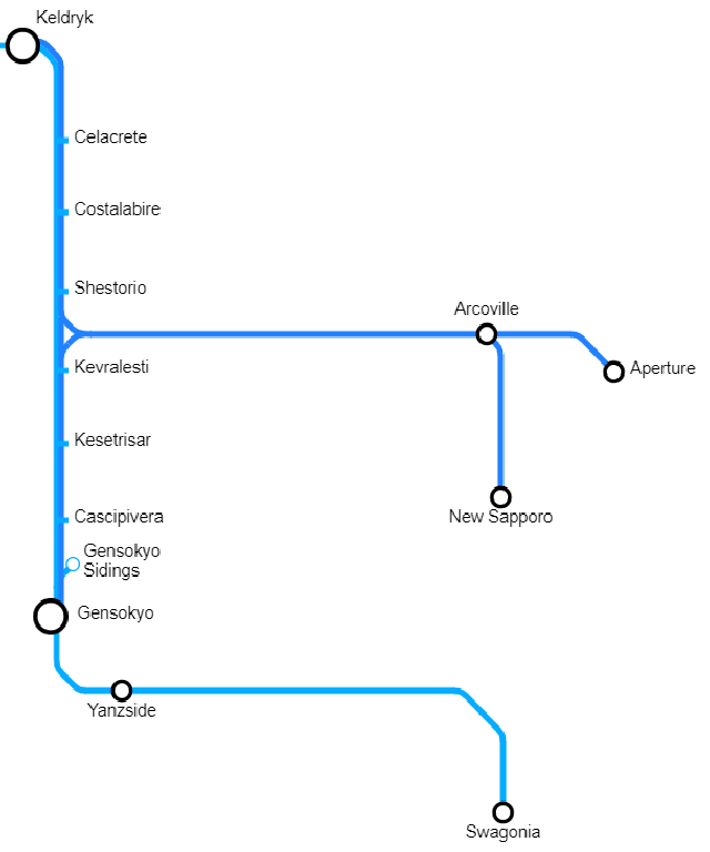
Yetian Routes: Year 200
-
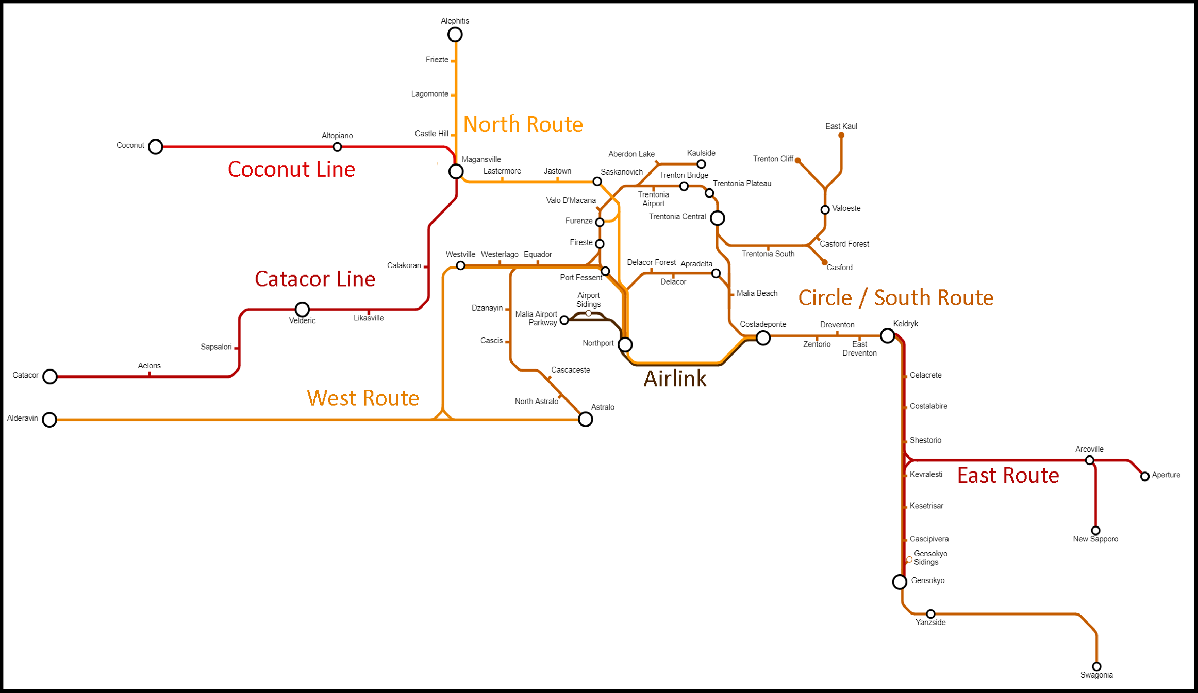
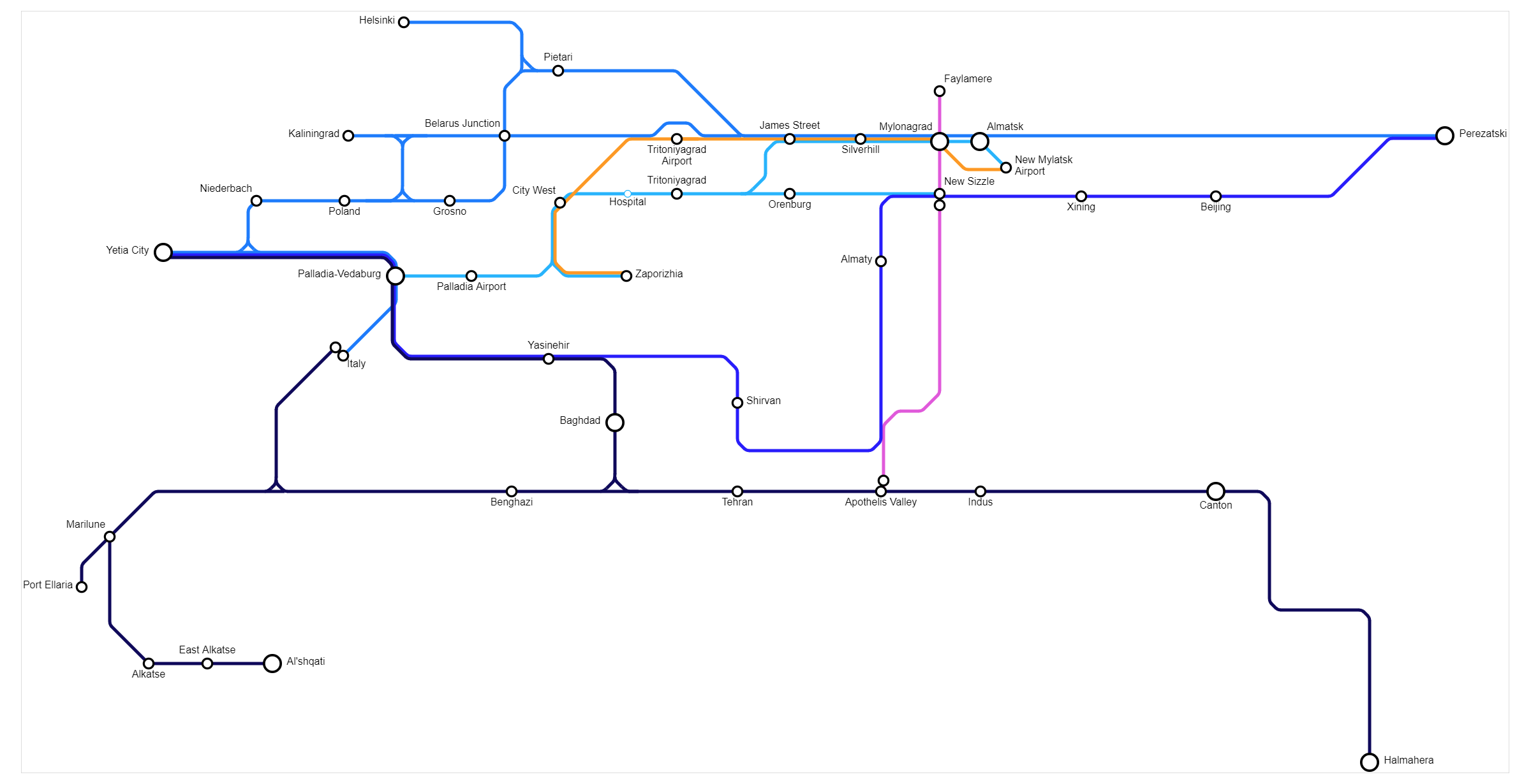
Alsavaeid Routes: Year 519
-
Alsavaeid Routes: Year 519
-
Theian Railways: Year 532


Other Maps
-
Map of the Alyphia Current
-
Neighbourhoods of New Mylatsk
-
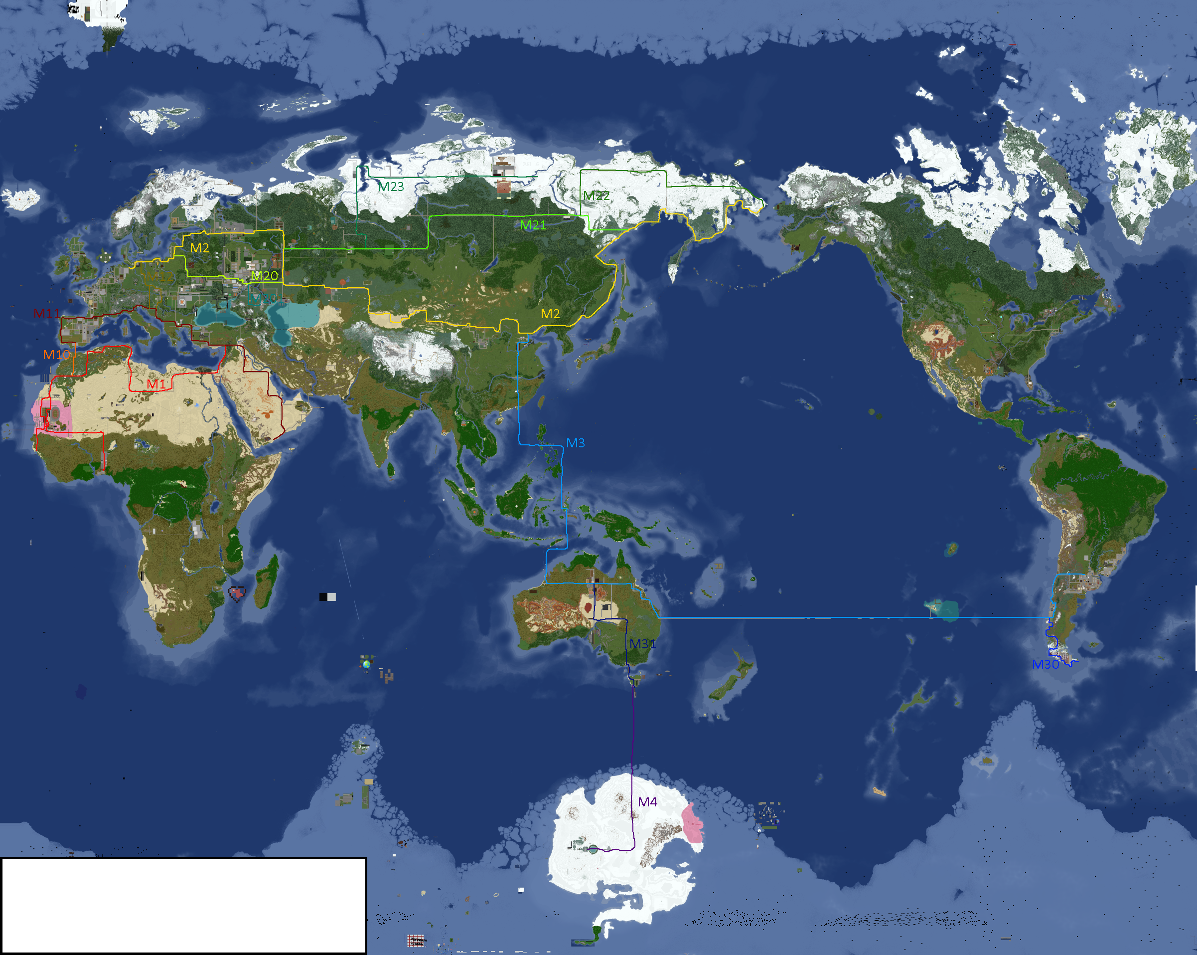
Player Locations
-
Player Locations
-
Fairé (non-canon)
-
Districts of Greater Tritoniyagrad
-
-


Art
| |
|---|---|
- ↑ red: NOT DEMOCRATIC, yellow: idfk in the middle, green: DEMOCRATIC :)
- ↑ 🔴 - Absolute Monarchy, 🟠 - Semi-Constitutional Monarchy, 🟡 - Constitutional Monarchy, 🔵 - Republic
- ↑ Dark Blue: Orthodox Christianity (Including Eastern Orthodoxy), Blue: Catholic Christianity, Light Blue: Protestant Christianity, Dark Green: Shi'a Island, Normal Green: Sunni Islam, Light Green: Ibadi Islam, Purple: Judaism, Yellow: Buddhism, Orange: Hinduism, Brown: Folk Religions, Gray: State Atheist
- ↑ ⚫ - Doesn't have nuclear weapons, 🔴 - Formerly had nuclear weapons (Weapons disarmed or otherwise destroyed), 🟡 - Nuclear weapons owned by other nations stationed there, ⚪ - Has nuclear weapons
- ↑ Darkest = ESC/RCC Member, Middle = Associated State (formally allied to some degree), Lightest = Pro-ESC/RCC
- ↑ 🔴 - Superpower, 🟠 - Great Power, 🟡 - Major Power, 🟢 - Middle Power, 🔵 - Regional Power, 🟣 - Minor Power
- ↑ green = good, red = bad
- ↑ 🟢 - Democracy, 🟡 - Somewhere kinda in the middle, 🔴 - Dictatorship
- ↑ 🔴 - State-Run, 🟠 - Mixed Economy (all variants), 🟡 - Private-Run
- ↑ 🔵 - Unifists / Confederacy-aligned (generally Globalist Democrats), 🟢 - Anti-Globalists / EAF-aligned & Brasil-aligned (generally Left-Wing Nationalists), 🟣 - East Asian Sphere / MingukYakamoto-aligned (generally Right-Wing Corporatist), 🔴 - TOCO / Yorica-aligned (generally Liberal Hawks)
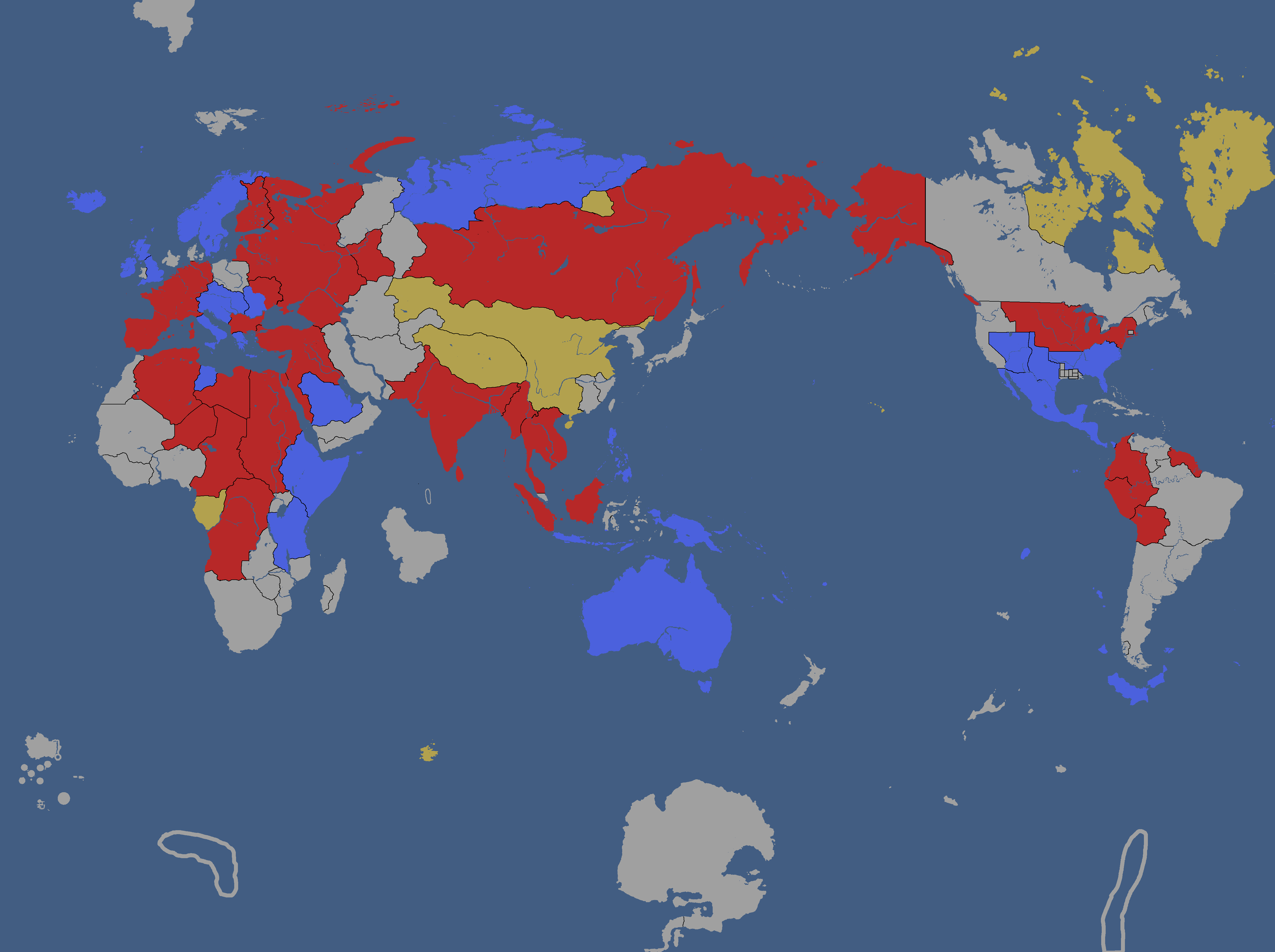
- ↑ 🔴 - Socialist Bloc (Including Socialist Assembly), 🔵 - Nationalist/Anti-Socialist Bloc (Including Intermarium, Thailand's Anti-Sizhou Pact, Brasil-Guarania-CIS Pact), 🟣 - Union of European Republics, 🟡 - Union of West African States
- ↑ Authoritarian Regime: A repressive regime headed by one singular dictator, though may include some other influential figures. Hybrid Regime: Combination of both Authoritarian and Democratic elements, although largely leans towards Authoritarianism. Closed Democracy: Democracy, but voting only available for a closed group of people (of whatever size). Flawed Democracy: Democracy with elections, although it has questionable validity and/or censorship of somekind. Democracy: Full Democracy with free and fair elections.
- ↑ 🟢 - They like the CIS, 🟡 - They're neutral towards it, don't have an opinion, or i wasn't sure, 🔴 - They dislike the CIS
- ↑ 🔴 - Socialist Bloc (Socialist Assembly & left-wing regimes), 🔵 - Anti-Socialist Bloc (Cairo Cooperation Pact, Intermarium, Brasil-Guarania-NovaPolska Pact, Union of West African States)
- ↑ 🔴 - Socialist Bloc (Socialist Assembly & left-wing regimes), 🔵 - Anti-Socialist Bloc (Cairo Cooperation Pact, Intermarium, Brasil-Guarania-NovaPolska Pact, Union of West African States)
- ↑ 🔴 - Socialist Bloc (Socialist Assembly & left-wing regimes), 🔵 - Anti-Socialist Bloc (Cairo Cooperation Pact, Intermarium, Brasil-Guarania-NovaPolska Pact, Union of West African States), 🟡 - Sizhou's Bloc (Technocratic Socialist and Sympathetic regimes)
- ↑ Authoritarian Regime: A repressive regime headed by one singular dictator, though may include some other influential figures. Hybrid Regime: Combination of both Authoritarian and Democratic elements, although largely leans towards Authoritarianism. Closed Democracy: Democracy, but voting only available for a closed group of people (of whatever size). Flawed Democracy: Democracy with elections, although it has questionable validity and/or censorship of somekind. Democracy: Full Democracy with free and fair elections.
- ↑ Darkest Colour = Directly member of an alliance part of the bloc, Middle Colour = aligned/associated with a bloc while not a member, Lightest colour, sympathetic towards a bloc. 🔵 - International Coalition against the Labour Collective of Sizhou (United Nations of Yata -led Coalition), 🔴 - Sizhou's Bloc (Technocratic Socialist and Sympathetic regimes)
- ↑ Darkest Colour = Directly member of an alliance part of the bloc, Middle Colour = aligned/associated with a bloc while not a member, Lightest colour, sympathetic towards a bloc. 🔴 - Socialist Bloc (Socialist Assembly & extreme left-wing regimes), 🔵 - Anti-Socialist Bloc (Cairo Cooperation Pact and other Anti-Socialist states), 🟣 - Initiative for Peace and Democracy (Initiative for Peace and Democracy, centrist & more moderate left-leaning regimes with a few exceptions.), 🟡 - Pan-Turkic Bloc (Alduria & its allies)
- ↑ Authoritarian Regime: A repressive regime headed by one singular dictator, though may include some other influential figures. Hybrid Regime: Combination of both Authoritarian and Democratic elements, although largely leans towards Authoritarianism. Closed Democracy: Democracy, but voting only available for a closed group of people (of whatever size). Flawed Democracy: Democracy with elections, although it has questionable validity and/or censorship of somekind. Democracy: Full Democracy with free and fair elections.
- ↑ Darkest Colour = Directly member of an alliance part of the bloc, Middle Colour = aligned/associated with a bloc while not a member, Lightest colour, sympathetic towards a bloc. 🔴 - Socialist Bloc (Socialist Assembly & far left-wing regimes) 🔵 - Anti-Socialist Bloc (Cairo Cooperation Pact and other Anti-Socialist states) 🟣 - Initiative for Peace and Democracy (Initiative for Peace and Democracy, centre-left & moderate left-wing regimes with a few exceptions.)
- ↑ Reinterpreted
- ↑ Reinterpreted
- ↑ red: NOT DEMOCRATIC, yellow: idfk in the middle, green: DEMOCRATIC :)
- ↑ 🔴 - Superpower, 🟠 - Great Power, 🟡 - Major Power, 🟢 - Middle Power, 🔵 - Regional Power, 🟣 - Minor Power
- ↑ 1 year before the Empire of Foarhinnea, the Goo Kingdom, and several other smaller interstellar states whom were founded by genetically engineered species created by the Kings were completely wiped out, leaving only a few scattered covert surviving "Space-Giraffes" - whom were previously the dominant species of Foarhinnea.
- ↑ red: NOT DEMOCRATIC, yellow: idfk in the middle, green: DEMOCRATIC :)
- ↑ (Eurasian/Tritonian/The Conf.)
- ↑ red: provinces, cannot be destroyed. green: territories, can be destroyed, cannot be split. blue: unorganized territories, can be split or destroyed
- ↑ The Slav-Romance culture group is a subdivision of both Slavic and Romance cultures. Distinct cultures part of the unique Slav-Romance group are: Tritonian, Drenemorian (alternatively Rusian), East Caspian, West Caspian, and Apartian. Note that Polish is sometimes compared to the group due to it's location and architecture. (I included it on the map because it extends into Tritonia border)
- ↑ Tritonia rule of succession: The throne always passes to the monarch's consort. If the consort is dead, pass to children. If no lineage can be found, trace to the nearest living family member and repeat. Any monarch can grant their consort monarchial status as a dual monarch.
- ↑ There's older versions but the map is so comically big it'd be laggy to have them all here so just go to the file page and go to its file history if you want them
- ↑ There's older versions but the map is so comically big it'd be laggy to have them all here so just go to the file page and go to its file history if you want them
- ↑ There's older versions but the map is so comically big it'd be laggy to have them all here so just go to the file page and go to its file history if you want them