List of Maps: Difference between revisions
m (Hakced moved page Maps to List of Maps) |
No edit summary |
||
| Line 1: | Line 1: | ||
{{Wip}}{{Tocright}} | {{Wip}}{{Tocright}} | ||
== | == International Maps == | ||
===Yatan Maps=== | ===Yatan Maps=== | ||
<gallery> | <gallery> | ||
File:yataoldmap1.png|Lost Archives Map: 1 | File:yataoldmap1.png|Lost Archives Map: 1 | ||
File:yataoldmap2.png|Lost Archives Map: 2 | File:yataoldmap2.png|Lost Archives Map: 2 | ||
| Line 11: | Line 10: | ||
File:yataoldmap6.png|Lost Archives Map: 6 | File:yataoldmap6.png|Lost Archives Map: 6 | ||
File:nukemap.png|Lost Archives: Nuclear Test Map | File:nukemap.png|Lost Archives: Nuclear Test Map | ||
file:kwimap.png|[[Kalevian War of Independence]] Map | |||
File:Tritonianworldnames.png|What Quatritonia calls the world | |||
File:europeculturemap.png|European Cultures: Year 103 | File:europeculturemap.png|European Cultures: Year 103 | ||
unlabled1.png|Unlabled | |||
southasiaoverlay.png|South Asia Overlay: Year 112 | |||
ownermap112.png|Nation Owners Map: Year 112 | |||
southasiaoverlay2.png|South Asia Overlay: Year 112 (2) | |||
communistmap.png|Communist Governments: Year 112 | |||
asiaoverlay.png|Asia Overlay: Year 113 | |||
worldpopulation.png|Population of Yata's Countries: Year 114 | |||
northcanadaoverlay.png|Northern Canada Overlay: Year 114 | |||
noclaims2162020.png|IRL Countries with no claims in them on YATA: Year 115 | |||
europedensity.png|Europe's Population Density: Year 115 | |||
yataifitwasgood.png|"Yata if it was good" meme: Year 116 | |||
</gallery> | </gallery> | ||
== National Maps == | == National Maps == | ||
===Anakistani Maps=== | |||
<gallery> | |||
anakistanprovinces.png|Anakistani Provinces & Regions: Year 112 | |||
</gallery> | |||
===English Maps=== | ===English Maps=== | ||
<gallery> | <gallery> | ||
| Line 22: | Line 38: | ||
File:goldariamapcb.png|Goldarian Federal States: Year 102 (Countryballs) | File:goldariamapcb.png|Goldarian Federal States: Year 102 (Countryballs) | ||
File:goldariamap.png|Goldarian Federal States: Year 102 | File:goldariamap.png|Goldarian Federal States: Year 102 | ||
</gallery> | |||
===Hayastani Maps=== | |||
<gallery> | |||
hayaslanguages.png|Languages of Hayas: Year 112 | |||
</gallery> | |||
===Humamboan Maps=== | |||
<gallery> | |||
humambocolonies.png|Homeland & Colonies of Humambo: Year 115 | |||
</gallery> | </gallery> | ||
===Islandian Maps=== | ===Islandian Maps=== | ||
| Line 30: | Line 54: | ||
===Linelandic Maps=== | ===Linelandic Maps=== | ||
<gallery> | <gallery> | ||
File:linelandfedsubj101.png|Linelandic Federal | File:linelandfedsubj101.png|Linelandic Federal Subjects: Year 101 | ||
linelandlanguages.png|Linelandic Languages: Year 112 | |||
ulsr republics.png|Member-Republics of the [[Union of Linelandic Socialist Republics]]: Year 112 | |||
ulsr republics 2.png|Member-Republics of the [[Union of Linelandic Socialist Republics]]: Year 113 | |||
</gallery> | |||
===Nakamaian Maps=== | |||
<gallery> | |||
nakmailanguages.png|Languages of Nakmai: Year 112 | |||
</gallery> | </gallery> | ||
===Old Osanian Maps=== | ===Old Osanian Maps=== | ||
| Line 39: | Line 70: | ||
<gallery> | <gallery> | ||
File:poavaksubdivs.png|Poavakian Subdivisions: Year 96 | File:poavaksubdivs.png|Poavakian Subdivisions: Year 96 | ||
</gallery> | |||
===Sarpistani Maps=== | |||
<gallery> | |||
sarpistanlanguages.png|Languages of Sarpistan: Year 114 | |||
sarpistanjeriyaprovinces.png|Provinces of Sarpistan and Jeriya (Protectorate): Year 115 | |||
</gallery> | </gallery> | ||
===Tritonian Maps=== | ===Tritonian Maps=== | ||
| Line 48: | Line 84: | ||
File:tritoniaregion101.png|Tritonian Regions: Year 101 | File:tritoniaregion101.png|Tritonian Regions: Year 101 | ||
File:tritoniarailway.png|Tritonian Railways: Year 106 | File:tritoniarailway.png|Tritonian Railways: Year 106 | ||
uqsr.png|Member-Republics of the Union of Quatritonian Socialist Republics: Year 114 | |||
quatritonialanguages.png|Languages of Quatritonia: Year 115 | |||
</gallery> | |||
===Utsongan Maps=== | |||
<gallery> | |||
utsonglanguages.png|Languages of Utsong: Year 114 | |||
utsongpopulation.png|Utsong's Population Distribution: Year 114 | |||
</gallery> | </gallery> | ||
===Vedan Maps=== | ===Vedan Maps=== | ||
| Line 55: | Line 98: | ||
===Yetian Maps=== | ===Yetian Maps=== | ||
<gallery> | <gallery> | ||
File:Yetiala1.png|Lost Archives Map: Yetia 1 | File:Yetiala1.png|Lost Archives Map: Yetia 1 | ||
File:Yetiala2.png|Lost Archives Map: Yetia 2 | File:Yetiala2.png|Lost Archives Map: Yetia 2 | ||
| Line 62: | Line 103: | ||
File:Yetiala4.png|Lost Archives Map: Yetia 4 | File:Yetiala4.png|Lost Archives Map: Yetia 4 | ||
File:Yetiala5.png|Lost Archives Map: Yetia 5 | File:Yetiala5.png|Lost Archives Map: Yetia 5 | ||
File:Ww5occupation.png|Map of which country captured what in yetia during WW5 | |||
File:Yetiaprovinces2.png|Yetian Provinces: Year 90 | |||
File:yetianprovinces108.png|Yetian Provinces: Year 108 | |||
yetianlanguages.png|Yetian Languages: Year 112 | |||
yetiacitydistricts.png|Districts of Yetia City: Year 114 | |||
yetialanguages2.png|Yetian Languages: Year 115 | |||
</gallery> | </gallery> | ||
[[Category:Maps]] | [[Category:Maps]] | ||
[[Category:Lore]] | [[Category:Lore]] | ||
[[Category:Countries]] | [[Category:Countries]] | ||
Revision as of 11:12, 23 April 2025

Work in Progress pages are pages that haven't been finished yet, leaving them with only spare and incomplete content. Please help by completing it!
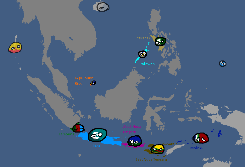
International Maps
Yatan Maps
-
Lost Archives Map: 1
-
Lost Archives Map: 2
-
Lost Archives Map: 3
-
Lost Archives Map: 4
-
Lost Archives Map: 5
-
Lost Archives Map: 6
-
Lost Archives: Nuclear Test Map
-
-
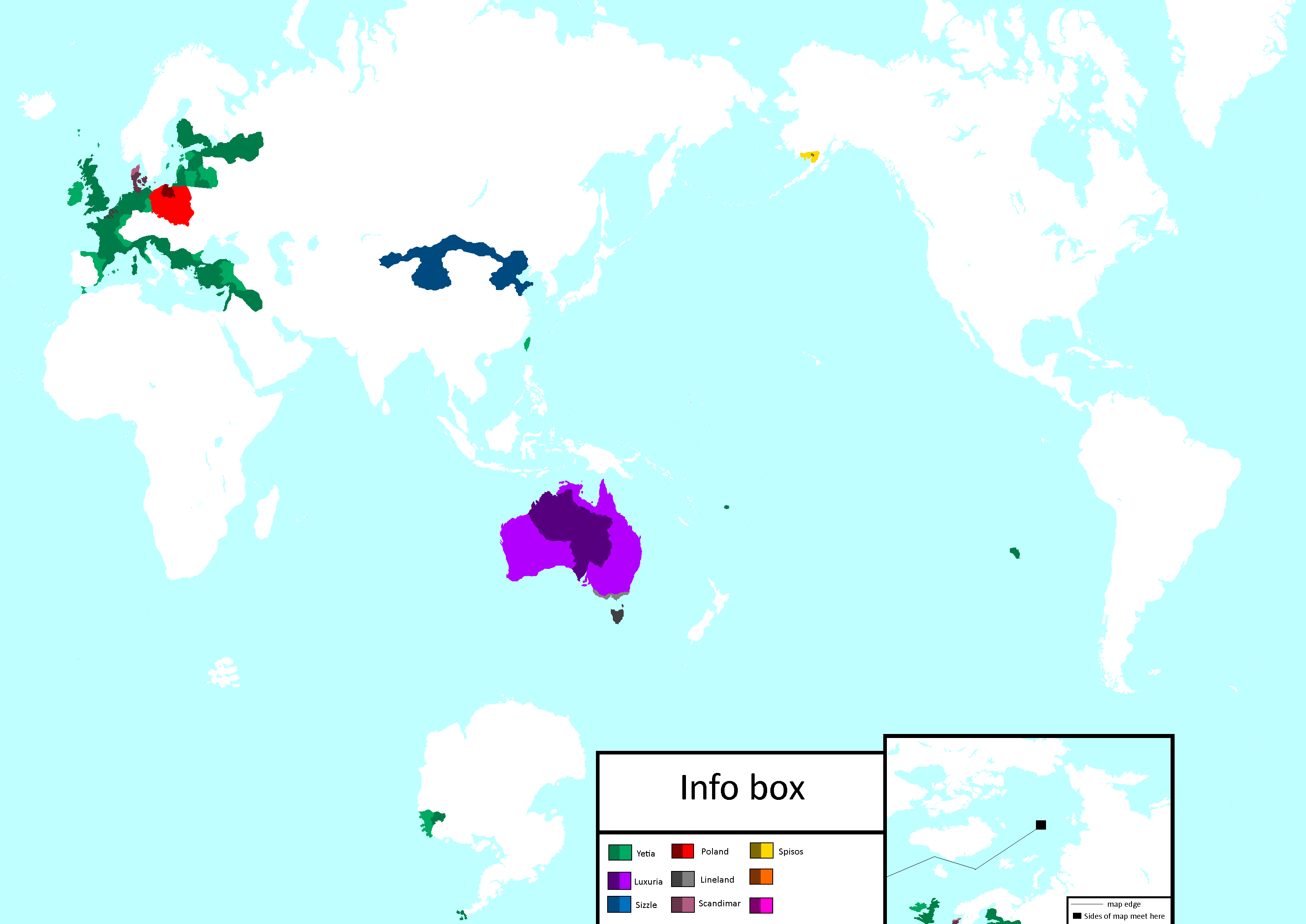
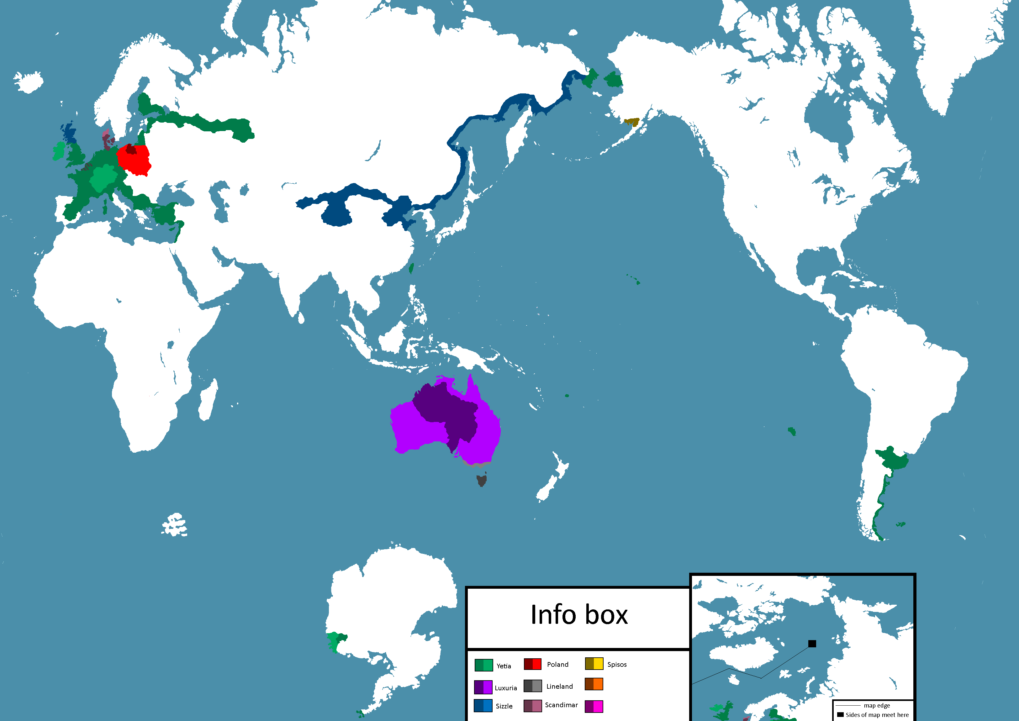
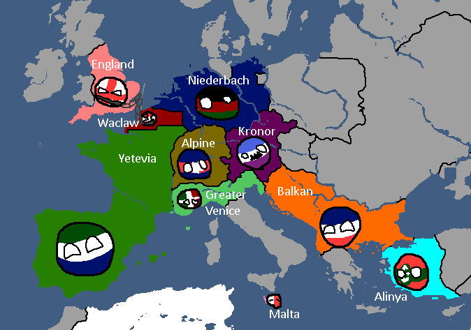
What Quatritonia calls the world
-
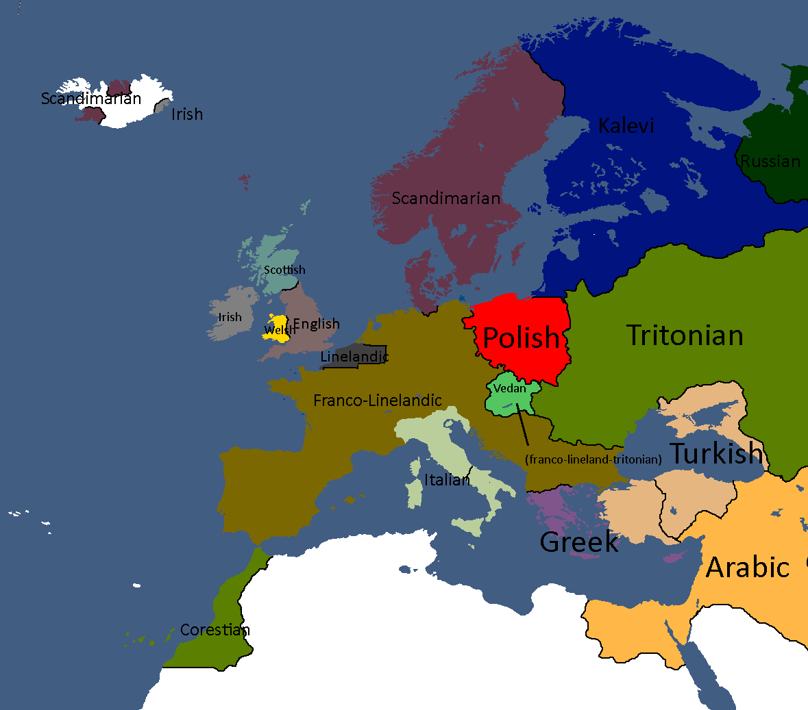
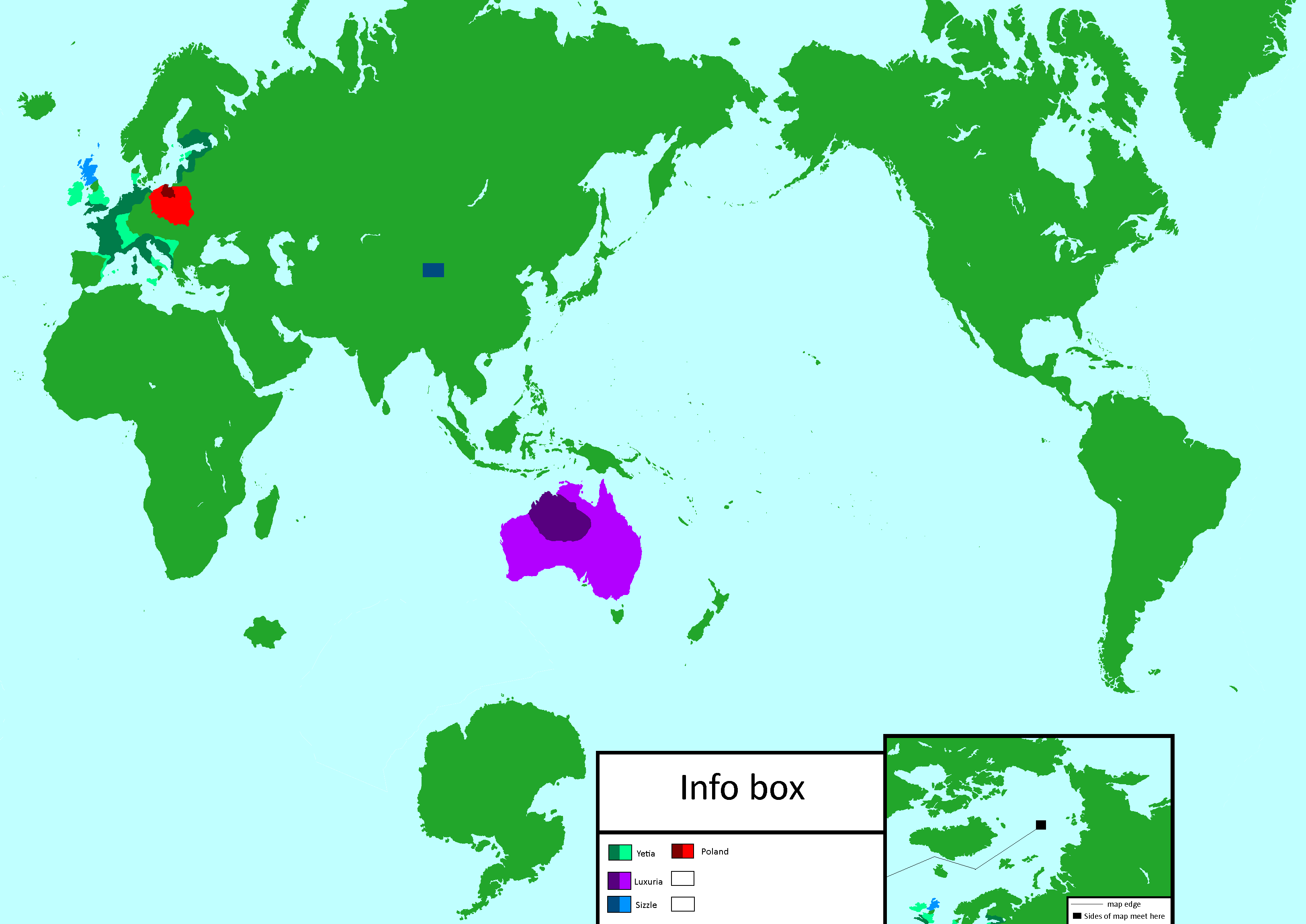
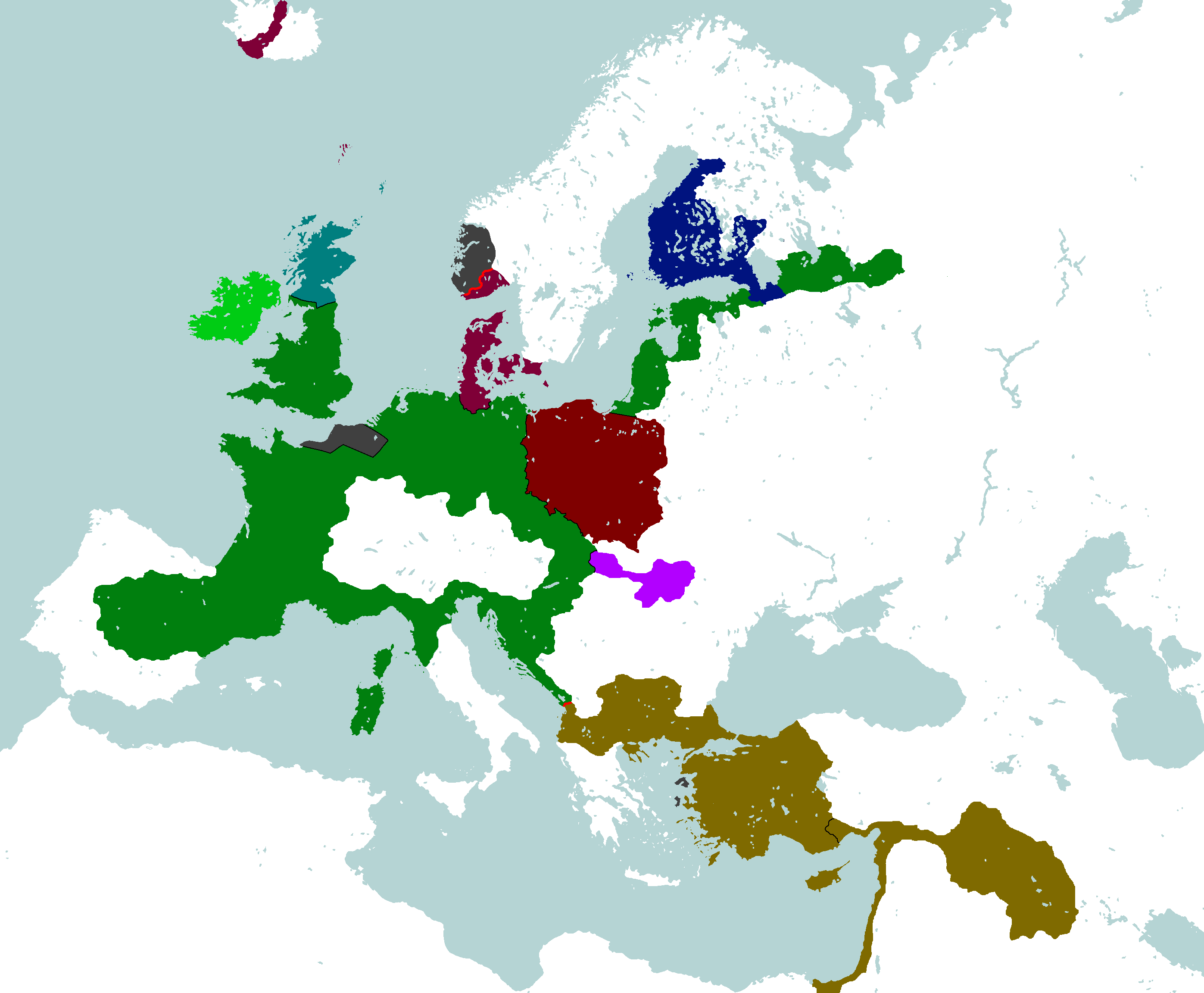
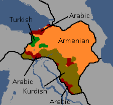
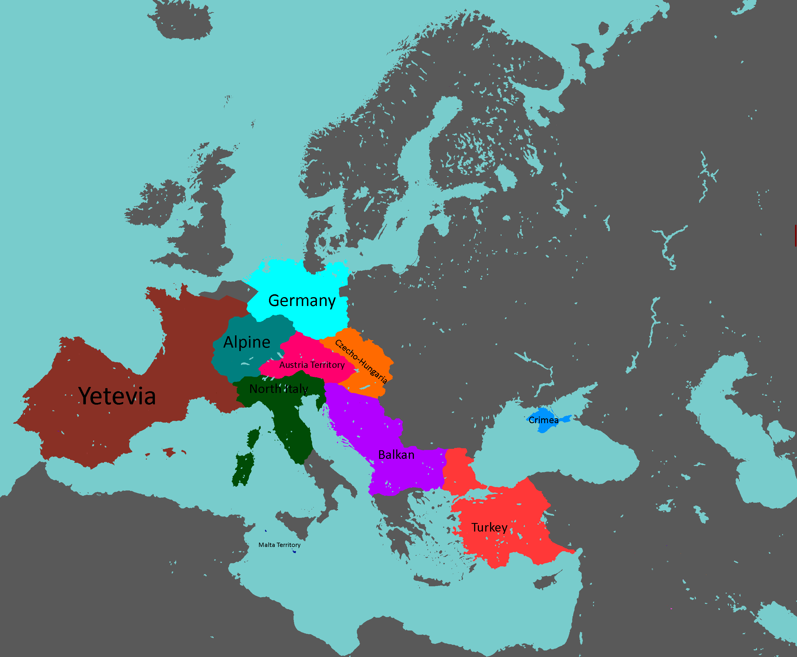
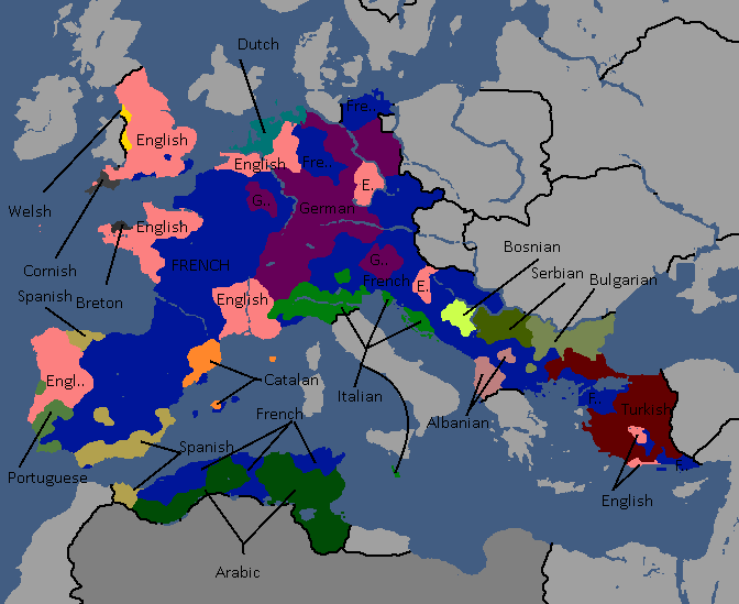
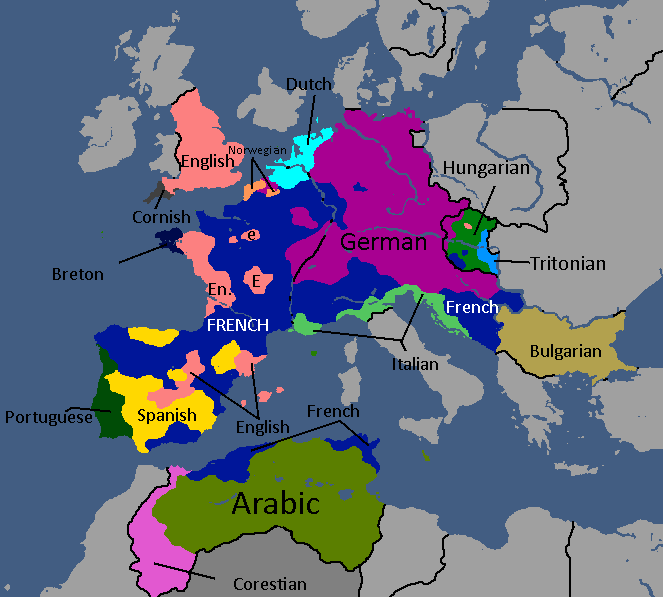
European Cultures: Year 103
-
Unlabled
-
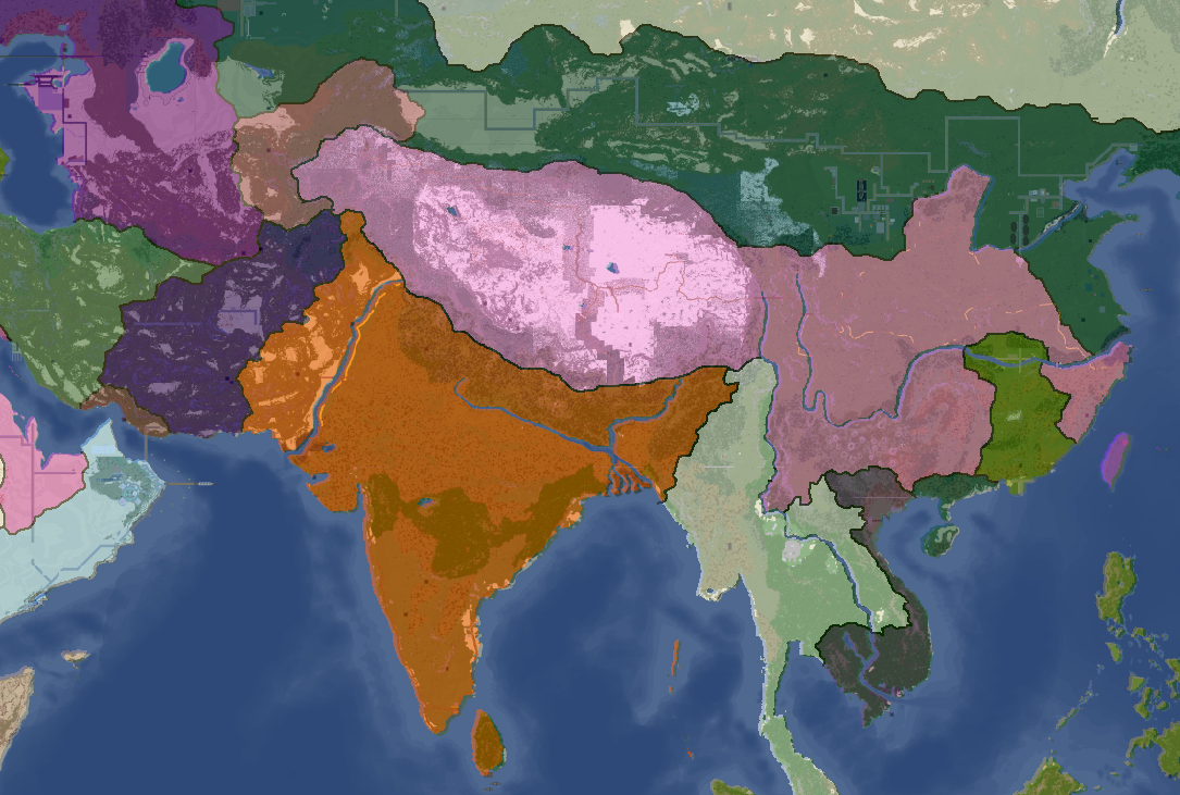
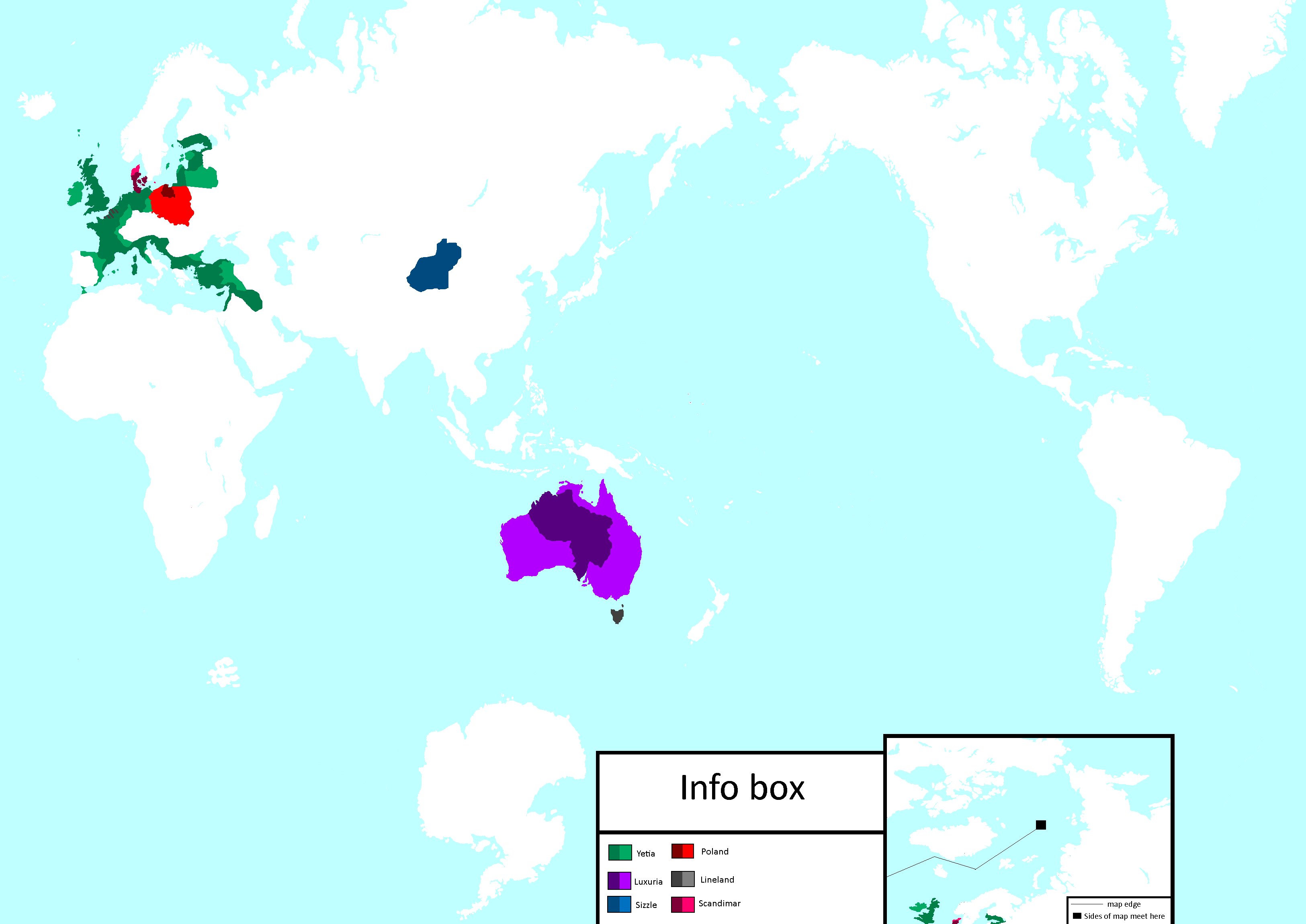
South Asia Overlay: Year 112
-
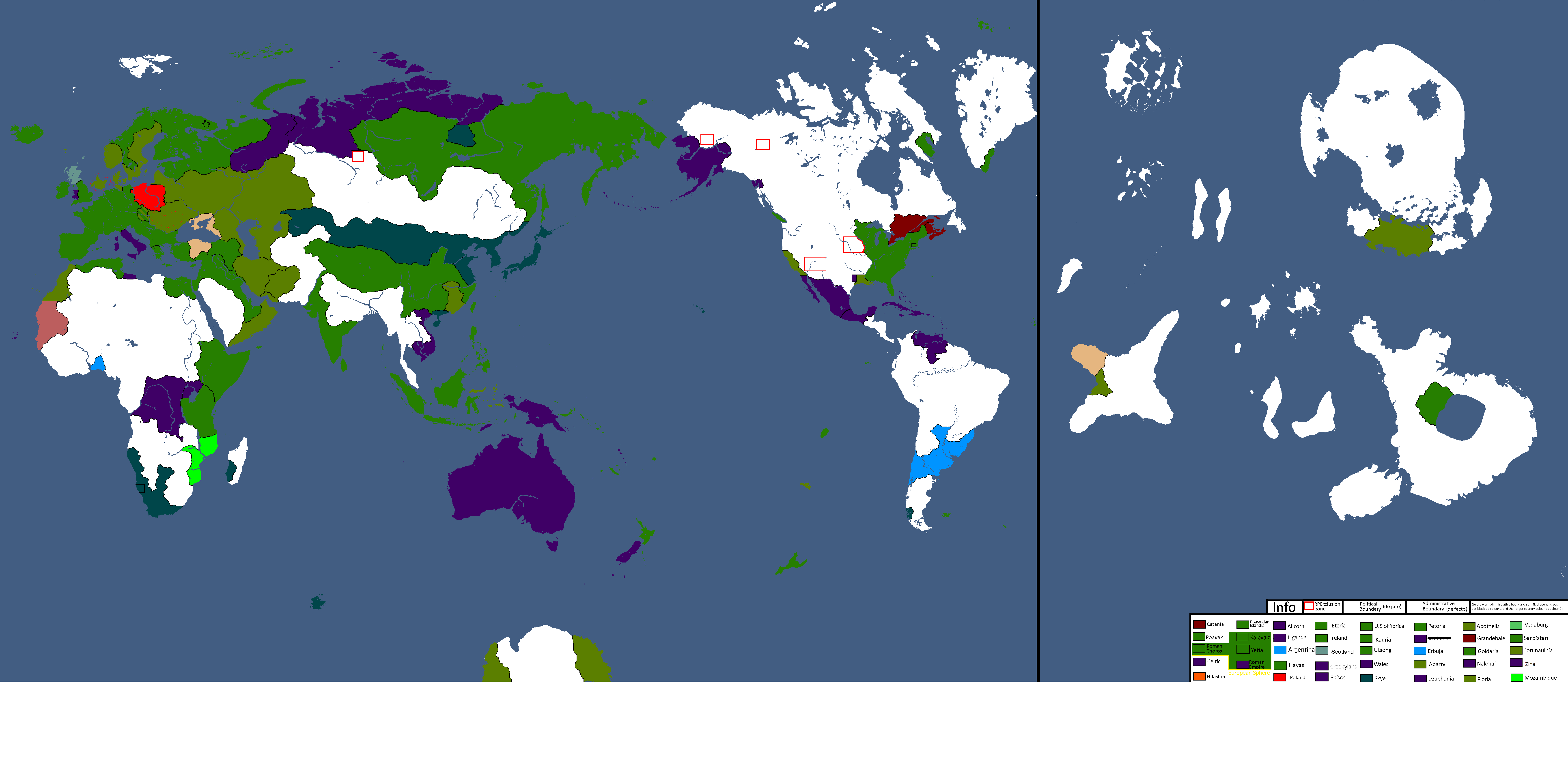
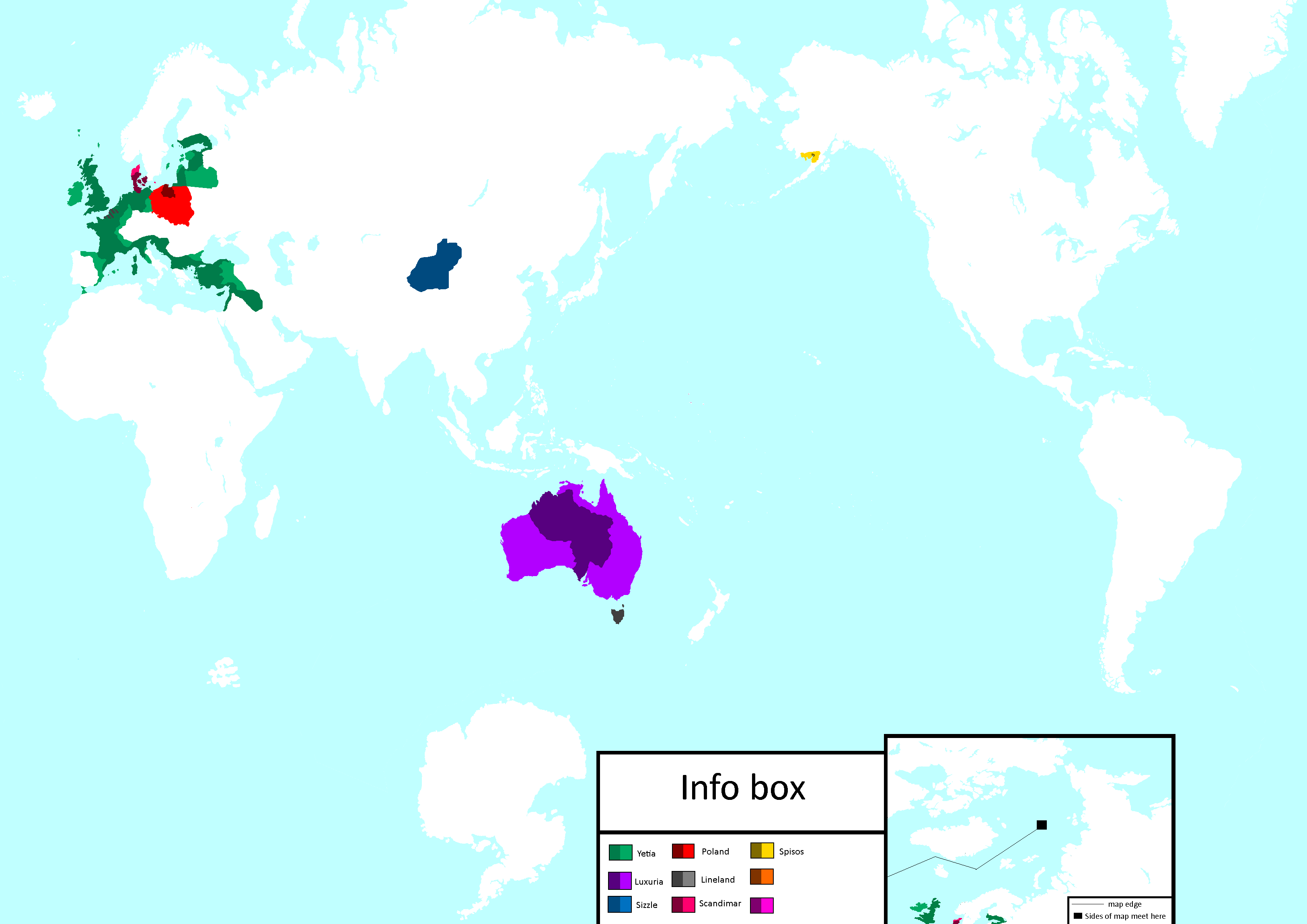
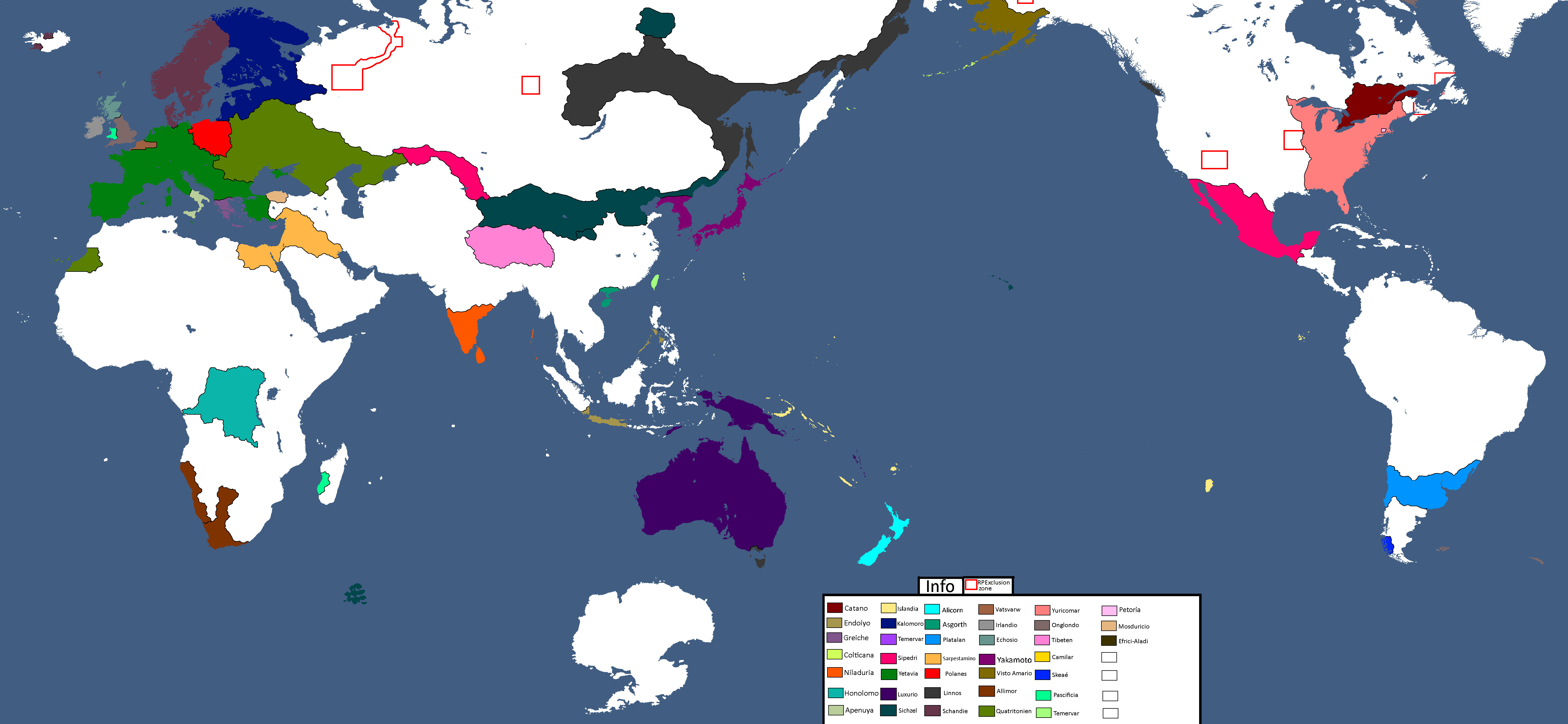
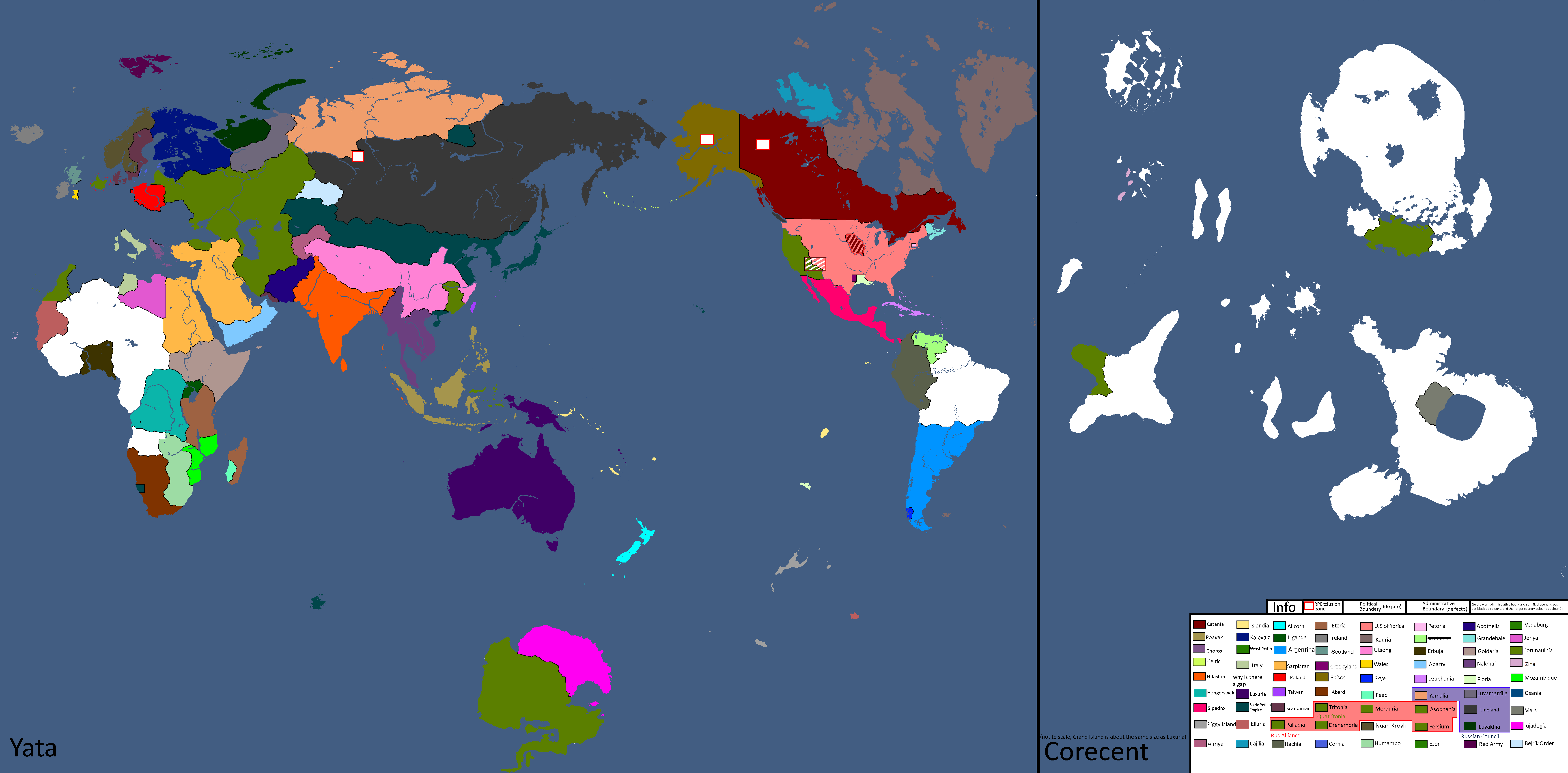
Nation Owners Map: Year 112
-
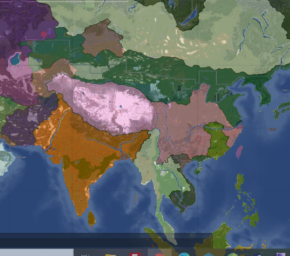
South Asia Overlay: Year 112 (2)
-
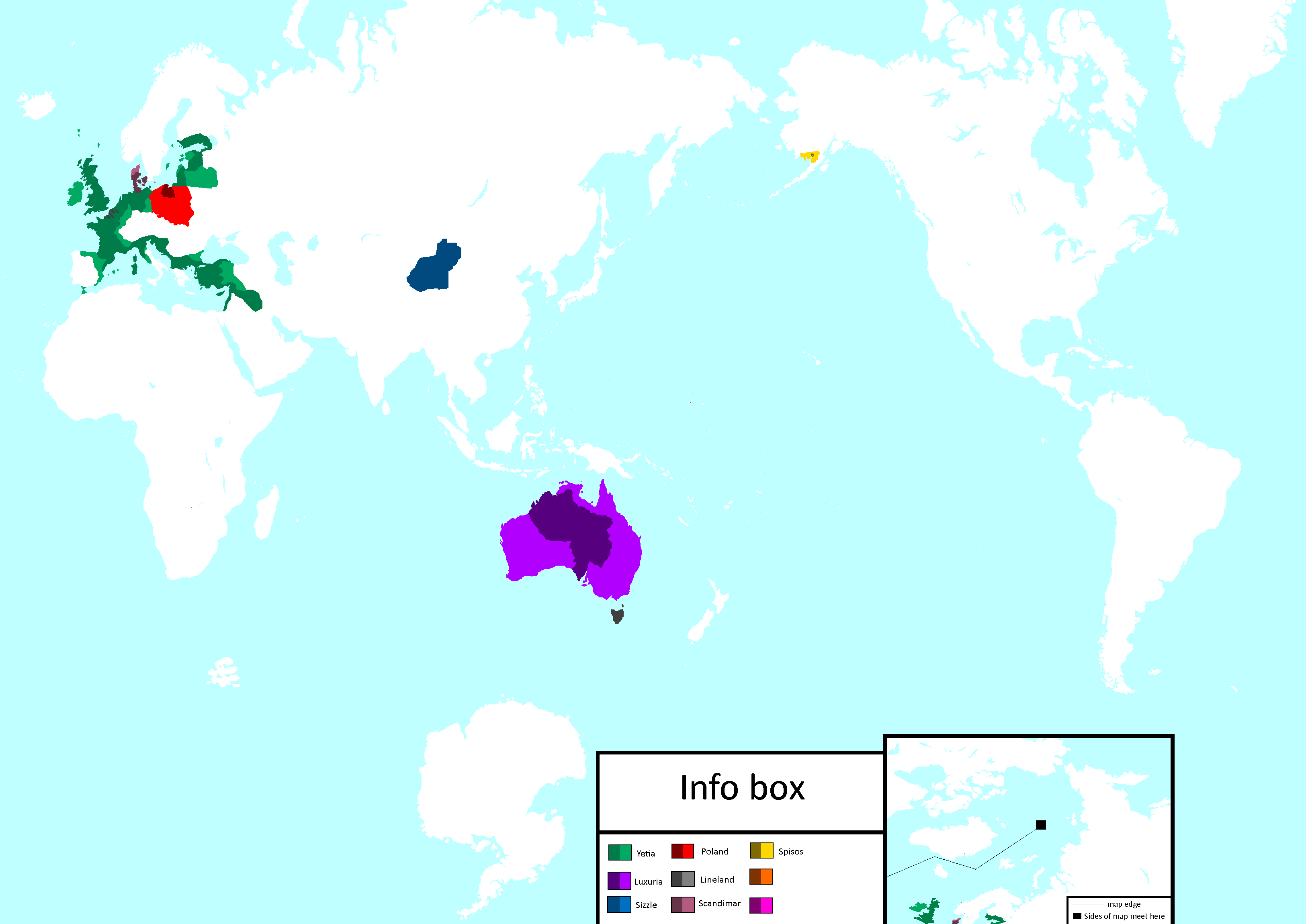
Communist Governments: Year 112
-
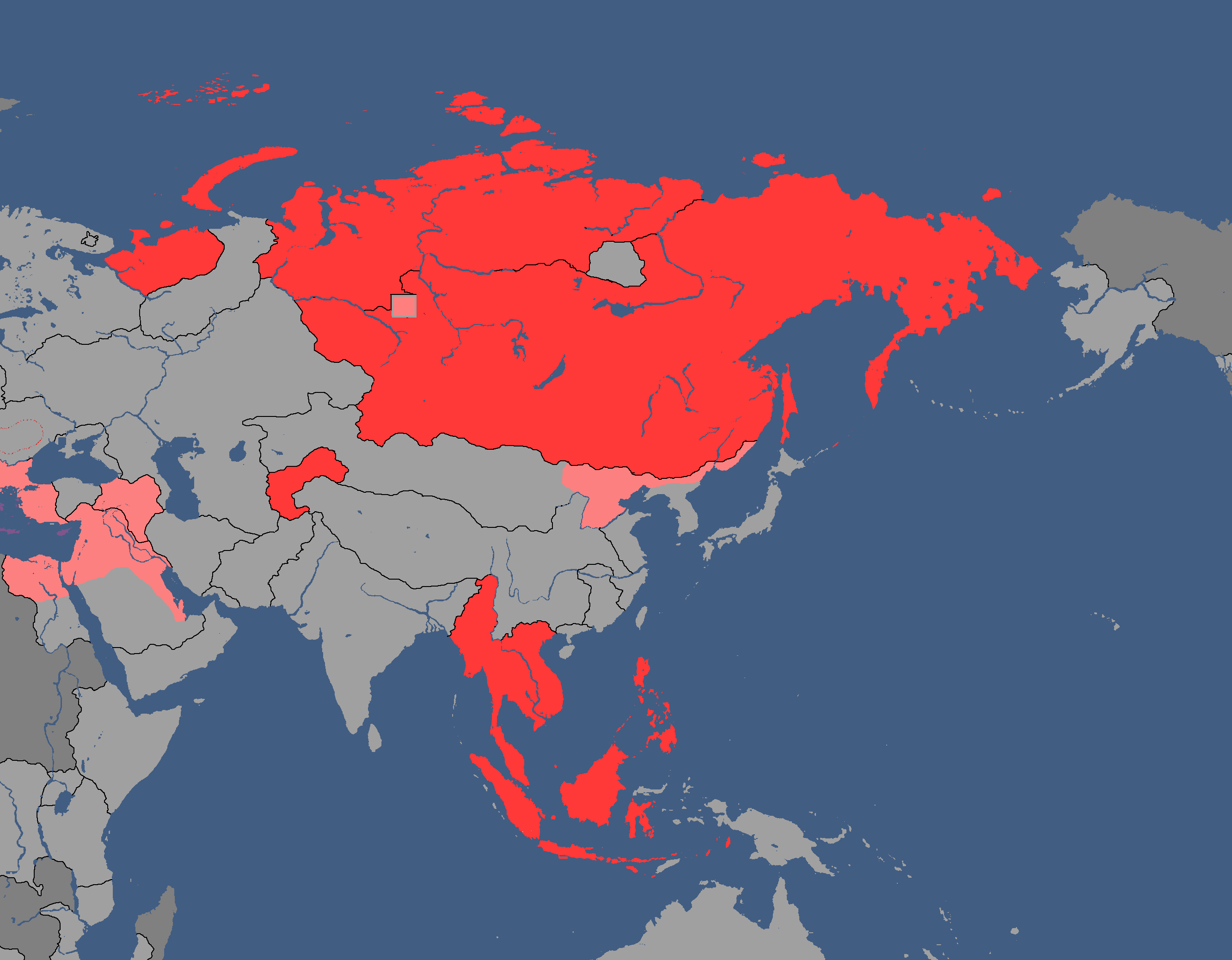
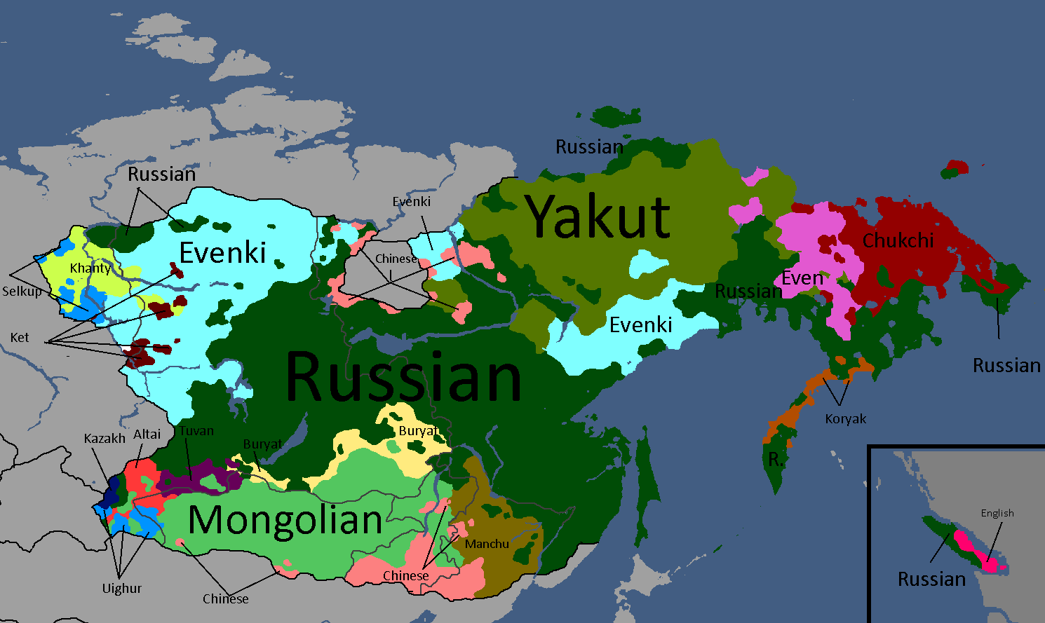
Asia Overlay: Year 113
-
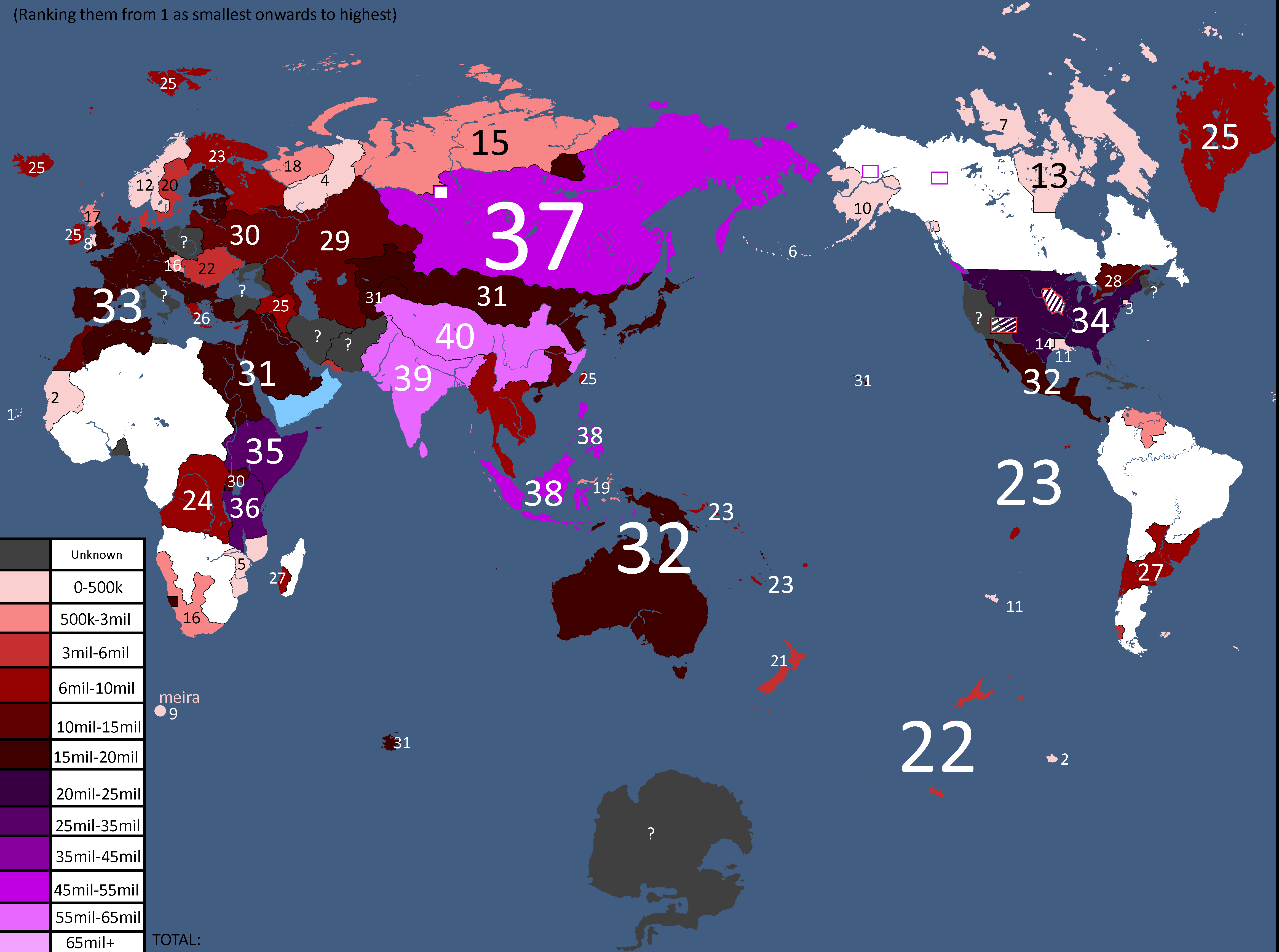
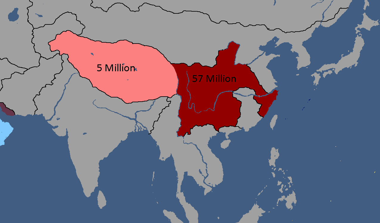
Population of Yata's Countries: Year 114
-
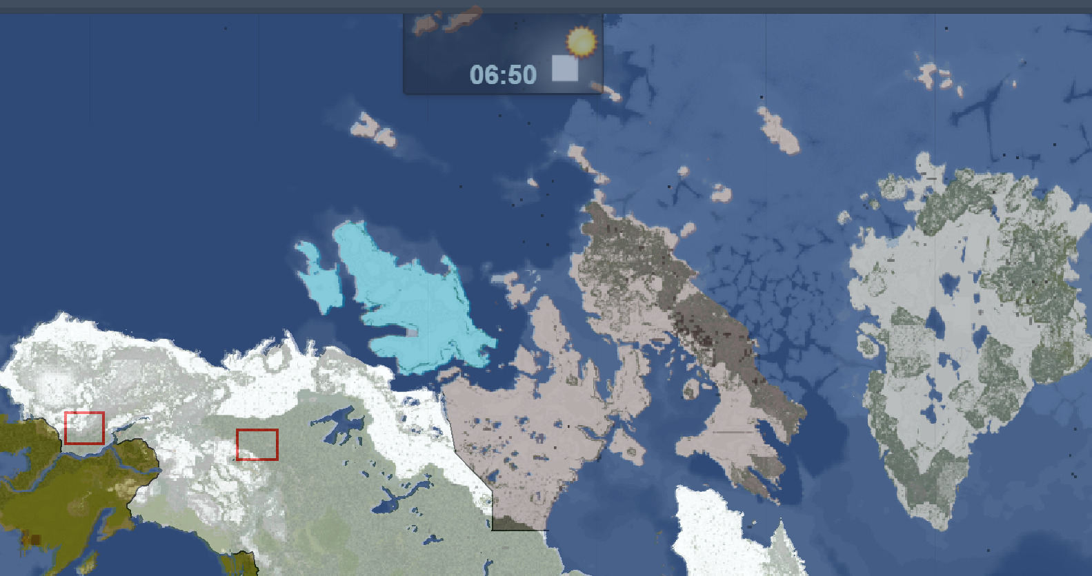
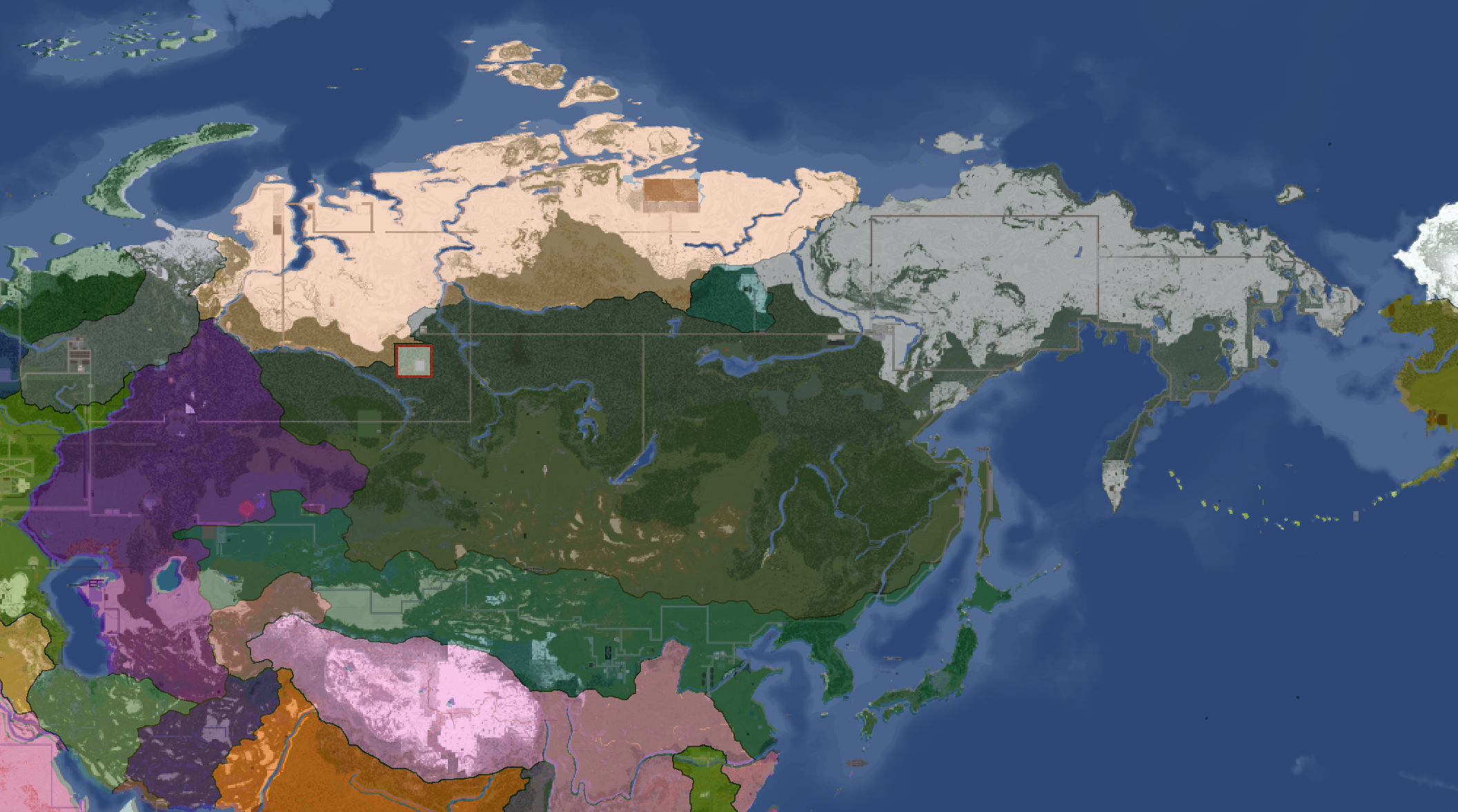
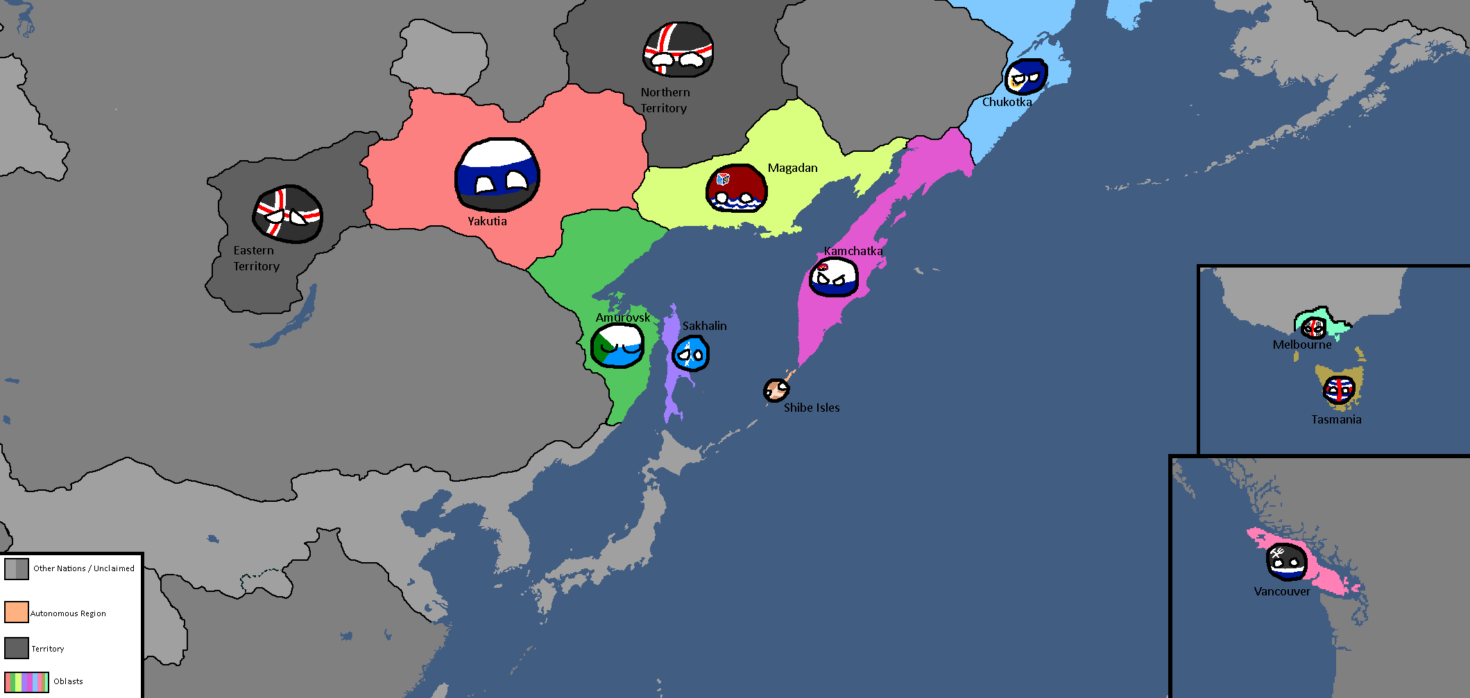
Northern Canada Overlay: Year 114
-
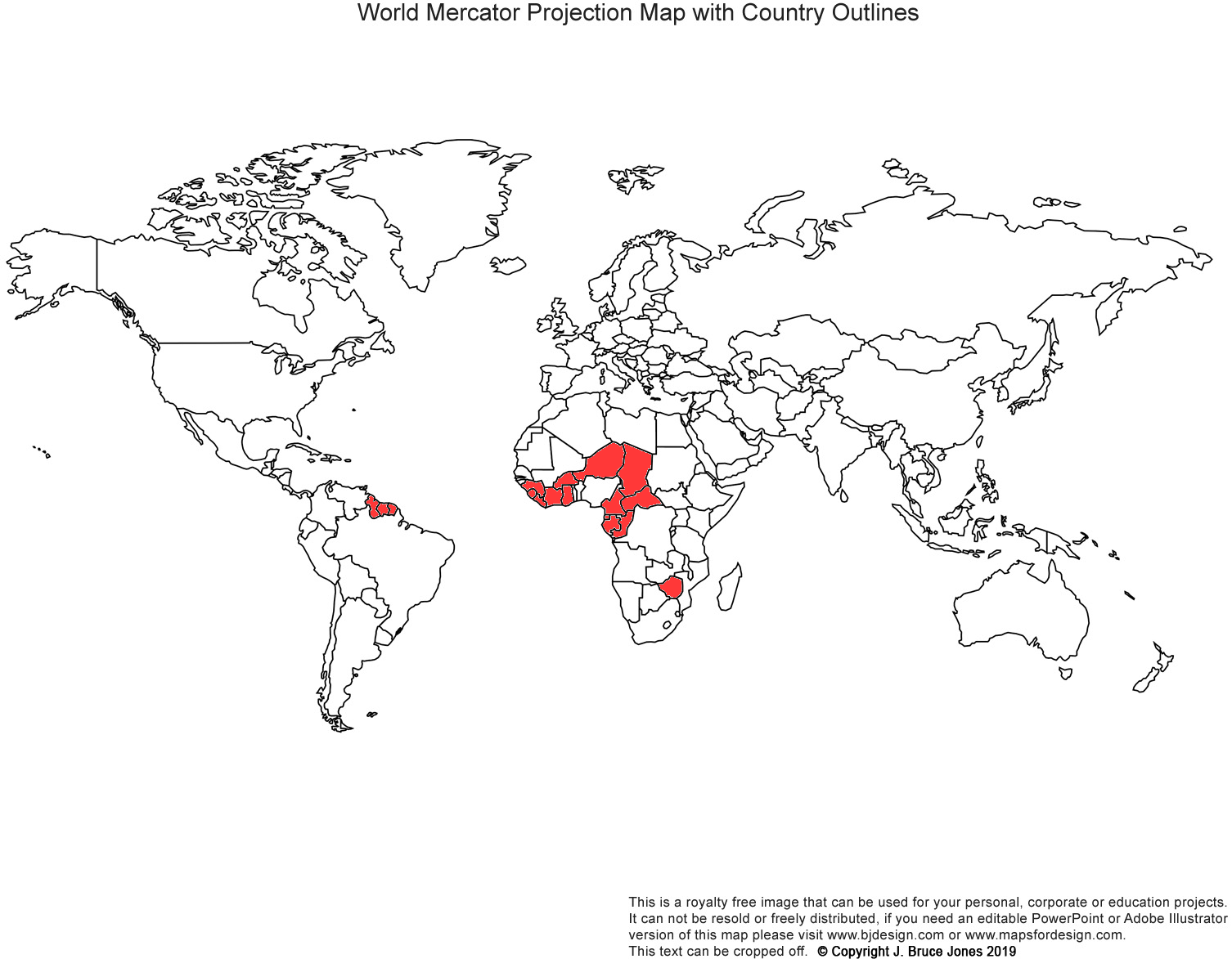
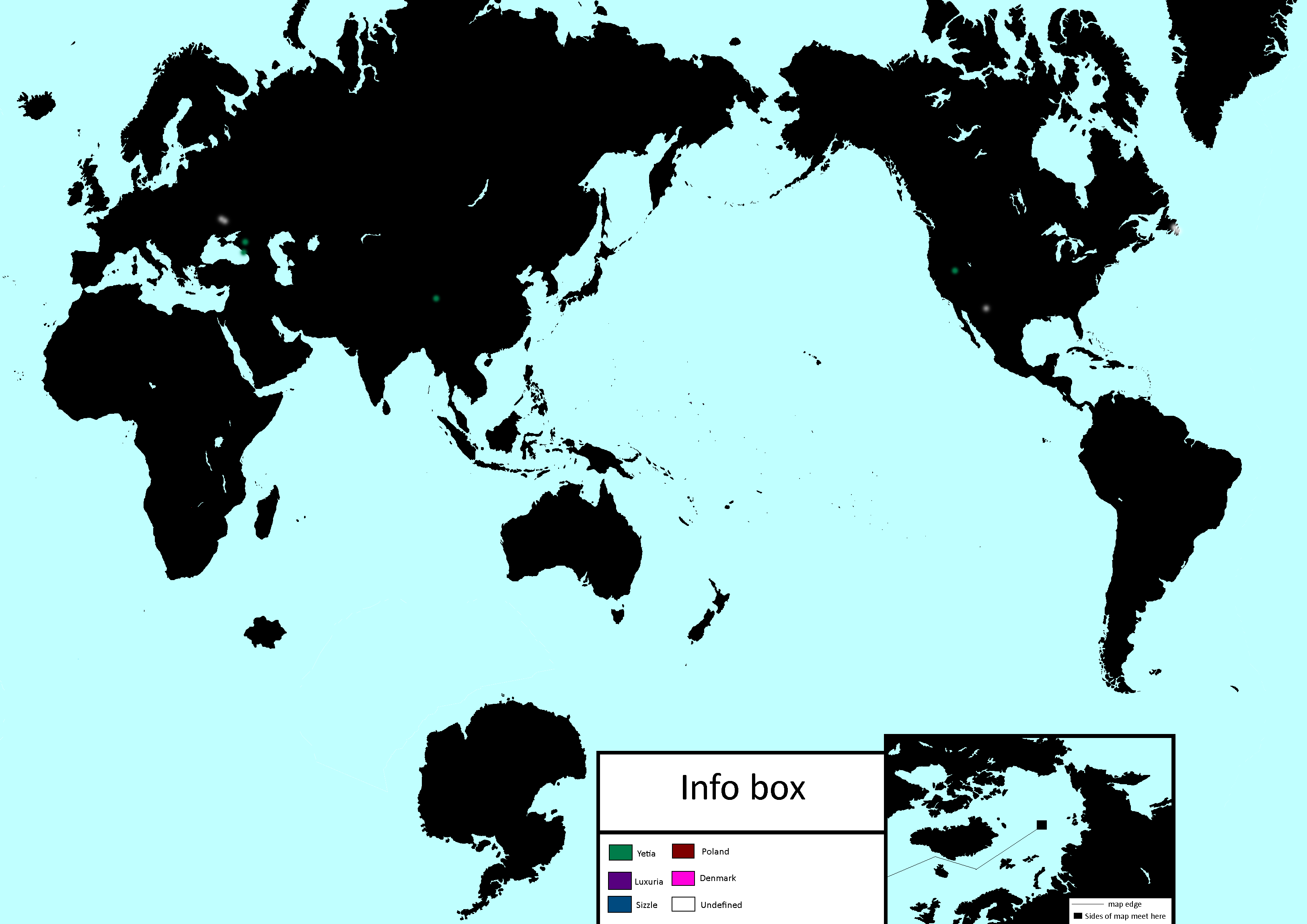
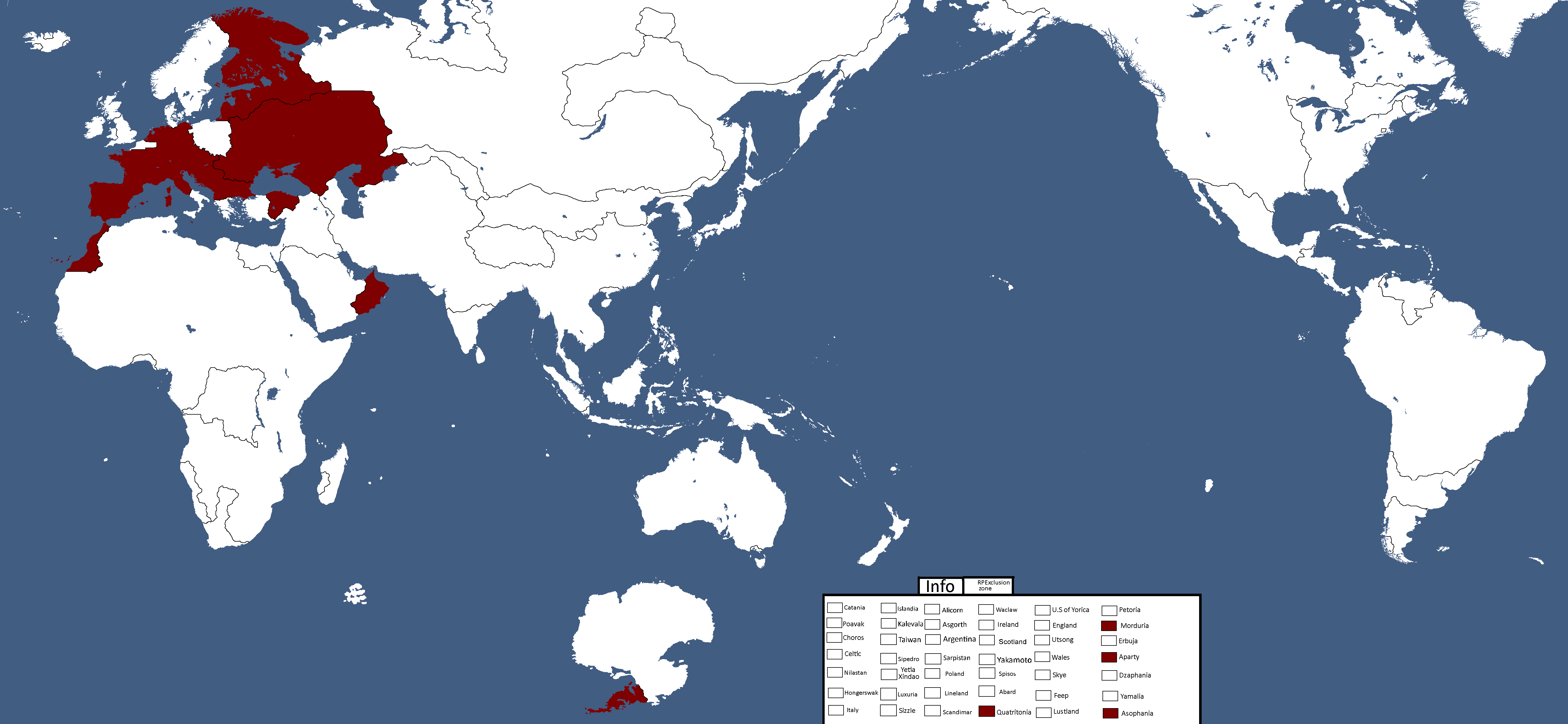
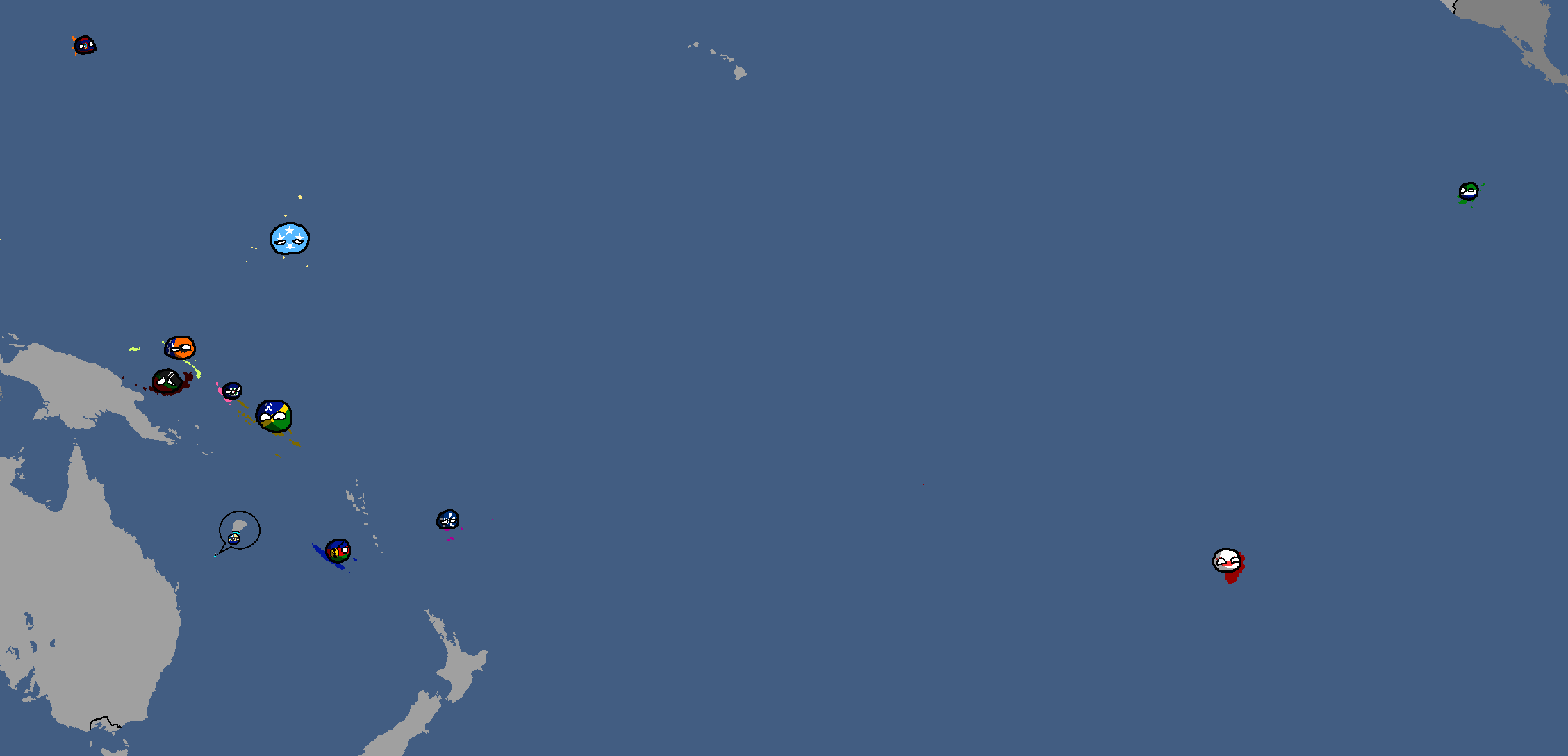
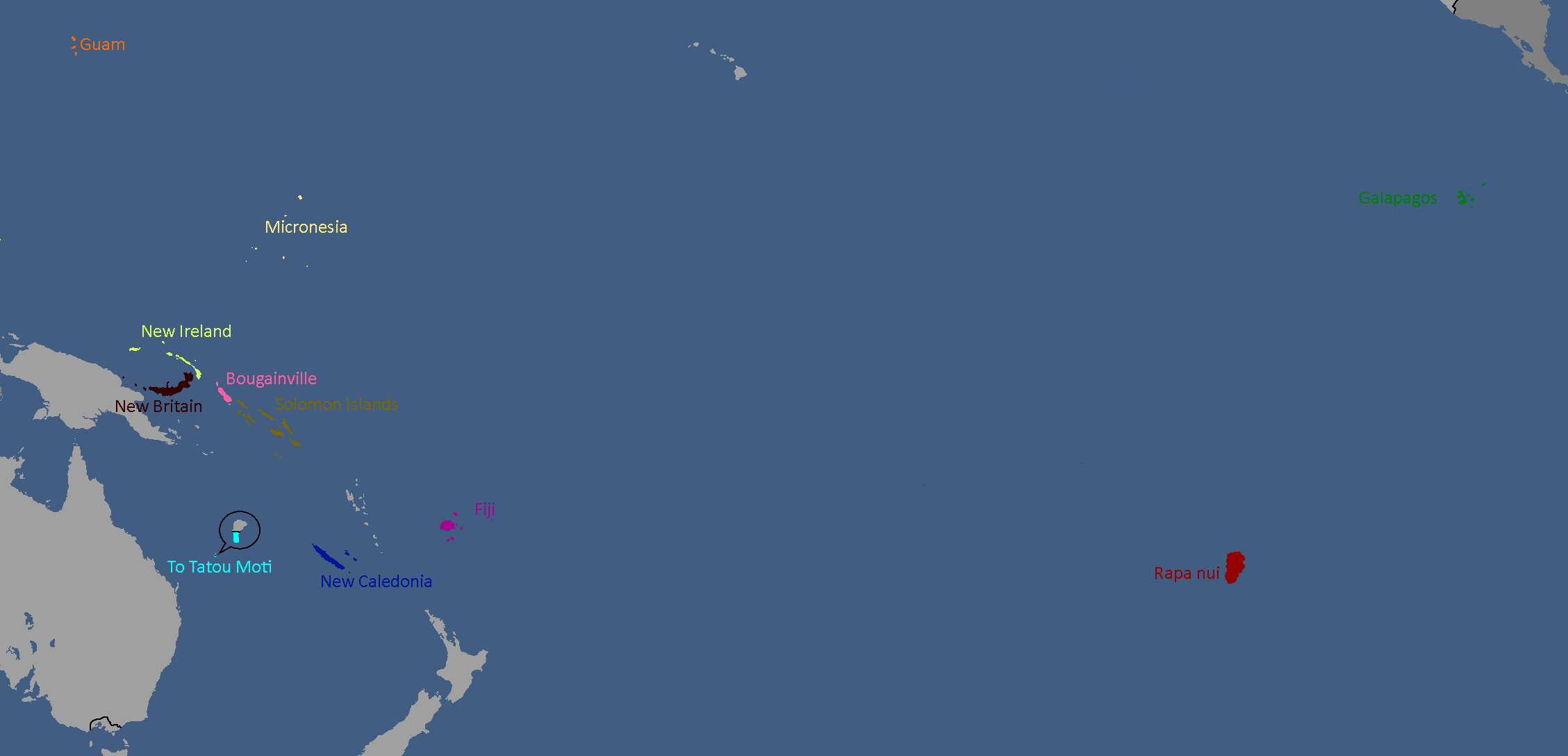
IRL Countries with no claims in them on YATA: Year 115
-

Europe's Population Density: Year 115
-
"Yata if it was good" meme: Year 116


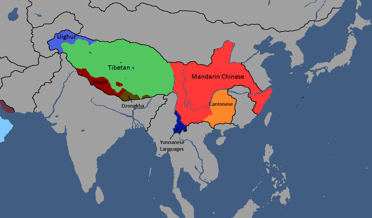
National Maps
Anakistani Maps
-
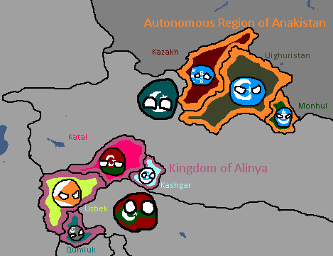
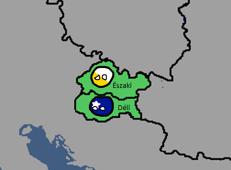
Anakistani Provinces & Regions: Year 112

English Maps
-
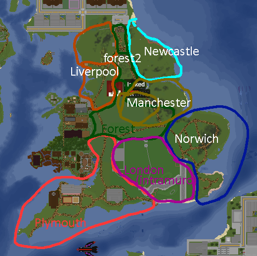
English City Plan: Year 105

Goldarian Maps
-
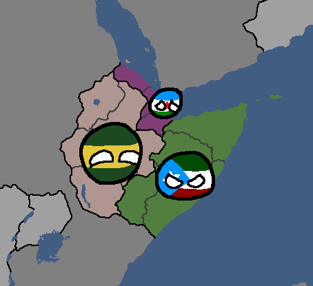
Goldarian Federal States: Year 102 (Countryballs)
-
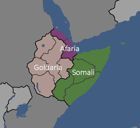
Goldarian Federal States: Year 102


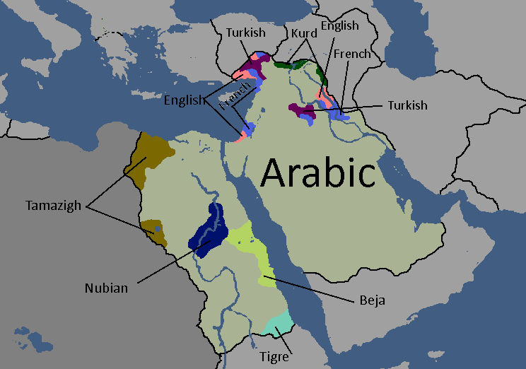
Hayastani Maps
-
Languages of Hayas: Year 112

Humamboan Maps
-

Homeland & Colonies of Humambo: Year 115

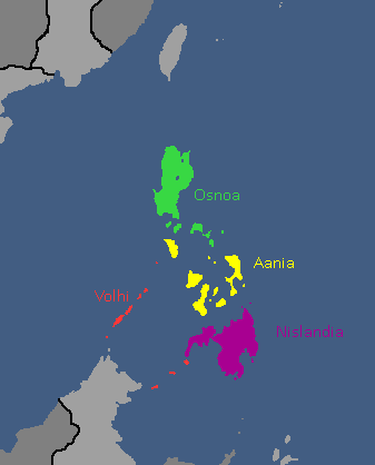
Islandian Maps
-
Islandian kingdoms and principalities: Year 95 (Countryballs)
-
Islandian kingdoms and principalities: Year 95


Linelandic Maps
-
Linelandic Federal Subjects: Year 101
-
Linelandic Languages: Year 112
-
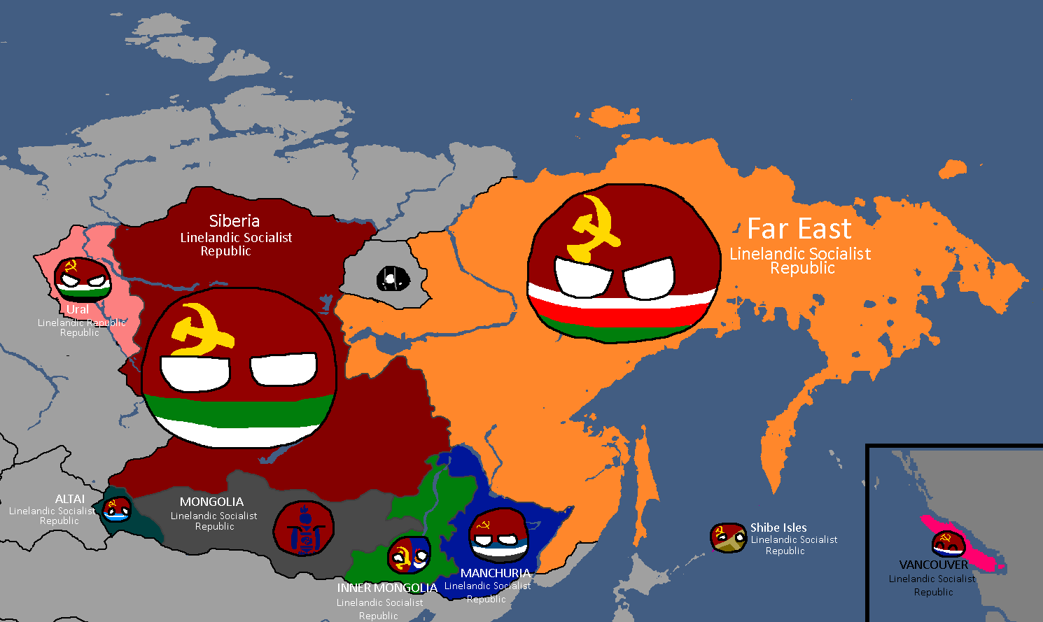
Member-Republics of the Union of Linelandic Socialist Republics: Year 112
-
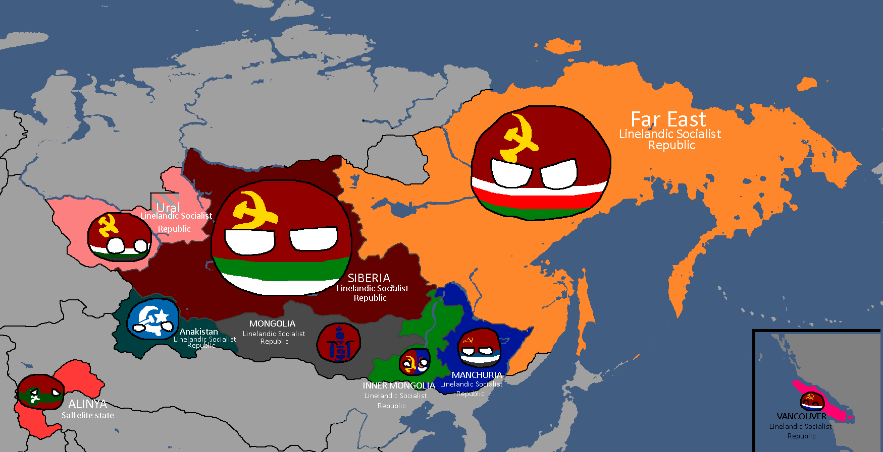
Member-Republics of the Union of Linelandic Socialist Republics: Year 113


Nakamaian Maps
-
Languages of Nakmai: Year 112

Old Osanian Maps
-
Old Osanian States: Year 105

Poavakian Maps
-
Poavakian Subdivisions: Year 96

Sarpistani Maps
-
Languages of Sarpistan: Year 114
-
Provinces of Sarpistan and Jeriya (Protectorate): Year 115


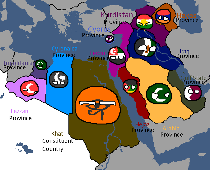
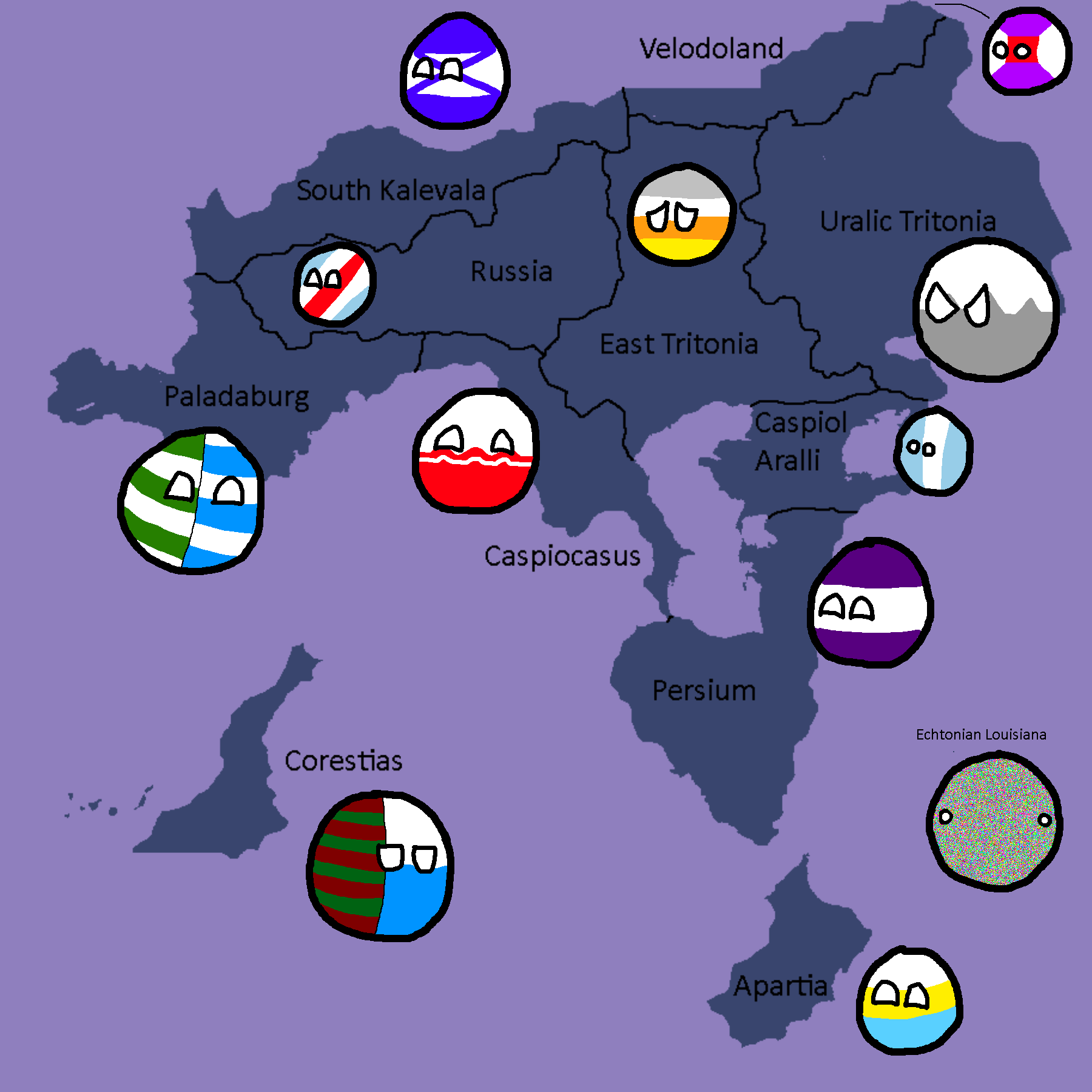
Tritonian Maps
-
Tritonian Regions: Year 90
-
Tritonian Regions: Year 91
-
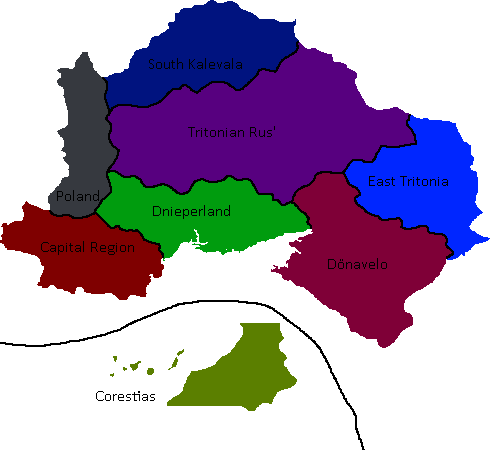
Tritonian Regions: Late Year 91
-
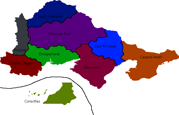
Tritonian Regions: Year 96
-
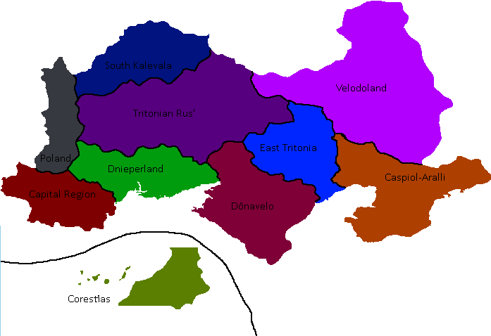
Tritonian Regions: Year 101
-
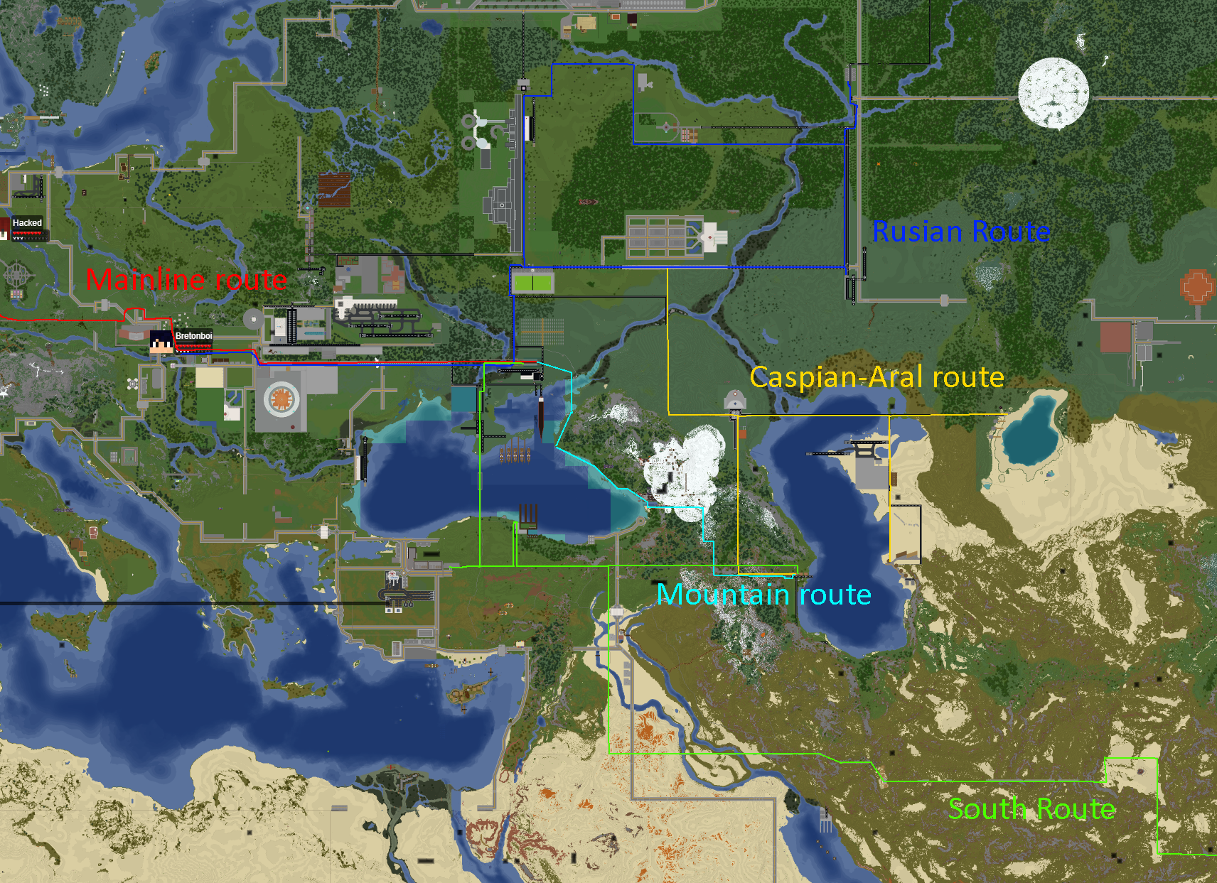
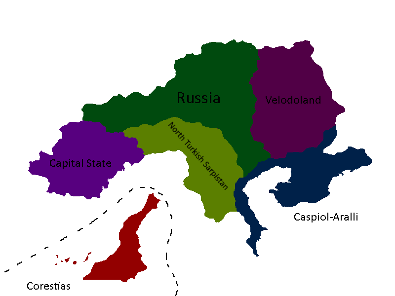
Tritonian Railways: Year 106
-
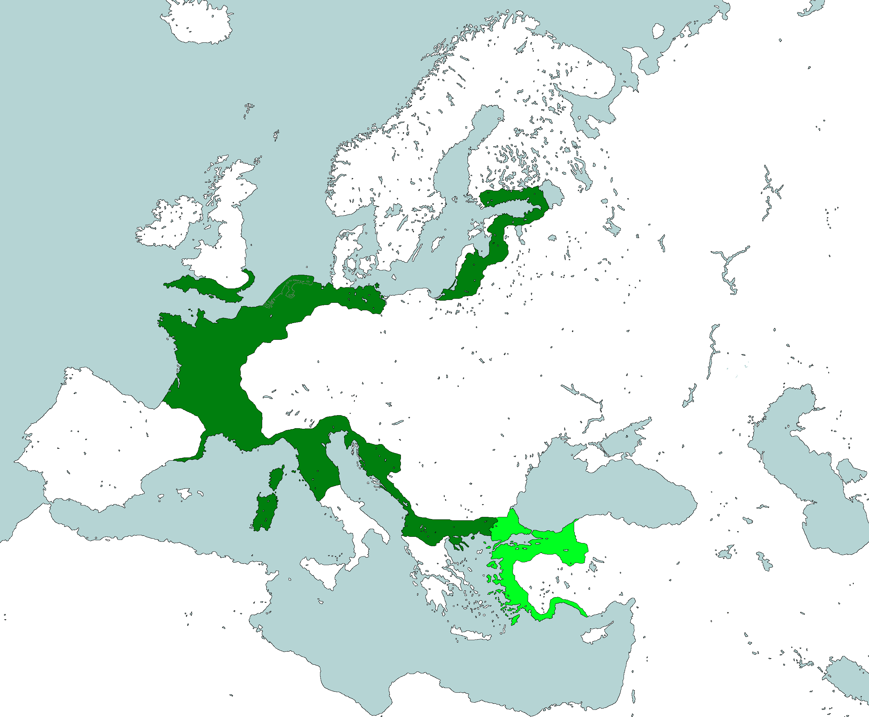
Member-Republics of the Union of Quatritonian Socialist Republics: Year 114
-
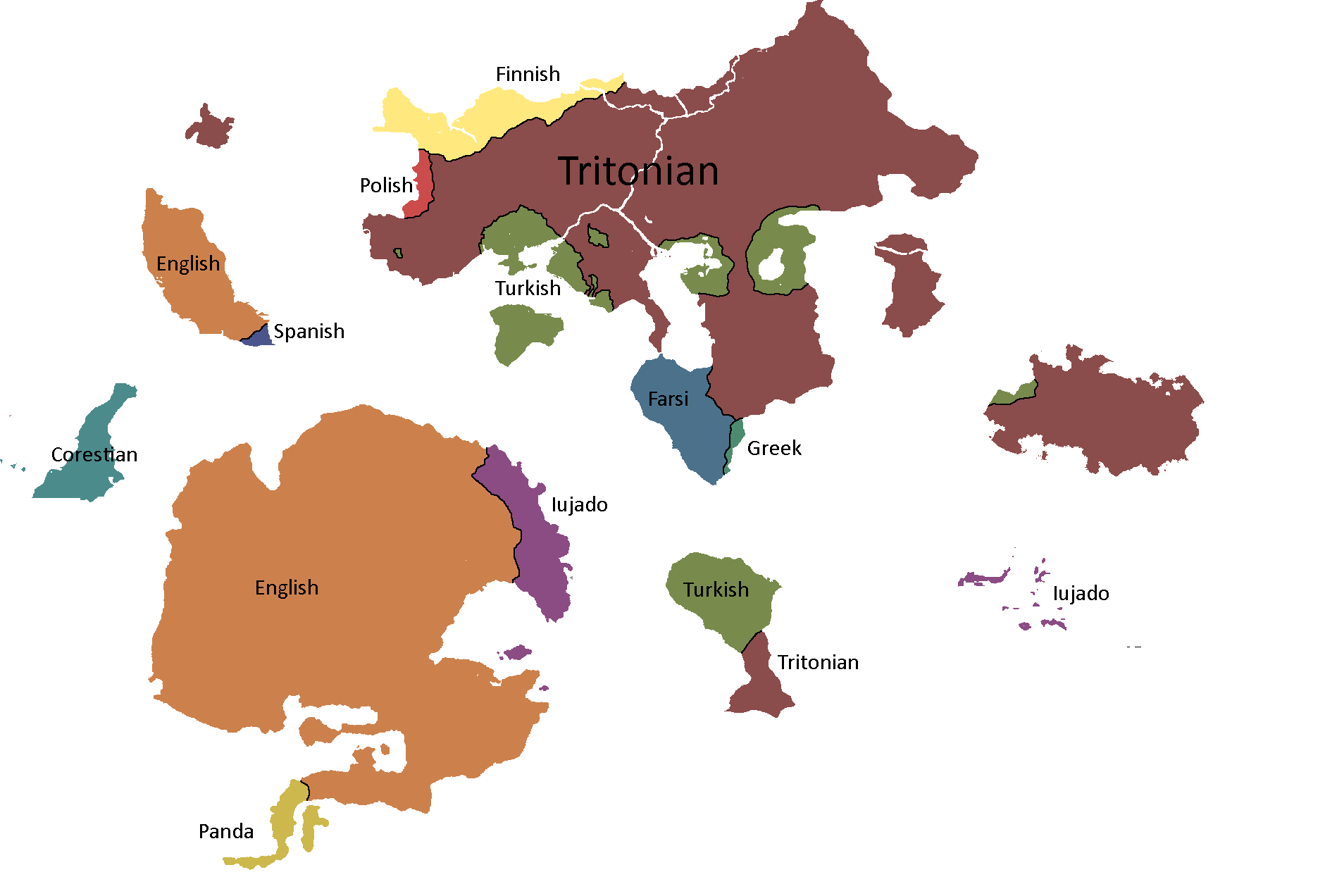
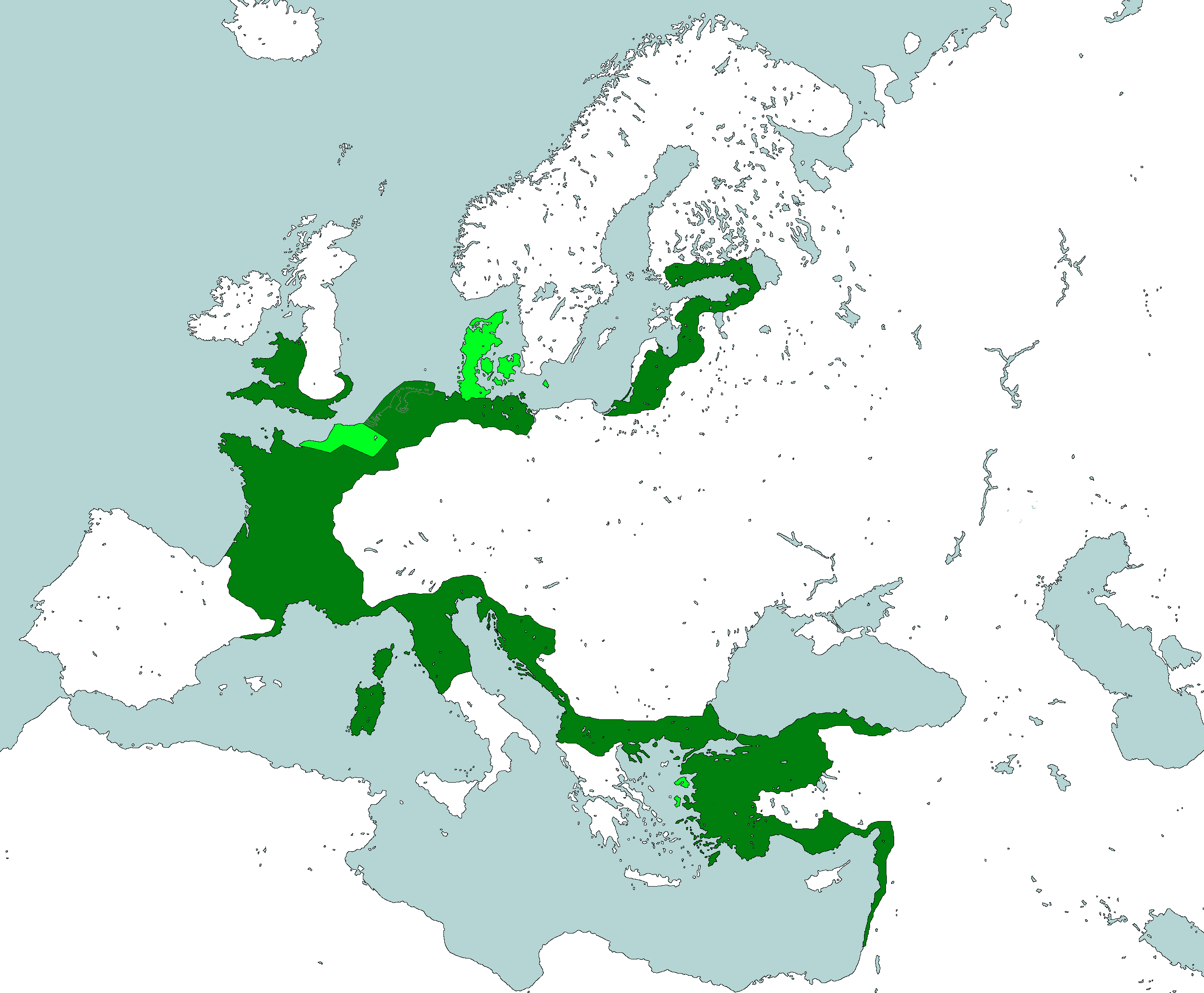
Languages of Quatritonia: Year 115


Utsongan Maps
-
Languages of Utsong: Year 114
-
Utsong's Population Distribution: Year 114


Vedan Maps
-
Vedan Districts: Year 103

Yetian Maps
-
Lost Archives Map: Yetia 1
-
Lost Archives Map: Yetia 2
-
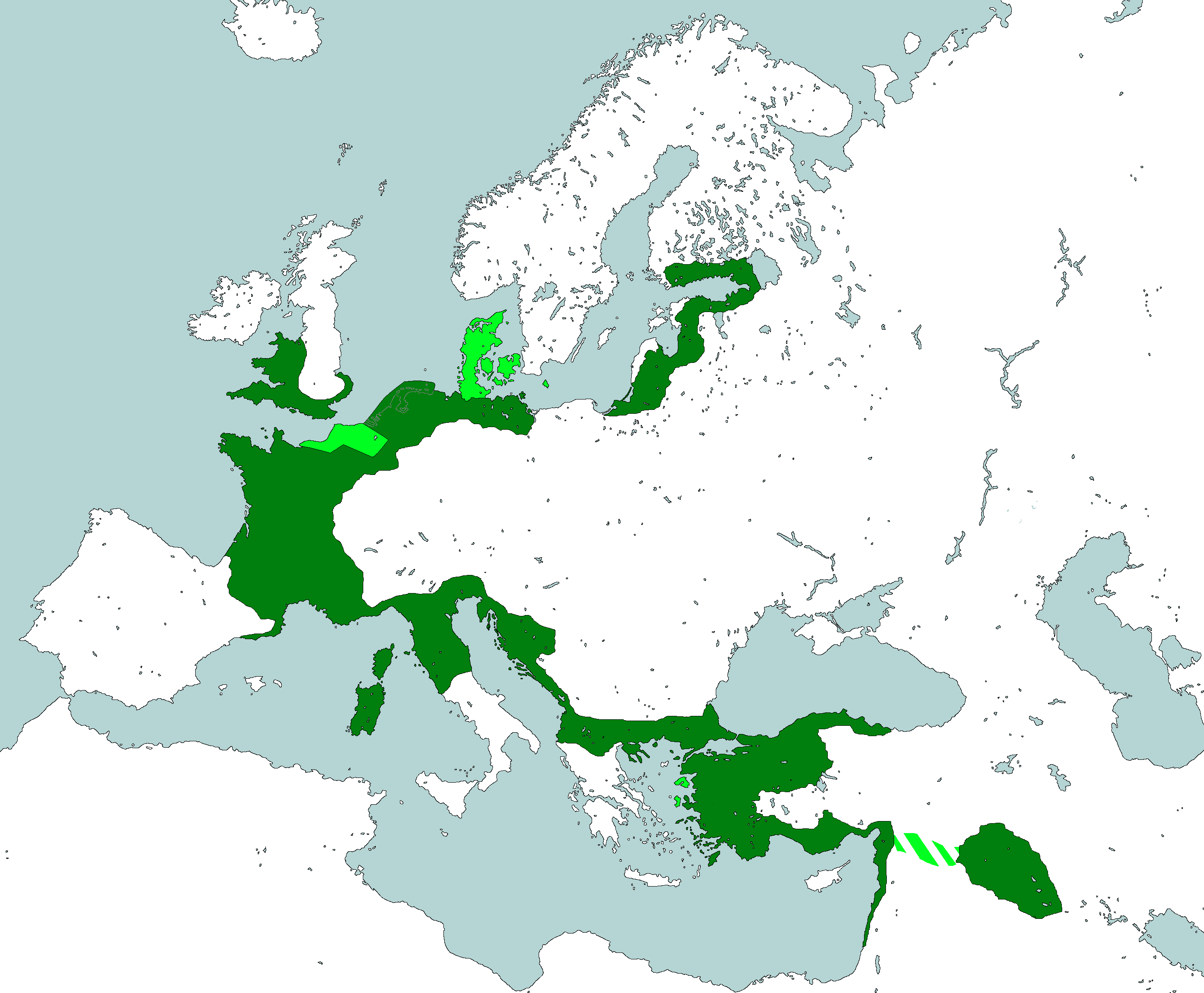
Lost Archives Map: Yetia 3
-
Lost Archives Map: Yetia 4
-
Lost Archives Map: Yetia 5
-
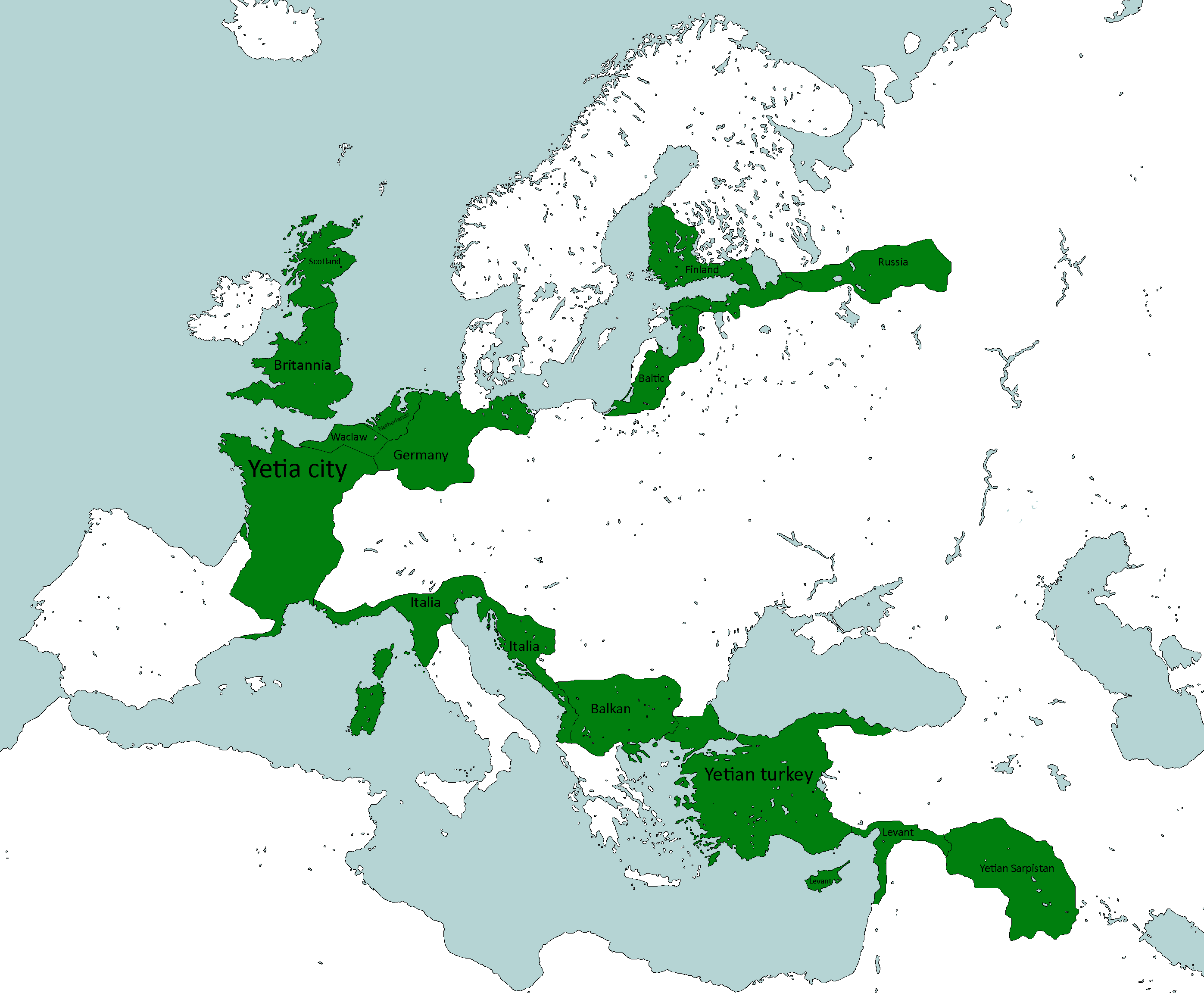
Map of which country captured what in yetia during WW5
-
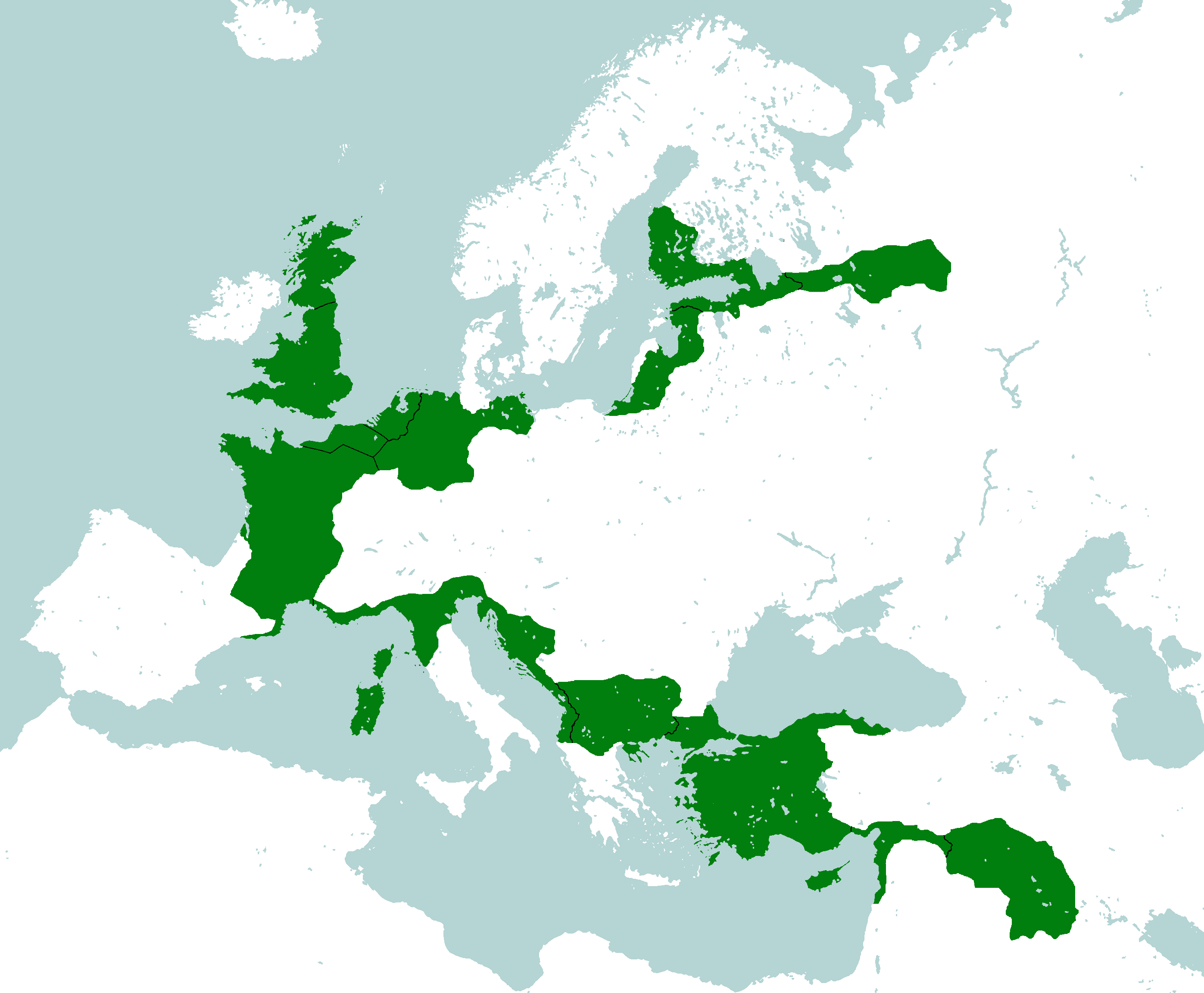
Yetian Provinces: Year 90
-
Yetian Provinces: Year 108
-
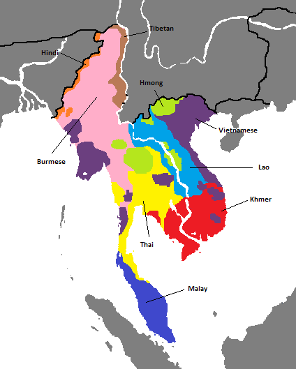
Yetian Languages: Year 112
-
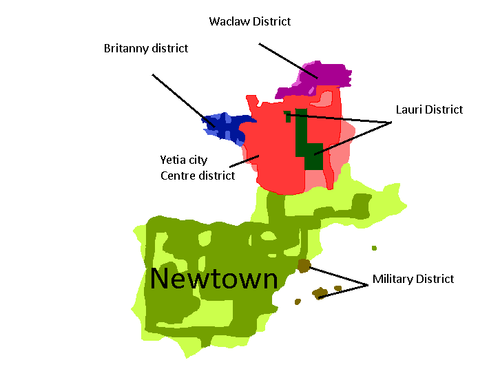
Districts of Yetia City: Year 114
-
Yetian Languages: Year 115


