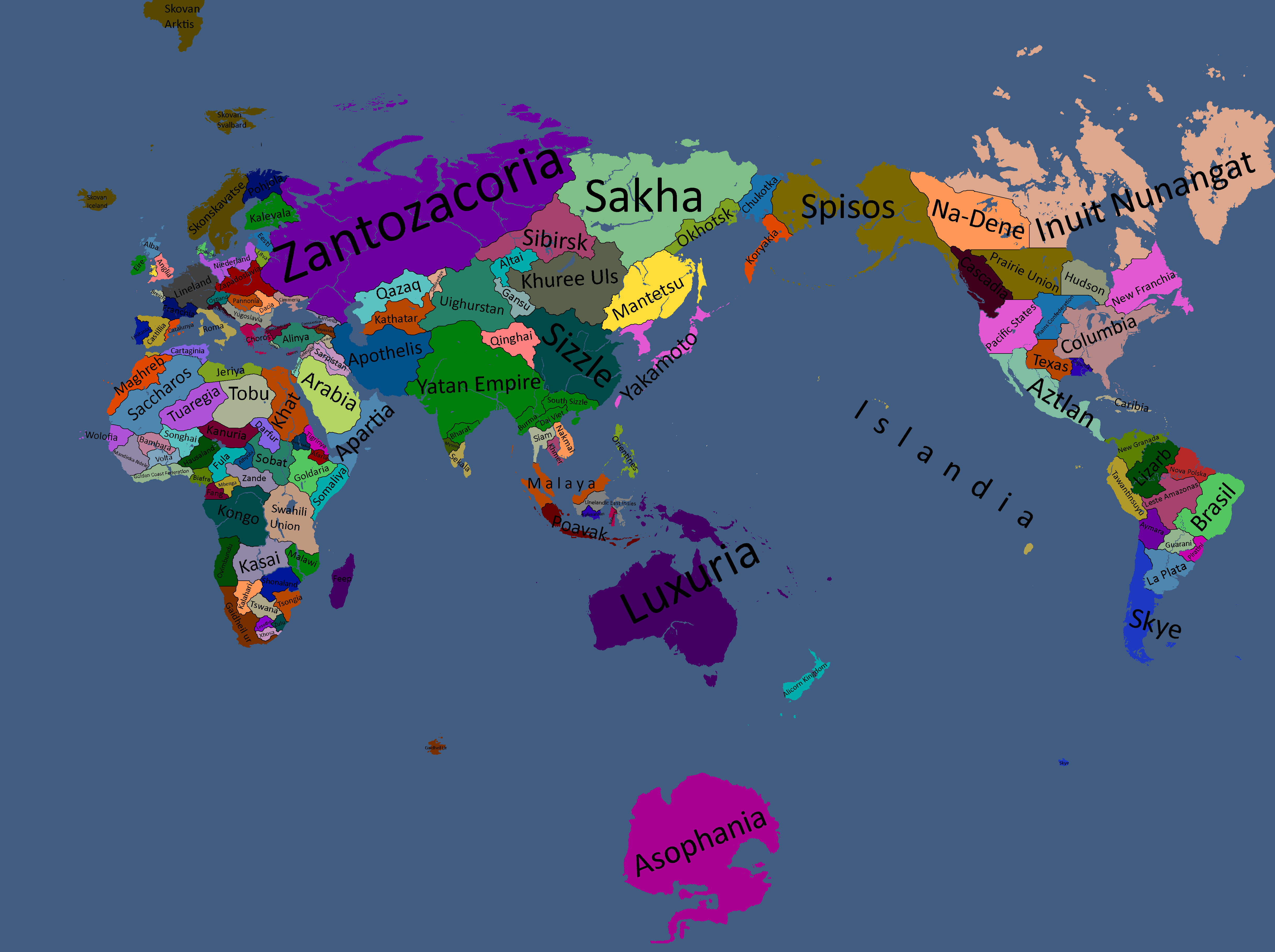
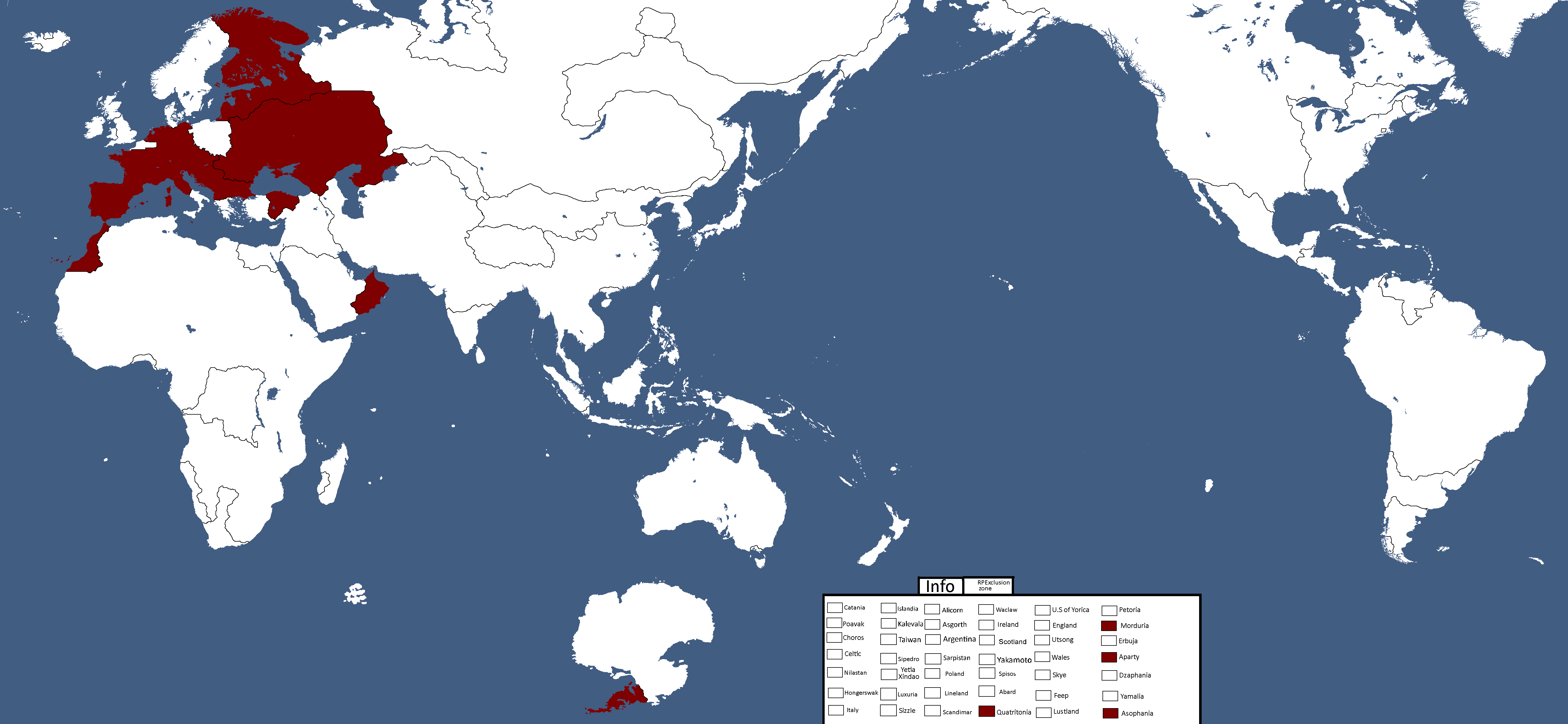
List of Maps
International Maps
Yatan Maps
-
Map of the First Human-Yomtach War: Year 15638 BCE
-
Map of Elemental Nations: Year 8701 BCE
-
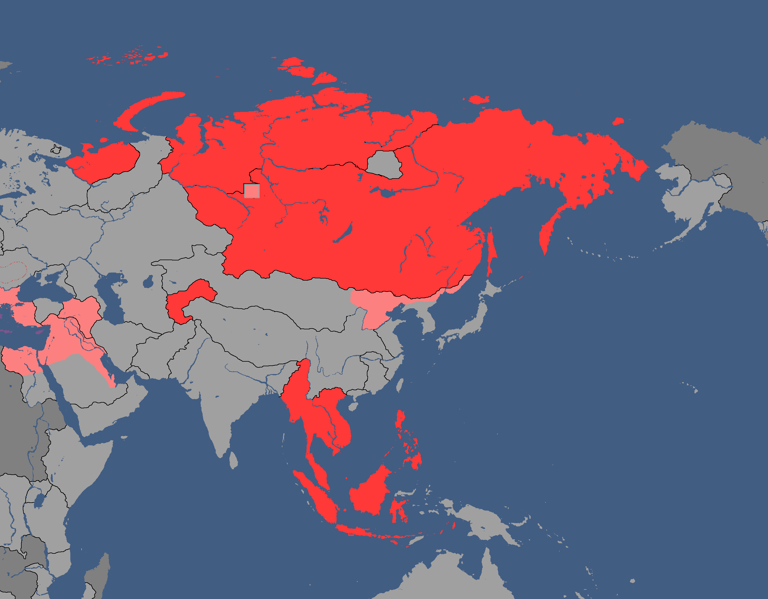
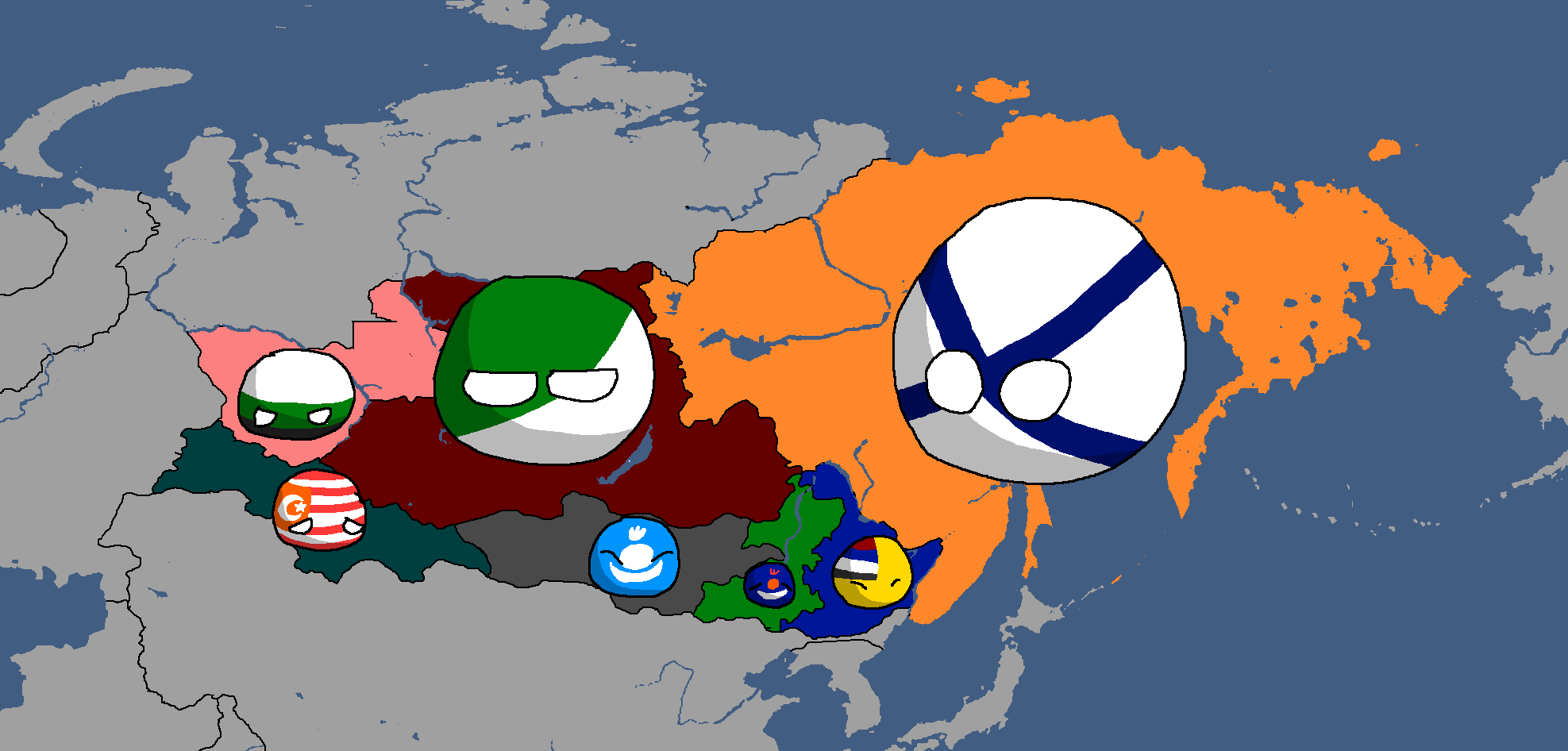
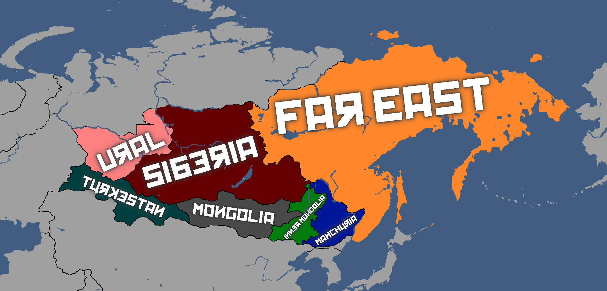
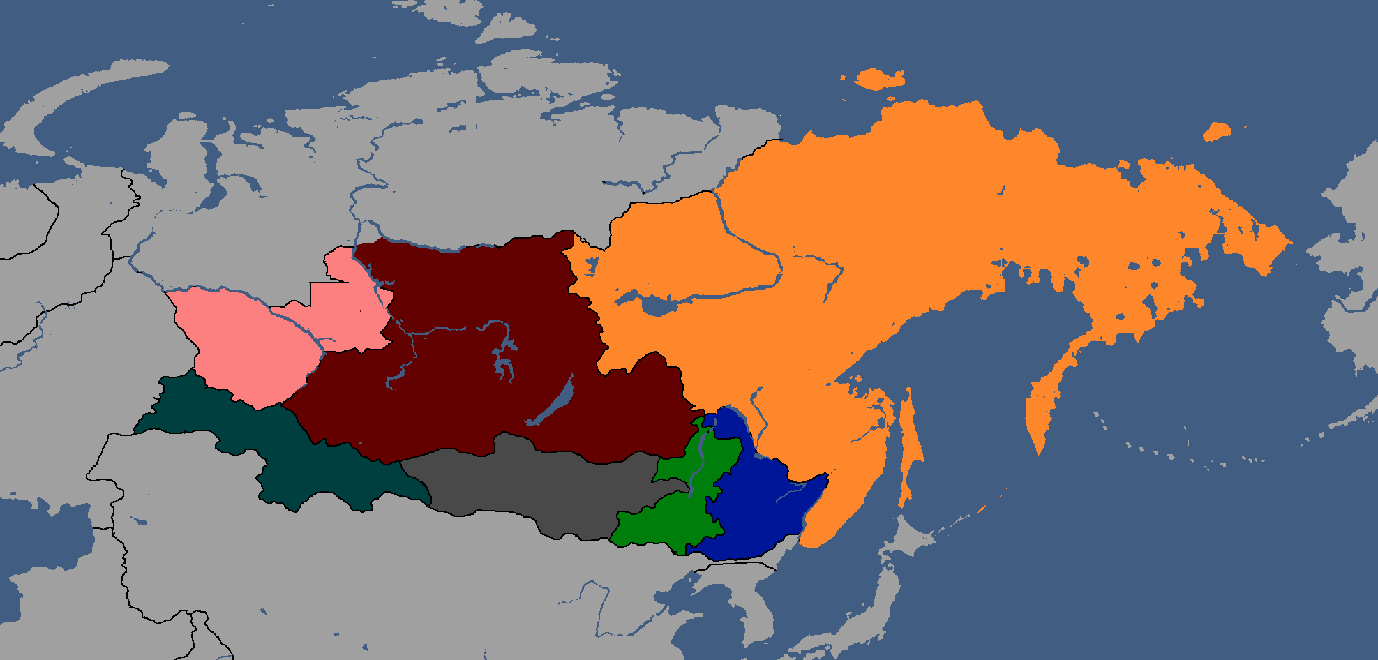
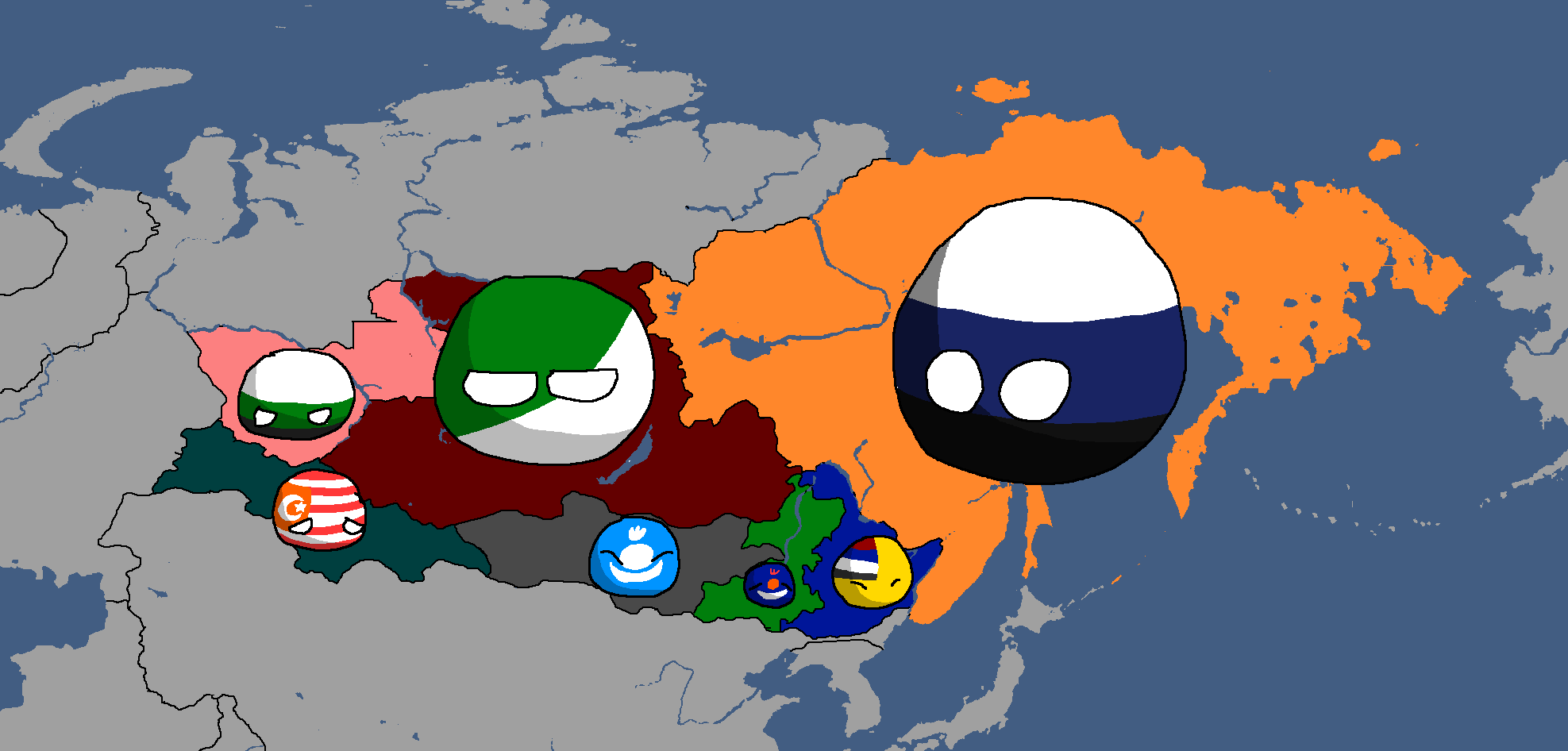
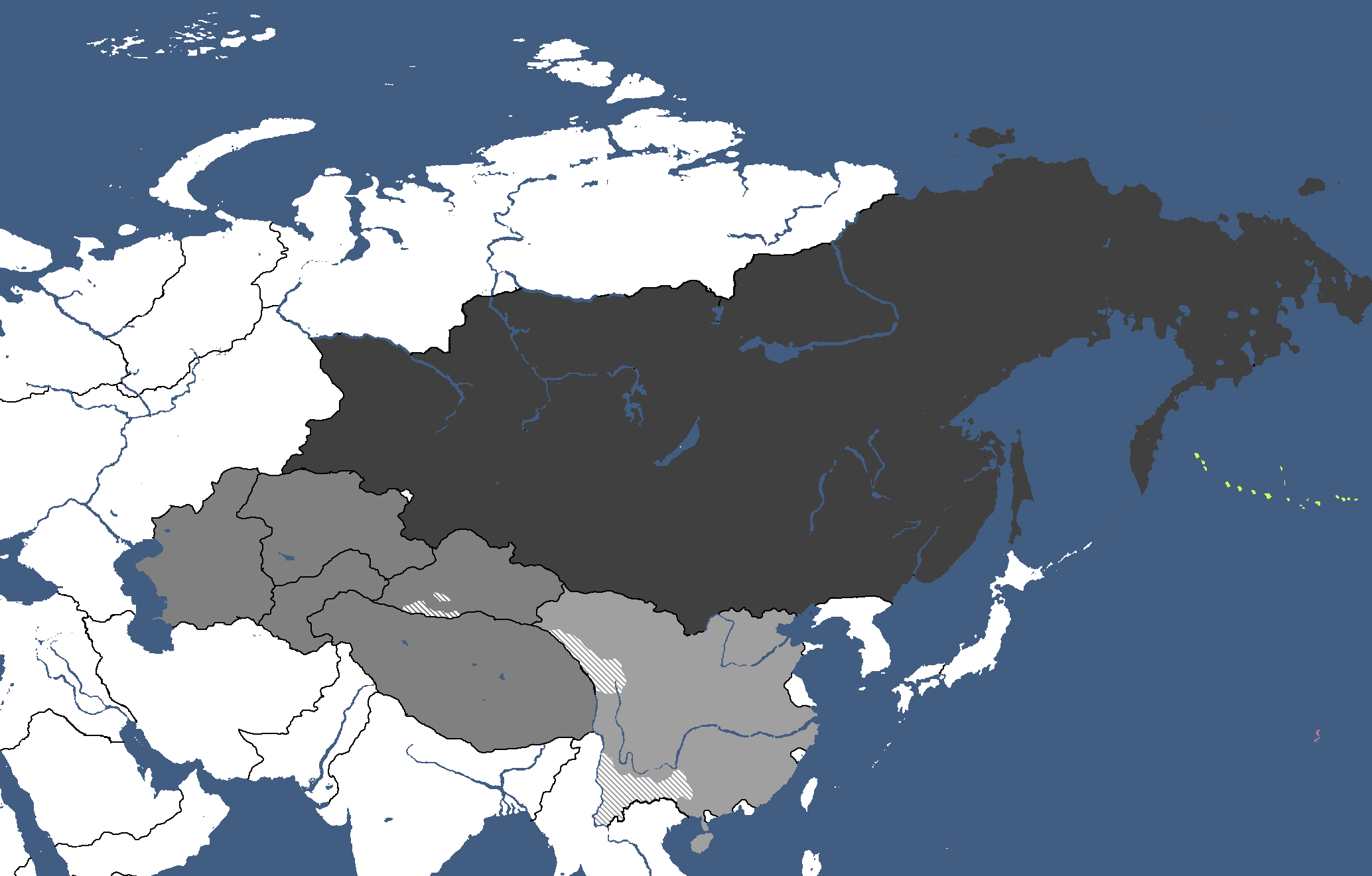
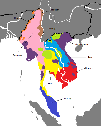
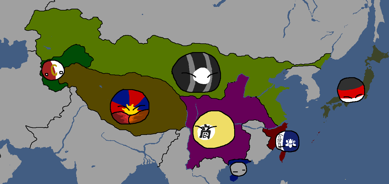
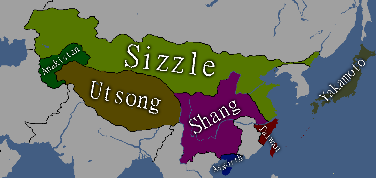
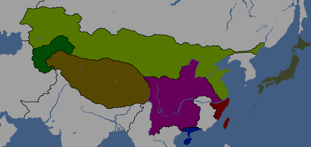
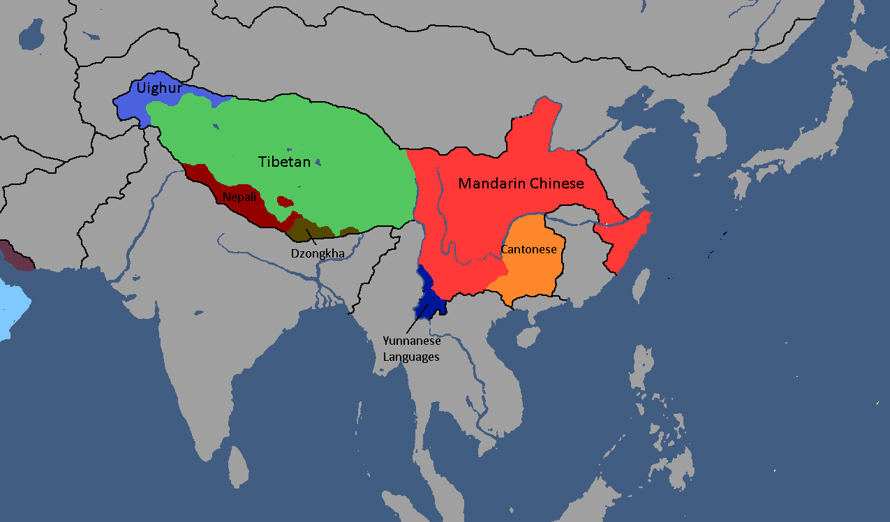
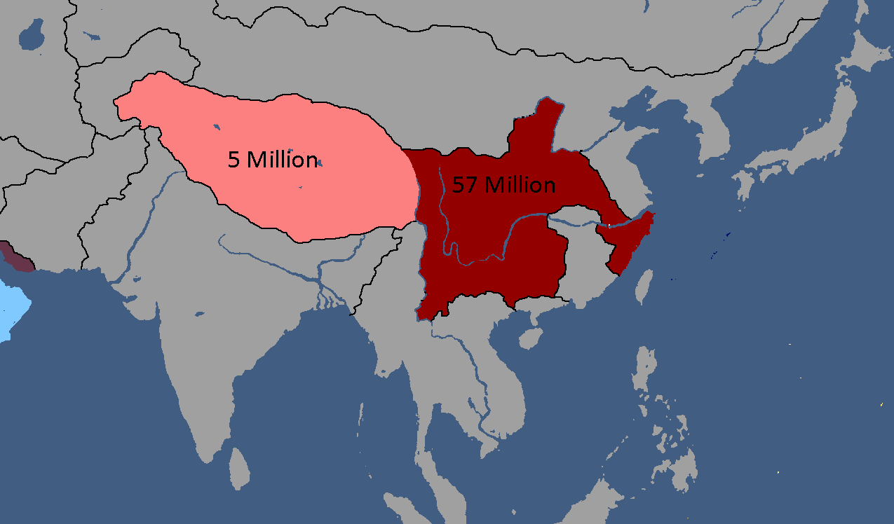
Map of East Asia: Year 1854 BCE
-
Map of the Tarqalan Empire: Year 1700 BCE
-
Map of Ancient Nations: Year 319 BCE
-
Lost Archives Map: 1
-
Lost Archives Map: 2
-
Lost Archives Map: 3
-
Lost Archives Map: 4
-
Lost Archives Map: 5
-
Lost Archives Map: 6
-
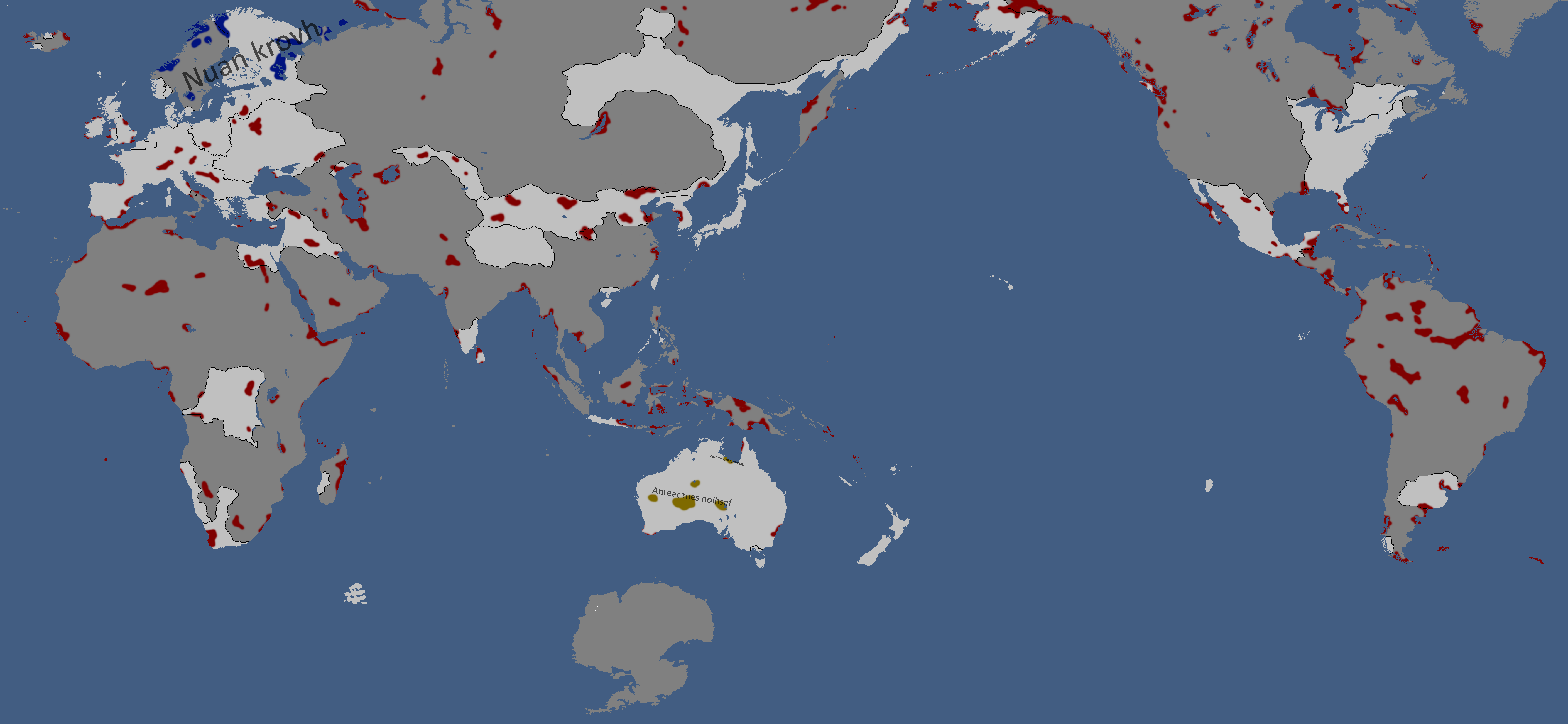
Lost Archives: Nuclear Test Map
-
-
Map of the end of World War 2
-
Map of early World War 3
-
Yomtach Tribes: Year 85
-
Pixels in sizes: Year 90
-
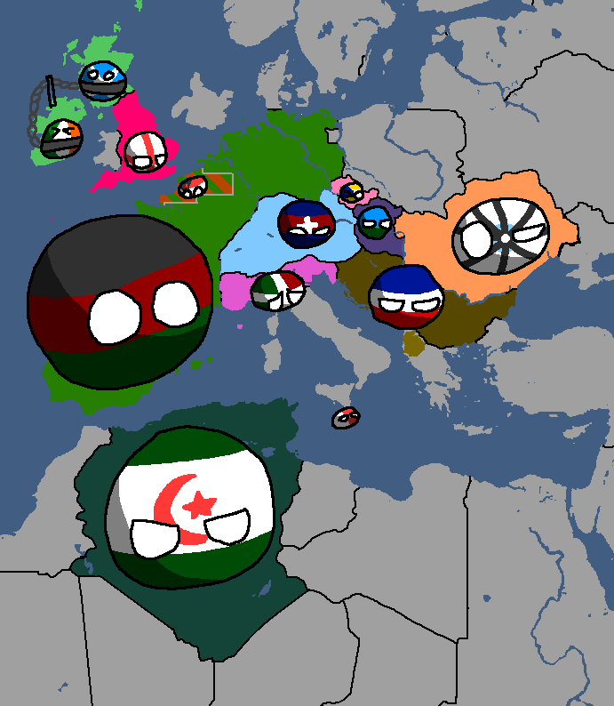
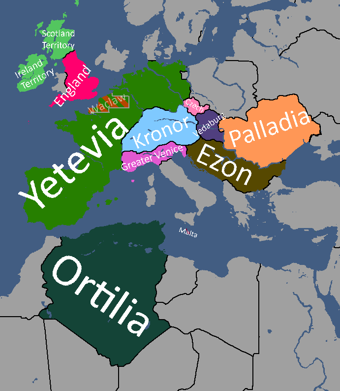
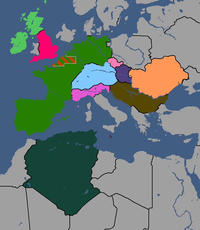
What Quatritonia calls the world
-
Year 97
-
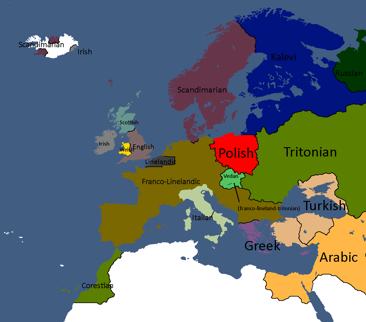
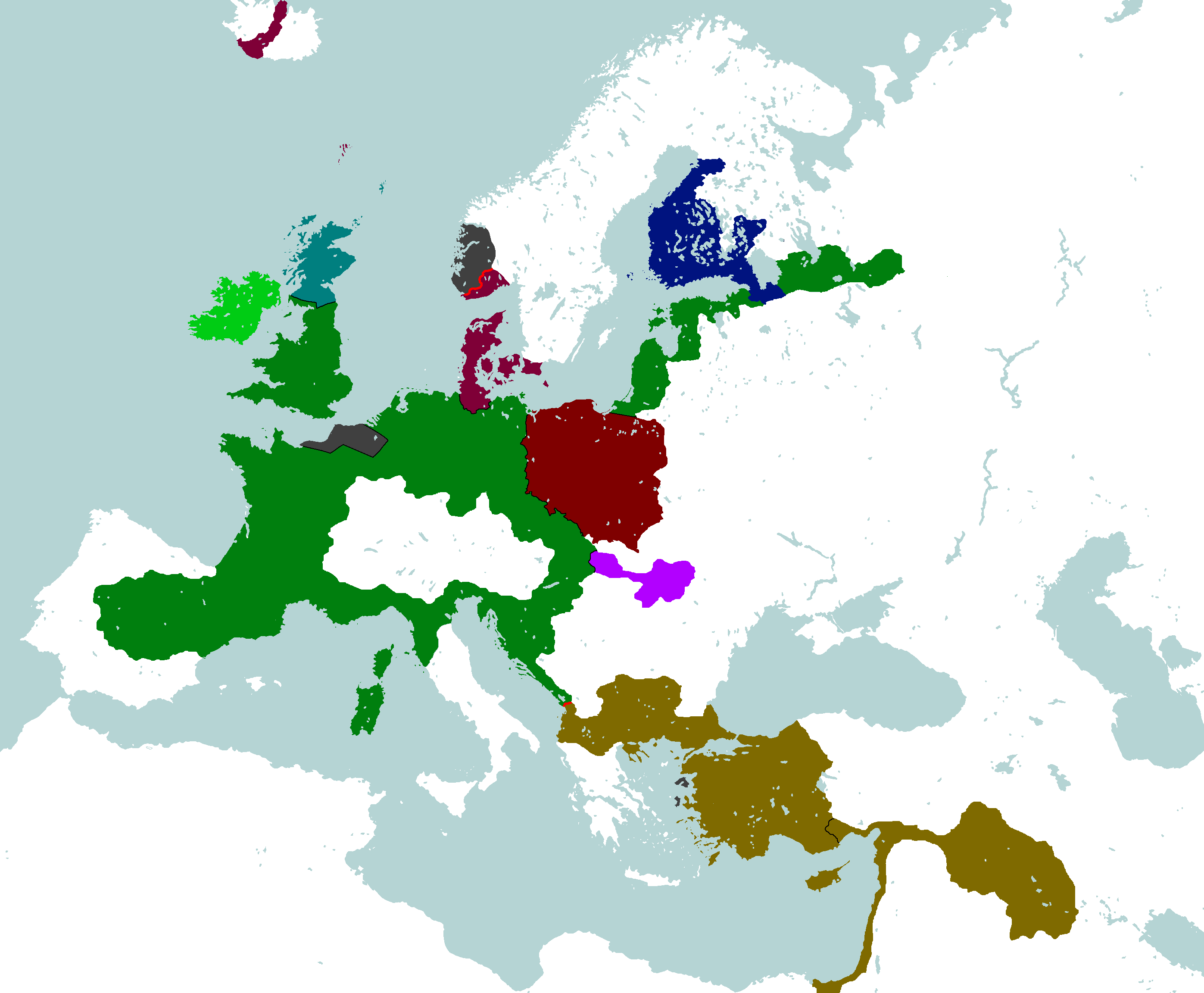
European Cultures: Year 103
-
Unlabled
-
South Asia Overlay: Year 112
-
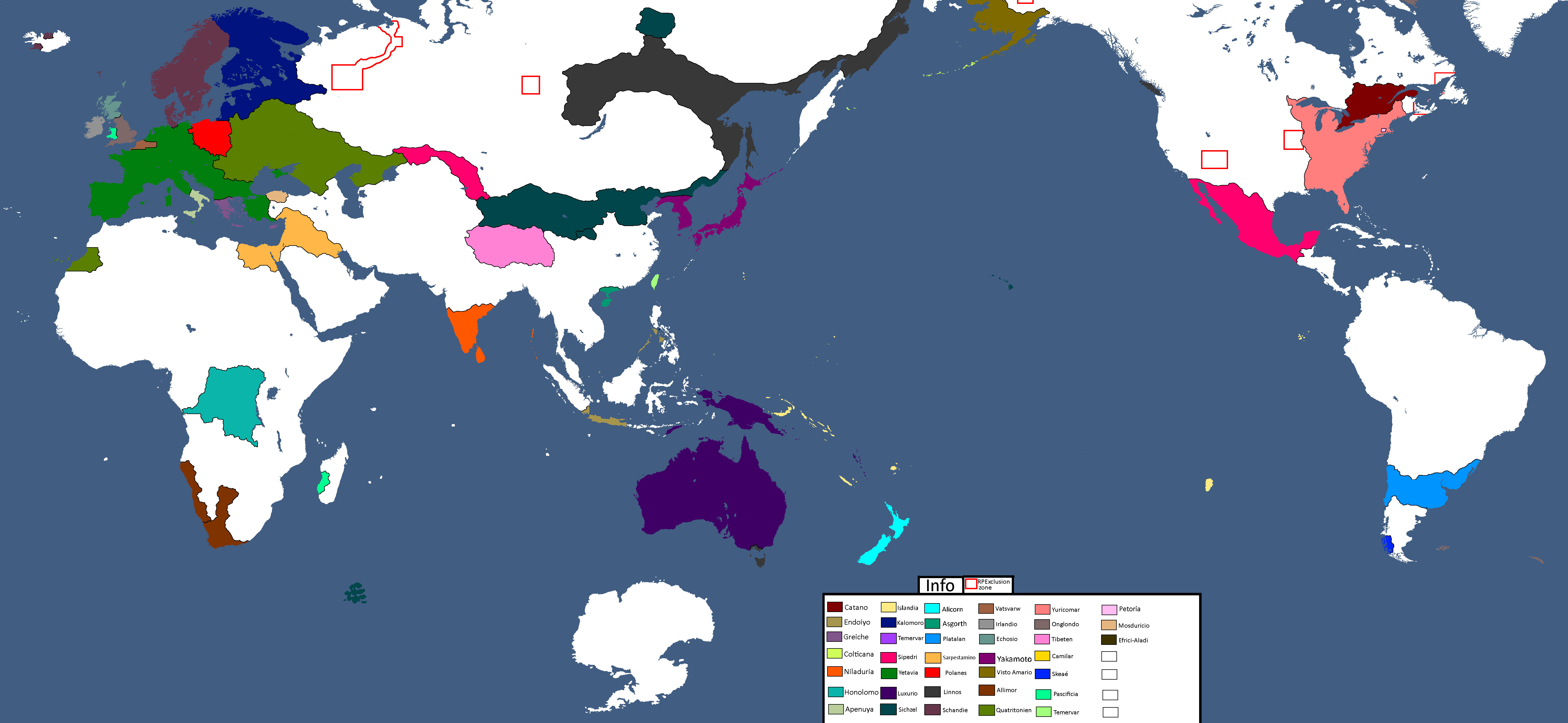
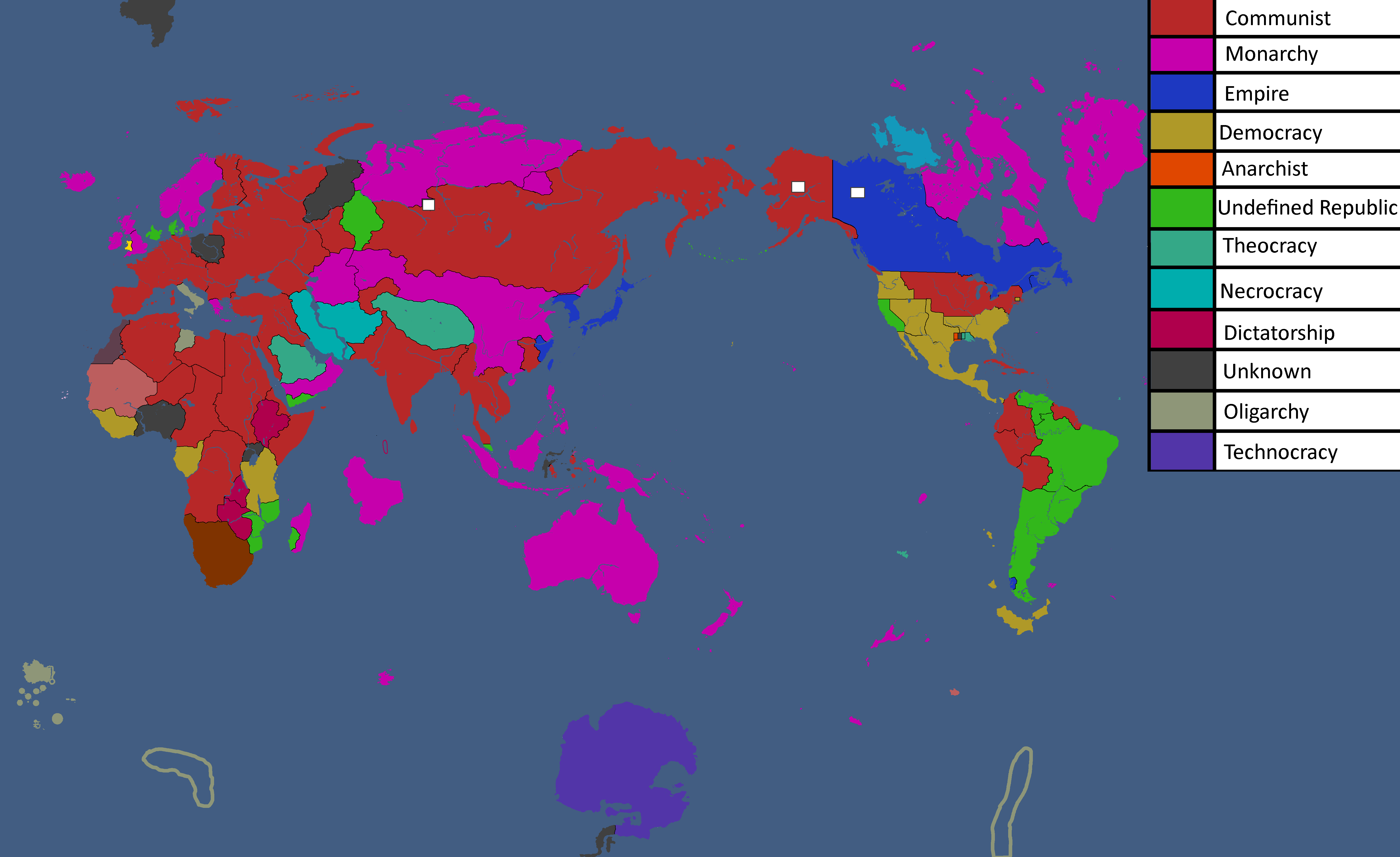
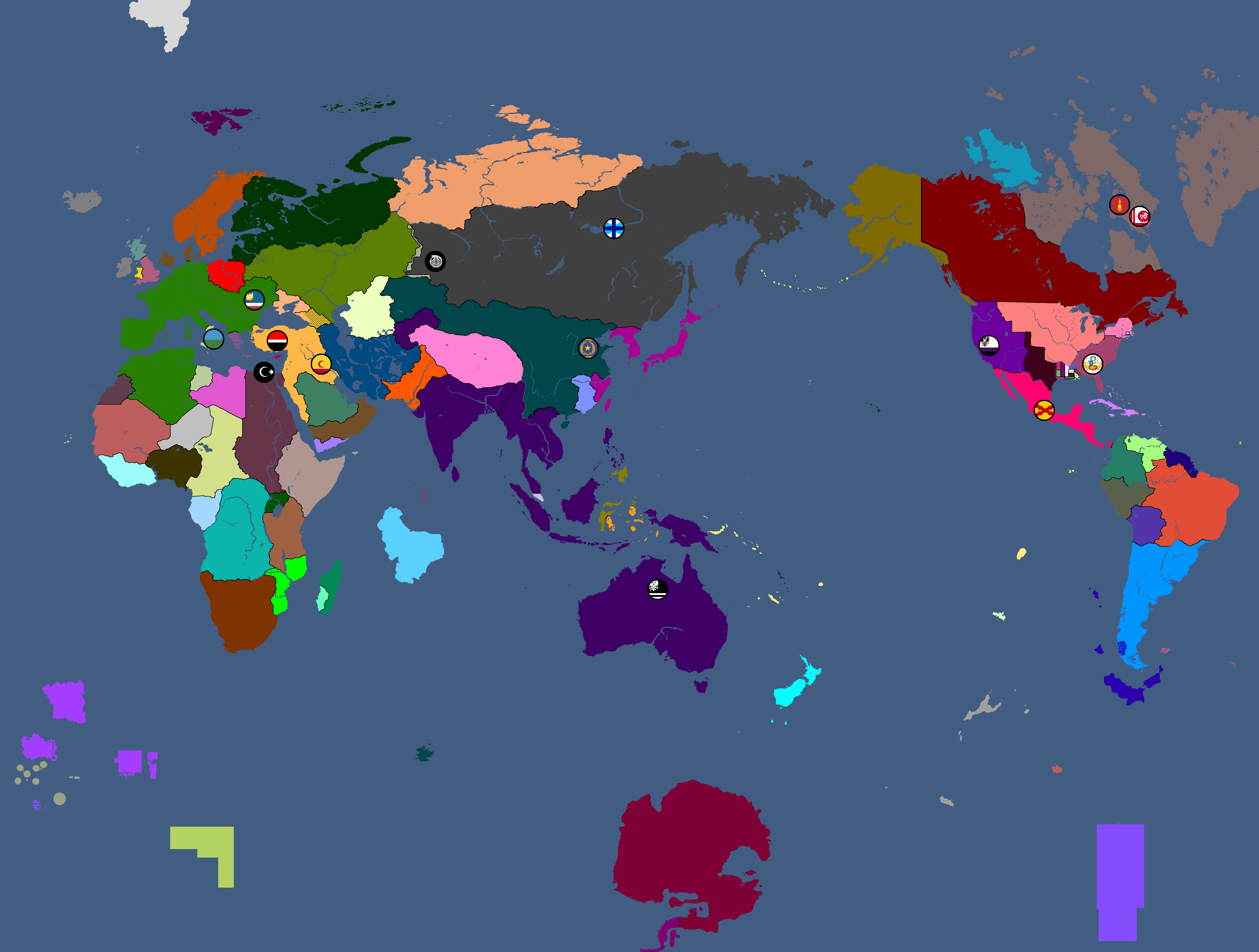
Nation Owners Map: Year 112
-
South Asia Overlay: Year 112 (2)
-
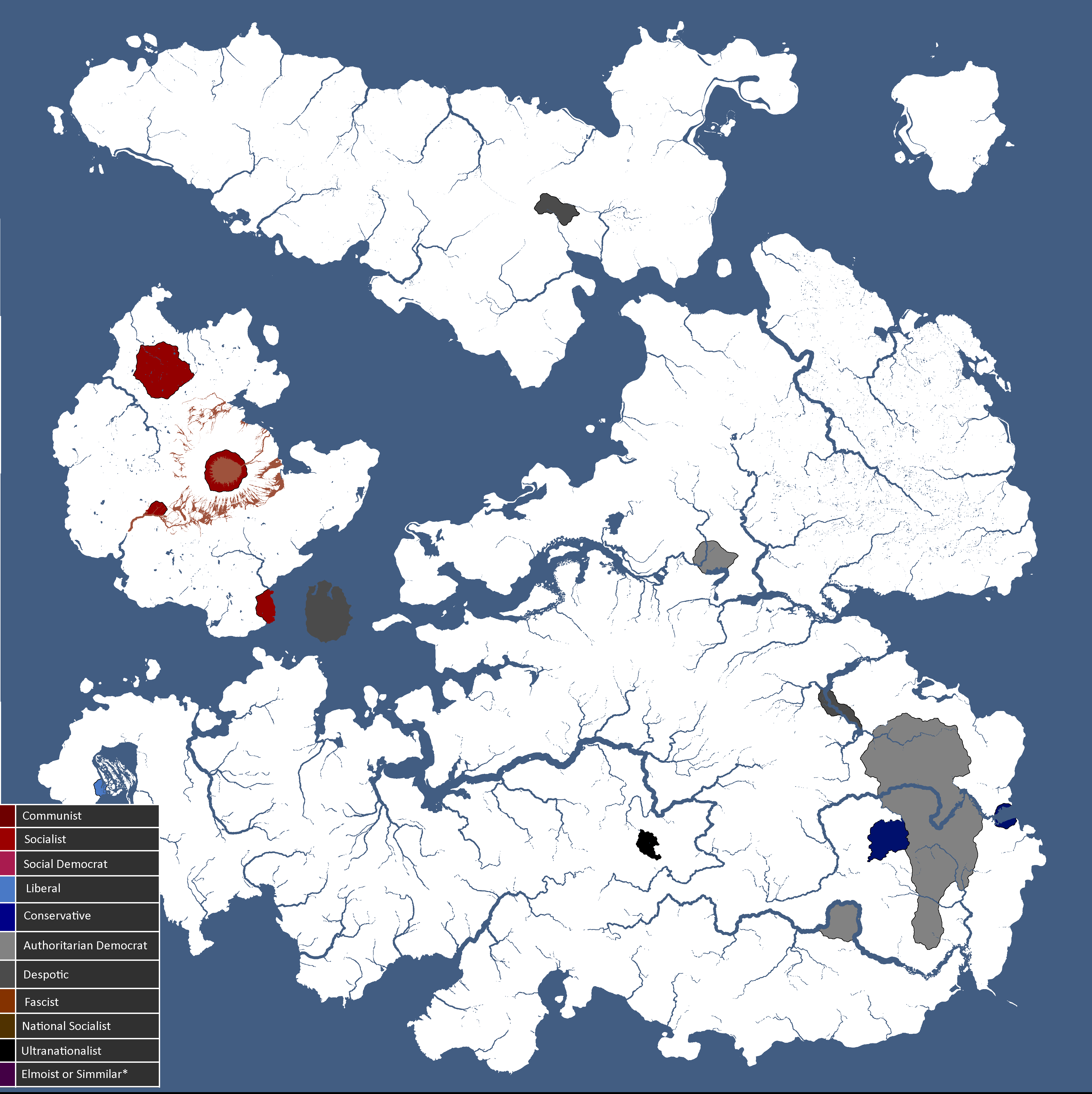
Communist Governments: Year 112
-
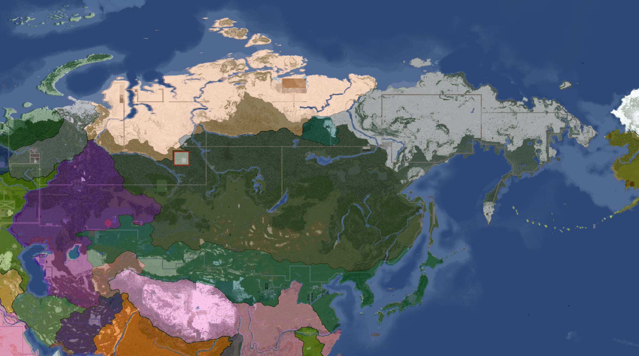
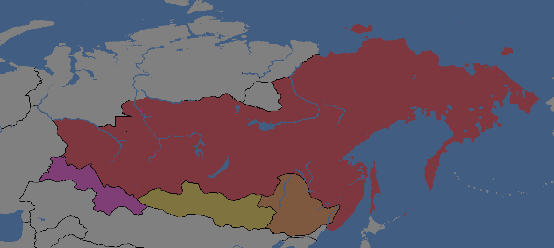
Asia Overlay: Year 113
-
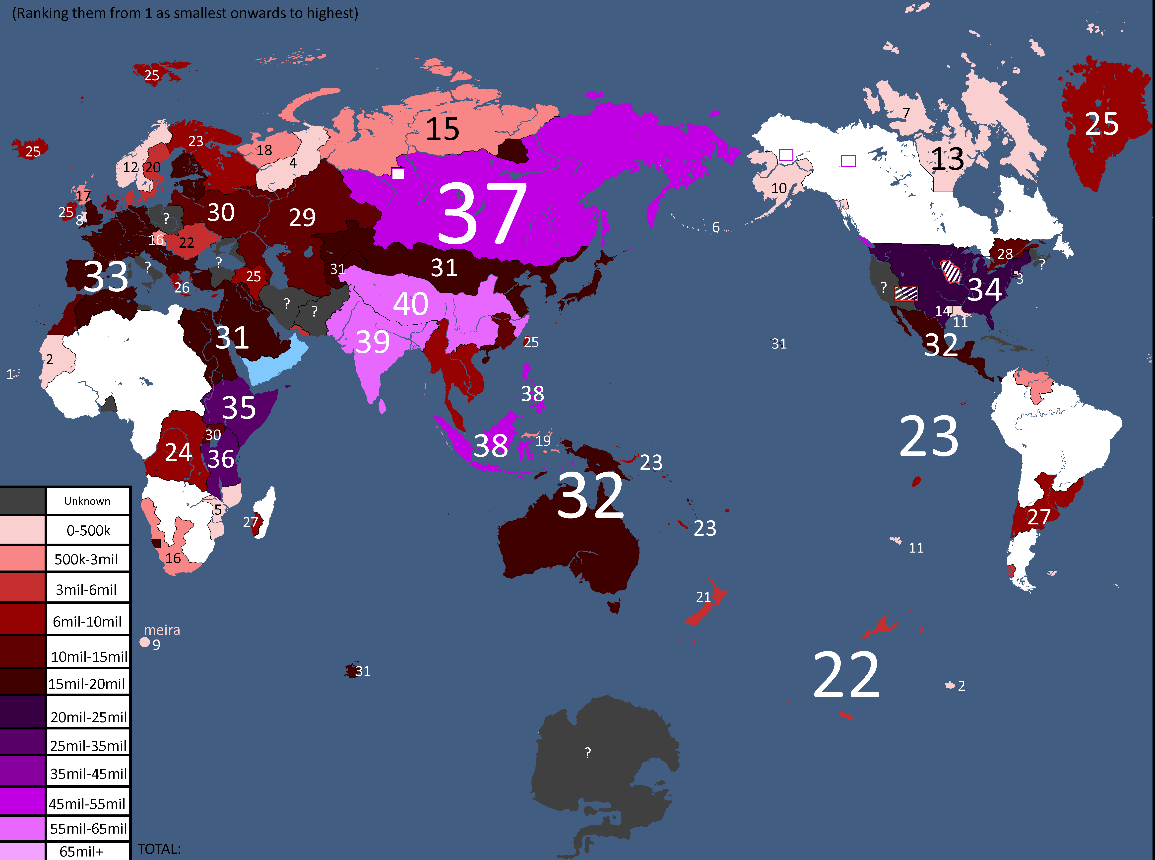
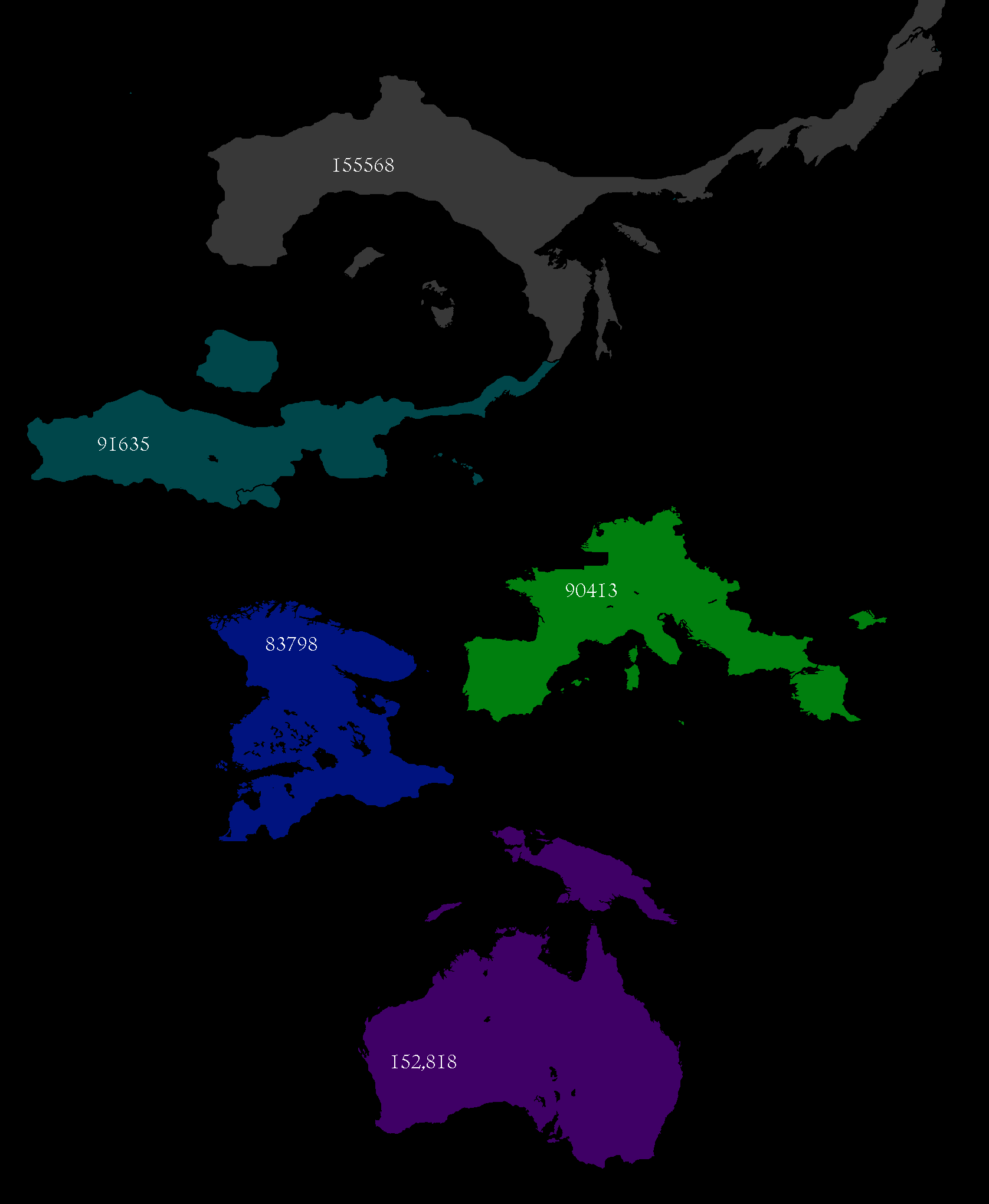
Population of Yata's Countries: Year 114
-
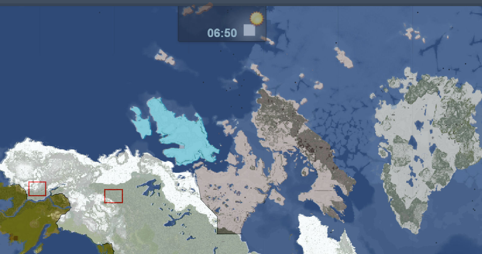
Northern Canada Overlay: Year 114
-
IRL Countries with no claims in them on YATA: Year 115
-

Europe's Population Density: Year 115
-
"Yata if it was good" meme: Year 116
-
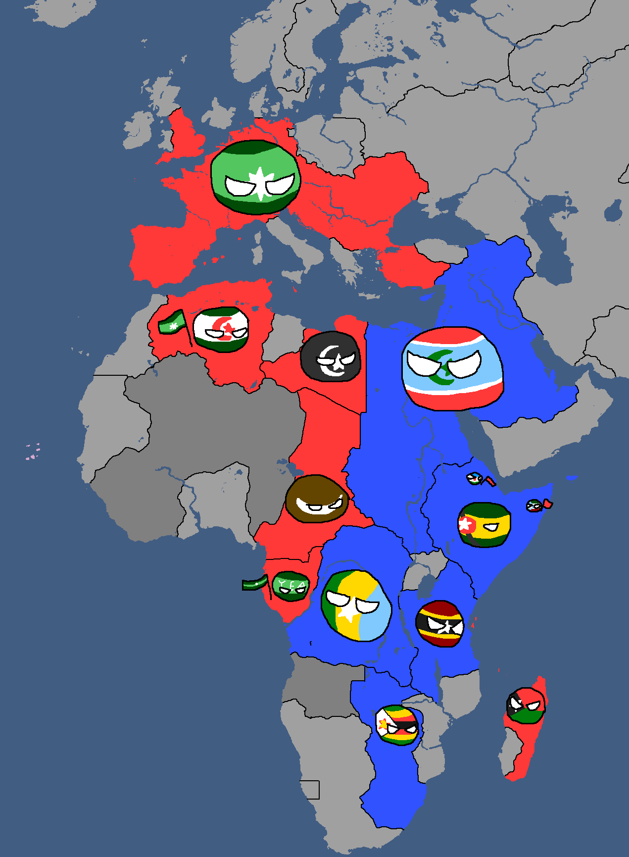
African Cold War: Year 117
-
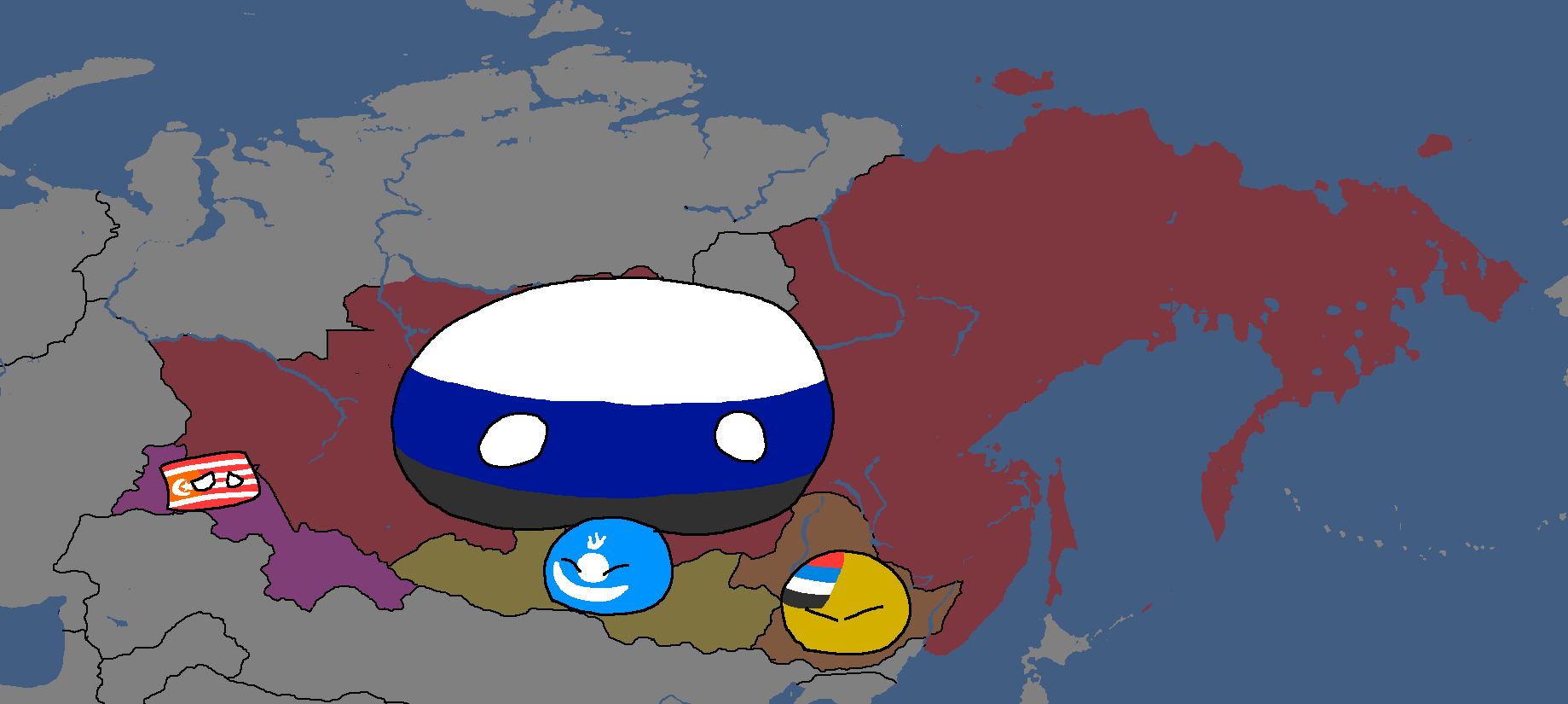
Yata Countryballs Map: Year 117
-
Hypothetical War between the UQSR and Aundzer Alliance: Year 117
-
Africa Overlay: Year 117
-
Lineland Overlay: Year 123
-
Nuclear Powers in White: Year 134
-
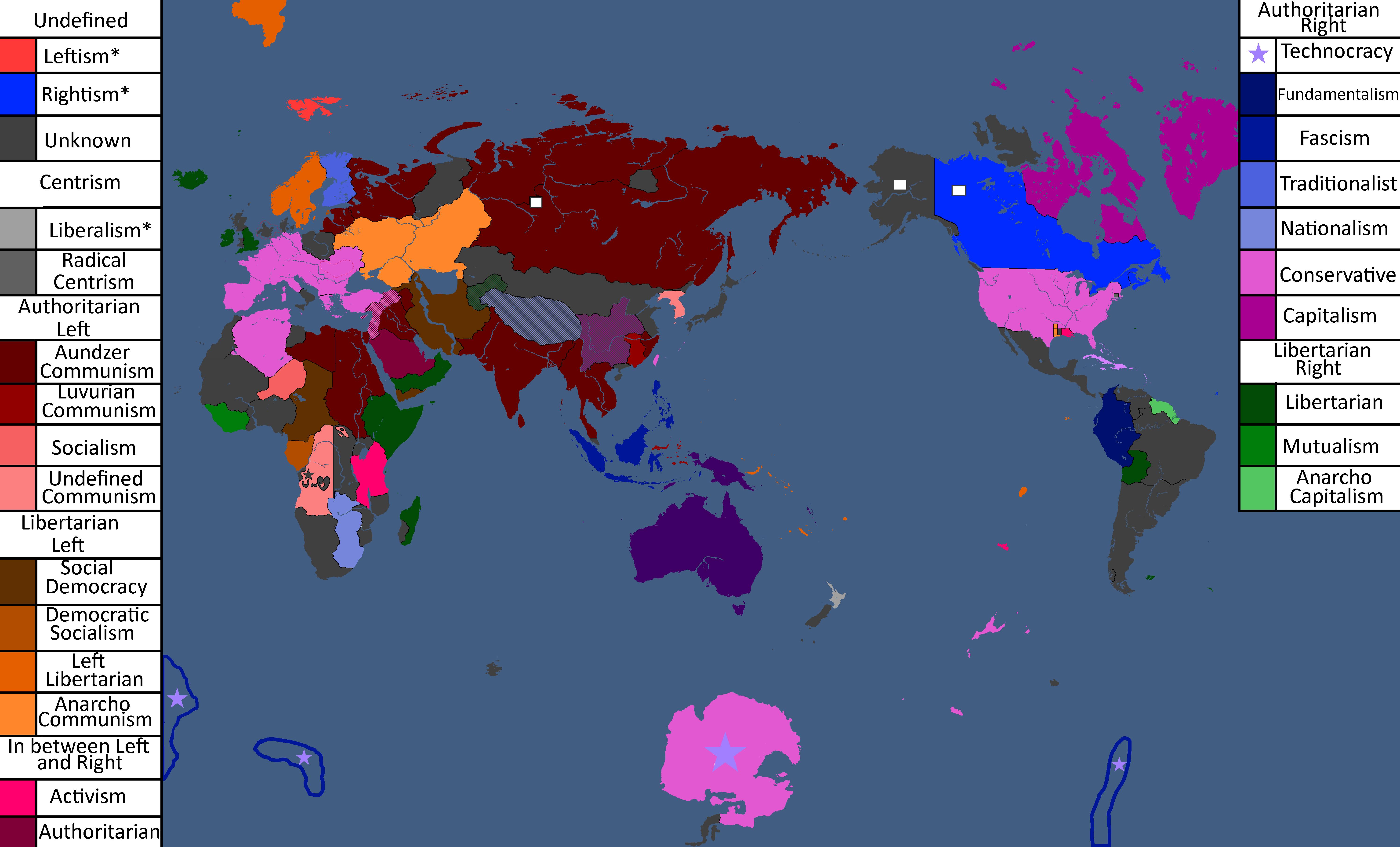
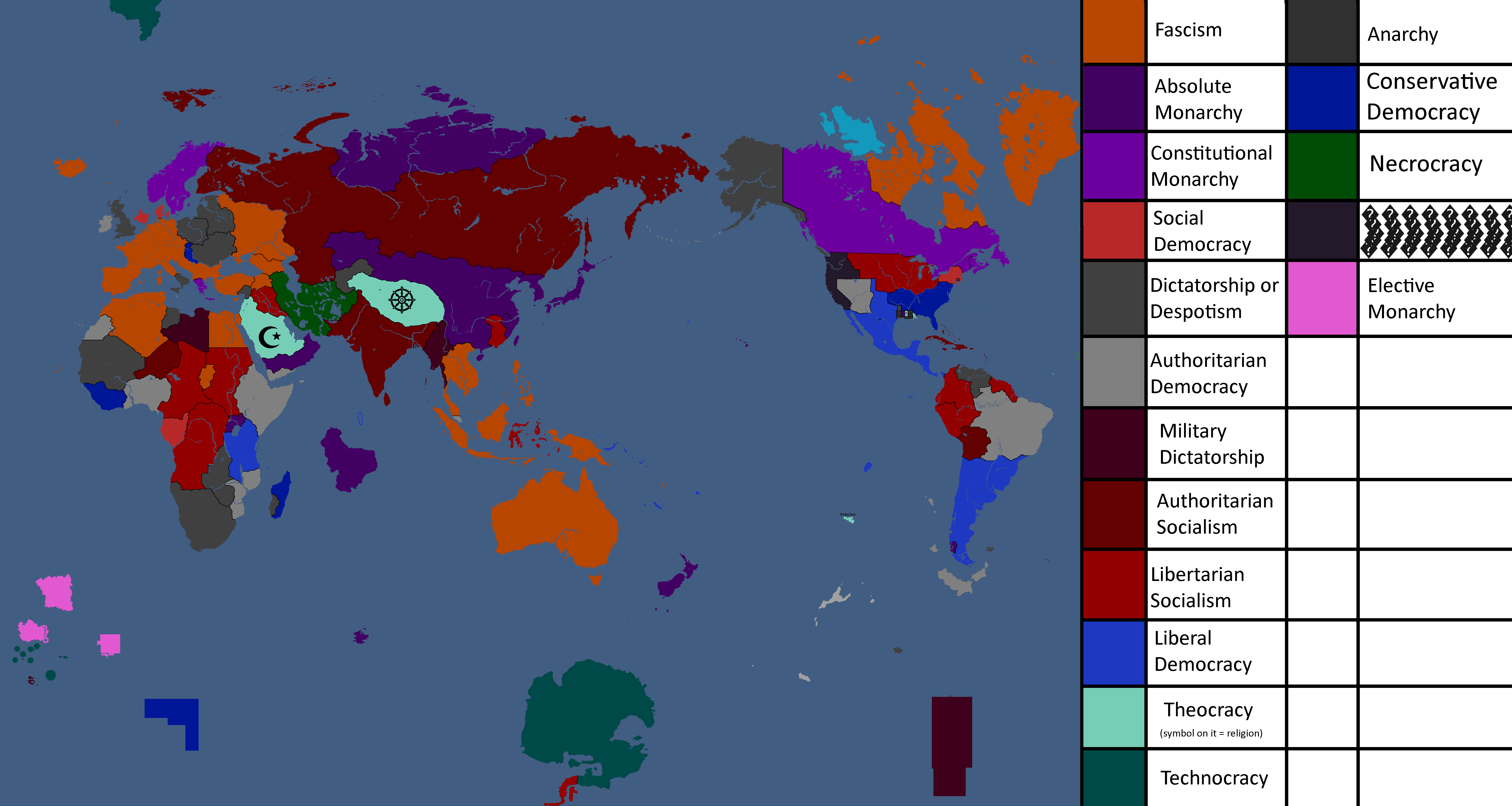
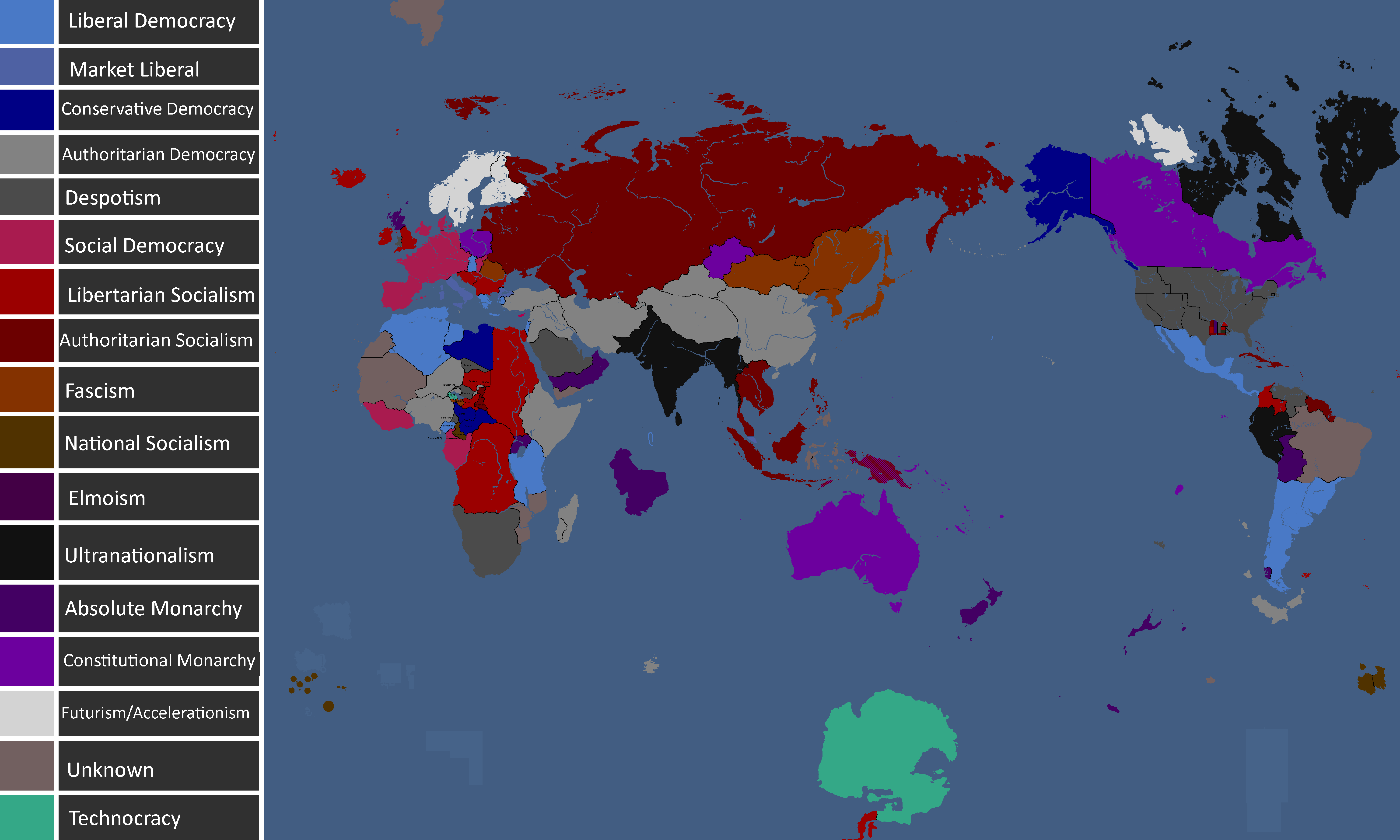
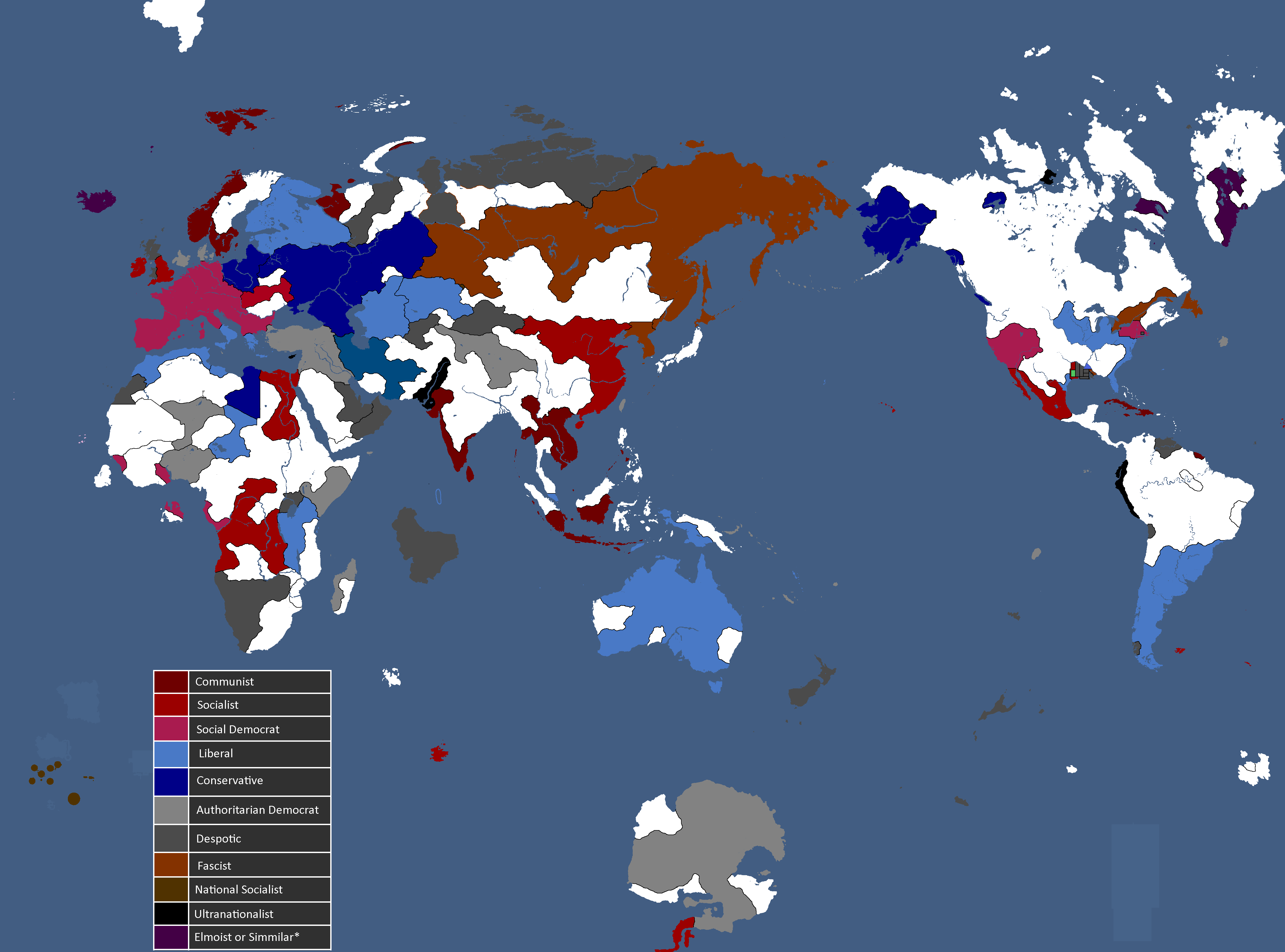
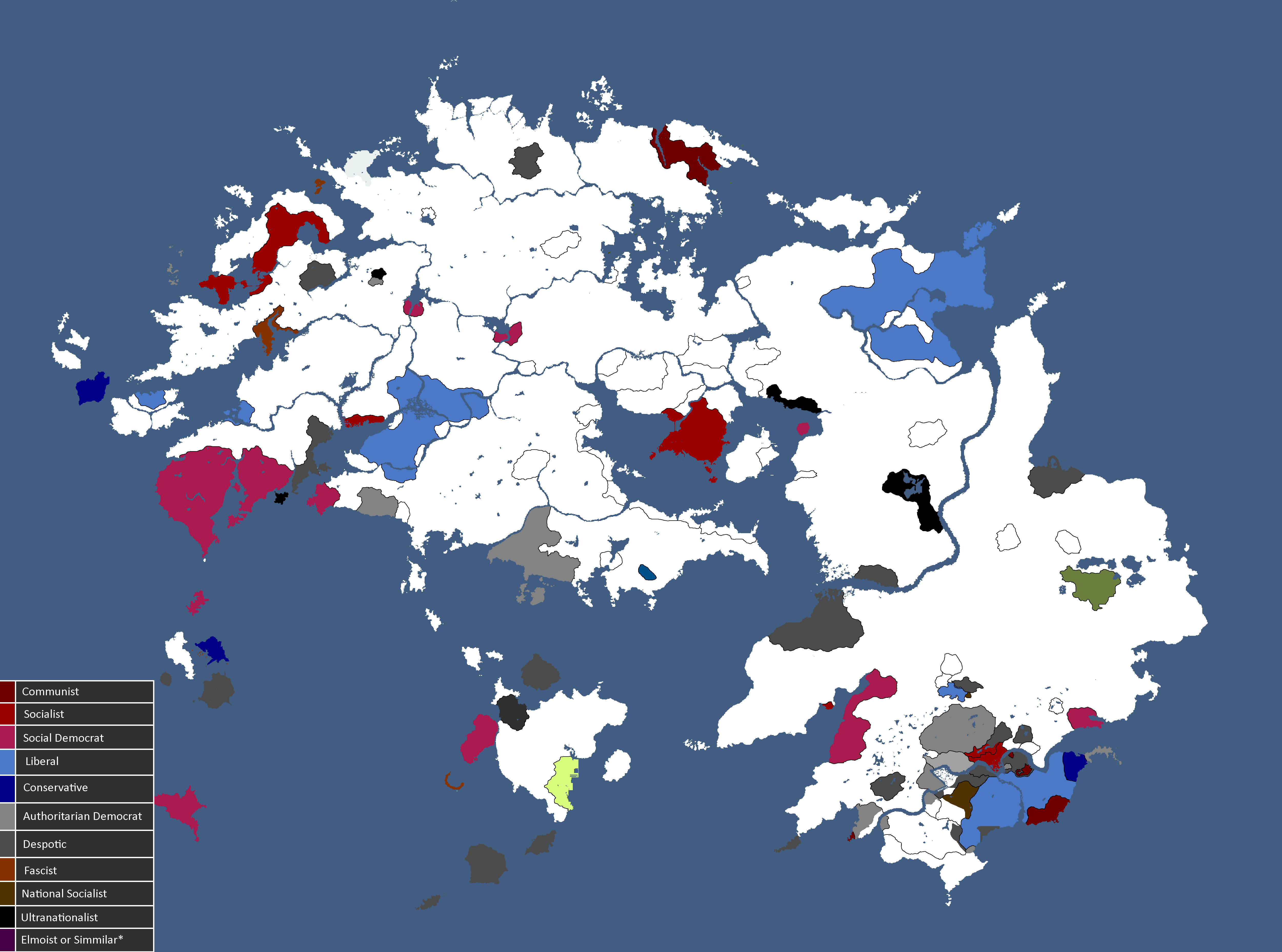
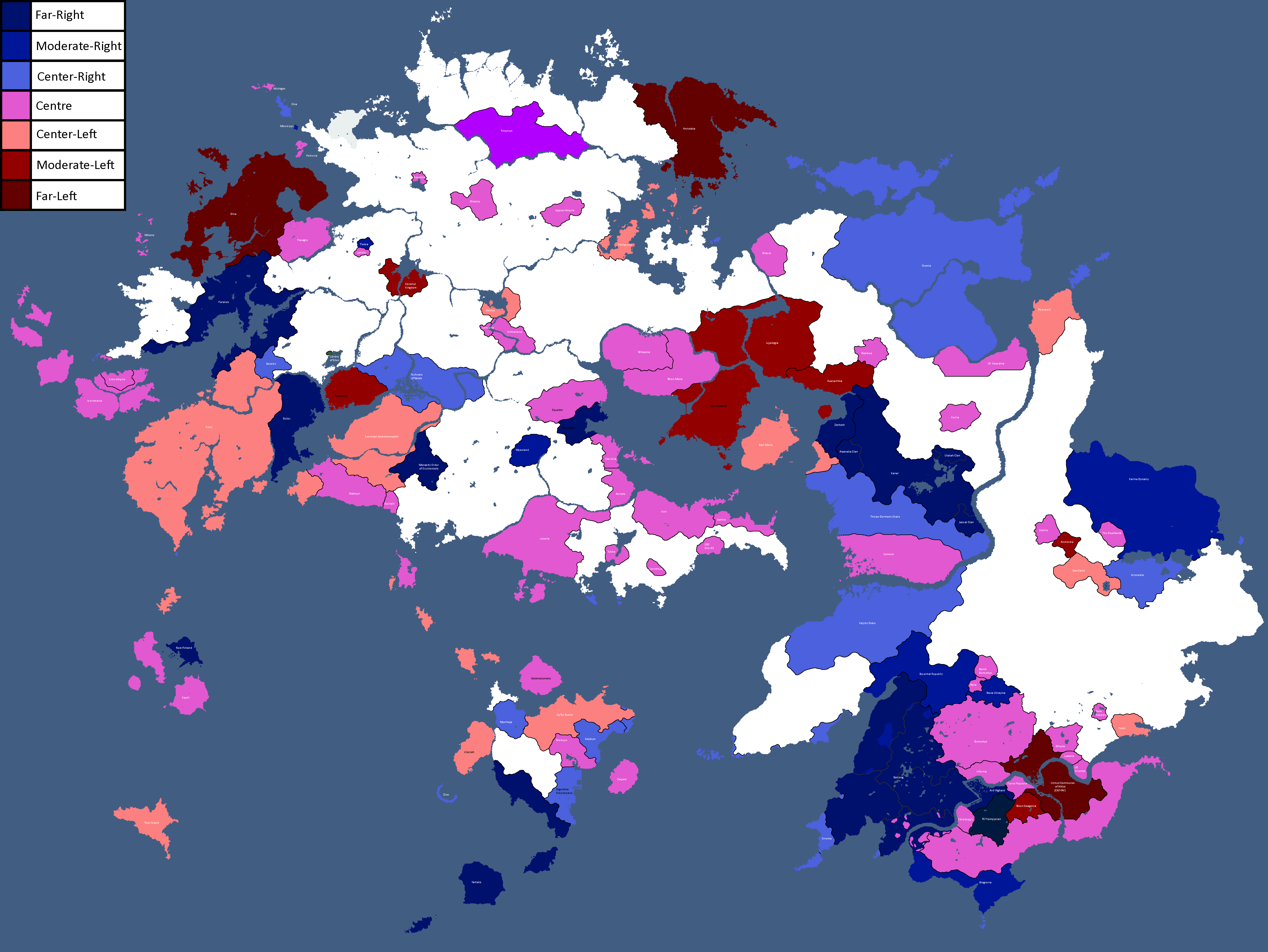
Map of Political Ideologies: Year 147
-
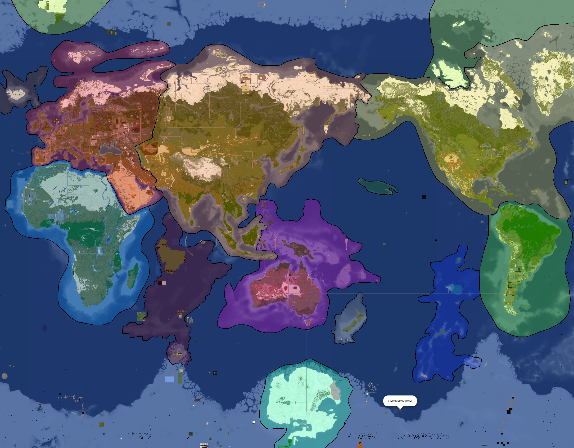
Proposed Map of Continents: Year 153
-
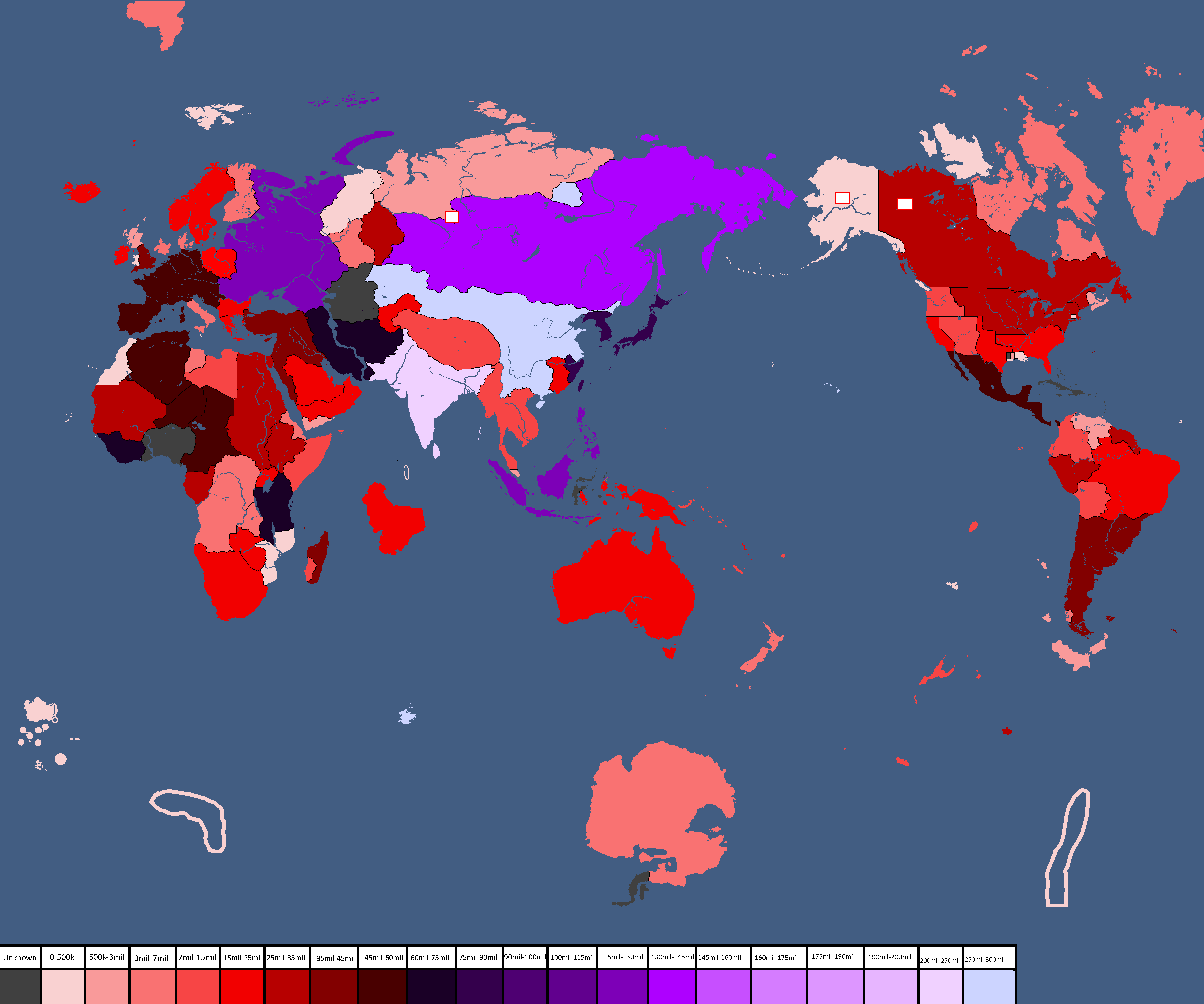
Population Map: Year 166
-
Ideology Map: Year 166
-
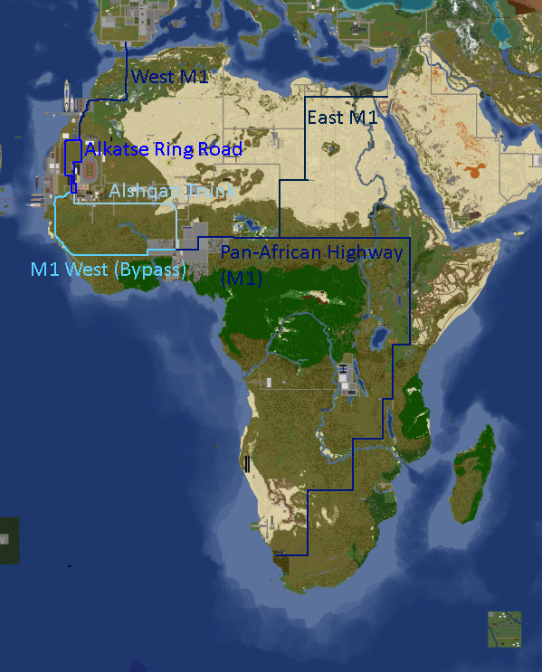
Africa Road Map: Year 168
-
Yatan Cold War: Year 172
-
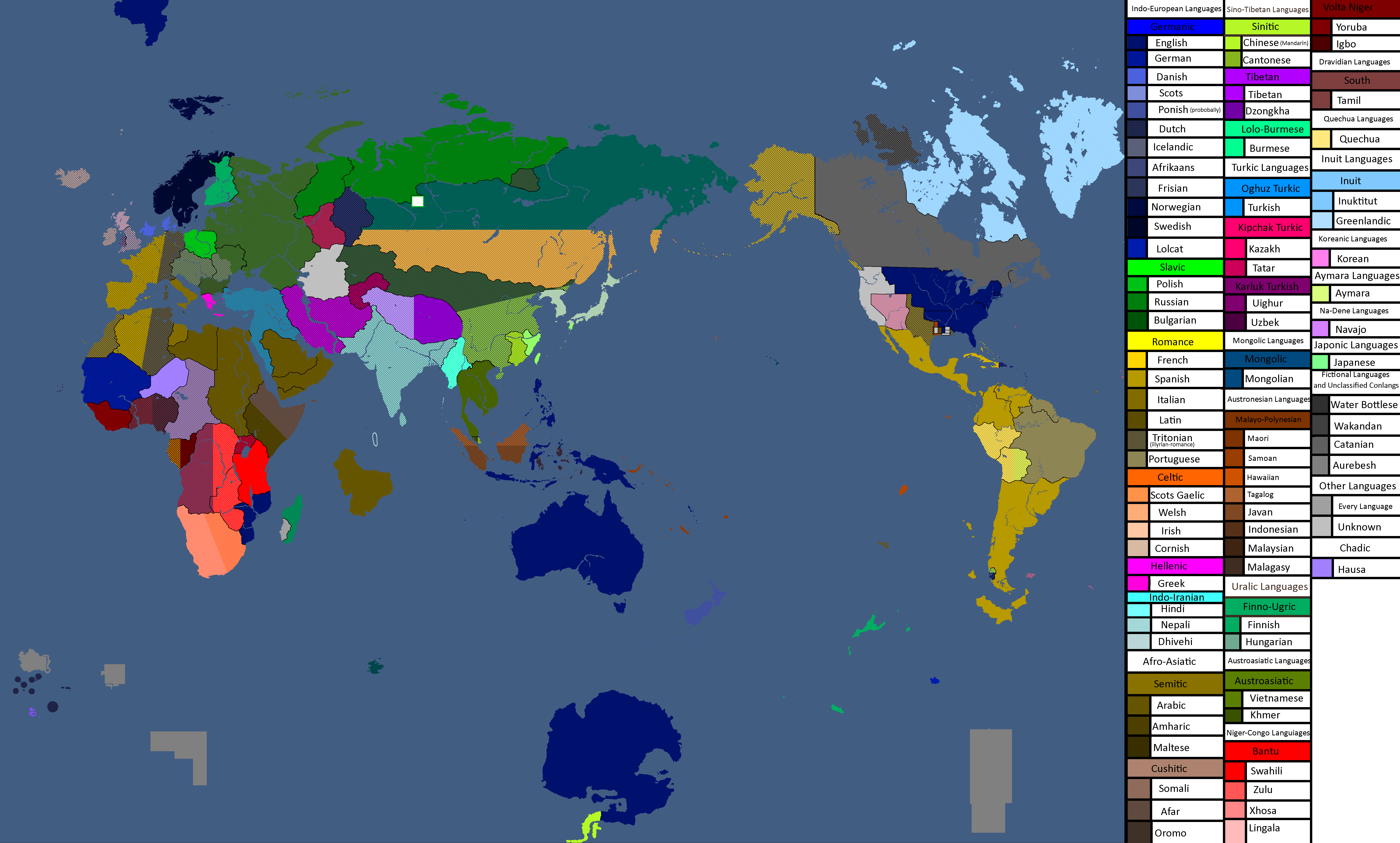
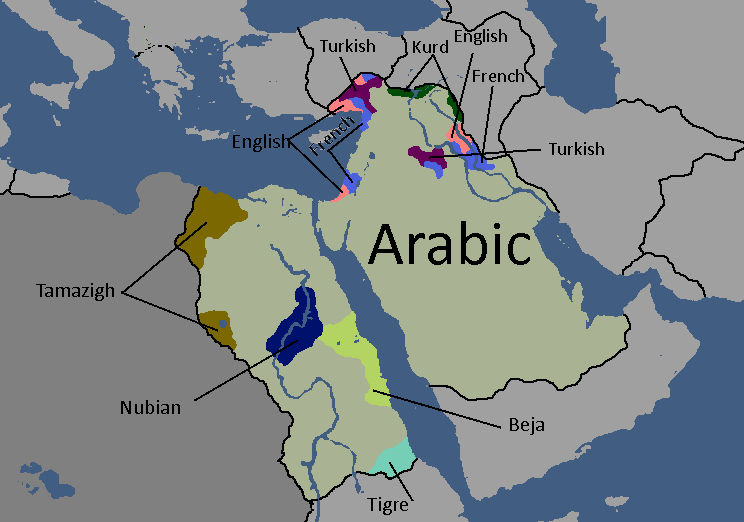
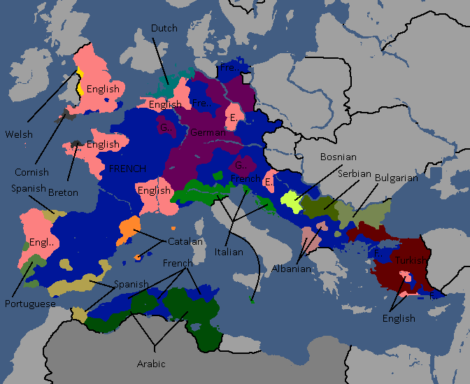
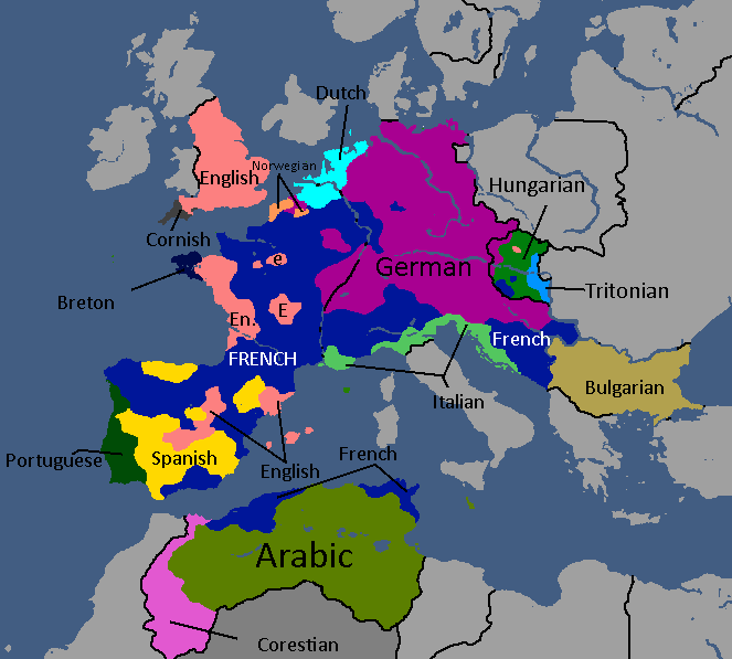
Map of Official Languages: Year 174
-
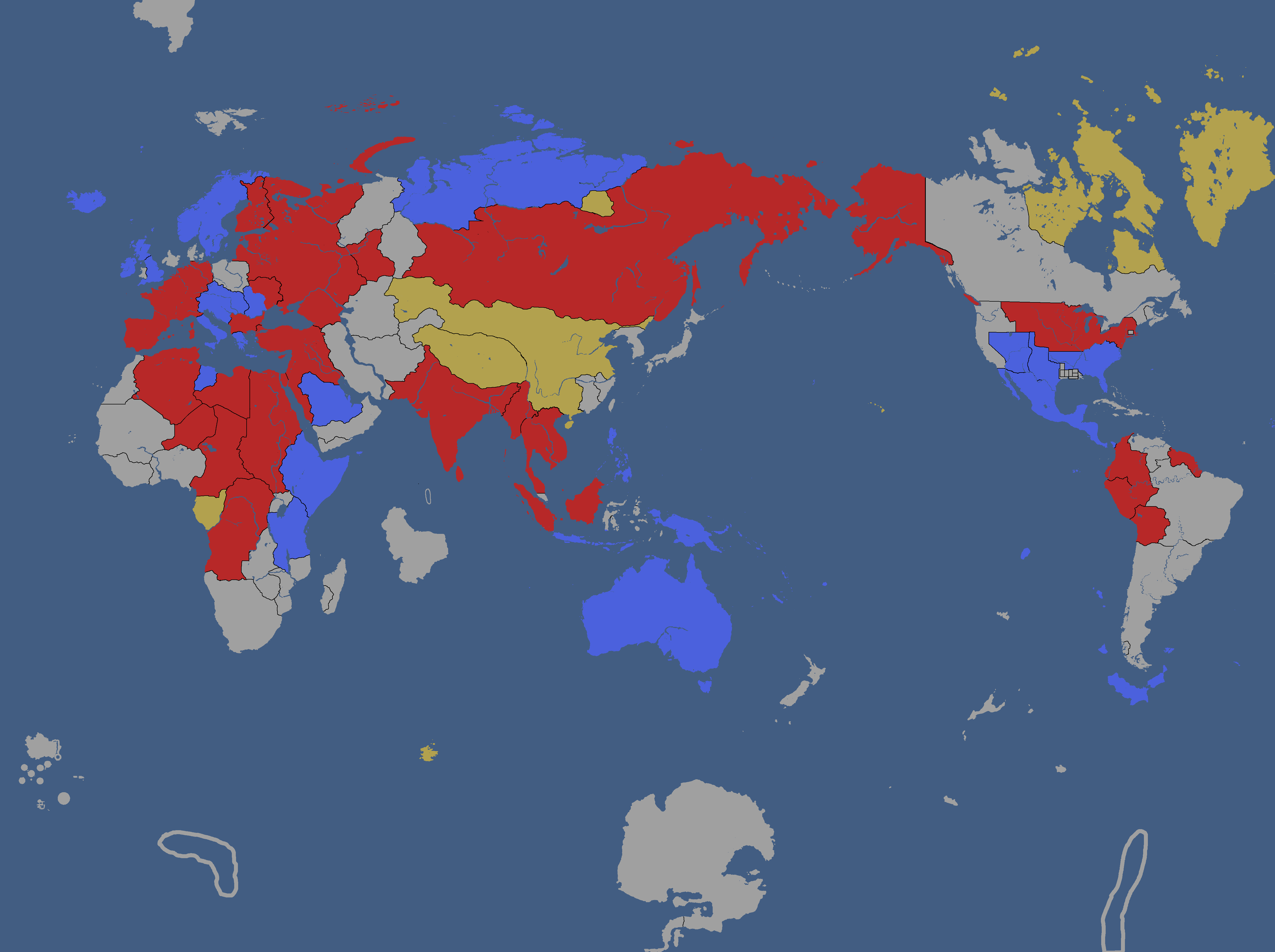
Map of Yata's Power Statuses: Year 180
-
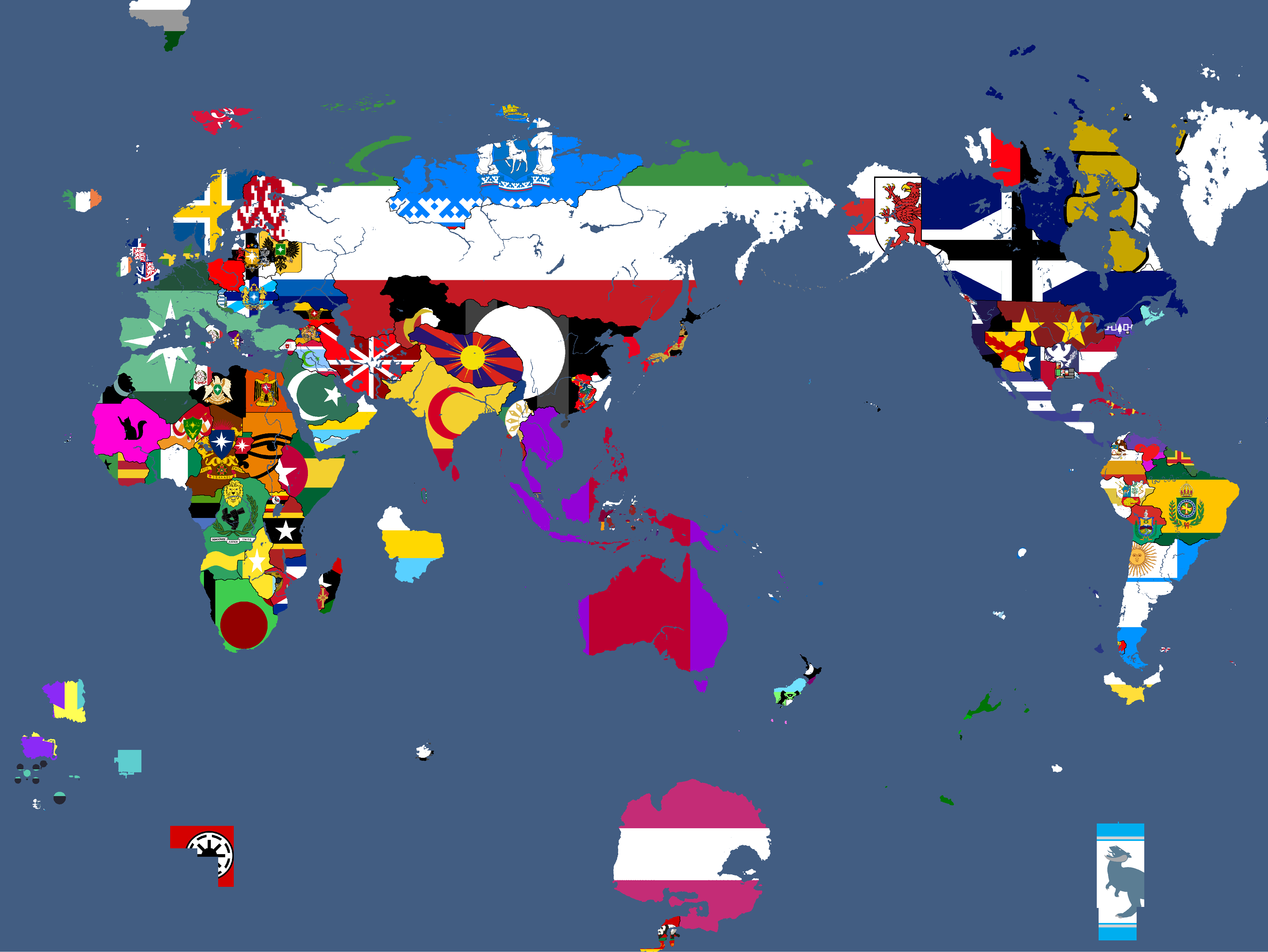
Flag Map: Year 183
-
Ideology Map: Year 183
-
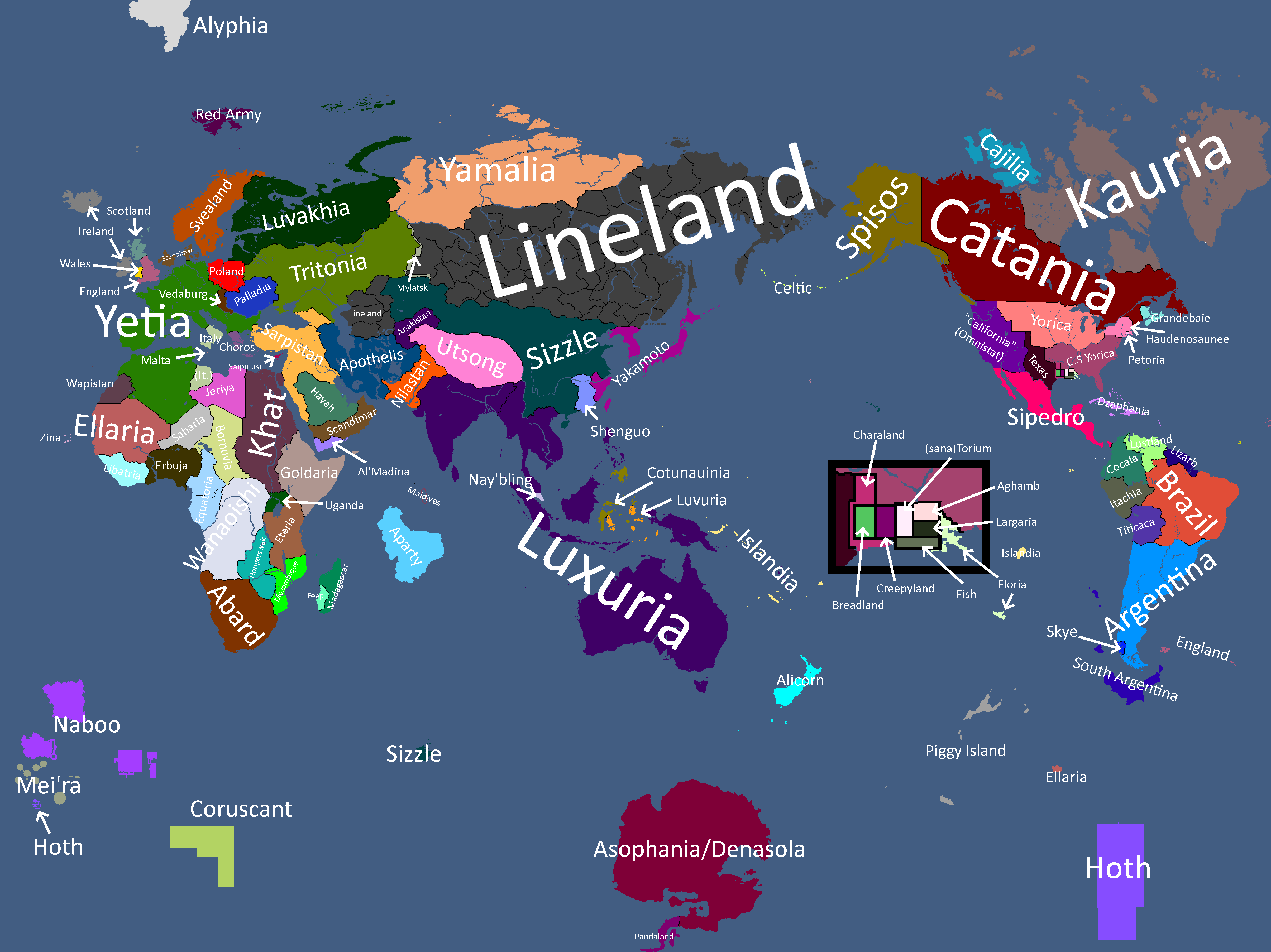
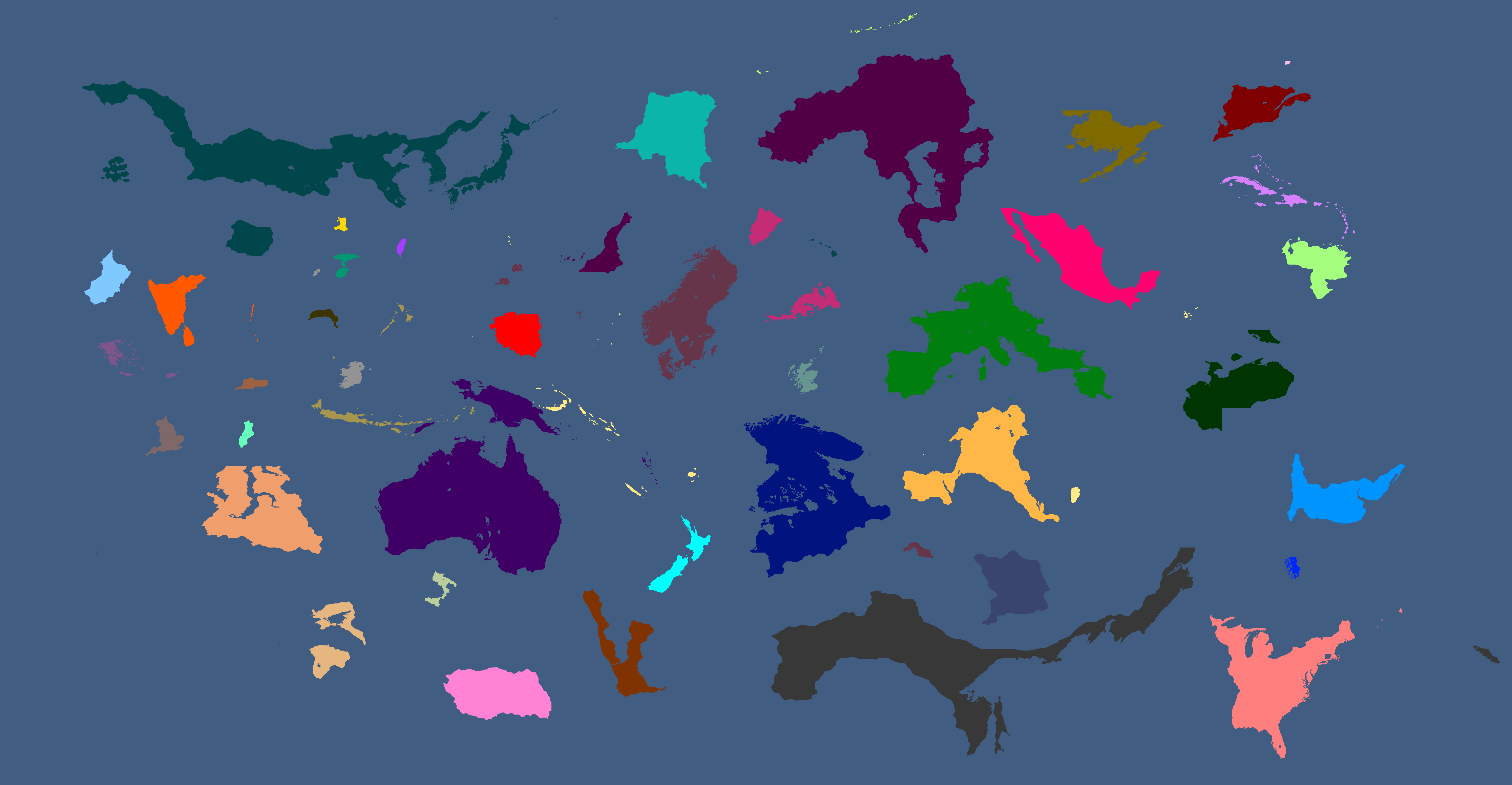
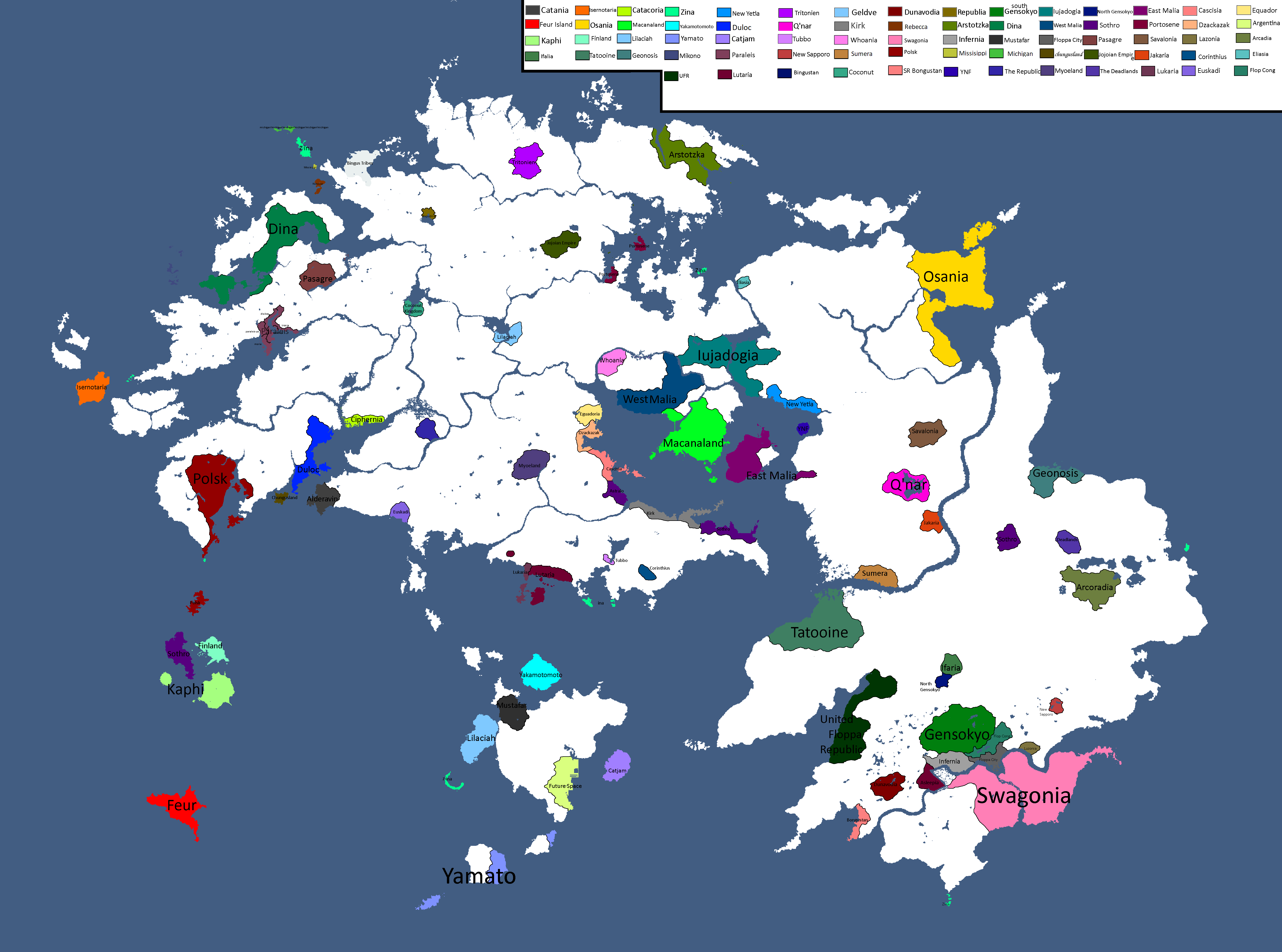
Map with names: Year 186
-
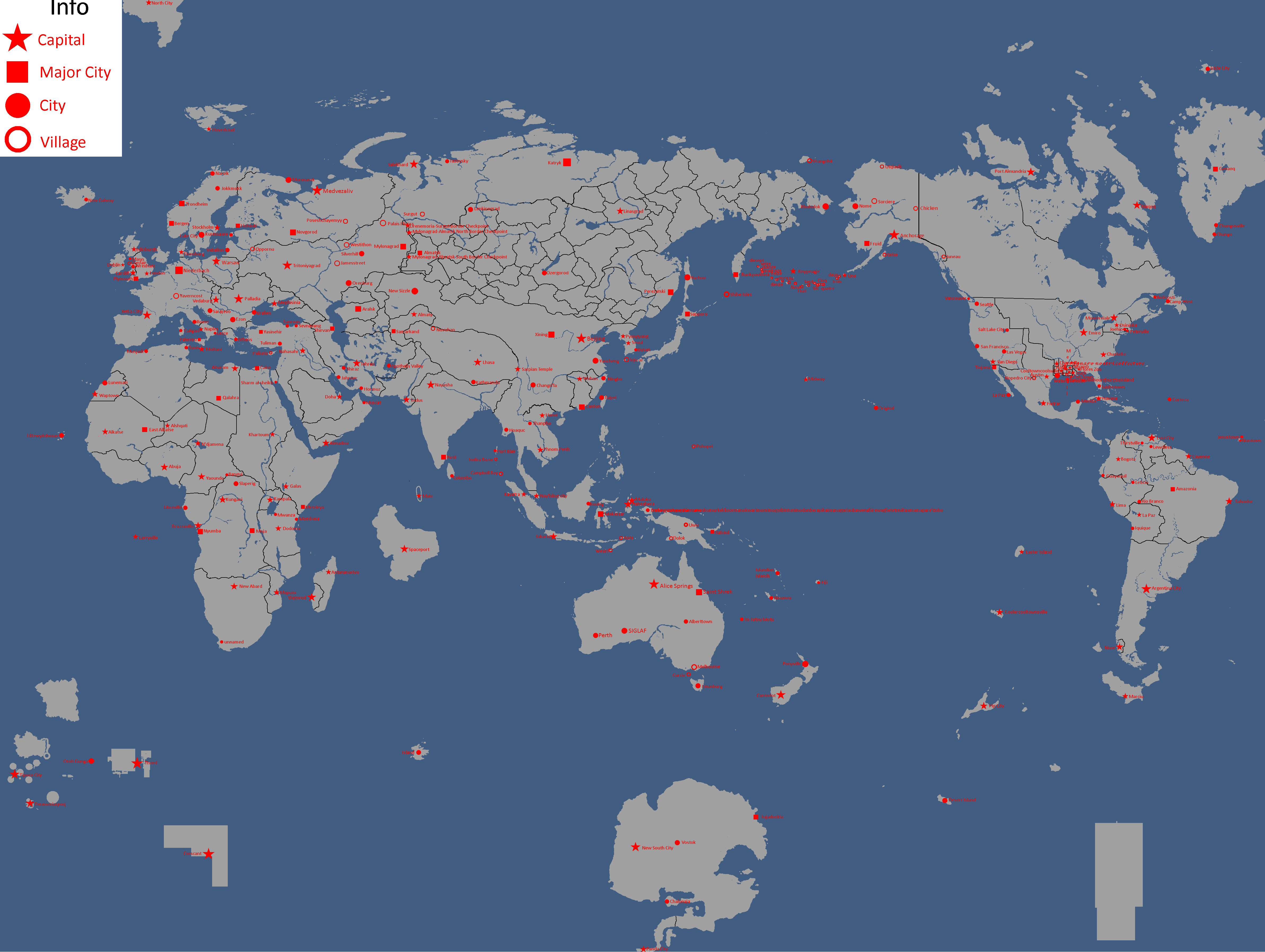
Map of Cities: Year 188
-
Map of Governments in Exile: Year 193
-
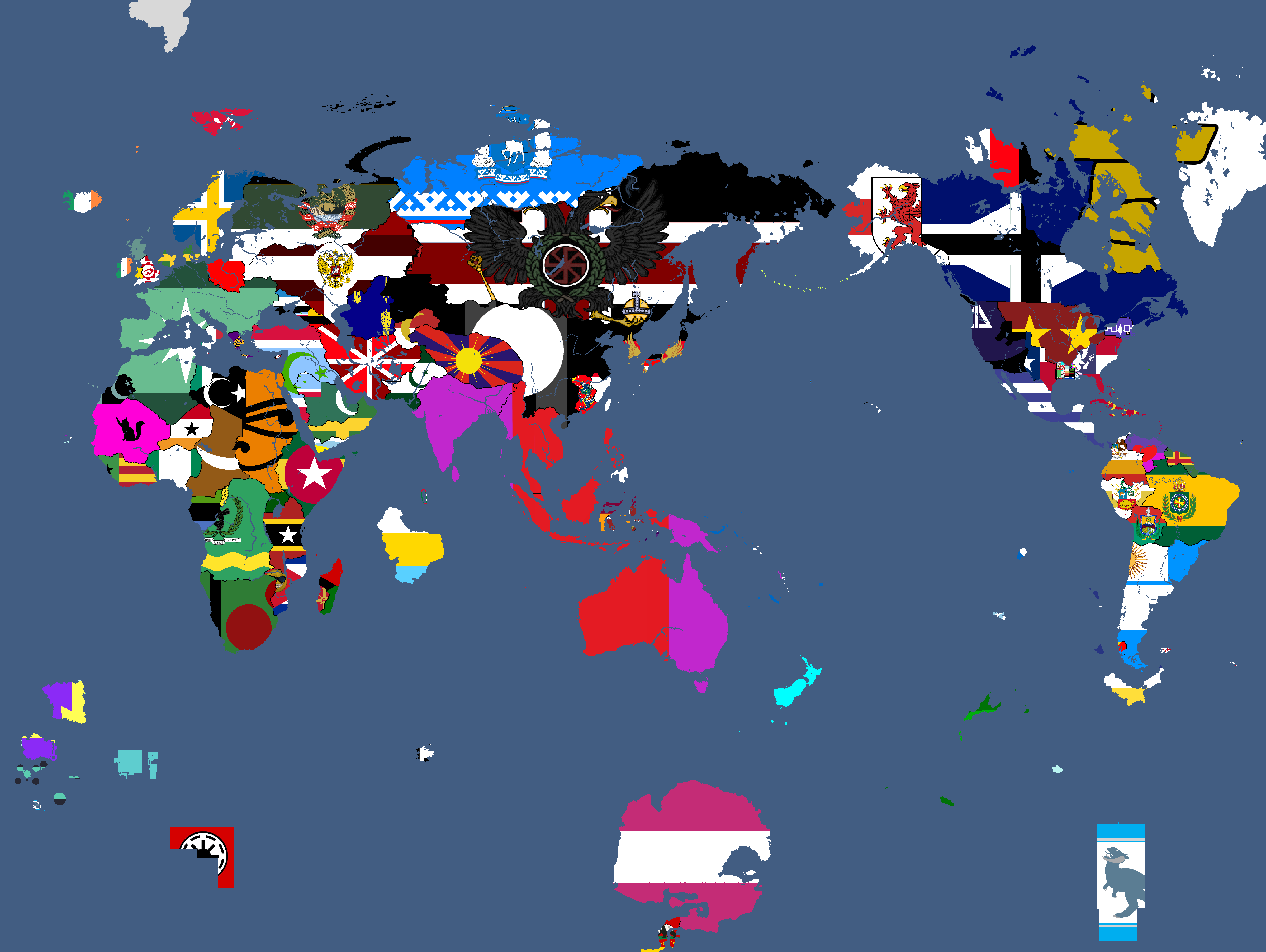
Flag Map: Year 193
-
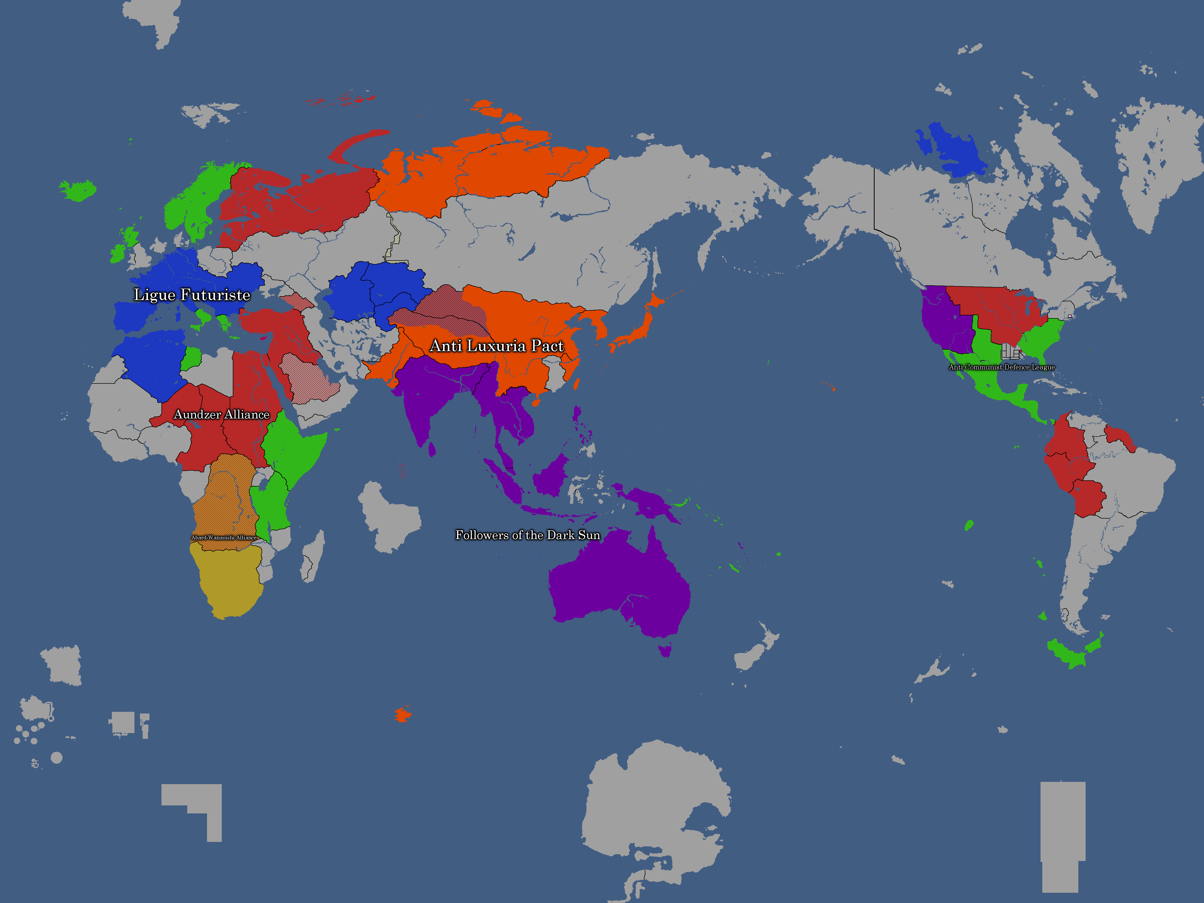
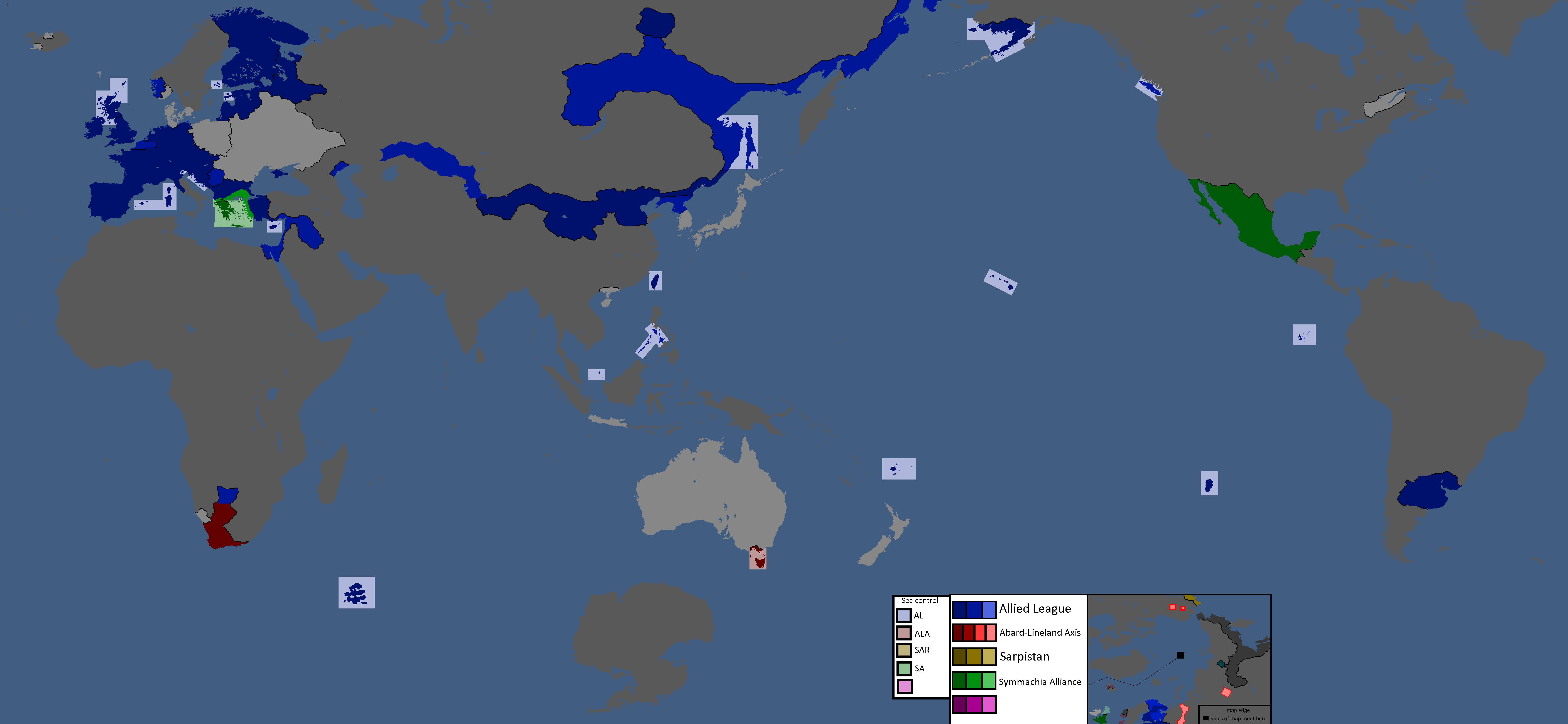
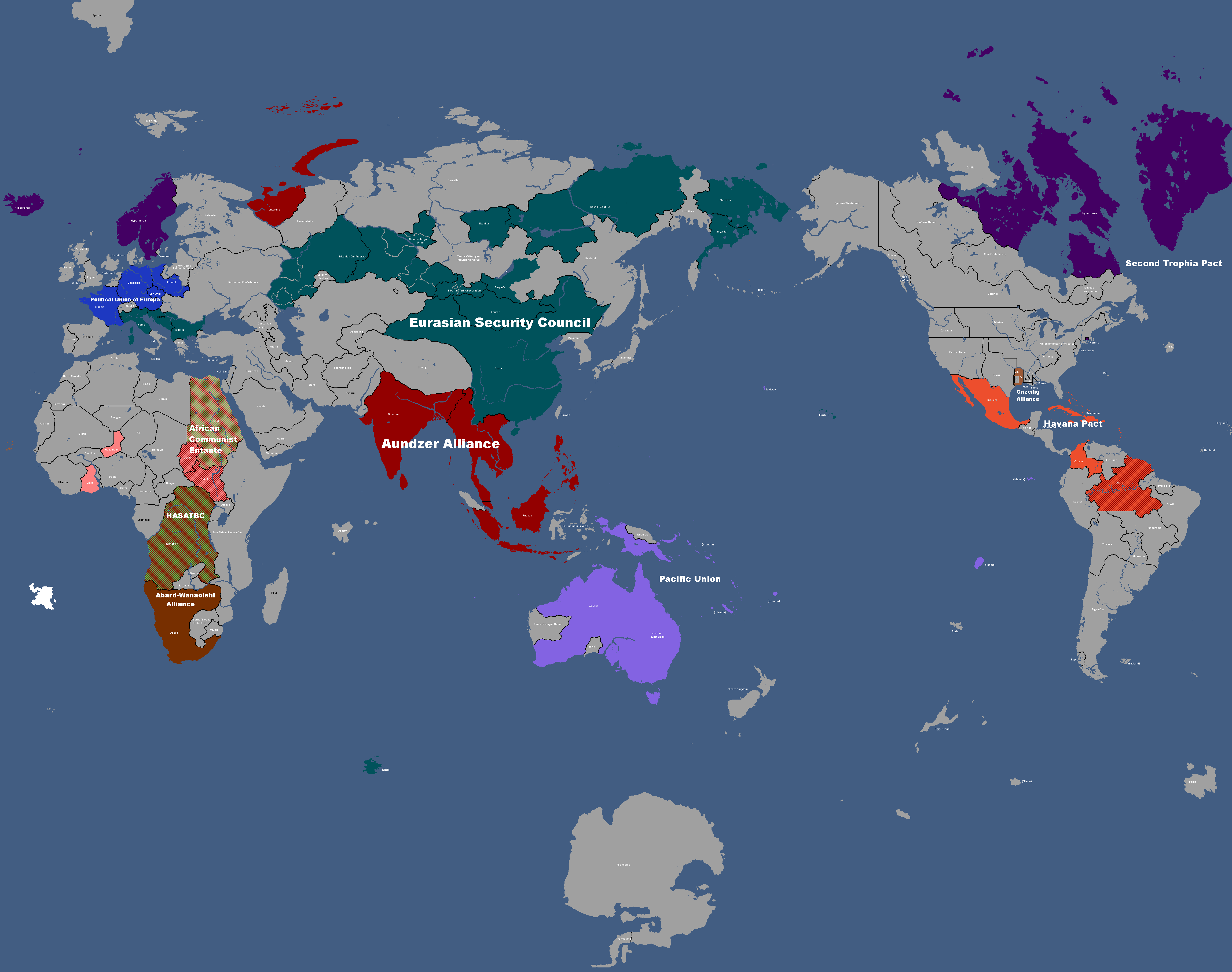
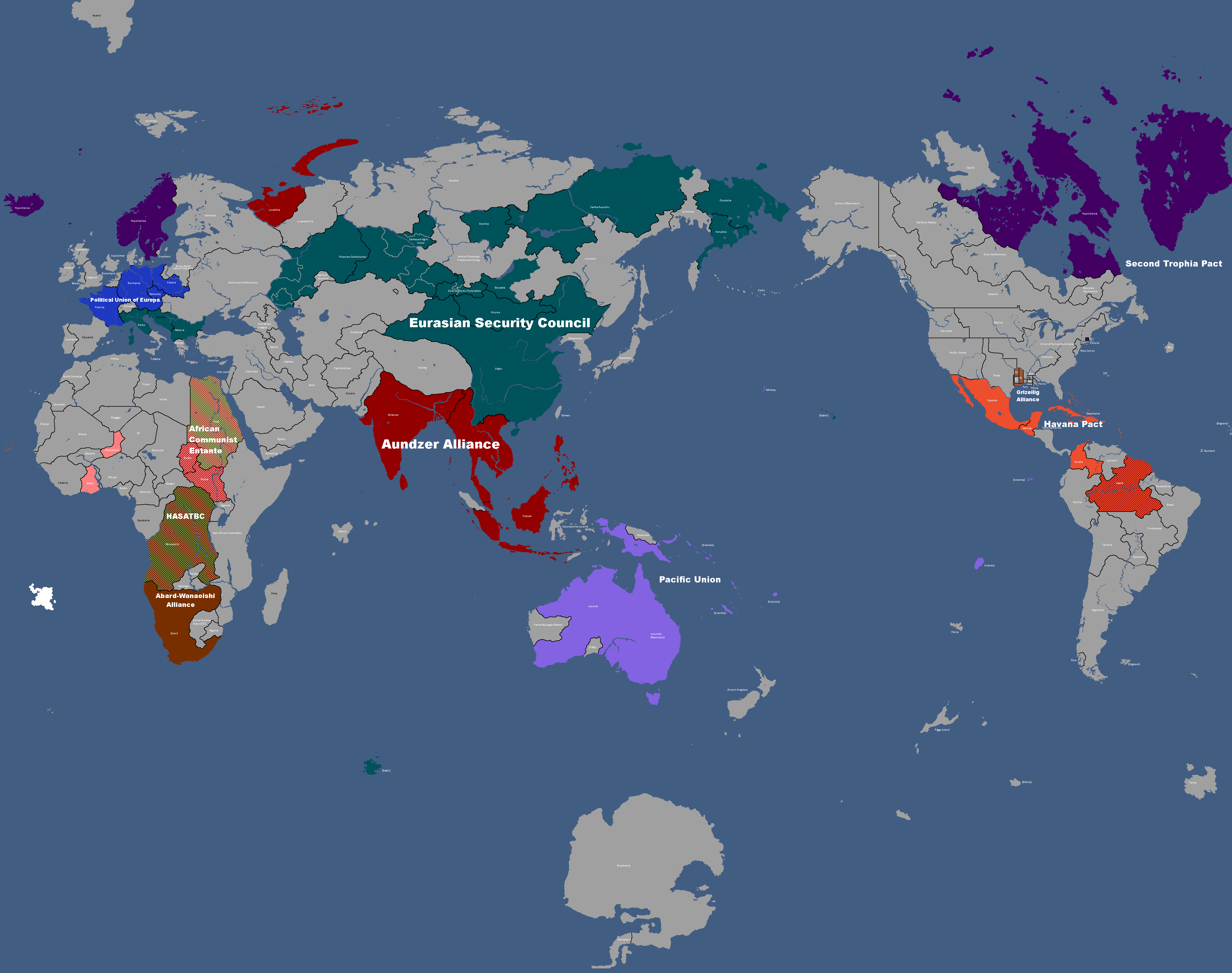
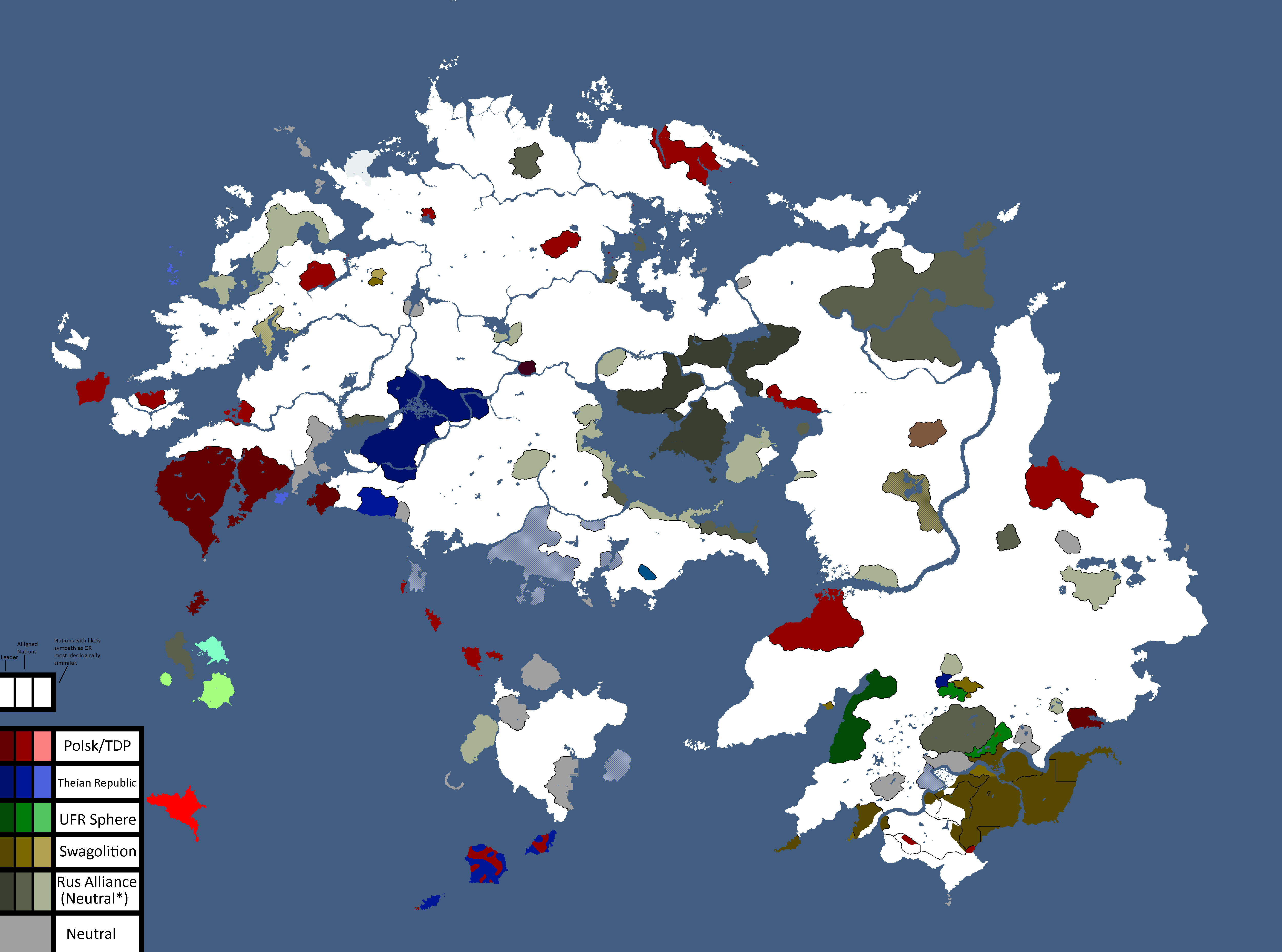
Map of Alliances: Year 195
-
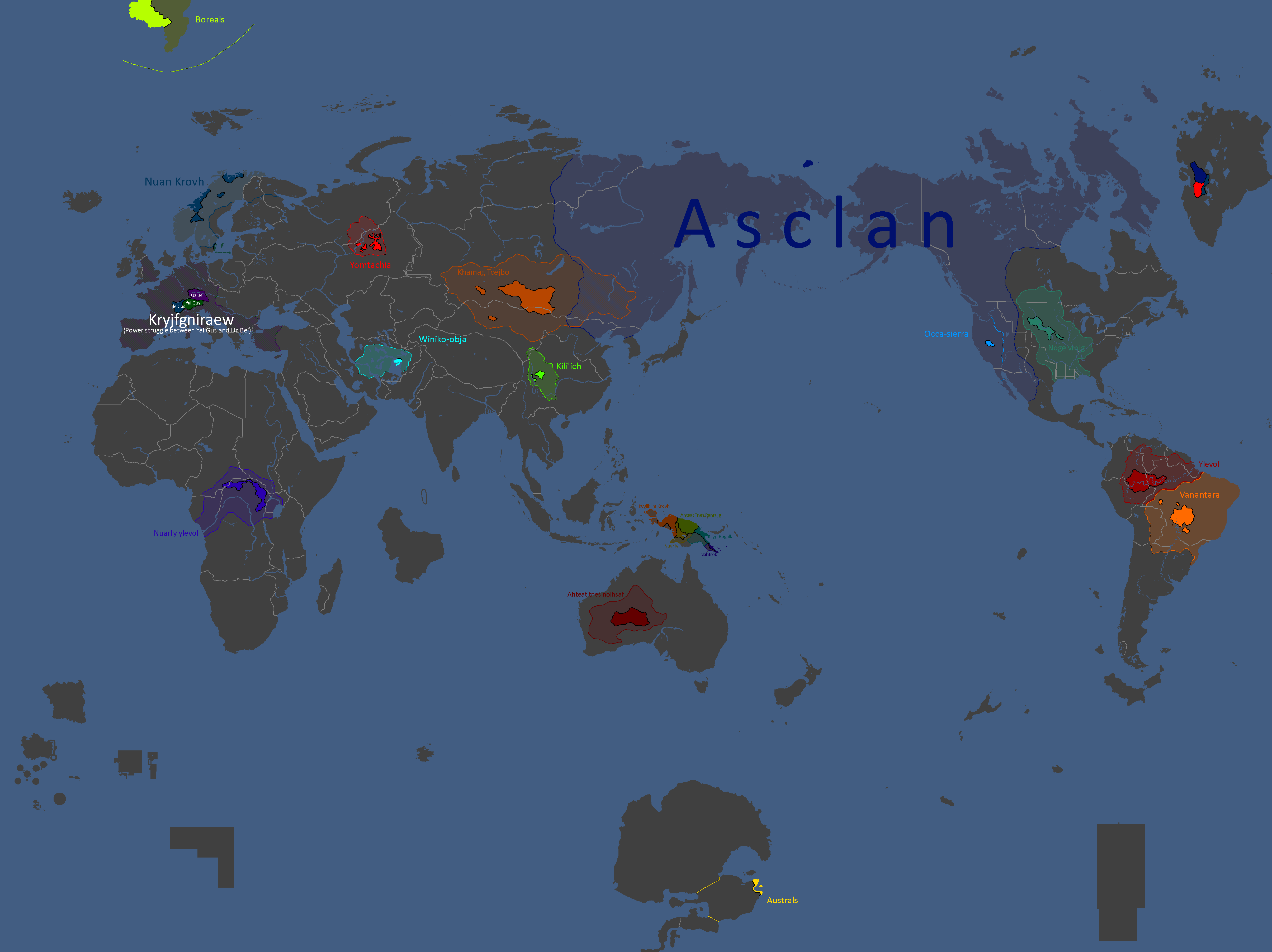
Map of Yomtach Clans: Year 196
-
Map of Ideologies: Year 211
-
Map of Alliances: Year 211 (Baghdad Accordin red, Liberty Pact in blue)
-
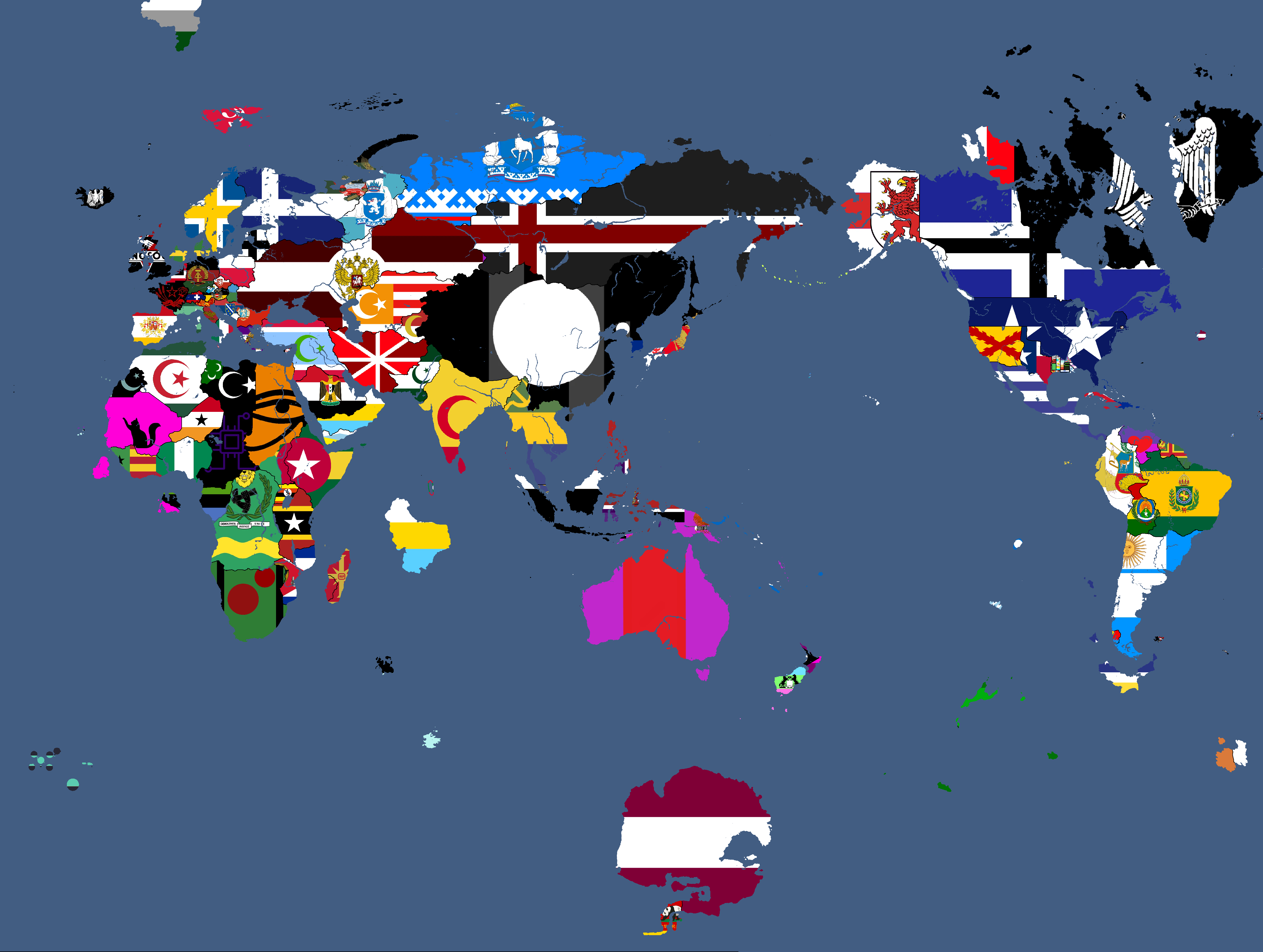
Flag Map: Year 217
-
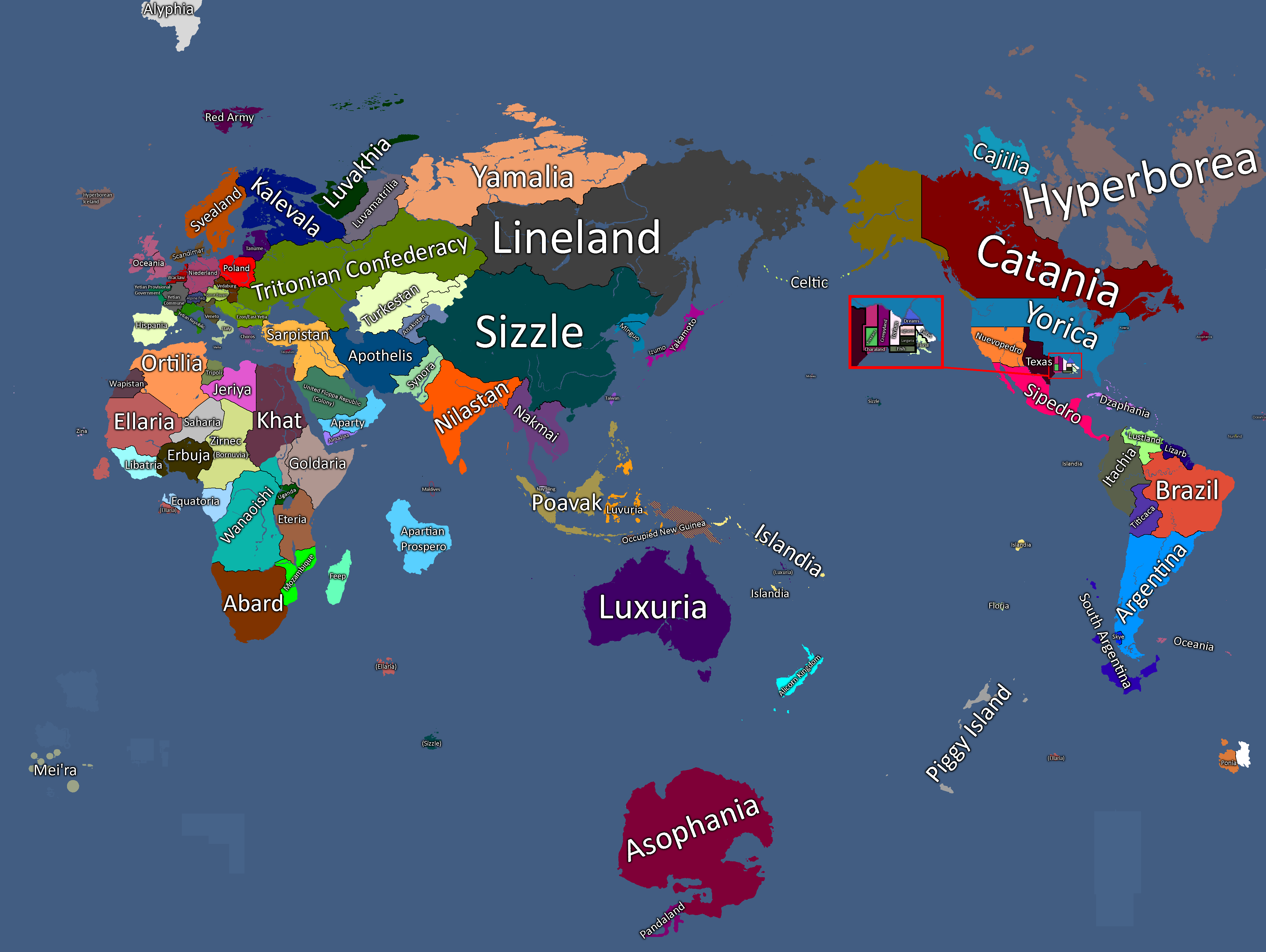
Map with names: Year 227
-
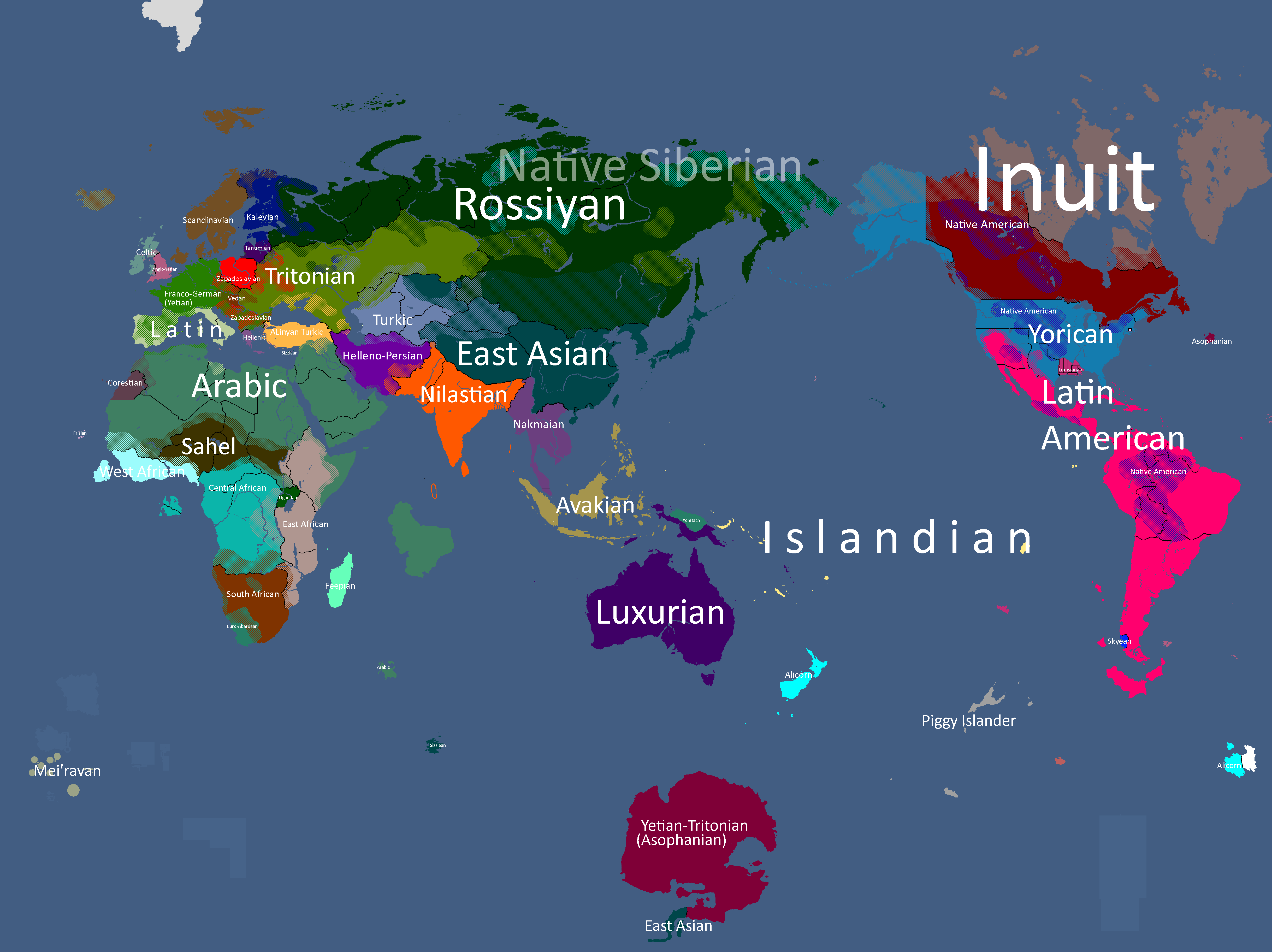
Map of Yatan Cultures: Year 230
-
Ideology Map: Year 247
-
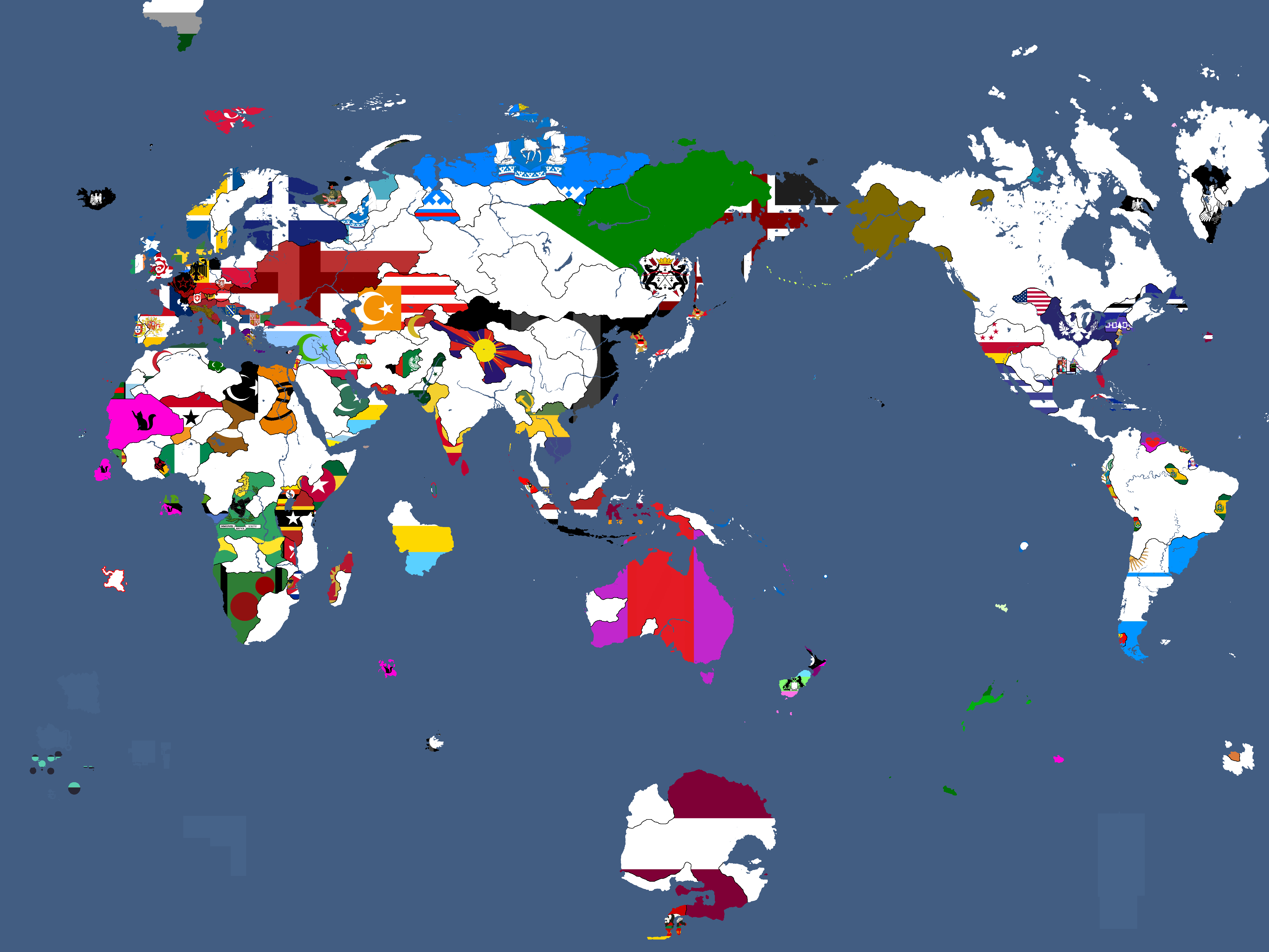
Flag Map: Year 266
-
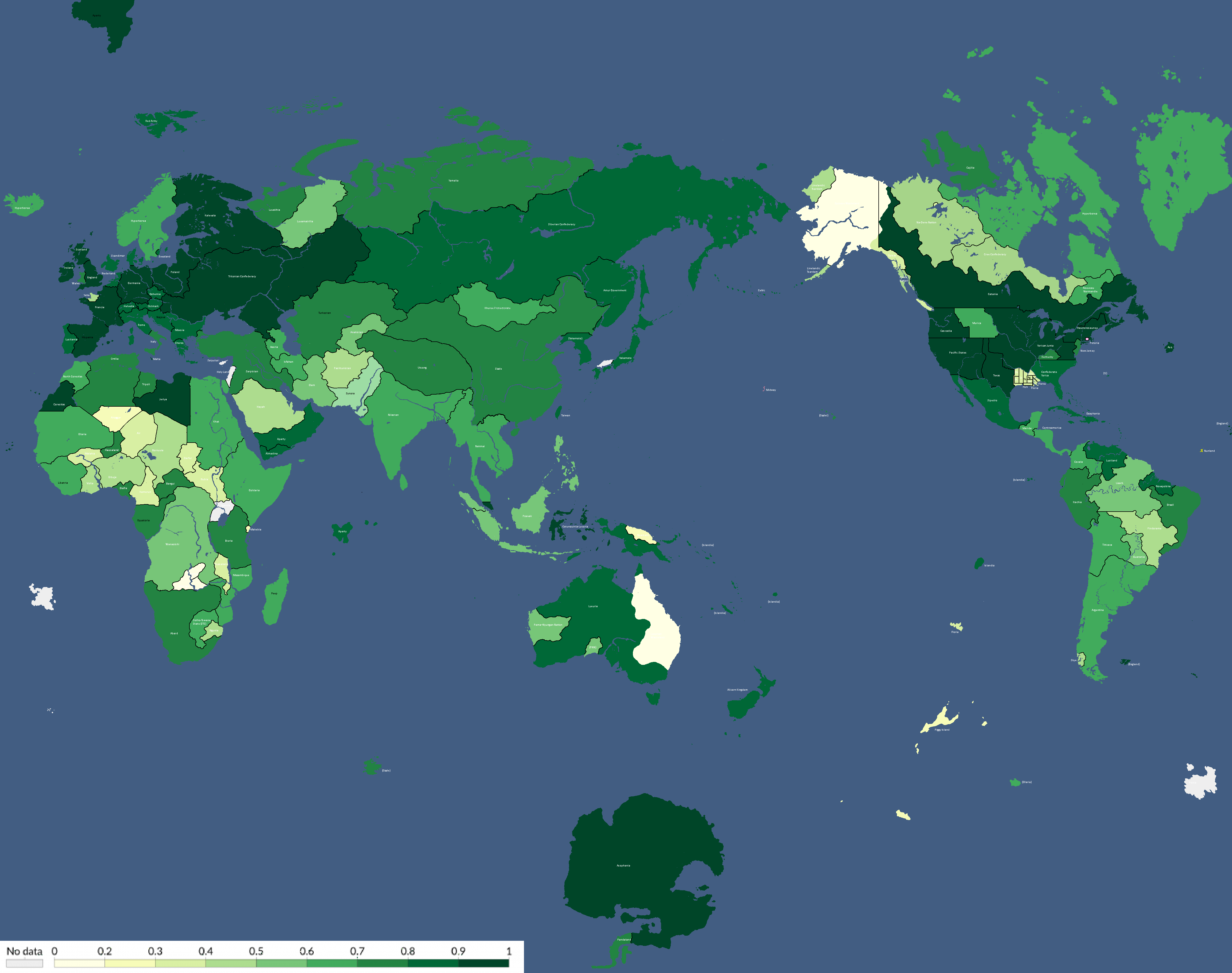
Human Development Index Map: Year 306
-
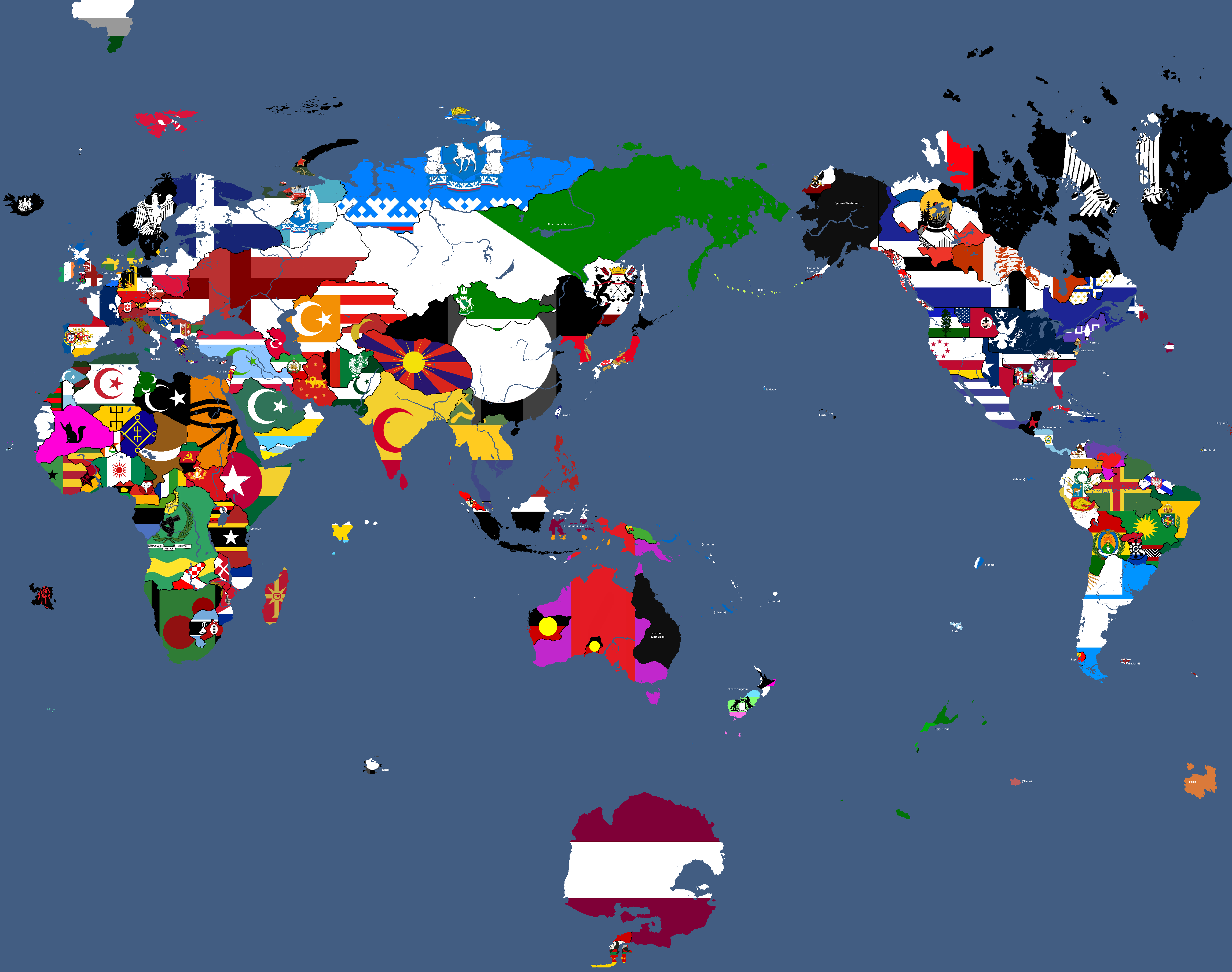
Flag Map: Year 311
-
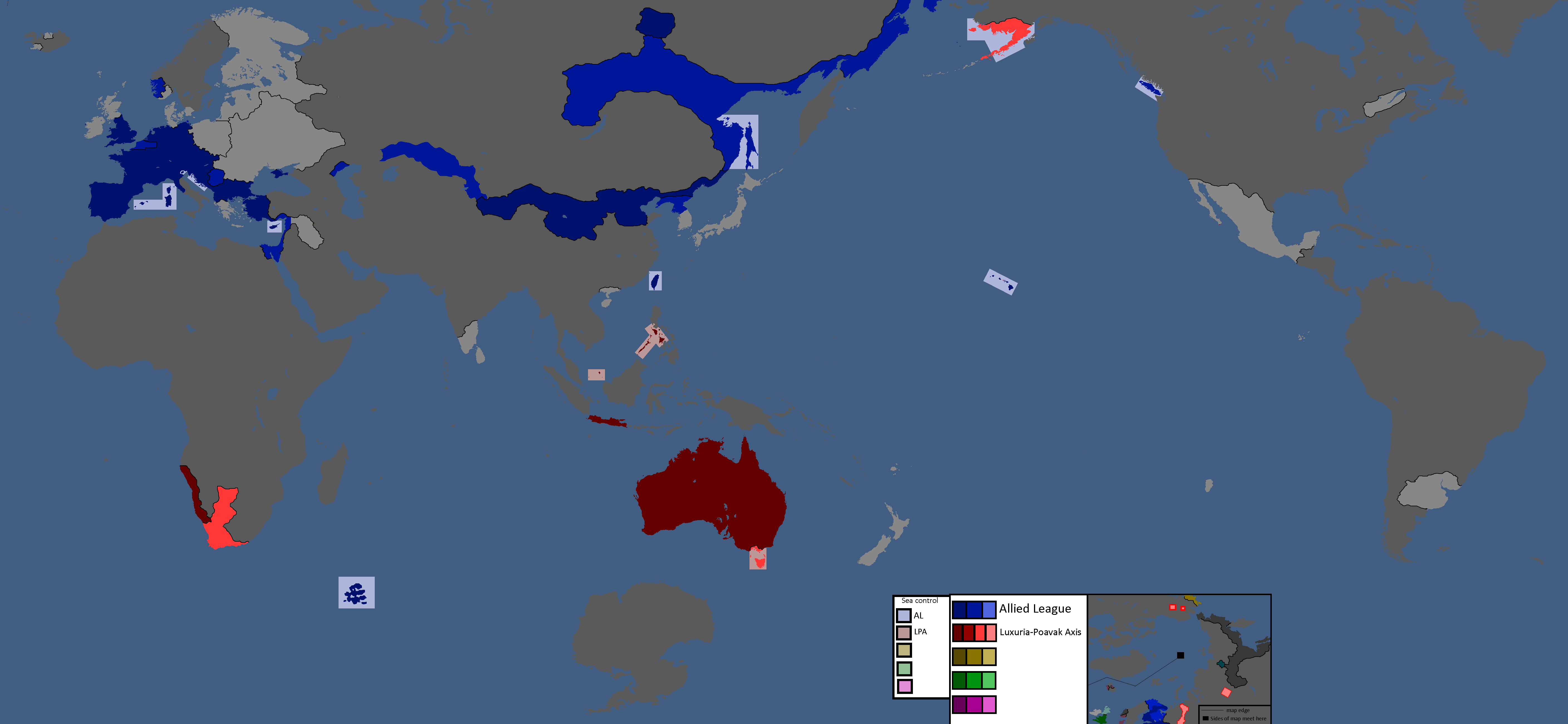
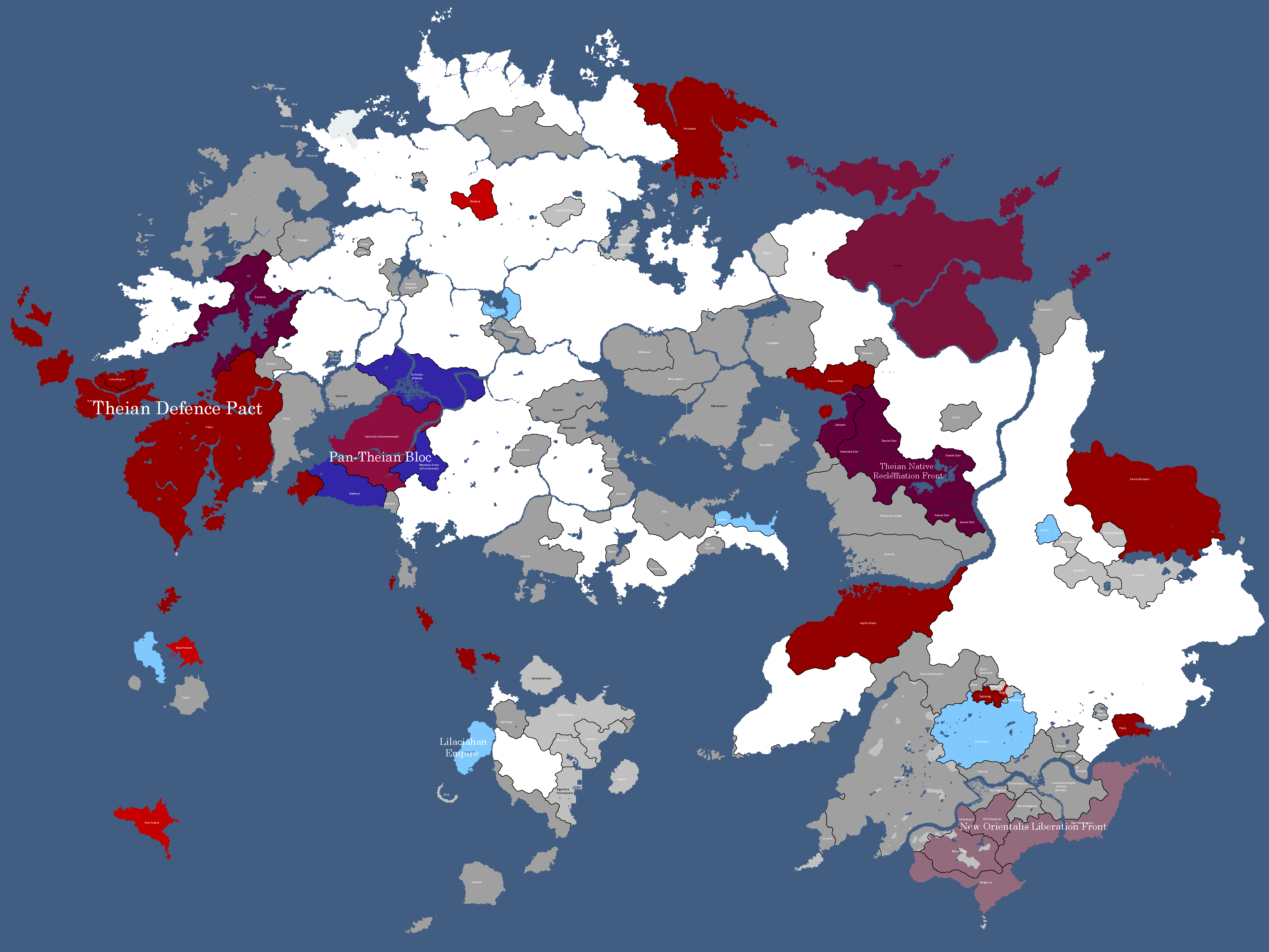
Map of Alliances: Year 315
-
Map of Alliances: Year 315
-
Map of Allied Nations: Year 332
-
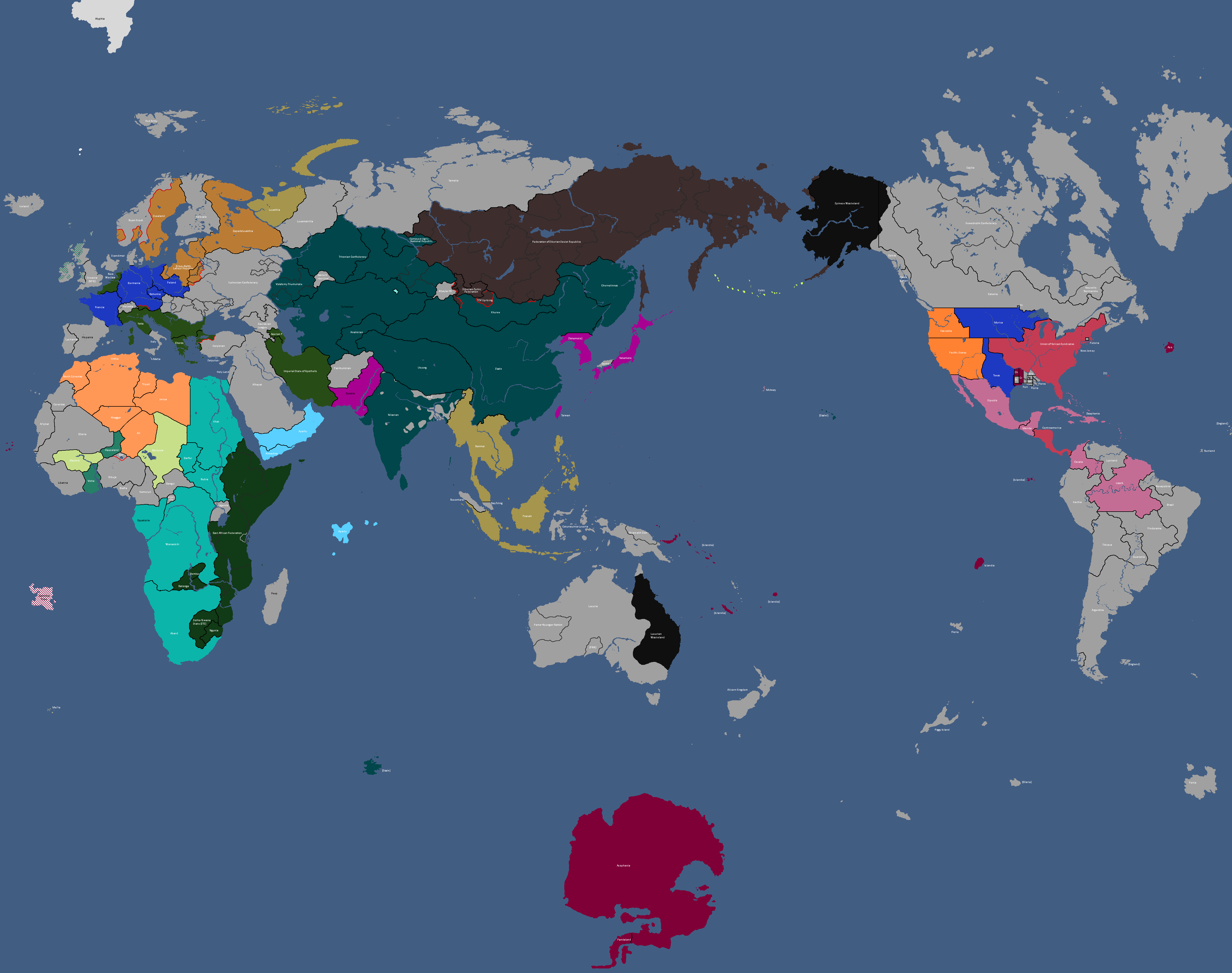
Map of the Yatan Cold War: Year 337
-
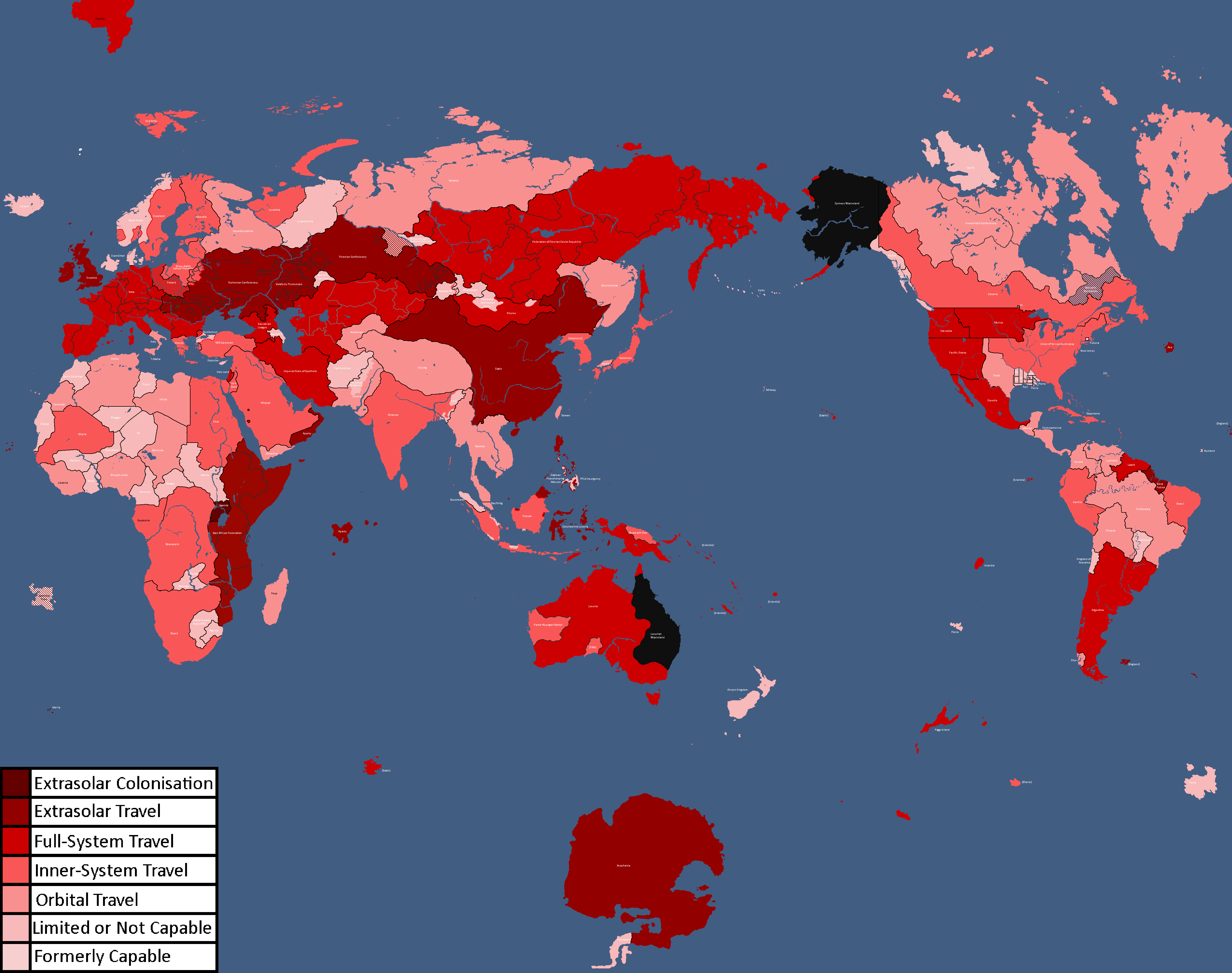
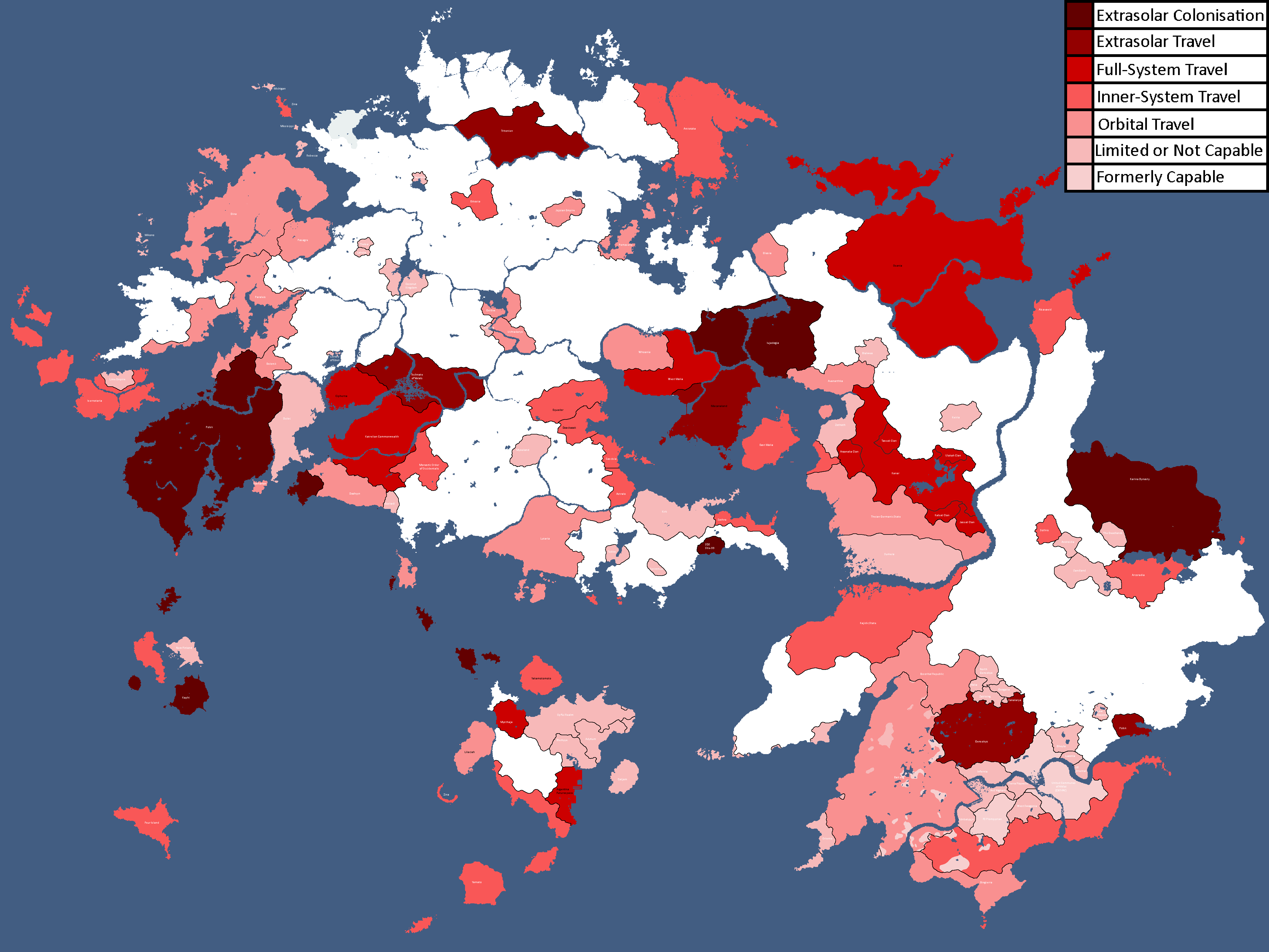
Map of Spacefaring Countries: Year 339
-
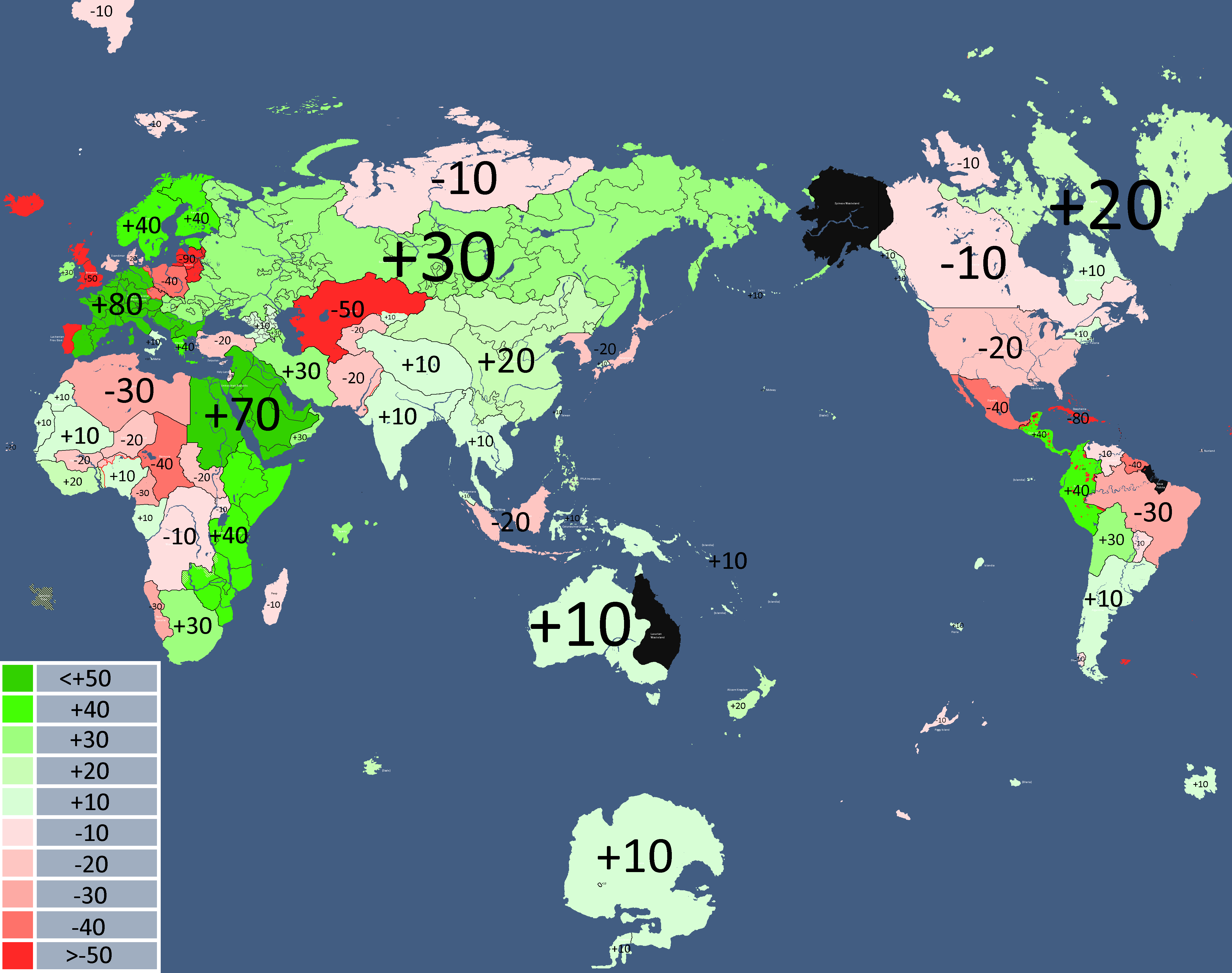
![Map of Democracy[1]: Year 343](/yatawiki/images/6/69/Democracymap.png)
Map of Democracy[1]: Year 343
-
![Monarchy or Republic[2]: Year 347](/yatawiki/images/5/5f/Monarchyrepublic.png)
Monarchy or Republic[2]: Year 347
-
Map of Major Alliances: Year 348
-
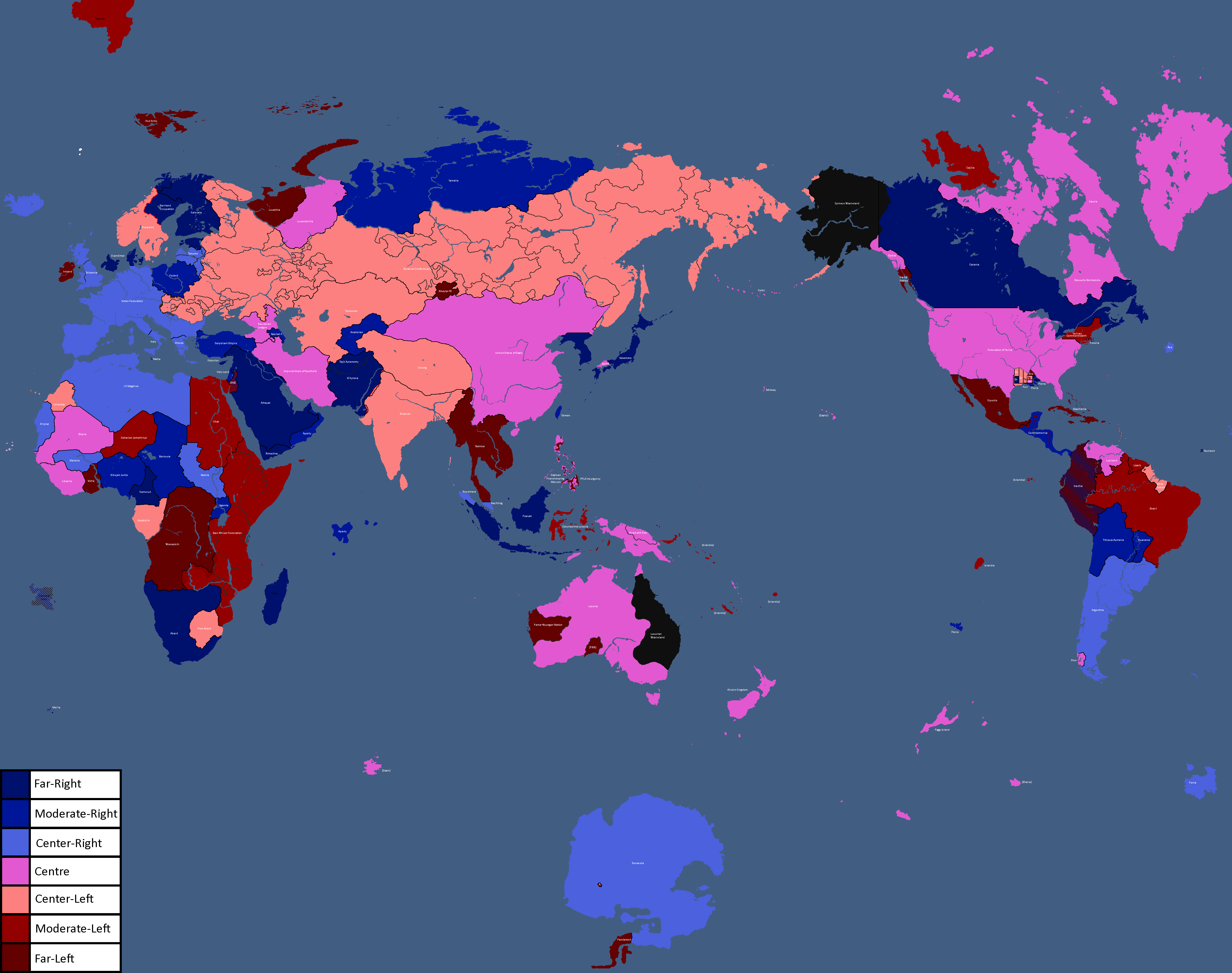
Map of Ideologies: Year 354
-
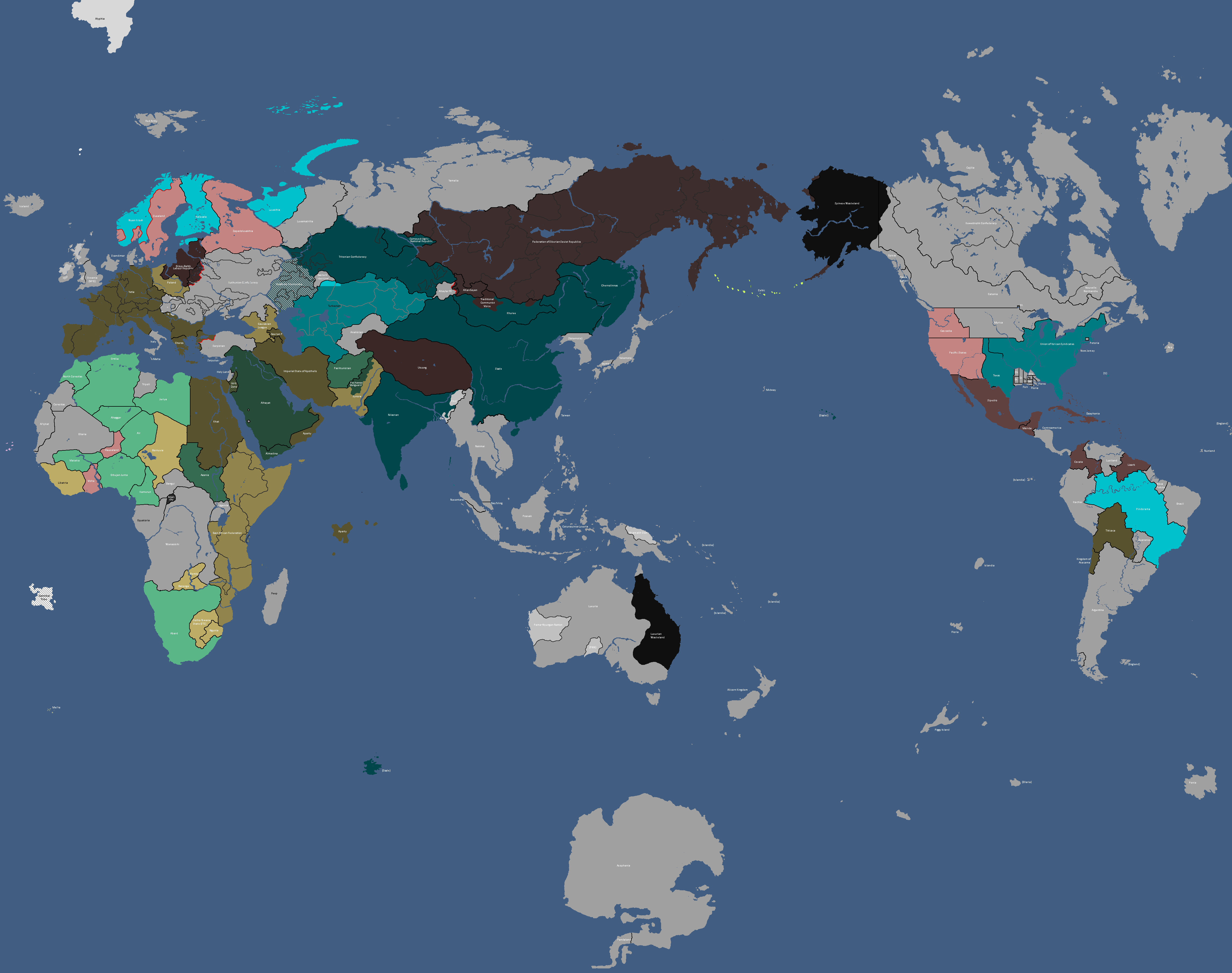
Map of the Yatan Cold War: Year 358
-
![Map of Religions[3]: Year 362](/yatawiki/images/1/15/Religionmap.png)
Map of Religions[3]: Year 362
-
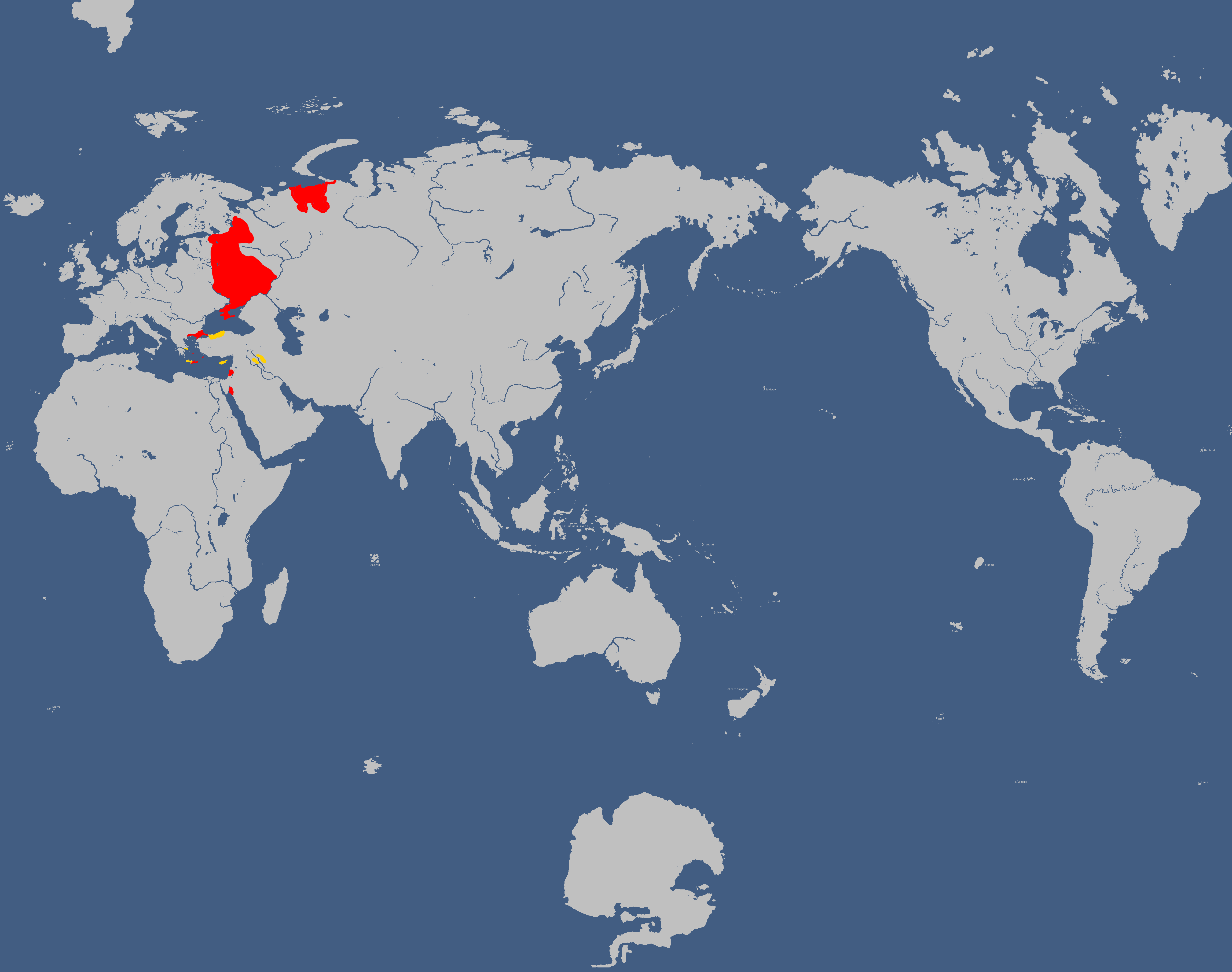
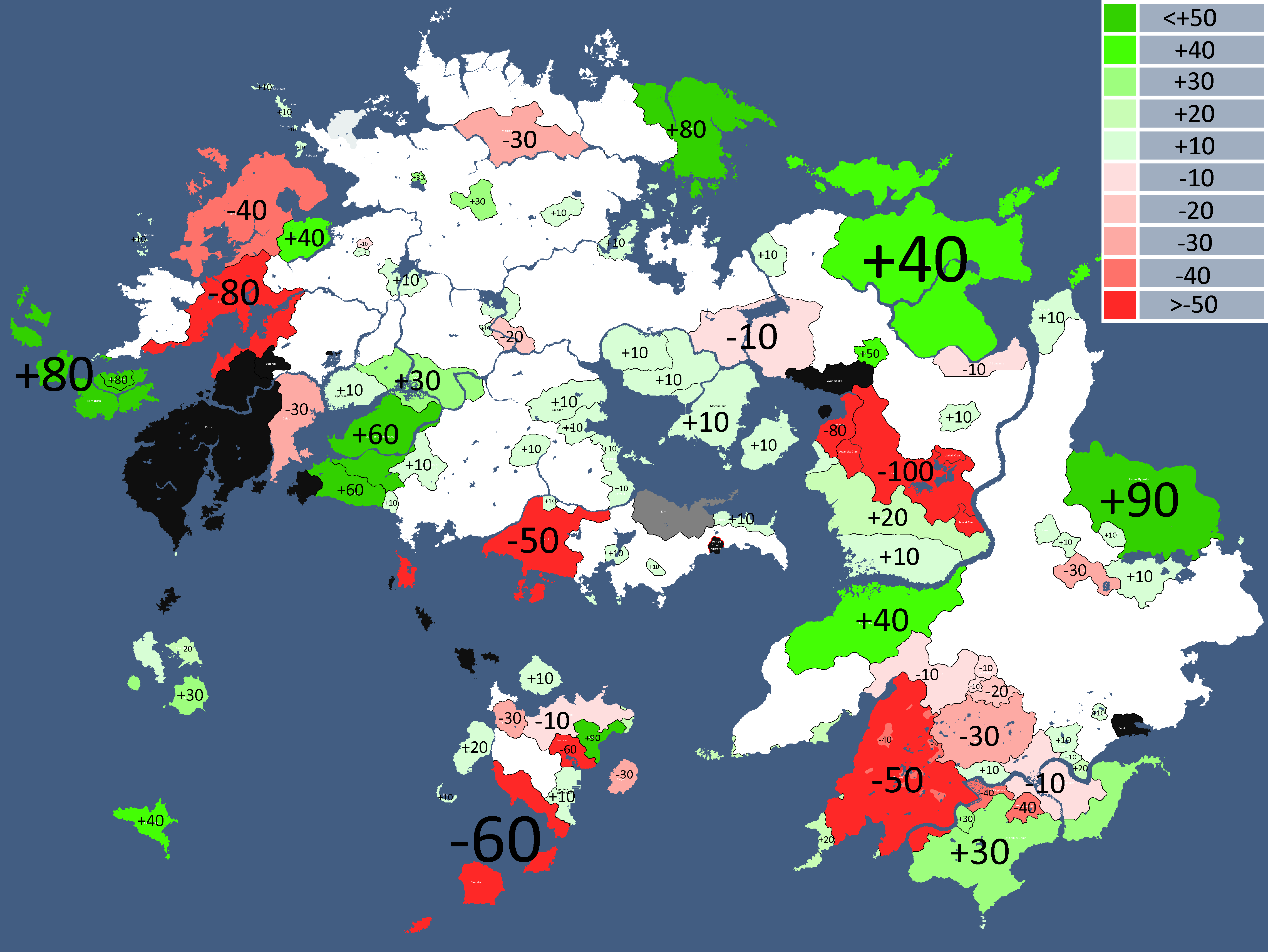
Other nations opinions of the CIS/Polsk: Year 367
-
![Map of Nuclear Powers[4]: Year 367](/yatawiki/images/1/10/Nuclearpowers.png)
Map of Nuclear Powers[4]: Year 367
-
![Map of the Yatan Cold War[5]: Year 371](/yatawiki/images/d/d8/Yatancoldwar.png)
Map of the Yatan Cold War[5]: Year 371
-
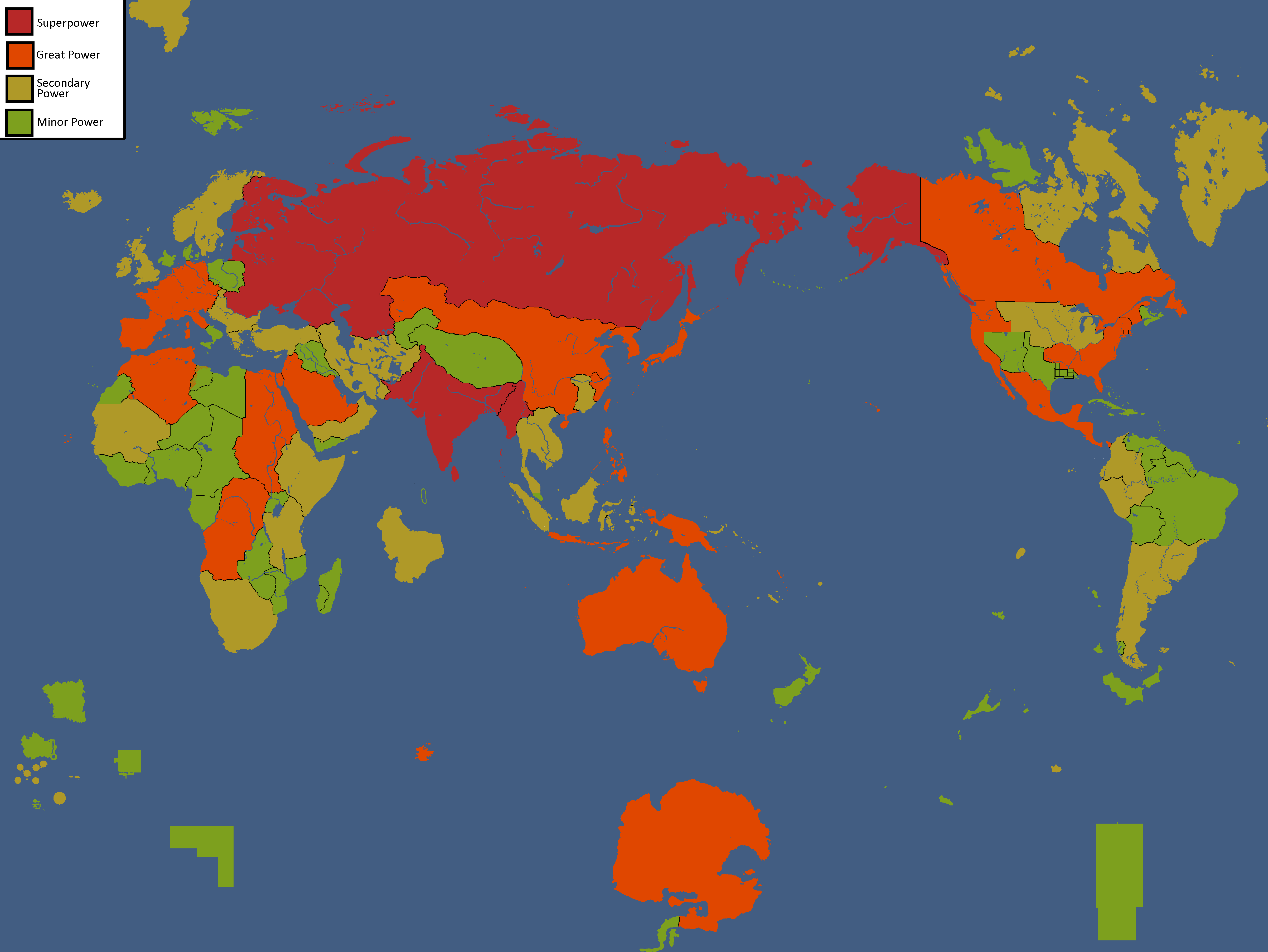
![Map of World Power Statuses[6]: Year 371](/yatawiki/images/c/c1/Powersmap.png)
Map of World Power Statuses[6]: Year 371
-
![Development Map[7]: Year 372](/yatawiki/images/2/21/Developmentmap.png)
Development Map[7]: Year 372
-
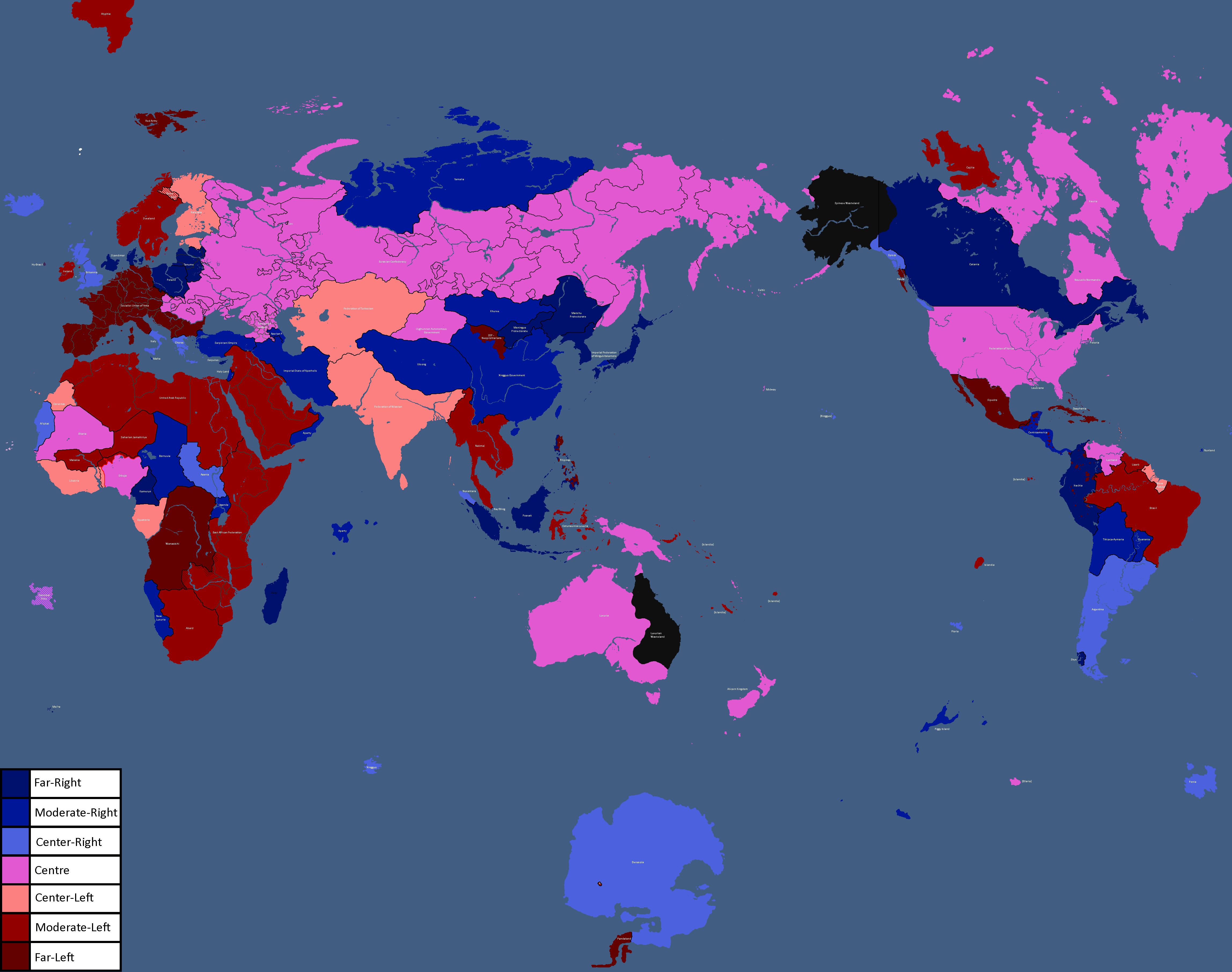
Map of Ideologies: Year 372
-
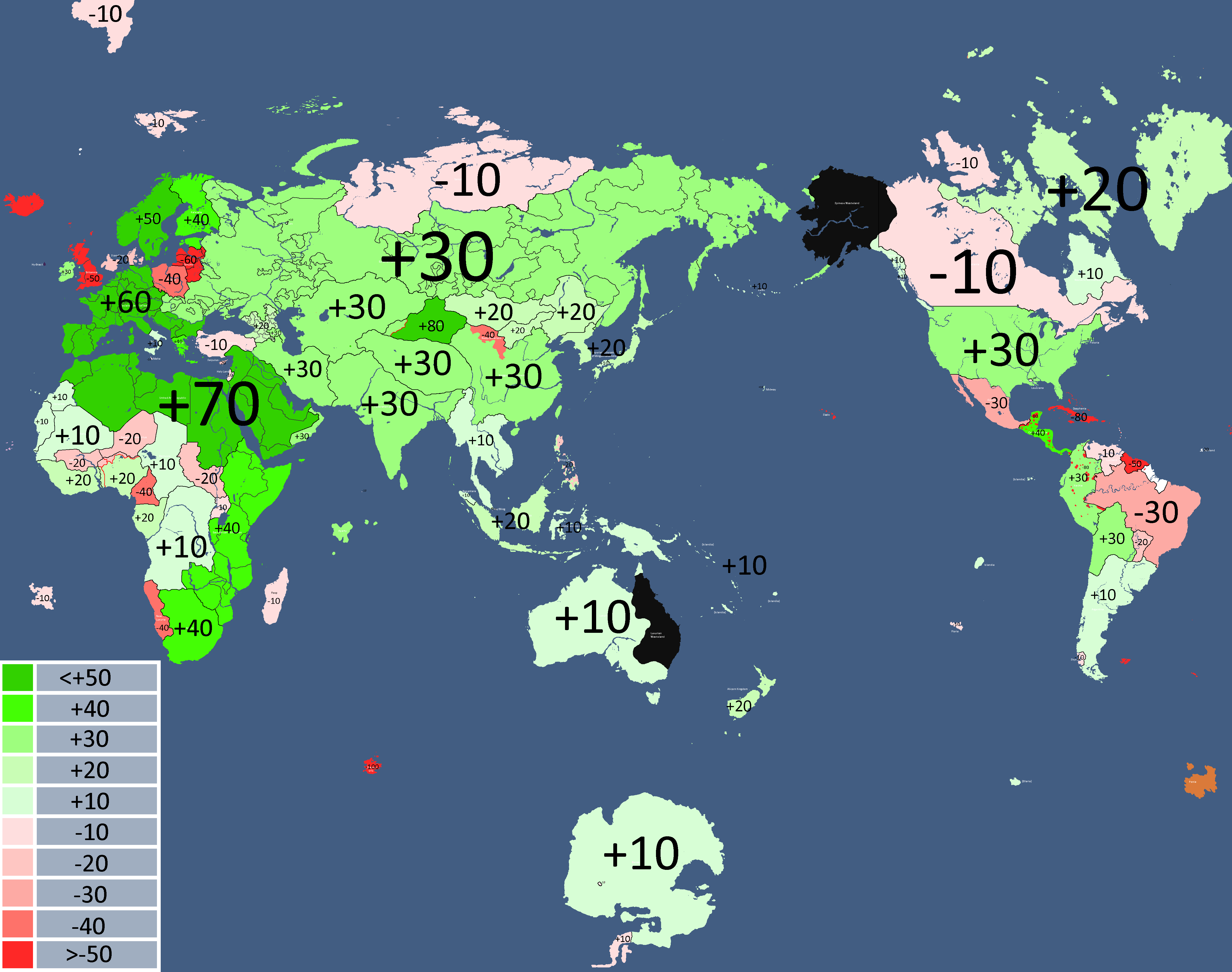
![Democracy Map[8]: Year 372](/yatawiki/images/6/6c/Democracymap3.png)
Democracy Map[8]: Year 372
-
Other nations opinions of the CIS: Year 372
-
![Map of Economic Structure[9]: Year 373](/yatawiki/images/6/64/Economymap.png)
Map of Economic Structure[9]: Year 373
-
Map of Ideologies: Year 375
-
-
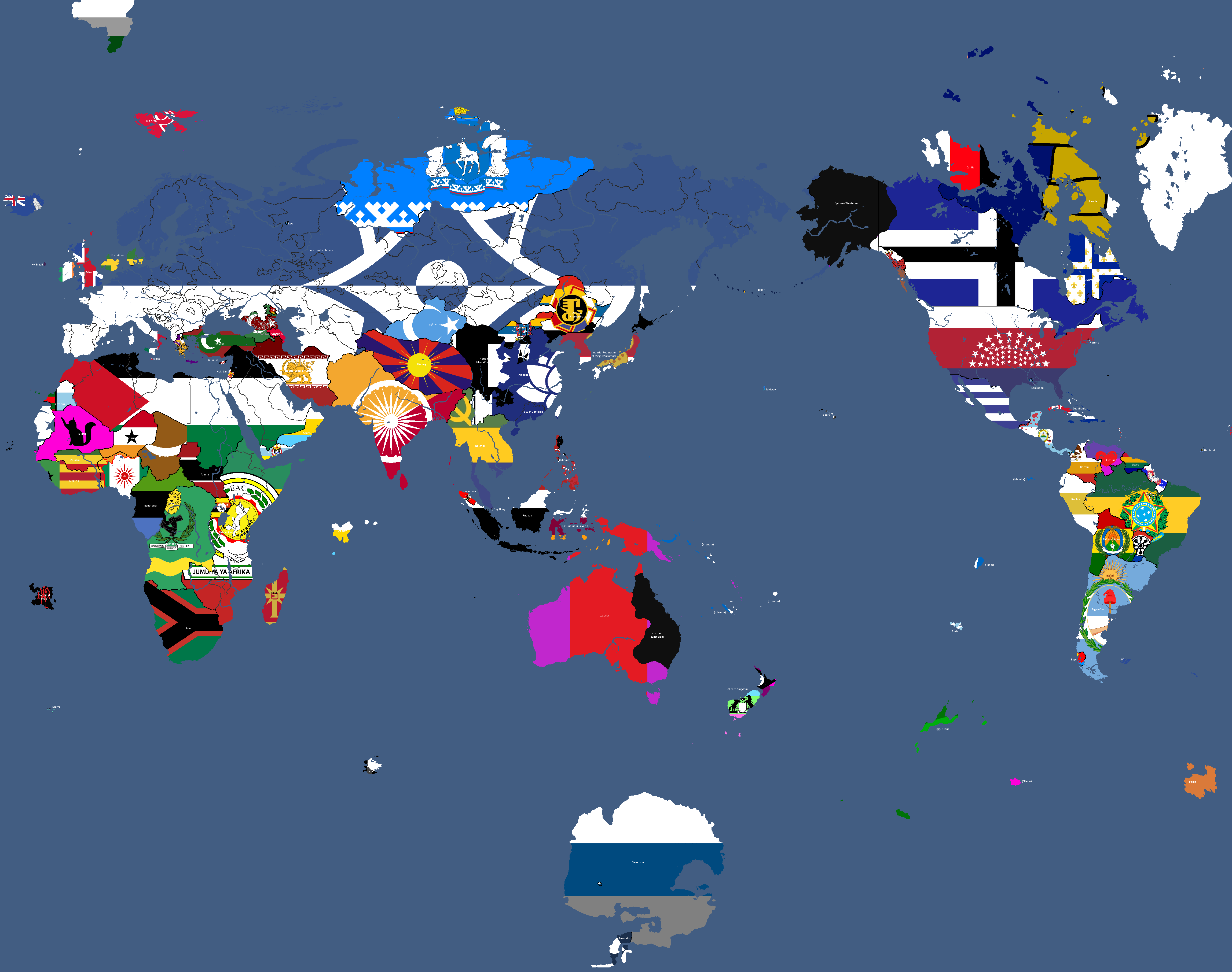
Flag Map: Year 377
-
![Flag of Post-Cold War Yata's Geopolitical Blocs[10]: Year 383](/yatawiki/images/c/ca/Yatacoldwar.png)
Flag of Post-Cold War Yata's Geopolitical Blocs[10]: Year 383
-
Map where the Church of Saint Peter has adherents: Year 391


![Map of Democracy[1]: Year 343](/yatawiki/index.php/File:Democracymap.png)
![Monarchy or Republic[2]: Year 347](/yatawiki/index.php/File:Monarchyrepublic.png)


![Map of Religions[3]: Year 362](/yatawiki/index.php/File:Religionmap.png)

![Map of Nuclear Powers[4]: Year 367](/yatawiki/index.php/File:Nuclearpowers.png)
![Map of the Yatan Cold War[5]: Year 371](/yatawiki/index.php/File:Yatancoldwar.png)
![Map of World Power Statuses[6]: Year 371](/yatawiki/index.php/File:Powersmap.png)
![Development Map[7]: Year 372](/yatawiki/index.php/File:Developmentmap.png)

![Democracy Map[8]: Year 372](/yatawiki/index.php/File:Democracymap3.png)

![Map of Economic Structure[9]: Year 373](/yatawiki/index.php/File:Economymap.png)


![Flag of Post-Cold War Yata's Geopolitical Blocs[10]: Year 383](/yatawiki/index.php/File:Yatacoldwar.png)

Theian Maps
-
Osanian Trade Routes: Year 141
-
Map of the Deltaic Region: Year 145
-
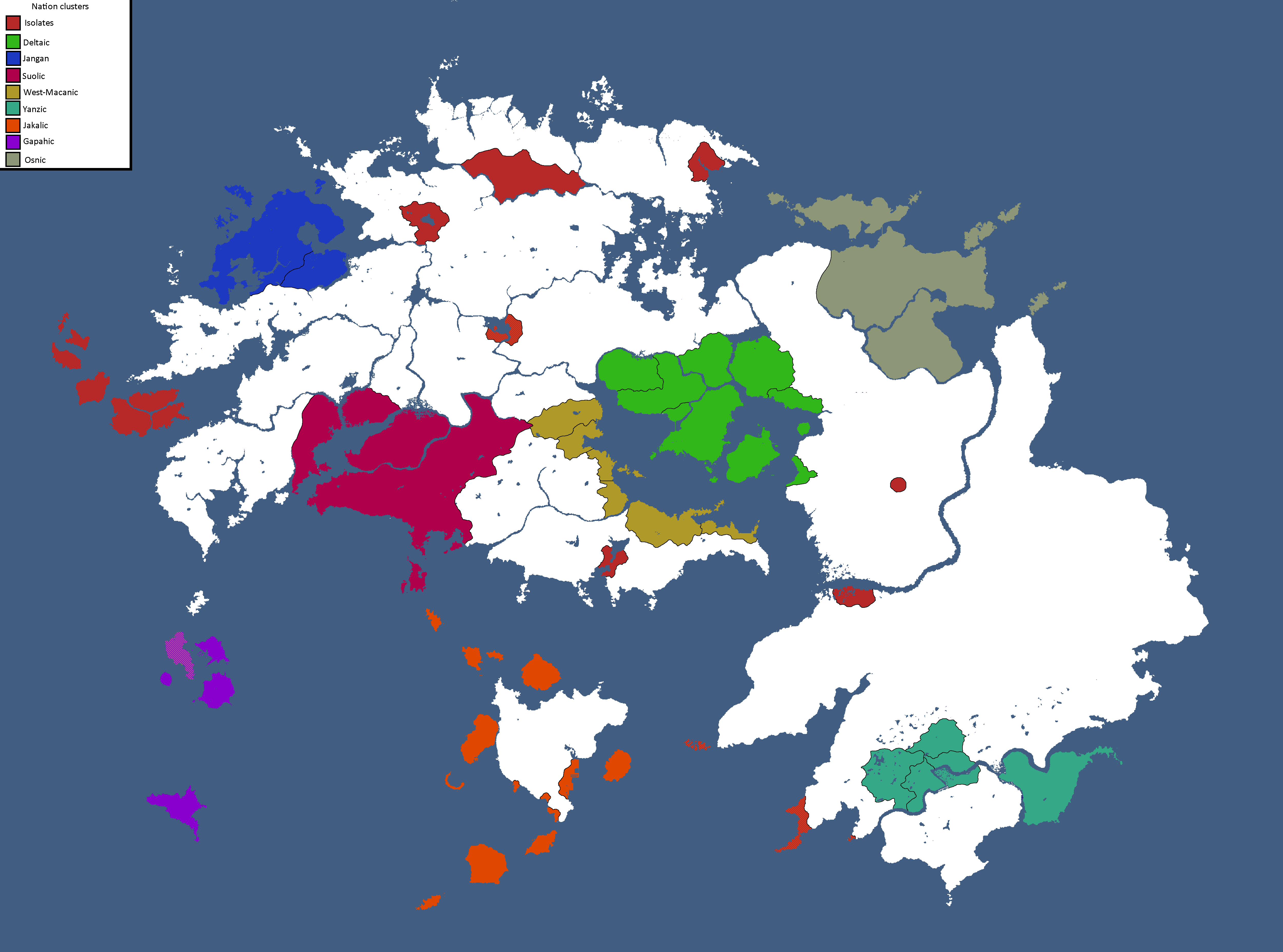
Nation Clusters of Theia: Year 165
-

Homelands of the Theian Natives: Year 171
-
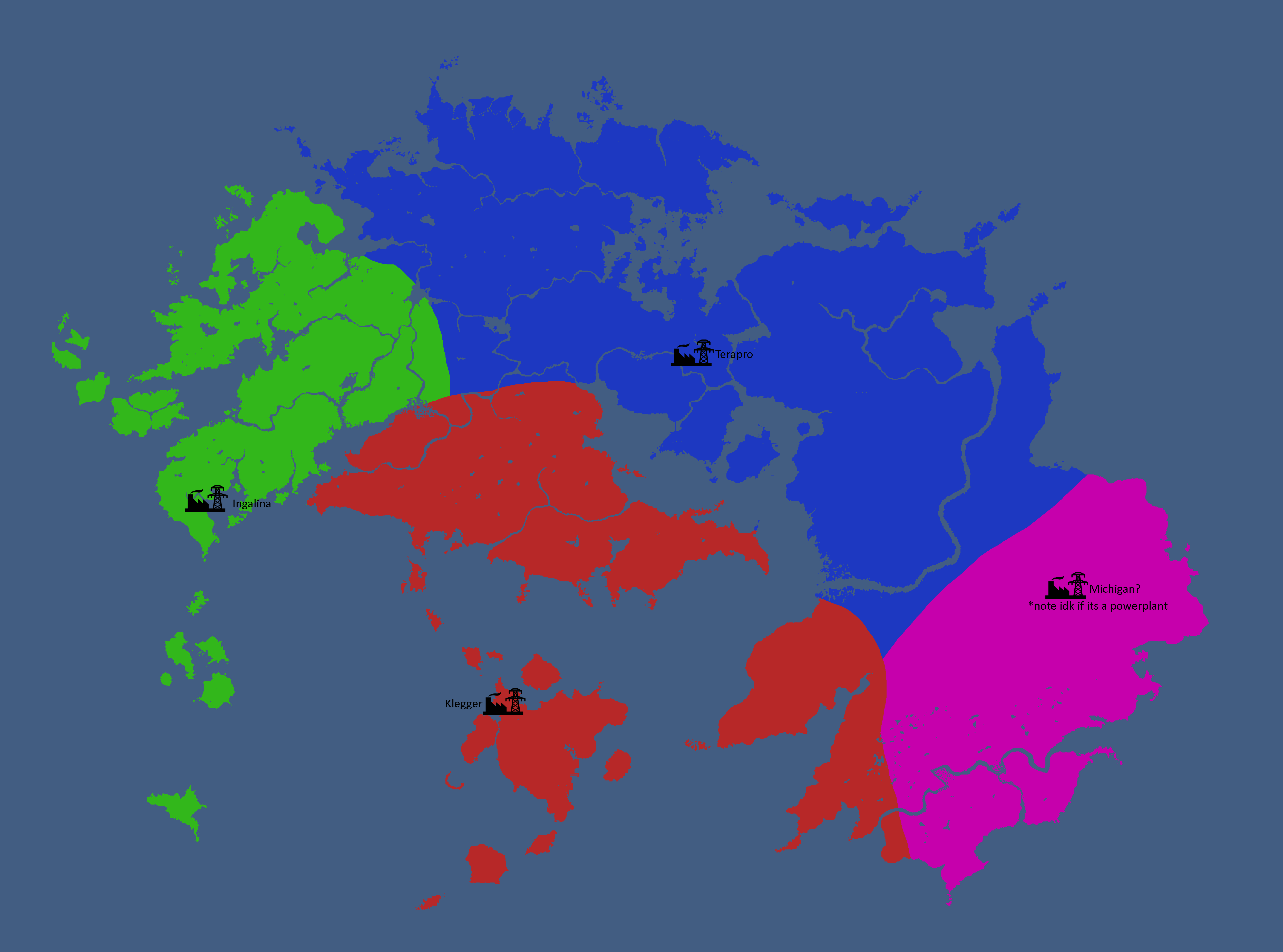
Major Powerplant Service Areas: Year 185
-
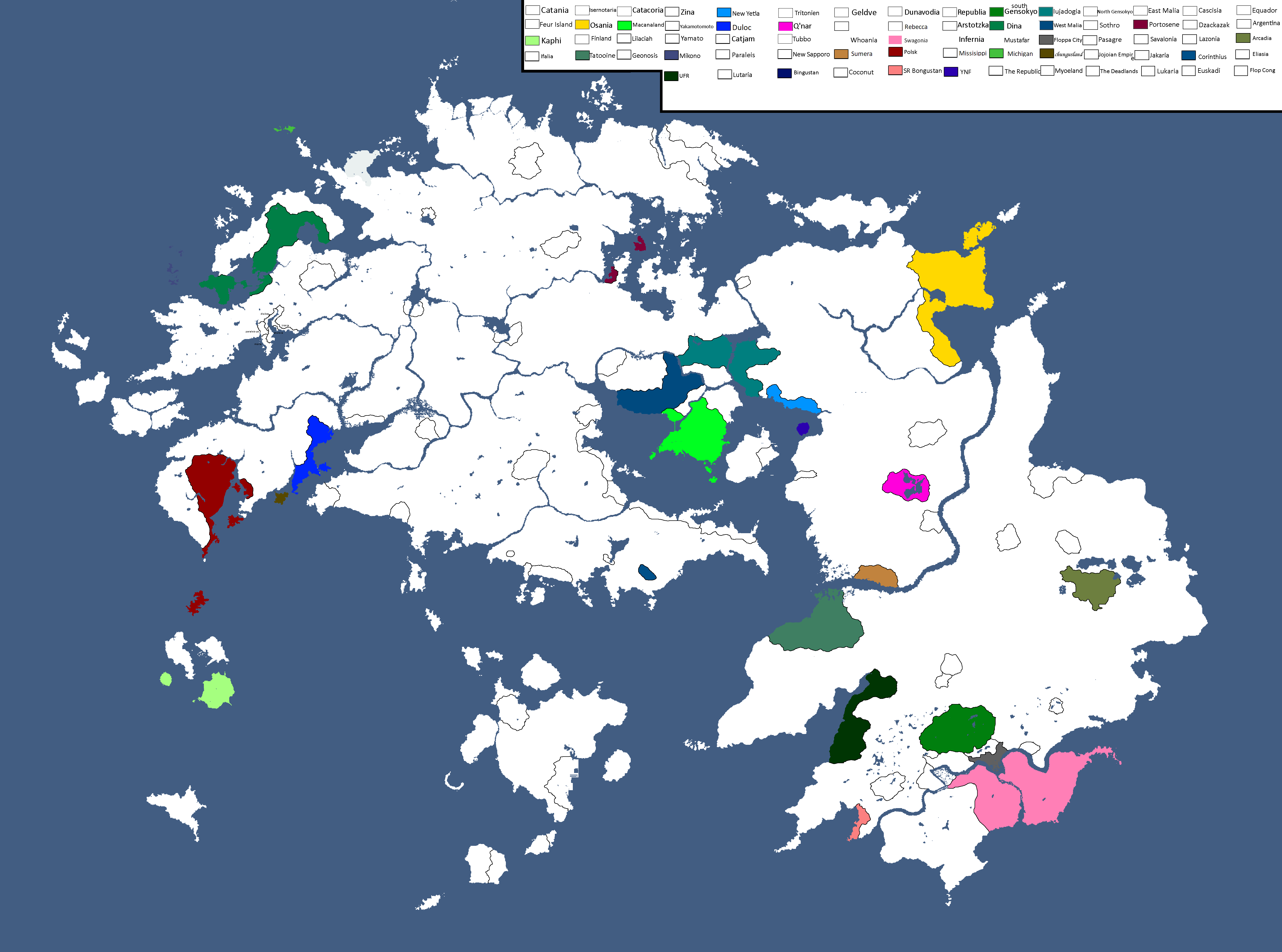
Relevant Countries of Theia: Year 229
-
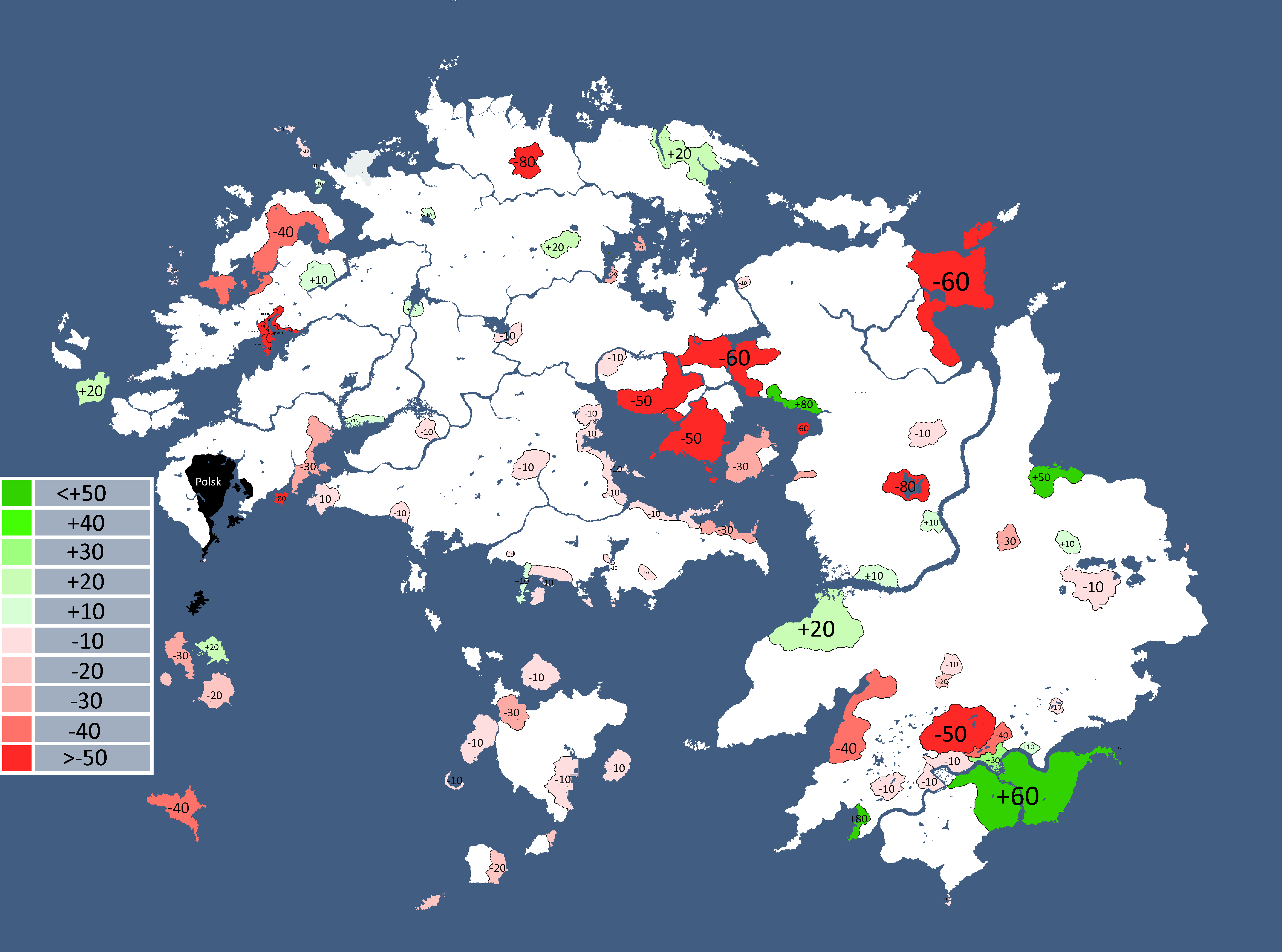
Theian Countries' opinions of Polsk: Year 229
-
Map with names: Year 229
-
Theian Cold War: Year 231
-
Map of Disputed Territories in Altilai: Year 233
-
Ideology Map: Year 247
-
Theian Cold War: Year 249
-
Alliance Map: Year 338
-
Map of Spacefaring Countries: Year 339
-
![Map of Democracy[11]: Year 343](/yatawiki/images/f/f0/Democracymap2.png)
Map of Democracy[11]: Year 343
-
Inspirations of Theian Countries: Year 343
-
Map of Ideologies: Year 354
-
Other nations opinions of the CIS/Polsk: Year 367
-
![Map of World Power Statuses[12]: Year 371](/yatawiki/images/9/92/Powersmap2.png)
Map of World Power Statuses[12]: Year 371
-
Map of Ideologies: Year 375


![Map of Democracy[11]: Year 343](/yatawiki/index.php/File:Democracymap2.png)


![Map of World Power Statuses[12]: Year 371](/yatawiki/index.php/File:Powersmap2.png)
Skantoan Maps
-
Ideology Map: Year 247
-
Map of Cities: Year 254


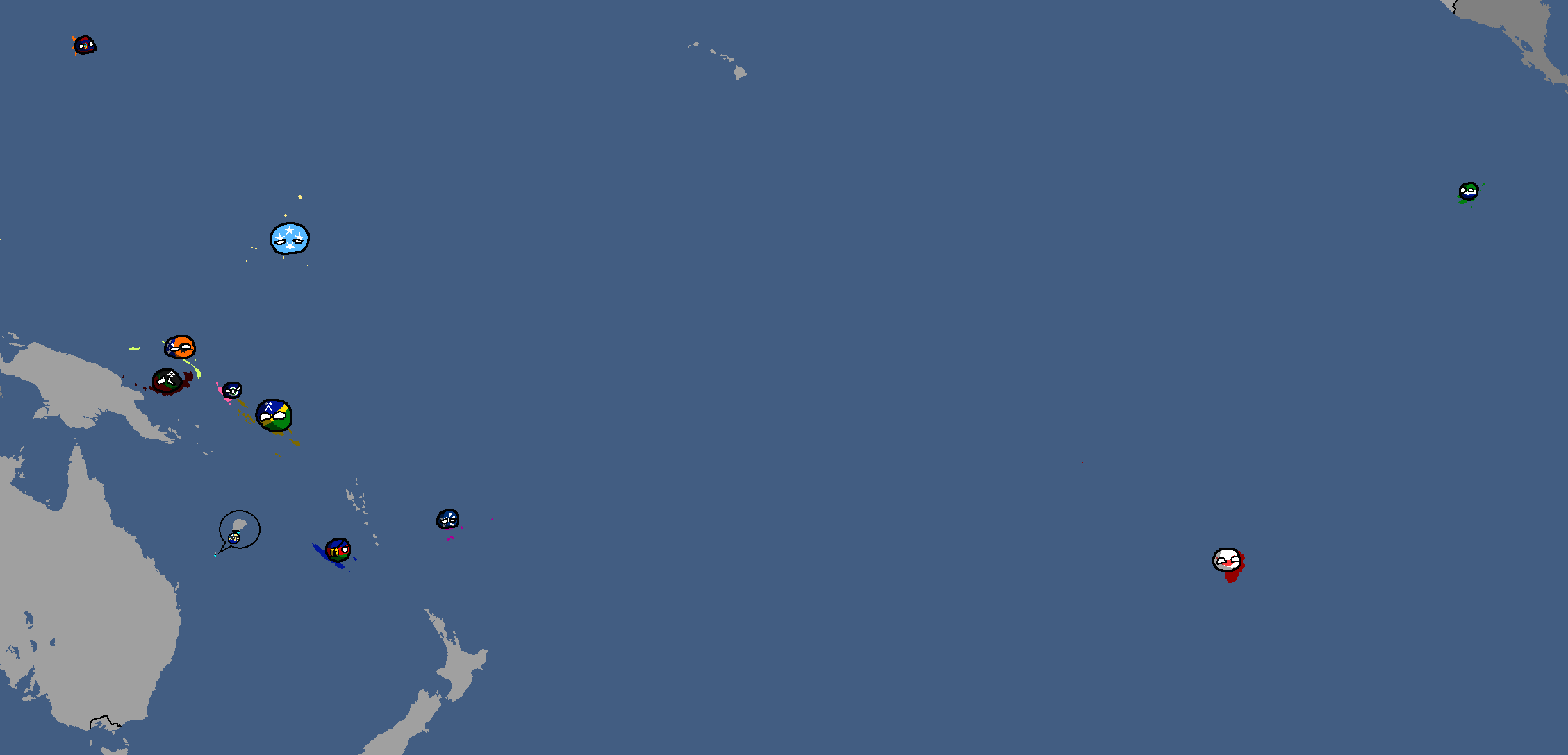
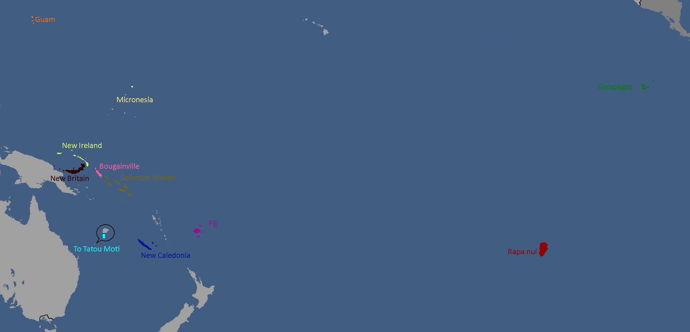
Other Planet Maps
-
Map of Kanashi: Year 296

Extrasolar Maps
-
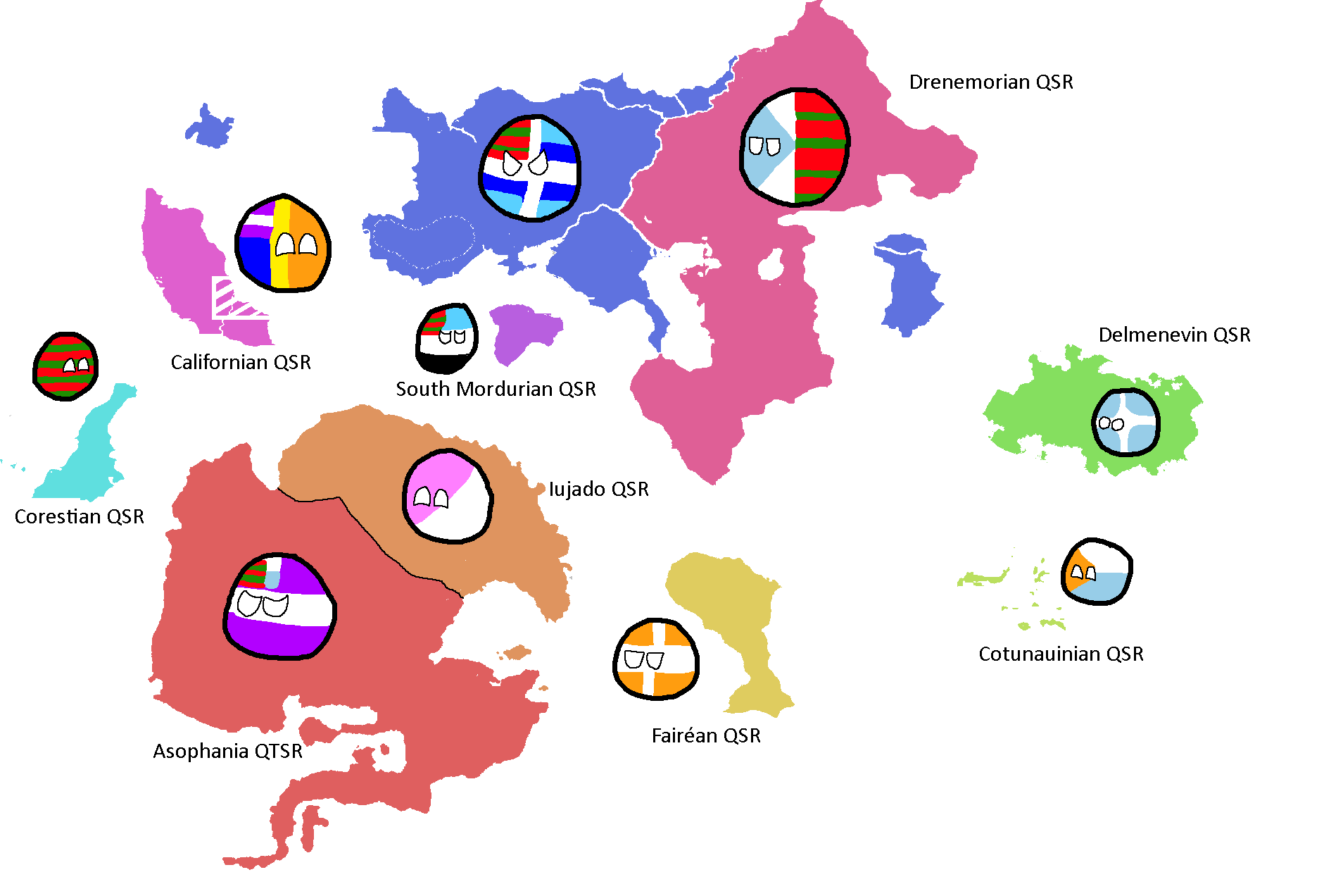
Map of Major Civilisations upon the beginning of the First Qu Invasion: Year 469,430 BGS
-
![Former Nations of modern King Space[13]: Year 199](/yatawiki/images/c/c5/Kingspace199bgs.png)
Former Nations of modern King Space[13]: Year 199
-
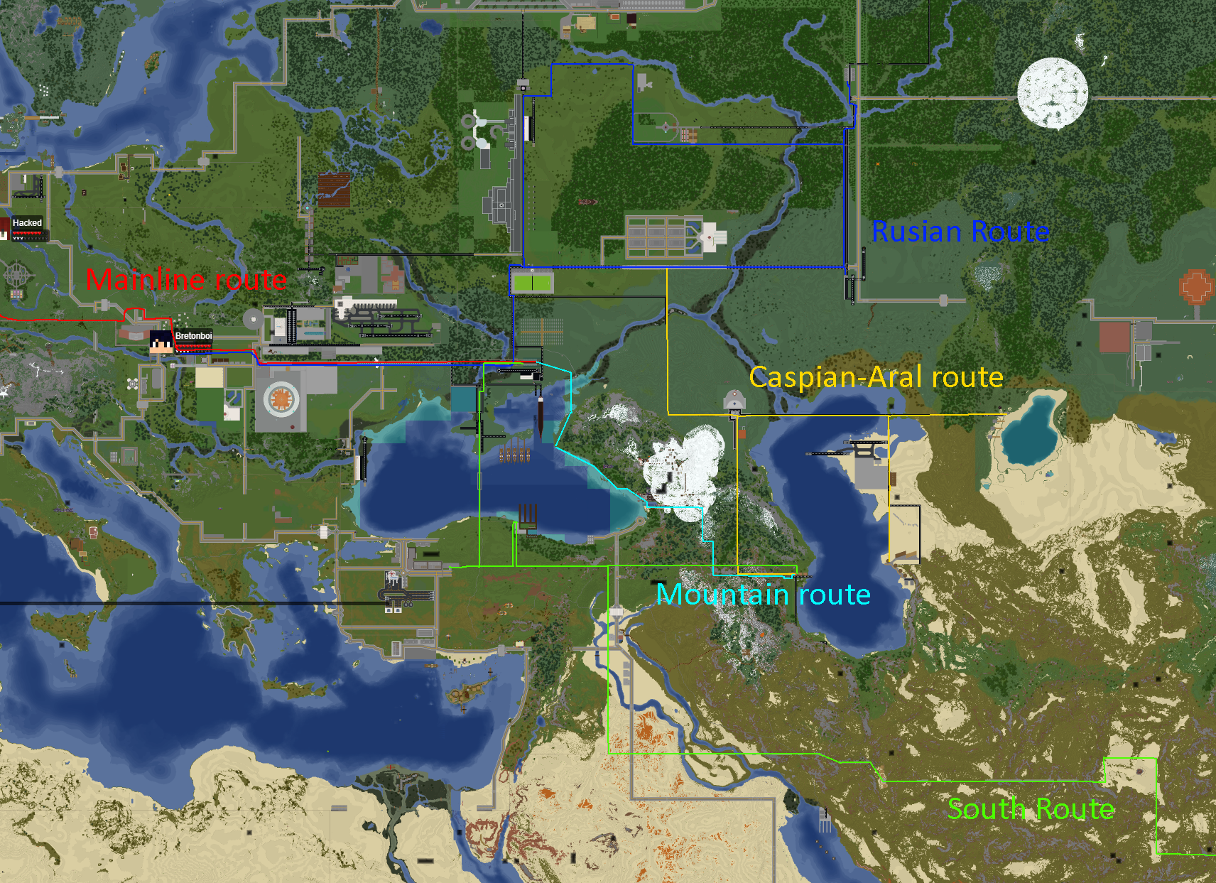
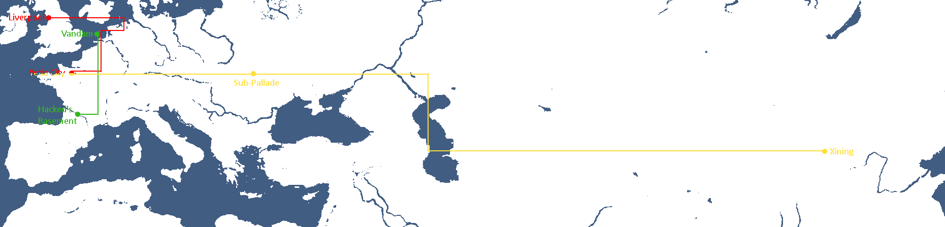
Map of FTL Routes: Year 327
-
![Map of Democracy[14]: Year 343](/yatawiki/images/5/5b/Democracymap4.png)
Map of Democracy[14]: Year 343
-
Map with only systems: Year 356
-
Map of areas Humanity has explored: Year 366
-
Map with only systems: Year 368

![Former Nations of modern King Space[13]: Year 199](/yatawiki/index.php/File:Kingspace199bgs.png)

![Map of Democracy[14]: Year 343](/yatawiki/index.php/File:Democracymap4.png)


National Maps
Abardean Maps
-
Provinces of Abard: Year 306

Adytian Maps
-
Map of Adytium: Year 324

Anakistani Maps
-
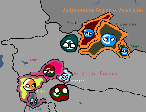
Anakistani Provinces & Regions: Year 112

Catanian Maps
-
Catania Flag Map: Year 215
-
Map of the Newfoundland National Restoration Council, de facto Catanian land: Year 229


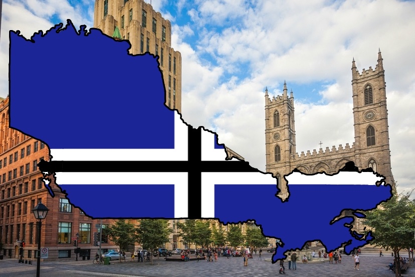
Cotunauinian-Luvurian Maps
-
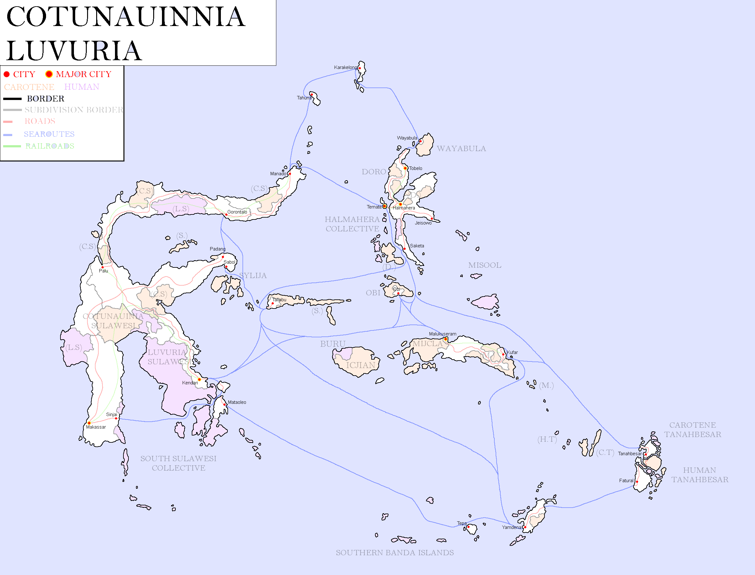
Map of Cotunauinia-Luvuria: Year 377

Drenemorian Maps
-
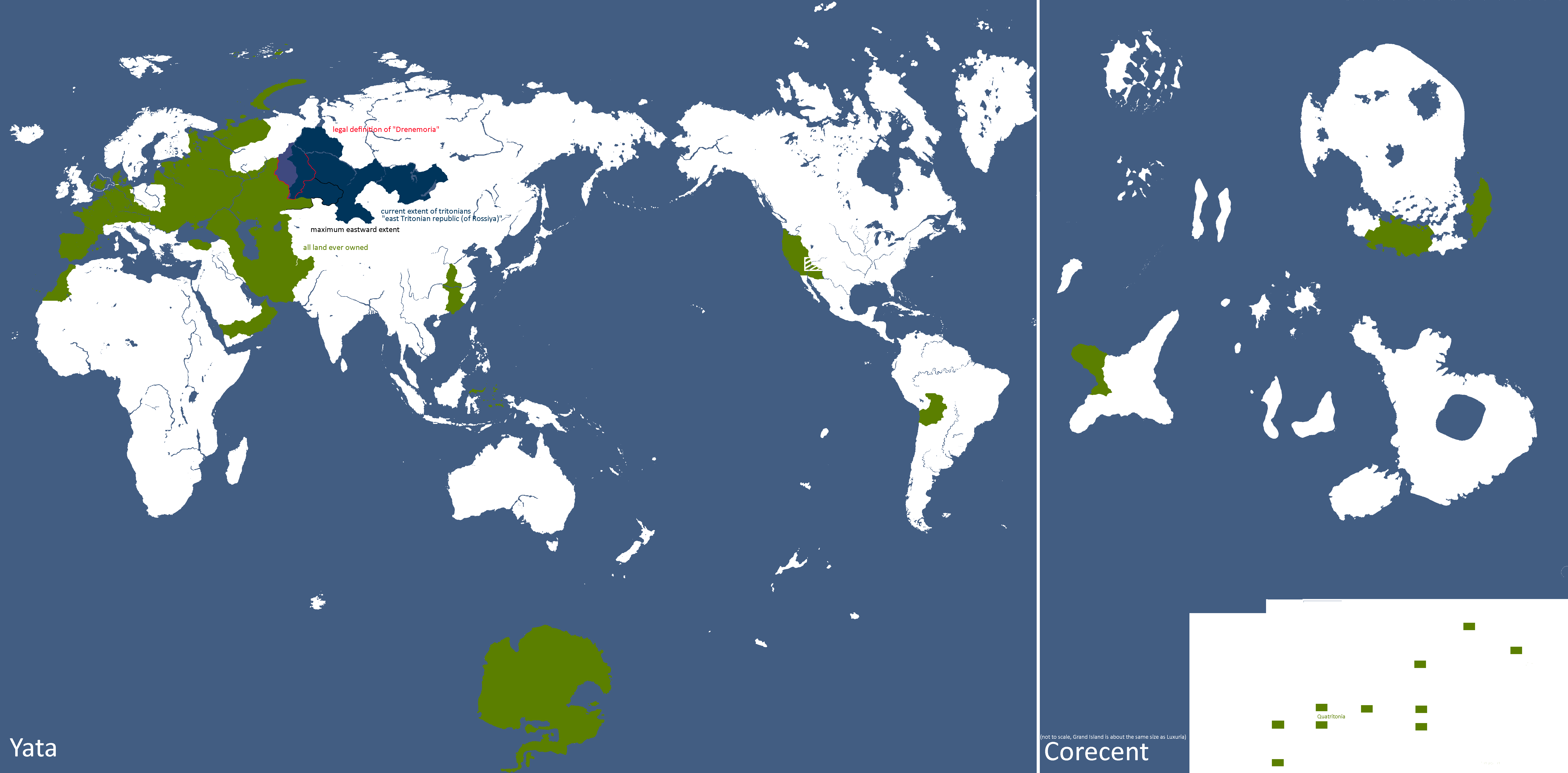
Drenemoria Territorial History: Year 185

East Tritonia Maps
-
Map of Linelandic Occupation in East Tritonia: Year 204

English Maps
-
English City Plan: Year 105
-

York: Year 160


Goldarian Maps
-
Goldarian Federal States: Year 102 (Countryballs)
-
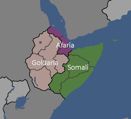
Goldarian Federal States: Year 102


Hayahian Maps
-
Languages of Hayah: Year 191
-
Flag Map of Alhayat: Year 345


Hayastani Maps
-
Languages of Hayas: Year 112

Humamboan Maps
-

Homeland & Colonies of Humambo: Year 115

Isernotarian Maps
-
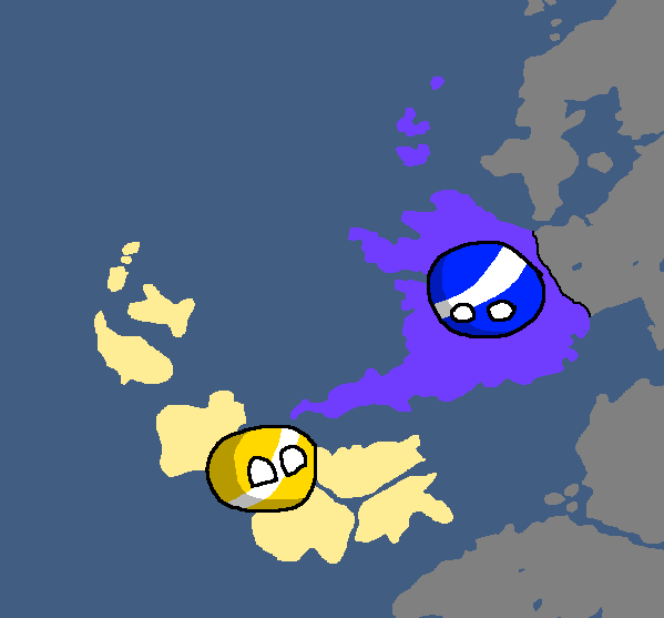
Isernotarian Constituent Nations: Year 116 (Countryballs)
-
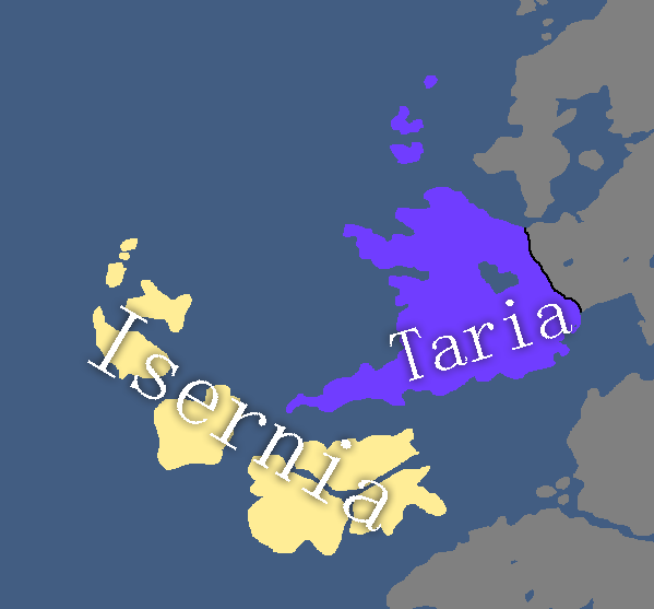
Isernotarian Constituent Nations: Year 116


Islandian Maps
-
Islandian kingdoms and principalities: Year 95 (Countryballs)
-
Islandian kingdoms and principalities: Year 95


Linelandic Maps
-
Linelandic Federal Subjects: Year 101
-
Linelandic Languages: Year 112
-
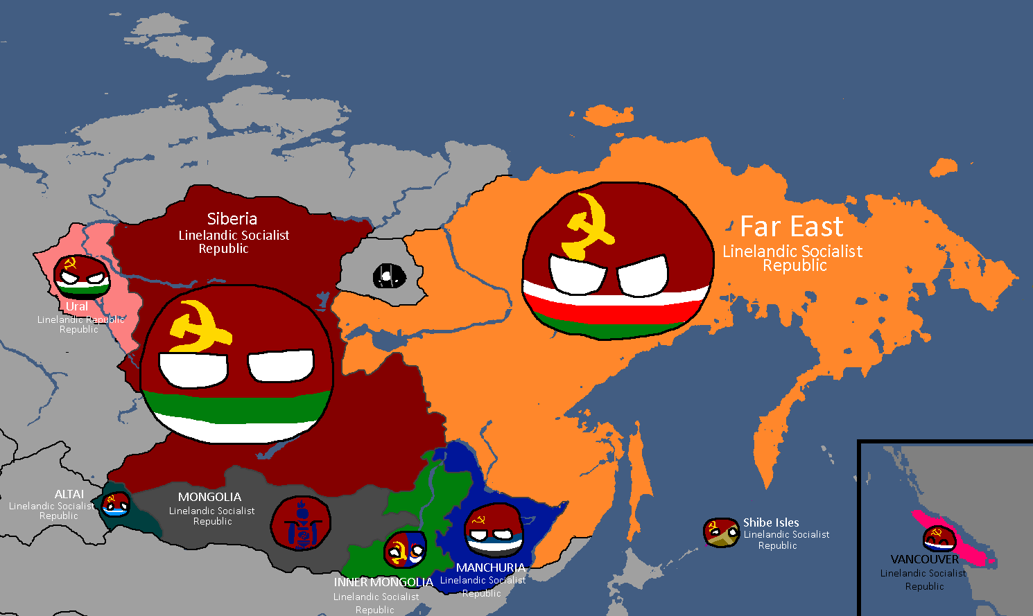
Member-Republics of the Union of Linelandic Socialist Republics: Year 112
-
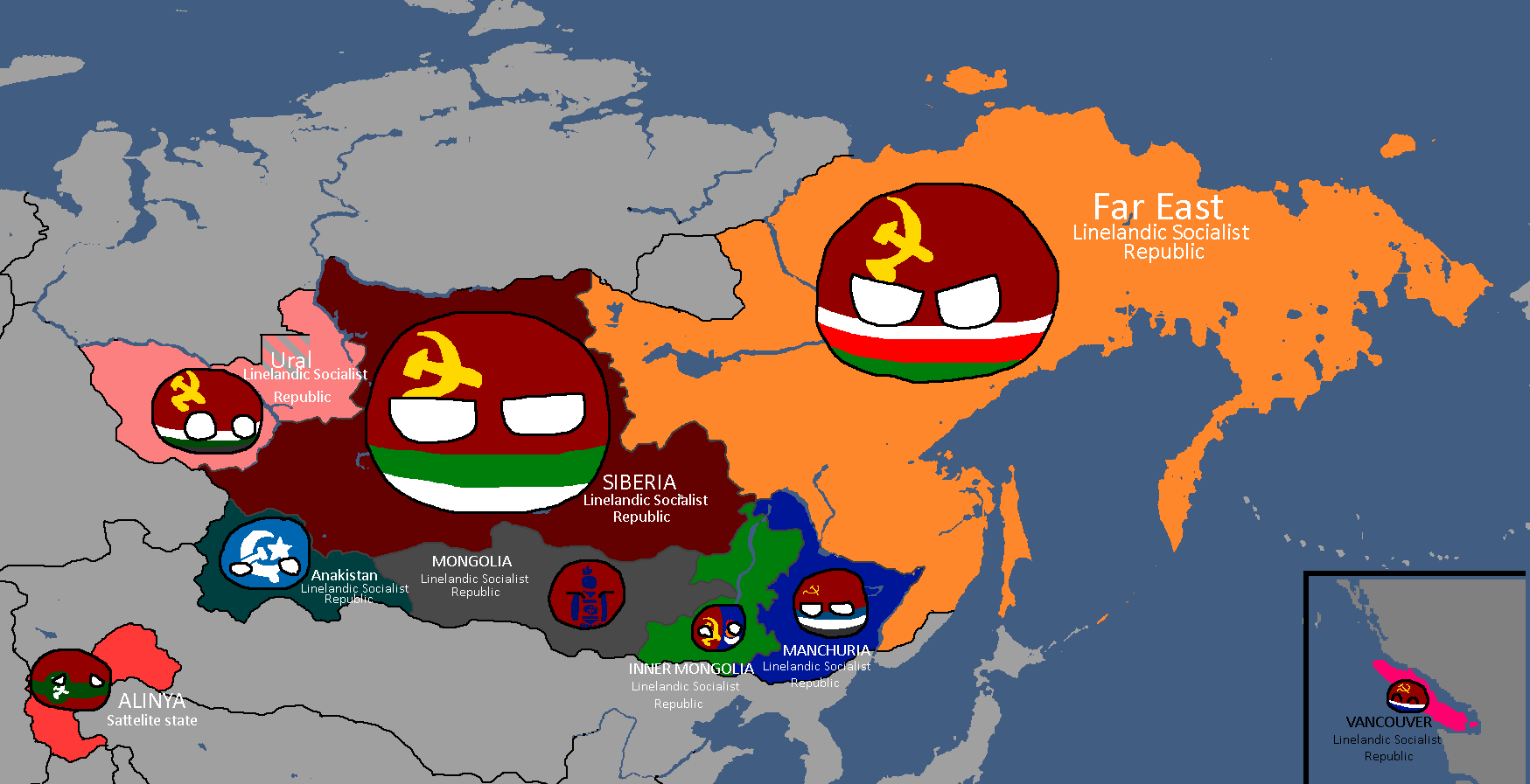
Member-Republics of the Union of Linelandic Socialist Republics: Year 113
-
Oblasts of Lineland: Year 130 (Countryballs)
-
Oblasts of Lineland: Year 130 (Names)
-
Oblasts of Lineland: Year 130 (Blank)
-
Oblasts of Lineland: Year 132
-
Constituent Countries of Lineland: Year 144 (Countryballs)
-
Constituent Countries of Lineland: Year 144
-
Map of damages caused by Tritonian terror-bombing: Year 185
-
Linelandic Warlords without labels: Year 186
-
Map of the Linelandic Sphere: Year 231
-
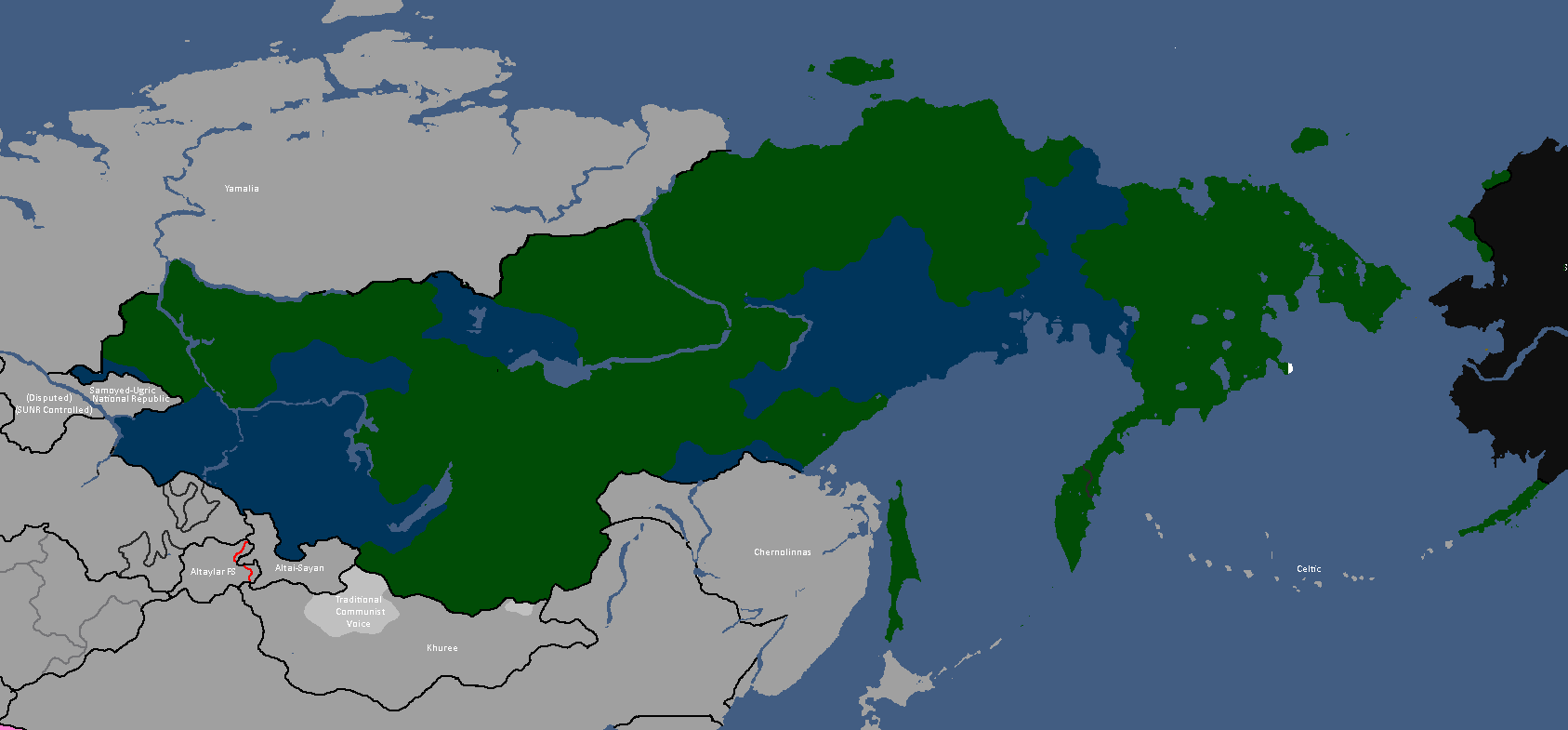
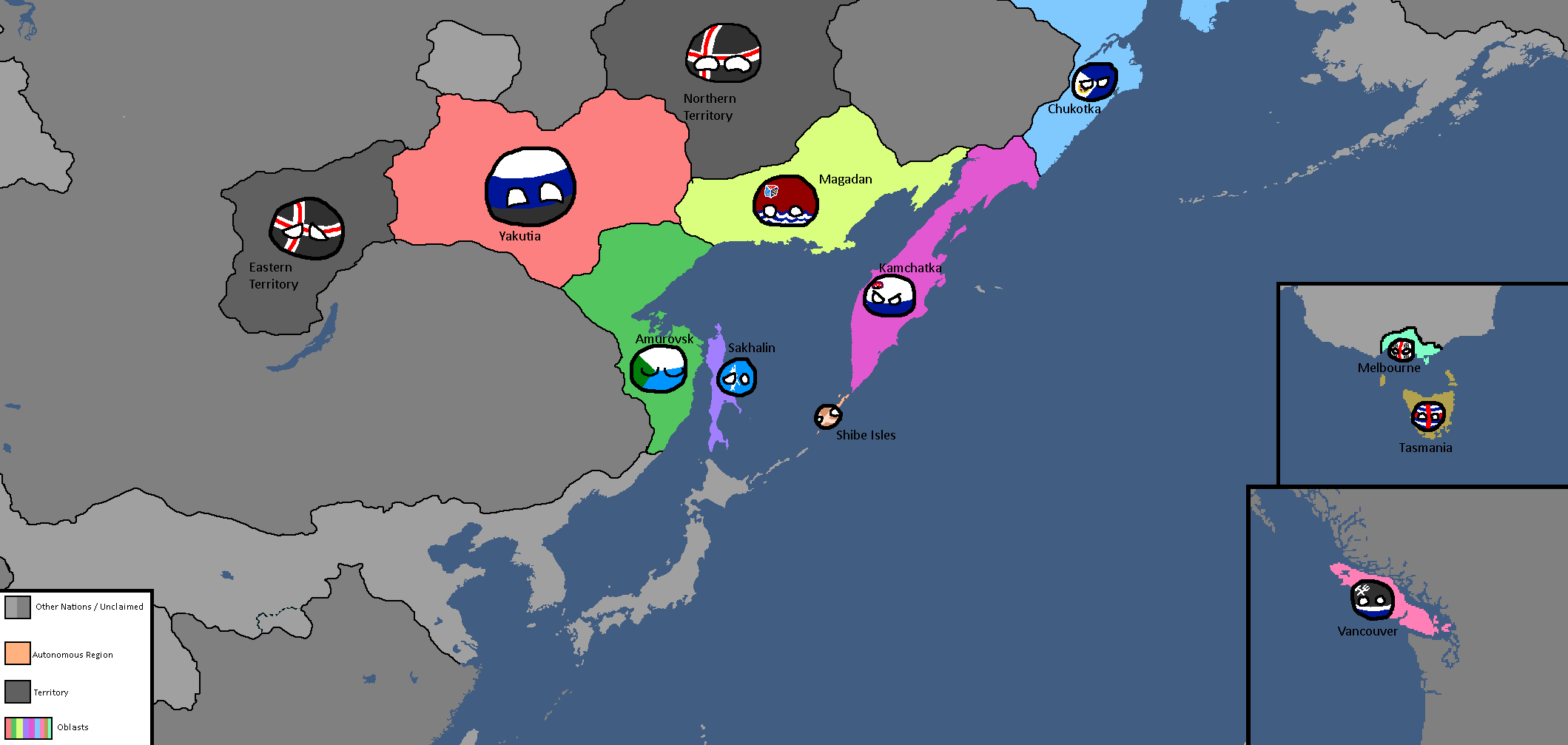
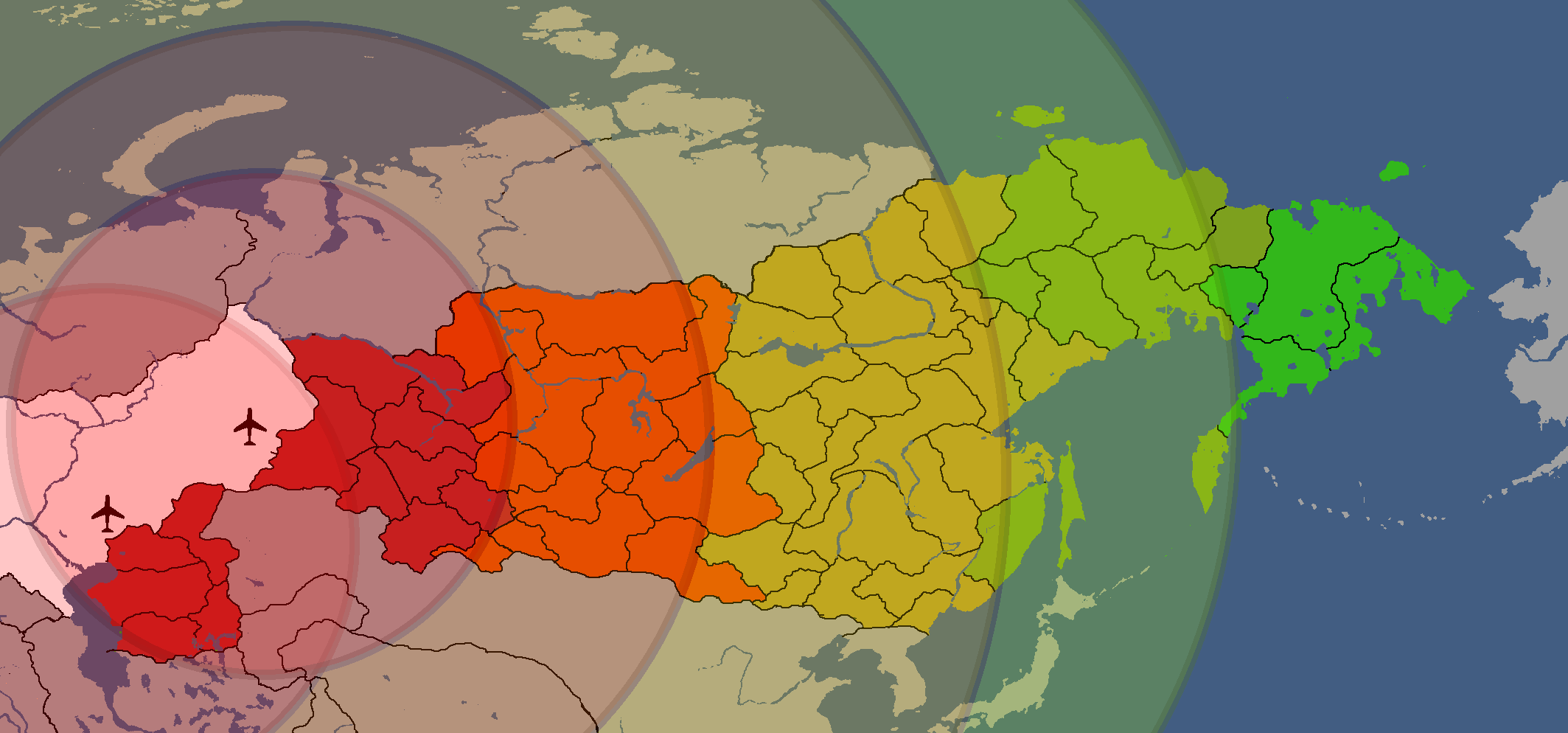
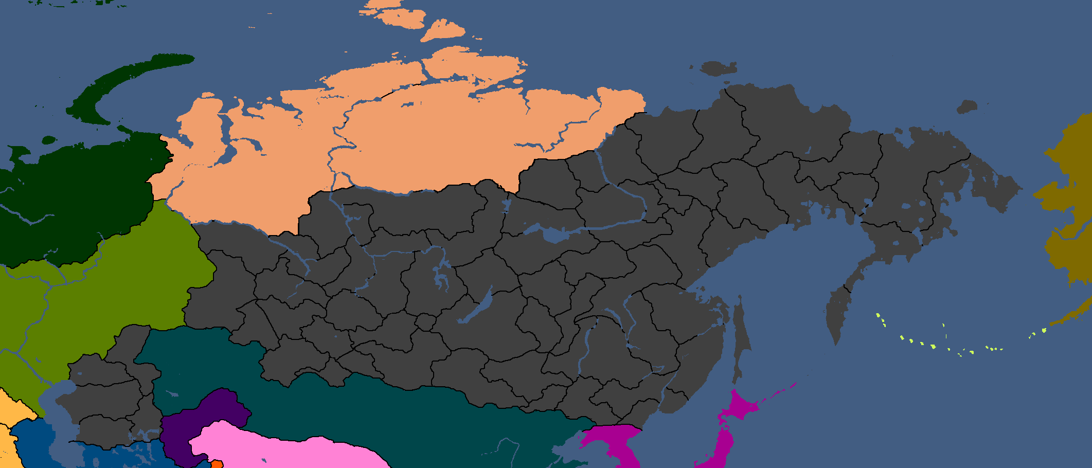
Map of Linelandic or Tritonian ethnicity in Siberia: Year 347


Luxurian Maps
-
Map of areas with active Poavakian resistance movements: Year 188
-
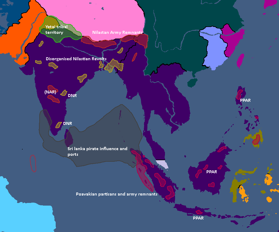
Map of areas with active resistance movements: Year 193


Nakamaian Maps
-
Languages of Nakmai: Year 112

Old Osanian Maps
-
Old Osanian States: Year 105

Poavakian Maps
-
Poavakian Subdivisions: Year 96
-
Areas settled by Nay'Bling refugees: Year 171


Rossiyan Maps
-
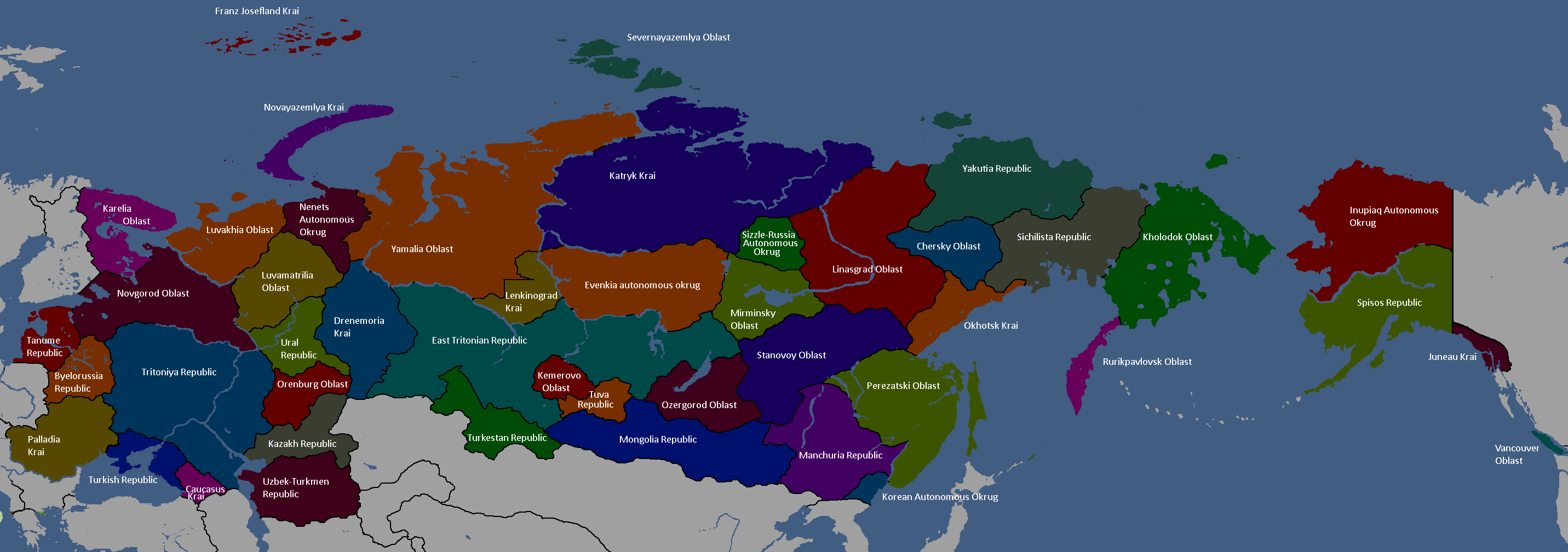
Federal Subjects of Rossiya: Year 176 (Names)
-
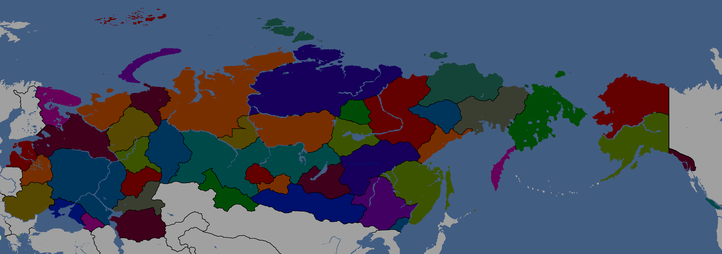
Federal Subjects of Rossiya: Year 176 (Blank)
-
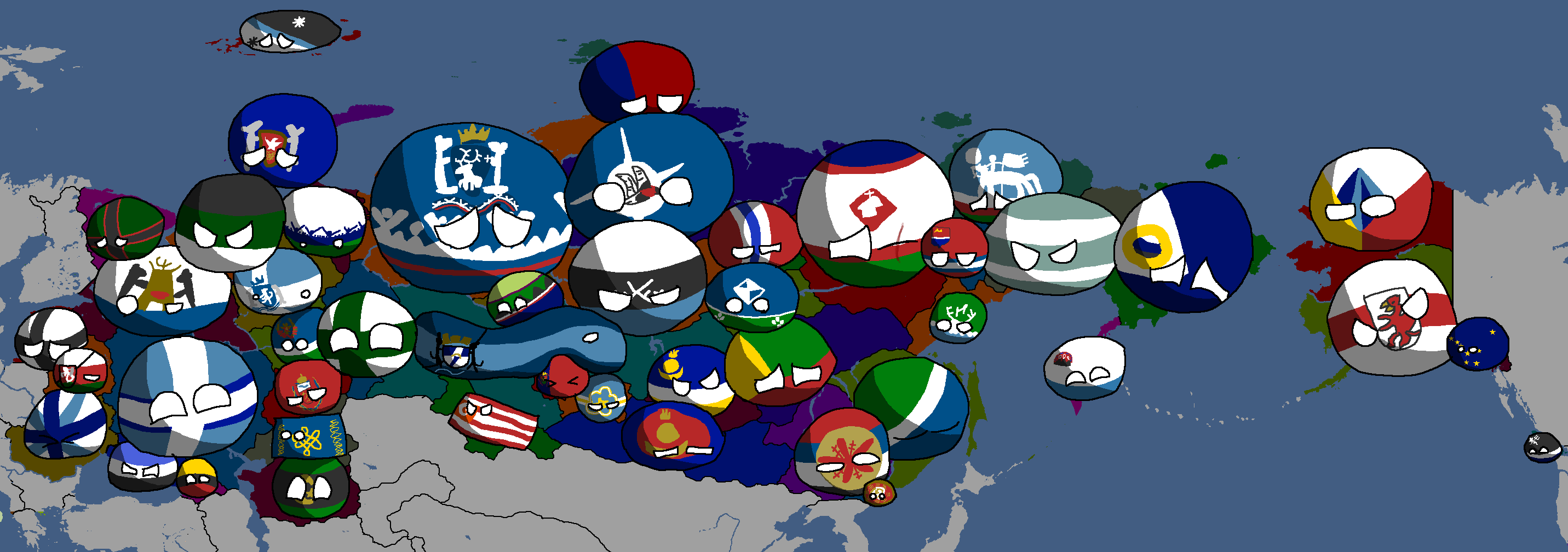
Federal Subjects of Rossiya: Year 176 (Countryballs)
-
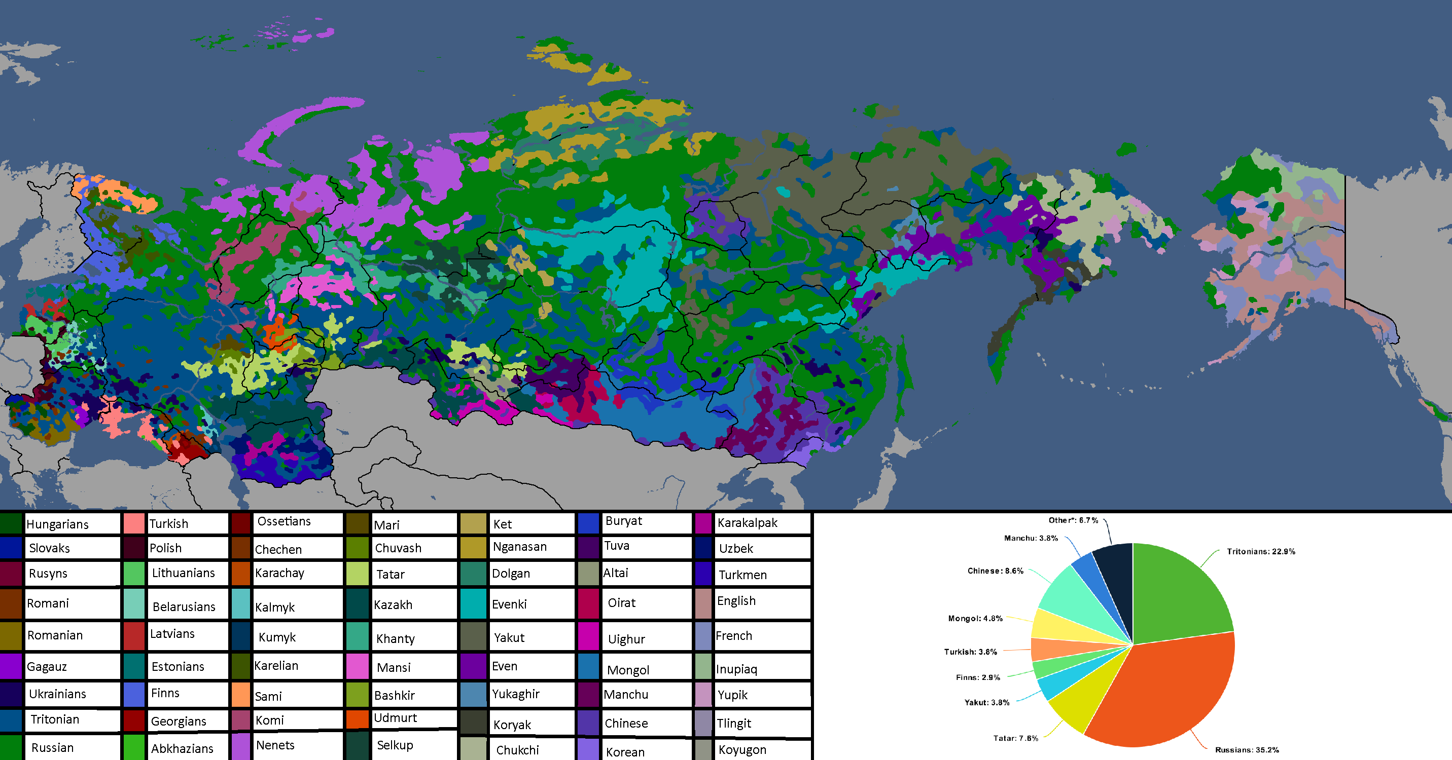
Languages of Rossiya: Year 180


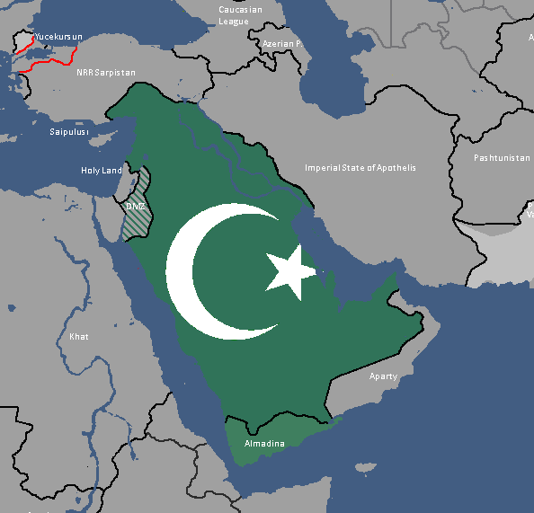
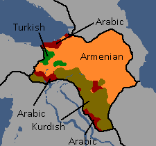
Sarpistani Maps
-
Languages of Sarpistan: Year 114
-
Provinces of Sarpistan and Jeriya (Protectorate): Year 115
-
Map of the planned partition of Sarpistan: Year 121


Sizzlean Maps
-
Map of the (First) Sizzlean Empire: Year ~40s
-
Regions of Great Sizzle: Year 128 (Countryballs)
-
Regions of Great Sizzle: Year 128 (Names)
-
Regions of Great Sizzle: Year 128 (Blank)


Swagonian Maps
-
Provinces of Swagonia: Year 218
-
![Swagonian Provinces by Type[15]: Year 218](/yatawiki/images/9/9f/Swagoniaprovincetypes.png)
Swagonian Provinces by Type[15]: Year 218
-
Counties of Swagonia: Year 253
-
Counties of Swagonia: Year 254

![Swagonian Provinces by Type[15]: Year 218](/yatawiki/index.php/File:Swagoniaprovincetypes.png)


Tanumian Maps
-
Languages of Tanume: Year 152

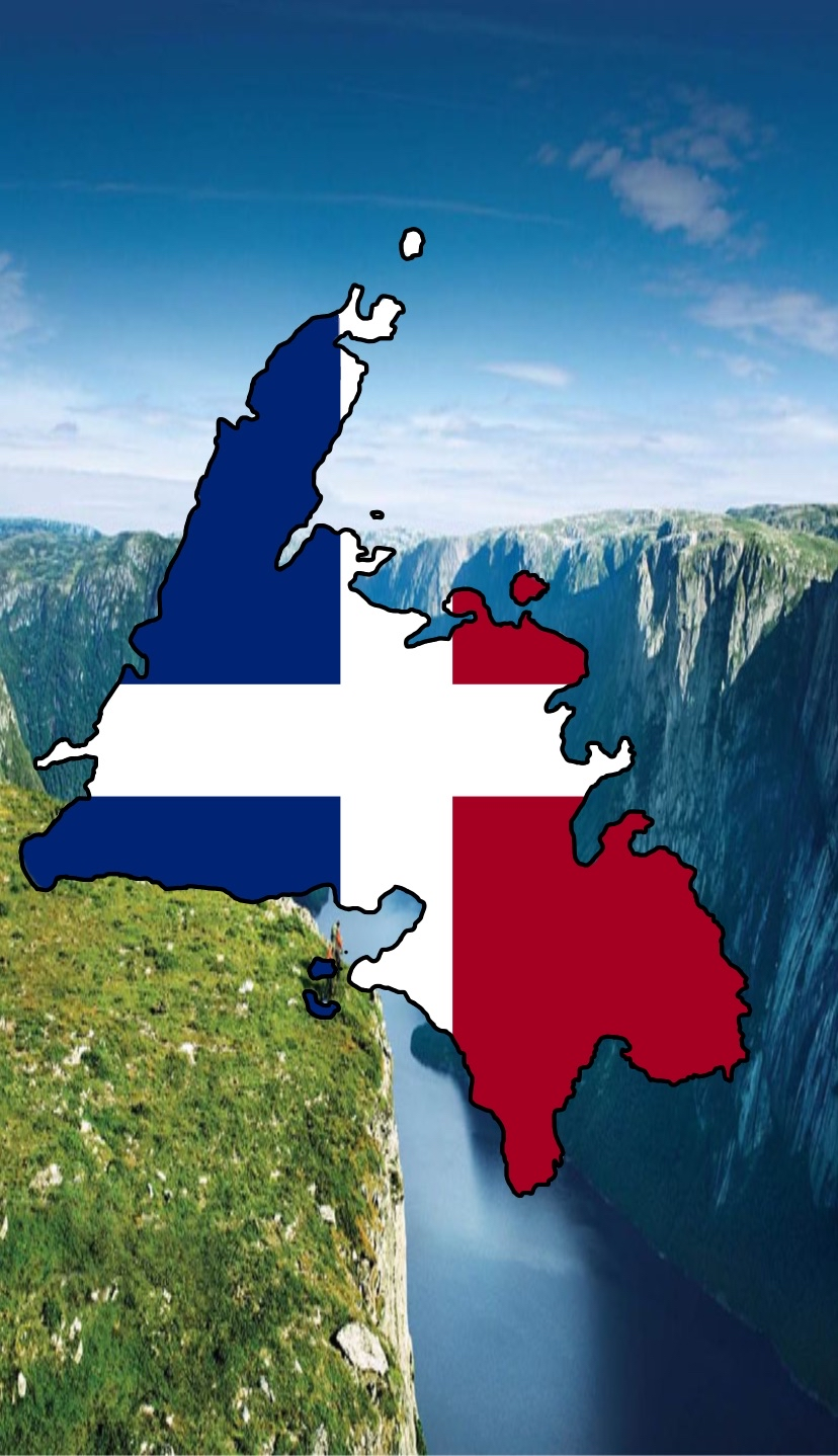
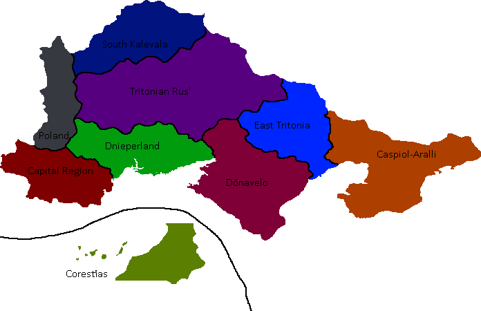
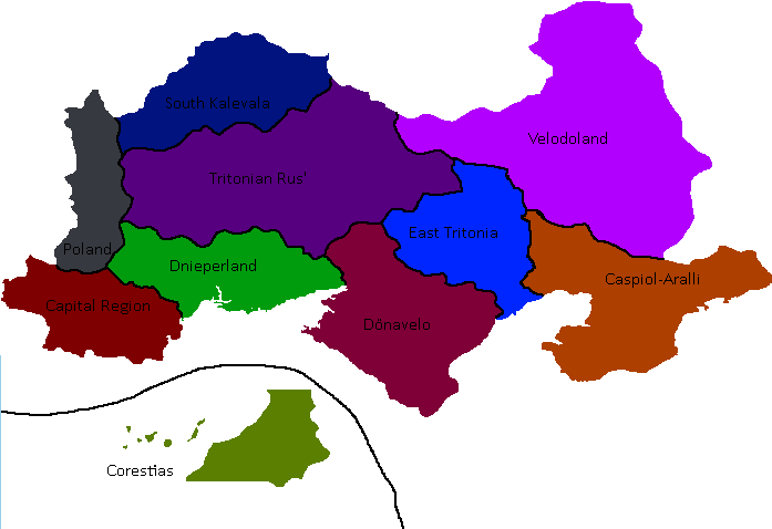
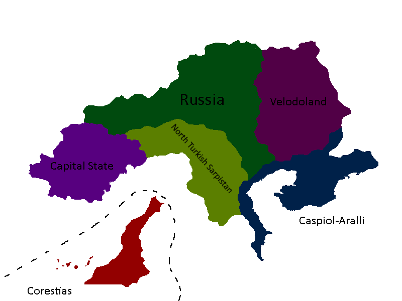
Tritonian Maps
-
Tritonian Regions: Year 90
-
Tritonian Regions: Year 91
-
Tritonian Regions: Late Year 91
-
Tritonian Regions: Year 96
-
Tritonian Regions: Year 101
-
Tritonian Railways: Year 106
-
Member-Republics of the Union of Quatritonian Socialist Republics: Year 114
-
Languages of Quatritonia: Year 115
-
Red = Original Tritonia, Green = Current Tritonia, Yellow ) Tritonia at height: Year 135
-
Lands Tritonia has owned across history: Year 175
-
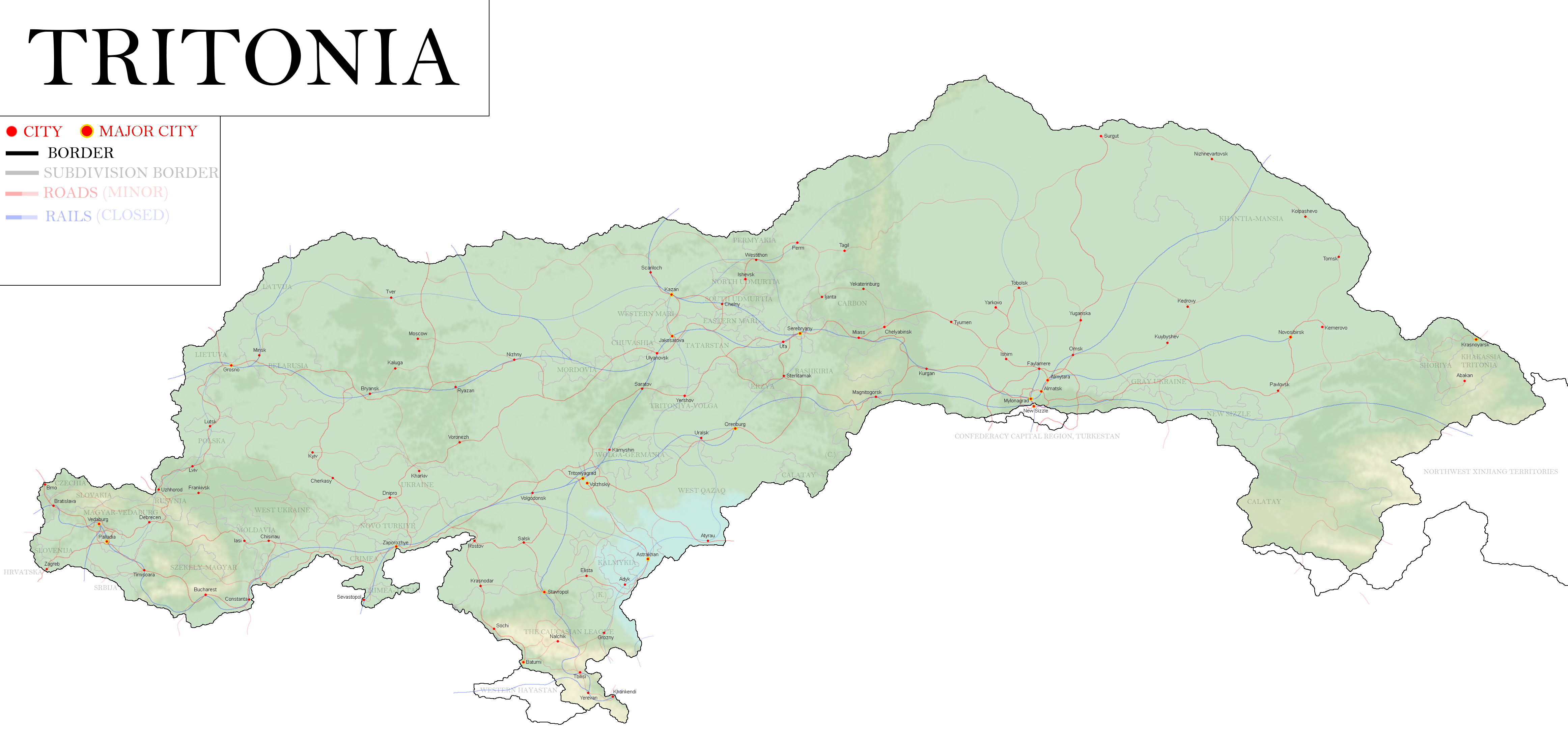
Map of Tritonia: Year 377


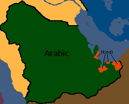
UAR/Arab Federation Maps
-
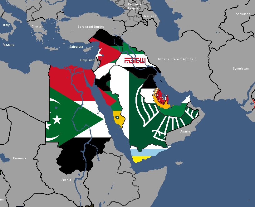
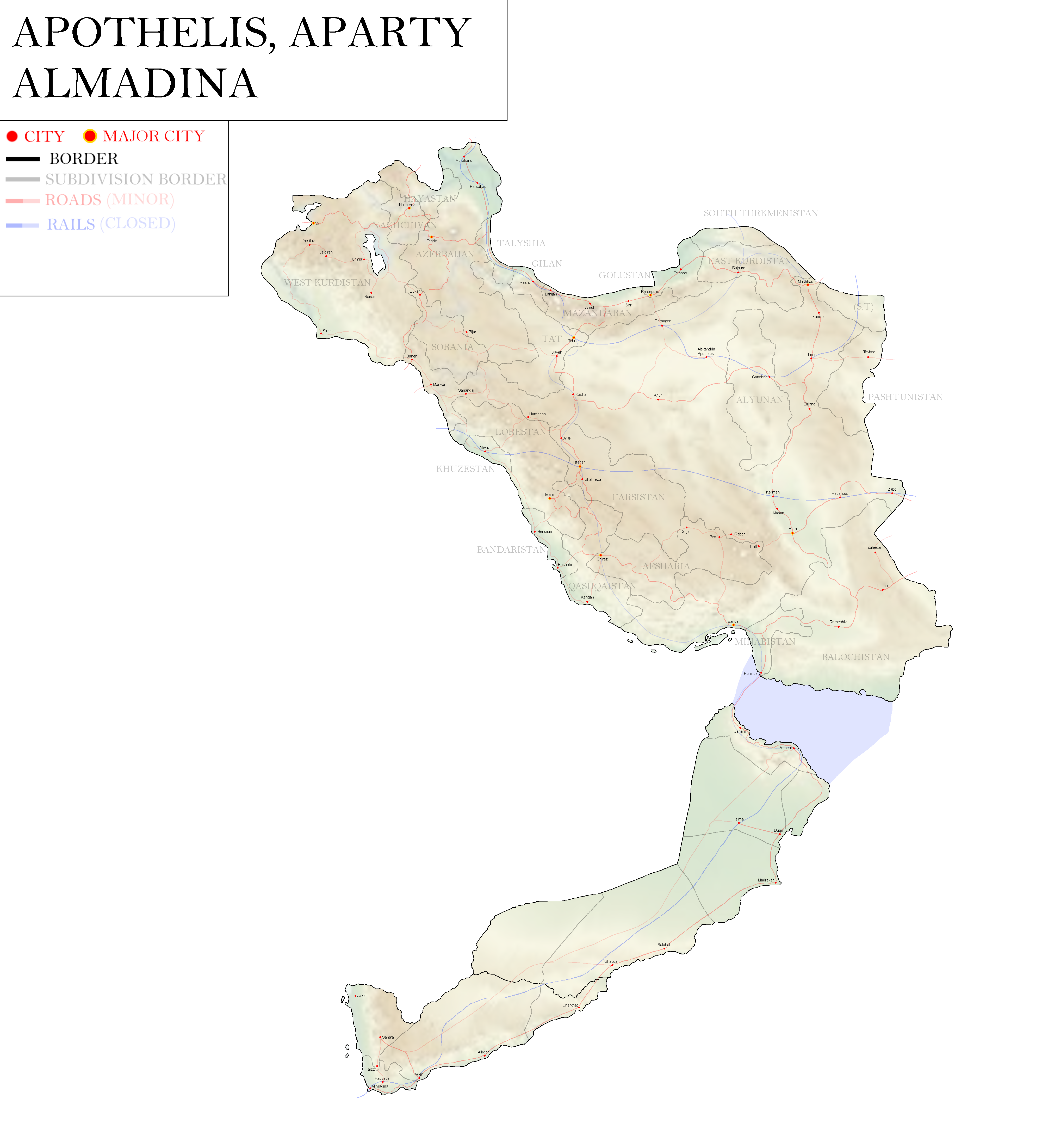
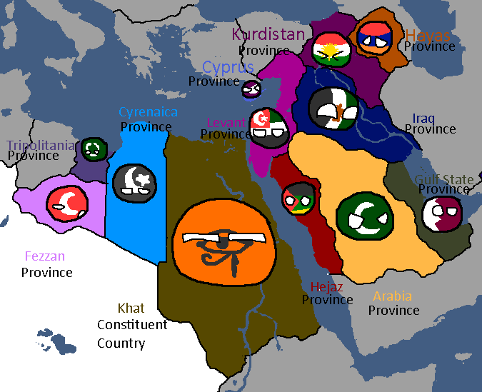
Map of UAR States: Year 365
-
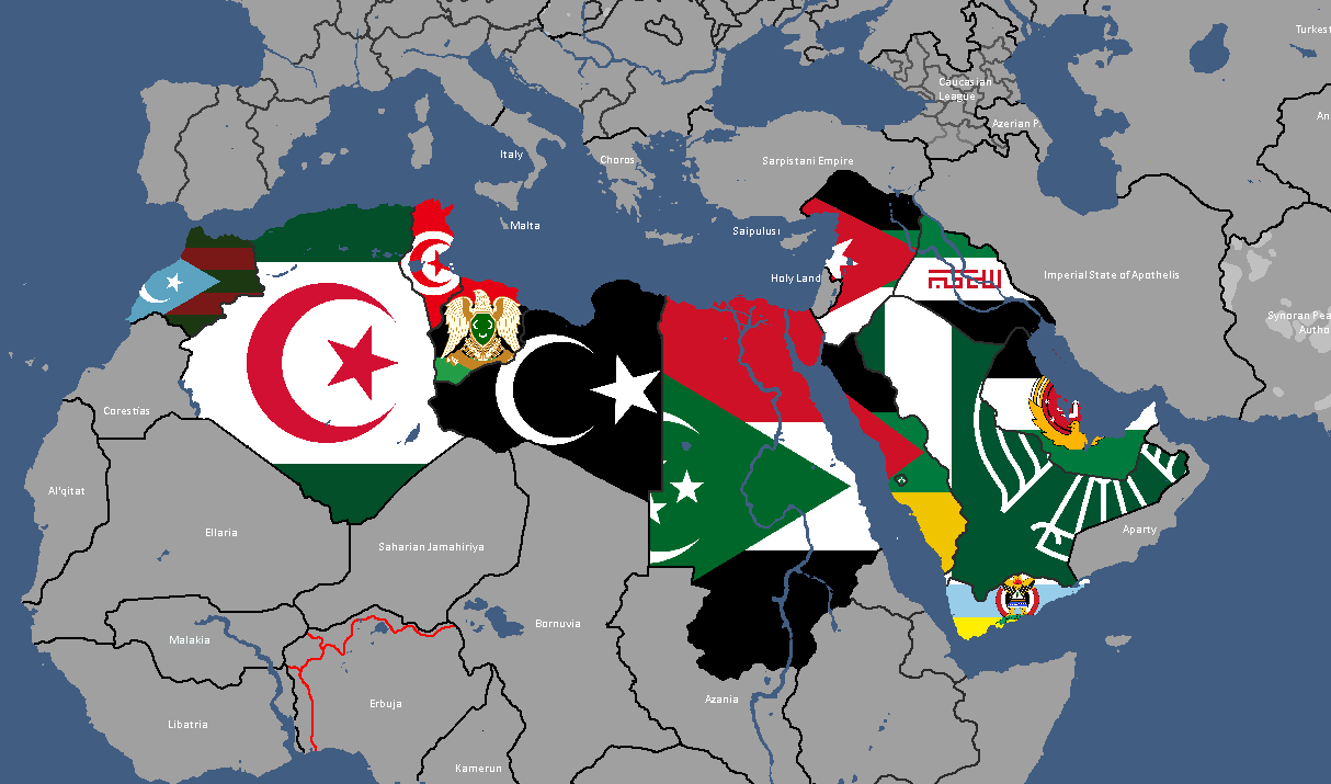
Map of UAR States: Year 368


UFR/Floppastani Maps
-
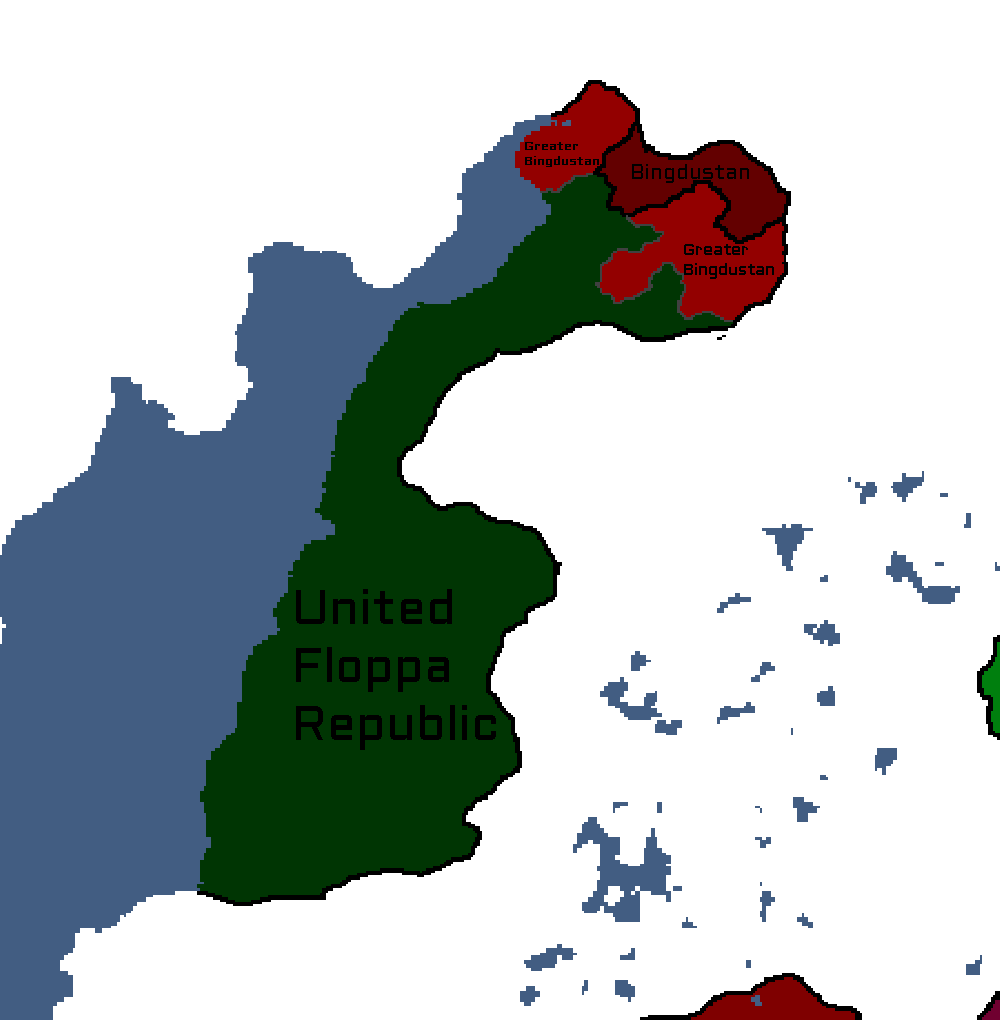
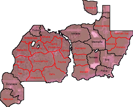
Map of the Bingdustan autonomy in the UFR

Utsongan Maps
-
Languages of Utsong: Year 114
-
Utsong's Population Distribution: Year 114


Vedan Maps
-
Vedan Districts: Year 103

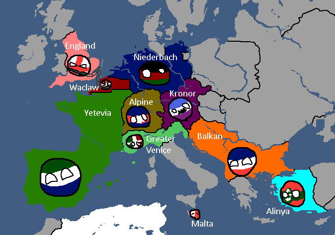
Waclawan Maps
-
Map of Waclaw: Year 172

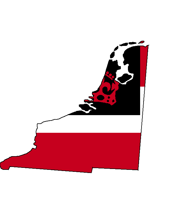
Yamatoan Maps
-
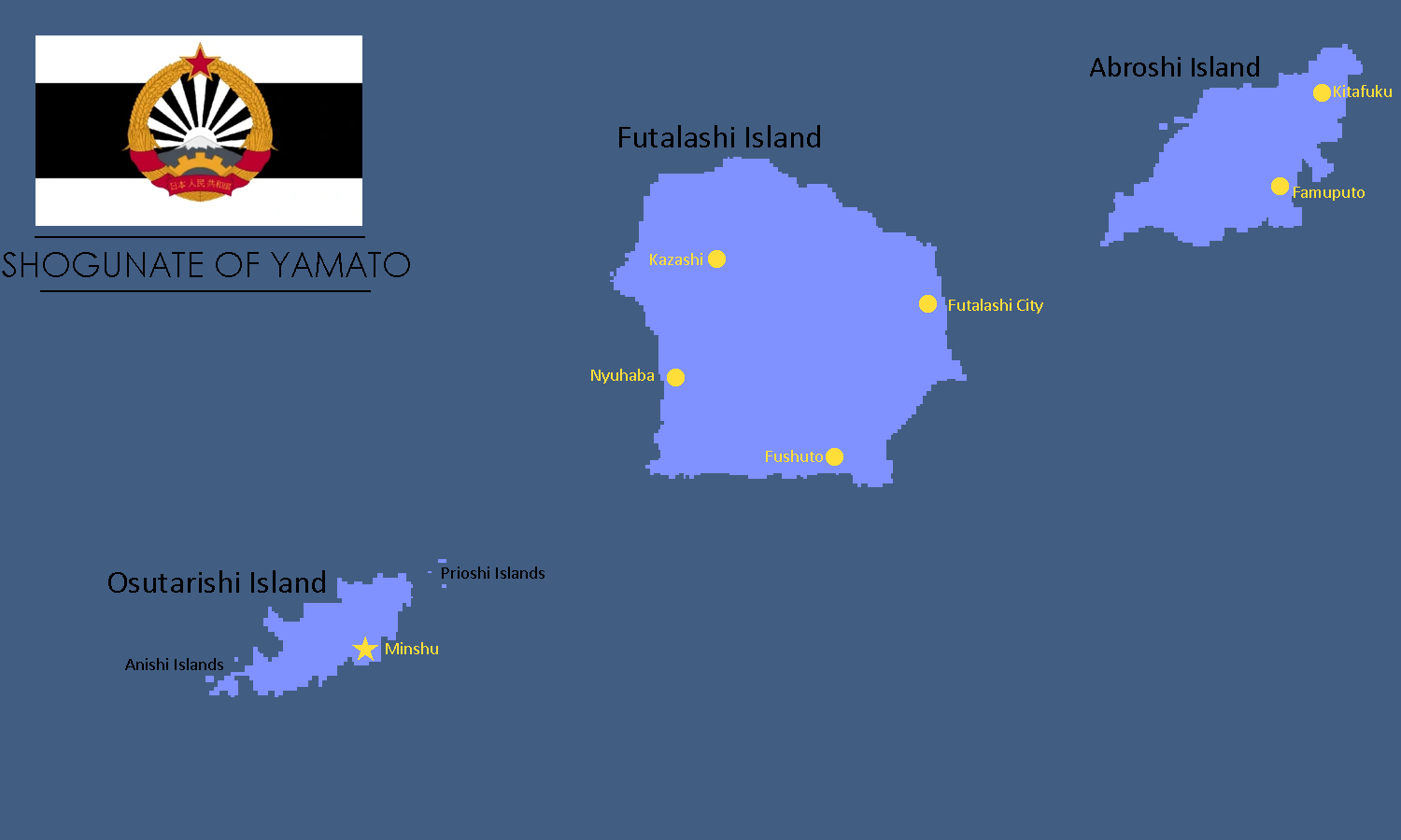
Map of Yamato: Year 245

Yatan-Theian Accord Maps
-
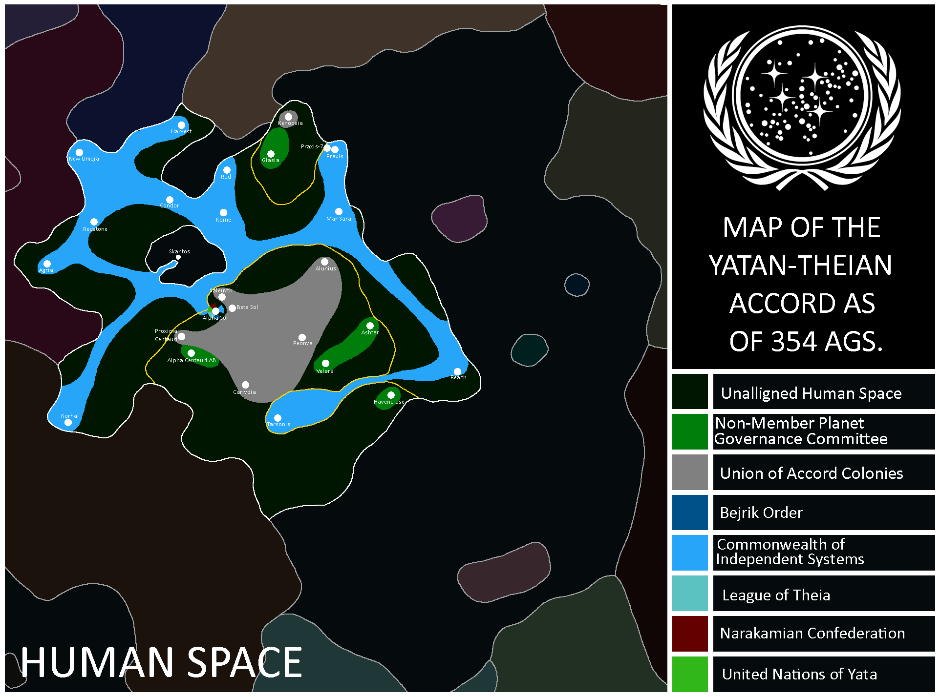
Map of the Accord: Year 354
-
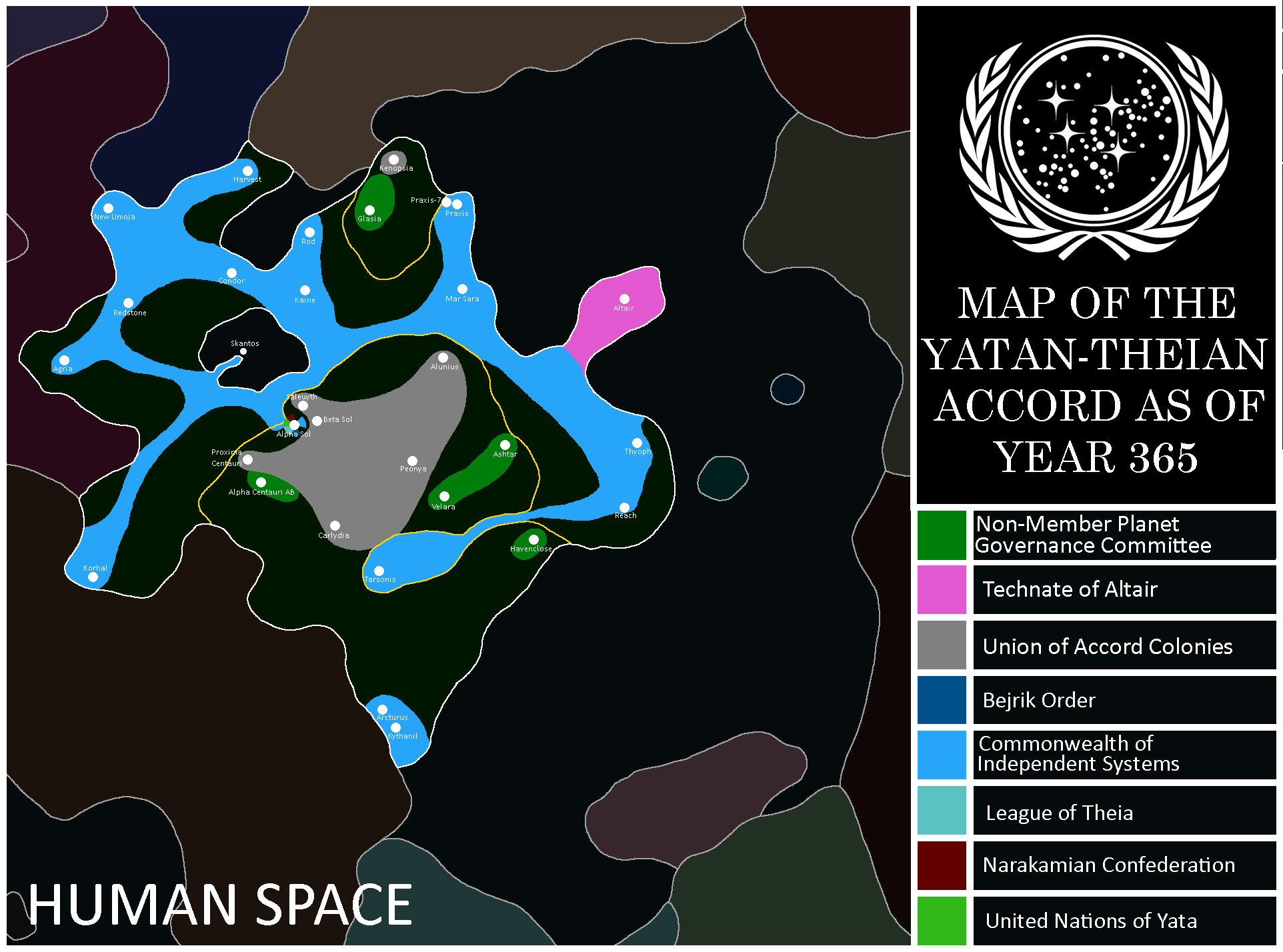
Map of the Accord: Year 365
-
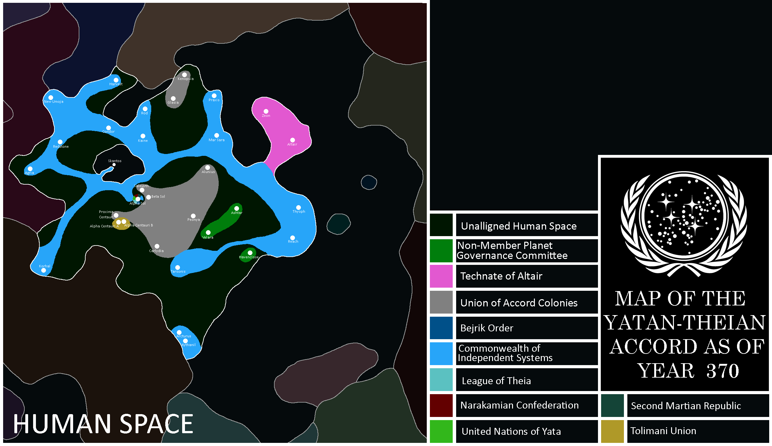
Map of the Accord: Year 370


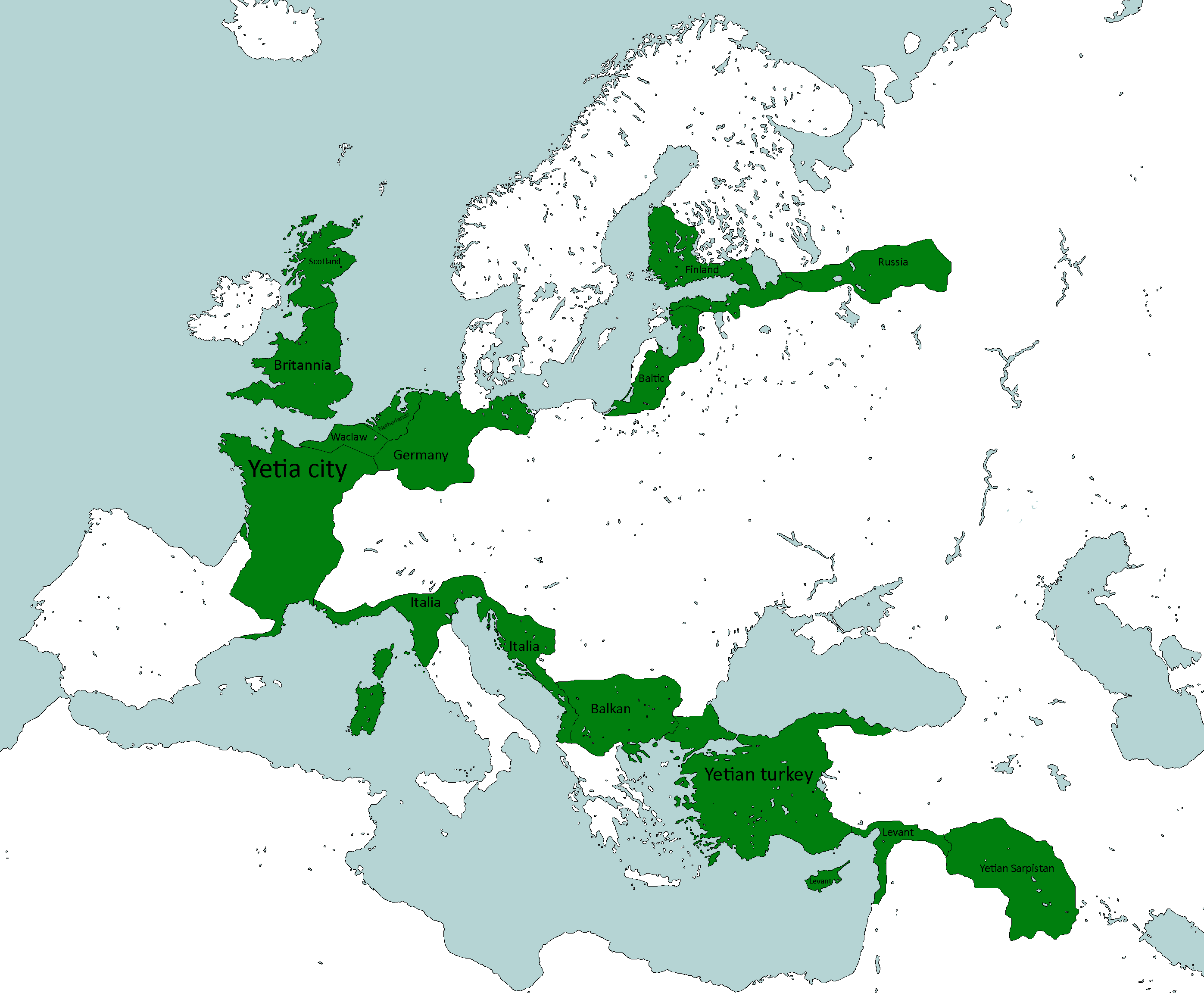
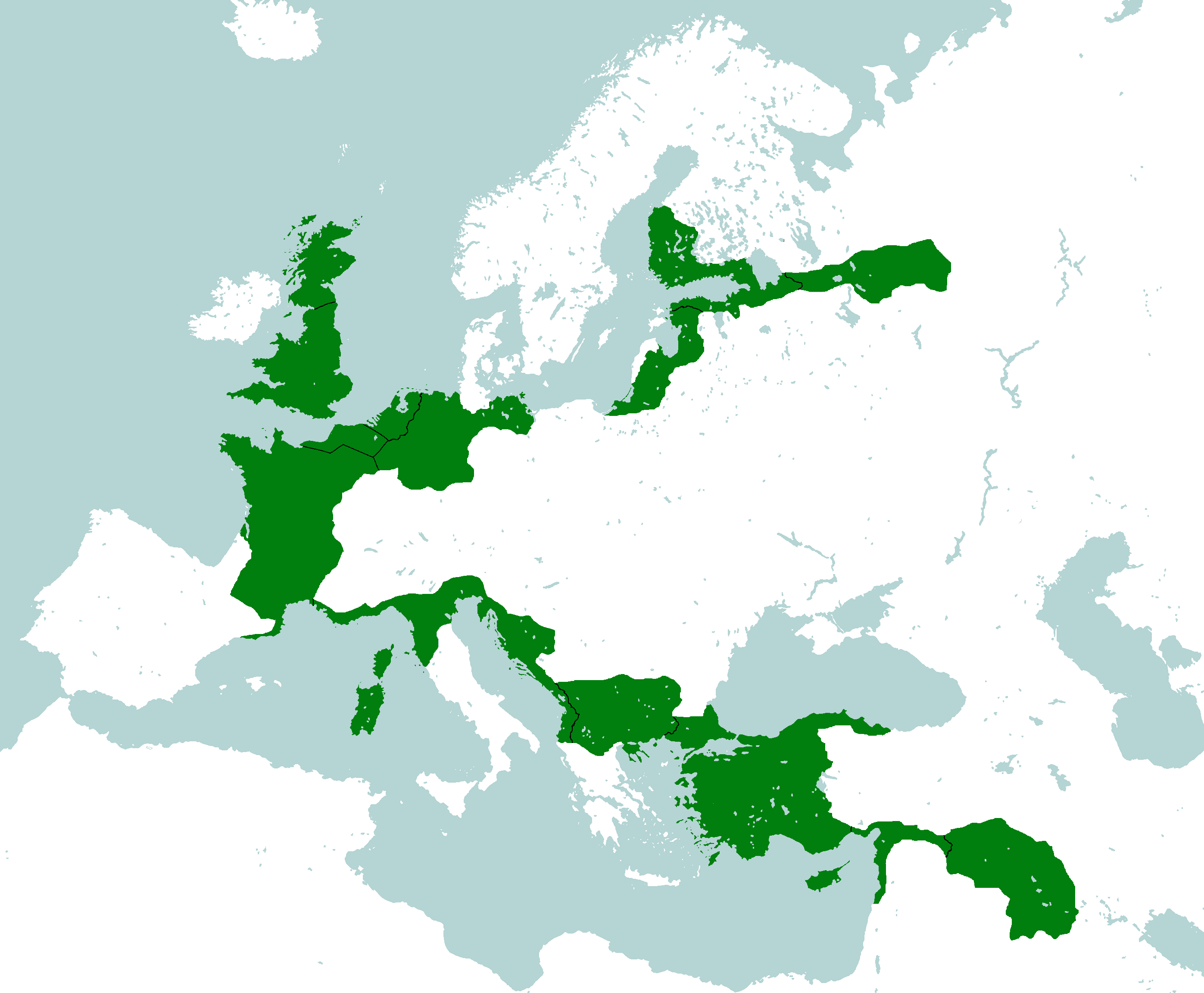
Yetian Maps
-
Lost Archives Map: Yetia 1
-
Lost Archives Map: Yetia 2
-
Lost Archives Map: Yetia 3
-
Lost Archives Map: Yetia 4
-
Lost Archives Map: Yetia 5
-
Yetian Provinces: Spring 2019
-
Yetian Provinces
-
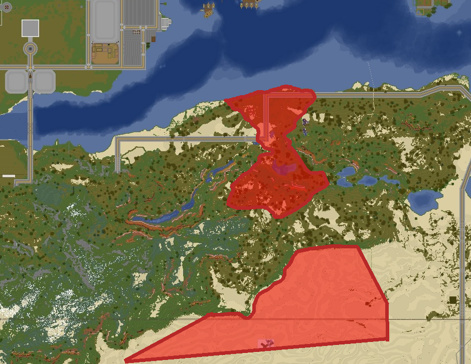
Map of where The Newtown Project was developed
-
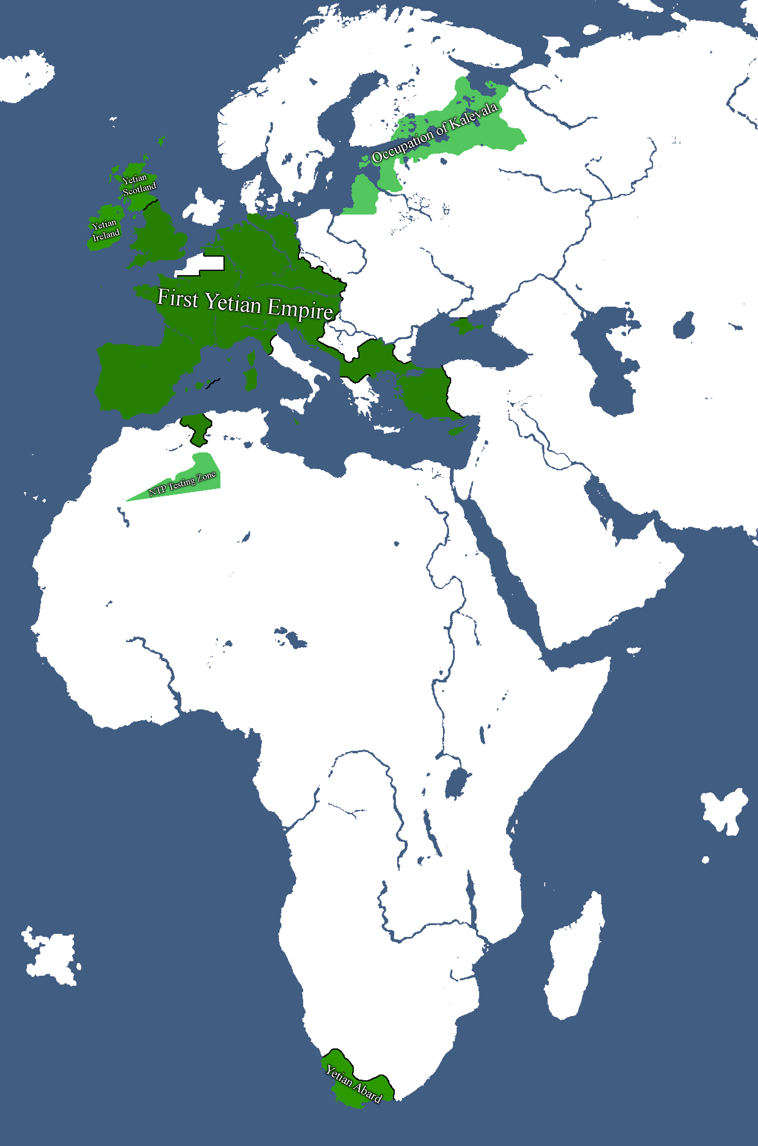
Map of the First Yetian Empire
-
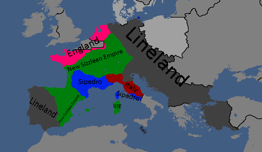
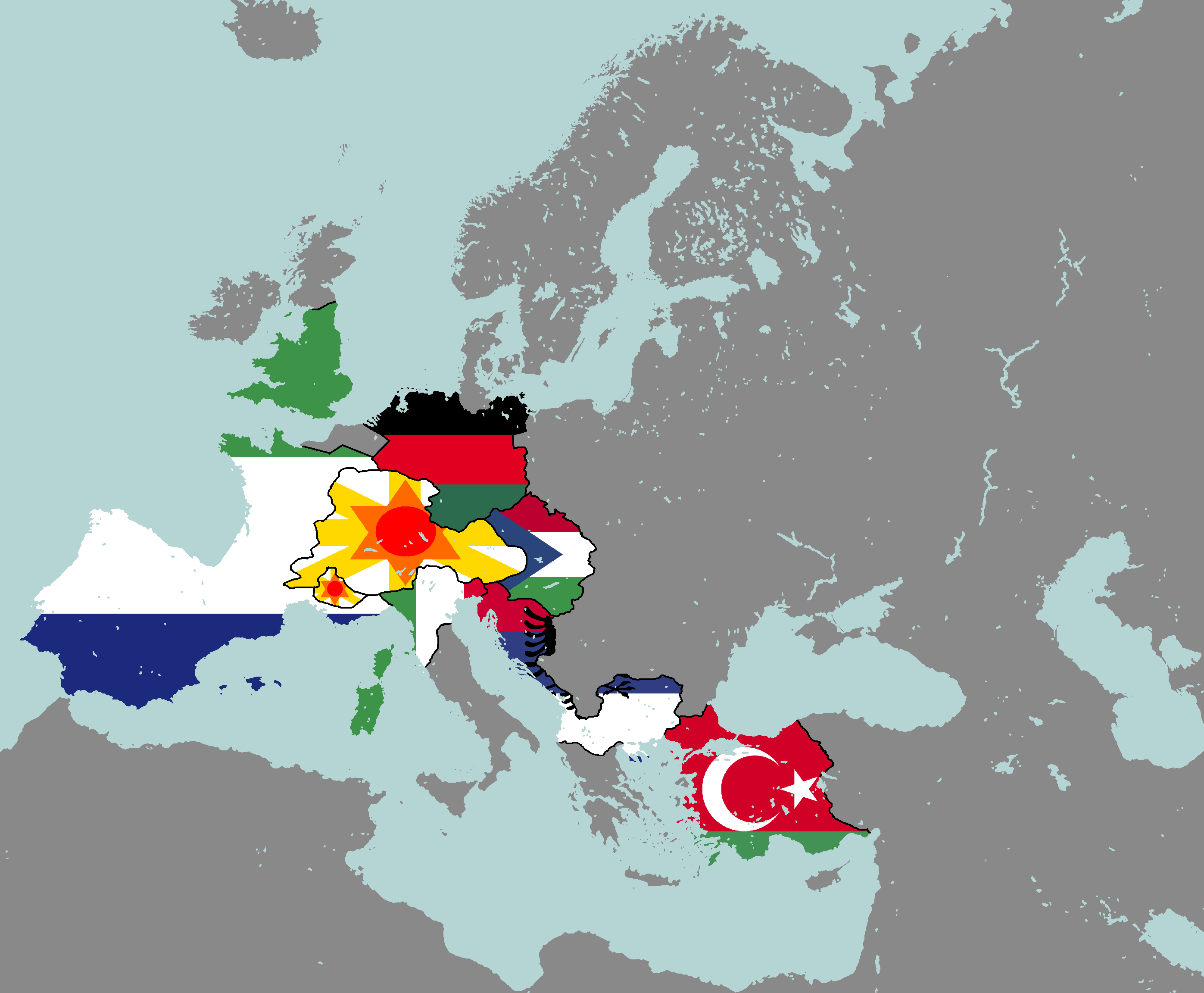
Map of which country captured what in yetia during WW5
-
Yetian Provinces: Year 90
-
Yetian Provinces: Year 108
-
Yetian Languages: Year 112
-
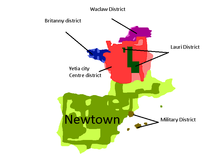
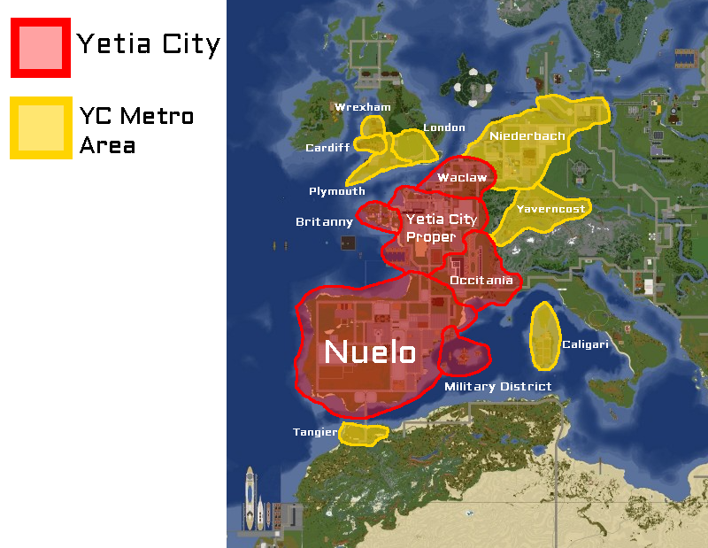
Districts of Yetia City: Year 114
-
Yetian Languages: Year 115
-
Yetian Provinces: Year 119 (Countryballs)
-
Yetian Provinces: Year 119
-
Yetian Provinces: Year 119 (Nameless)
-
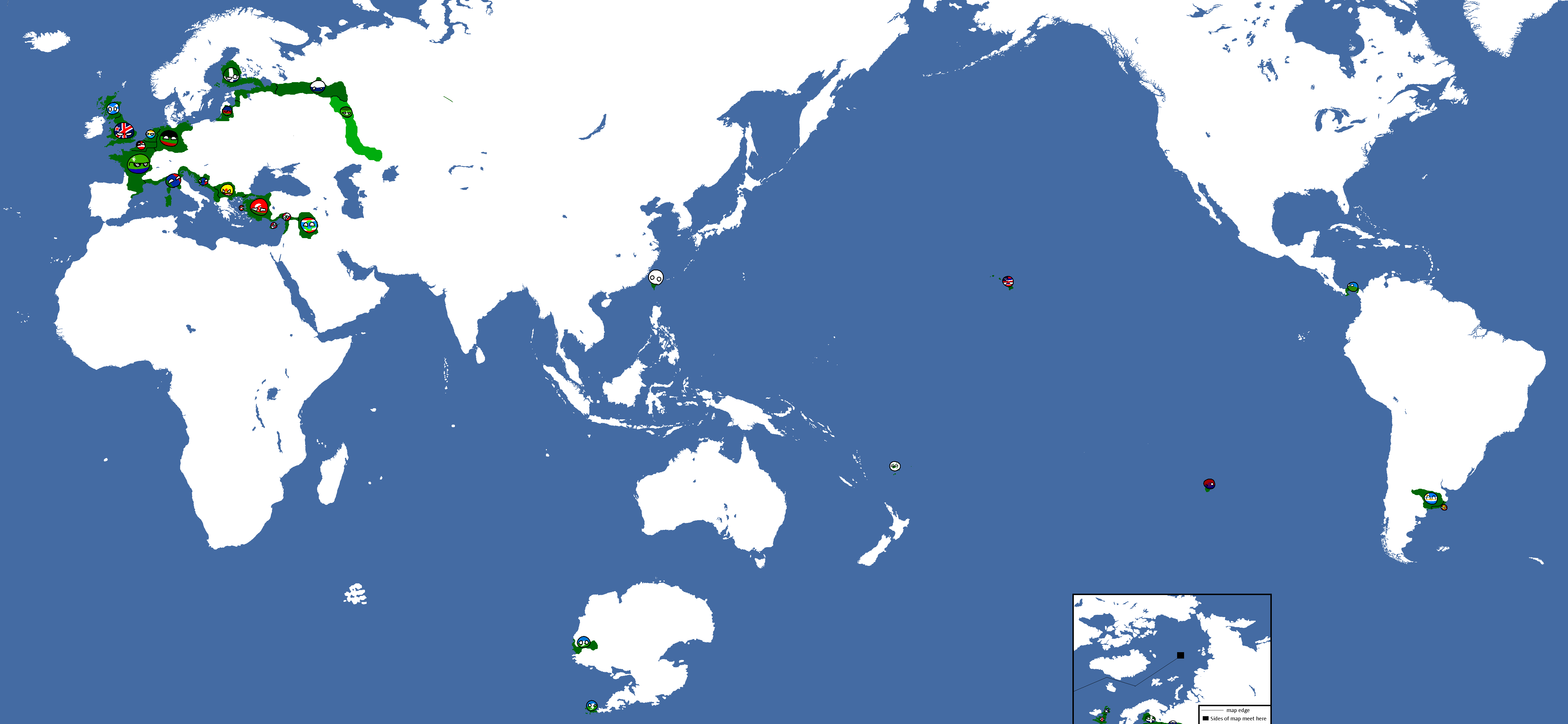
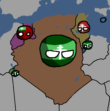
All territories ever ruled by Yetia: Year 121
-
Governorates of the Yetian State: Year 122
-
Boroughs of Greater Yetia City: Year 225
-
Map of the Yetian Old Metro: Year 225
-
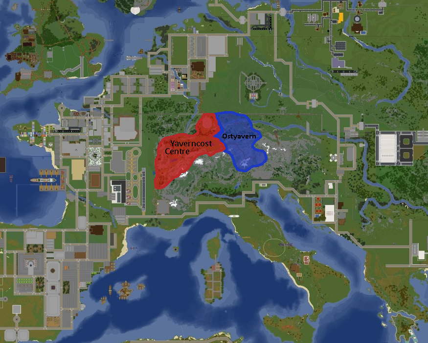
Map of Yaverncost: Year 237
-
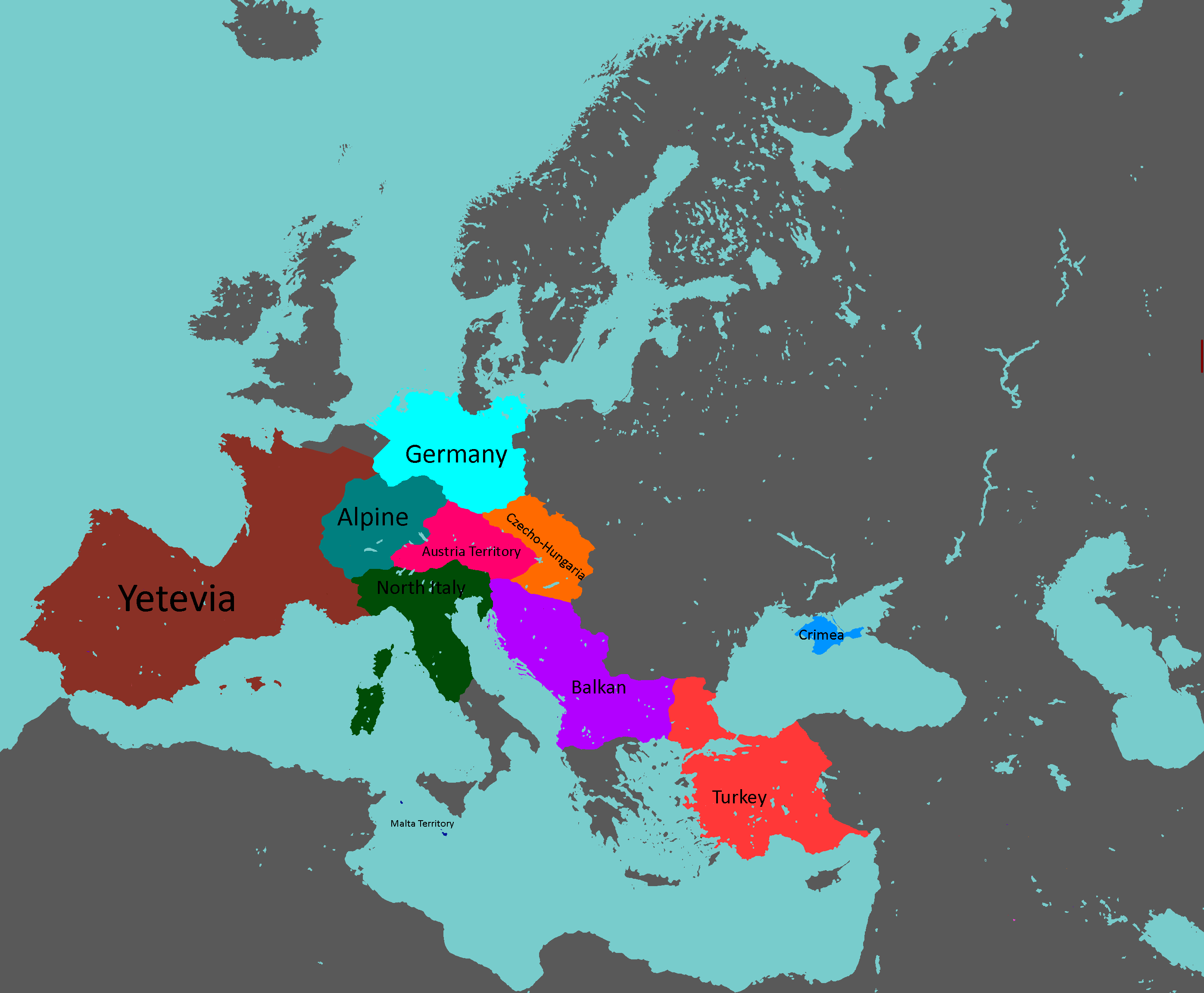
Yetian Federal Provinces: Year 362


Yorican Maps
-
Yorican States: Year 117
-
Yorica Overlay: Year 117
-


Other Maps
-
Map of the Alyphia Current
-
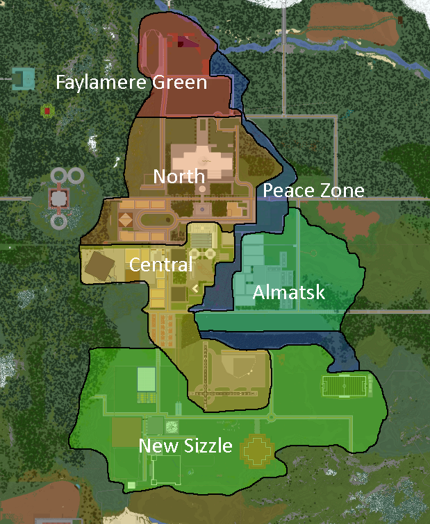
Neighbourhoods of New Mylatsk


- ↑ red: NOT DEMOCRATIC, yellow: idfk in the middle, green: DEMOCRATIC :)
- ↑ 🔴 - Absolute Monarchy, 🟠 - Semi-Constitutional Monarchy, 🟡 - Constitutional Monarchy, 🔵 - Republic
- ↑ Dark Blue: Orthodox Christianity (Including Eastern Orthodoxy), Blue: Catholic Christianity, Light Blue: Protestant Christianity, Dark Green: Shi'a Island, Normal Green: Sunni Islam, Light Green: Ibadi Islam, Purple: Judaism, Yellow: Buddhism, Orange: Hinduism, Brown: Folk Religions, Gray: State Atheist
- ↑ ⚫ - Doesn't have nuclear weapons, 🔴 - Formerly had nuclear weapons (Weapons disarmed or otherwise destroyed), 🟡 - Nuclear weapons owned by other nations stationed there, ⚪ - Has nuclear weapons
- ↑ Darkest = ESC/RCC Member, Middle = Associated State (formally allied to some degree), Lightest = Pro-ESC/RCC
- ↑ 🔴 - Superpower, 🟠 - Great Power, 🟡 - Major Power, 🟢 - Middle Power, 🔵 - Regional Power, 🟣 - Minor Power
- ↑ green = good, red = bad
- ↑ 🟢 - Democracy, 🟡 - Somewhere kinda in the middle, 🔴 - Dictatorship
- ↑ 🔴 - State-Run, 🟠 - Mixed Economy (all variants), 🟡 - Private-Run
- ↑ 🔵 - Unifists / Confederacy-aligned (generally Globalist Democrats), 🟢 - Anti-Globalists / EAF-aligned & Brasil-aligned (generally Left-Wing Nationalists), 🟣 - East Asian Sphere / MingukYakamoto-aligned (generally Right-Wing Corporatist), 🔴 - TOCO / Yorica-aligned (generally Liberal Hawks)
- ↑ red: NOT DEMOCRATIC, yellow: idfk in the middle, green: DEMOCRATIC :)
- ↑ 🔴 - Superpower, 🟠 - Great Power, 🟡 - Major Power, 🟢 - Middle Power, 🔵 - Regional Power, 🟣 - Minor Power
- ↑ 1 year before the Empire of Foarhinnea, the Goo Kingdom, and several other smaller interstellar states whom were founded by genetically engineered species created by the Kings were completely wiped out, leaving only a few scattered covert surviving "Space-Giraffes" - whom were previously the dominant species of Foarhinnea.
- ↑ red: NOT DEMOCRATIC, yellow: idfk in the middle, green: DEMOCRATIC :)
- ↑ red: provinces, cannot be destroyed. green: territories, can be destroyed, cannot be split. blue: unorganized territories, can be split or destroyed